earthlight Posted February 12, 2014 Share Posted February 12, 2014 Wait until you guys get a hold of these 4km nam radar images on the back end. Link to comment Share on other sites More sharing options...
+SNfreak21 Posted February 12, 2014 Share Posted February 12, 2014 Wait until you guys get a hold of these 4km nam radar images on the back end. 35+ DBZ echoes in that band Link to comment Share on other sites More sharing options...
PB GFI Posted February 12, 2014 Share Posted February 12, 2014 Wait until you guys get a hold of these 4km nam radar images on the back end. I have the front looks like 12 in 6 hours area wide Link to comment Share on other sites More sharing options...
user13 Posted February 12, 2014 Share Posted February 12, 2014 The question in my head is the warming takes place as the precip (and its cooling) shuts off, if the dry slot is over foretasted, would we still warm as fast? I think the EUro has less of a dry slot which is why it is now colder than the nam. Link to comment Share on other sites More sharing options...
friedmators Posted February 12, 2014 Share Posted February 12, 2014 25 mb pressure drop in about 20 hours. Rather impressive. Link to comment Share on other sites More sharing options...
Stormlover74 Posted February 12, 2014 Share Posted February 12, 2014 The question in my head is the warming takes place as the precip (and its cooling) shuts off, if the dry slot is over foretasted, would we still warm as fast? I think the EUro has less of a dry slot which is why it is now colder than the nam. Not the dry slot being overcast, dry slot precip. Meaning rather than going light it might very well shut off before the CCB moves through cutting down on rain/sleet amounts Link to comment Share on other sites More sharing options...
CSheridan12 Posted February 12, 2014 Share Posted February 12, 2014 This may belong in the observation threads, but I'm looking at the current radar and comparing it to what was forecasted with the 12Z models and it appears that there is more cold air than most had predicted. I only know because I was looking closely at Norfolk because my company had some guests visiting from Norfolk and it looked like it was supposed to change over to rain within 30 minutes down there, but it has been snowing now for just over an hour and there is plenty of room before the changeover occurs. This may be good news for the snow lovers in us all near NYC Link to comment Share on other sites More sharing options...
SnoSki14 Posted February 12, 2014 Share Posted February 12, 2014 The CCB on the 4k NAM crushes pretty much the entire state of NJ. One giant convective blob. The 4k Nam seems to be notorious for its crazy "weenie" type runs, so I'm not sure whether I buy it at this time. I think it's probably best to lean on the Euro as it's been the most consistent with this storm. Latest updates to the WSW from Mt. Holly increased amounts in NW NJ to 8-14" with locally higher and still has 6-10 closer to central NJ with the potential for 10-14 in the far north and west burbs of Philly. I guess they aren't quite buying the CCB quite as much and lean more on the front end thump. Link to comment Share on other sites More sharing options...
pazzo83 Posted February 12, 2014 Share Posted February 12, 2014 This may belong in the observation threads, but I'm looking at the current radar and comparing it to what was forecasted with the 12Z models and it appears that there is more cold air than most had predicted. I only know because I was looking closely at Norfolk because my company had some guests visiting from Norfolk and it looked like it was supposed to change over to rain within 30 minutes down there, but it has been snowing now for just over an hour and there is plenty of room before the changeover occurs. This may be good news for the snow lovers in us all near NYC Mid-levels are being flooded with warmth though. Sleet is mixing in already into VA, per obs thread in the SE forum. Link to comment Share on other sites More sharing options...
user13 Posted February 12, 2014 Share Posted February 12, 2014 This may belong in the observation threads, but I'm looking at the current radar and comparing it to what was forecasted with the 12Z models and it appears that there is more cold air than most had predicted. I only know because I was looking closely at Norfolk because my company had some guests visiting from Norfolk and it looked like it was supposed to change over to rain within 30 minutes down there, but it has been snowing now for just over an hour and there is plenty of room before the changeover occurs. This may be good news for the snow lovers in us all near NYC Models are sometime to aggressive with warm air Link to comment Share on other sites More sharing options...
hudsonvalley21 Posted February 12, 2014 Share Posted February 12, 2014 This may belong in the observation threads, but I'm looking at the current radar and comparing it to what was forecasted with the 12Z models and it appears that there is more cold air than most had predicted. I only know because I was looking closely at Norfolk because my company had some guests visiting from Norfolk and it looked like it was supposed to change over to rain within 30 minutes down there, but it has been snowing now for just over an hour and there is plenty of room before the changeover occurs. This may be good news for the snow lovers in us all near NYC Up here at KSWF, the forecast highs busted about 6 deg. low for today. Last night we hit -4 and today's high only reached to 19. Link to comment Share on other sites More sharing options...
Zelocita Weather Posted February 12, 2014 Share Posted February 12, 2014 This may belong in the observation threads, but I'm looking at the current radar and comparing it to what was forecasted with the 12Z models and it appears that there is more cold air than most had predicted. I only know because I was looking closely at Norfolk because my company had some guests visiting from Norfolk and it looked like it was supposed to change over to rain within 30 minutes down there, but it has been snowing now for just over an hour and there is plenty of room before the changeover occurs. This may be good news for the snow lovers in us all near NYC No question EWR is 24/4 right now, could start snowing with temps in upper teens/around 20 Link to comment Share on other sites More sharing options...
Zelocita Weather Posted February 12, 2014 Share Posted February 12, 2014 Snow should begin around midnight I would think in the city.... Link to comment Share on other sites More sharing options...
PB GFI Posted February 12, 2014 Share Posted February 12, 2014 4K NAM front end 10 hours of snow 3 hours of drizzle . Then precip shuts off Highest temp hour 24 CNJ 34 - KNYC 33 by hour 25 all start to tick lower .10 -12 inches from CNJ to KNYC falls on the front end then we wil be dry for a few hours but the 0 line is way out a head of the CCB line that begins to take shape over CPA down thru DC at hour 27 At hour 29 , its starting to deepen and head NE Link to comment Share on other sites More sharing options...
PB GFI Posted February 12, 2014 Share Posted February 12, 2014 4K NAM front end 10 hours of snow 3 hours of drizzle . Then precip shuts off Highest temp hour 24 CNJ 34 - KNYC 33 by hour 25 all start to tick lower .10 -12 inches from CNJ to KNYC falls on the front end then we wil be dry for a few hours but the 0 line is way out a head of the CCB line that begins to take shape over CPA down thru DC at hour 27 At hour 29 , its starting to deepen and head NE Link to comment Share on other sites More sharing options...
ForestHillWx Posted February 12, 2014 Share Posted February 12, 2014 With the models appearing to indicate a closer to the coast track, I would imagine snow ratios will be between 10-12:1. My concern is not for accumulations, as opposed to the water content of what's about to fall. In the Northern part of Morris County, I have seen numerous homes with substantial snow pack on roofs currently; concerns of collapses on some of the older homes? Apologizes if this is the wrong thread for this question. Thank you all for the incredible analysis. Link to comment Share on other sites More sharing options...
Pennfisherman Posted February 12, 2014 Share Posted February 12, 2014 Sorry for posting non related topic, but uptown has upgradaded total again Link to comment Share on other sites More sharing options...
IsentropicLift Posted February 12, 2014 Share Posted February 12, 2014 Counting every panel on the 4k NAM, snow moves in at 04z, Heavy snow moves in at 09z and lasts through 16z. Then dry slot or very light precipitation from 17z through 23z. Then back end heavy snows from 00z to 09z. Total QPF is 2.5"+ for pretty much everyone from EPA into SW CT with a larger general area of 2"+ from VA to MA. Link to comment Share on other sites More sharing options...
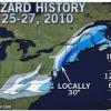
IsentropicLift Posted February 12, 2014 Share Posted February 12, 2014 Updated totals. Link to comment Share on other sites More sharing options...
liwxfan Posted February 12, 2014 Share Posted February 12, 2014 What will it take for upton to upgrade Suffolk county to a warning with such a front thump of snow looking likely? Link to comment Share on other sites More sharing options...
jm1220 Posted February 12, 2014 Share Posted February 12, 2014 4k NAM nails N NJ and S NY with the upper low related snow but also swipes NYC/western half of LI good for a few hours. Link to comment Share on other sites More sharing options...
GD0815 Posted February 12, 2014 Share Posted February 12, 2014 With the models appearing to indicate a closer to the coast track, I would imagine snow ratios will be between 10-12:1. My concern is not for accumulations, as opposed to the water content of what's about to fall. In the Northern part of Morris County, I have seen numerous homes with substantial snow pack on roofs currently; concerns of collapses on some of the older homes? Apologizes if this is the wrong thread for this question. Thank you all for the incredible analysis. IMO ratios for the front end, especially initially could be better than that....of course that changes as the storm progresses Link to comment Share on other sites More sharing options...
PB GFI Posted February 12, 2014 Share Posted February 12, 2014 So tomorrow nite should really be a show ANY MIX OR RAIN WILL CHANGE BACK TO SNOW THU NGT AS THE H5 LOWPASSES OVER THE CWA AND THE ENTIRE COLUMN COOLS. WINDS WILL BEGINTO PEAK DURING THIS TIME AS WELL WITH THE LOW DROPPING AT A RATEOF 15-20 MB PER 6 HR. BECAUSE THERE IS NOT AN INTENSE HI BUILDINGIN FROM THE W...EXPECTING PEAK GUSTS IN THE 40-50 MPH RANGE ATTM. Link to comment Share on other sites More sharing options...
Heisy Posted February 12, 2014 Share Posted February 12, 2014 WOW! Can this be right?! Link to comment Share on other sites More sharing options...
jm1220 Posted February 12, 2014 Share Posted February 12, 2014 Guys, paid model images are not allowed to be posted. People are going to start being suspended who keep doing this. Link to comment Share on other sites More sharing options...
EastCoastKU Posted February 12, 2014 Share Posted February 12, 2014 At that point sustained winds should be around the 35 mph blizzard range I assume... Link to comment Share on other sites More sharing options...
Metsfan Posted February 12, 2014 Share Posted February 12, 2014 So tomorrow nite should really be a show ANY MIX OR RAIN WILL CHANGE BACK TO SNOW THU NGT AS THE H5 LOW PASSES OVER THE CWA AND THE ENTIRE COLUMN COOLS. WINDS WILL BEGIN TO PEAK DURING THIS TIME AS WELL WITH THE LOW DROPPING AT A RATE OF 15-20 MB PER 6 HR. BECAUSE THERE IS NOT AN INTENSE HI BUILDING IN FROM THE W...EXPECTING PEAK GUSTS IN THE 40-50 MPH RANGE ATTM. Any mix/rain I think will be minimal with the dry slot forecast to go over our region. Link to comment Share on other sites More sharing options...
REDMK6GLI Posted February 12, 2014 Share Posted February 12, 2014 So tomorrow nite should really be a show ANY MIX OR RAIN WILL CHANGE BACK TO SNOW THU NGT AS THE H5 LOW PASSES OVER THE CWA AND THE ENTIRE COLUMN COOLS. WINDS WILL BEGIN TO PEAK DURING THIS TIME AS WELL WITH THE LOW DROPPING AT A RATE OF 15-20 MB PER 6 HR. BECAUSE THERE IS NOT AN INTENSE HI BUILDING IN FROM THE W...EXPECTING PEAK GUSTS IN THE 40-50 MPH RANGE ATTM. Still my main concern is can we get those intense CCB snows to translate over LI and not substantially weaken. That is my major concern paul as NJ/NYC/HV and SWCT get jackpotted and we get the leftovers more often than not Link to comment Share on other sites More sharing options...
jm1220 Posted February 12, 2014 Share Posted February 12, 2014 Updated totals. There's a map that makes sense to me. I think a number of people can see 10" from the front end snow and whatever else from the CCB that we should call bonus from the city east. From Teaneck/Wayne, NJ west-blitzed. Link to comment Share on other sites More sharing options...
user13 Posted February 12, 2014 Share Posted February 12, 2014 4k has winds around 25kts over LI towards the end of the front dump Link to comment Share on other sites More sharing options...

Recommended Posts
Archived
This topic is now archived and is closed to further replies.