powderfreak Posted April 3, 2014 Share Posted April 3, 2014 Well this time of year there are days that are sunny, and there are days that it's not. Cloudy days mean firmer snow, sunny days mean awesome soft snow. Today is one of the cloudy days, even some flurries falling. Link to comment Share on other sites More sharing options...
ORH_wxman Posted April 3, 2014 Share Posted April 3, 2014 Well this time of year there are days that are sunny, and there are days that it's not. Cloudy days mean firmer snow, sunny days mean awesome soft snow. Today is one of the cloudy days, even some flurries falling. How do you think conditions would be if there was like an inch or two of snow and then another inch of pellets? This is assuming that Saturday then warms into the 30s...I would think the denser snow/pellets wouldn't be too bad for conditions, but not 100% sure since I don't think I've skied right after sleet. But based on the consistency, I think that stuff would warm better than fluff. I'm seriously thinking about sneaking up to N NH or something on Saturday but it looks like Friday night is a quick shot of 1-2" of snow and then a pelletfest for a while. So I don't want to bother if the conditions will suck. Bretton Woods has $29 lift tickets now...not the best challenge of a mountain but $29 is $29 and I've heard its good for cruisers and has some easy routes down, so it would be a good mountain to bring Megan to. Link to comment Share on other sites More sharing options...
powderfreak Posted April 3, 2014 Share Posted April 3, 2014 Will, that is probably a pretty good surface if there's 2" then sleet...honestly at this point in the year when the snow has gone through a few thaw-freeze cycles you need something dense to cover the firm snow. 3" of fluff wouldn't do much of anything. Last April I think it was we had a sleet storm that dropped like 3-4" and it was the smoothest surface ever. It's like sliding on ball bearings. The only thing is sleet is a fine surface...but sleet runs the risk of freezing mist or freezing rain which is what crusts the snow and can cause it to deteriorate. Sleet on its own is fine if not great. Sleet and freezing rain can be horrific as the rain just freezes to the groomed trails and causes that sheet of ice effect, where you can see fresh corduroy but it's frozen solid and unpleasant. Link to comment Share on other sites More sharing options...
ORH_wxman Posted April 3, 2014 Share Posted April 3, 2014 Will, that is probably a pretty good surface if there's 2" then sleet...honestly at this point in the year when the snow has gone through a few thaw-freeze cycles you need something dense to cover the firm snow. 3" of fluff wouldn't do much of anything. Last April I think it was we had a sleet storm that dropped like 3-4" and it was the smoothest surface ever. It's like sliding on ball bearings. The only thing is sleet is a fine surface...but sleet runs the risk of freezing mist or freezing rain which is what crusts the snow and can cause it to deteriorate. Sleet on its own is fine if not great. Sleet and freezing rain can be horrific as the rain just freezes to the groomed trails and causes that sheet of ice effect, where you can see fresh corduroy but it's frozen solid and unpleasant. Yeah Im worried about ZR too...the sleet will probably end a period of ZR or even RA-....but if it warms into the 30s/low 40s on Saturday, I'd think that stuff softens up quite nicely...better than a block of cement underneath it would. I guess I'll just keep an eye on the obs up there. Link to comment Share on other sites More sharing options...
Ginx snewx Posted April 3, 2014 Share Posted April 3, 2014 Sleet is awesome to ski on,nice upslope sigs continue Link to comment Share on other sites More sharing options...
ORH_wxman Posted April 3, 2014 Share Posted April 3, 2014 I might actually go north on Sunday...that could be the better day. Esp with maybe a little bit of upslope on Sat night. Guess I'll just have to monitor conditions. Link to comment Share on other sites More sharing options...
radarman Posted April 3, 2014 Share Posted April 3, 2014 I might actually go north on Sunday...that could be the better day. Esp with maybe a little bit of upslope on Sat night. Guess I'll just have to monitor conditions. Sunday looking pretty sweet I think, headed north myself. Link to comment Share on other sites More sharing options...
ORH_wxman Posted April 3, 2014 Share Posted April 3, 2014 Sunday looking pretty sweet I think, headed north myself. Yeah agreed. Looks perfect with probably firmer up high and corn down lower...but not too warm/slushy. Probably in the 30s to around 40F. Upslope spots in N Whites and N Greens def look like they will get a few inches Sat night to refresh things. Link to comment Share on other sites More sharing options...
ORH_wxman Posted April 3, 2014 Share Posted April 3, 2014 Euro has decent measurable in upslope spots Sat night...I wonder if this will be a typical situation where powderfreak posts pics of ripping dendrites and "already 4" at the base and its still snowing!!!" when the forecast is for like 1-2". N whites should get it on it too...more tempting to go up on Sunday because of that. Link to comment Share on other sites More sharing options...
Quakertown needs snow Posted April 3, 2014 Share Posted April 3, 2014 not sure if this was posted? Record Avalanche on East Coast Slide on New Hampshire's Mount Washington propagates 650 feet across with 20 people on slope, but no one was caughthttp://www.powdermag.com/avalanche-education/record-avalanche-east-coast/?utm_source=Newsletters&utm_medium=email&utm_campaign=Powder+NL+040314_765824&utm_content=8186038555&utm_term=_765824_765835 Link to comment Share on other sites More sharing options...
HoarfrostHubb Posted April 3, 2014 Share Posted April 3, 2014 Wachusett might open for April 18 and 19 Link to comment Share on other sites More sharing options...
powderfreak Posted April 3, 2014 Share Posted April 3, 2014 Euro has decent measurable in upslope spots Sat night...I wonder if this will be a typical situation where powderfreak posts pics of ripping dendrites and "already 4" at the base and its still snowing!!!" when the forecast is for like 1-2". N whites should get it on it too...more tempting to go up on Sunday because of that. Yeah you just never know...all you can do is recognize the signal is there and say there's probably a chance of anything from a dusting to 5" haha. This time of year the issue becomes snow growth temperatures, as obviously in upslope the lift and crystal formation is occurring low in the atmosphere at H85 or so. Looks like temps at that level will start out at -3C on Saturday afternoon and drop to -7C after midnight Saturday night. Not ideal temps for dendrites...we like to see -10C at H85, but this time of year there's also usually more moisture in the air to act on so sometimes these spring upslope signals can produce. I could see 1-2" of a graupel-like snow or small flakes. This is graupel season too...lots of that in upslope/convective mountain snow showers in the springtime. The timing of any upslope overnight though is better than daytime...at night it seems to be able to develop into a more congealed band of upslope snow over the spine, whereas during the day the sun's strength this time of year seems to cause that more cellular pulse type upslope (as opposed to a more steady precipitation at night, its more squally during the day). Link to comment Share on other sites More sharing options...
ORH_wxman Posted April 4, 2014 Share Posted April 4, 2014 Yeah you just never know...all you can do is recognize the signal is there and say there's probably a chance of anything from a dusting to 5" haha. This time of year the issue becomes snow growth temperatures, as obviously in upslope the lift and crystal formation is occurring low in the atmosphere at H85 or so. Looks like temps at that level will start out at -3C on Saturday afternoon and drop to -7C after midnight Saturday night. Not ideal temps for dendrites...we like to see -10C at H85, but this time of year there's also usually more moisture in the air to act on so sometimes these spring upslope signals can produce. I could see 1-2" of a graupel-like snow or small flakes. This is graupel season too...lots of that in upslope/convective mountain snow showers in the springtime. The timing of any upslope overnight though is better than daytime...at night it seems to be able to develop into a more congealed band of upslope snow over the spine, whereas during the day the sun's strength this time of year seems to cause that more cellular pulse type upslope (as opposed to a more steady precipitation at night, its more squally during the day). It looks a bit colder to me than that...mor elike -8C to -10C. Though typically you'd probably want things more aligned NW rather than WNW at 850mb? Still might be a window there for some good upslope with the leftover moisture at H7 too. Link to comment Share on other sites More sharing options...
powderfreak Posted April 4, 2014 Share Posted April 4, 2014 It looks a bit colder to me than that...mor elike -8C to -10C. Though typically you'd probably want things more aligned NW rather than WNW at 850mb? Still might be a window there for some good upslope with the leftover moisture at H7 too. Yeah I was just looking at GFS temps off yesterday's 12 or 18z I think... WNW works too, even westerly works with the right moisture. In real marginal low level moisture though I'd rather it come NW and not have to pass over the northern Adirondacks, though. Anyway, would be nice to just see an inch or two...though so hard to tell if it'll organize into anything or if its just left over snow showers and a dusting to an inch up at like 3,000ft or something. Link to comment Share on other sites More sharing options...
powderfreak Posted April 4, 2014 Share Posted April 4, 2014 Its that time of year for wet slides... the Stowe/Smugglers Notch backcountry has seen a few wet avalanches the past few days. A lot of them this time of year are started by ice falls off rocks/cliffs. Another good reason to stay out of the slide paths around here are the vehicle sized chunks of ice that release off the cliffs. You can hear them from the ski resort as the noise just echos through the notch. Link to comment Share on other sites More sharing options...
gravitylover Posted April 4, 2014 Share Posted April 4, 2014 Sleet and graupel can be so good especially if it doesn't get wet/foggy/misty at the end. Smooth and bouncy FTW. Link to comment Share on other sites More sharing options...
ORH_wxman Posted April 4, 2014 Share Posted April 4, 2014 Soundings have really cooled off up in the NE Whites/SR area and certainly up toward Sugarloaf...might be a nice little paste bomb tonight. Link to comment Share on other sites More sharing options...
toller65 Posted April 4, 2014 Share Posted April 4, 2014 Soundings have really cooled off up in the NE Whites/SR area and certainly up toward Sugarloaf...might be a nice little paste bomb tonight. Bring it on! Cannot wait to be in the lift line at SL tomorrow morning at 830, hoping for 2-4 inches! Link to comment Share on other sites More sharing options...
alex Posted April 4, 2014 Share Posted April 4, 2014 Soundings have really cooled off up in the NE Whites/SR area and certainly up toward Sugarloaf...might be a nice little paste bomb tonight. Do you think Wildcat has a chance of seeing snow? I have the Attitash/Wildcat season pass, I was thinking of skiing Wildcat this weekend... Link to comment Share on other sites More sharing options...
ORH_wxman Posted April 4, 2014 Share Posted April 4, 2014 Do you think Wildcat has a chance of seeing snow? I have the Attitash/Wildcat season pass, I was thinking of skiing Wildcat this weekend... Yeah I'll bet they see a few inches of paste tonight...its probably going to change to pellets though and there could be ice accretion on wildcat too...esp near the top where its 4k. But the soundings have been getting colder, so it could end up as mostly snow with a bit of sleet and only minor glaze. Link to comment Share on other sites More sharing options...
alex Posted April 4, 2014 Share Posted April 4, 2014 Yeah I'll bet they see a few inches of paste tonight...its probably going to change to pellets though and there could be ice accretion on wildcat too...esp near the top where its 4k. But the soundings have been getting colder, so it could end up as mostly snow with a bit of sleet and only minor glaze. Thanks! I'll keep my fingers crossed! Link to comment Share on other sites More sharing options...
powderfreak Posted April 4, 2014 Share Posted April 4, 2014 Soundings have really cooled off up in the NE Whites/SR area and certainly up toward Sugarloaf...might be a nice little paste bomb tonight. Yeah that's looking more like snow over there...and more IP/ZR at elevation over here. Link to comment Share on other sites More sharing options...
Hitman Posted April 4, 2014 Share Posted April 4, 2014 Yeah I was just looking at GFS temps off yesterday's 12 or 18z I think... WNW works too, even westerly works with the right moisture. In real marginal low level moisture though I'd rather it come NW and not have to pass over the northern Adirondacks, though. Anyway, would be nice to just see an inch or two...though so hard to tell if it'll organize into anything or if its just left over snow showers and a dusting to an inch up at like 3,000ft or something. I might be totally wrong, but I think the MRV does better when the winds are more WNW, while Mansfield and stowe do better when its more Northerly. ???? Link to comment Share on other sites More sharing options...
ORH_wxman Posted April 4, 2014 Share Posted April 4, 2014 Yeah that's looking more like snow over there...and more IP/ZR at elevation over here. I'm pretty convinced I'll be heading up this weekend...either to take advantage of Bretton Woods' $29 lift tickets in the northern whites there or I might be tempted to go all the way to SR, lol. Bretton Woods is a much duller mountain...more family and lots of cruisers...but for $29 it has enough. Plus, I really stretched myself to the limit at Sunday River a couple weeks ago...I don't need a bunch of double blacks again. I might be okay with the cruisers and looking at awesome views of Mt. Washington...though BW did say most of their glades are still open with deep snow, so that's not too shabby for April 5-6th. Plus, if they get 4 or 5 inches of dense paste tonight even with some pellets, that would probably be a nice bonus. Our discussion of ski resorts got me thinking the other day...I've never actually skied Stowe. I may have to try it out next season when the deals allow me to get there for cheaper. I've done Jay, Sugarbush, Smuggs in N VT. Link to comment Share on other sites More sharing options...
powderfreak Posted April 4, 2014 Share Posted April 4, 2014 Not the cheapest, but starting Monday till the end of the season is $49 ($39 child) when you buy online at Stowe. Walk up rate will be $68, so buying online saves ya around 20 bucks. Link to comment Share on other sites More sharing options...
powderfreak Posted April 4, 2014 Share Posted April 4, 2014 I might be totally wrong, but I think the MRV does better when the winds are more WNW, while Mansfield and stowe do better when its more Northerly. ????To be honest there's not really an upslope flow (westerly upslope) that favors SB/MRG more than Mansfield...with westerly flow the air goes over the High Peaks of the Dacks before hitting SB/MRG. Upslope is always going to favor north over south, just like Jay will always be favored over Mansfield...it's just sort of how it works.The way SB could be more favored is if they get into a streamer from Lake Ontario or something, same with Killington. The other wild card is early season cold air masses on NNW flow advecting Lake Champlain moisture down into MRG and SB. That phenomena seems to hit MRG more though. Now, SE flow will favor Killington and MRV area more than Mansfield and Jay. That flow has an increased effectiveness the further south you go, while W or NW has increased effectiveness as you go north if that makes sense. Link to comment Share on other sites More sharing options...
Brewbeer Posted April 4, 2014 Share Posted April 4, 2014 I'm pretty convinced I'll be heading up this weekend...either to take advantage of Bretton Woods' $29 lift tickets in the northern whites there or I might be tempted to go all the way to SR, lol. How about Tuckerman Ravine/Sherburne Trail? Those are nearby, too, and you can't beat the price. Link to comment Share on other sites More sharing options...
tamarack Posted April 4, 2014 Share Posted April 4, 2014 That phenomena seems to hit MRG more though.That's because they're right next to App Gap and get first dibs on moisture coming from the west? (Even though Mts Ellen/Lincoln are a few hundred feet taller.) Link to comment Share on other sites More sharing options...
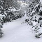
powderfreak Posted April 4, 2014 Share Posted April 4, 2014 Today was just an awesome spring day on the slopes...doesn't get much better than this. And ridiculous coverage for early April. Link to comment Share on other sites More sharing options...
Ginx snewx Posted April 5, 2014 Share Posted April 5, 2014 http://www.boston.com/travel/explorene/specials/ski/blog/2014/04/wheres_your_hom.mobile.html Link to comment Share on other sites More sharing options...

Recommended Posts
Archived
This topic is now archived and is closed to further replies.