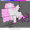
mattmfm Posted July 9, 2012 Share Posted July 9, 2012 MESOSCALE DISCUSSION 1441 NWS STORM PREDICTION CENTER NORMAN OK 1109 PM CDT SUN JUL 08 2012 AREAS AFFECTED...NRN VA...DC...WRN SHORE OF MD CONCERNING...SEVERE POTENTIAL...WATCH UNLIKELY VALID 090409Z - 090545Z PROBABILITY OF WATCH ISSUANCE...5 PERCENT SUMMARY...MARGINAL/LOCALIZED SEVERE POTENTIAL WITH SCATTERED TSTMS THAT ARE NOT EXPECTED TO INTENSIFY SUBSTANTIALLY. DISCUSSION...WITHIN A FAVORABLE RIGHT ENTRANCE REGION OF A 110 KT UPPER-LEVEL JET STREAK OVER NEW ENGLAND AND WEAK MID-LEVEL HEIGHT FALLS ON THE GLANCING INFLUENCE OF AN IMPULSE OVER SRN ONTARIO...A CLUSTER OF TSTMS HAS FORMED DURING THE PAST COUPLE OF HOURS IN ERN WV/NRN VA. MODERATE ELEVATED BUOYANCY IN MODIFIED 00Z IAD RAOB AMIDST AROUND 30 KT EFFECTIVE SHEAR COULD SUPPORT A RISK FOR MARGINALLY SEVERE HAIL. NEARLY UNIDIRECTIONAL DEEP-LAYER WLY FLOW MAY YIELD SPLITTING CELLS...BUT OVERALL STORM STRUCTURES WITHIN A CLUSTER TYPE MODE SHOULD NOT BE PARTICULARLY CONDUCIVE TO SUSTAINING ROTATING UPDRAFTS. ..GRAMS/CORFIDI.. 07/09/2012 ATTN...WFO...AKQ...LWX... Link to comment Share on other sites More sharing options...
Ian Posted July 9, 2012 Share Posted July 9, 2012 heh, dropped below 80 4 minutes after minute. Ian can rest easy. PS. Any actual strong winds reported on this? Doesn't look like it we'll see.. it also runs till 1 am at least part of the yr i think, not sure if it's on daylight time etc. it looked like there was a bit of a mini downburst when it first got warned but dont see anything of note on velocity Link to comment Share on other sites More sharing options...
thunderman Posted July 9, 2012 Share Posted July 9, 2012 I am too far away to even try to tell ... but can anyone confirm any positive strikes between Warrenton and Culpeper? Link to comment Share on other sites More sharing options...
thunderman Posted July 9, 2012 Share Posted July 9, 2012 Also, not sure if anyone saw it, but there was splitter on the WV/VA line near Woodstock a bit ago. Was showing some weak rotation on both cyclones for a brief time. Link to comment Share on other sites More sharing options...
yoda Posted July 9, 2012 Share Posted July 9, 2012 Dont really see this around here at 1 am... VAC047-061-153-157-090530- /O.CON.KLWX.SV.W.0188.000000T0000Z-120709T0530Z/ RAPPAHANNOCK VA-CULPEPER VA-PRINCE WILLIAM VA-FAUQUIER VA- 104 AM EDT MON JUL 9 2012 ...A SEVERE THUNDERSTORM WARNING REMAINS IN EFFECT UNTIL 130 AM EDT FOR FAUQUIER...PRINCE WILLIAM...CULPEPER AND RAPPAHANNOCK COUNTIES... AT 102 AM EDT...A SEVERE THUNDERSTORM WAS DETECTED NEAR WARRENTON... AND WAS MOVING EAST AT 20 MPH. THIS STORM IS CAPABLE OF PRODUCING HAIL UP TO THE SIZE OF GOLF BALLS AND DESTRUCTIVE WINDS IN EXCESS OF 70 MPH. Link to comment Share on other sites More sharing options...
Fozz Posted July 9, 2012 Share Posted July 9, 2012 Just saw a few flashes of lightning, probably from a cell in southern Carroll county that's headed my way. EDIT: it's going to miss me to the south. Link to comment Share on other sites More sharing options...
TalcottWx Posted July 9, 2012 Share Posted July 9, 2012 Areas could really see a good deal of rain Link to comment Share on other sites More sharing options...
Mrs.J Posted July 9, 2012 Share Posted July 9, 2012 Woke to a lot of lightning. Just came down to check radar when I heard my phone alert go off. The storm just to my East although I would have guessed it was right over me with the lightning. Just got a Flash Flood warning till 5:45 for my area. Rain just started with the bulk of it to my East. Link to comment Share on other sites More sharing options...
TalcottWx Posted July 9, 2012 Share Posted July 9, 2012 That storm west of baltimore is strengthening Link to comment Share on other sites More sharing options...
TalcottWx Posted July 9, 2012 Share Posted July 9, 2012 What an epic fail of an AFD from LWX. 'Stray' storms through the overnight. It is quite widespread right now. Link to comment Share on other sites More sharing options...
TalcottWx Posted July 9, 2012 Share Posted July 9, 2012 Areas west of the city have seen 2-3" in this past hour with this storm hovering in its location. Link to comment Share on other sites More sharing options...
jnis Posted July 9, 2012 Share Posted July 9, 2012 Heavy rain, and a lot of lightning here in Damascus. My dog is having a meltdown... Link to comment Share on other sites More sharing options...
Ellinwood Posted July 9, 2012 Share Posted July 9, 2012 Where the hell did all of this come from? Link to comment Share on other sites More sharing options...
jnis Posted July 9, 2012 Share Posted July 9, 2012 I went to bed sort of depressed thinking myb missed out on the rain. This is a nice surprise! Link to comment Share on other sites More sharing options...
Stebo Posted July 9, 2012 Share Posted July 9, 2012 Where the hell did all of this come from? Looks like a weak trough sliding through. Link to comment Share on other sites More sharing options...
jnis Posted July 9, 2012 Share Posted July 9, 2012 Looks like a weak trough sliding through. I tried to explain that to my dog, but he ignored me a continued clawing the carpet. Link to comment Share on other sites More sharing options...
Ellinwood Posted July 9, 2012 Share Posted July 9, 2012 Some CGs and loud lightning in Gaithersburg right now... nice cell developed over northern MoCo. Link to comment Share on other sites More sharing options...
jnis Posted July 9, 2012 Share Posted July 9, 2012 Some CGs and loud lightning in Gaithersburg right now... nice cell developed over northern MoCo. Yeah, it is starting to crank back up here in Damascus. Link to comment Share on other sites More sharing options...
Mrs.J Posted July 9, 2012 Share Posted July 9, 2012 Pouring up here. Nice little cell coming through. Has been continuous since 2:30 this morning. Link to comment Share on other sites More sharing options...
snowfan Posted July 9, 2012 Share Posted July 9, 2012 Nice rain overnight! Link to comment Share on other sites More sharing options...
North Balti Zen Posted July 9, 2012 Share Posted July 9, 2012 What an unexpected surprise, cold front apparently draped over my part of the area and a steady rain falling at 73 degrees. Absolutely what we need in this part of the city, where, in addition to the heat, it has been so dry. It feels great. Windows open and air conditioners off. The change to my zone forecast is LOLworthy. All of a sudden 100% chance of rain...LWX playing catch-up on this one. Link to comment Share on other sites More sharing options...
MN Transplant Posted July 9, 2012 Share Posted July 9, 2012 Where the hell did all of this come from? Hi res models yesterday nailed it, down to the direction of movement. Link to comment Share on other sites More sharing options...
Ellinwood Posted July 9, 2012 Share Posted July 9, 2012 Hi res models yesterday nailed it, down to the direction of movement. Nice. I honestly wasn't paying much attention to anything beyond the afternoon stuff, so it was a pleasant surprise for me to see some lightning on my drive into work this morning Link to comment Share on other sites More sharing options...
BlizzardNole Posted July 9, 2012 Share Posted July 9, 2012 This is AWESOME -- just over 1.5" and maybe a bit more to go. My garden beds were so dry that there were huge cracks (despite watering every few days) and some parts were actually pulling away from the front wall of the house LOL. Outside of 0.5" from that derecho, we'd gotten almost no rain for a while here. Link to comment Share on other sites More sharing options...
Mrs.J Posted July 9, 2012 Share Posted July 9, 2012 So far 1.24" for the day. I agree with BlizzardNole. This is wonderful, hope it helps green up the brown patches. Link to comment Share on other sites More sharing options...
wxmeddler Posted July 9, 2012 Share Posted July 9, 2012 What is this gray sky all around me? I do not understand!!! Link to comment Share on other sites More sharing options...
H2O Posted July 9, 2012 Share Posted July 9, 2012 Interesting night. Woke up to by far some of the loudest thunder I've heard at 2am. It poured for a while and plenty of lightning to boot. Kids freaked with how loud it got. Some of Ian's positive strikes I guess. Some nice showers this morning too Link to comment Share on other sites More sharing options...
EastCoast NPZ Posted July 9, 2012 Share Posted July 9, 2012 After somehow whiffing on storm after storm yesterday and afternoon and evening, we seemingly got a steady parade of showers and t-storms overnight. More than 1.1" in the gage this morning. Everytime I woke up I heard it raining, steadily and moderately. Just what the doctor ordered. Still very muggy out though. I'm afraid if we get much sun today we're going to really bust on the forecasted highs. Link to comment Share on other sites More sharing options...
catoctin wx Posted July 9, 2012 Share Posted July 9, 2012 Got almost as much rain last night as I have in the last 6 weeks combined. Already have 3.40" in the tipping bucket today. Woke up at some point (2:30-ish) to the EBS tones on the radio due to a flash flood warning. The (usually empty) water retention area behind my neighbors house is a full blown lake this morning. Link to comment Share on other sites More sharing options...
TradeWinds Posted July 9, 2012 Share Posted July 9, 2012 1.00" exactly in the gauge since 1 AM when it started. Glad Mother Nature proved me wrong about the summer drought comment I made. Link to comment Share on other sites More sharing options...

Recommended Posts
Archived
This topic is now archived and is closed to further replies.