
baroclinic_instability
-
Posts
7,869 -
Joined
-
Last visited
Content Type
Profiles
Blogs
Forums
American Weather
Media Demo
Store
Gallery
Posts posted by baroclinic_instability
-
-
It has been years (4-5), happy to still see all the old usernames on here, I recognize almost all of them still.
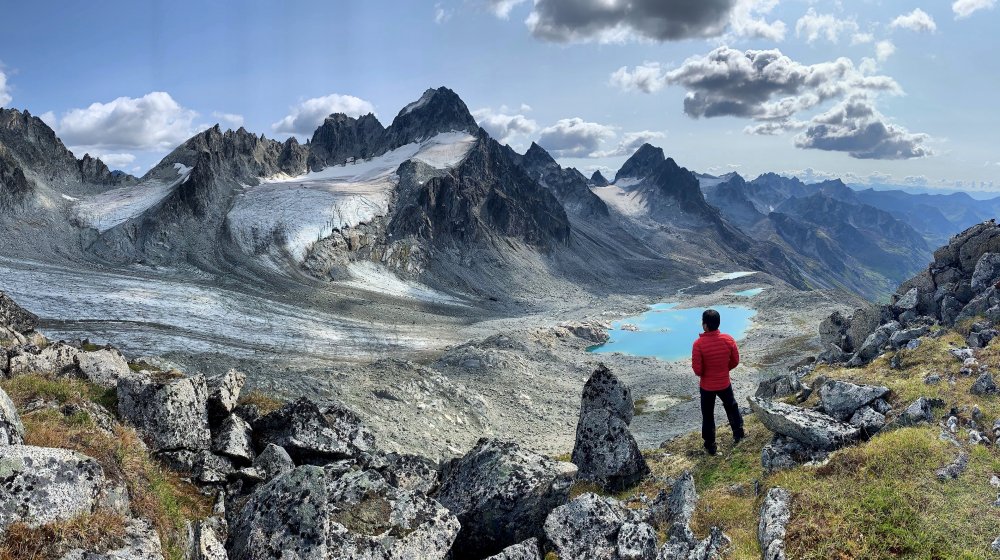
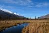
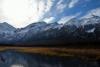
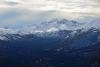
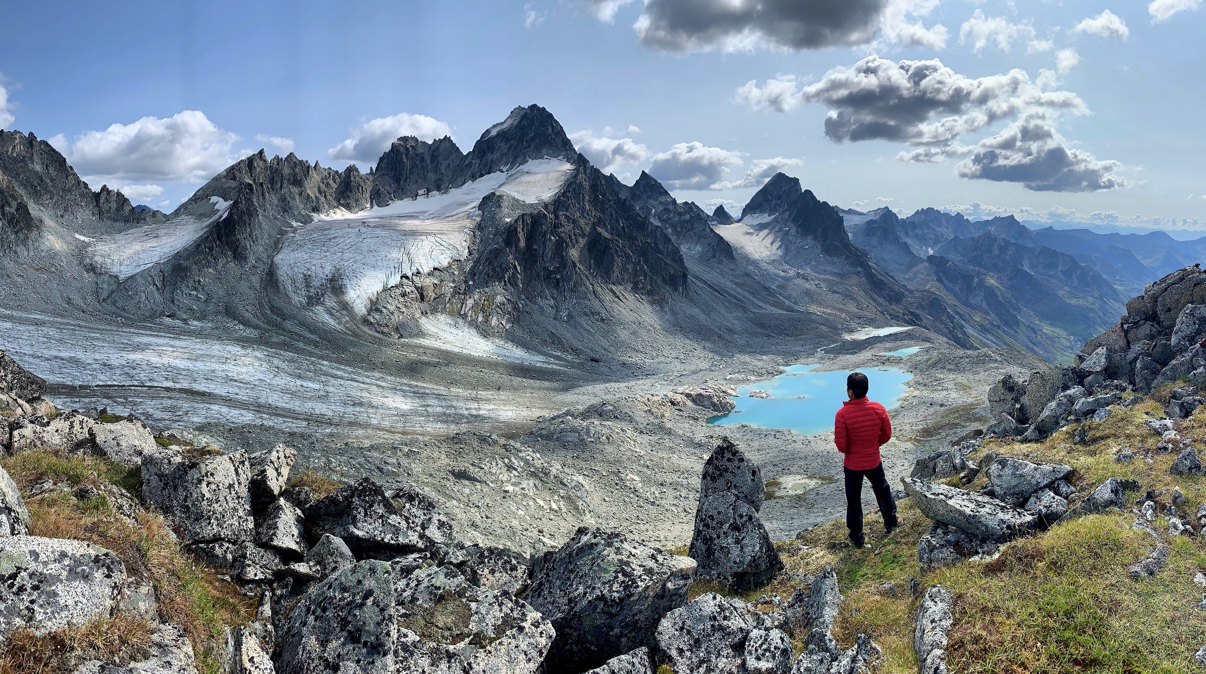
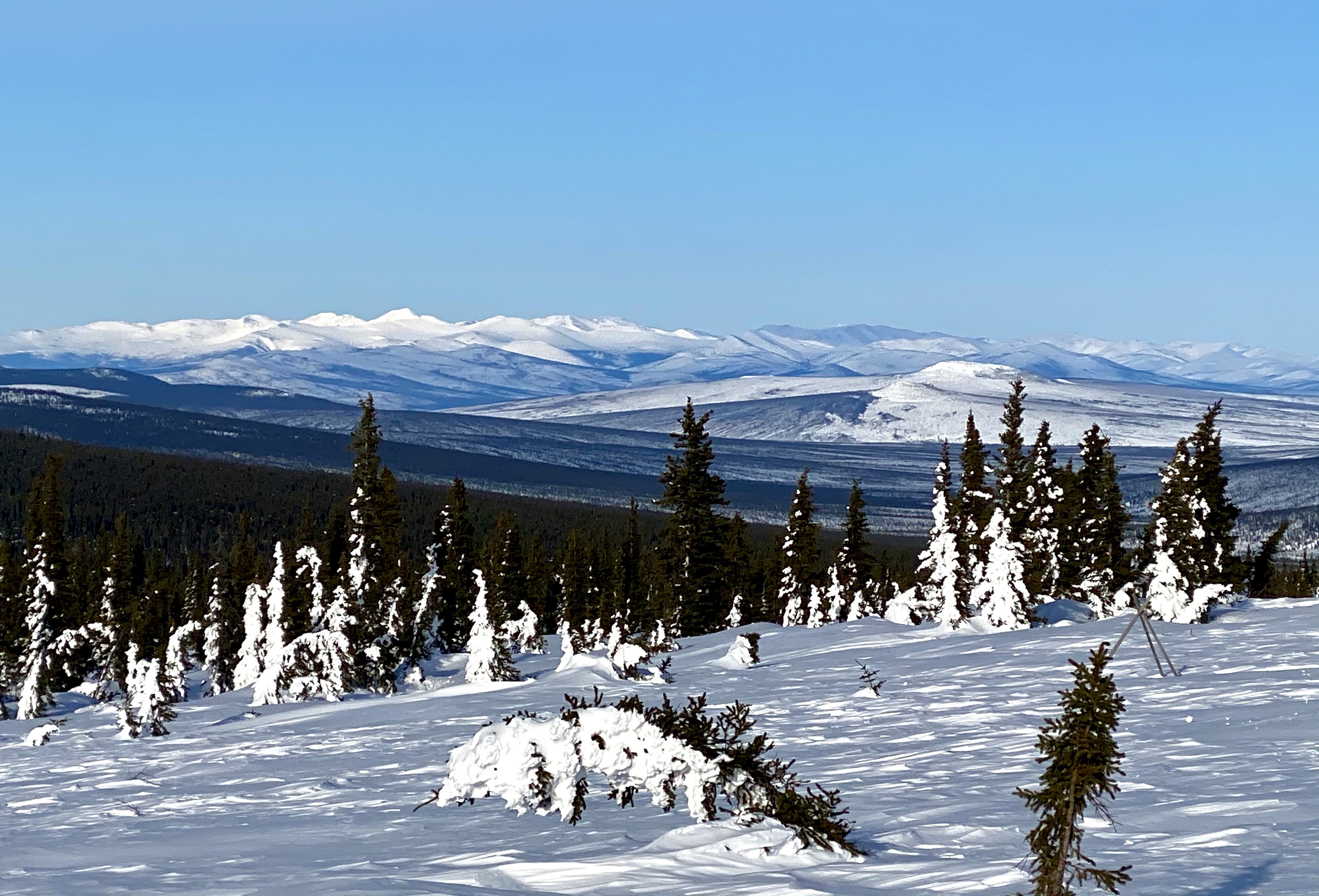
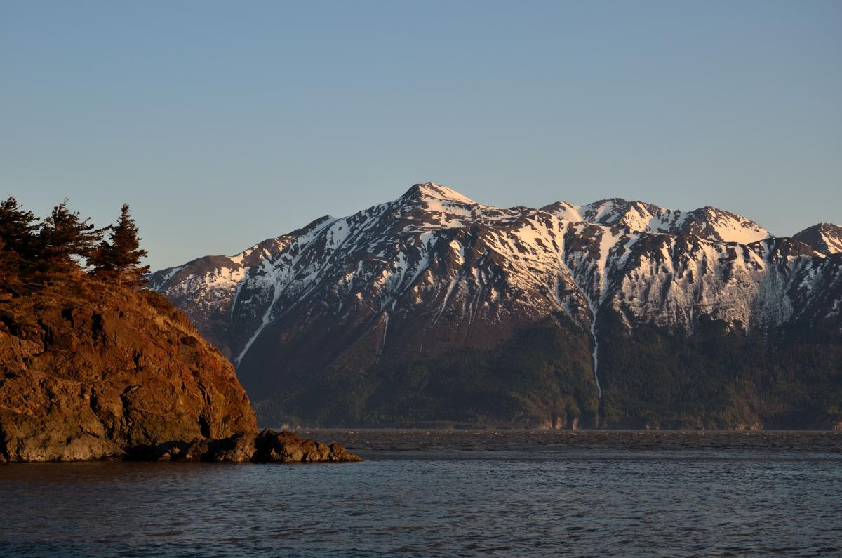
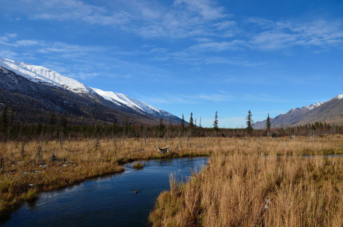
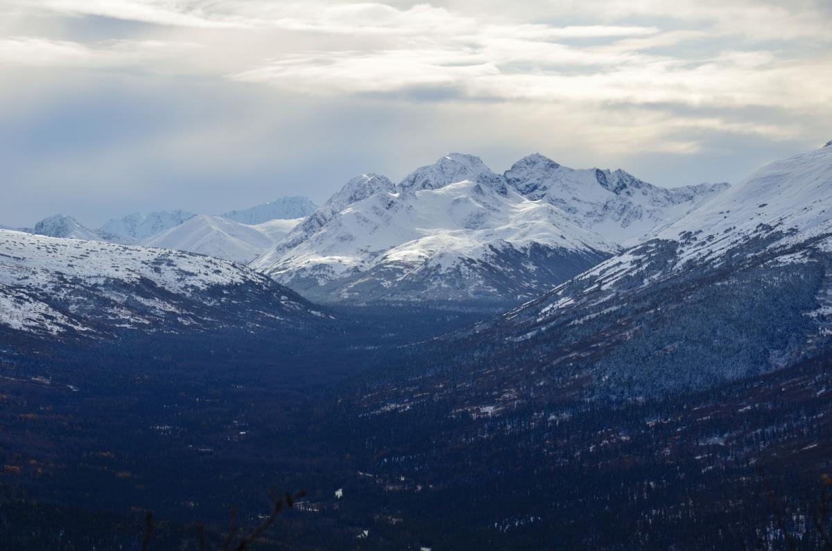
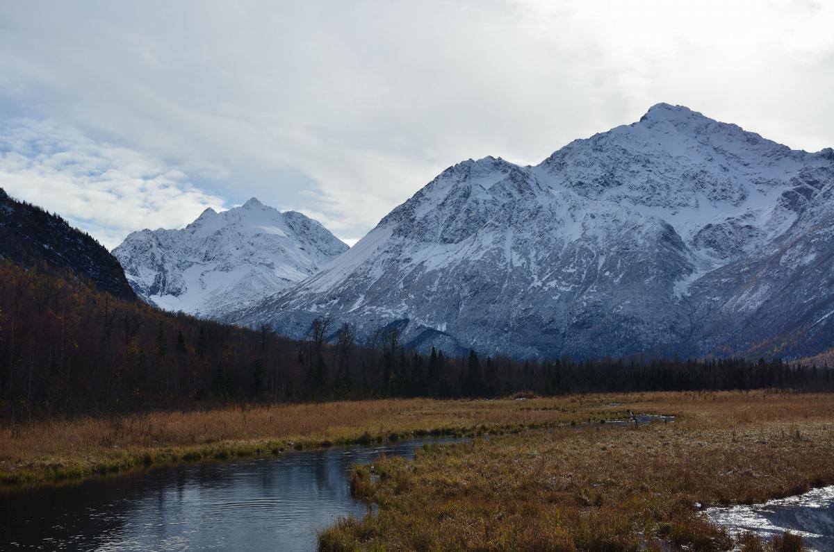
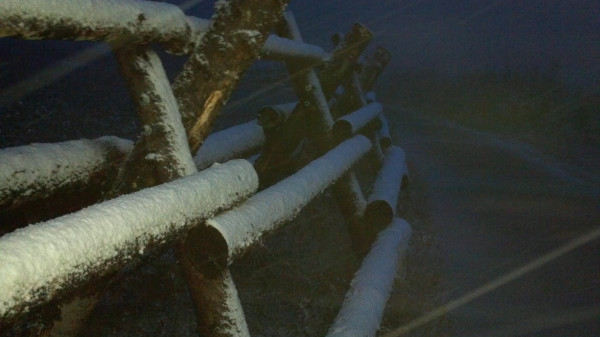
Still in the AK, still loving it. Now in Fairbanks. Thought I would toss in a few pics. Cheers everyone, I hope you are all well. I don't have anything else to add.

-
 6
6
-
-
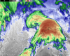
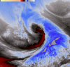
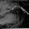
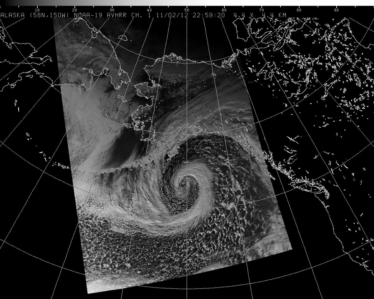
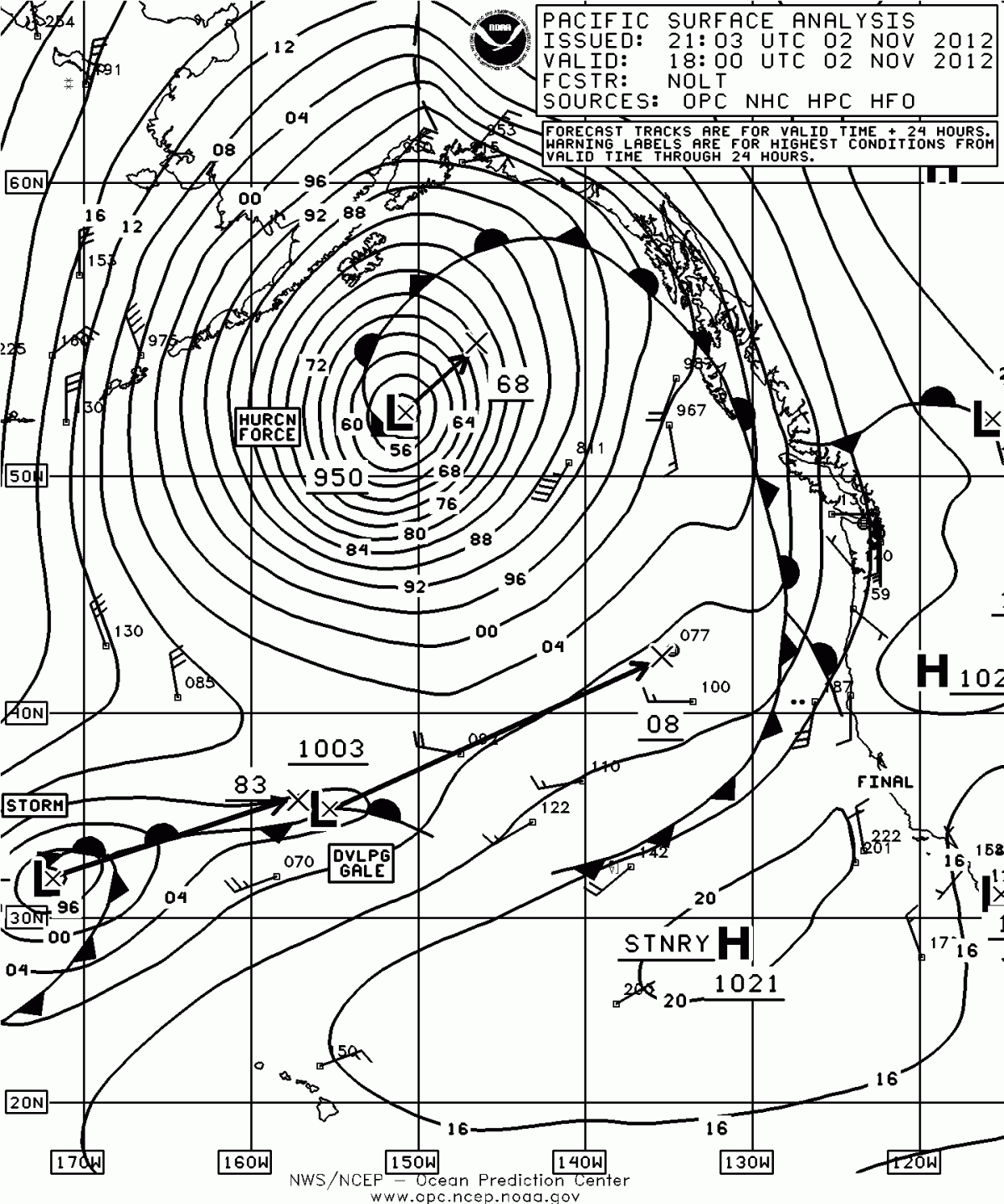
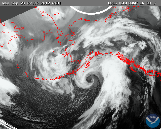
Hurricane warm seclusion and a storm force low.

-
You don't see this type of cyclogenesis in the lower 48.
-
Relatively insane temperature records set today. Can't believe we had snow less than a month ago.
PUBLIC INFORMATION STATEMENT
NATIONAL WEATHER SERVICE ANCHORAGE AK
415 PM AKDT MON JUN 17 2013
...ALL TIME RECORD HIGHS FALL AT SEVERAL LOCATIONS ACROSS SOUTH
CENTRAL ALASKA...
A EXPANSIVE RIDGE OF HIGH PRESSURE OVER SOUTHERN ALASKA IS CONTINUING
THE STRING OF UNUSUALLY HOT DAYS. TEMPERATURES AT MANY LOCATIONS WERE
IN THE 80S TO MID 90S.
THE FOLLOWING STATIONS SET ALL-TIME HIGH TEMPERATURE RECORDS TODAY:
TALKEETNA....94 DEGREES. PREVIOUS RECORD WAS 91 SET ON JUNE 16
2013...JUNE 14 1969...AND JUNE 26 1953.
CORDOVA......90 DEGREES. PREVIOUS RECORD WAS 89 SET ON JULY 16 1995.
VALDEZ.......90 DEGREES. PREVIOUS RECORD WAS 87 SET ON JUNE 26 1953
AND JUNE 25 1953.
SEWARD.......88 DEGREES. PREVIOUS RECORD WAS 87 SET ON JULY 4 1999.
THE VALDEZ TEMPERATURE WAS RECORDED IN THE CITY OF VALDEZ. THE HIGH
TEMPERATURE AT THE AIRPORT WAS 84 DEGREES.
TEMPERATURES WILL REMAIN ABOVE NORMAL ON TUESDAY BUT WILL BE COOLER
THAN TODAY. THE COOLING TREND WILL CONTINUE ON WEDNESDAY.
MORE CLIMATE INFORMATION FOR SELECT SITES IN SOUTHCENTRAL ALASKA MAY
BE FOUND AT PAFC.ARH.NOAA.GOV/CLIMATE.PHP
SNIDER/LUDWIG
$ -
Summer is finally here, and in a grand way.
-
1
-
-
as a snow lover i would never have disgust reporting snow, i may grow tiresome of endless cold but snow from late sept to mid/late may (almost 8 months sounds great)
Trust me, I love snow too, but our locale close to the Pacific means there can be awfully long stretches of clouds and rain in the summer (our wettest climo is late summer...but it begins as early as mid June), so combined with a total lack of winter sun, prolonging the winter like this during our driest time of the year is a big blow, especially for outdoor enthusiasts who like to hike (mtns are snow covered still...with mud a likelihood deep into the hiking season). This isn't the lower 48 where you are basically guaranteed a nice stretch of weather in summer.
-
I don't blame you I can only imagine how terrible it would be to have a winter that has stretched on now for 9 months. I like snow, but I'd be sick of it to at this point in May. Hang in there, it looks better for you in the extended forecast.
as a snow lover i would never have disgust reporting snow, i may grow tiresome of endless cold but snow from late sept to mid/late may (almost 8 months sounds great)
It sucks, and if you guys even remotely know a little about me, I LOVE snow. I am a snow weenie. But it was a psychological blow. This is our best climo of the year (driest), and this is where we hike and enjoy the outdoors after a long winter.
-
...WINTER RETURNING TO THE INTERIOR FRIDAY AND SATURDAY...
A VERY STRONG COLD FRONT NOW IN THE WESTERN INTERIOR OF ALASKA
WILL MOVE EAST THROUGH FAIRBANKS FRIDAY AND CONTINUE EAST TO THE
CANADIAN BORDER BY SATURDAY AFTERNOON. SNOW...WINDS AND RECORD
COLD TEMPERATURES WILL ACCOMPANY THE COLD FRONT. AFTERNOON
TEMPERATURES ARE ONLY IN THE TEENS ALONG THE WEST COAST OF ALASKA
BEHIND THE COLD FRONT TODAY.
HEAVY SNOW WILL FALL OVER THE ALASKA RANGE AND THE BROOKS RANGE
TONIGHT THROUGH SATURDAY WITH STORM TOTAL SNOW ACCUMULATIONS OF 6
TO 12 INCHES. THE HILLS OF THE INTERIOR ABOVE 1500 FEET WILL HAVE
4 TO 6 INCHES OF SNOW FROM FRIDAY THROUGH SATURDAY. THERE WILL
ALSO BE BLOWING SNOW OVER HILLS AND IN PASSES. TRAVEL WILL BE
DIFFICULT IN THOSE AREAS.
IN FAIRBANKS...RAIN AND SNOW SHOWERS ON FRIDAY MORNING WILL
CHANGE TO SNOW BY FRIDAY AFTERNOON AS THE COLD FRONT PASSES
THROUGH. SNOW IS EXPECTED TO CONTINUE INTO SATURDAY. MOST OF THE
SNOW WILL MELT AFTER ITS HITS THE GROUND AT LOWER ELEVATIONS...BUT
HILLS ABOVE 1500 FEET WILL HAVE 4 TO 6 INCHES OF SNOW
ACCUMULATION. GUSTY WEST WINDS 15 TO 25 MPH WILL ACCOMPANY THE
FRONT FRIDAY AFTERNOON THROUGH SATURDAY. TEMPERATURES WILL FALL
FROM FRIDAY THROUGH SATURDAY...WITH HIGHS SATURDAY IN THE UPPER
20S TO LOWER 30S.
I would include snow pics right now, but I am too disgusted. Accumulating on grass now, but there should be a legit shot for accumulations on the road after dark.
-
The Nenana Ice Classic is aiming for the latest melt out on record (97 years worth). I doubt it can last to beat the 1964 date of May 20th, but 2nd place is attainable if the tripod stands another 24 hours:
http://www.nenanaakiceclassic.com/
Been an amazing spring (or lack of) up there.
Yeah, it has been awful. We are going to get snow tomorrow here in ANC. Latest accumulating snow in ANC is May 22.
-
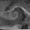
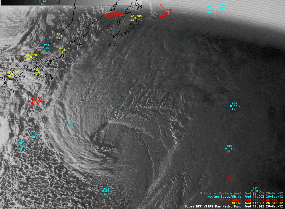
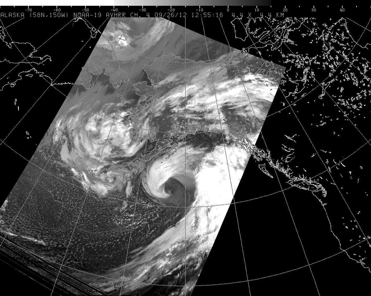
Beaufort Sea ice breakup this spring, via the Suomi polar orbiting satellite. Awesome.
-
It has been a joke of a spring. We just had more snow yesterday...breaking the daily record.
-
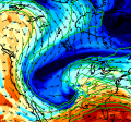
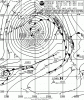
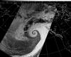
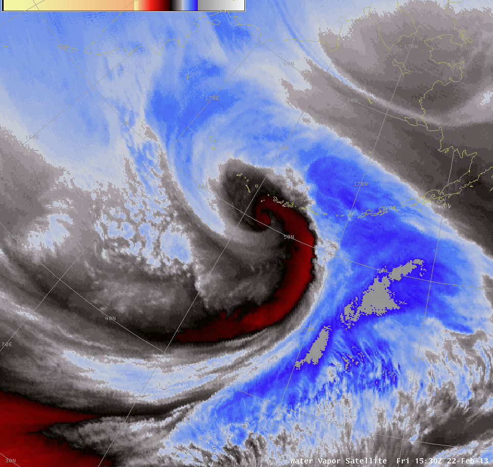
About time. A real mesoscale sting jet, this beauty formed near the dateline the last two days. Note the "tail hook" wrapping into the center of the dryslot in between the bent-back warm front and the cold front (frontal fracture). The tail hook is right near the dateline/50N.
-
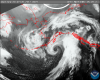
I thought you guys/gals might enjoy this little 936 hpa beauty.
-
For the first time in over 3 weeks, it is snowing in Anchorage. Finally.
-
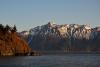
Alaska weather pron.
-
Dang seeing pictures like that really makes me want winter to come soon! Beautiful pictures you have been putting up. Just amazing!
It was a nice to see snow in the mountains. The Chugach around Anchorage are much more distinct and scenic covered in snow. We are getting back into the wrong side of another blocking pattern, so much of this snow will be eroded away in the next week, unfortunately.

-
Snow pouring down at 1500 feet earlier (Glen Alps parking lot near Anchorage). Now snow changing over right here at sea level in Anchorage.

-
Thats just amazing. Absolutely incrediblel! And b i, those pics you posted earlier in the thread are beautiful.
Extratropical cyclones, IMHO, are the most beautiful atmospheric phenomena known to man.
-
Just a beautiful storm!
Perhaps I say it too much, but that was seriously the best cyclone I have seen in a very long time.
-
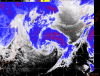
Doesn't get any better. Hurricane force winds all across the GOA.

-
Atmospheric perfection.
-
As expected, already spectacular looking, only going to get better through the afternoon.

-
Lord that is a beautiful presentation on the RH map, about as classic as it gets.
I can't wait to see this storm ripping. The actual sting jet on the backside of the low stays out of our marine area, but even the warm front may be close to hurricane force winds.
-
Looks somewhat innocuous at first glance, but dual warm conveyor belt streams already taking shape on sat. Bomb out mode is just beginning.


Baroclinic_Instability
in Outdoor and Weather Photography
Posted
Oh man, Alek, great to see you are still around, too.