FXWX
-
Posts
834 -
Joined
-
Last visited
Content Type
Profiles
Blogs
Forums
American Weather
Media Demo
Store
Gallery
Everything posted by FXWX
-
 Agree,,, should be a solid hit...
 -
How are you feeling about southern Fairfield County?
-
I warned my 100 districts at 2 pm to not jump on early decisions...
-
Cape districts have announced... I'm in the process of telling everyone to not do anything... If 18z runs follow euro trend then we are cooked... Not sure they will..
-
Yep... I'm in favor of a law that allows only 2 globals and 1 meso to be viewed for the duration of the storm's forecast period; let's say starting at 5 days out. Once you've picked your models you are locked in... No changes allowed... Lol
-
Love seeing that moist flow plowing westward into the cold dome... great inflow, as depicted...
-
Yep... Still decent snows but 700 in particular is not ideal for srn CT... Still wiggle room to watch...
-
Could be a heck of a deformation band somewhere across south-central to northeast Mass??? Room for this to shift around in the next couple of days so anyone from northern CT north and northeast should be interested in how that shakes out. Going to be a zone of great rates for several hours...
-
Yep... Discount the sheared option at your own peril. Not betting it but I refuse to throw out any option given the potential for more or less interaction, and or more or less suppression. Given we are still in 72+ hour range, we'd be foolish to discount anything.
-
850/700 inflow configuration continues to improve (IMHO), and I suspect we will see qpf numbers inch up further, especially from central / northern Mass on eastward into interior northeastern Mass. In fact, I'm becoming more impressed with the hvy snow potential across these areas??? For southern CT/RI/southeastern Mass folks, the 850/700 centers are a bit too close for comfort and will likely cause some precip type issues, unless then trend a bit further south.
-
I think the GFS has a reasonable trend both surface and aloft but I expect it's max qpf axis to adjust further north... Confluence trends are strongly arguing for a heck of fronto band setting up... I usually favor the fronto band to setup a bit further north than modeled at 5 days out.
-
Nice trend; at least for now... I long for the days when we would see a solid arctic air mass sitting across the Northeast the NE prior to a storm's arrival...
-
It was a Flop... February 2024 Disco. Thread
FXWX replied to Prismshine Productions's topic in New England
I would always rather play the odds with suppression than pattern dominated by strong southern stream... -
It was a Flop... February 2024 Disco. Thread
FXWX replied to Prismshine Productions's topic in New England
Based on recent history it is a valid concern... Kind of the Charlie Brown/ Lucy football scenario... -
1,140' will do that... Today I drove to Waterbury for expert witness testimony and there was nary a flake on the ground down there...
-
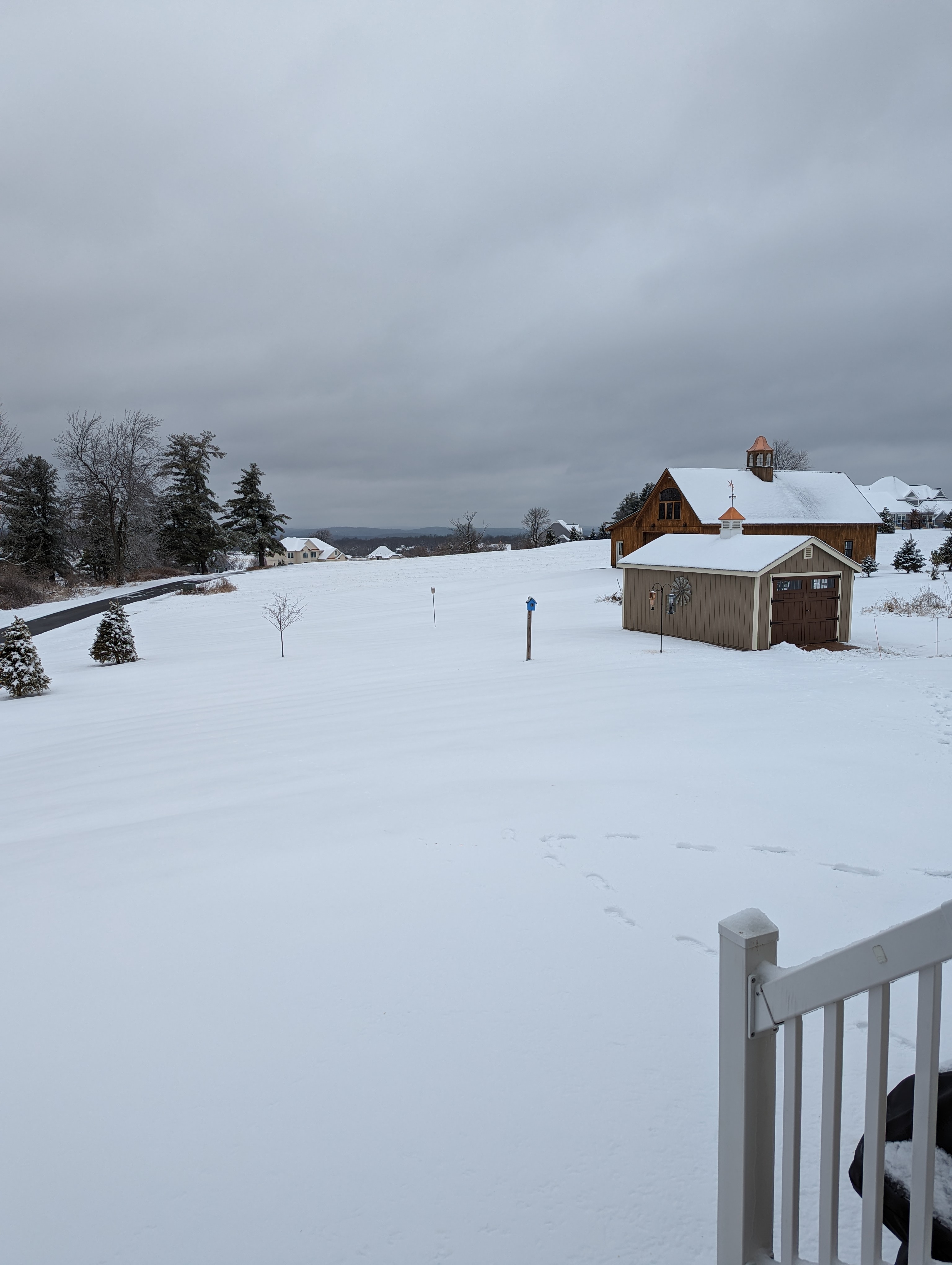
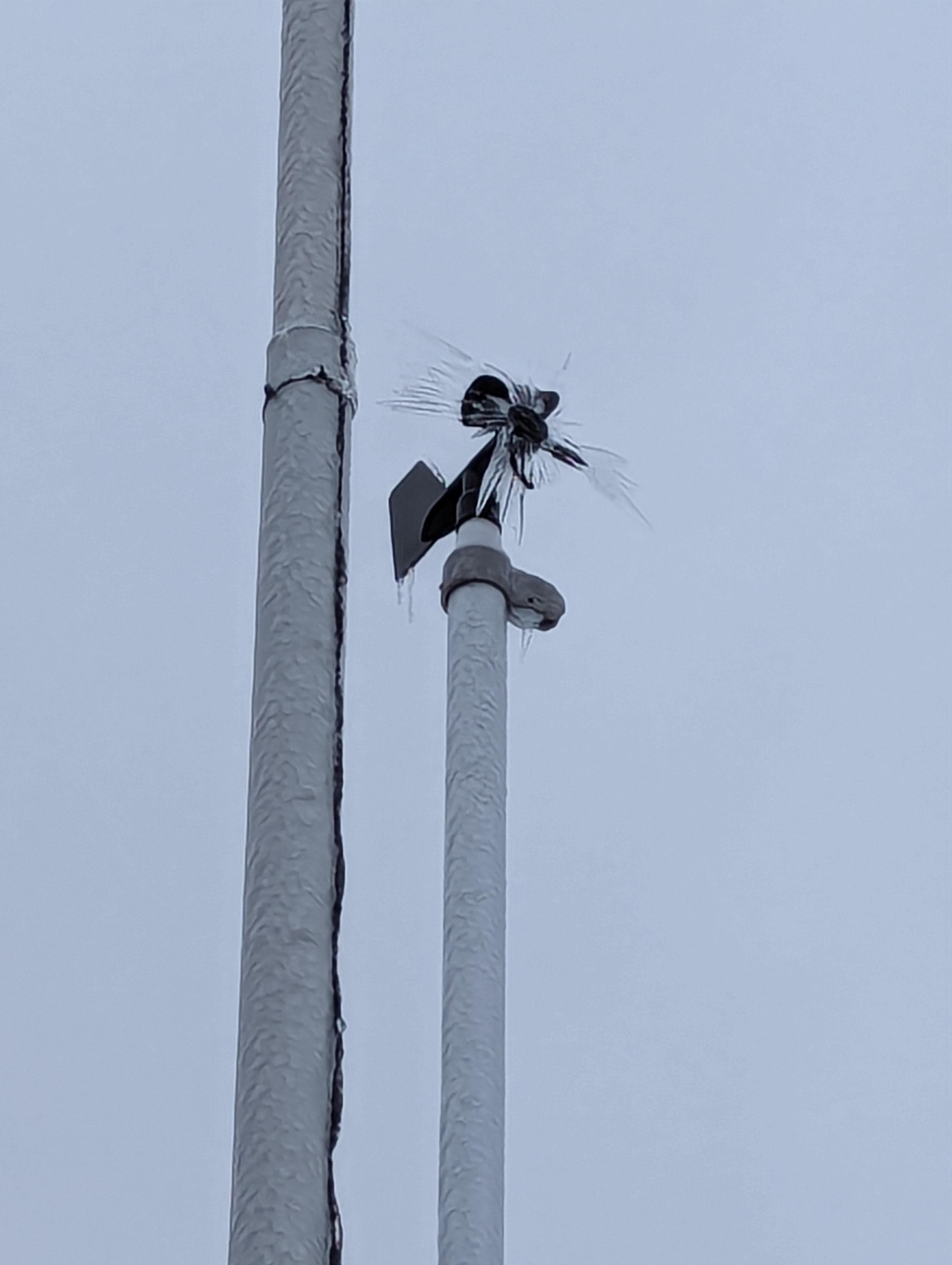
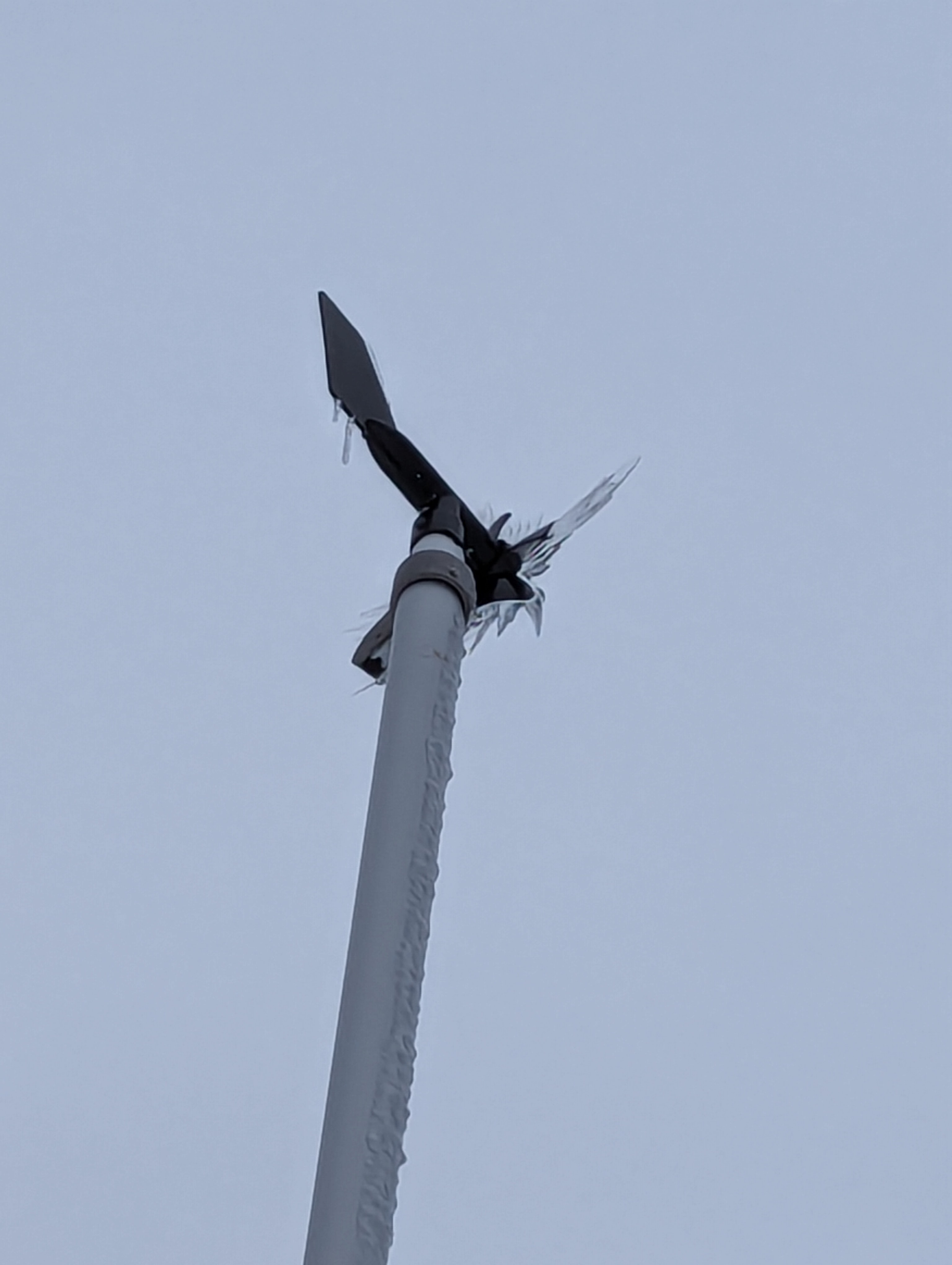
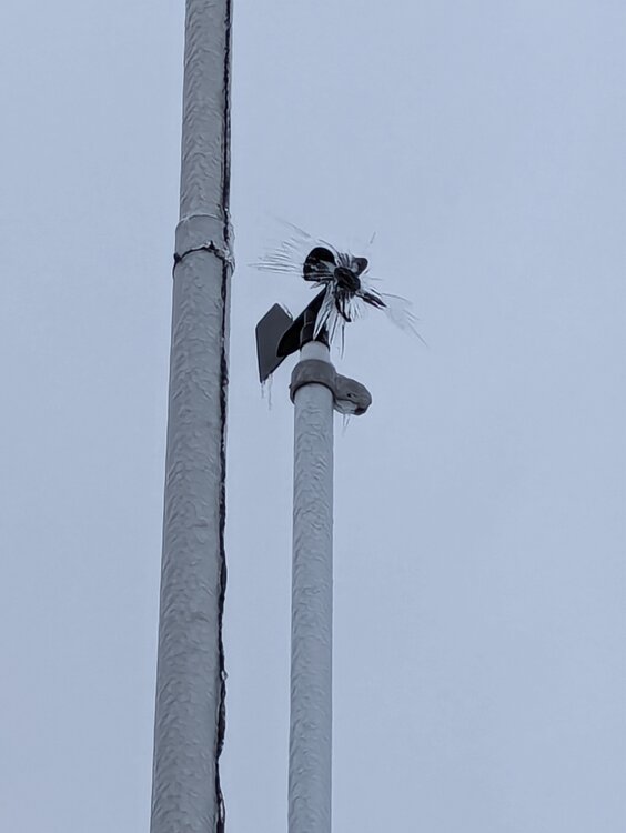
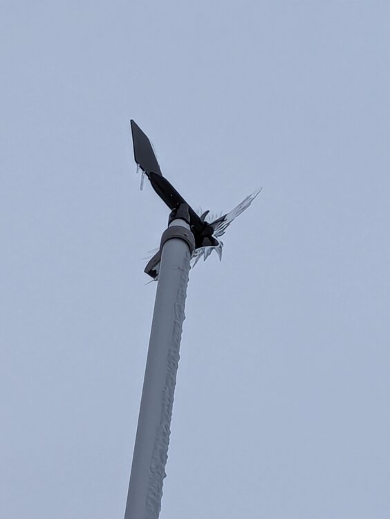
Still a nice wintery scene across the high points Burlington, CT... Sunday's 4" snow/sleet holding tight and solid glaze from several freezing rain on trees, etc... My Rainwise anemometer still encased in ice!

-
January 30, 2022
-
3.9 Burlington... 1,140'
-
Lots of lingering moisture with enough lift to keep occasional light snow and additional coatings into predawn hours. Common for Litchfield cty to see these things linger even with poor radar presentation. Drives DPW crews up there crazy across the county since it forces retreatments and the occasional scraping. Most crews will call it quits soon and then come back in prior to bus runs in the morning...
-
Conservative... Won't go with 3... 1-2 mainly along and north of 84
-
Yes... Icycles hanging from the porch railings etc...
-
It's not a pure snow line... It's mainly a mix of sleet and snow... Here is be mainly heavy sleet mixed with snow...
-
Yep... it will all be based on feedback from local DPW and facility guys...
-
still an interesting 12 to 14 hour period coming up...