FXWX
-
Posts
834 -
Joined
-
Last visited
Content Type
Profiles
Blogs
Forums
American Weather
Media Demo
Store
Gallery
Everything posted by FXWX
-
On our way to Rangeley area from southern Maine!!!
-
exactly
-
I'd refuse to release them... But if they left, I would assign a 10-page research paper; handwritten in cursive!
-
Bunch of Litchfield Cty and western Hartford County schools that were delayed are now cancelled... snow cover and elevation changes are wild this morning across NW CT...
-
Agree... There has been long running multi model support for the srn NH on east into southwest Maine area; I'd be surprised if they don't cash in. I have to be in the York / Ogunquit area Saturday. Assume there will still be decent snow cover...
-
If only theory always ended up being reality...
-
I think there is a tendency for some to look at the radar trends during the early evolution period of a storm, and assume it represents how the storm precip pattern will look hours later during the maturing stage of the storm. In this case, the chaotic look of what is going on now across southeastern NY and SNE will likely blossom into a widespread concentrated precipitation shield across northern Mass / NH and western Maine later tonight and early Thursday.
-
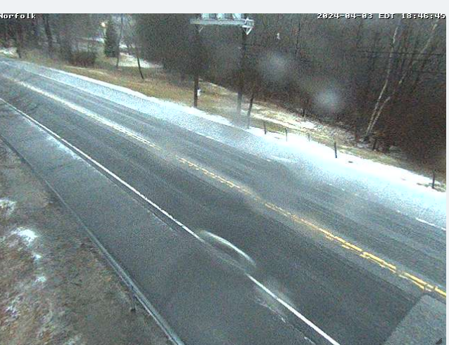
Sleet cover on Rt 44 in Norfolk, CT
-
Crews heading out in Burlington as sleet cover on high elevation roads are causing slick conditions...
-
Mix of hvy rain/sleet in highest elevations of Burlington, CT...
-

Significant Miller B Nor'easter watch, Apr 3rd-4th
FXWX replied to Typhoon Tip's topic in New England
Sleeting in Burlington, CT -
Significant Miller B Nor'easter watch, Apr 3rd-4th
FXWX replied to Typhoon Tip's topic in New England
Agree completely with your caveats; I think you can survive the marginally cold at 925 with modest rates in mid-winter, but not in early April... Some of the past monsters being thrown around either excessive dynamics or much colder profiles. And 1982 had both with pure Arctic cold... I will get more interested if the consolation process appears likely to be perfect... -
Significant Miller B Nor'easter watch, Apr 3rd-4th
FXWX replied to Typhoon Tip's topic in New England
Agree... In this setup at this time of the year I'd be wary of hvy snows in the southwest quadrant of the snow shield... -
The Congrats Dendrite Deck Destroyer 3/23-3/25 obs discussion
FXWX replied to Ginx snewx's topic in New England
Those size flakes build up quick -
The Congrats Dendrite Deck Destroyer 3/23-3/25 obs discussion
FXWX replied to Ginx snewx's topic in New England
Rotting at 31.5 at 1,140 ft in Burlington, CT -
The Congrats Dendrite Deck Destroyer 3/23-3/25 obs discussion
FXWX replied to Ginx snewx's topic in New England
Still building up

- 832 replies
-
- 10
-

-
The Congrats Dendrite Deck Destroyer 3/23-3/25 obs discussion
FXWX replied to Ginx snewx's topic in New England
Fog making pic ill-defined...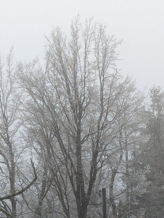
-
The Congrats Dendrite Deck Destroyer 3/23-3/25 obs discussion
FXWX replied to Ginx snewx's topic in New England
Will grab a couple in a few... 2 trees down in town according to my DPW... -
The Congrats Dendrite Deck Destroyer 3/23-3/25 obs discussion
FXWX replied to Ginx snewx's topic in New England
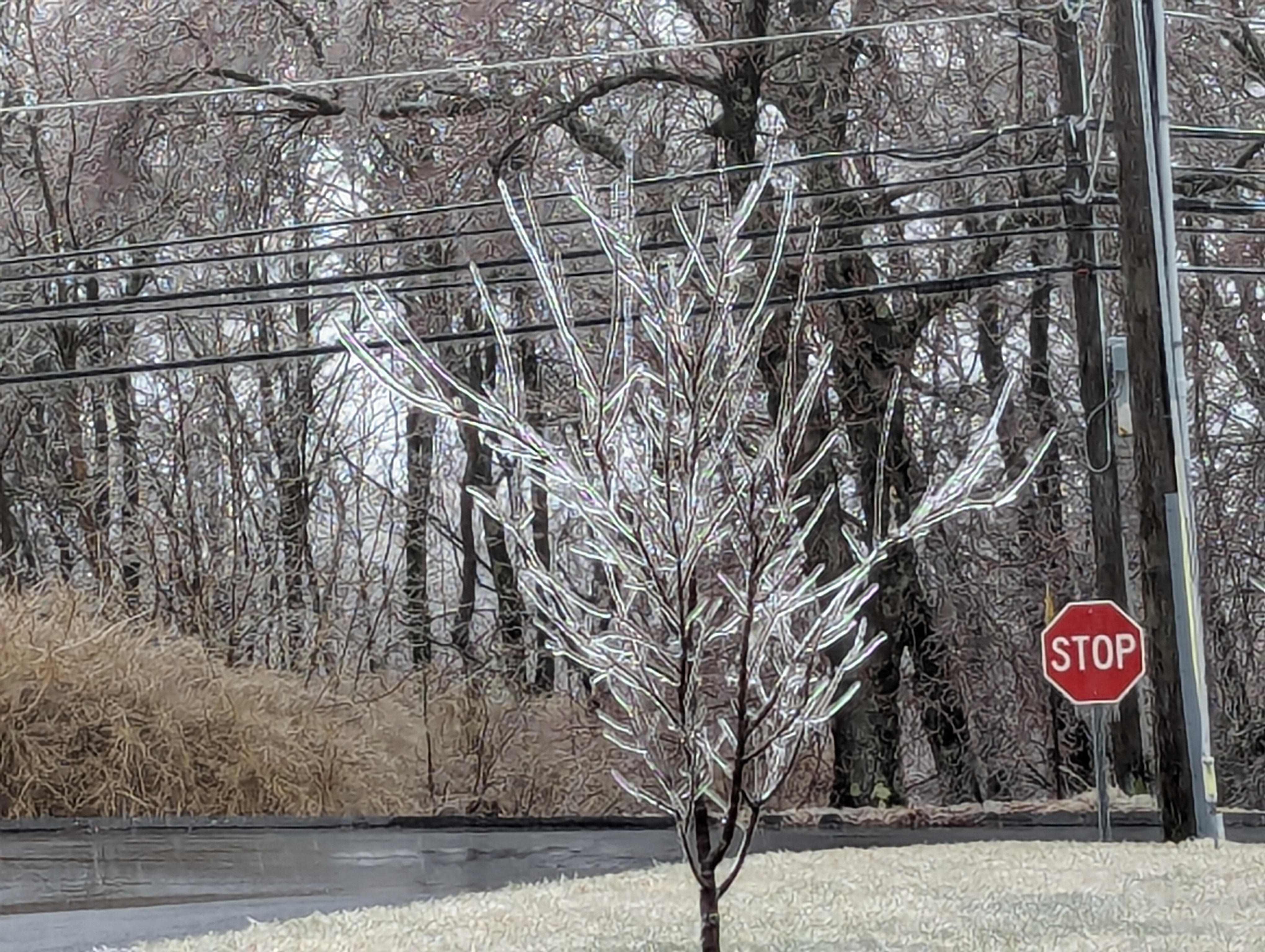
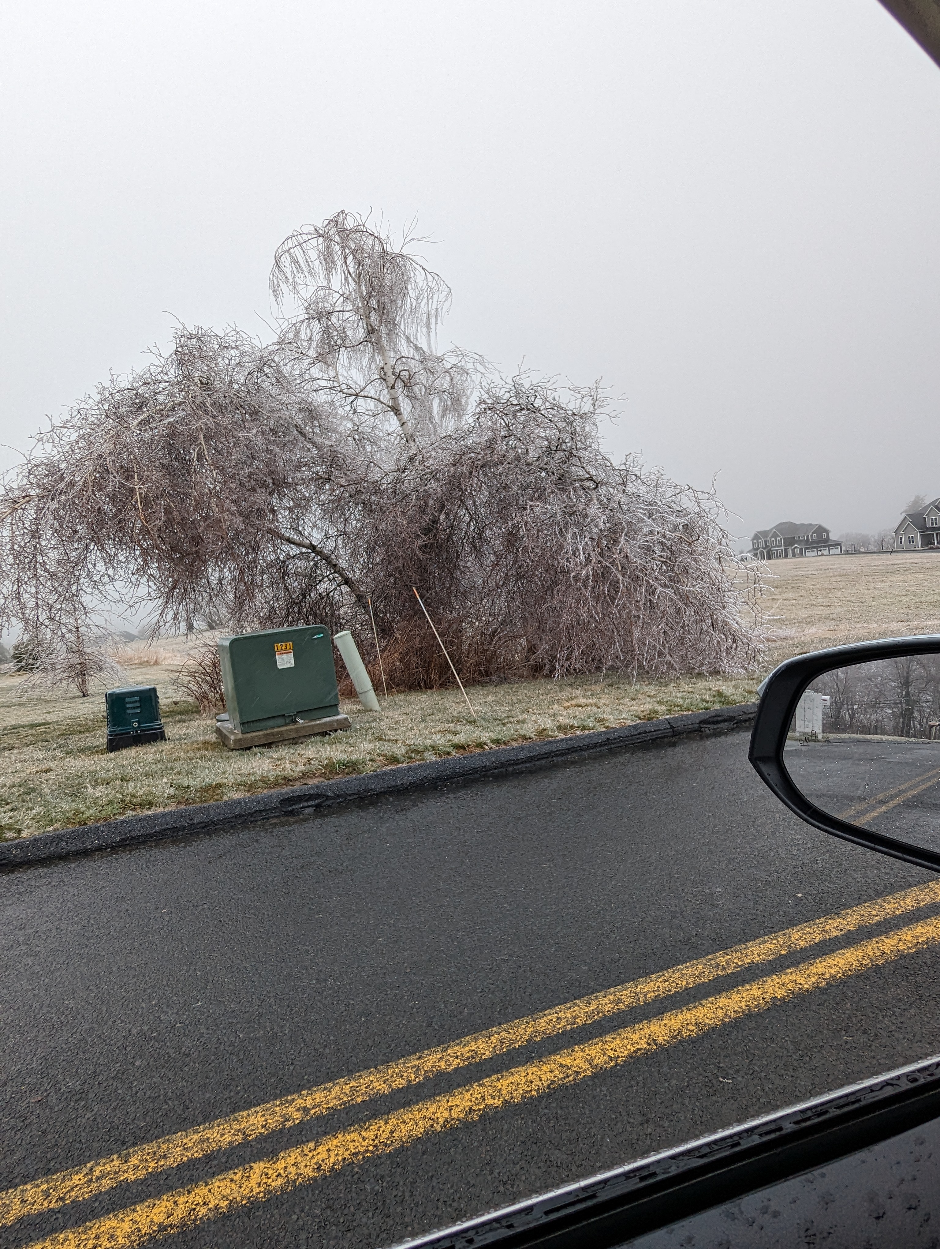
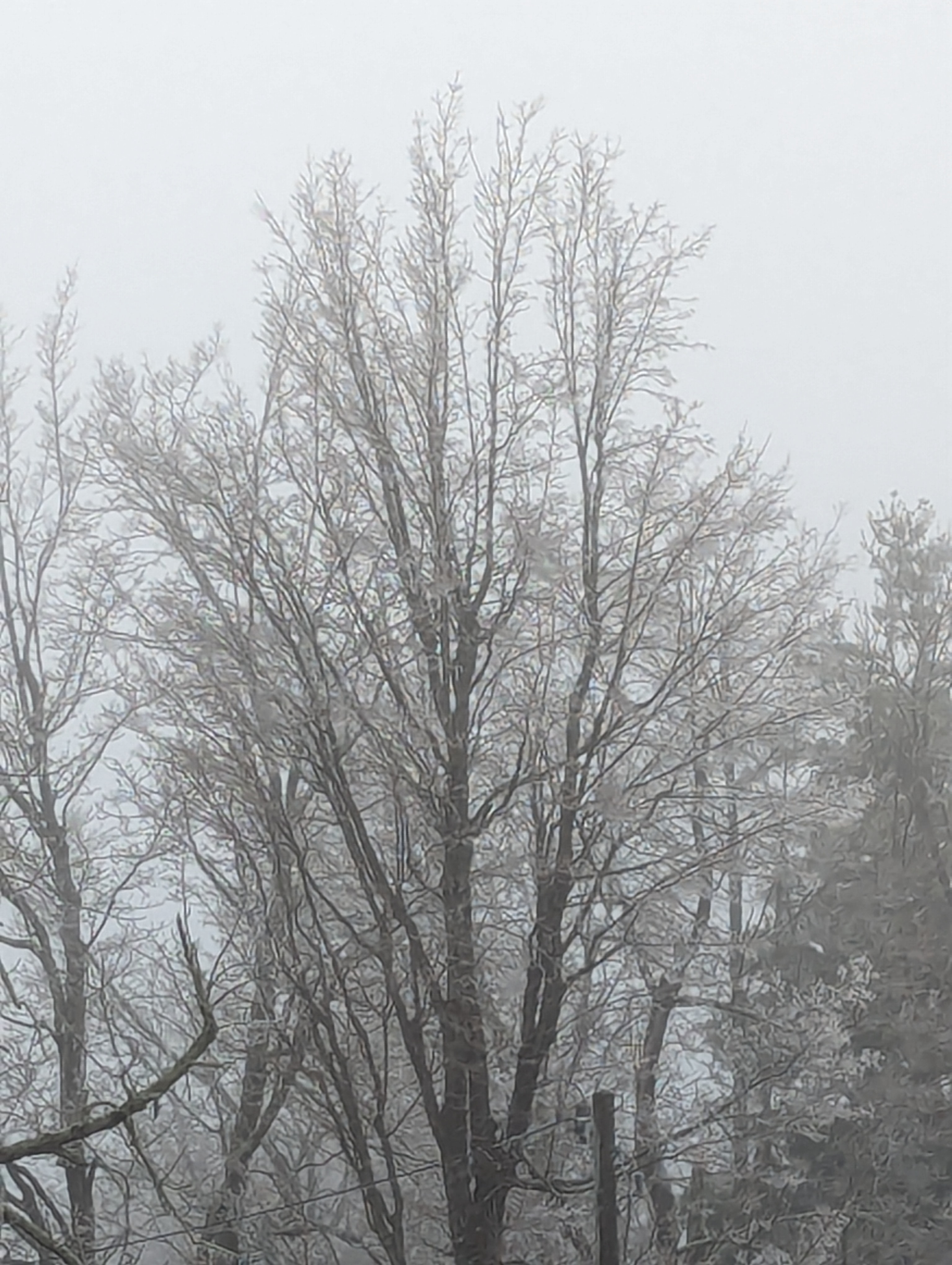
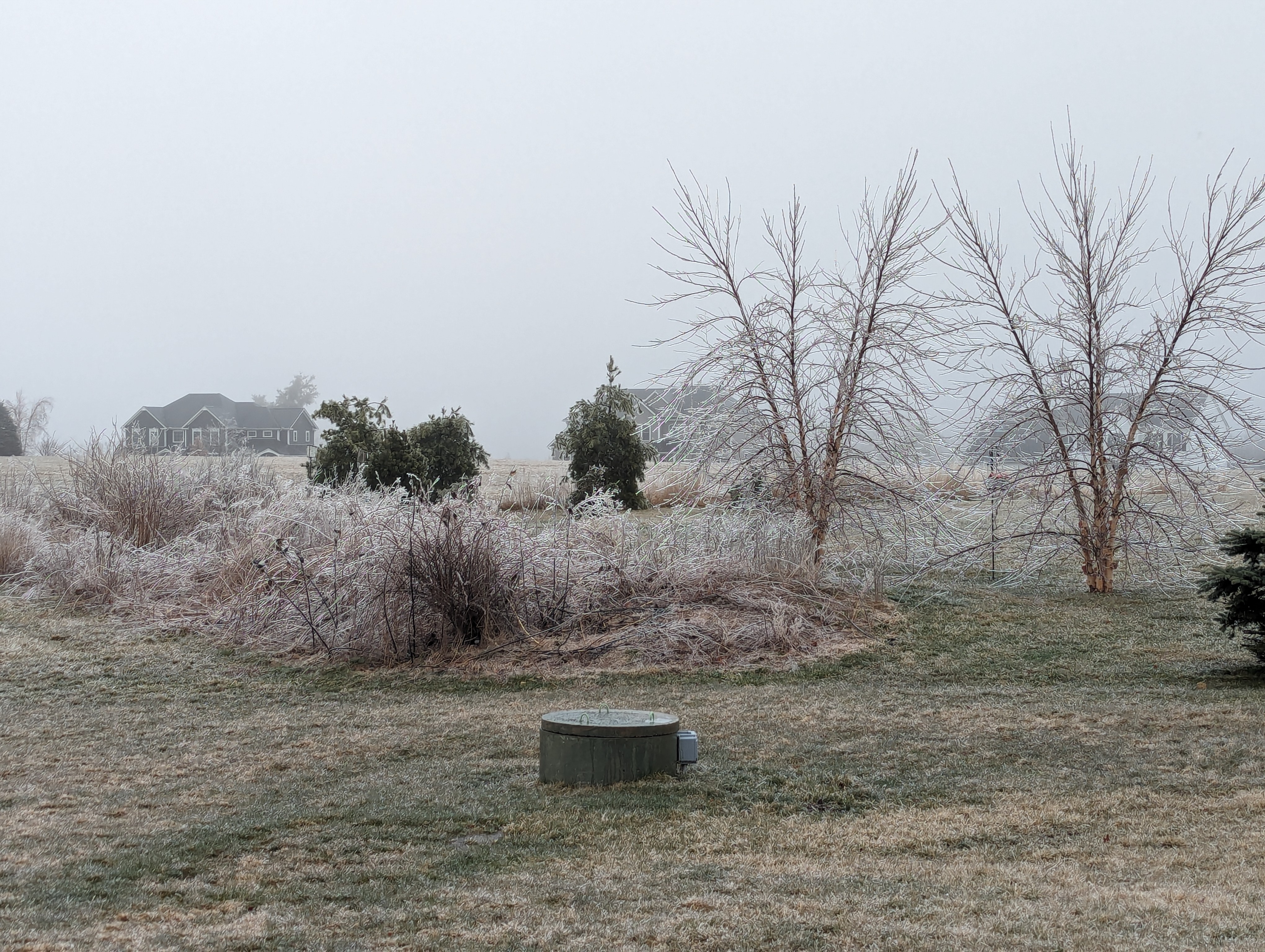
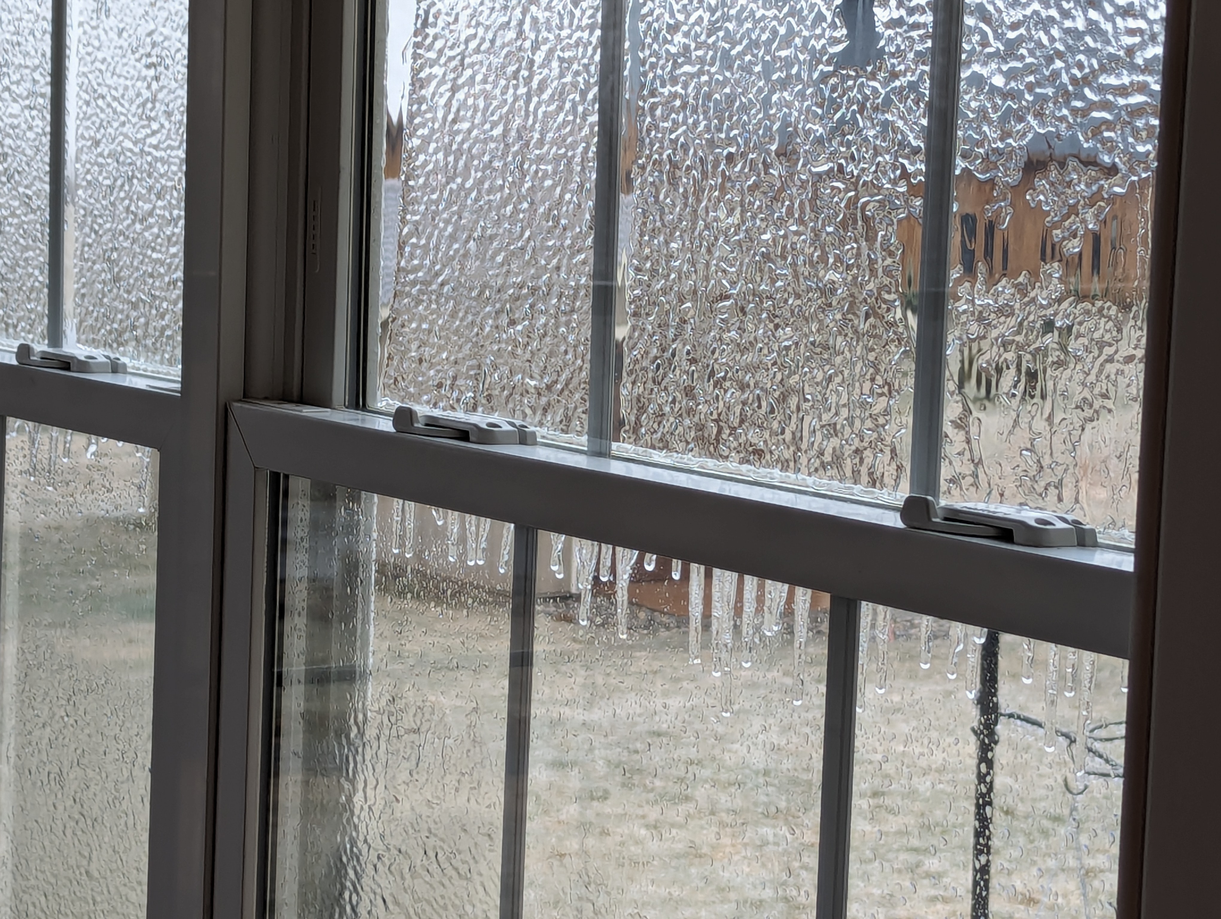
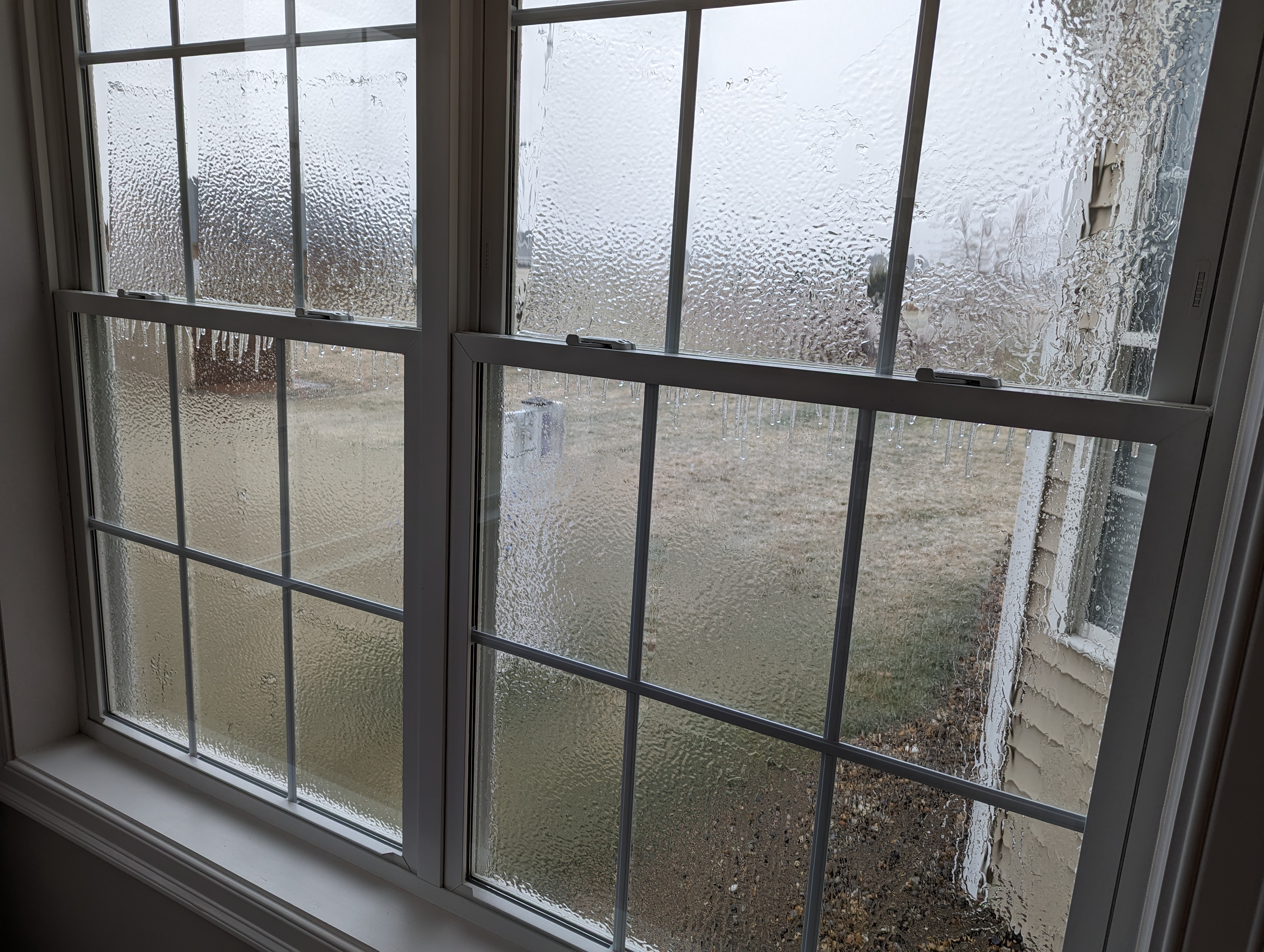
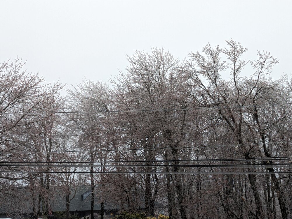
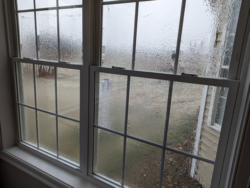
Lots of tree / deck railing icing here in Burlington, CT with a couple of trees down; east facing Windows all iced up...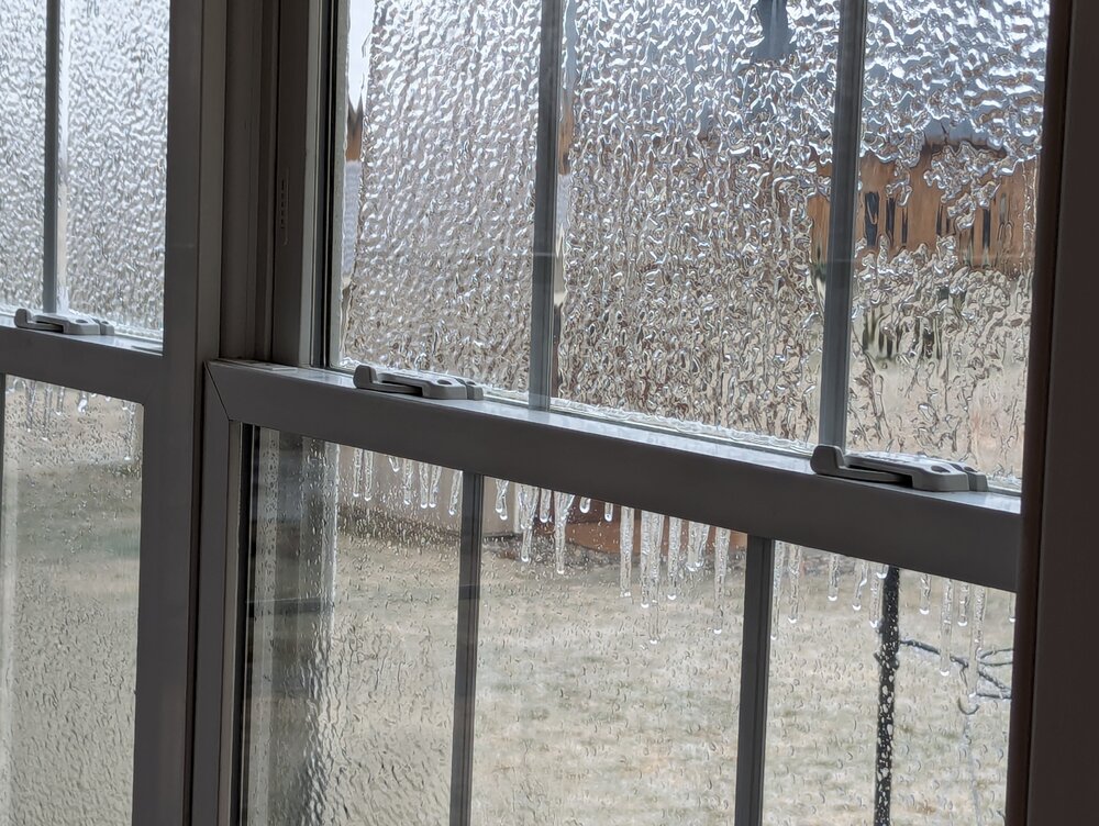
-
The Congrats Dendrite Deck Destroyer 3/23-3/25 obs discussion
FXWX replied to Ginx snewx's topic in New England
*** Here's a snippet from my late morning update to my Aubuchon Hardware Group across VT/NH/ME; an hour later I expanded concern into northern Mass... 11:35 AM FRIDAY, MARCH 22, 2024 HEAVY TO LOCALLY EXCESSIVE SNOW AND ICE ACCUMULATION POTENTIAL CONTINUES TO SEE INCREASED MODEL SUPPORT… VERY CONCERNING TREE DAMAGE / POWER OUTAGE POTENTIAL IN PLAY FROM CENTRAL NY ON NORTH AND EAST ACROSS PORTIONS OF VT, NH AND INTERIOR MAINE… Discussion: If anything, the outlook for widespread heavy to locally excessive snowfalls and ice accumulations has grown even more worrisome with almost universal model support. While I think the modeling may still be a bit over-blown, even if the totals are only 80% of reality, they still suggest a widespread damaging heavy snowfall and ice accumulation event late tonight and Saturday for many areas along and either side of the axis depicted on the snowfall map below. LONG DURATION OUTAGES A DISTINCT POSSIBILITY??? -
If the modeling is close to correct for portions of VT/ NH/ME, the darkness that follows this storm will blow away the total eclipse many times over! Instead of 2 to 3 minutes of totality it will be a long duration power outage event!!!
-
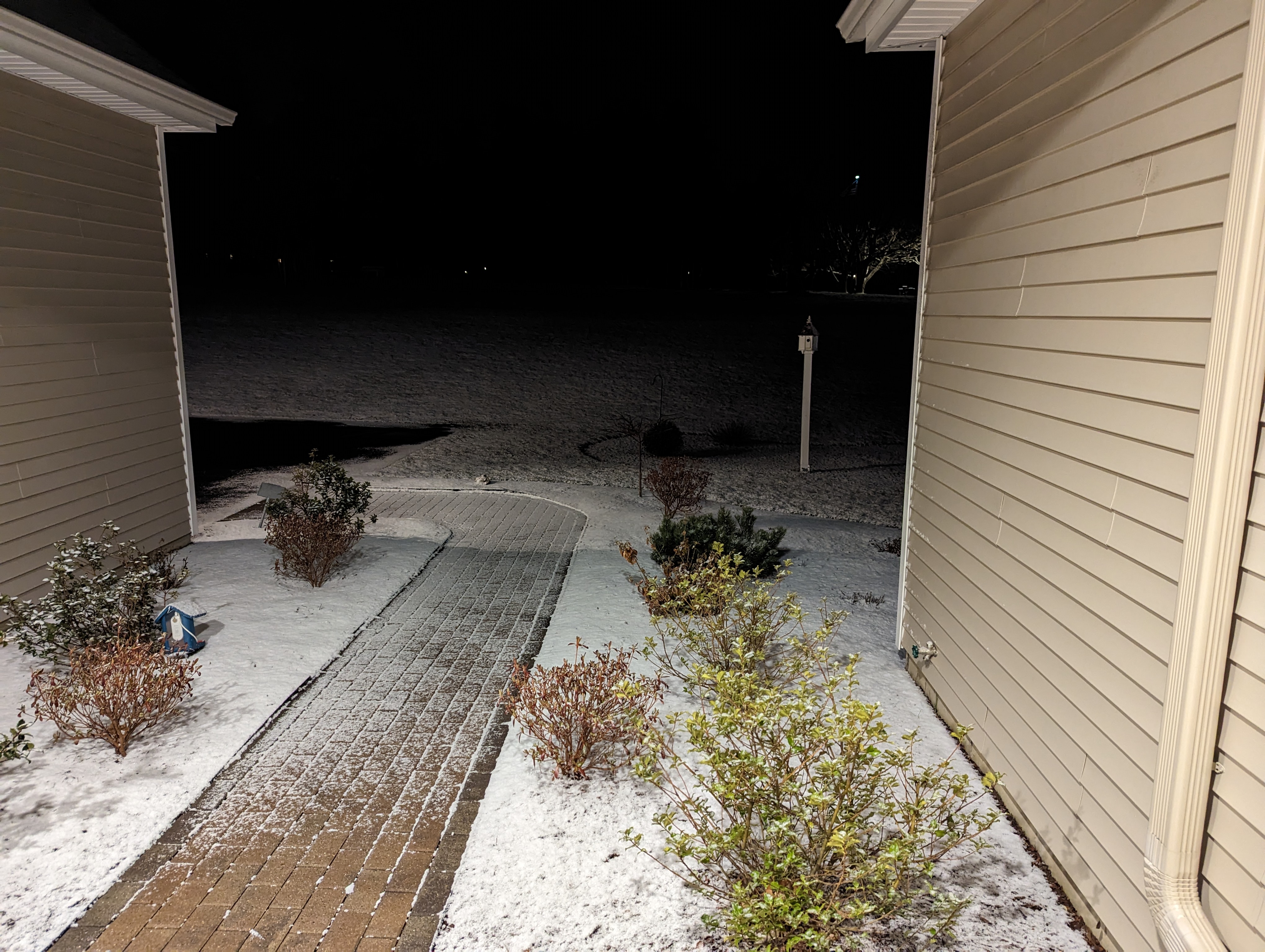
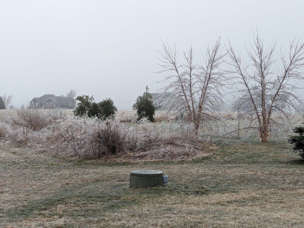
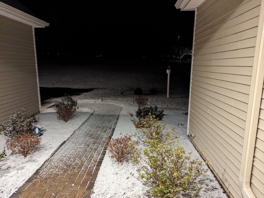
~1" on cold surfaces here...
-
Same here... Solid coating but only on grassy surfaces... Temp down to 29...
-
Squall Time Burlington CT. . PXL_20240320_231515723.TS.mp4
-
42 and steady snow in Burlington, CT... PXL_20240320_175353758.TS.mp4