

NycStormChaser
-
Posts
2,374 -
Joined
-
Last visited
Content Type
Profiles
Blogs
Forums
American Weather
Media Demo
Store
Gallery
Posts posted by NycStormChaser
-
-
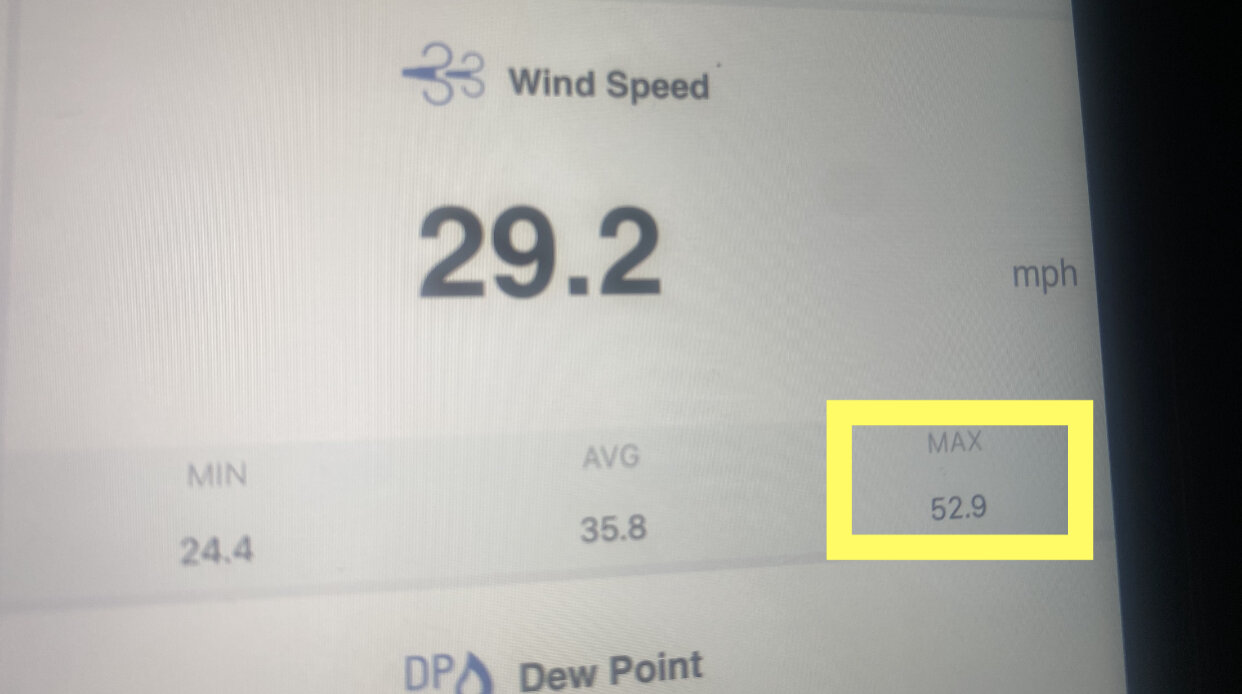
Got to Montauk at 5am. Highest gust so far is 52.9

-
 1
1
-
-
17 minutes ago, Intensewind002 said:
I'd be surprised if there are wide spread power outages in suffolk, at least on the south shore. There has to be wind gusts to at least around 75-80 mph (ala Sandy, Isaias, march 2010 noreaster) to really get anything beyond moderate where I live, and maybe more around 60-65 if the ground is saturated enough like with Irene, which only the forks are probably gonna see.
Most of Isaias wind gusts were in the 50s and 60s across long island minus one or two in the 70s
-
1
-
-
I'll be heading out to Montauk shortly, should be fun.
-
1
-
-
1 hour ago, jconsor said:
NWS Upton finally pulled the trigger on a high wind warning for eastern Suffolk County on LI as well as s. New London County in se CT. Would have been better from public awareness perspective to put up a high wind watch 24+ hours ago IMHO.
They mention gusts up to 65 mph for South Fork and 60 mph North Fork and se coastal CT.
I think all of Suffolk County (especially near the shores) could see gusts up to ~60 mph, with perhaps locally up to 70 mph on the end of the Twin Forks.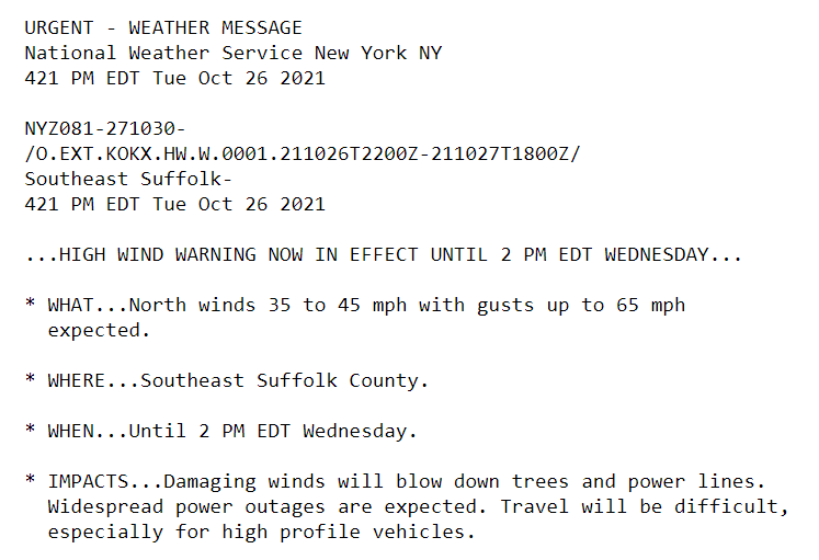
They issued that this morning. They updated the text this afternoon.
-
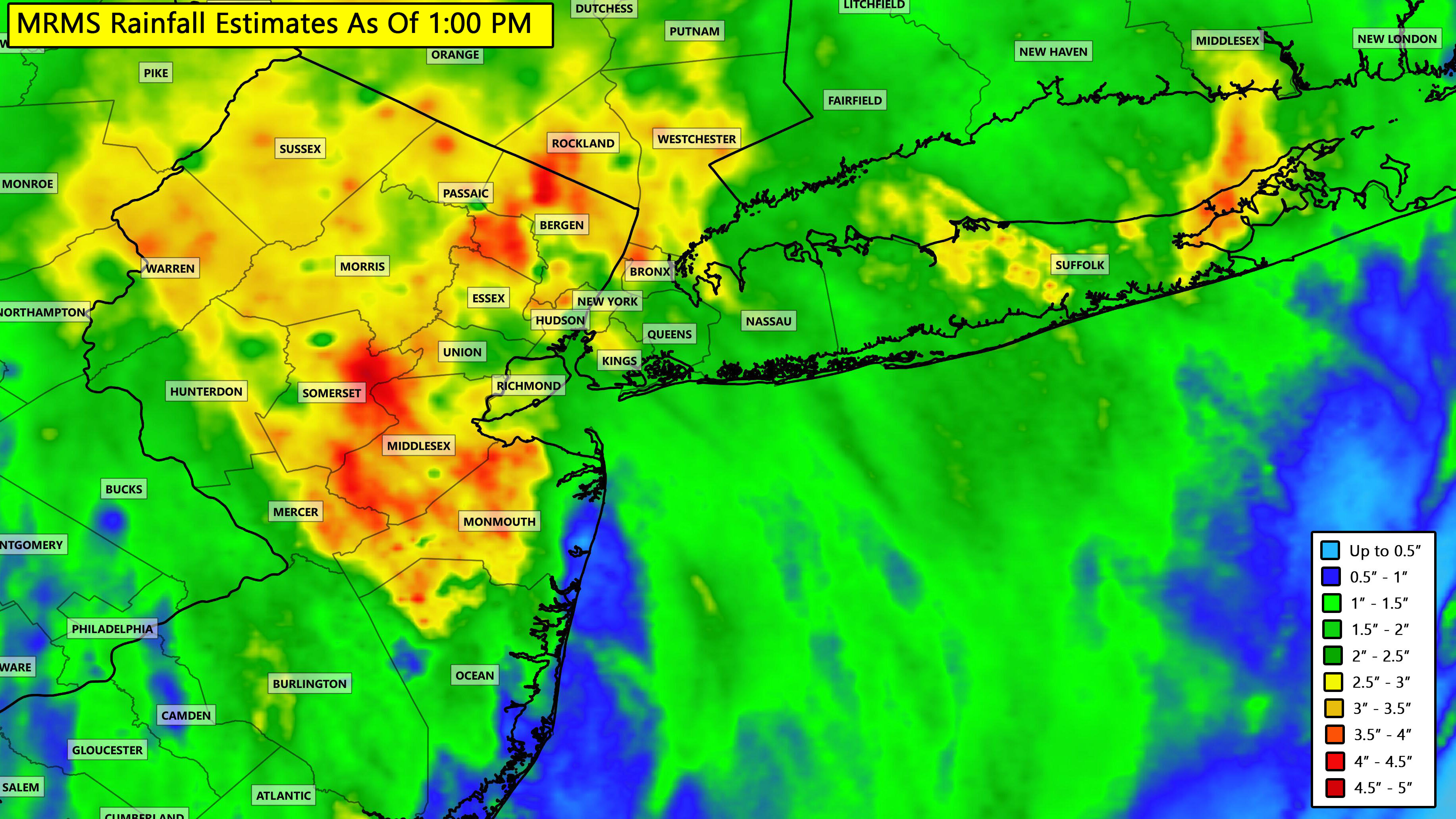
Current rainfall totals as of 1:00 PM

-
-
-
I think this was always a threat for NYC / NE NJ into the Hudson Valley. Long Island was never really in the game.
-
12 minutes ago, Jeff Grann said:
You didn't need to go all the way to the Catskills. Up the Thruway to Harriman and you were in it
Better for photography :-)
-
1 hour ago, Jeff Grann said:
For Brooklyn maybe. To say there is no threat after the 1st week in March for the whole forum is very presumptive.
Yep. I was in a heavy snowstorm last May in the Catskills.
-
1
-
-
6 minutes ago, Snowlover11 said:
no, we wont have those conditions 3 straight hours
NYC will definitely have frequent gusts at 35mph or higher for 3 hours. Not sure if they issue a warning though.
-
2
-
-
2 hours ago, Will - Rutgers said:
Most people haven't the faintest idea about things outside of their very narrow field of vision nor are they capable of empathy or imagination, plus, they're just pissed off that the power's out. Probably everyone here has had a boss at one time or another who wanted a week's worth of work done by lunchtime.
I think it has to do with lack of resources and manpower. NYC can pay big money for lots of con ed workers on overtime to get power back asap. Some of these smaller cities and towns don't have that option so it takes longer.
-
Our footage of a large waterspout turned tornado in Cape May County on Tuesday. It was just rated an EF1 but when we saw it as it’s biggest point I think it was stronger than that however it was over marsh land mostly (thankfully) so hard to gauge. Also footage of damage around Bay Ridge Brooklyn from the wind.
https://youtu.be/FkrDyQjjmKE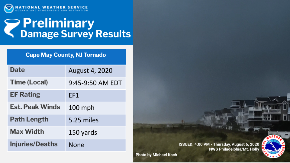
-
6
-
-
Shelf cloud from Asbury Park.

Here is a quick timelapse to go with it:
-
2
-
-
also heard a couple of rumbles of thunder here in the North Bronx
Several reports of thundersnow on social media.
. -
Looks cool over the city


.-
7
-
-
Finished up with 4 inches in Margaretville. Most was from a narrow but heavy band early this morning.
-
-
-

Snow coming down nicely now in the Catskills. Sticking to grassy surfaces.
.-
2
-
-
Tannersville, NY
-

Latest from NWS Albany.
.-
1
-
-
Fail here.... would've figured I would've flipped here by now @2000' but this light precip isn't helping. Light rain continues with maybe a few few mangled flakes mixing in the past 10 min or so.
What’s your location? Here’s the latest from Nws Binghamton
. -
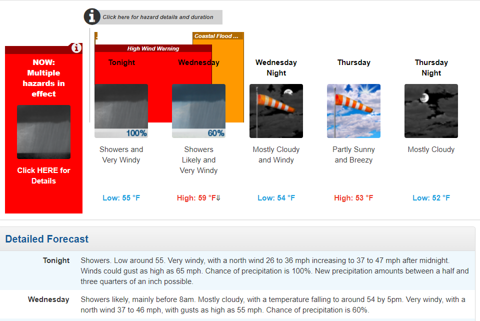
OBS and nowcast 9PM tonight-8A Wednesday for a general 2-5" rain, isolated 8" possible. 40-60 kt damaging wind likely Tuesday-early Wednesday. Focus for damaging wind and heaviest rain is the I95 corridor to the coasts. Power outages esp CT LI.
in New York City Metro
Posted
Highest gust so far is 58.3 MPH