

Windspeed
-
Posts
4,156 -
Joined
-
Last visited
Content Type
Profiles
Blogs
Forums
American Weather
Media Demo
Store
Gallery
Posts posted by Windspeed
-
-
Agree on the Cat 3 intensity. However, the windfield is expanding. This poses an increase in surge potential for a slow-moving landfall or stall near landfall. Greater fetch. Additionally, even with expansion of windfield, favorable environmental conditions can still result in intensification of the core vortex. We still have a long ways to go. It wouldn't be unrealistic for reintensification back to a Cat 4 and then additional weakening trend near landfall.
-
What exactly is a moat in a hurricane?
We use "moat" to describe the area of subsidence that occurs due to an outer rain band intensifying to the point of forming an outer concentric ring of convection or "outer eyewall". This isn't quite there yet based on earlier microwave, however, clearly there is a strong outer band right now causing that subsidence and it could lead to concentric walls if it continues to organize.
-
 4
4
-
-
Strong convection in the southern band. Even looks like it is creating a moat of subsidence outside SW portion of the eyewall. Even though Florence has a decent-sized eye, don't be surprised at another ERC cycle and an even larger eye. The current eye also does look to be contracting a bit.

-
Oh! Didn't realize this was them, my bad. Yes, I really enjoy "Stewart" discussions.
Nice save there!

-
Do you have a link to something recent to read?
https://www.nhc.noaa.gov/text/refresh/MIATCDAT1+shtml/112056.shtml -
Stacy Stewart is the master of meteorological discussion of TCs and synoptic reasoning. That is all.
-
545 WTNT41 KNHC 112056 TCDAT1 Hurricane Florence Discussion Number 50 NWS National Hurricane Center Miami FL AL062018 500 PM AST Tue Sep 11 2018 Microwave satellite data indicate that Florence completed a full eyewall replacement cycle (ERC) a few hours ago, and recent visible and infrared imagery suggests that the eye has contracted slightly. Outflow continues to expand in all quadrants, and the outflow jets to the northwest and east have become better defined. Satellite intensity estimates from TAFB, SAB, and UW-CIMSS ADT are all T6.0/115 kt, and recent NHC objective intensity estimates are T6.2/120 kt. Given that the eye has mostly cleared out and has also warmed to near 19 deg C, the initial intensity has been bumped upward to 120 kt, which could be conservative. All of the wind radii had to be expanded/increased based on a blend of the earlier reconnaissance data and a 1430 UTC ASCAT scatterometer pass. The initial motion estimate is now 300/15 kt. There remains no significant to the previous track forecast or reasoning. Overall, the global and regional models have done a good job capturing the evolving synoptic- scale flow pattern across CONUS, with an amplifying trough moving onshore the the northwestern U.S. coast, which is inducing downstream ridging across the northeastern U.S. and the northwestern Atlantic Ocean. Water vapor imagery indicates that the blocking high pressure northwest of Bermuda is continuing to build and shift slowly eastward. The 12Z GFS model made a significant shift to the west, the UKMET made a shift to the east, and the ECMWF track has remained basically unchanged through 72 hours. As a result the consensus models have made only minor track shifts to the west. What is noticeable is that all of the global and regional models are indicating that the steering currents will collapse by 72 h when Florence is approaching the southeast U.S. coast. The weak steering currents are expected to continue through the weekend, which makes the forecast track on days 3-5 quite uncertain. The latest NHC forecast track is very similar to the previous two advisory tracks, and lies the middle of the guidance envelope between the consensus models TVCA to the north and the HCCA and FSSE models to the south. During the next 24 hours or so, Florence is expected to remain in a very favorable environment consisting of low shear near 5 kt, an expanding upper-level outflow pattern, and above-average SSTs of 29.0-29.5 deg C, which should result in additional strengthening. By 48 h, the decreasing forward speed along with the large inner-core wind field should induce some upwelling and gradual weakening. Although the GFS- and ECMWF-based SHIPS intensity models are indicating an increase in the southwesterly shear to near 20 kt, this could be due to the SHIPS model capturing Florence's own strong outflow from the GFS and ECMWF model fields. Despite the weakening shown at 72 hours, Florence is still expected to remain a dangerous hurricane through landfall. After Florence moves inland, the slow forward speed of less than 5 kt should cause a rapid spin down and weakening of the hurricane's circulation. The new NHC intensity forecast is a little above the highest guidance based on the aforementioned very favorable synoptic outflow pattern, and to maintain continuity with the previous forecast. Key Messages: 1. A life-threatening storm surge is now highly likely along portions of the coastlines of South Carolina and North Carolina, and a Storm Surge Warning is in effect for a portion of this area. All interests from South Carolina into the mid-Atlantic region should ensure they have their hurricane plan in place and follow any advice given by local officials. 2. Life-threatening, catastrophic flash flooding and significant river flooding is likely over portions of the Carolinas and Mid-Atlantic states from late this week into early next week, as Florence is expected to slow down as it approaches the coast and moves inland. 3. Damaging hurricane-force winds are likely along portions of the coasts of South Carolina and North Carolina, and a Hurricane Warning has been issued for a part of this area. Damaging winds could also spread well inland into portions of the Carolinas and Virginia. 4. Large swells affecting Bermuda and portions of the U.S. East Coast will continue this week, resulting in life-threatening surf and rip currents. FORECAST POSITIONS AND MAX WINDS INIT 11/2100Z 27.5N 67.1W 120 KT 140 MPH 12H 12/0600Z 28.7N 69.3W 130 KT 150 MPH 24H 12/1800Z 30.4N 72.1W 135 KT 155 MPH 36H 13/0600Z 32.1N 74.5W 130 KT 150 MPH 48H 13/1800Z 33.4N 76.2W 120 KT 140 MPH 72H 14/1800Z 34.5N 77.7W 100 KT 115 MPH...NEAR THE COAST 96H 15/1800Z 35.0N 78.8W 40 KT 45 MPH...INLAND 120H 16/1800Z 35.7N 81.7W 25 KT 30 MPH...INLAND $$ Forecaster Stewart -
sup...i'm unbanned. glad the mods saw the light and went SEP and it was fun watching you all trash njwx85, mr "this is definitely hitting as a cat 4" anyone else think icyclone should have chased mangkut? it's looking like irma for sure

Exposure. Exposure. Exposure. Western media and the threat is great in a highly publicized event. The possibility of a stall on the coastline could also make for a long-duration event. Something Josh has not had a lot of dealings with versus short intense landfalls. Also he already explained his reasoning in potential difficulties in chasing and penetrating Mangkhut in the Luzon Strait as well. I think he made a good call.
-
Images Me thinks that system in the gulf gonna have something to do with where Flo goes in the end.... Def starting to blow up down there.
This really needs its own thread vs lagging down the main thread.
Edit: Thanks for fixing and embedding one main animated url image versus 20+.

-
New 12z ECMWF totals:

-
 3
3
-
-
This is a cruel run for Wilmington. SW drift would keep onshore flow surging Cape Fear for several days.
-
Yes, through 96 it stalls and fails to make landfall. Drifting SW.Doesn't appear to make landfall this run, but drift just offshore
-
ECMWF is a slow agonizing landfall between Wilmington and Jacksonville, NC., and a long-duration hurricane force wind event over shoreline. Florence would be weakening, but slowly until core got inland. Even if you don't get sustained major hurricane force for very long, 24-36 hrs straight of hurricane force winds is going to be devastating.
Edit: Fails to make landfall through 96. Just stalls near shore and then begins to drift SW.
-

Maybe I'm forgetting but I don't recall seeing a storm with that satellite presentation before. What's the deal with the fingers of cooler cloud tops oriented straight out from the center?
It's due to strong divergence aloft. You have strong upper level airflow jets away from the convection that stretches the high cirrus clouds. It creates finger-like linear striations / furrows in the cloud canopy's appearance. Essentially, the CDO is being stretched and it's also a sign of strong outflow channeling establishing.
-
2
-
-
Now that the GFS has produced a run that looks more realistic, let's analyze the nice ventilation on approach. Look at that Hugo-esque outflow channel to the SW. This is the same one the ECMWF had been showing around the 400-300 mb ULL over Florida. Florence will be near the edge of a southerly shear axis. I'm not yet sure if that will merely be adjacent to the southern mid-level circulation or over it. If it is over, then certainly a faster stall would induce weakening; however, if WNW motion doesn't stall until after landfall, Florence may not weaken much for it, and in fact, may be enhanced by upper-level easterly flow away from the core. This would be a timing issue between 54 and 72 hrs depending on slowdown of steering flow.
12z ECMWF is probably going to be close enough now to start nailing down that stall. It had it just inland on the 0z.
-
3
-
-
273 WTNT44 KNHC 101436 TCDAT4 Hurricane Isaac Discussion Number 12 NWS National Hurricane Center Miami FL AL092018 1100 AM AST Mon Sep 10 2018 Isaac's cloud pattern is currently a bit ragged-looking, with an irregular CDO and limited convective banding. Dvorak intensity estimates from both TAFB and SAB are 65 kt, and that value will be used for the advisory. There is significant uncertainty in the intensity forecast for this system. Vertical wind shear over the hurricane is forecast to be weak to moderate during the next day or so, which should allow Isaac to strengthen somewhat. By 48 hours, however, the global models depict significantly stronger northwesterly shear, associated with an upper-level trough over the central Atlantic, affecting the tropical cyclone. Most of the guidance does not show Isaac strengthening over the Caribbean. The HWRF model is an outlier, strengthening Isaac into a major hurricane later in the period, and it is the main contributor to high consensus forecasts at days 3-5. The NHC intensity forecast is above the model consensus through 72 hours and below it by the end of the period. Isaac continues to move westward, or 275/12 kt. A subtropical ridge should be maintained to the north of the tropical cyclone for the next several days, so a continued westward track seems likely. The U. K. Met. Office model is an outlier and shows Isaac turning northwestward and northward to the northeast of the Leeward Islands. The official track forecast, like the previous one, follows the other reliable global models and is also close to the HFIP corrected consensus guidance. Key Messages: 1. Isaac is a small hurricane and uncertainty in the forecast is greater than normal. Although Isaac is forecast to begin weakening when it approaches the Lesser Antilles, it is still expected to be at or near hurricane intensity when it reaches the islands. 2. Interests in the Lesser Antilles should continue to monitor Isaac during the next few days. FORECAST POSITIONS AND MAX WINDS INIT 10/1500Z 14.7N 43.9W 65 KT 75 MPH 12H 11/0000Z 14.9N 45.9W 70 KT 80 MPH 24H 11/1200Z 15.0N 48.7W 75 KT 85 MPH 36H 12/0000Z 15.0N 51.4W 75 KT 85 MPH 48H 12/1200Z 15.1N 54.0W 75 KT 85 MPH 72H 13/1200Z 15.4N 59.4W 70 KT 80 MPH 96H 14/1200Z 15.5N 64.5W 60 KT 70 MPH 120H 15/1200Z 15.7N 70.0W 50 KT 60 MPH $$ Forecaster Pasch -
Helene expected to become a major hurricane before lifting north into east-central Atlantic and weakening.
274 WTNT43 KNHC 101436 TCDAT3 Hurricane Helene Discussion Number 13 NWS National Hurricane Center Miami FL AL082018 1100 AM AST Mon Sep 10 2018 Helene's cloud pattern has become much better organized during the past few hours, with a clear 20 n mi wide eye seen in Meteosat infrared imagery, and a clear eye noted in a 1135 UTC AMSU overpass. A Dvorak classifications from TAFB and SAB were both T5.0/90 knots at 1200 UTC, and that is the initial intensity for this advisory. Helene will remain in an environment that should support some additional strengthening for the next 12 hours or so, with very low shear and SSTs of 27C or above. After that time, the SSTs cool quickly and the shear increases dramatically by 36 hours, which should induce steady weakening. Late in the period, the shear continues, and while SSTs increase the atmosphere dries out, and the intensity is held steady at day 5. The new NHC intensity forecast is above most of the guidance through 24 hours to account for the recent intensification of the storm, but then is close to or slightly above HCCA and IVCN. The initial motion estimate is 285/14. The subtropical ridge north of Helene will gradually weaken as an upper-level trough digs southward around 40W. This pattern will cause Helene to slow down and gradually recurve during the forecast period, with a faster northward motion expected at days 4 and 5 as Helene interacts with the aforementioned upper-level trough. While there is significant variability between the various global models in the exact evolution of the upper-level pattern, the track model guidance is in generally good agreement on this evolution, although the UKMET, its ensemble mean and the GEFS mean are notable outliers to the right. The new NHC track was not changed much from the previous one and lies near the middle of the guidance envelope and is close to HCCA. FORECAST POSITIONS AND MAX WINDS INIT 10/1500Z 14.6N 30.0W 90 KT 105 MPH 12H 11/0000Z 15.2N 32.0W 100 KT 115 MPH 24H 11/1200Z 15.9N 34.3W 100 KT 115 MPH 36H 12/0000Z 16.8N 36.1W 90 KT 105 MPH 48H 12/1200Z 18.0N 37.7W 75 KT 85 MPH 72H 13/1200Z 21.5N 39.5W 60 KT 70 MPH 96H 14/1200Z 27.0N 40.5W 50 KT 60 MPH 120H 15/1200Z 32.5N 40.5W 50 KT 60 MPH $$ Forecaster Brennan -
Apologies, as I did not notice this until now. I think Florence does make landfall. It's current location and the WAR at 500mb is building into the Mid-Atlantic well enough to get the TC into the Carolinas. The big question for us is how ridging over the Ohio Valley to New England evolves versus surface highs / upper trough over Central and Upper Plains. If we're looking at a more amplified pattern / advancing trough, western edge of WAR should erode. Florence should run into a brick wall and the destructive precip shield should remain over Piedmont and coastal plain until it gets kicked out. However, if it is less amplified and Florence gets tucked under a negligible steering flow, stronger 500mb heights from Ohio to NE could leave a stall further NW or WNW over the Blue Ridge. That could potentially bring the destructive precip shield over W NC/VA highlands, perhaps even NE TN, SWVA. So closely watching how this plays out. I don't want to go all hyperbole at the risk yet because a lot can still change in 96-144 hrs range with respect to our neck of the woods.[mention=845]Windspeed[/mention], what do you think? Is this making a landfall in the SE, and if so, do we feel the impacts in this area? We really want no part of that monster.-
3
-
1
-
-
Excellent piece of ground breaking information in from Phillip Klotzbach regarding Florence this evening. I just wanna say that we are so blessed to have people around that can share this kind of revolutionary insight with us.
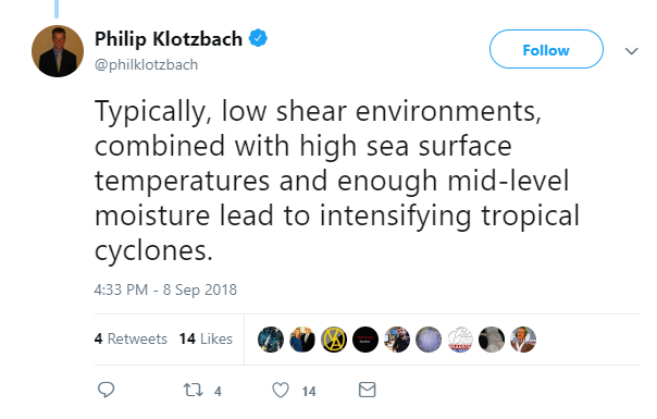
(posted as an image as tweet wouldn't embed properly.)
To be fair, he's responding to person's question on Twitter. I'm surprised he didn't begin by explaining what a surface low is...-
1
-
-
251 WTNT44 KNHC 090242 TCDAT4 Tropical Storm Isaac Discussion Number 6 NWS National Hurricane Center Miami FL AL092018 1100 PM AST Sat Sep 08 2018 Isaac is strengthening this evening. Satellite images indicate that the deep convection has been increasing in intensity and coverage with better defined banding features. The center is not located in the center of the convection, however, due to some easterly shear. An ASCAT pass around 00Z showed maximum winds in the 40-45 kt range. These data are also in line with the latest Dvorak classifications of 3.0/45 kt from TAFB and SAB. Based on these estimates, the initial intensity is raised to 45 kt. Isaac will likely continue to strengthen during the next few days as the storm remains over warm waters and moves into an environment of decreasing wind shear. Beyond a few days, the SHIPS model shows a notable increase in shear, in part due to the outflow from Florence, which should end the strengthening trend and cause some weakening. With the exception of the HMON and COAMPS-TC models, the remainder of the intensity guidance is higher this cycle. The NHC intensity forecast is raised from the previous one, but it is a little lower than the HCCA and IVCN guidance. The storm is moving due westward at 7 kt. The track forecast seems fairly straightforward. A strengthening subtropical ridge to the north of the system should cause Isaac to move westward at an increasing forward speed during the next several days. This scenario is supported by the usually more reliable GFS and ECMWF models, and the NHC track forecast is near a blend of those aids. Based on the current forecast, Isaac will be near the Lesser Antilles in 4 to 5 days and interests there should monitor the progress of this system. FORECAST POSITIONS AND MAX WINDS INIT 09/0300Z 14.4N 37.5W 45 KT 50 MPH 12H 09/1200Z 14.4N 38.7W 50 KT 60 MPH 24H 10/0000Z 14.5N 40.9W 60 KT 70 MPH 36H 10/1200Z 14.5N 43.5W 70 KT 80 MPH 48H 11/0000Z 14.5N 46.1W 75 KT 85 MPH 72H 12/0000Z 14.5N 51.5W 85 KT 100 MPH 96H 13/0000Z 14.6N 57.0W 80 KT 90 MPH 120H 14/0000Z 15.0N 62.9W 75 KT 85 MPH $$ Forecaster Cangialosi -
Yeah I am a little puzzled at the HWRF's intensity, however, it is possible the shear axis from the Florence's outflow channel will stay north of Isaac due to a cutoff low in the central Atl., east of Bermuda. Also, a TUTT may develop over the Greater Antilles, which, if Isaac is positioned just right, there could be a sufficient upper ridge east of the Leewards to support major hurricane intensity. Granted, Isaac may encounter an unfavorable environment as it traverses deeper into the Caribbean. Unfortunately, it may have already impacted hard hit areas from last year before it reaches a more unfavorable environment.
-
510 WTNT44 KNHC 082048 TCDAT4 Tropical Storm Isaac Discussion Number 5 NWS National Hurricane Center Miami FL AL092018 500 PM AST Sat Sep 08 2018 The structure of the cyclone, while still a shear pattern, is improving, with the low-level center now near the convective overcast and improved outflow in the eastern semicircle. Satellite intensity estimates have increased to the 30-45 kt range, with the CIMSS satellite consensus technique now suggesting winds near 35 kt. Based on these estimates, the initial intensity is increased to 35 kt and the depression is upgraded to Tropical Storm Isaac. Isaac is now moving slowly westward, with the initial motion 275/6. The subtropical ridge to the north of Isaac is forecast to steer the system westward with an increasing forward speed for at least the next 2-3 days. After that time, there is some uncertainty in the track forecast due to the formation of a mid- to upper-level trough over the central Atlantic, with some of the track guidance showing a decrease in forward speed and a more northerly motion near the end of the forecast period. The GFS and ECMWF models show a continued westerly motion through that time, and the official forecast follows that scenario, although with a slower forward speed than in the previous forecast. The new forecast is again similar to the earlier forecast and lies near the various consensus models. Conditions appear favorable for gradual strengthening during the next 72 h as Isaac moves westward across the warm waters of the tropical Atlantic. In best agreement with the SHIPS model for the next three days, the new intensity forecast is raised from the previous forecast during this time. From 72-120 h, the system is expected to encounter westerly wind shear, which is expected to cause some weakening. FORECAST POSITIONS AND MAX WINDS INIT 08/2100Z 14.5N 36.6W 35 KT 40 MPH 12H 09/0600Z 14.6N 37.7W 40 KT 45 MPH 24H 09/1800Z 14.7N 39.5W 50 KT 60 MPH 36H 10/0600Z 14.7N 42.0W 60 KT 70 MPH 48H 10/1800Z 14.7N 44.6W 65 KT 75 MPH 72H 11/1800Z 14.5N 50.0W 75 KT 85 MPH 96H 12/1800Z 14.5N 55.5W 75 KT 85 MPH 120H 13/1800Z 15.0N 61.0W 70 KT 80 MPH $$ Forecaster Beven -
12 minutes ago, WxWatcher007 said:Looking like this could be Isaac at 5pm.
Little doubt. One look at the visible and even though the TC is still encounter mid-level easterly shear, that i abating. Convection canopy and MLC looks slightly more aligned. If you focus on low-level cumulus cloud flow on the south side of circulation, it is screaming east. This has got to be of TS intensity.Edit: Oops. Board is lagging and messed up initial post.
-
720
WTNT44 KNHC 080255
TCDAT4

Tropical Depression Nine Discussion Number   2
NWS National Hurricane Center Miami FL       AL092018
1100 PM AST Fri Sep 07 2018

The depression continues to be impeded by moderate easterly shear
with the center of circulation decoupled to the east of a deep
convective banding feature.  The initial intensity is held at 30 kt
based on subjective intensity estimates from TAFB and SAB.

The dynamical-statistical intensity guidance, as well as the
large-scale models, indicate that the shear should diminish to less
than 10 kt within the next 24 hours.  A more favorable upper-wind
pattern along with warm oceanic temperatures is expected to promote
steady strengthening commencing after that time.  The intensity
forecast is based on a blend of the IVCN and the HCCA consensus
models and remains below the stronger HWRF at days 4 and 5.

The depression has been meandering during the past several
hours, as a result of weak low- to mid-level steering currents
created by a deep-layer trough digging southward over the eastern
Atlantic.  In 12 to 24 hours, a westward motion with a gradual
increase in forward speed is forecast thereafter as the trough lifts
northeast, and the subtropical ridge re-establishes to the north of
the cyclone.  The NHC track forecast lies closest to the HCCA and
TVCN guidance and takes the system toward the Lesser Antilles by the
end of the forecast period.


FORECAST POSITIONS AND MAX WINDS

INIT  08/0300Z 13.9N  34.9W   30 KT  35 MPH
 12H  08/1200Z 14.1N  35.6W   35 KT  40 MPH
 24H  09/0000Z 14.2N  36.7W   35 KT  40 MPH
 36H  09/1200Z 14.3N  38.4W   45 KT  50 MPH
 48H  10/0000Z 14.4N  40.4W   55 KT  65 MPH
 72H  11/0000Z 14.4N  45.2W   75 KT  85 MPH
 96H  12/0000Z 14.4N  50.2W   80 KT  90 MPH
120H  13/0000Z 14.9N  56.2W   85 KT 100 MPH

$$
Forecaster Roberts
Major Hurricane Florence: STORM MODE THREAD
in Tropical Headquarters
Posted
Harvey had exceptional upper atmospheric environmental conditions on approach, a tight vortex and 30-31°C up to the shoreline. Florence is a much larger hurricane. It's not impossible that Florence could make landfall as a Cat 4, it's just not as likely based on slow movement in a less favorable environment.