

J.Spin
-
Posts
6,151 -
Joined
-
Last visited
Content Type
Profiles
Blogs
Forums
American Weather
Media Demo
Store
Gallery
Posts posted by J.Spin
-
-
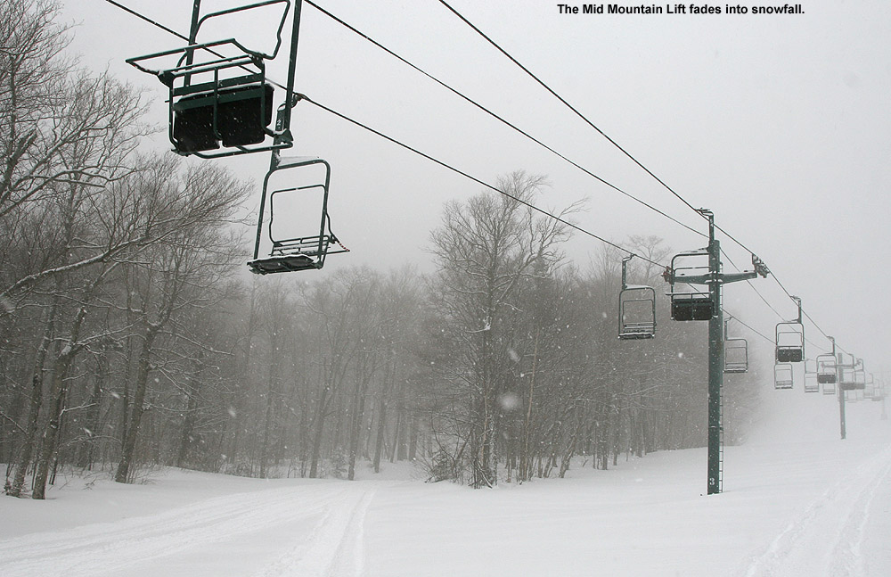
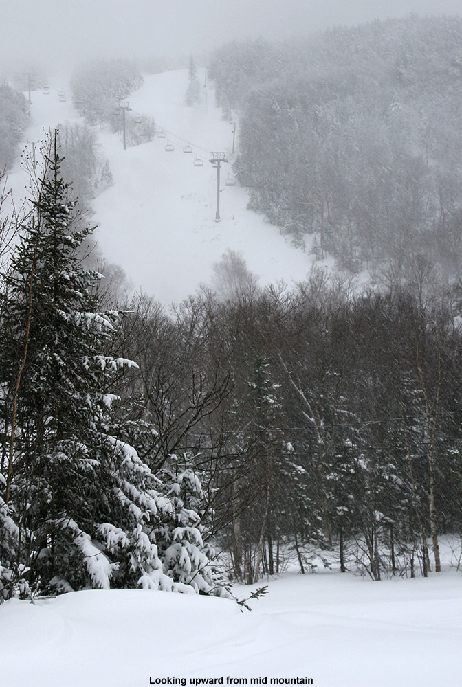
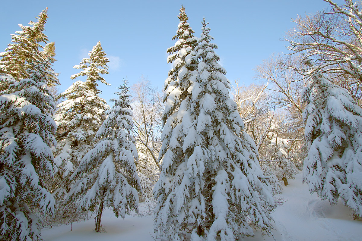
The clipper that began affecting the area Thursday evening was definitely potent – by the time I headed up to the mountain early Friday morning, we’d already picked up 7 inches of new snow at the house. I couldn’t really get a sense for accumulations heading up the Bolton Valley Access Road, but up in the Bolton Valley Village elevations around 2000’ I was measuring 8 inches of new snow. That was definitely a transient number though, because it was snowing at least an inch an hour. Visibility was so low in the heavy snowfall that you could only see about a dozen chairs on the Mid Mountain Lift – beyond that it simply disappeared.
I started off my session with a quick tour up to about 2,500’ using the Wilderness Uphill Route. Powder depths didn’t seem to increase drastically with elevation, as I measured about 9 inches at the 2,500’ level. Being a weekday morning, it was very quiet and I don’t recall seeing another soul until a lone rider appeared as he descended the Wilderness Liftline off in the distance. The Vista Quad had started loading, and the appearance of the rider meant that people were starting their first descents. It was a good sign that it was time for me to descend as well. I descended on Lower Turnpike, which hadn’t seen much skier traffic, so there were plenty of fresh turns to be had. I’d brought my 115 mm fat skis, and they were definitely the right tool for the terrain, keeping me surfing at a nice pace on the lower angle slopes. My analyses from down at the house indicated that we’d picked up about a third of an inch of liquid at that point, and assuming something similar for the mountain that meant the powder was somewhere in the 3 to 4% H2O range. It offered little resistance with respect to slowing my descent, and fat skis were more than enough to keep the turns bottomless.
After my descent I caught up on texting with my colleague Stephen about getting together for some turns. He and his son were just finishing up in the lodge and met up with me a few minutes later. We rode the Vista Quad and hit Alta Vista followed by Fanny Hill. The subsurface out there is really firm due to the extended period we recently went through without much snowfall. Aside from the areas of powder along the trail edges, Alta Vista was really firm. Fanny Hill was much better – after the initial steep chute area, the rest of the trail was out of the wind and had seen little skier traffic. It had a mid-angle pitch that skied perfectly for bottomless turns in the available powder. I couldn’t stay too long at the mountain, but from what I was able to sample, that mid-angle terrain was great. You really wanted to be getting fresh tracks though for quality turns – there just wasn’t enough liquid equivalent down at that point to really hold up to multiple skiers before you’d be contacting the base. A third of an inch of liquid can’t go too far in that regard, but thankfully it was midweek so there were plenty of opportunities for untracked snow.


-
 5
5
-
-
59 minutes ago, powderfreak said:
Yeah I like 3-6” for the mountain through noon tomorrow, then another 2-4” into Sat AM. Say 5-10” by 7am SAT. Can apply that to all local mountains.
I’m a little skeptical of 8”+ by 1pm tomorrow but when am I not? If ratios are 25:1 it’ll get there.
18 minutes ago, bwt3650 said:very reasonable...I think it will be a wintery feel throughout the holiday weekend with very few actual breaks in the snow at the mountain. Throw in another 3-6 Sunday into Monday, and President's day itself, when everyone is leaving might be a sneaky top ten day of the season. Midweek skiing next week should be great.
I think PF’s thoughts are quite reasonable as usual – the larger numbers can likely come about depending on how high the snow ratios are. I put some of the BTV NWS forecast discussion below – it looks like they are seeing some increased QPF values relative to earlier. I’m not sure which specific models they’re focusing on, but they do mention the extra moisture from the Great Lakes, which we wouldn’t always have as much of this time of year.
The quality of the resurfacing for the slopes really depends on the amount of liquid equivalent anyway, so in that regard the actual snow amounts are really just for record keeping.
.NEAR TERM /THROUGH FRIDAY/...
As of 911 AM EST Thursday...
Mainly clear skies will prevail this morning before high clouds begin to stream in later today ahead of a quick, moisture- ridden clipper. With this update, moisture has increased across several model solutions, causing us to increase our QPF amounts. The low pressure clipper appears to draw some extra moisture from the Great Lakes, which remain virtually free of ice. With this QPF increase and expected snow ratios remaining relatively high, our snow totals have also increased, which spurred both an addition to the Winter Weather Advisory already in effect as well as an issuance of a Winter Storm Warning in southeastern St. Lawrence County. For the Winter Weather Advisory, we have added Essex, Caledonia, and Orange counties of Vermont with expected snowfall amounts of about 3 to 6 inches.
The spine of the Greens could also score a large amount of snow with this system with up to 10 inches possible at highest peaks. One of the main concerns for this clipper will be the potential for high snowfall rates of around 1 inch per hour in northern New York and gusty winds blowing snow around to reduce visibilities.
Travel for the Thursday evening and Friday morning commutes may be treacherous. The snow growth zone is looking well saturated for the duration of the event, and models indicate solid frontogenesis stretching across northern New York.
-
1
-
-
I saw that the BTV NWS updated their maps this morning, so the new ones are pasted below. On the Event Total Snowfall map, a notable update is the appearance of the 8-12” orange shading along the spine. The point forecast for our site is in the 6-10” range through the day tomorrow, and that seems consistent with the map, which goes through midday Friday. More snow is expected into Friday night though, and with a quick look at the series of impulses coming through, I wouldn’t be surprised if the mountain areas along the spine of the Northern Greens didn’t see too many breaks in the showery regime right through Monday. Even in the valley, the graphic panels from our point forecast suggest snow chances throughout the period:


-
5
-
-
5 hours ago, bwt3650 said:
The 3-5 today is blown all over the place, but that, combined with 6-10 by Saturday and maybe another 3-6 late weekend and early next week would go a long way right now. This is the bread and butter set up over the next 7 days we need to get back into the game. I'd have to think losing about 10 days worth of accumulation in peak snow climo has put us significantly behind average now.
The cumulative snowfall plot for our site (below) clearly shows the period of snowfall stagnation we just went through – we’d recovered right up to a very average pace with those early January storms, and held that pace for much of January. A flat stretch like we had obviously threw us behind. We’re ~66% of the way through the snowfall season as of today, and snowfall at our site is currently 82.3% of average (down from being at 96.7% of average snowfall pace as of the end of January). This recent slow stretch wasn’t as long as the December one though.
Up at elevation above us, I see that Bolton is reporting 186” on the season as of this morning, and based on my calculations, they should be at about 206” if they were on average pace, so that would put them at 90.2% of average. They were a bit ahead of the game due to some of those large, elevation-dependent storms, so that’s kept them closer to average.
If we get into a bread and butter pattern like the modeling shows though, we could certainly make up a bit of ground. We really haven’t been in that bread and butter clipper pattern much this season. We made up for it somewhat with those larger systems, but those maintenance snows are part of the climate up here that really makes a difference. One potential benefit going forward is that Great Lakes moisture is somewhat more in play than it normally would be at this time of year because they haven’t cooled off as much with the mild weather.

-
4
-
-
17 minutes ago, mreaves said:
I wonder why I don't get those text alerts? Anyway, nice to see a slight uptick and the advisory.
Hmm, not sure on the alerts – they do come in the same text stream as all my Washington County VT-511 traffic alerts though.
-
This afternoon I received a text that we’d been put under a Winter Weather Advisory in association with the upcoming clipper system, and the latest BTV NWS maps are below. Our point forecast comes in around 5” to 8” of snow accumulation through Friday night, which generally lines up with the Event Total Snowfall map having us in the darkest blue 4-6” shading, but fairly proximal to the yellow 6-8” shading. Checking the point forecasts in the Bolton-Stowe-Smugg’s stretch of the spine just to our north, I’m seeing projected accumulations through that period top out in the 4-10”/5-11” range, which is where they’ve put that concentration of yellow shading.


-
1
-
-
Today was forecast the be the warmest day of this current stretch, and while there was a chance for showers, it was sunny most of the morning. We had an appointment in the afternoon, but with sunshine and valley temperatures expected to get into the 50s F, it seems like too nice a day to pass up the chance to get in some turns.
We headed up to Bolton’s Timberline area, since the relatively low elevation and exposure there make it the best bet for the snow to start softening up. I think even snow on the main mountain would have been fine though – the snow was already nice and soft all the way up to the Timberline Summit at 2,500’ when we arrived in the midmorning period. With the soft snow and sunshine, today on the slopes had more of a March feel than a typical February feel.
I don’t think the snow has seen too much freeze-thaw cycling over the past couple of days, but in general it was skiing quite well. I felt that my skis were sticking just a touch at the start of my first run, but that seemed to disappear quickly, so it was likely just an issue of working off some old wax or maybe some residual skin glue that had been left over from last weekend’s ski tours. We found the best turns to be where others were churning up the snow and getting down a bit into the cooler layers, but in general you could go anywhere. In terms of coverage, even the natural snow trails down at Timberline elevations are doing well, with a few bare spots here and there that were inconsequential in general. They’ll need some additional winter storms though for those lower elevation trails to maintain robust coverage into March and April.


-
3 hours ago, MRVexpat said:
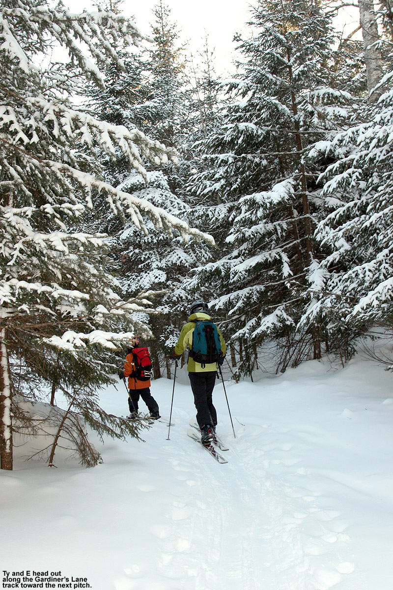
Got out into the Bolton BC on Saturday for my first tour ever in that area. Lots of terrain to be had! We skinned up to Stowe View and then dropped into the Cotton Brook area via Paradise Descent. More of a cut trail than a glade run for the first several hundred vertical feet before it opened up more as the terrain first steepened, then mellowed out. The real fun was had on the south facing aspect of the ridge that separates the Cotton Brook basin from Nebraska Valley. Lots of great ski terrain there that wasn't too steep and the 2-3" that J Spin mentioned skied well on top of a light crust. We were tempted to drop the other side of the ridge into Nebraska Valley for a nice long descent but were running out of time. After skiing the southern aspect back down to the Cotton Brook basin we skinned up to the Catamount trail and made our way back to the Bolton base area via some glades off of Gardiner's Lane. All in all a great day!
That’s great to hear you got out – I wasn’t sure if you would change plans based on the size of the most recent storm. Thankfully that clipper was helpful in at least taking the edge off a bit with respect to the snow surfaces, and as you noted, the base isn’t bulletproof hard or anything. As you probably observed as well, turns in untracked snow on those lower angle pitches were actually fairly pleasant. It sounds like you hit a lot of great areas in your tour, so I hope you get a chance to try them out with a more substantial dump at some point. That first image of yours looks like it’s from Stowe View based on that caked-up tree on the right – it seems to be the same one I had in my image from that area.
-
On 2/1/2024 at 8:58 PM, powderfreak said:
I’m definitely jonesing for a period of trackable winter weather.
Today was gorgeous, but we’re definitely in a dry spell with respect to winter weather events.
Relative to the usual frequency of winter storm in the Northern Greens at this time of year, the period we’re in right now feels like being in the middle of a desert. The little clipper system that came through at the end of the week would typically be just a blip in the storm parade, but in this case it was a much appreciated mini oasis for this stretch of winter. I wasn’t sure if I was going to ski at all this weekend, let alone get out for two sessions, but the way the new snow set up the low angle terrain for powder turns wound up creating some respectable conditions. And then of course there was today’s perfect midwinter weather with clear blue skies and temperatures pushing into the upper 20s F – that really sealed the deal to get out for another ski tour.
On yesterday’s tour I hit a good collection of low angle terrain and explored some new spots that don’t typically lend themselves to great turns in deeper powder. Whereas yesterday I’d topped out around 2,800’ on Heavenly Highway, today I pushed out a bit father out toward Stowe View and topped out around 3,200’. Even up at that altitude, I wasn’t detecting any notable increases in new snow depths, so the general 2 to 3 inches that I’d encountered yesterday was still the rule.
My target terrain for today was some of the lower angle slopes in the Moose Glen/White Rabbit area. I hadn’t been up there in a while, and it turns out there was a lot of terrain that was steeper than I’d remembered, especially in the initial parts of the descent dropping down from Stowe View and Moose Glen. Although that terrain was a bit steep for today’s conditions, the visit did serve as a reminder to get out there when the powder is a bit deeper, because the terrain is quite expansive. I eventually got into more of the lower angle terrain that I’d remembered, and that offered some nice powder turns with similar consistency to what I’d experienced yesterday. Overall I’d say yesterday’s tour had a slightly higher yield in terms of catching smooth, bottomless turns on the right terrain, but today being Sunday, it did mean another full day of visitors getting out there in the snow. Even on the backcountry network, traffic eventually tracks up the snow, and with these conditions, you really needed untracked snow for the best turns. Just one pass through the snow by another skier makes a big difference with these lighter accumulations.
One neat thing I did see today while heading up Birch Loop was a skier returning from out on the Catamount Trail heading toward Bryant Cabin. There’s a bit of rolling terrain there that isn’t optimal for having skins either on or off, and what he did was to have a skin on one ski but not the other. When he was skiing, he was one-footing it on the ski with no skin for maximum glide, and then he could use the other ski with the skin on it for better grip going uphill. I thought that was a pretty slick compromise for that sort of rolling terrain. Being on Telemark gear, I typically just go without skins on rolling terrain since herring boning on the uphill sections is simpler with the light gear, but that guy’s technique could be a nice way to go on a heavier setup like alpine touring gear.
The snowpack out there is midwinter deep and ready for prime time as soon as we get another decent storm - let’s hope something pops up before mid-month so we don’t have to spend another ten days in this veritable snowfall desert.


-
3
-
-
On 2/1/2024 at 9:09 PM, powderfreak said:
We just went +8.1F locally at MVL in January… Saint Johnsbury (1V4) with a period of record to 1800s was also +8.1F.
It turned into a +6 to +8 above normal January here. Thats pretty high-end to have temps of 30.2/17.4 for a mean up here.
On 2/2/2024 at 9:15 PM, powderfreak said:Definitely craving some sunshine at this point. Starting to go a bit crazy, ha.
2 hours ago, powderfreak said:Man, to see the sun again. What a treat. Some awesome alpenglow this morning too as the sun first came up.
That does tell you how potent the winter climate is up here when temperatures can run greater than +8 F and the average high is still below freezing. January is the perfect month to do that, and it’s a great way to run the month – we didn’t have to sit through any of those arctic weeks where you’re constantly dealing with all those cold weather issues like the hassles with vehicles, frigid lift rides, etc.
And, without that artic air constantly being driven right into our back yard, we didn’t have the problem of the moisture and storm track being pushed elsewhere. Over the years, one of the reasons I’ve seen our January snowfall take a hit in some seasons is because we deal with those artic weeks where you just can’t get new snow. The snowfall averages are the averages for a reason of course, so that’s baked into our climate, and it’s really just a “perceived” loss in snowfall because the parade of storms stops relative to what it was. In any event, this was one of those Januarys where we didn’t have to take that arctic snowfall hit.
The stats at our site definitely tell the tale. While January snowfall was actually just a bit above average and not especially notable, it was the most January snow we’ve seen in five seasons. And while the snowfall wasn’t overly noteworthy, the month did take its place among the records in a couple of different categories. Speaking to your comments about the lack of sun, we only had two days in the entire month without snow here at our site. That’s 29 out of 31 days with snow, and it tied January 2021 for the highest number of days with snow for any month in my records. This January actually has its real claim to fame in another category though – number of storms. The month had a total of 19 distinct storms/events, which simply blew away the previous record holders of December 2014 and December 2008, which both had 16 storms. So if it felt like it was snowy and we rarely got to see the sun out here in the Northern Greens, your perception was indeed correct. I don’t have the exact numbers, but Bolton Valley probably reported around 80 inches of snow from the month based on the 100 inches they had through the end of December? That’s not quite the typical doubling I often see for snowfall relative to what we record here in the valley, but it’s reasonably close. Similar to here in the valley, it was definitely a solid snowfall month for the resort.
I think if most skiers had their choice though, what we experienced was the way to run January: moderate midwinter temperatures that keep things below freezing, with solid snowfall plus lots of refreshers to top off the conditions and keep the powder days coming.

-
4
-
-
The clipper system that came through the area at the end of the week had been shown in the modeling for quite a while. Some of the earlier runs even suggested the potential for some additional upslope snow on the back side of the system, but that component faded in the prognostications as the week wore on, and the system was essentially a clipper passing north of the area. Yesterday morning’s early snow reports of 2 to 3 inches for the Northern Greens resorts were somewhat encouraging, and that was bolstered by PF’s comments from Stowe indicating that the snow wasn’t just fluff – it had some substance to it.
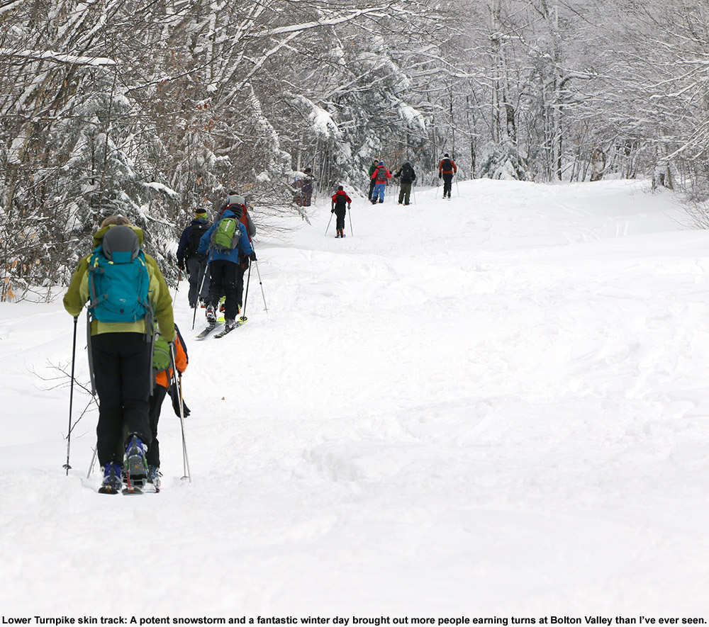
After a consistent run of storm cycles throughout January, we’re in a relatively slow period of snowfall right now. We haven’t had a substantial storm in several days, and it looks like it will be at least a few more until our next one, so this is likely our best immediate window of fresh snow. With that in mind, it seemed like a good day to get our for some turns, so I headed up to Bolton Valley for some touring on the backcountry network.
Starting from the Village at around 2,000’, I skinned up past Bryant Cabin to roughly 2,800’ on Heavenly Highway. The new snow depths were very much as advertised, with 2 to 3 inches of powder through that entire elevation range. There really wasn’t much increase in the snowfall totals at those elevations where I was touring, but the totals definitely started to tail off below 2,000’. I can’t say exactly how much fell at 1,500’, but it was noticeably less, and once you got below 1,000’ there was no new snow. At some point in the past several days there’s also been some riming in the mountains; you can see the rime on the trees at various elevations throughout the resort.
With the available snow I stuck to low-angle glades for as much of my descent as possible, and as noted, the new powder had some substance to it so the turns would up being quite decent. On mid-fats I was probably getting 25-50% bottomless turns on terrain with the appropriate pitch. And even when touching down, the turns were still feeling very good because the subsurface has some pliability – it’s certainly dense, but nothing like the sheet of ice that would result from a big rainstorm. The base snow is soft enough that you can punch down into the snowpack if you’re not on a floatation device like skis or snowshoes, and I saw numerous signs of this happening where snowboarders or hikers were traversing areas in boots.
For the last part of my tour on the backcountry network I worked my way along Gardiner’s Lane and made good use of the low-angle terrain there. In many areas I was able to explore lines that you often can’t hit because the powder is too deep to sustain good momentum, but they were great today, so I experienced a lot of new sections of the network that I often breeze past.
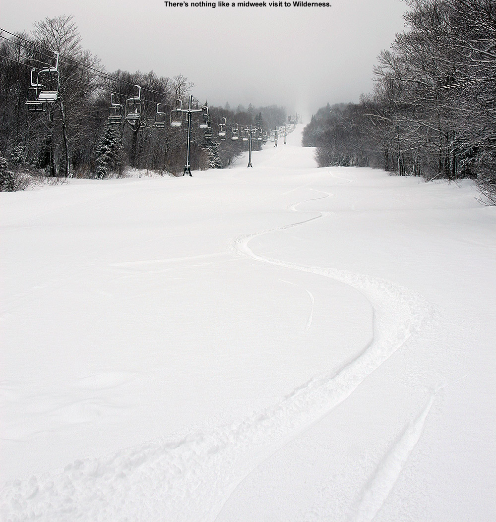
I connected onto the alpine trails at Lower Turnpike for the last part of my tour, and let’s just say, if you didn’t get out for lift-served turns around here today, you’re really not missing anything. Lower Turnpike typically maintains some of the highest quality snow on the alpine trails because of relatively low skier traffic, modest pitch, and good protection from the wind. Even there, the surface was firm unless I was able to get into the untracked powder off to the sides, and if it’s firm on Lower Turnpike you know it’s going to be very rough elsewhere. I don’t actually have to imagine what the conditions were like on the main trails though, because some friends sent us video of their son snowboarding today, and the sound of his board on the snow was excruciating. That’s probably going to be a common situation until the next substantial storm comes into the area or it gets very warm, so we’ll be looking for Mother Nature to get another good winter storm system through here as soon as possible.


-
6
-
-
On 1/30/2024 at 10:25 AM, bwt3650 said:
It really has fizzled out... looked so good for about 6-8 runs or so, but I agree; it’s not going to get it done.I’m seeing reports of 2 to 3 inches of new snow from the resorts in their early morning reports, so it’s going to be a nice addition, but we’re not talking the levels of snow/liquid that would be needed for a thorough resurfacing. It is actually snowing here in the BTV area at the moment, and the short-term models show the snow continuing through tonight along the spine as they have been, so we’ll see what additional snow they pick up through tomorrow. Watching the Bolton Valley Live Cam you can see that things look nice with the new snow, but the event would definitely need to be a couple notches bigger to really kick things up.
-
2 hours ago, bwt3650 said:
It really has fizzled out..looked so good for about 6-8 runs or so, but I agree; it’s not going to get it done.
Most of the models seem to be suggesting something in the range of 0.2” to 0.5” of liquid from the system through Saturday morning, with the GFS on the high end at 0.60” up in the Jay Peak area from its most recent run. As I mentioned, this far out, I find that the GFS seems to have better depictions of what happens in the Northern Greens with these northerly systems (maybe the other medium range models don’t have the mountains incorporated into their modeling in the same way). It’s interesting to note that the BTV NWS actually touches on this concept in their discussion:
“For now, leaned towards the GFS depiction, enhancing QPF a bit in areas that do well with low Froude numbers.”
One can’t even use the short-range models yet for total precipitation because they don’t really cover out through the end of the event, so they’re not quite in the mix yet. The current timing of this event is great though in terms of hitting the slopes, it would start up on Thursday and finish up on Saturday morning. For the most part this is an icing on the cake event since the snowpack is plenty robust in terms of coverage with four feet at the Mt. Mansfield Stake. Personally, I’d need some sort of event to entice me out though, since the conditions are going to be fairly blasé otherwise. My younger son was out on Saturday and he confirmed that – there just wasn’t enough interest among his friends to head back out on Sunday.
The BTV NWS is definitely starting to dissect the potential in their discussion though; we’re definitely lucky to have them using their expertise for all the mountain recreation interests. This should be nice to watch over the next few days to see how it ultimately plays out.
National Weather Service Burlington VT
924 AM EST Tue Jan 30 2024
.SHORT TERM /WEDNESDAY NIGHT THROUGH THURSDAY NIGHT/...
As of 409 AM EST Tuesday...Most, or possibly all, of the active weather during the next seven days will be in this timeframe as a clipper rolls through near or just north of our region. To see moderate snowfall from these systems you need the track to our south, and its low pressure center may also be on a slight weakening trend as it approaches. That being said, widespread light precipitation will occur for much of the day Thursday, transitioning into potentially a decent upslope snow event Thursday night. Some possible limitations for snowfall during the daytime will be associated with warm boundary layer temperatures and track of the upper level shortwave. If precipitation is on the light side and/or arrives well after sunrise, expect temperatures in the wide valleys/lowest elevations to be above 36 degrees, making rain about as likely as snow. However, if the system tracks overhead as depicted by the 00Z NAM-12, better cooling and upper level divergence will aid in both precipitation rates and snow growth. The strong global model consensus at this time does favor a track farther north. Without particularly deep moisture to draw from, low level westerly flow could induce a shadowing effect of precipitation, east of the high peaks of the Adirondacks and Green Mountains. Overall, snow accumulations will probably be elevationally dependent and on the wetter side of average (about as 10-12:1 snow-to-liquid ratio) during the day, with some slick travel possible across the Adirondacks and central and eastern Vermont, especially northeastern areas.
Moving into Thursday night, there are signals for upslope snow with blocked flow given weak westerly to northwesterly flow and abundant low level moisture. As cold mid-level temperatures and associated push of stronger northwesterly winds lag behind the exiting clipper, snow showers will be quite terrain-driven. For now, leaned towards the GFS depiction, enhancing QPF a bit in areas that do well with low Froude numbers. With 850 millibar temperatures on the warm side Thursday night (roughly -6 to -7 Celsius), snow ratios will tend to be lower than normal for upslope snow showers, limiting snowfall amounts. A preliminary snowfall forecast through Friday morning shows the expected upslope impacting amounts greatly, where 2 to 4 inches in much of the western Adirondacks tapers off to an inch or less in areas like the Ausable Valley. Similarly 2 to 3 inches may be common in the western slopes of the Greens, tapering to 0.5 to 2 inches in the eastern Champlain Valley and with lowest snow amounts of a dusting or so in the lower Connecticut Valley.
-
19 hours ago, bwt3650 said:
Gfs has been hammering days of upslope starting late week into next weekend for several runs now. Nice signal and position.

Yeah, I’d noticed that for a few runs. About 48 hours back, the modeling suggested the possibility of the low pressure hanging up in Northern Maine and the Canadian Maritimes for a bit, and we of course know what potential that holds for the Northern Greens, but that isn’t prominent in the more recent runs. You’ll see that right now that the BTV NWS forecast discussion mentions the shortwave that pivots through the region Thursday into Friday. Even if it just pivots through though, the current GFS modeling suggests a half inch or so of liquid equivalent, which is a decent resurfacing for the low and moderate angle slopes, although it’s not going to cut it for the steeper pitches. It could be double digit snowfall depending on the ratios, but it’s really the liquid that matters for the resurfacing. None of the other models are as robust with the moisture as the GFS, so it can’t be taken more seriously until other models start to bump up the QPF. The BTV NWS will be all over it in their discussion if the QPF starts to increase in the next couple of days.
I do find that the GFS is excellent in general when it comes to typical northern stream systems interacting with the Northern Greens in the medium range, actually the best overall from years of casual observation. When it comes to our bread and butter type systems, all I find I typically have to do is quickly run through what the GFS shows for roughly the next week out, and you’ll pretty much have an idea of what’s going to happen up here. Phasing systems and all that are an entirely different beast, but whatever coding and algorithms they have in the GFS, it seems primed to show what’s going to happen in the Northern Greens for our bread and butter systems better than any of the other medium range models.
-
2
-
-
1 hour ago, mreaves said:
I think the top photo is in the same place as this one I took a couple of years ago.
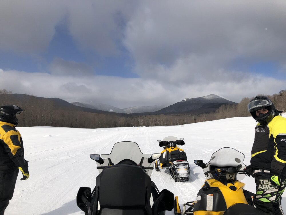

That’s seems very likely! I saw a couple of big open areas like that as I was heading to that Sterling Forest area, and they produced some great views of the Sterling Range. There were definitely signs of snowmobile activity in the area as well. In fact, there was a snowmobile trailer parked at the Sterling Forest parking area, and I saw one guy pass through the parking area on his snowmobile. Also, when you head out from the main access point to the trails, you cross a perpendicular VAST trail after a few minutes. With the elevation and snowpack they have in the area, it’s not surprising that there’s so much winter activity there.
-
Early this morning I received a text that we’d been put under a Winter Weather Advisory in association with the next storm coming into the area (Winter Storm Jarvis that put down various areas of freezing rain in the Midwest and south). The current BTV NWS Event Total Snowfall map has our area in the 2-3” shading, and that’s right in line with our point forecast as well.


-
1
-
-
Yesterday was still quite cold, so I again opted to stick to ski touring instead of riding the lifts, but it was a bit warmer than Saturday, and I decided to go a bit farther afield and higher in elevation. I set my sights on skiing in the Sterling Range, an area that has been on my list of ski touring spots for quite a while, but I just hadn’t gotten around to making the trip. A very convenient access point to the range is through the Sterling Forest area, and they have a really nice parking lot that’s maintained at the top of Sterling Valley Road.
I’d been up to the area in the warm season for mountain biking, but I haven’t been up there much in the winter. The snowpack around the houses up there is impressive, and you can tell that the area gets, and holds, a lot of snow. I guess it shouldn’t be too surprising with a number of houses that are well above 1,000’. Indeed there’s some good elevation there – the parking area is around 1,700’, which is 500’ higher than where I began my tour on Saturday.
Most people I’ve talked to, as well as reports and videos I’ve seen, use the Upper Gorge Loop trail area as their main thoroughfare for touring. It serves as the approach and as a collector trail if you’re skiing the north side of the basin. For my approach I followed the northerly section of the Upper Gorge Loop Trail, which seemed to be the most popular based on the packing of the snow. Following the trail, I began to see skin tracks branch off to head up the north side of the basin, but I continued on the loop trail until I hit its apex, just so I could get the lay of the land. I then skinned back a couple of minutes and took the highest skin track that was available. That brought me to the top of the ridge on the north side of the basin, and along the way I passed numerous open glades that had very few tracks and offered a lot of impressive skiing. I topped out around 2,900’ along the ridge, and descended through the glades back to the Upper Gorge Loop Trail.
Powder depths were very similar to what I found on Saturday with respect to similar elevations. I was curious if there might be a difference since I was about 12 miles farther north in the Northern Greens, but I didn’t. I did ascend substantially higher on this tour though, so it let me add on to what I’d found on Saturday. The powder depth profile I found was as follows:
1,700’: 7-8”
2,000’: 7-8”
2,200’: 8-9”
2,500’: 10-11”
2,700’: 11-12”
2,900’: 12-13”
There are other options for nice touring out there, such as dropping down the back side of the ridge into the next drainage, but the approach to the slopes in the main basin is already a couple of miles even before you begin the main ascent through the glades, so I couldn’t really tack on more with the time I had. It was a gorgeous midwinter day though, with lots of sunshine, and that definitely helped to bring the temperature up that extra notch.


-
2
-
-
Since yesterday’s forecast was in the single digits F, and there was the possibility of wind as well, ski touring seemed like the natural choice vs. riding the lifts. In addition, yesterday’s weather system, while certainly enough to freshen up surfaces, wasn’t expected to be large enough to really reset the powder in areas that had been recently skied.
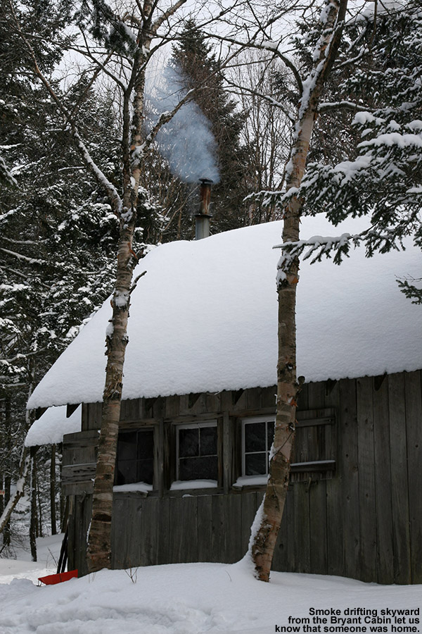
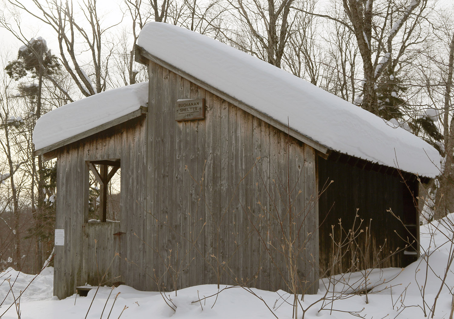
With the cold temperatures, and the way the depth and quality of the snowpack has been improving over the past week or two, I decided that I’d tour in some lower elevations around here to see what potential they held. I started my tour at the Catamount Trail access area at roughly 1,200’ on the Bolton Valley Access Road, and did a ski tour up to the Buchanan Shelter up near the 2,200’ elevation. That’s not a heavily used part of the Bolton Valley Backcountry Network, so I suspected that untracked powder would be relatively plentiful.
While I was out touring in the afternoon, light snow fell continuously, and throughout the tour I checked powder depths above the highest detectable subsurface layer in the snowpack. The powder depth profile I found with respect to elevation was as follows:
1,200’: 6-8”
1,500: 6-8”
1,800’: 7-8”
2,000’: 7-8”
2,200’: 8-9”
Even with cold temperatures, powder of the 3-4% H2O variety that we recently received can’t sustain that level of loft forever. Indeed the powder I encountered yesterday had settled down to something more in the 6-8% H2O range, so the numbers above are the depths to which the surface snow has currently settled. Obviously all these recent storms continue to push the useful snowpack to lower and lower elevations, so overall snowpack depth wasn’t an issue even down to the 1,200’ mark. It’s hard to get estimates of the total snowpack depth because the lower layers are so settled and thick, but the snowpack is maybe a couple feet deep down at 1,200’? It’s hard to say, but even if there was only a foot of base below the powder, it’s so consolidated and flush with liquid equivalent that it would easily do the job.
In terms of the skiing, the best turns were certainly up in the slopes below the Buchanan Shelter where there is some solid pitch up into the black diamond realm. The approach portions of the tour have enough pitch to make a nice glide out and grab a few low-angle turns in certain spots, but with the current depths and density of the powder, it’s on the slower side right now. Also, cold temperatures like these reduce ski glide somewhat due to less melting, so that factors in as well. In the slopes up by the Buchanan Shelter I had the run of the area though in terms of fresh tracks. One person had recently skied back down the Beaver Pond Access Trail, but that was even a bit old, so it must have been from a couple of storms ago. Off in the trees, there were no prior tracks of any kind, so I had my pick of the most open lines, streambeds, chutes, etc. Fat skis were the call, and turns were definitely bottomless, but the best turns came from hitting those correct areas that appropriately accommodated the pitch, powder depth, cold snow, tree spacing, and all that. There were some excellent powder turns on the tour though, so even down to the lower elevations in the ~1,000’ range, the current snowpack is really delivering


-
1
-
-
On 1/14/2024 at 12:29 PM, borderwx said:
Back to the regular Jan program apparently
Mountain absorbed the past week well, somehow skiing is the best of the season
Did not expect that. Looks like a good week of winter ahead.I’d been meaning to follow up on this mention of things getting back to reality when I had a chance. The snowfall data from here at our site say that’s precisely the case. On Tuesday, we caught back up to average snowfall for the first time since mid-December. That dramatic flat area on the plot below is a great visual representation of just how long the snowfall was languishing around here, and shows how far behind things were. On the recovery point though, we’re current bang-on average to the tenth of an inch with 73.3” for season snowfall, although that will likely change since we’re continuing to get snow from the current system. The current snowpack here is also within an inch of average, so for both snowfall and snow depth parameters, things are currently back to something quite “normal”. As you can see from the plot, over the past week we’ve pretty much been back and forth flirting with the line for average snowfall pace.
With over 40 inches of snow for the month here in the valley and 60 inches being reported from up on the hill at Bolton, January has thus far been an extremely helpful period around here for making up the deficiencies from that slow second half of December. The contributions from Winter Storm Ember, Winter Storm Finn, and Winter Storm Heather were extremely important and are shown by those dramatic January jumps on the cumulative snowfall plot.

-
By observations time early this morning, the backside snows of Winter Storm Heather had departed and skies here at the house were partly cloudy. The skies didn’t really seem to jive with the snow I saw in the forecast, but sure enough, clouds soon began to roll in, and within an hour, flakes were flying.
I decided to get in a quick morning session up at the mountain, and the snowfall continued to intensify as I ascended the Bolton Valley Access Road. Up in the Village there was steady snowfall, and while it wasn’t the pounding 1-2”/hour snowfall of yesterday, visibility dropped substantially and it felt like we were right back in the meat of the storm. It looks like today’s snow was rolling in from the lake effect snow event off to the west, so we thank big Lake Ontario for that.
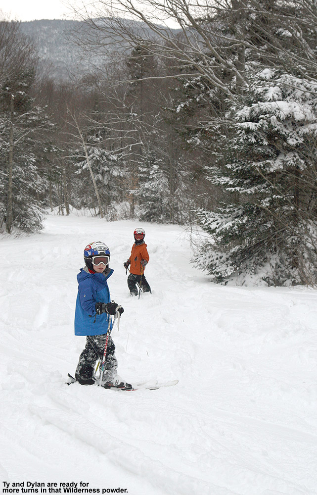
Wilderness was the hot ticket for skiing today, since the Wilderness Double Chair doesn’t run on Mondays and Tuesdays, and this was the first chance for lift-served access to all the recent snowfall from Winter Storm Heather. I decided to start off with a short workout tour using the Wilderness Uphill Route, then stuck around for a bit of lift-served skiing after that.
It’s getting a bit tougher to discern how much powder came specifically from Winter Storm Heather, since it’s just blending in with the layers below it as the subsurface is buried deeper and deeper, but the approximate powder depths I found today were as follows:
2,000’: 6-8”
2,500’: 8-10”
3,000’: 10-12”
There was definitely a bump in powder depths even compared to what we skied yesterday thanks to the additional overnight snow and the new snow that was falling. One obvious clue that depths had increased was the fact that the snow was now getting a bit too deep for low-angle terrain. Moderate and steep terrain skied the best today. I had a feeling we’d be getting to that point today, and indeed while I’d been on mid-fats for the past few day, today I bumped up to the fat skis and that was the correct call as long as you were skiing untracked snow.
Bolton Valley is indicated that they’ve picked up roughly 60 inches of snow since the start of the year, which is very solid snowfall total for the first half of the month. Heck, 60 inches of snow is respectable even for a full month’s total at many resorts.


-
2
-
-
A few more storm day session photos from yesterday’s outing at Bolton Valley skiing the snows of Winter Storm Heather…


-
2
-
-
It wasn’t even snowing this morning when my son and I headed off to Burlington for an early appointment, so we knew we’d be giving Mother Nature some time to get rolling and freshen up the slopes. The snow from Winter Storm Heather started up a couple hours later, and by midafternoon we decided to head up to Bolton for some turns.
We were happy to see that the Timberline Quad was running, so were able to park and start our session right there. Snow was simply pouring down at that point, and my initial measurements revealed storm totals of 4-5” at 2,500’ and 6-8” at 3,000’.
The snow was light and dry (my past couple of liquid analyses from down here in the valley averaged right around 4% H2O), so it was very high quality powder. With such cold smoke powder, you weren’t getting bottomless turns on steep terrain, but you could on low and moderate angle terrain, and the turns were great even if you were contacting the subsurface.
It was pounding 1-2”/hour snow the entire time we were on the mountain, so one could easily tack on another couple inches or so to the storm totals by closing time, and it even kept snowing into the evening.


-
7
-
-
In this morning’s update, Bolton was reporting an additional 3-5” of snow from yesterday’s lake-effect snow and snow squalls. The other recent snowfall numbers they had in their report looked solid, with 12” in the last two days, 27" since Tuesday night and more than 48” for the first half of the month. The season snowfall for the resort currently stands at 157”, and that’s very respectable since it’s already about half their annual snowfall average when we’re not even halfway through the snowfall season. What makes that pace more impressive is that they’ve had all that snowfall despite the second half of December being quite lean on snow. That really speaks to how much has been falling up there during the snowier periods.
There was no new snow falling today, which was somewhat notable because this morning’s snow report also indicated that if the current forecast for tomorrow’s snow comes through, they’ll be looking at 14 out of the first 16 days of 2024 with snowfall. With today’s break in the falling snow, I figured it was time to head out for a tour on the backcountry network as a reliable route to untracked powder.
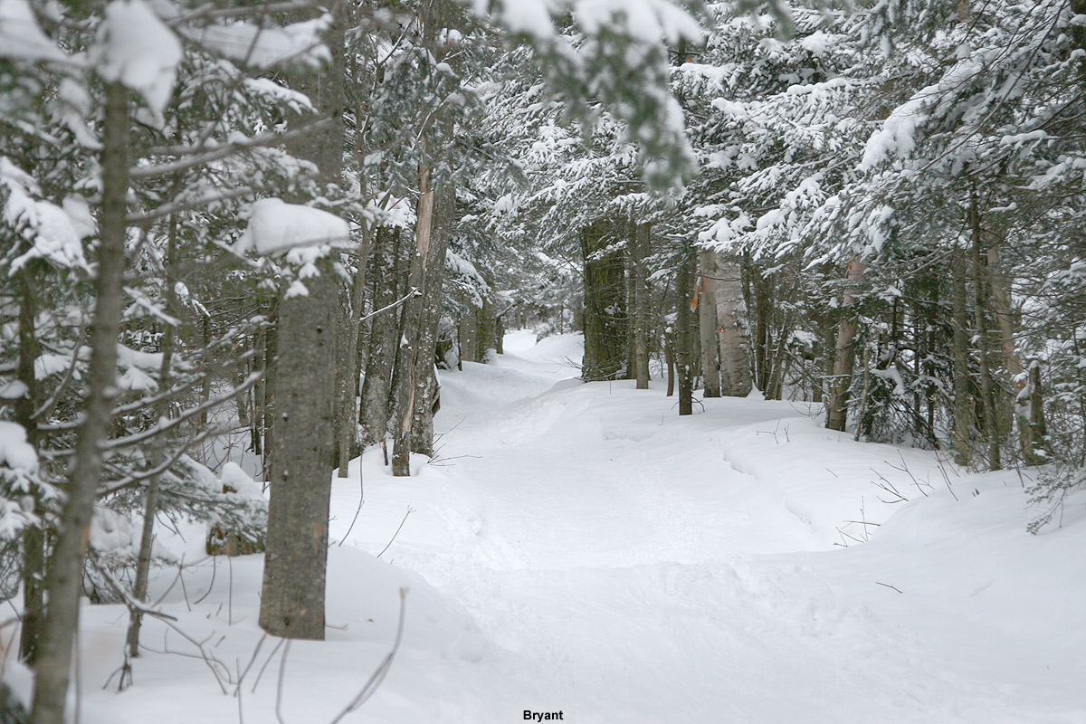
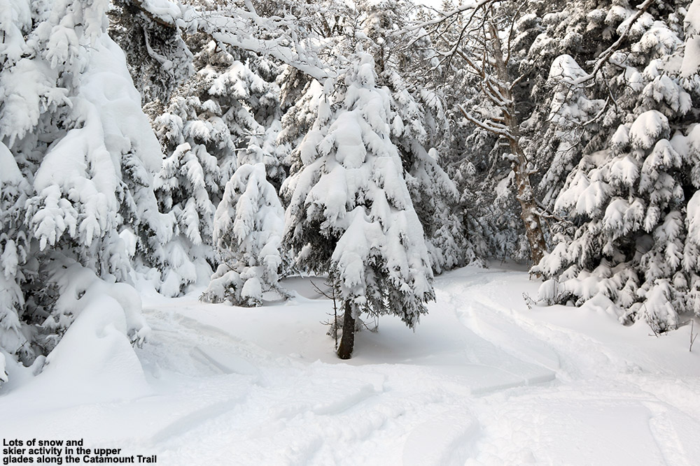
I decided to head up the Bryant Trail to Bryant Cabin in the afternoon, and play it by ear depending on how my supply of daylight was looking. I was well ahead of sunset, therefore I just continued on up to the Catamount Trail Glades so I could get in some turns in the higher elevations. Based on my recent outings at the resort, I knew that conditions improved a lot with elevation, so I wanted to get a good sampling of the powder up high. I topped out at an elevation of about 3,100’ on the back side of Bolton Mountain, descended through the Catamount Trail Glades, and then traversed back above Bryant Cabin and navigated a route through another half dozen different glades back to the base. Today definitely had a nice midwinter vibe, with bright afternoon sun, temperatures probably around 20 F, and great powder.
The surface powder and upper snowpack analysis was really interesting today. Starting my tour around 2,000’ in the Village, I found 4-5” of surface powder, and then there was a fairly solidified layer below it. That layer marks the wet snow that recently came from Winter Storm Gerri, which hardened up somewhat as temperatures dropped back below freezing. The surface snow above it is from the snow on the back side of the storm, plus the additional drier snows that have fallen over the past couple of days. As you ascend to higher elevations though, that hard layer gradually begins to soften, and then above 2,500’ it starts to disappear altogether. At that point there is another substantial subsurface layer, which I suspect comes from Winter Storm Finn. So, monitoring the elevation profile for the depths of the powder was bit unusual. Compared to the 2,000’ elevation, I didn’t detect any notable increase in the powder depths at 2,250’, but at 2,500’ it finally started to deeper, and as I continued higher, I could still sort of detect an interface from Winter Storm Gerri, but it eventually became hard to discern. So, what I’ve done for the surface snow depth elevation profile below is to indicate those different layers, with the first depth being snow down to the dense layer from Winter Storm Gerri, and the second being the depth of the snow down to the dense layer from Winter Storm Finn.
2,000’: 4-5”
2,250’: 4-5”
2,500’: 5-6”/8-10”
2,750’: 6-7”/10-12”
3,000’: 7-8”/14-16”
At some point between 2,500’ and 3,000’ that first depth number sort of becomes moot, and you’re essentially skiing in the 8-16” of powder depending on elevation, so go I’d say go in with that mentality. In terms of getting out there in the backcountry around this part of the Northern Greens, I’d recommend touring above 2,500’ if you can for the best turns. I went with mid-fats on today’s tour, but you could easily go with fat skis if you’re going to spend most of your time above 2,500’. When I was up in the Catamount Trail Glades in the 3,000’ range, fat skis would have been nice, except in some of the denser areas of evergreens where they have trapped so much of the snowfall on their boughs, that you actually notice the deficiency of powder below.
The system that is expected to come into the area tomorrow is name Winter Storm Heather, and any snow from that should really be icing on the cake in terms of the ski conditions. Temperatures are forecast to stay cold, so you can pretty much take the powder depths I have above and then tack on whatever new snow comes next.


-
7
-
-
5 hours ago, EMontpelierWhiteout said:
Some good model trends today throwing more moisture further NW. With high snow to liquid ratios, I think we’ll see some yellow shading along the spine in subsequent updates.
Indeed that yellow 6-8” shading is showing up as you suggested, so that’s good to see.


NNE Cold Season Thread 2023/2024
in New England
Posted
On Friday, my wife wanted to catch up with some friends who were doing some night skiing, so on top of my morning session, I ended up right back up at the mountain in the evening. It was very busy for a Bolton night skiing session, and we ended up parking in the lower tennis court lot because the others were so full. It’s very dark down there, but it does provide some neat views of the resort at night. It’s also right along the Nordic trails, so it makes for a fun evening ski to get back to the car. With so many visitors on Friday night, I assume all the new snow and the kickoff to the holiday weekend came together to really ramp up people’s interest for getting out for turns.
I doubt I would have headed up for the evening session were in not for getting out to make some turns with friends, because I would only have expected the on piste conditions to deteriorate further after a full day of traffic. And at night, only the most popular trails are open, so that means extra traffic in the high-traffic areas. One thing about the end of a long day though, especially when there’s been new snow, is that you do get those terrain areas where the snow collects due to traffic. Directly under the Mid Mountain Chair was one of those spots on Friday night. Patrol has set up marking poles right beneath the chair because the snowpack is deep enough that you might run into people’s skis, and even after the caution area, people never return to skiing the center near the lift towers and just push a lot of snow there. So, that held some of the best snow we found in the Beech Seal area.
Areas with traffic-related accumulations, and low-angle terrain were definitely the best bets when we were out Friday evening, but when possible, I’d recommend just heading out in the day and venturing off piste if you can. The off piste conditions are just so much better right now, especially on moderate-angle terrain and anywhere that is untracked. The subsurface is definitely firm, so do watch out for places where the wind has scoured the powder or evergreens are dense enough that it’s reduced accumulations – those areas can leave you bottoming out on some unforgiving snow.