

J.Spin
-
Posts
6,151 -
Joined
-
Last visited
Content Type
Profiles
Blogs
Forums
American Weather
Media Demo
Store
Gallery
Posts posted by J.Spin
-
-
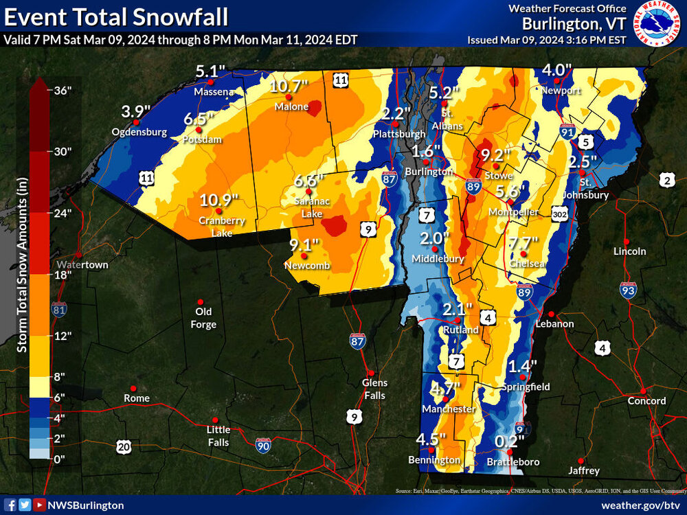
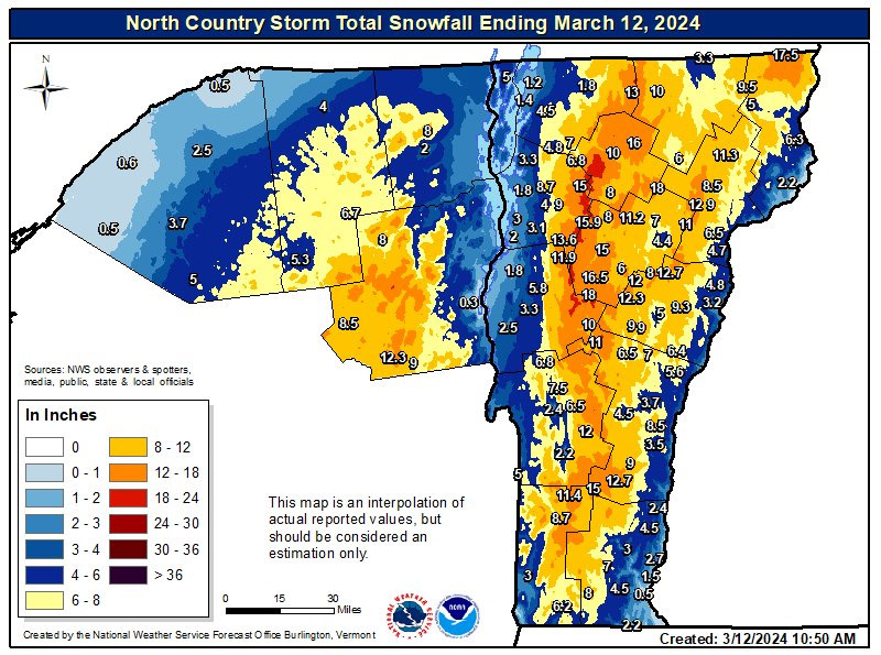
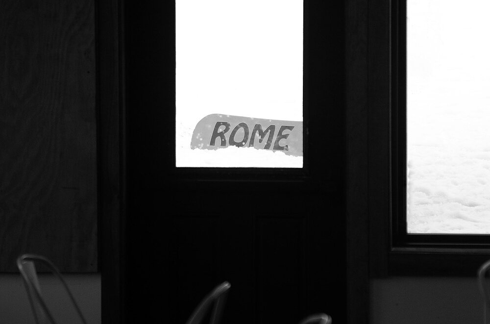
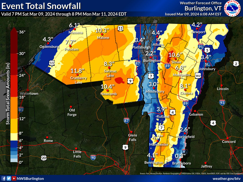
I see that the BTV NWS created a final storm total map for the system earlier in the week – it seems like a decent match with their Event Total Snowfall map in many areas. It was certainly on track around here at the spine of the Northern Greens.
-
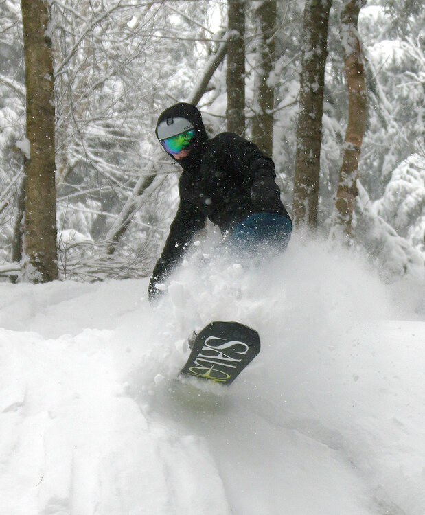
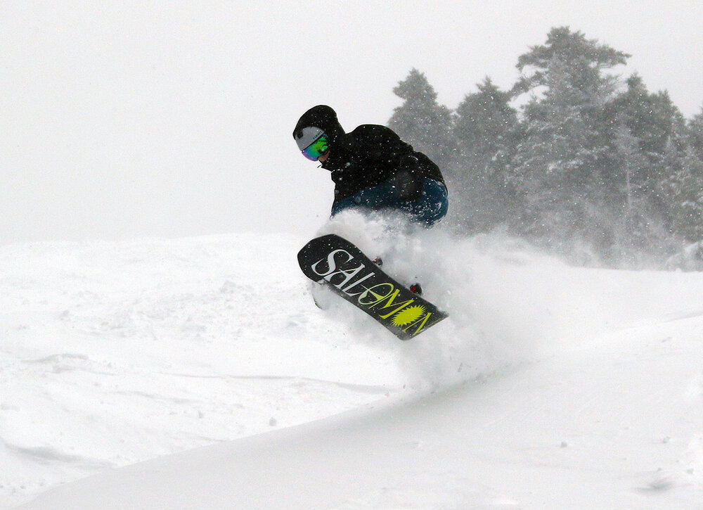
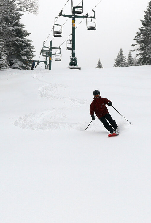
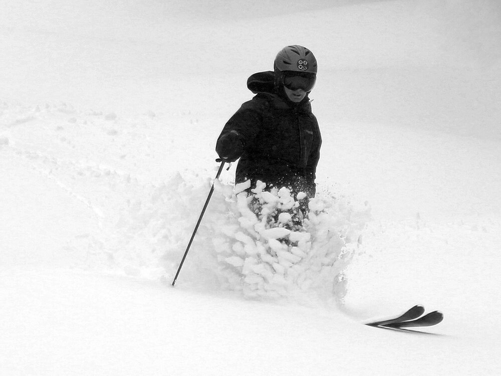
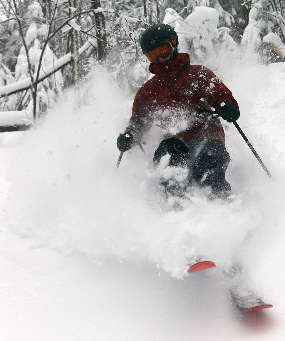
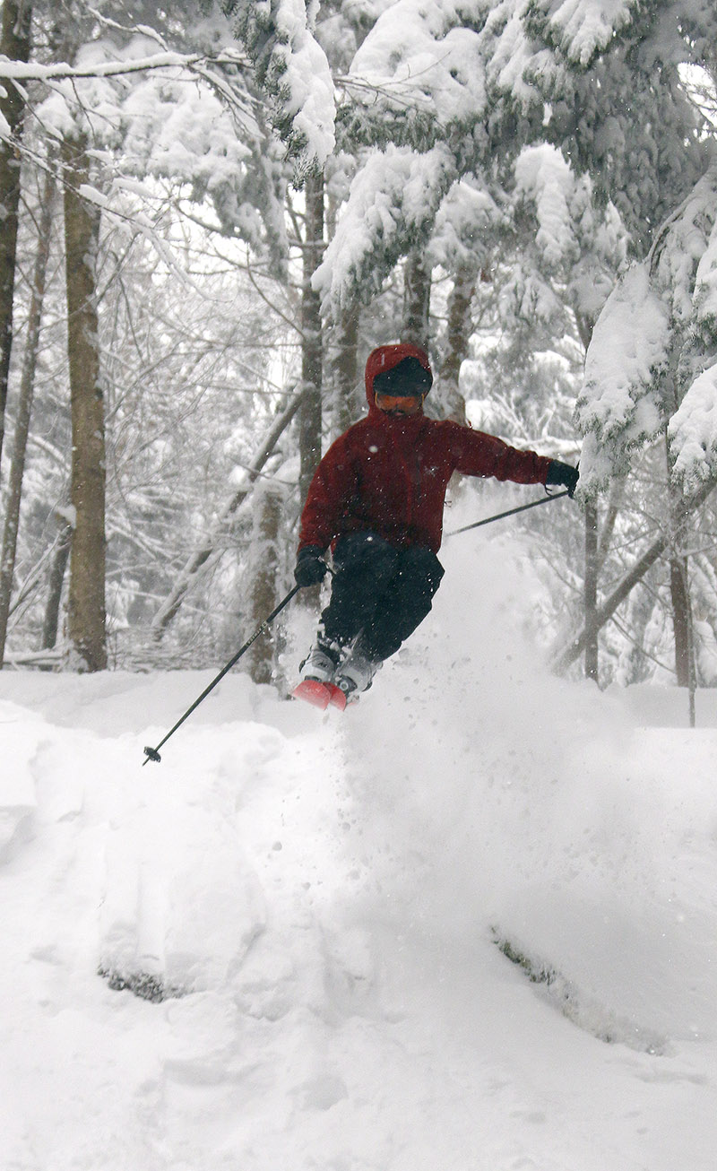
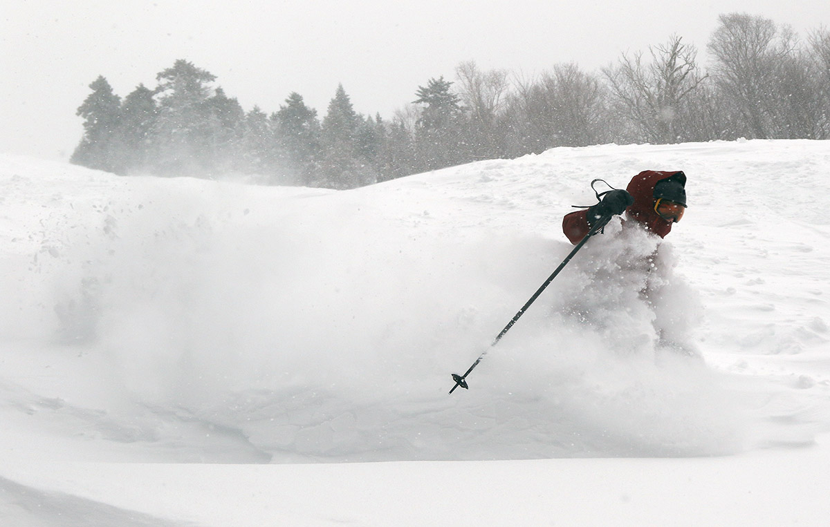
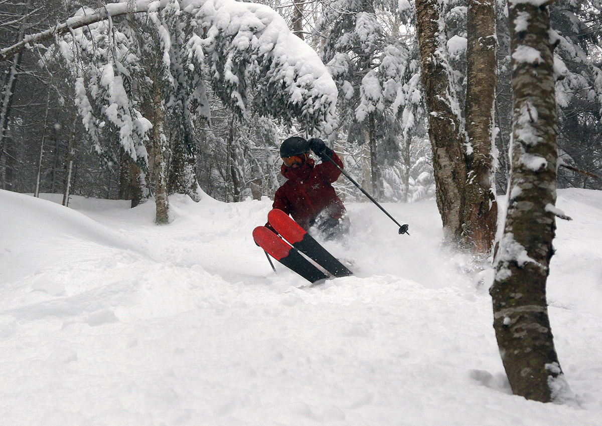
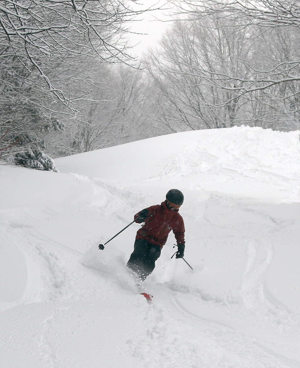
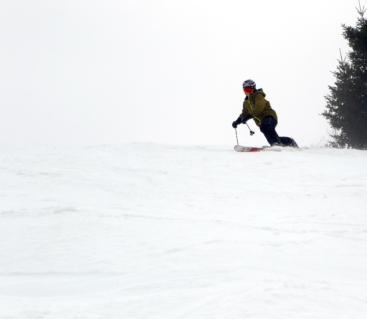
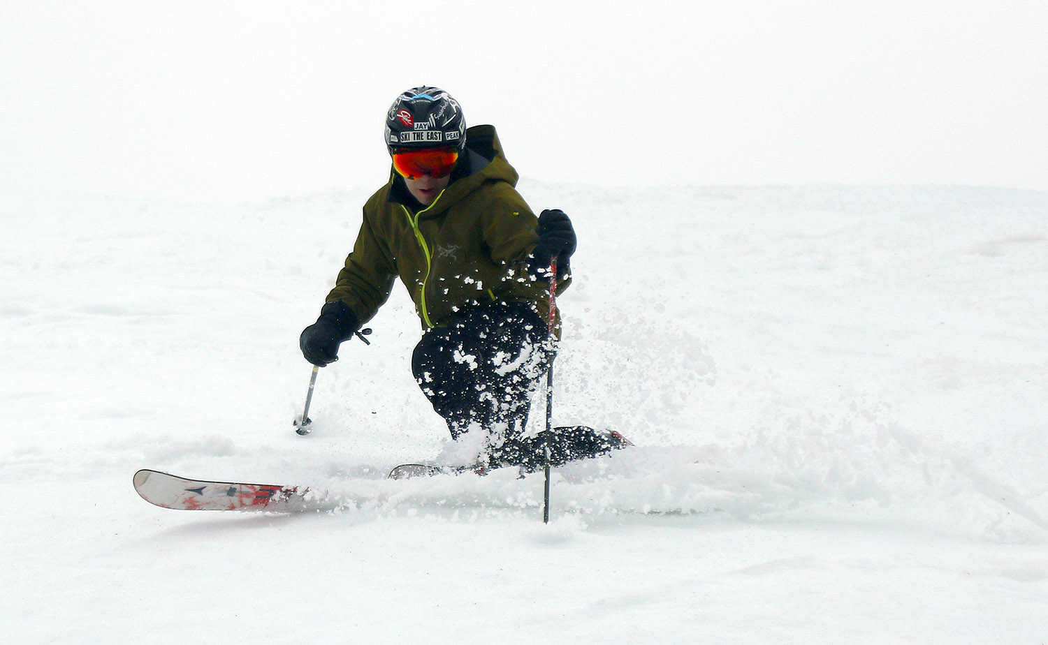
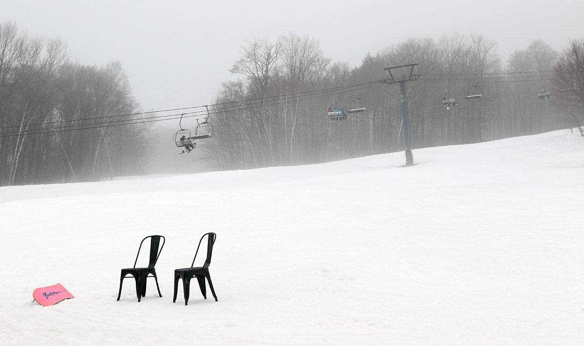
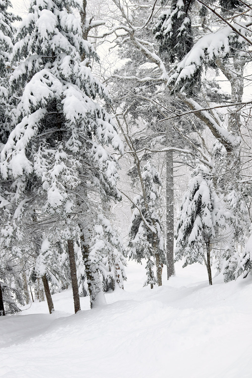
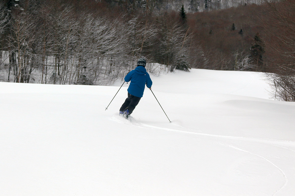
As our most recent storm cycle progressed into its second half on Monday, it brought prodigious upslope snowfall, but heavy winds also pounded the upper mountain areas at Bolton Valley. That meant that the Vista Quad Chair never ran on Monday, so all that fresh snow would still be sitting there for Tuesday.
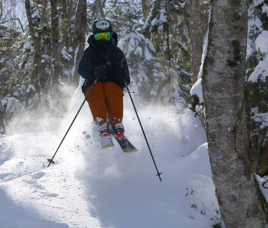
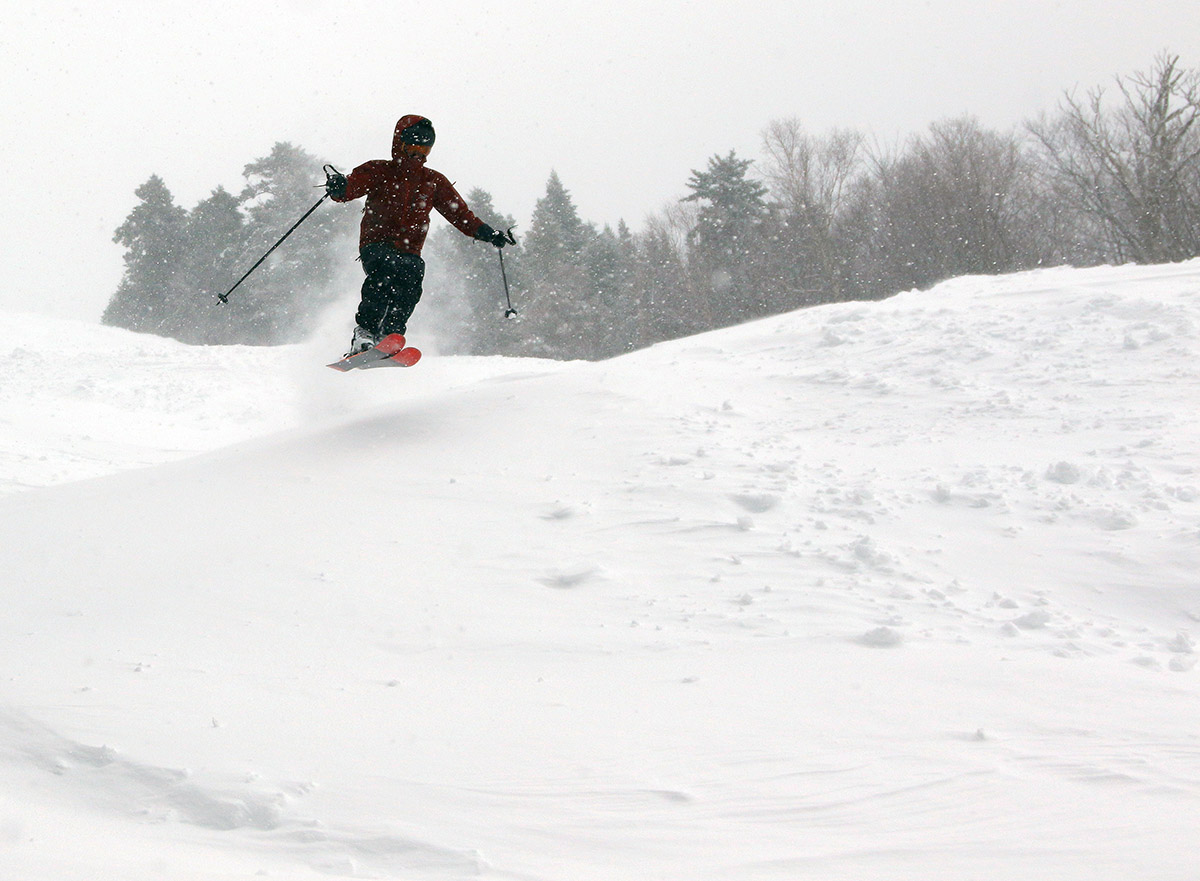
For my older son, Tuesday was one of his days off from work, so the two of us headed up to the mountain for a ski session. At this point in the ski season we’re well past President’s Day and school vacation week, it’s mid-March, and yesterday was just a random midweek Tuesday - we didn’t expect a lot of visitors to the mountain. Apparently nobody told the skiers about that though – we arrived up in the Village within a half hour of lift opening, and we were already having to park all the way down by the Sports Center, in an impromptu middle lane of cars. Where did all these people come from? What we eventually discovered was that every parent in the state had decided to pull their kids out of school for the day to get in some skiing. On our Vista lift rides, we literally paired up with multiple dads and their kids who had done this, so apparently it was the thing to do!
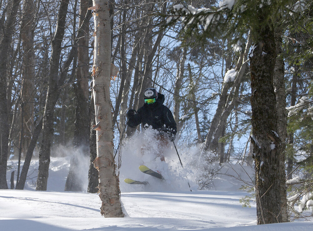
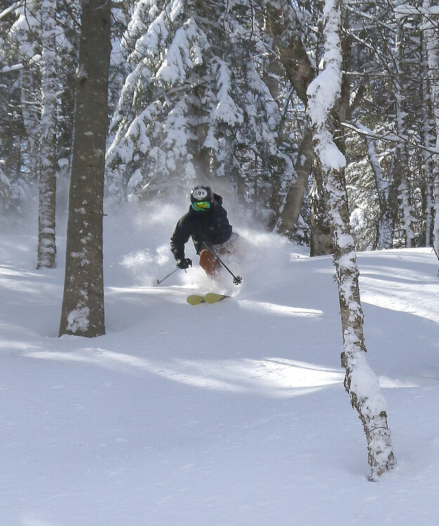
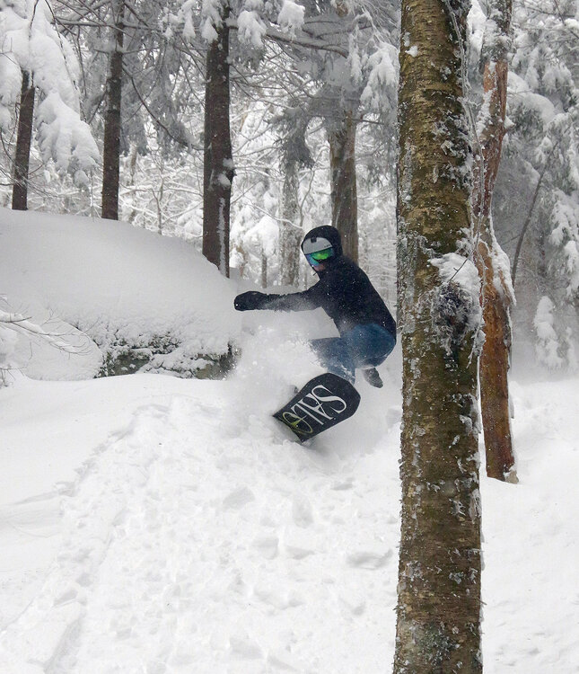
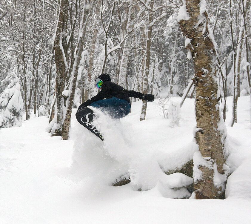
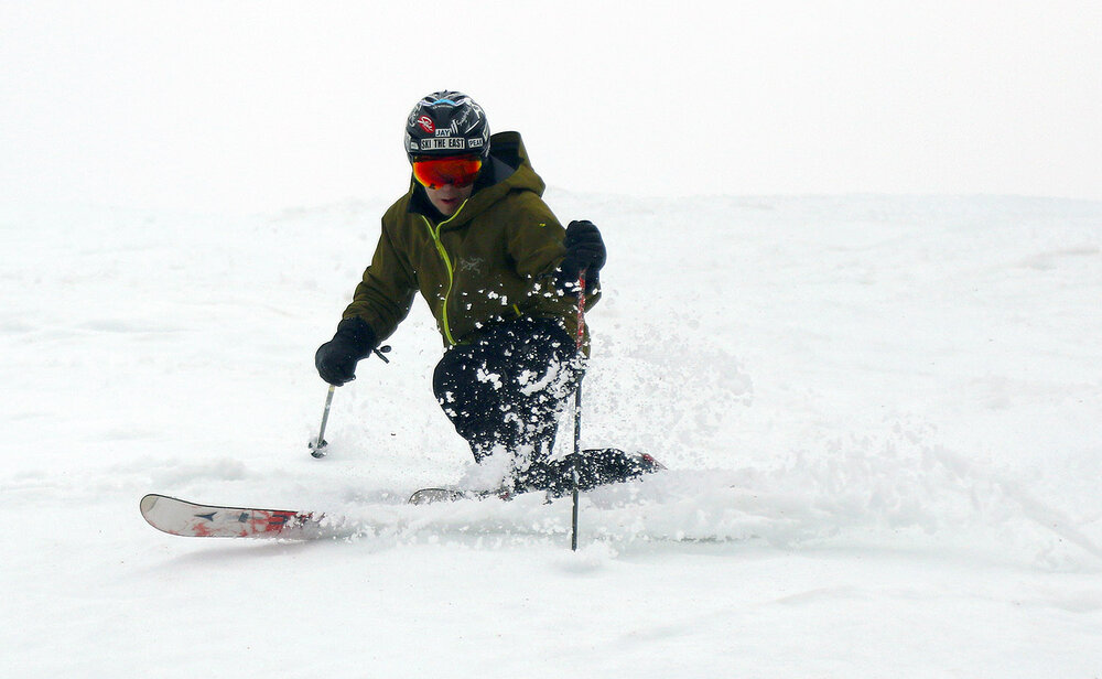
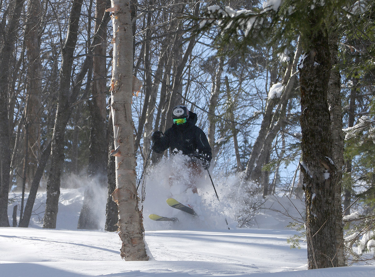
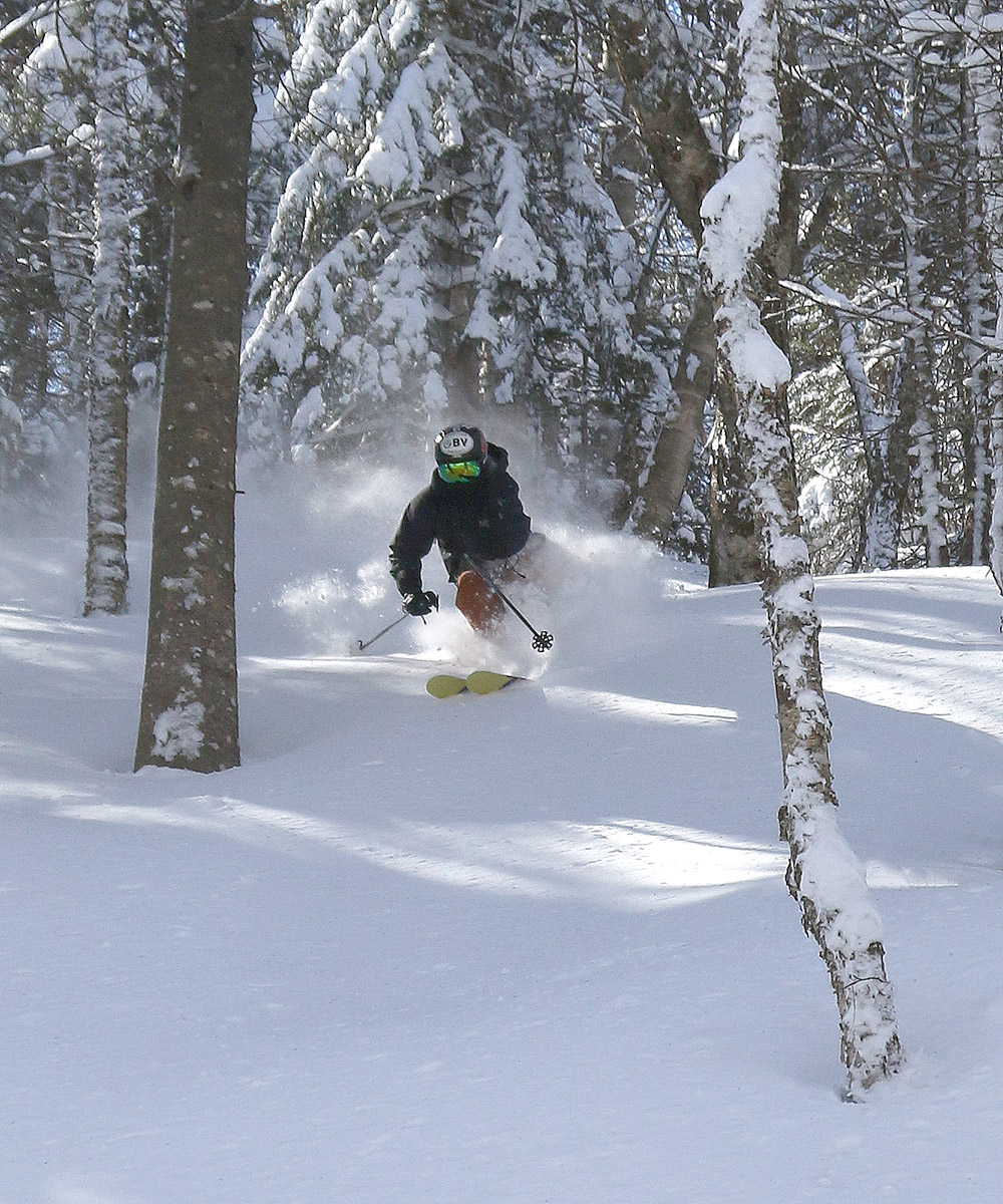
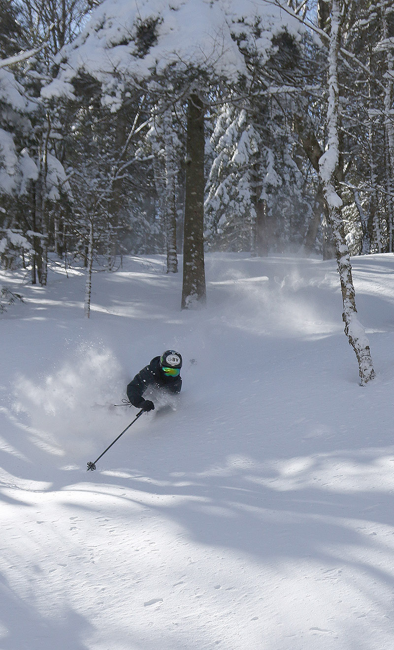
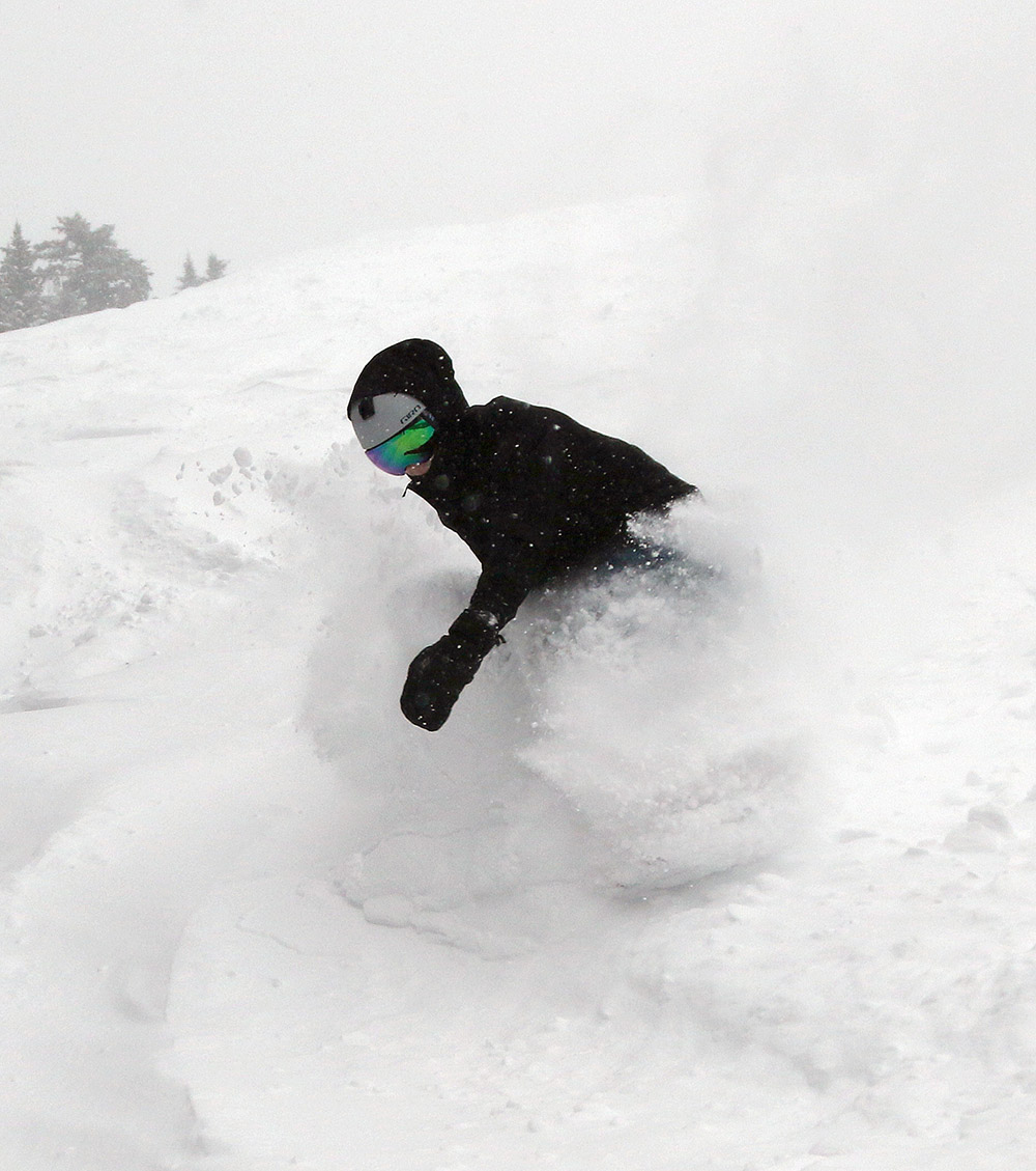
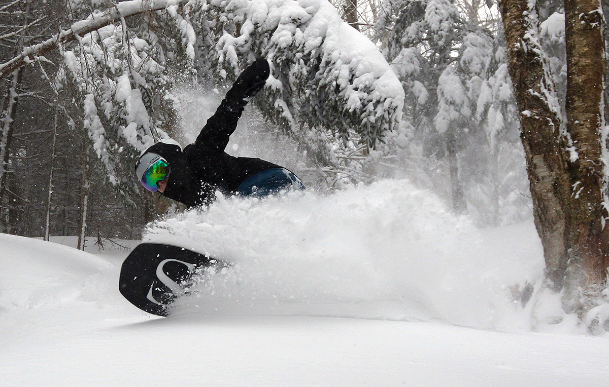
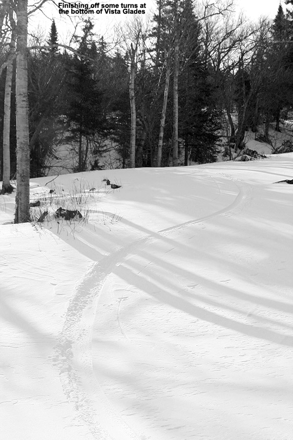
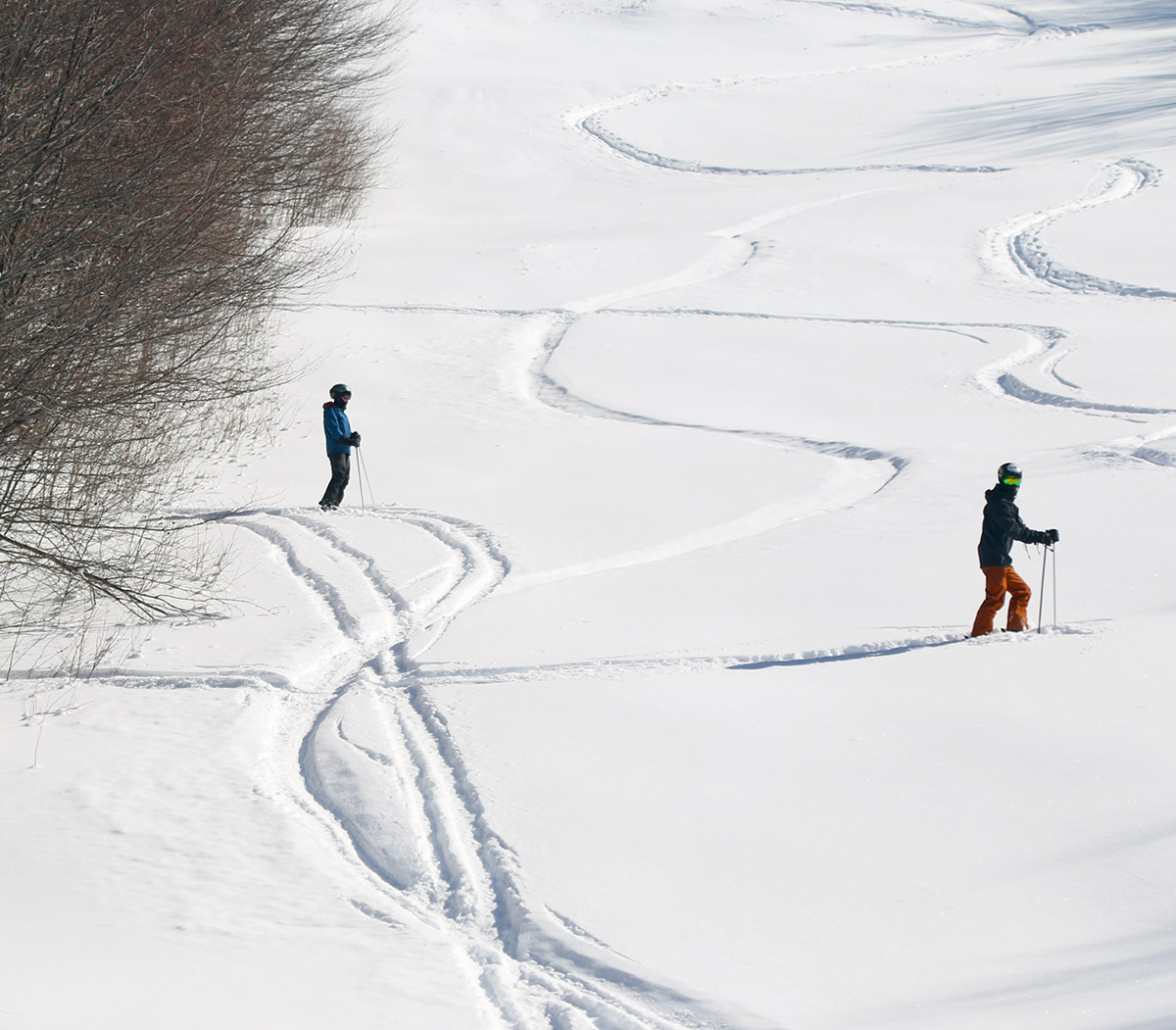
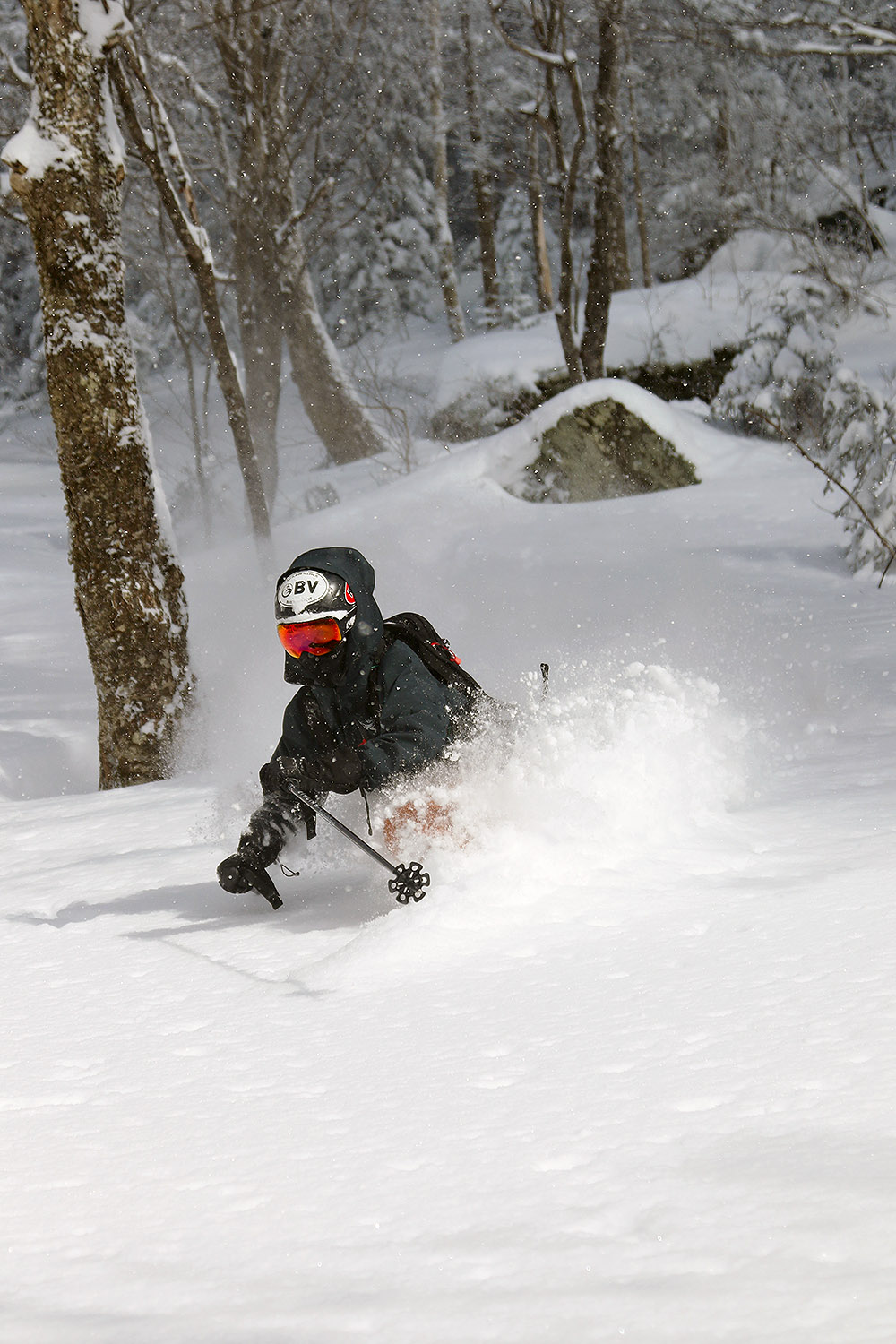
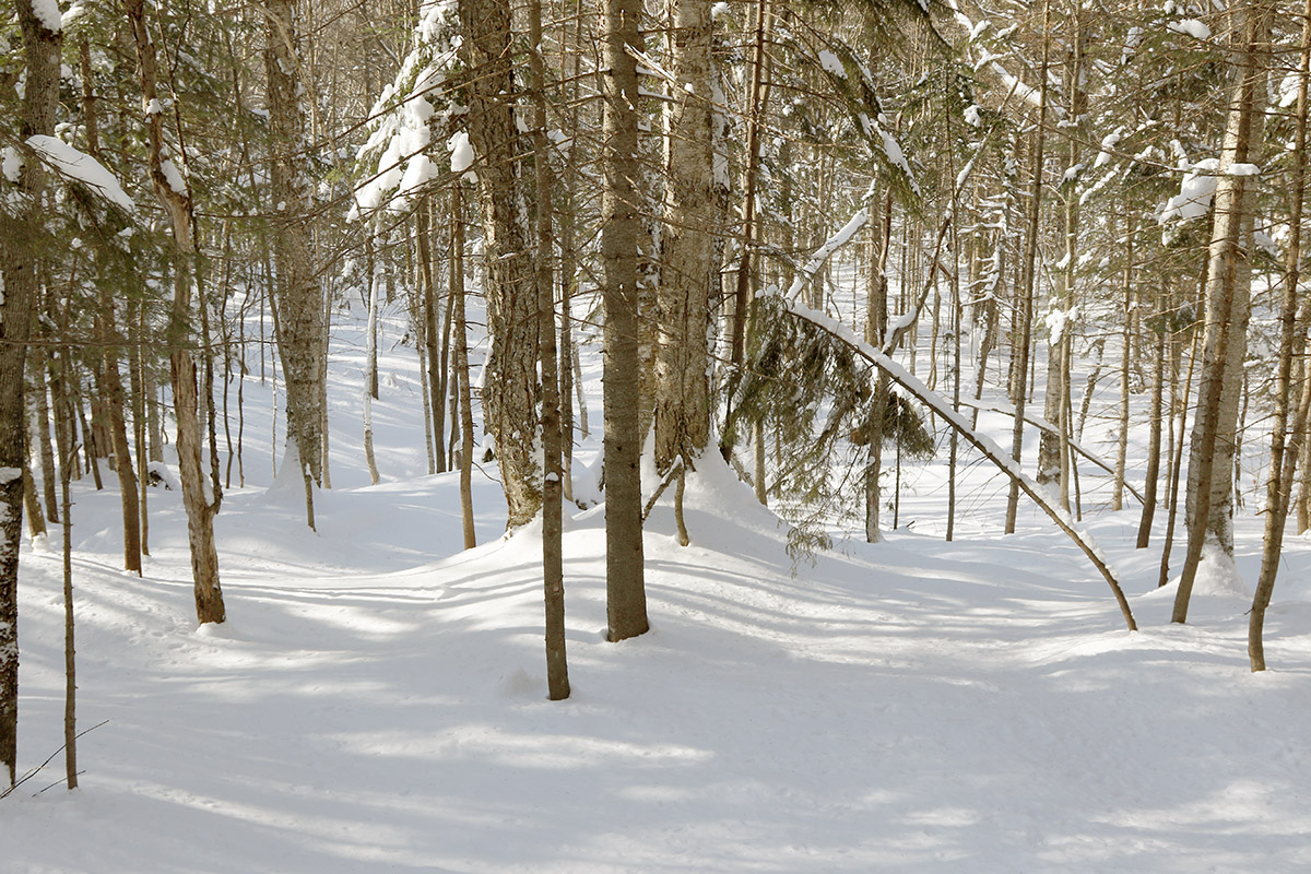
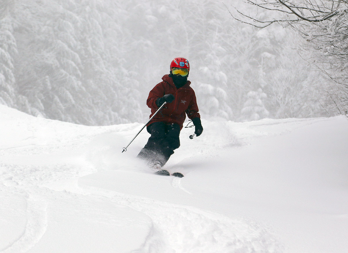
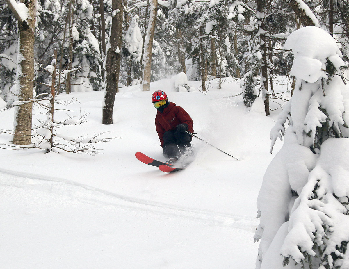
The weather yesterday was absolutely clear with brilliant March sunshine, so it was quite a contrast to Monday’s snowy maelstrom, but winds were still brisk near the summits. Despite the bit of remaining wind, overall yesterday had that “day after” the storm feel. The new snow from the storm had been pounded and scoured in exposed areas like the tops of trails near the Vista Summit, but thankfully most terrain was protected enough to hold onto quite an excellent bounty of soft accumulations from the storm. There was a bit of wind crust in areas depending on exposure, but nothing that ruined the skiing aside from reducing the explosiveness of the powder relative to Monday’s consistency in the more exposed areas. My snow depth checks revealed the same roughly two feet of accumulation that I’d found near the middle of day on Monday, so there was probably some additional accumulation and continued settling that left things about where they were.
We prioritized hitting some of the steepest terrain to really make use of the resurfacing that the storm brought us, so we visited areas like Devil’s Playground and the Vista Glades, which I hadn’t yet visited at all this season. There were still a lot of nice areas of untracked snow, but areas that had seen skier traffic still provided top notch conditions. The storm was so potent that even the steepest terrain has the coverage to keep you from encountering the old base snow, so you can just drop into anything and anticipate your edges biting into packed powder without the worry of touching the crusty stuff underneath. Along with the steeps, we also visited some of our favorite areas for powder turns, and as long as the snow was protected from the winds, it was still delivering that cold smoke that we enjoyed on Monday.

-
 8
8
-
-
18 hours ago, Jebman said:
Absolutely EPIC. Glad you guys got some decent resurfacing snow. I wish it had been four feet.
It looks like totals topped out around 30 inches, so not quite 4 feet, but there’s a lot of liquid equivalent in the snow and it definitely delivered in that regard – great skiing and riding!


-
3
-
-
19 hours ago, dmcginvt said:
Curious about the MRG vs Bush. Bush may only be going by their cam sites? It was tough with all the wind. Look at that 24 stowe cam. The board gains nothing while the blown in piles up behind it
") I loved see that. Almost looked like it wanted to buried the thermo
I loved see that. Almost looked like it wanted to buried the thermo
I’ve put the final north to south list of storm totals for the Vermont ski areas below – there is still a bit of MRG vs. Sugarbush discrepancy, so I’m not sure exactly where that came from, but it looks like totals for this storm cycle topped out around 30 inches.
Jay Peak: 28”
Burke: 21”
Smuggler’s Notch: 21”
Stowe: 21”
Bolton Valley: 24”
Mad River Glen: 30”
Sugarbush: 23”
Middlebury: 21”
Pico: 27”
Killington: 27”
Okemo: 18”
Bromley: 14”
Magic Mountain: 15”
Stratton: 15”
Mount Snow: 10”
-
1
-
-
-
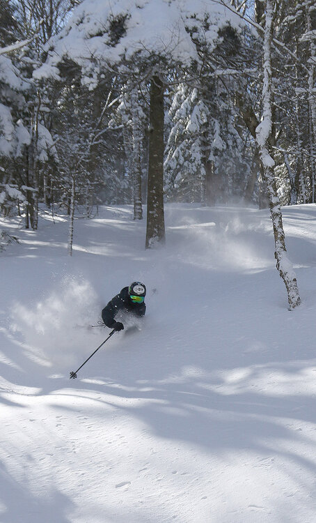
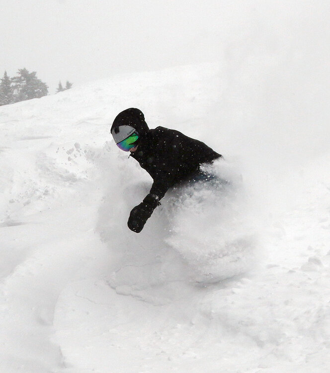
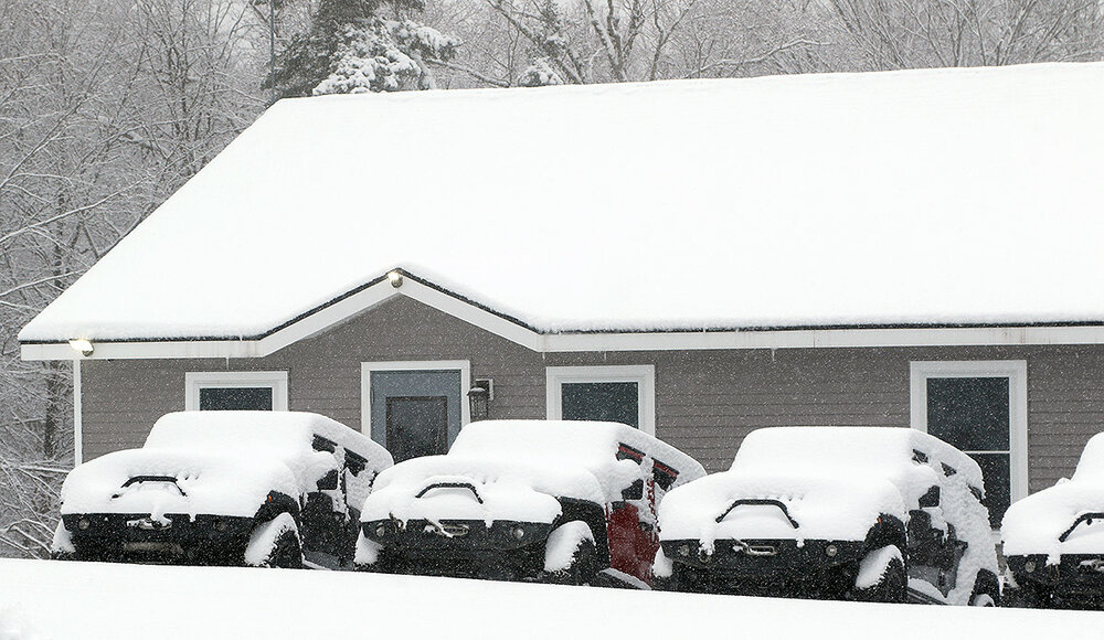
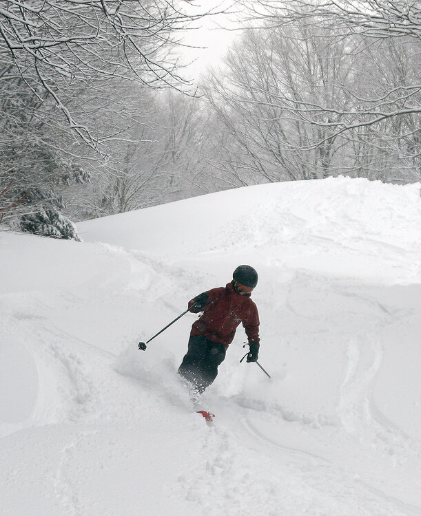
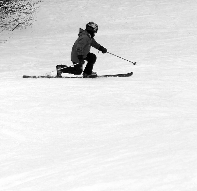
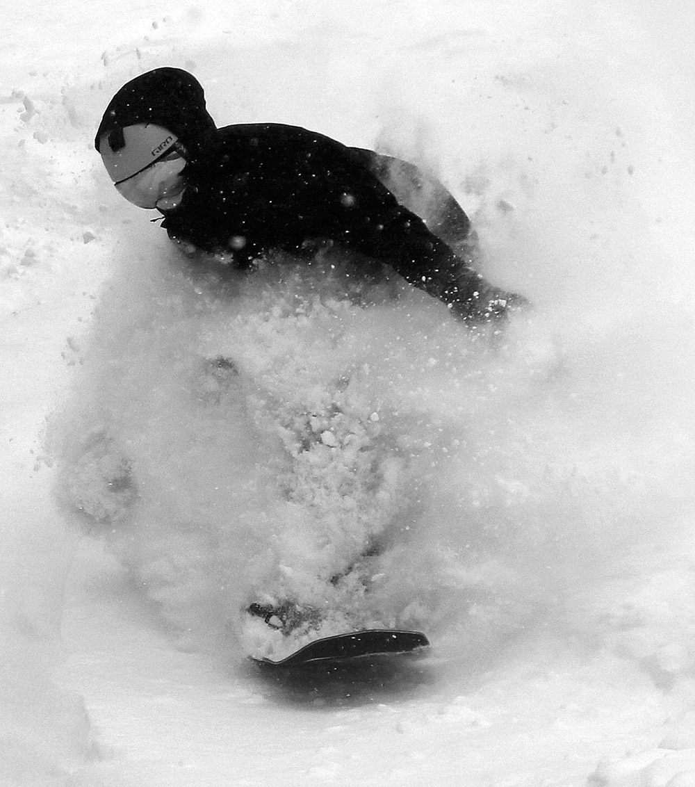
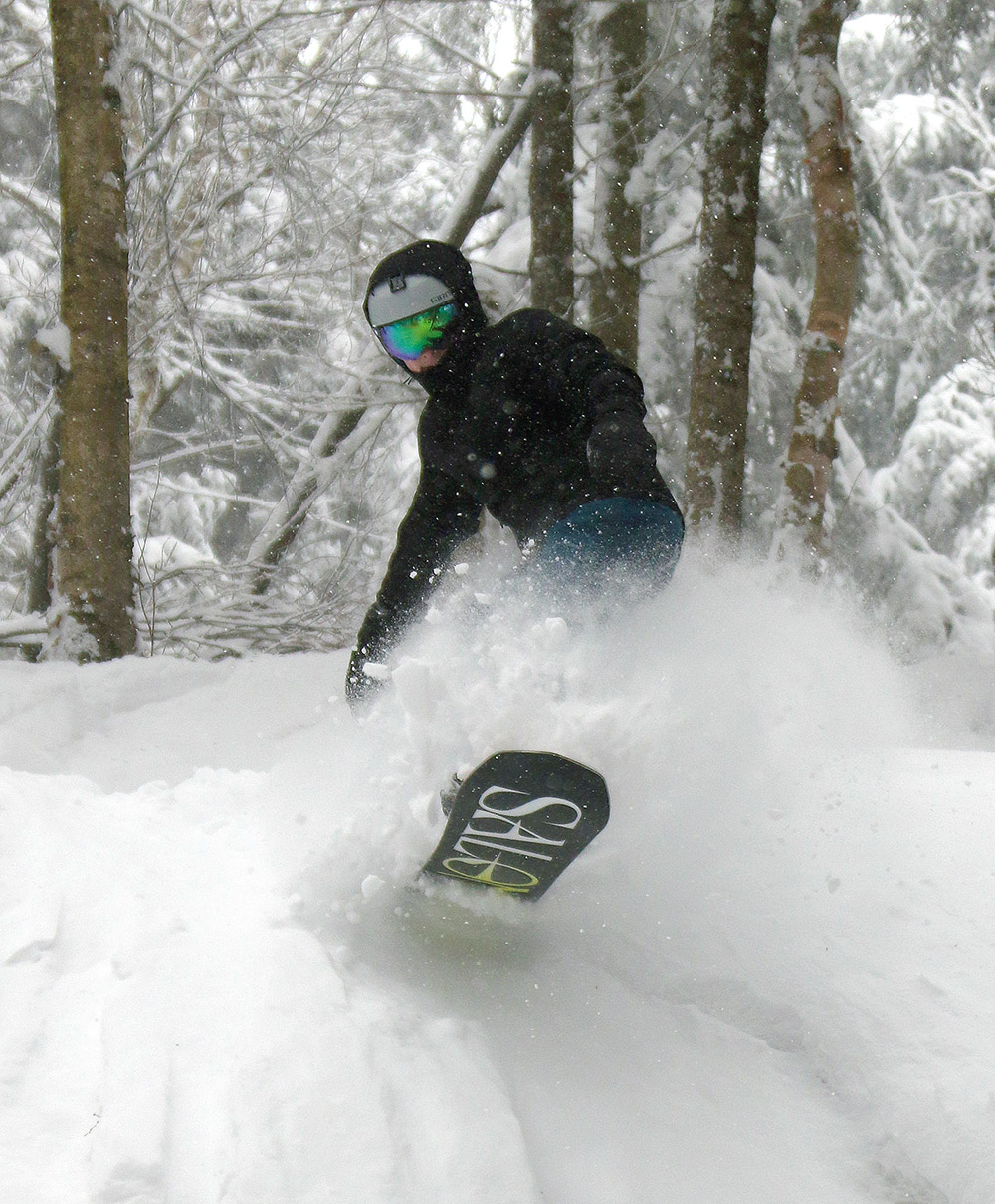
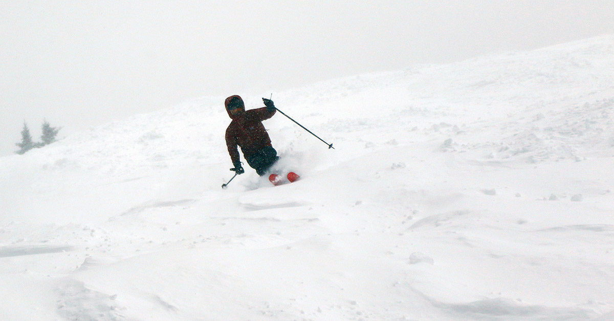
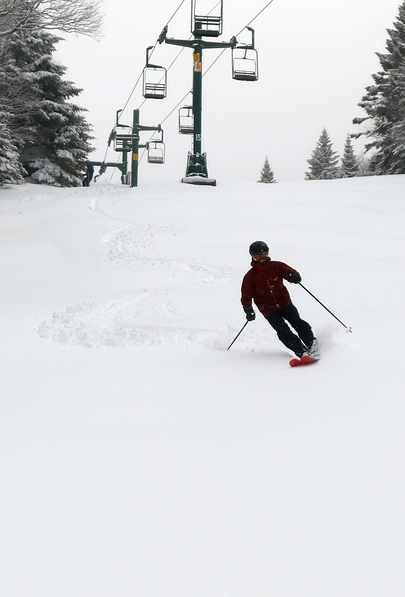
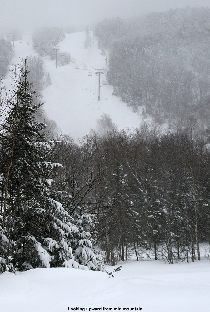
With the storm cycle transitioning into its back half overnight, the upslope really turned on in the Northern Greens. Bolton Valley was reporting 20 inches for the storm total in their early morning update, so I headed up for some turns with my younger son and his roommate. There was solid 1”/hr. snow falling in the valley and up at the resort, so I was worried about vehicles struggling to get up the Access Road like my older son and I experienced a couple weeks back, but the road was in nice shape and we made it up to the Timberline Base easily.
The upslope winds were roaring all throughout the resort, and the Vista Quad was not likely to get off wind hold at all during the day, so we spent our entire session down at Timberline. Relatively speaking, the lower elevations of Timberline meant that the winds were at least somewhat lower, and the temperatures a bit warmer. And, temperatures were cold enough everywhere so that even the lower elevations were still pulling in cold smoke powder, so Timberline was definitely the place to be. Even calling the weather “cold” is relative though – we’re talking “March cold”, which is nothing like “January cold”. Temperatures were well up into the 20s F and quite pleasant. There were no lift queues for most of the morning, so it was simply hop on and run laps until we approached late morning when more people started to arrive and others realized that Timberline was the place to be. We did overhear conversations from people who were arriving from other resorts like Stowe that were having wind hold issues as well.
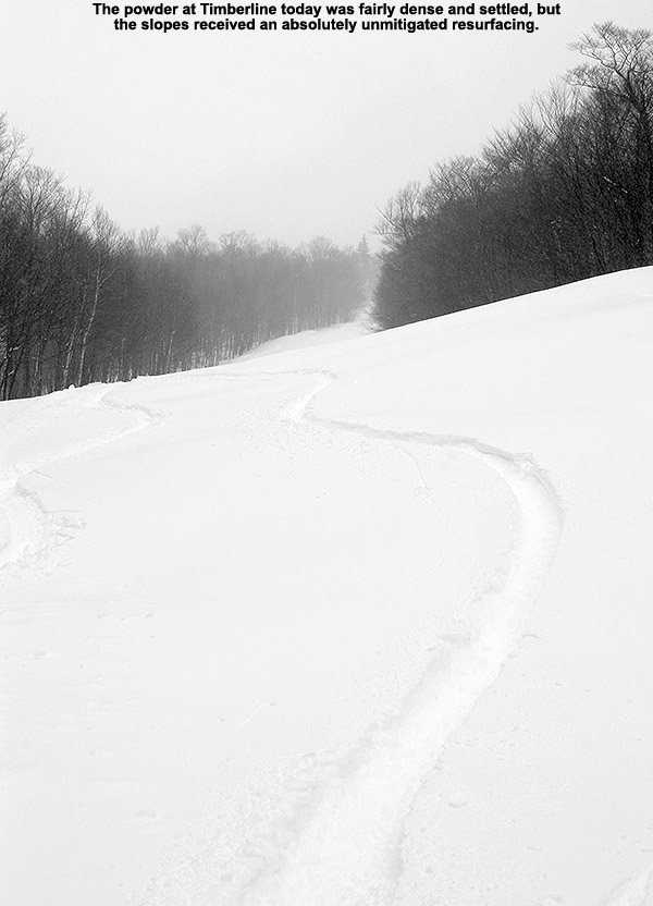
As expected with the beautiful right-side-up nature of this storm cycle, the powder skiing, and even the packed, on piste skiing, were excellent. We picked up 2.34 inches of liquid equivalent from the storm down in the valley at our site, so the mountains must have seen close to 3 inches of liquid from the event. When you get to those levels of fresh liquid equivalent on top of the snowpack, you’re looking at an unmitigated resurfacing of the slopes. And aside from the occasional scoured areas, a thorough resurfacing is just what we found. During our session, my depth measurements at around 2,500’ were indicating roughly 24 inches of accumulation, and I see that’s what the resort is indicating for their storm total as of their midday update, so that seems very much in sync with what I found. For our session, we made use of the solid resurfacing dump and jumped into just about all of our steepest favorites. There were really only a couple of very steep spots that we skipped (craggy cliff bands and super steep lines in very dense evergreens) that I knew wouldn’t quite be there since the snowpack below 2,000’ was a little too lean coming into this system.
All in all though, it’s been an excellent storm cycle thus far, and the boys clearly picked a good week for their spring break.


-
5
-
-
4 hours ago, powderfreak said:
21” for Stowe at 4pm.
Documented and measured.
8” yesterday morning.
1” yesterday 4pm.
9” this morning.
3” at 4pm today (rounded up to make up for a couple rounded down earlier).
8 + 1 + 9 + 3 = 21”.
Due diligence in accurate totals, ha.
Thanks for the full summation and storm total PF, well done. I’ve updated the north to south list of reported storm totals for the Vermont ski areas as of this evening. Some resorts made end-of-day updates, but some are still just morning totals.
Jay Peak: 24”
Burke: 19”
Smuggler’s Notch: 21”
Stowe: 21”
Bolton Valley: 24”
Mad River Glen: 29”
Sugarbush: 23”
Middlebury: 21”
Pico: 27”
Killington: 27”
Okemo: 16”
Bromley: 14”
Magic Mountain: 15”
Stratton: 15”
Mount Snow: 9”
-
2
-
-
This storm cycle is ongoing, but below is the current north to south listing of storm totals from the Vermont ski areas. Some totals are from early morning, and some are midday updates, so there’s going to be some extra heterogeneity at this point.
Jay Peak: 24”
Burke: 19”
Smuggler’s Notch: 15”
Stowe: 15”
Bolton Valley: 20”
Mad River Glen: 29”
Sugarbush: 19”
Middlebury: 13”
Pico: 27”
Killington: 27”
Okemo: 16”
Bromley: 14”
Magic Mountain: 15”
Stratton: 15”
Mount Snow: 9”
-
4
-
-
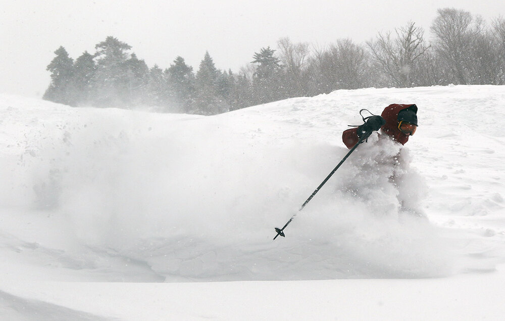
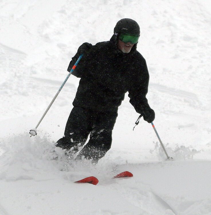
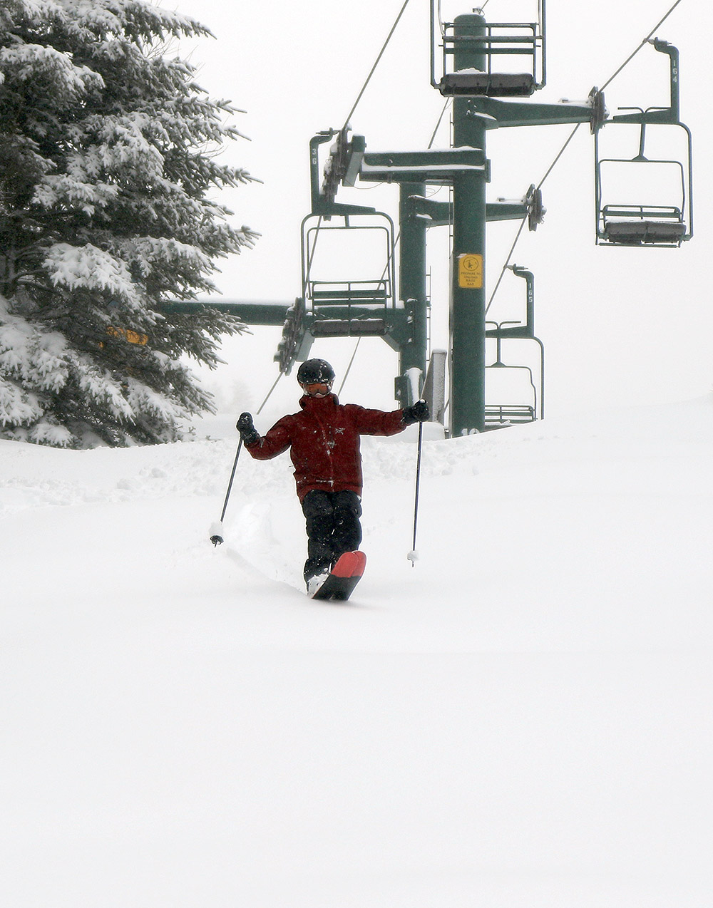
We headed up this morning for a session at Bolton Valley to check out the snow from the front end of this current storm cycle, and as the resort snow reports from around the state have indicated, the higher elevations received a solid shot of snow. We’ve picked up roughly 1.4 inches of liquid equivalent in the snow and mixed precipitation that has fallen down at the house, so up on the mountain they’ve likely seen upwards of an inch and a half of liquid equivalent in their accumulations. That’s certainly enough for a solid resurfacing, and they’re all set in that regard all the way from the summit areas above 3,000’ down to the lowest slopes at 1,500’.
Bolton’s early morning snow report was indicating 8 inches of new snow, but my own measurements while out on the mountain up above 3,000’ were already reading 10 to 12 inches by midday, so they’d obviously continued to pick up some substantial accumulations since that first report. Their midday report is now indicating 10 to 12 inches new, so that lines right up with what I was finding. As noted above, it was a solid resurfacing, and I’d say we were getting 95%+ bottomless turns on even the steepest slope angles, with just a few spots here and there where you might touch down depending on skier traffic, obstacles, deposition, etc.
The only knock against the snow at this point is that it’s rather dense, so the usual caveats apply with respect to the quality of the turns. We suspected that the snow was going to be dense going into today’s session, so we went with alpine setups instead of Telemark, and that was definitely the right call for stability and ease of turning in the thick snow. Snowboards would also have been a good choice for what we saw out there, and skiing in and on the snow today had me thinking fondly of some of those surfy turns on a board. The snow became denser the lower one went in elevation, so although we parked at Timberline in the morning, we stayed above 2,000’ essentially the whole time, and only returned back down below that when were we heading back to the car at 1,500’ at the Timberline Base. The powder turns out there are still great, since the snow is so dense that you can really lay into whatever you want and tackle any pitch with the confidence of not dealing with underlying obstacles, but both the powder and groomed conditions are better the higher you go. While the new snow was dense, it wasn’t wet or sticky until we dropped down toward the Timberline Base around midday. That was likely a result of both the initial snow being wetter, and temperatures creeping above freezing in the lower elevations by that point. If the snow transitions to a drier consistently for the next part of the storm cycle as the forecasts suggests, it should be an excellent topping off for what’s fallen thus far.

-
5
-
-
Below is the north to south listing of available snowfall totals that I saw for this winter storm cycle as of the early morning reports from the Vermont ski areas. It looks like roughly 8-12” up and down the spine with a few areas above and below that range.
Jay Peak: 8”
Burke: 6”
Smuggler’s Notch: 7”
Stowe: 8”
Bolton Valley: 8”
Mad River Glen: 12”
Sugarbush: 9”
Middlebury: 8”
Saskadena Six: 8”
Pico: 9”
Killington: 9”
Okemo: 13”
Bromley: 10”
Magic Mountain: 12”
Stratton: 12”
Mount Snow: 8”
-
1
-
-
3 hours ago, powderfreak said:
The positive snow depth maps are the way to go here to visually see the valleys vs mtns.
HRRR 10:1 showing 1.50”+ QPF as snow.
But depth increase of only 5” tells me it’s full on glop at MVL and under 1,000ft. While the mountains stay 12-24” depth increase.
3KM NAM does the same.
Yeah, the positive snow depth maps are definitely helpful and provide some realism – I know you’ve been working to infuse those into storm discussions, and hopefully it helps temper some of the more unrealistic maps that get posted.
Maps can be challenging to use for our site because we’re so tight to the spine (just about in line with it) that the resolution isn’t always there to differentiate this location from the surrounding higher elevations. The base of the Winooski Valley is only about 1/4 to 1/3 of a mile wide here, rising up to ~2,000’ pretty quickly, and then to the 3,000’ to 4,000’ range within a few miles, so resolution is important in differentiating the various elevations.
Another factor is that being so tight to the spine can get this area in on a lot of the forced ascent, resulting in additional accumulations relative to its elevation. Typically what seems to work is to go into events with the assumption that the running forecast for this elevation from something like positive snow depth map is a good baseline, and then sometimes the orographics push accumulations above that level a bit if the setup is appropriate.
-
2
-
-
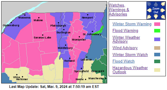
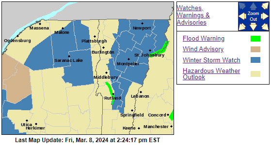
The Winter Storm Watch that was posted here in our area was converted to a Winter Storm Warning, and various Winter Weather Advisories have been added as well. On the Event Total Snowfall map, the area of 18-24” shading along the local Bolton-Stowe-Smugg’s portion of the spine has expanded. Down here at our site, we’re in the 12-18” shading, and that does correlate well with our point forecast, but depending on the temperatures, that may not be quite representative of accumulations in the valley bottoms. Snowfall intensity will probably factor into accumulations here, but up at elevation, the potential is definitely there for a solid resurfacing of the slopes.

-
1
-
-
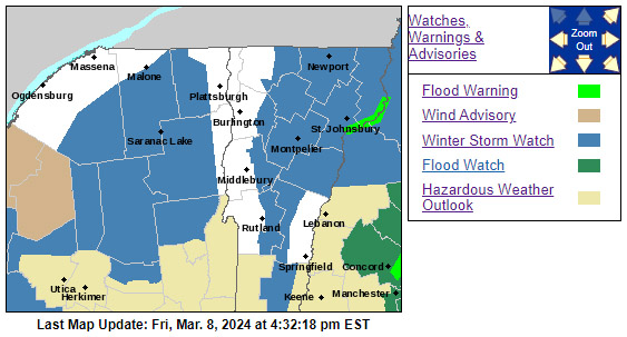
I see that the BTV NWS maps have been updated now with some expansion of the Winter Storm Watches and adjustments to the Event Total Snowfall map. There’s also an extensive section of the area forecast discussion dedicated to the upcoming storm, and from the numbers they have there, it looks like totals would be topping out at around 2 feet for the event. That seems to correlate fairly well with the projected accumulations map, since they now have that extensive area of 12-18” shading along the spine, with a touch of 18-24” appearing in the Mansfield area.

-
2
-
-
45 minutes ago, J.Spin said:
I’m sure they’ll tweak those numbers and the maps as the event gets closer...
I was just notified that we’ve been put under a Winter Storm Watch, so we’ll see what the BTV NWS is thinking when their afternoon updates come out.
-
1
-
-
2 hours ago, powderfreak said:
Not going to lie, I like what I'm seeing for the elevations. This could go fairly big (12"+ above 2,000ft). Some of these model runs have 2"+ total QPF so it it holds snow at the elevations it's going to dump.
Thanks for posting some of the latest QPF output – I was going to bring it up if you hadn’t, since indeed there’s plenty of it there for a resurfacing if it’s all snow. The graphical forecast output at elevation in the Mansfield area looks fine with respect to temperatures from Saturday night through Monday night:
This morning’s BTV NWS forecast discussion doesn’t have any outrageous totals, but their current thinking for the higher elevations is 1-4” on the front end and 6-12” on the back end. I’m sure they’ll tweak those numbers and the maps as the event gets closer, but the spine currently has 8-12” shading through 8:00 A.M. Monday morning.
National Weather Service Burlington VT
.SHORT TERM /SATURDAY NIGHT THROUGH SUNDAY NIGHT/...
As of 341 AM EST Friday...Where cold enough in eastern Vermont and the eastern slopes of the Adirondacks, snow should be the dominant p-type, and may be briefly moderate to heavy, which will be needed for accumulations likely around 1 to 4 inches above 2000 feet and less than 1 inch below 1000 feet. Progressing into Sunday afternoon and evening, the coastal development should be taking over and shifting east, but with the dry slot shifting overhead. It should be later Sunday night that wrap around moisture begins a period of snow showers into Monday. Dynamical cooling with the upper low position should result in all snow, even if temperatures are around 35. The amount of wrap around moisture and deformation owing to the upper low should result in fairly substantial orographic snow, with northwest slopes receiving an additional 3 to 6", while the rest of the area could see another 1 to 3" with an added 6 to 12" on the summits (highest northern Greens).

-
1
-
-
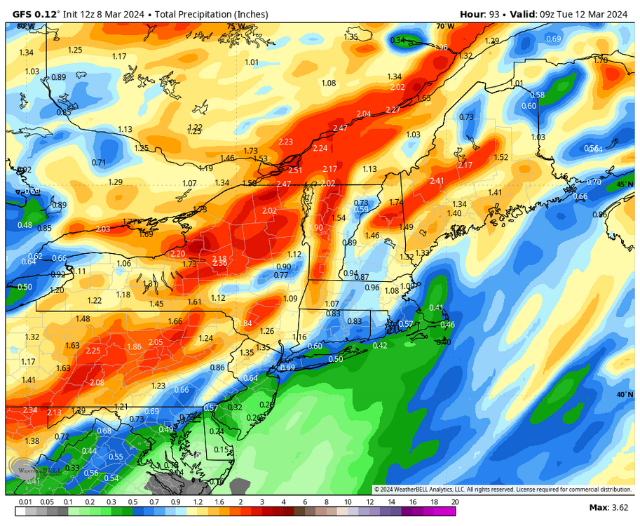
With the latest updates, it doesn’t look like the BTV NWS is seeing much snow potential on the back side of our current system, but they are starting to talk a bit more about the potential from the weekend system now that it’s getting a bit closer. Accumulations of 12-18” are already mentioned in the forecast discussion for the Saturday night through Monday night period – and some of the modeling has that snow continuing right into Wednesday. On top of that, the GFS has been showing more snow potential, with storms stacked up right through the end of its run. The farther out one goes, the more the storms are subject to change of course, but there is some ensemble support for another snowy stretch coming up.
.LONG TERM /SATURDAY THROUGH WEDNESDAY/...
As of 411 PM EST Wednesday...No major changes made to the forecast for the weekend into early next week as the 12Z medium range deterministic and ensemble guidance did not significantly shift from previous runs.
After a tranquil Saturday morning under exiting high pressure, a digging upper trough over the Great Lakes looks to phase with southern stream energy ejecting out of the TN/OH Valleys. A primary surface low develops over the Ohio Valley and tracks northeast through the St. Lawrence Valley Saturday night, while secondary low pressure develops along the southern New England coast early Sunday morning, eventually becoming the primary low Sunday afternoon while bombing to around 980 mb along the Maine Coast. In contrast to the 00Z guidance, latest guidance supports the secondary low becoming the primary a bit sooner, with less of a mid-level dry slot noted, which will help to filter colder temps back into the forecast area Sunday afternoon/evening before a transition to more terrain-focused precipitation Sunday night through Monday and potentially Monday night.
Overall, thermal profiles continue to support snow being very elevationally dependent with elevations below 2000 feet mainly rain through Sunday, ending with a light accumulation of snow Sunday night into Monday. Across the higher elevations though, snow remains the dominant ptype, very wet and heavy Saturday night through Sunday night, before decreasing in density on Monday. A first guess at storm total snowfall would support a winter weather advisory Sunday night through Monday across the western slopes of the Adirondacks and northern Greens for 3-6" of snow, while elevations above 2000 feet could see accumulations of 12-18" from Saturday night through Monday night.
-
5
-
-
I didn’t expect Saturday’s cloudy conditions and temperatures in the 30s F to do much in terms of softening up the snowpack, but with today’s forecast calling for temperatures in the 40s F, there seemed much more potential for softening the slopes. Temperatures looked optimal in the afternoon, so my wife and I headed up to Timberline at Bolton for some runs. The weather for our session started out with a mix of foggy and cloudy conditions, and even a light mist of rain, but that quickly dissipated and moved on to produce mostly sunny conditions by the end.
When I checked the snow report earlier today, I saw that some of the natural snow trails were closed down at the Timberline elevations, and that initially had me worried about the available coverage. When we got to the mountain though, coverage was actually much better than the trail report had led me to believe. Twice as Nice was indeed closed, but it wasn’t as if it was devoid of snow – there were bare spots on the back sides of some of the rolls that would have made the skiing challenging, so I can see why they had it closed. I though Spell Binder was going to be closed, but it wasn’t – they’d made snow on the steep headwall section at some point, so it had an incredible amount of snow. The lower parts of the trail that have not seen any snowmaking were under a sort of “soft” closure – they had signs suggesting it was closed, but no rope and most people were skiing it. From the Timberline Summit, Intro was open with wall-to-wall coverage, and they blew in so much snow in the gap above the Timberline Mid Station that the ledges aren’t even visible.
Conditions were definitely soft enough to get in some nice corn snow turns, but it wasn’t really warm enough to soften the snow too deep into the snowpack. We found that terrain that had not been touched by other skiers was the best, because you could peel away a couple inches of snow without encountering the firm subsurface too much. Areas that had seen higher traffic revealed more of the firm subsurface and resulted in louder turns that were much less spring-like.
It looks like the coming week will feature some warmer spring-like days in the first half, which should be enough to get the snow softened more than today. Later in the week, the weather cools a bit and becomes more unsettled with snow chances. There’s nothing in the modeling yet that indicates a slam dunk March storm with solid mountain snows, but some runs show the potential. We’d need a decent shot of liquid equivalent to get much of a resurfacing, but the base is ready if we do get enough, and the more that falls as snow, the more terrain that would be in play for quality turns.

-
3
-
-
On 2/18/2024 at 9:22 PM, powderfreak said:
Snorkeling tours go out daily during vacation week.

Hasn’t been a great winter by any means. It’s had a few periods of fun though. I guess the Mansfield Stake sitting at exactly average for this date and this graph is pretty normal.

I see that the stake had even pushed back above average a bit with Monday and Tuesday’s snowfall, so that’s consistent with the ups and downs the snowpack has had. Our recent stretch of roughly a week brought almost 20 inches of snow to our site in the valley, and another double-digit storm to add to the season, so it’s not too surprising that the snorkels came out in the high country.
2/12/2024 0.1 Frontal boundary across southern Quebec
2/13/2024 4.3 Potent shortwave passing through upper-level flow
2/15/2024 10.4 Quick moving moisture-ridden clipper
2/17/2024 2.7 Shortwave swinging through the BTV NWS forecast area
2/18/2024 0.2 Lake effect snow with south/southwest flow
2/18/2024 1.6 Arctic boundary with snow showers and embedded heavier snow squalls
2/20/2024 0.4 Light snow showers on northwest flow
Sum 19.7

It wasn’t enough to quite catch us back up to average pace at our site, but it was another nice jump on the seasonal snowfall progression plot, and it did get us to 92.6% of average
Monday’s snow even pushed Bolton Valley’s season snowfall total just above average for the first time in a while: their 217” season total put them at 100.6% of average.
A couple more of those bread and butter periods would be nice to keep things rolling, but it doesn’t look like we’re quite going to get a stretch like the past week in the immediate future. The GFS does show those three systems coming up in the next few days, but they don’t seem as potent as the recent ones.
-
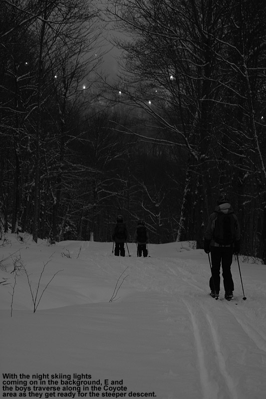
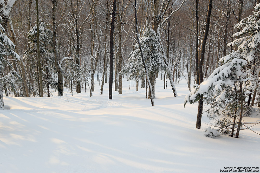
I was fairly busy yesterday, but I did have a chance to get out for a sunset ski tour up on the Bolton Valley Nordic and Backcountry Network. I’d say powder depths were roughly similar to what I found on my Monday tour, with perhaps a touch of settling. The powder in the backcountry just seems to get better each day though as the lower layers of the surface powder settle and bond to the subsurface. This is one of the more impressive progressions I’ve seen in the improvement of the powder skiing over time, and as I was gearing up for my tour yesterday, I heard other skiers talking about it as well.
I didn’t have a ton of time before dinner, so I did a quick loop up Brant to Coyote and on to Gotham City with a descent of Gun Sight and subsequent glades. As mentioned, the powder was simply fantastic, and by the time I was descending the sun had gone down and I was skiing by the light of the moon (with headlamp assistance at times). There are still plenty of untracked lines throughout the lesser used glades, although you have to work a bit more to get untracked lines in the more popular glades since it’s now been a couple of days since the last substantial snowfall.
Since it’s a big vacation week, the night skiing was going full tilt when I got back to my car, and it seems like the resort is getting some solid visitation. For those who are on school vacation this week, they certainly got a doozy in terms of both snow conditions and weather.


-
3
-
-
I was too busy to get out for turns yesterday, but I had some time this afternoon and was able to head up to Bolton. Thanks to the arctic front that came through overnight, they picked up another 4-6” of snow, bringing their recent totals to 16” in the last 48 hours and 36” in the past week.
I was definitely interested in checking out the new snow, but between still being in the holiday period, temperatures a bit on the chilly side, and the typical consistency of the subsurface I’ve observed in areas with skier traffic, touring on the Nordic and Backcountry Network seemed like the best option. Based on my experience out there today though, issues with the subsurface snow quality are rapidly disappearing. While we’re not typically looking for the champagne powder on the slopes to settle, it eventually does, and in this case the compaction of the lower levels of the surface snow is really starting to pay dividends with respect to the overall quality of the skiing. When we first began to get these latest rounds of fluff, it was just dry powder atop the old firm base. There was no bonding between the old and new snow, and if you weren’t in bottomless snow, you were hitting a very hard subsurface. Whether due to the new overnight snow, the settling of the lower layers in the surface snow, or more likely a combination of both, I noticed a dramatic change in that surface/subsurface interface today. There’s a substantial, denser layer of snow above the subsurface now, and contact with the old subsurface is far less frequent. Even when it comes to very dry powder, if you get enough of it, you will eventually get to the level of a resurfacing, and apparently, snorkel-deep levels of champagne are enough.
In any event, powder turns were absolutely fantastic out there today. With the lower levels of the powder getting crushed into denser snow, in undisturbed areas you’ve got a right-side-up snowpack that is reaching very high quality. The powder is so good that it’s now supporting great turns on low-angle, mid-angle, and even high-angle terrain. The addition of the new snow combined with settling seems to have held powder depths in the range of what I found on Saturday, with probably 12+” at 2,000’ and 17-18” around 3,000’. I’m amazed that the powder still works for low angle terrain with how deep it is, but it’s so dry in the upper layers that it just does – at least on 115 mm fat skis.
With the powder hitting the depth for even high-angle terrain, I opted for exploring some steeper lines today. On my tour, I started up Heavenly Highway and set in a skin track out toward Devil’s Drop to get in some turns there, and also put in a track to get me out to some of the steeper terrain above North Slope. All the terrain out there is really good right now.
The clouds pulled away today to leave us with a brilliant, sunny, midwinter afternoon. Anyone out there touring in the backcountry was definitely getting a top 10-20% day, and the snow quality should stay great with these cold temperatures, so tomorrow should be just as good. As a bonus, I was surprised to see that despite the holiday weekend, traffic on the Nordic and Backcountry Network has actually been fairly light the past couple of days – I’d say 75% of the glades I saw had in the range of zero to three tracks in them when I was out this afternoon.


-
4
-
-
9 hours ago, powderfreak said:
Snorkeling tours go out daily during vacation week.
Hasn’t been a great winter by any means. It’s had a few periods of fun though. I guess the Mansfield Stake sitting at exactly average for this date and this graph is pretty normal.
9 hours ago, NW_of_GYX said:Northern greens doing northern greens things. Love it.
Indeed, hard not to love that - the Northern Greens went from a settled snowpack to snorkel deep snow and we never even had a big storm, just…

-
2
-
-
-
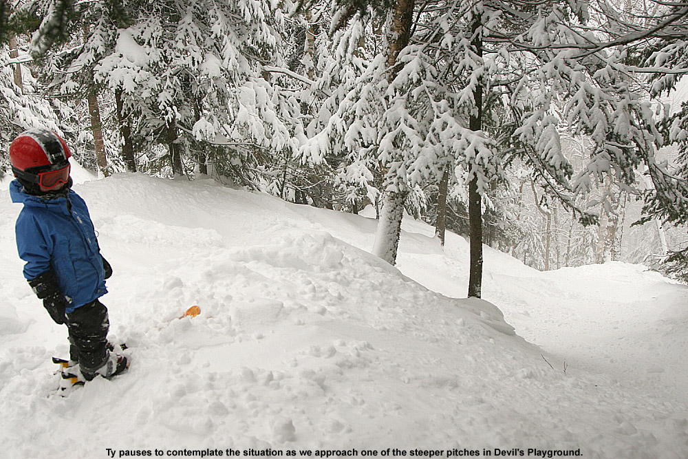
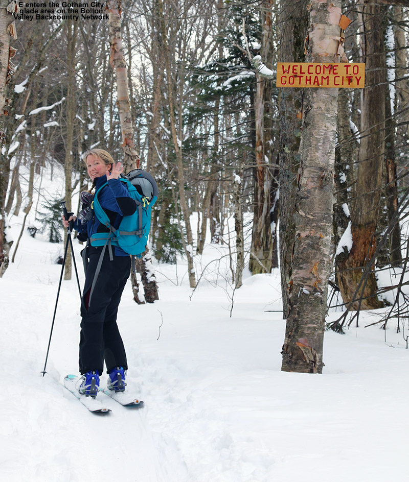
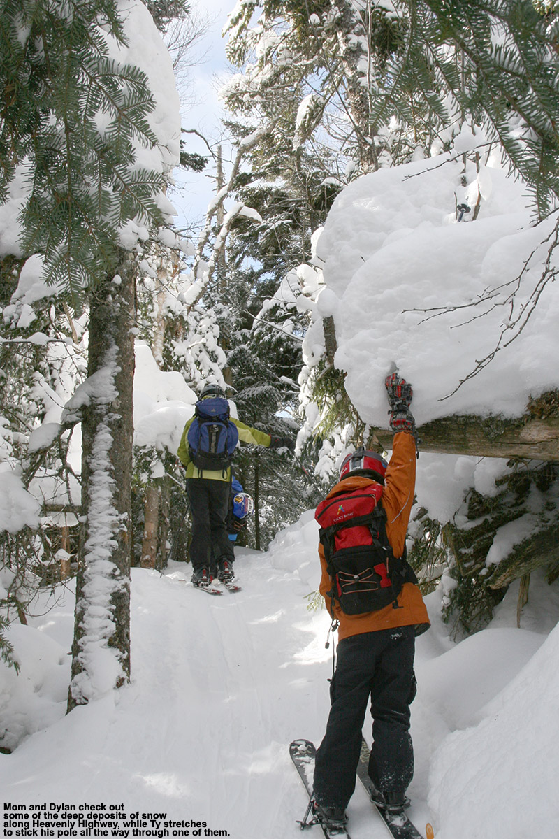
With the off piste conditions being so much better than the trails right now, my older son and I had plans to take a ski tour up to Stowe View yesterday and hit some of the Moose Glen terrain at Bolton Valley. I was just up there a couple of weeks ago, and there are many acres of high elevation glades that I’d expect to have fantastic snow with the way the spine has recently been getting round after round of heavy snowfall.
It was dumping huge flakes at the house when we left in the morning, and 1”/hr. snows in the valley turned to 1-2”/hr. snows as we ascended the Bolton Valley Access Road. The snow was falling so hard and fast that the access road was absolutely covered. Even down by the Catamount Trail parking area before the big S-curve below Timberline, vehicles were already lined up due to some cars not being able to get enough traction on the grade. I’m not sure where they were in the plowing cycle for the road because there wasn’t a plow around that we saw, but with the rate the snow was falling, it almost wouldn’t have mattered. Cars were turning around to descend, and some were evening having to back down in the downhill lane because they couldn’t turn around. Descending cars were moving at an absolute crawl to avoid sliding, and some still struggled with sliding just due to the crown of the road. After about 15 minutes we made it up to the base of the S-curve and started the ascent there, and I saw that a line of cars were stopped about halfway down from the top of the grade. That’s one of the steepest parts of the access road, and you don’t want to have to restart there from a dead stop if you can help it.
I could see that the whole situation was going to be trouble, and there was no immediate sign of the next plow, so we made the split second decision to turn around and simply park at the Catamount Trail parking area about 100 yards below us. We were going to be ski touring anyway, so we figured we’d just start our tour from there instead. It does add a couple of extra miles to the route, but we had the time, and it was far better than sitting in traffic and risking an accident on the road. And as bad as it was at that point, the snow simply continued to pound down and make the road worse. While gearing up for our tour at the car, we met another couple of guys who had decided on the same plan. They weren’t too familiar with the resort, but I assured them that the trail network connected right up to the Nordic Center and Village, and from that point they could head wherever they wanted on the network.
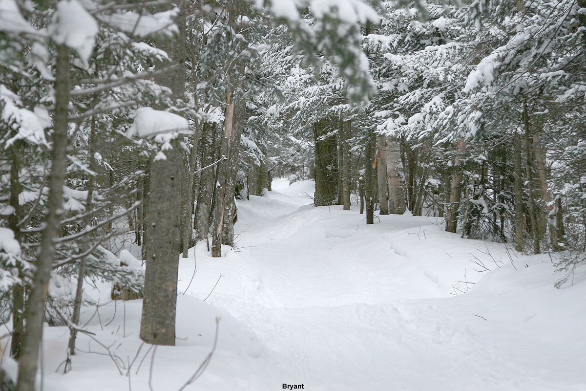
The ascent to the Village was beautiful, and the very heavy snowfall was with us for the first mile or so before it tapered down at least a bit. I’d actually never skied that full connection before, so it was great to be able to experience the route. We didn’t need to stop in at the Nordic Center, so we just cut right up to the Bryant Trail along with a couple of women who were out on a similar tour. From there, it was just the usual route on up to Stowe View with some water and snack breaks. My son hadn’t had any breakfast, so with the extra distance, he quickly made use of the snack he’d brought, and I dove heavily into the reserves in my pack to get him additional calories. It was about 4.5 miles and over 2,000’ vertical up to Stowe View by that route, so that’s about double the vertical and triple the distance relative to a typical tour to that area starting in the Village. That increase definitely required more calories.
We skied various parts of the Moose Glen glade areas as planned, and the powder was simply fantastic. Even down at 1,200’ there was a solid 12” of settled powder, and up around 3,000’ it was typically in the 17-18” range. It was champagne light, so it actually worked well on a variety of different slope angles. As long as you had first tracks, even steeper terrain was in play for bottomless turns. We had a long, long run, with glade after glade of powder, down through areas White Rabbit and Branches, and eventually we reached the Village where we could take a quick break and plan our next move.
We were on contact with my younger son, who had parked at Timberline and we decided that instead of heading back to the car via the Nordic and Backcountry Network, we’d complete our tour using the alpine trails. We got a lift assist off the Vista Quad, and made our way from Cobrass to Maria’s where there were still plenty of untracked lines to ski. Lower Tattle Tale was also still really good along the edges where we found untracked snow.
We met up with my younger son at the Timberline Base Lodge and caught up over some El Gato burritos. We’d planned to ski down to our car at the Catamount Trail parking area if necessary, but we just caught a ride with my son and it made for pleasant finish to a tour that was almost 10 miles in total and brought us literally from one end of the resort to the other using the Nordic, backcountry, and alpine trail networks. It was a great way to make use of all the recent snows and great conditions that have developed.


-
2
-
-
19 hours ago, powderfreak said:
21” storm total at Mansfield’s High Road Plot over 48 hours. It’s so deep out there. The photos and videos on social media in the woods off the Gondola is just snorkeling stuff.
That seems right in line with what Bolton had in their snow report yesterday afternoon, so it’s been a nice couple of days along the spine up here:
“Saturday, February 17, 2024, 5:15pm Update: With 20" of snowfall in the last 48 hours we are thrilled to have 100% of the mountain open with all 6 lifts and 71 trails across our 3 summits expected to have another go of it for Sunday Funday tomorrow with lifts from 9am to 4pm - night skiing is Tuesday to Saturday.”
Today’s update says well over two feet in the past few days, and indeed it’s great out there. I’ll put together some Saturday photos when I get a chance.
I see that Bolton is reporting 211” on the season now, which is right where they should be based on average pace, so the past few days have allowed them to catch back up after that February lull.


NNE Cold Season Thread 2023/2024
in New England
Posted
This morning I was seeing reports of 2 to 5 inches of new snow for the resorts of the Central and Northern Greens. Snow levels were relatively high, thus the accumulations were likely to be fairly dense, but that would mean the liquid equivalent could be there for some decent resurfacing of the slopes. I wasn’t actually sure how much resurfacing would be needed, but the past couple of days have had some spring-like warmth and sun at times, and I haven’t been up to the hill during that time, so there would be plenty for me to discover about the state of the snowpack.
Heading up to Bolton, light rain in the valley didn’t actually change over to snow until just below 2,000’, so indeed snow levels were relatively high as expected. With the anticipated snow levels, I’d planned to ski out of the main base area, and the elevation of the snow line confirmed that I likely wouldn’t be heading down to the Timberline elevations for my outing.
The resort only indicated a couple inches of new accumulation in their early morning report, but that was either very early and/or from the base elevations, because I definitely found more than that up high. I started off with an Alta Vista run, and I’m not sure when it was groomed, but I’d say 2 to 3 inches of dense powder atop the groomed surface would be a good description of what I found there. Turns there in the untracked snow above the groomed surface were ~75% bottomless on 86 mm mid-fats, so I was occasionally touching down to the firmer surface below, but overall it was quite a pleasant and surfy experience. Off piste, things were a bit different. At the Wilderness Summit above 3,000’ I measured what seemed to be 5 to 6 inches of new snow, but it was a little challenging to get exact numbers. In many areas off piste, especially up high, the new dense snow has simply bonded into the underlying snowpack and you can’t find an interface. I can’t say exactly at what elevation that changes, but it’s most pronounced up high where the snowpack presumably has seen fewer or less intense freeze-thaw processes over the past couple of days. Off piste turns were especially good up in those high elevation areas, but in general I found that everything off piste in all but the lowest areas of the main mountain delivered consistent bottomless turns thanks to the dense snow.
The freezing line seem to sit right around 2,200’ for most of the morning while I was there, and that was based on the fact that the snow got sticky for roughly the last 100’ of vertical on my runs. As midday approached, the freezing line seemed like it began to rise because on my last run I’d say the stickiness of the snow started to appear about 200’ above the base.
It was really quiet at the resort this morning, being a random March Friday without a major publicized snowstorm, but I did ride the Vista Quad with a guy who had come up from Northampton, Massachusetts. He’s and Indy Pass owner, his home mountain is Berkshire East, and with Bolton Valley being on the Indy Pass as well, it was a perfect fit for a trip. He said it’s been a rough season down there at Berkshire East, at least in terms of natural snow. Thankfully they were able to get by fine on manmade terrain, but he was blown away by the natural snowpack at Bolton. From about Mid Mountain on up during our lift ride, when the surroundings really started to get white, he could not stop talking about all the snow. He said he really needed this trip for his overall state of mind because it’s been so long since he’s seen snow around his area, and from looking at the Berkshire East Webcams, I can see what he means. He’s really lamenting that fact that he thinks this is only going to continue to get worse with climate change. With the way the last couple of seasons have gone with regard to snowfall down in Southern New England, I can understand why it’s so depressing. He’s a passionate backcountry skier as well, and I definitely wanted to ask if he’d considered the idea of relocating to somewhere like NNE or the Rockies etc. with more reliable snowfall, but I didn’t get a chance to go there before our lift ride ended.
Looking ahead on the weather models, it seems like we’ll have snow chances right on through to the end of the month and beyond. That’s typically par for the course during March and April, but getting snow becomes more fickle toward the end of the season, and sometimes the supply of new snow just shuts off due to above average temperatures.