

It's Always Sunny
-
Posts
1,943 -
Joined
-
Last visited
Content Type
Profiles
Blogs
Forums
American Weather
Media Demo
Store
Gallery
Posts posted by It's Always Sunny
-
-
2 minutes ago, hudsonvalley21 said:
I believe the phase would be better if it happens east of the Mississippi River.
Yeah somewhere across the MS Valley would be ideal. You'd want to give the storm enough room to cut northeast too without swinging and missing.
-
 1
1
-
-
50/50 low is irrelevant to this storm's track in my opinion. What's important is where this storm develops. It's all about the timing/location of jet stream phasing. 12Z ECMWF similar to what GFS has been showing past couple runs:


-
 1
1
-
-
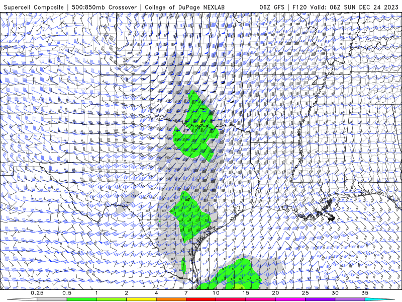
Sensitivity analyses will be fun to unpack once this event gets a bit closer. Trying to dissect an ensemble analysis at 180 hours lead time won't serve much purpose, however quickly glancing at it since its hard to resist, it does highlight the timing and strength of the jet stream phasing across Baja CA and NW Mexico as a key proponent to this materializing into anything good, in addition to any blocking potential across northern New England.
-
1
-
-
Not to offend anyone but GIFs & YT video posts are annoying af...it pains me to waste my energy scrolling past them every time.
-
3
-
4
-
 1
1
-
-
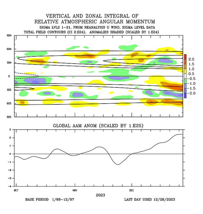
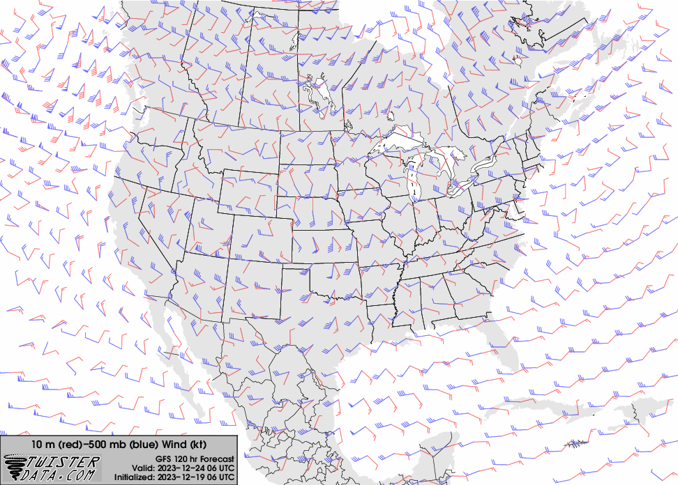
Same can be said for the jet stream:

-
2
-
-
5 minutes ago, It's Always Sunny said:
Too much stock is going into "background state". We still get snow during La Nina winters people seemingly have forgot. I'm seeing El Nino signals of late.
December has been mostly an El Nino look. Southern tier of the U.S. not textbook but upper latitudes playing the part mostly.

-
2
-
-
Too much stock is going into "background state". We still get snow during La Nina winters people seemingly have forgot. I'm seeing El Nino signals of late.
-
6
-
1
-
-
Quite the shift in guidance since yesterday...synoptic feature to watch will be the timing of jet stream phasing across Baja California/NW Mexico. Earlier phasing-->deeper/more amplified trough.


-
3
-
-
3 minutes ago, qg_omega said:
Hard to get excited on something 35 days away
I'd stop short of saying to get excited as this is still no guarantee of anything, however it's what you currently want to see.
-
2
-
-
More reason to buy stock for end of January/early February.

-
2
-
-
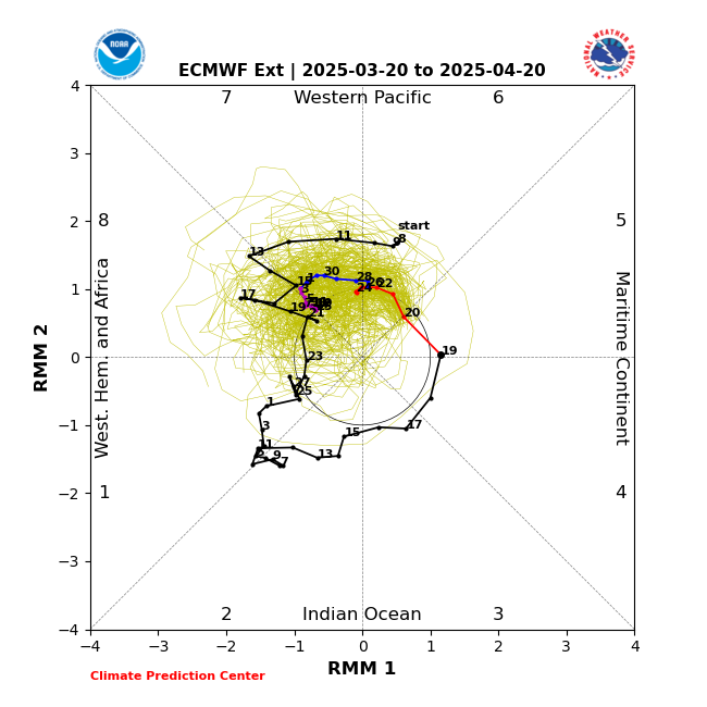
Westerly momentum across the poles appears to be refracting back towards subtropics....could possibly speed up the MJO progression a bit which *could* be a favorable thing timing wise when considering end of January/early February becoming more active. Conjecture, but food for thought.
-
2
-
-
29 minutes ago, EastonSN+ said:
Well, December actually acted like a true strong El nino background state with the entire continent void of arctic air (flooded by PAC air).
As for January, we do see the trough dip first out west, the million dollar question is will the trough move east with time. If it's just 1 to 2 weeks that's fine. If not we are waiting for shorter wavelengths in Feb and March (and unfortunately April which has been cool and dreary lately).
Also, WRT the la Nina/trough out west look, are we saying this has never happened before in a strong El Nino? We never experienced a western trough in strong El nino history in January? Not sure but perhaps Don or Bluewave knows.
After such a Pac Jet extension you will generally have a retraction of sorts, which is that trough you see develop across the W US. It's normal and inherently part of any sort of pattern change to right the ship to a pattern most people want to see.
-
1
-
1
-
-
9 minutes ago, MJO812 said:
I don't think anyone is but people are frustrated.
Climatologically, December isn't a great month anyways for much of the Northeast so those people are just ill-informed or ignorant...whichever of the two.
-
Idk why some people here are punting winter with really 2.5-3 months left. End of January-February is looking very good from a LR perspective...
-
2
-
-
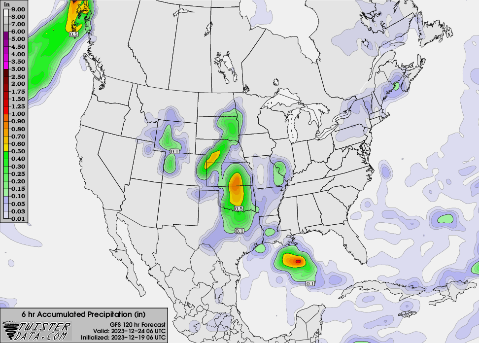
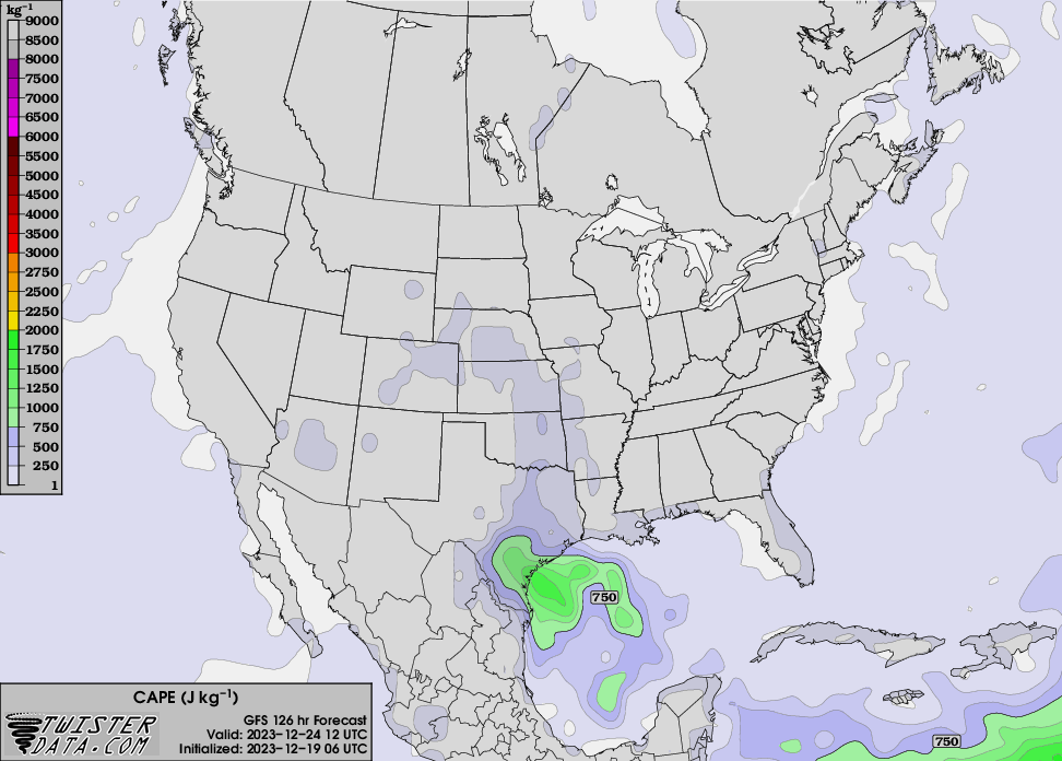
Saturday evening into Sunday morning (Christmas Eve) looking dicey for some severe potential across central-eastern TX/OK. My mind immediately goes to December 26, 2015. Super scary and sad day across the DFW Metroplex.

-
22 hours ago, bluewave said:
The MJO has successfully been used as a forecast tool for a while now. But the rapid expansion of the WPAC pool has slowed and amplified it in the warmer phases in recent times. Numerous papers were published in the last 5 years on this topic. So you are hearing about it now more because of the warming influence for us plus more understanding how it’s altering our local climate. Everything from mountain torques to sudden stratospheric warming have there roots in the MJO dynamics. So it’s right up there in importance with El Niño and La Niña. The key is figuring out how the ENSO and MJO will interact and drive the Rossby wave pattern.
I’m well aware, I just find it entertaining how some view it as the be all end all.
-
I feel like I’ve heard more about the MJO driving this winter’s pattern than in past years. As Nittany suggested there’s far more to it. I literally feel like someone sold a cheap tabloid about how MJO drives all things winter and everyone ran home to hang it on the fridge.
-
3
-
2
-
-
I agree the pattern becomes more favorable but the cold may not be there to feed it, especially down in the NYC/LI area.
-
3
-
-
20 minutes ago, MJO812 said:
January has huge potential but don't give up on the outlook towards the holidays .
Yes I know it's 384 hours on the geps but it has trended colder.

The 540 line is in southern Canada lol; that's not what you want to see.
-
4
-
-
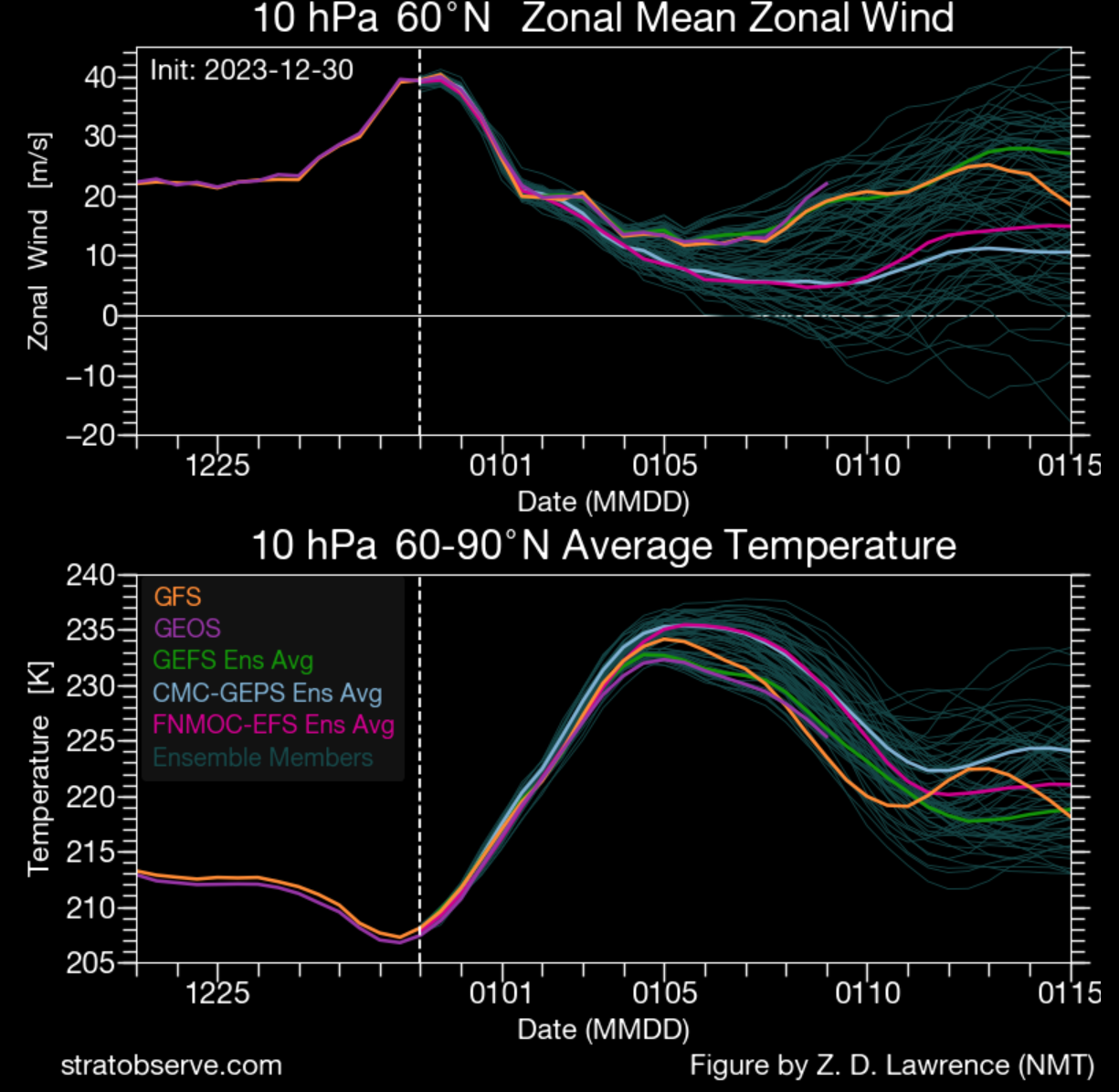
Having analyzed everything I personally don't see a huge signal for any big storm or cold air outbreak this month. I think attention should be focused on January's potential given current state of the stratosphere. Synoptically, this month holds a mild pattern look.
-
3
-
-
1 hour ago, It's Always Sunny said:
Potential for some light snow flurries across portions of LI later this afternoon and tonight. Parts of northern NJ & Hudson River Valley reporting light snow. HRRR did a nice job highlighting this potential.
-SN in Islip!
-
Potential for some light snow flurries across portions of LI later this afternoon and tonight. Parts of northern NJ & Hudson River Valley reporting light snow. HRRR did a nice job highlighting this potential.
-
1
-
1
-
-
+EAMT event expected in eastern Asia which will likely trigger a North Pacific Jet extension a few days later. This would lead to us snapping out of this zonal flow pattern we've been stuck in. Lowest confidence lies in what we actually get out of it here, as much will depend on how deep W US trough gets and the behavior of the ridge downstream. I'd expect us to be up and down temperature wise in terms of anomalies mid-latter half of this month but hard to tell with full certainty. I'd welcome a few days shy of 60F in a couple weeks.
-
1
-
-
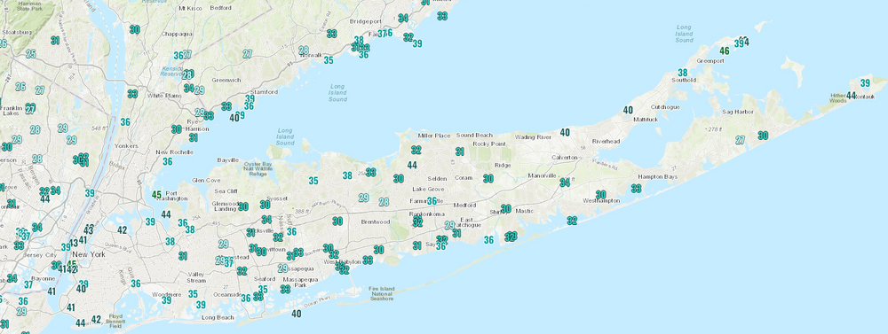
Cold start to today....saw frost on a few cars driving into work. Most spots were at/below freezing at some point, similar to yesterday:


February 2024
in New York City Metro
Posted
Not a bad thing to see for back half prospects...