

hawkeye_wx
-
Posts
5,922 -
Joined
-
Last visited
Content Type
Profiles
Blogs
Forums
American Weather
Media Demo
Store
Gallery
Posts posted by hawkeye_wx
-
-
Several hours of solid snow late morning through afternoon added <1" to my snow board, so my board is officially useless. I'll just have to go with whatever the other Cedar Rapids area spotters report.
-
 1
1
-
-
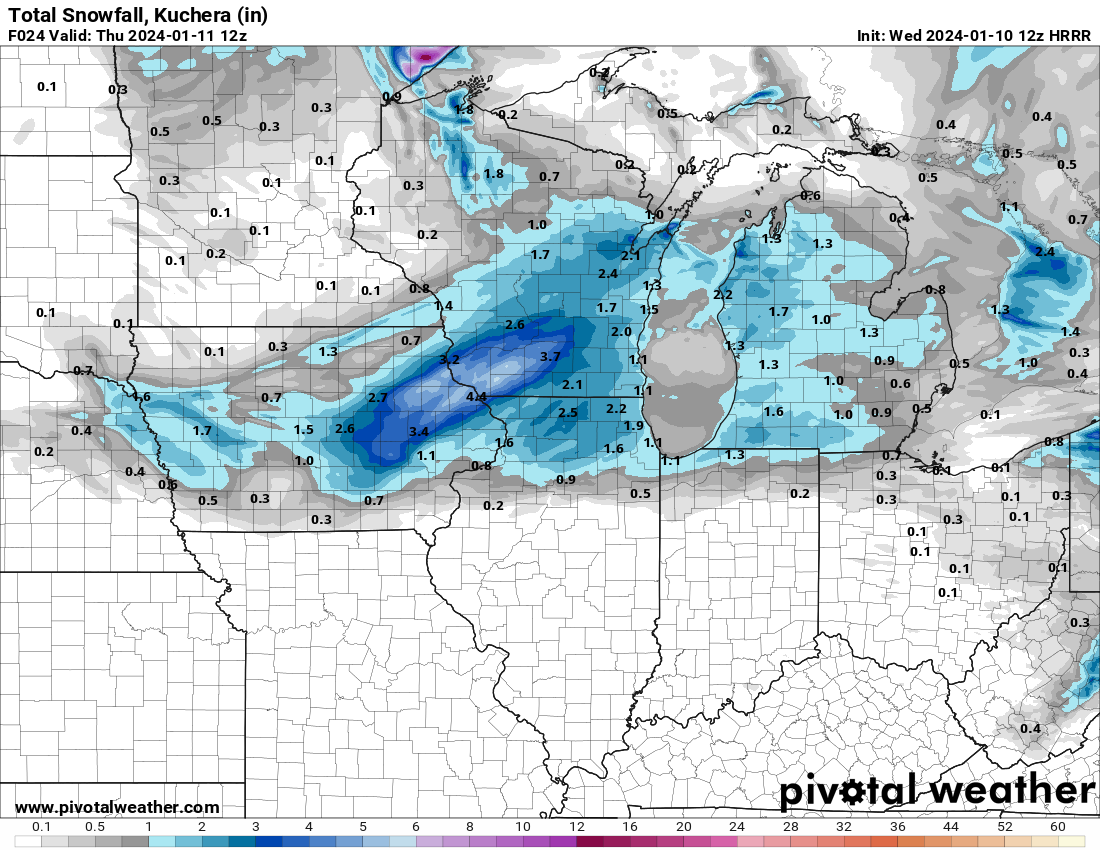
This storm has been a snow dud for a large chunk of east-central Iowa. Models really struggled with the placement of the heavy band. A couple days ago it was expected to be sw through northern Iowa, but instead it tracked through southern Iowa and turned north around the Quad Cites. We didn't get much from the WAA band overnight and accumulation from the defo zone has been iffy today. A couple hours ago I only measured 3.3" and I probably still have <4". The HRRR continues to show snow over us through late evening, but radar shows a big dry hole forming and moving into Cedar Rapids, so we may not get much more snow. Oh well. We got the brunt of the early week storm and now we get the other end of that. That's life.
Update: There is a new 6" report from a few miles north of me. It's so frustrating watching everyone around me report significantly higher totals when there is wind. Where are these people measuring?!? I swear, we could get two feet of snow and my snow board will have 6" on it.

-
Unfortunately, the snow crapped out as it headed north overnight. Southern Iowa got a nice 4-6", but only about 1.5" here. Our totals have come down quite a bit. I'm just hoping for a few more inches at this point.
-
1
-
-
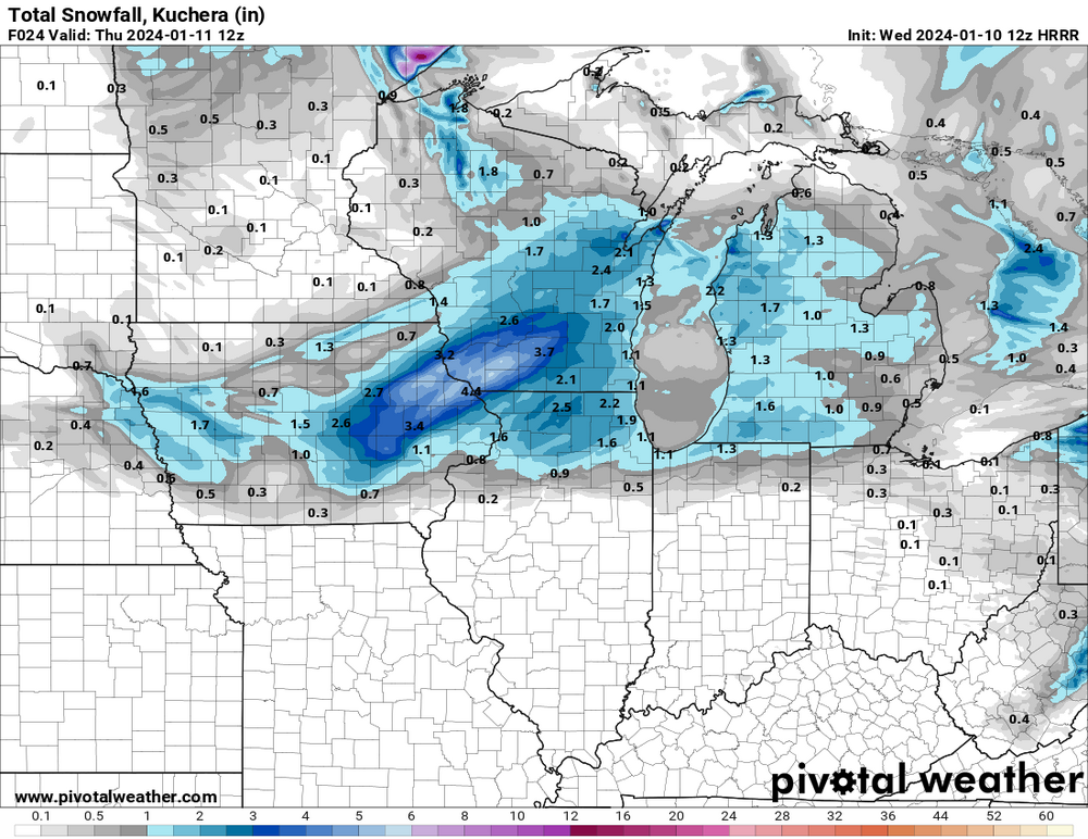
The Euro (including the EPS) and both NAMs have suddenly dropped a nasty dry hole over my area and cratered the snow total for Cedar Rapids/Iowa City. Other models are down as well. Tonight's surge of heavy WAA snow is veering more east into northern Illinois, so it's off to a shaky start. Instead of 8-12", latest guidance suggests maybe 3-6".
-
The NAMs actually dried out Iowa.
-
The Euro is trending much wetter across eastern Iowa. The 06z run had a big dry pocket over my area. The 12z run got rid of that pocket. Now the 18z has us in a wet area.
-
The GFS appears way overdone for southern Iowa.
-
EPS

-
 3
3
-
-
I finished with 2.7" last night. 3-4" fell just northeast of me. Models had it nailed pretty good.
-
1
-
-
I just got 1 inch of snow in 15 minutes. It is probably the heaviest snow I've ever seen.
-
5
-
-
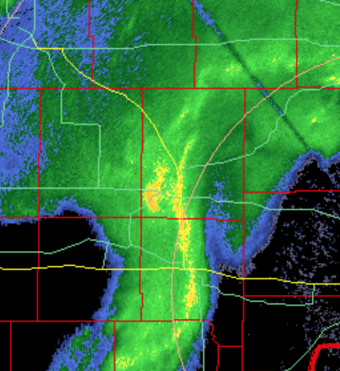
It is ripping hard here, the heaviest snow of the season. The comma head of this potent little disturbance is about to go over me with very intense snow.
-
5
-
-
9 minutes ago, madwx said:
Hoping for some sunshine with this bitter cold stretch upcoming. Definitely makes the days more tolerable
The last two weeks have been extremely cloudy. I remember only a few brief peaks of sun over that period.
-
Tonight's sneaky little wave has been improving for my area. The 12z HRRR now has a strip of 3-4" from Cedar Rapids to Dubuque.
-
1
-
 1
1
-
-
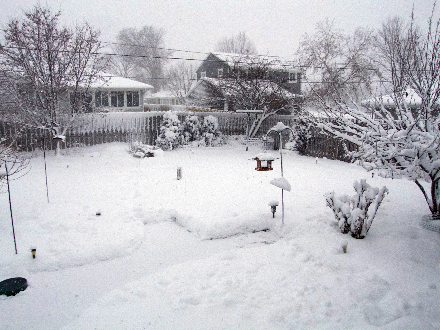
My final measurement is 11.0", so I've still never measured a foot. Without the blowing and drifting later in the storm, I probably would have. All the spotters in and around Cedar Rapids who are reporting 12-15" must have more favorable locations to measure. Even with a 2-stage blower, cleaning this stuff was a long workout. It's the most wet snow I've ever received.
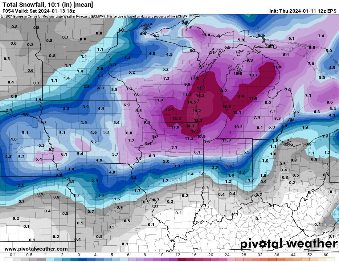
Models really blew it when they shifted the heaviest snow band southeast yesterday.
-
2
-
-
I'm up to 10.5". Everything is plastered with snow, including the sides of the house. Models show we have another 2.5 hours to go, but it's beginning to taper off. It's pretty awesome to have a solid defo zone parked over us all day. That is rare.
-
3
-
-
This is the part of big storms I hate. Now that we are into the blowing and drifting, all the spotters in my area surge well ahead of my total. Reports of 11-12.5" are now coming in across Cedar Rapids and Iowa City, but somehow I've only managed to accumulate 1" on my board over the last 2.5 hours, despite the fact it has been ripping the entire time. Snow gets blown off my board, so my accumulation rate slows to a crawl. I am officially only at 9.7". Reality is probably closer to 11". This is why I always fall short of 12" in big storms.
-
1
-
-
As we approach 10 inches, the general condition is much worse than this morning. This morning the flakes were big and they were not blowing much. Now the flakes are small and a bit drier and the wind is howling. Snow is whipping off roofs and visibility is low.
-
5
-
-
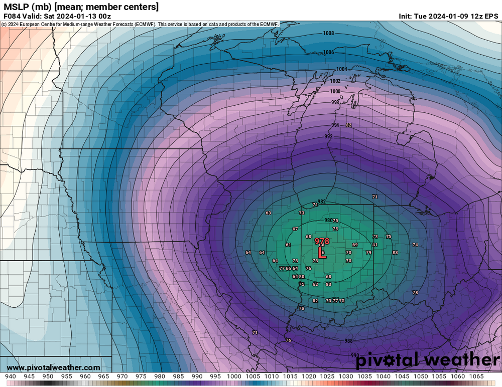
12z EPS... stronger and nw of 00z.
-
2
-
1
-
-
My photo doesn't show how hard it is snowing. I received 1.3" in the last hour, now up to 8.6". The snow has dried a bit and the wind is really gusting, so it is much nastier than just an hour ago.
-
5
-
-
-
I'm at 7.3 inches. Heavy bands are expanding over me, so we have a real shot at 10 inches. It's a beautiful snow, too. Wet, but fluffy.
-
3
-
-
Up to about 6 inches here. The snow is wet, but not slop. It's perfect for piling up without blowing around.
-
1
-
-
My total this morning is 4.8". The ratio is 8.7 to 1.
-
1
-
-
I'm at 3.1". The next several hours should be mostly lighter snow, so I'm hitting the sack. The heavier deformation snow arrives early in the morning.
-
1
-


Jan 11-13th Blizzard
in Lakes/Ohio Valley
Posted
My snow board maxed out at 3.5" yesterday and was down to 2.5" this morning, but I'm going with 5" for my storm total. Several reports from the Cedar Rapids area are in the 6-8" range. The 2.5" of "dry" snow on my board this morning had 0.43" liquid in it, for a 6 to 1 ratio. I always get a terrible ratio when there is wind, even if the snow is bone dry.