Met1985
-
Posts
13,951 -
Joined
-
Last visited
Content Type
Profiles
Blogs
Forums
American Weather
Media Demo
Store
Gallery
Everything posted by Met1985
-

2023-2024 Fall/Winter Mountain Thread
Met1985 replied to The Alchemist's topic in Southeastern States
Some big storms rolling through now. -
2023-2024 Fall/Winter Mountain Thread
Met1985 replied to The Alchemist's topic in Southeastern States
Today we are tracking this. Sent from my SM-G998U using Tapatalk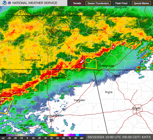
-
2023-2024 Fall/Winter Mountain Thread
Met1985 replied to The Alchemist's topic in Southeastern States
The 18z has it also. It's all about the wave that rides along the front. Timing is everything. -
2023-2024 Fall/Winter Mountain Thread
Met1985 replied to The Alchemist's topic in Southeastern States
Yeah and the Euro is being really aggressive also. Definitely looks like a bug cool down. -
2023-2024 Fall/Winter Mountain Thread
Met1985 replied to The Alchemist's topic in Southeastern States
Had a low of 23 this morning. Been a cool day today as well. -
2023-2024 Fall/Winter Mountain Thread
Met1985 replied to The Alchemist's topic in Southeastern States
It's cold tonight. Current temp is 30 with a stiff breeze. -
2023-2024 Fall/Winter Mountain Thread
Met1985 replied to The Alchemist's topic in Southeastern States
Anyone surprised... Sent from my SM-G998U using Tapatalk
-
2023-2024 Fall/Winter Mountain Thread
Met1985 replied to The Alchemist's topic in Southeastern States
Low of 29 as well. Had some flurries in the air. Looking ahead things look colder and possibly snowy. -
Yeah I've got trees in my area that are budding for green new growth. I feel bad for them.
-
2023-2024 Fall/Winter Mountain Thread
Met1985 replied to The Alchemist's topic in Southeastern States
Rabun-Habersham-Stephens-Franklin-Hart-Macon-Southern Jackson- Transylvania-Henderson-Polk Mountains-Eastern Polk-Anderson- Oconee Mountains-Pickens Mountains-Greenville Mountains-Greater Oconee-Greater Pickens-Central Greenville-Southern Greenville- Northern Spartanburg-Southern Spartanburg- Including the cities of Brevard, Hendersonville, Rainbow Springs, Rocky Bottom, East Flat Rock, Mountain Rest, Glassy Mountain, Oakway, Boydville, Columbus, Spartanburg, Fletcher, Wellford, Little River, Fountain Inn, Saluda, Seneca, Franklin Springs, Clarkesville, Highlands, Lyman, Mountain City, Cornelia, Canon, Dacusville, Baldwin, Clayton, Hartwell, Tuxedo, Mauldin, Royston, Anderson, Wolf Mountain, Berea, Gumlog, Mill Spring, Easley, Clemson, Fork Shoals, Taylors, Inman, Tryon, Landrum, Etowah, Reed Creek, Franklin, Duncan, Cashiers, Cedar Mountain, Pine Mountain, Hollywood, Simpsonville, Nuberg, Dana, Greer, Toccoa, Westminster, Lavonia, Demorest, Kyle, Walhalla, Fingerville, Boiling Springs Sc, and Greenville 302 PM EST Fri Mar 8 2024 ...FLOOD WATCH REMAINS IN EFFECT FROM 7 PM EST THIS EVENING THROUGH SATURDAY EVENING... * WHAT...Flooding caused by excessive rainfall continues to be possible. * WHERE...Portions of northeast Georgia, including the following areas, Franklin, Habersham, Hart, Rabun and Stephens, western North Carolina, including the following areas, Eastern Polk, Henderson, Macon, Polk Mountains, Southern Jackson and Transylvania, and upstate South Carolina, including the following areas, Anderson, Central Greenville, Greater Oconee, Greater Pickens, Greenville Mountains, Northern Spartanburg, Oconee Mountains, Pickens Mountains, Southern Greenville and Southern Spartanburg. * WHEN...From 7 PM EST this evening through Saturday evening. -
2023-2024 Fall/Winter Mountain Thread
Met1985 replied to The Alchemist's topic in Southeastern States
Heavy rainfall tonight. Sent from my SM-G998U using Tapatalk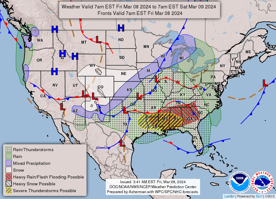
-
2023-2024 Fall/Winter Mountain Thread
Met1985 replied to The Alchemist's topic in Southeastern States
This is going to lead to some flood along the southern escarpment. Sent from my SM-G998U using Tapatalk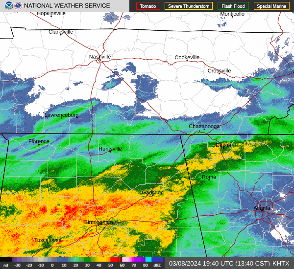
-
2023-2024 Fall/Winter Mountain Thread
Met1985 replied to The Alchemist's topic in Southeastern States
Yeah this past weekend was absolutely beautiful. We know it's not going to last. -
Wow! The totals out there are crazy!
-
Just an amazing storm up and down the West coast!
-
2023-2024 Fall/Winter Mountain Thread
Met1985 replied to The Alchemist's topic in Southeastern States
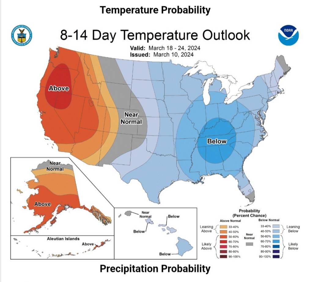
Well I call this a small victory for this winter. Looks like we might have something possibly brewing the second half of March. -
I tell you what that 4 to 6 week window you preach about is darn close every single time just about. There is definitely something to that in my opinion going off of your theories.
- 750 replies
-
- 2
-

-
- snow elk
- wooly worm
- (and 1 more)
-
2023-2024 Fall/Winter Mountain Thread
Met1985 replied to The Alchemist's topic in Southeastern States
34 with moderate to heavy rainfall this afternoon. -
2023-2024 Fall/Winter Mountain Thread
Met1985 replied to The Alchemist's topic in Southeastern States
Going to be a very wet afternoon. Sent from my SM-G998U using Tapatalk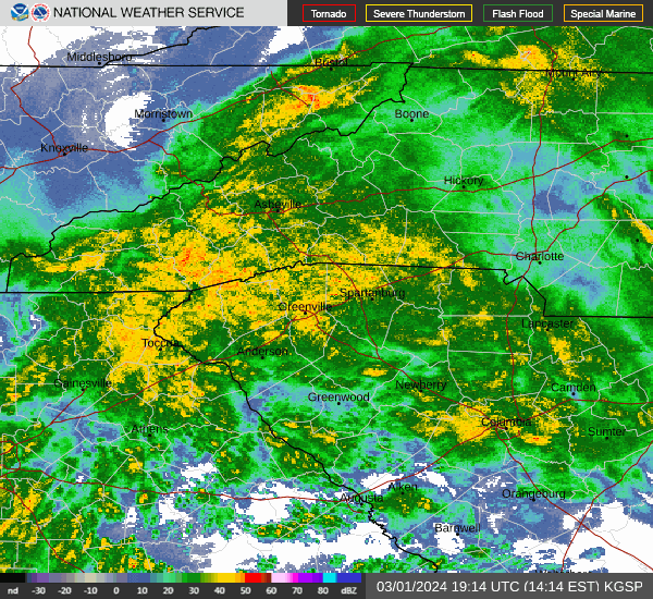
-
2023-2024 Fall/Winter Mountain Thread
Met1985 replied to The Alchemist's topic in Southeastern States
Nice! Thank you. -
2023-2024 Fall/Winter Mountain Thread
Met1985 replied to The Alchemist's topic in Southeastern States
Just getting blasted out west. https://www.mammothmountain.com/on-the-mountain/mammoth-webcam/the-summit -
2023-2024 Fall/Winter Mountain Thread
Met1985 replied to The Alchemist's topic in Southeastern States
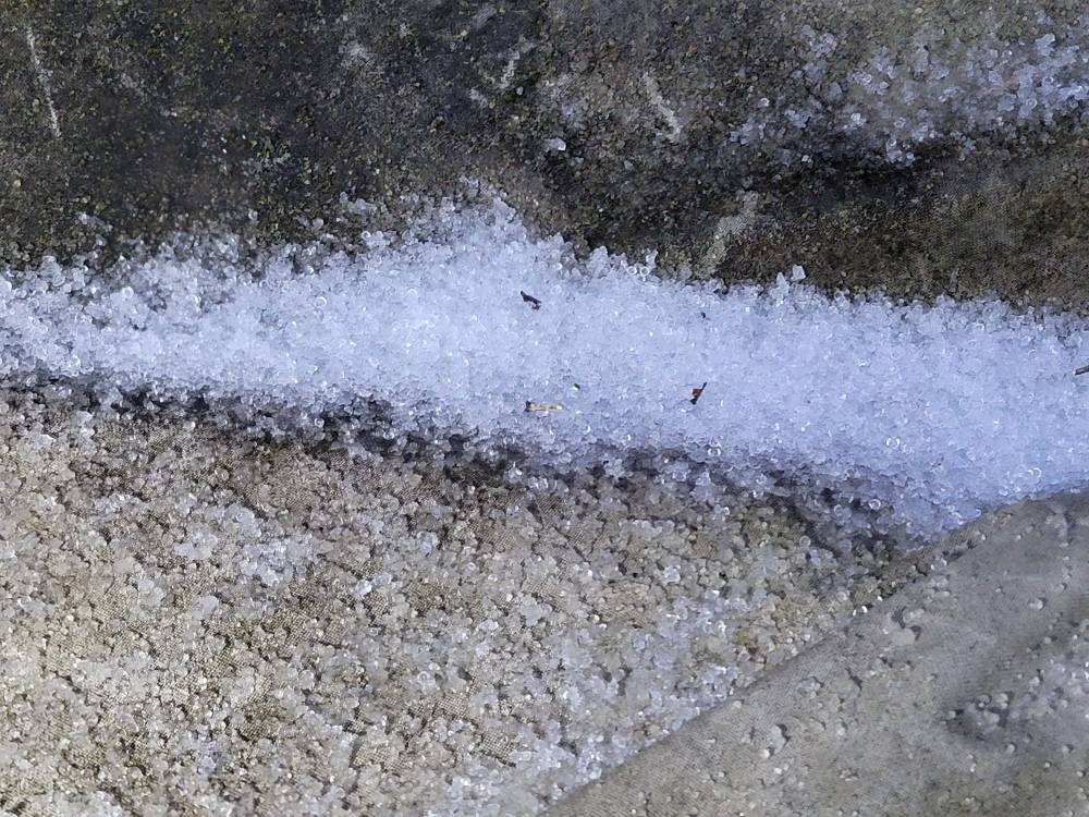
Impressed with the cold air entrenched today. Temps been hovering around 32/33 all morning..we still have ice hanging around from earlier. -
2023-2024 Fall/Winter Mountain Thread
Met1985 replied to The Alchemist's topic in Southeastern States
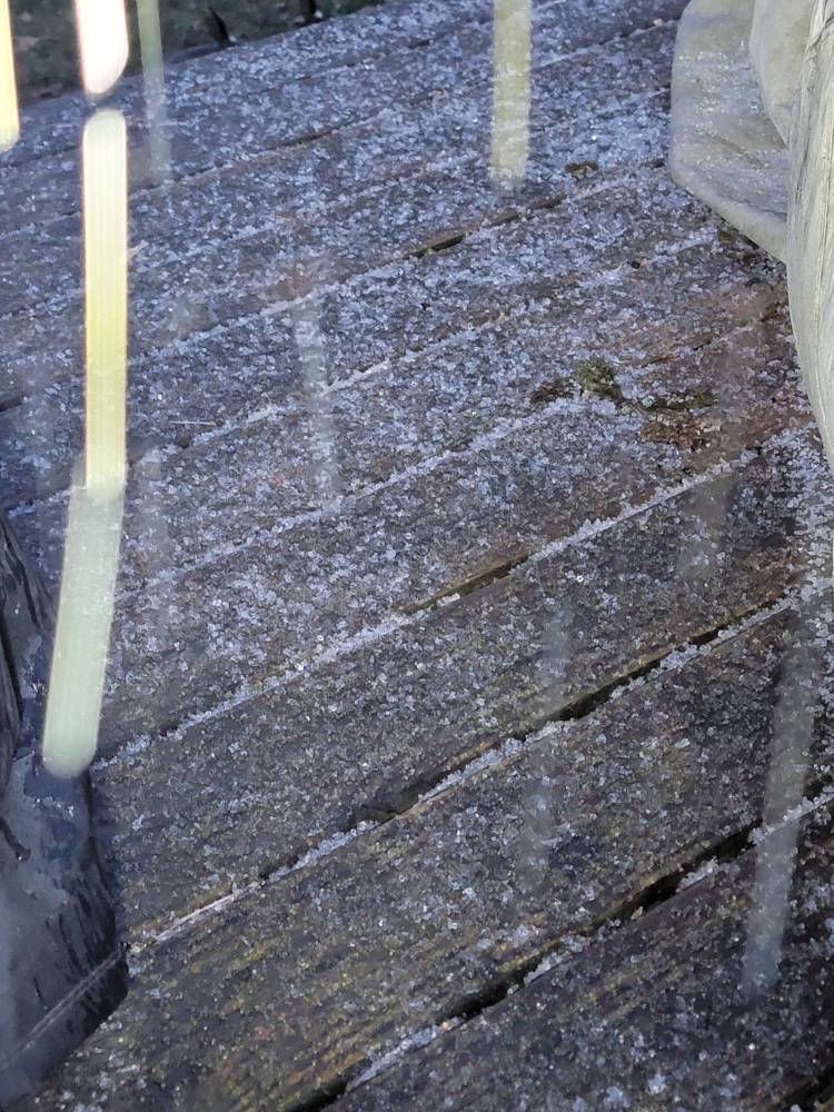
Some deck ice pics..still icing moderately currently. Sent from my SM-G998U using Tapatalk
-
2023-2024 Fall/Winter Mountain Thread
Met1985 replied to The Alchemist's topic in Southeastern States
Silver dollar flakes mixing in. -
2023-2024 Fall/Winter Mountain Thread
Met1985 replied to The Alchemist's topic in Southeastern States
Heavy icing currently covering the deck and sidewalk.