

Rtd208
-
Posts
12,617 -
Joined
-
Last visited
Content Type
Profiles
Blogs
Forums
American Weather
Media Demo
Store
Gallery
Posts posted by Rtd208
-
-
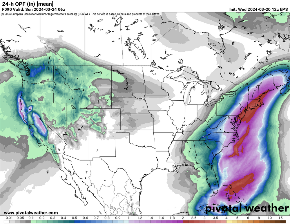
Interesting storm on some of the models for next week especially for New England.
-
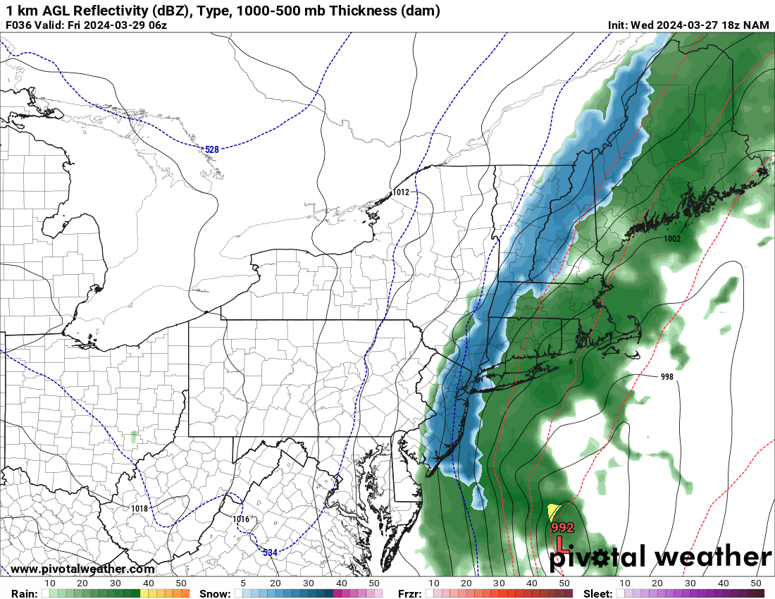
18z NAM


.thumb.png.aa091c2f7a366f71c38823d1e4fb154d.png)
-
 1
1
-
-
18z GEFS for later this week.
.thumb.png.575380525b9bcf4e4c667b3b703f4b05.png)
-
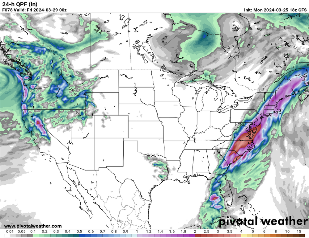
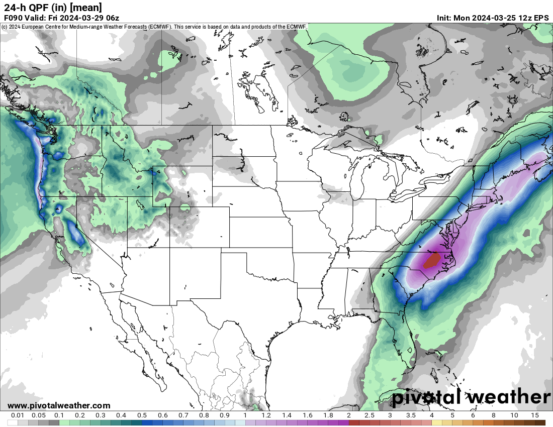
The 18z GFS Op is wetter and further west for later this week.
-
1
-
-
-
12z EPS is further west then the Euro Op but that was also west of 00z.

-
1
-
-
17 minutes ago, bluewave said:
It will be interesting to track the evolving storm details for later in the week. It looks like there will be a powerful phase involved. So the timing will be important as to how much heavy rains the region can get. It is also forecast to generate an impressive wave break which could set up a strong Greenland block into early April. That would mean a continued stormy pattern and probably limit the number of 70° days until the blocking relaxes a bit.


We'll have 4 days to dry out but that could certainly create some addiitonal flooding problems with the 3-4" of rain we received yesterday.
-
1
-
-
-
Storm total of 3.24" here.
-
Storm total of 3.24" here.
-
1
-
-
Picked up 3.14" of rain so far today.
-
1
-
-
Picked up 3.14" of rain so far today.
-
1
-
-
Picked up 2.04" of rain so far today.
-
1
-
-
Picked up 2.04" of rain so far today.
-
Under a Flood Warning here now.
-
1
-
-
Picked up 1.01" of rain so far today
-
Picked up 1.01" of rain so far today.
-
The overnight models are pretty locked in on a widespread 2.5"-3.5" rainfall w/locally higher amounts possibly up to or exceeding 4.0"
-
-
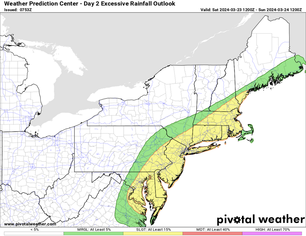
Flood Watch in effect here from late Friday night thru Sunday morning for 2.5"-3.5" of rain w/locally higher amounts.
-
2
-
-
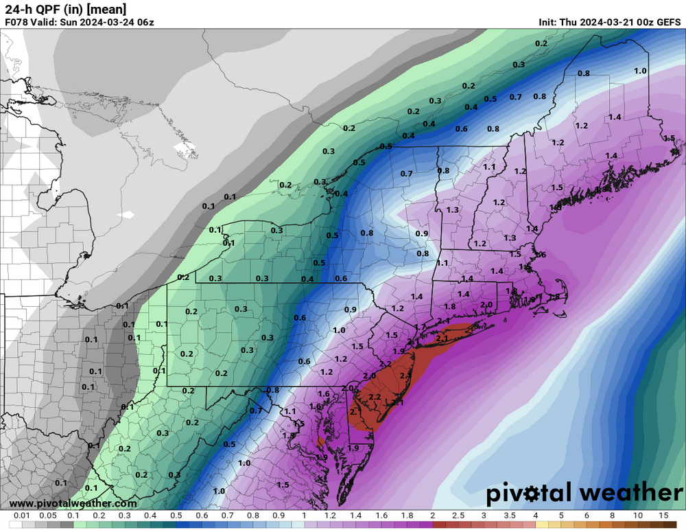
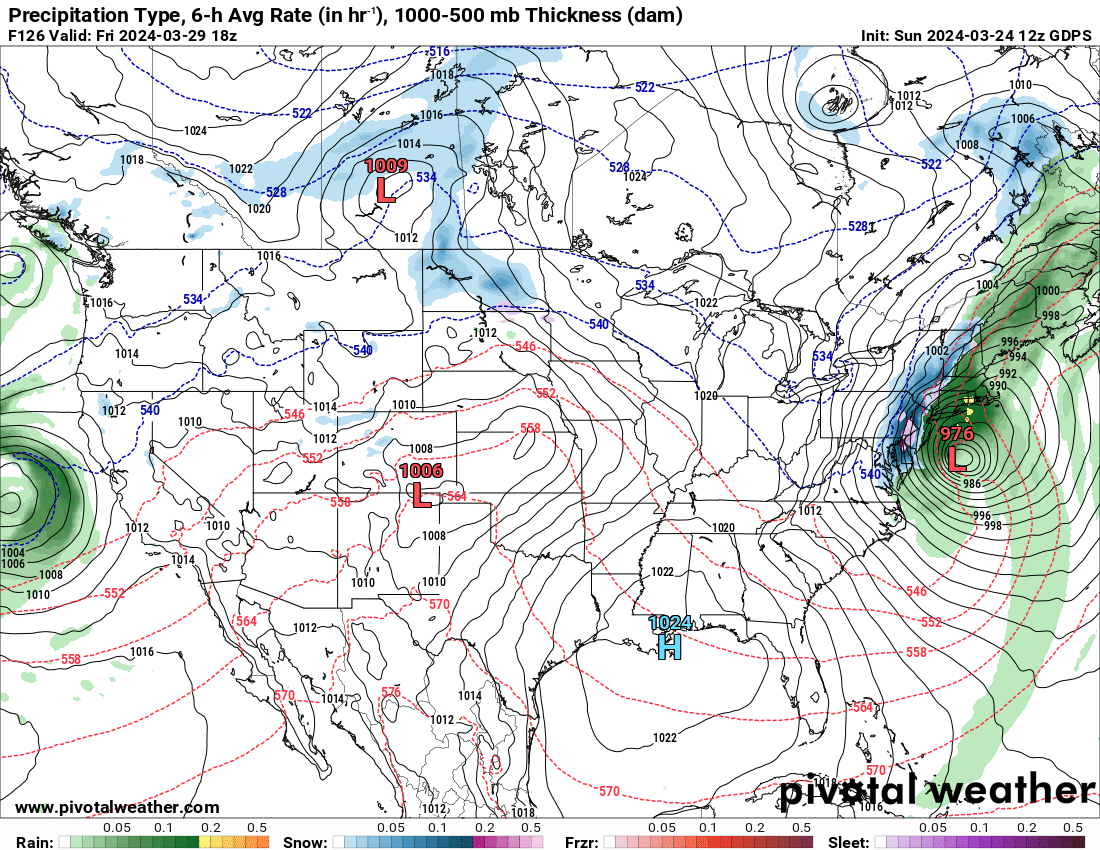
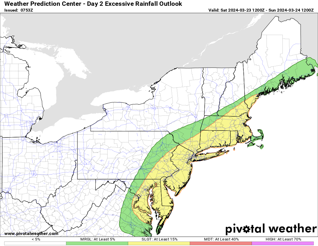
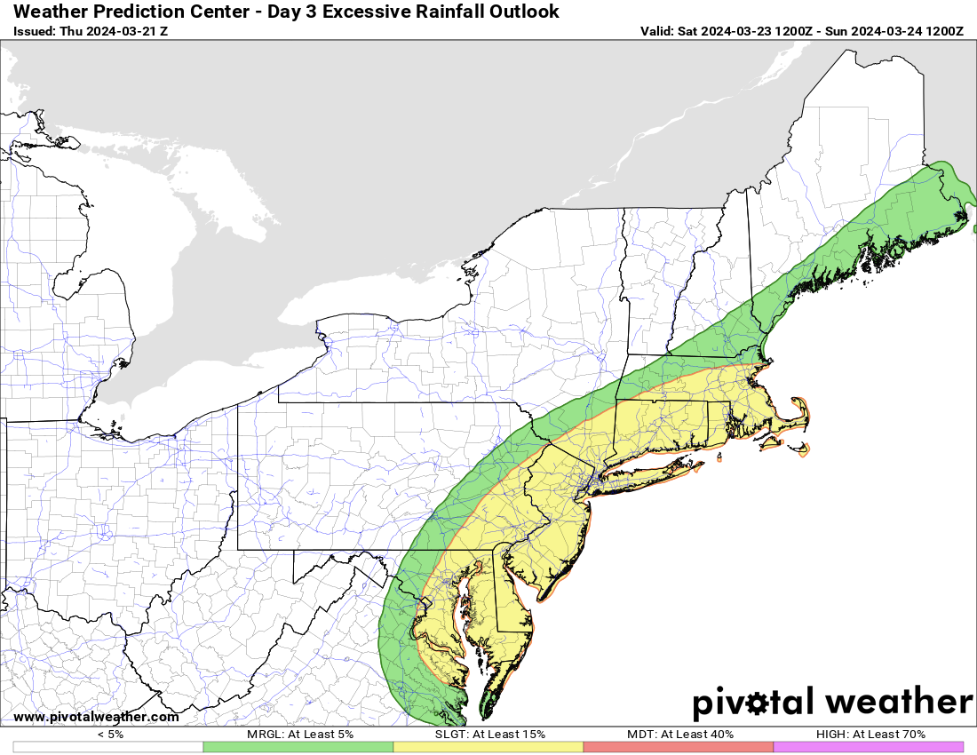
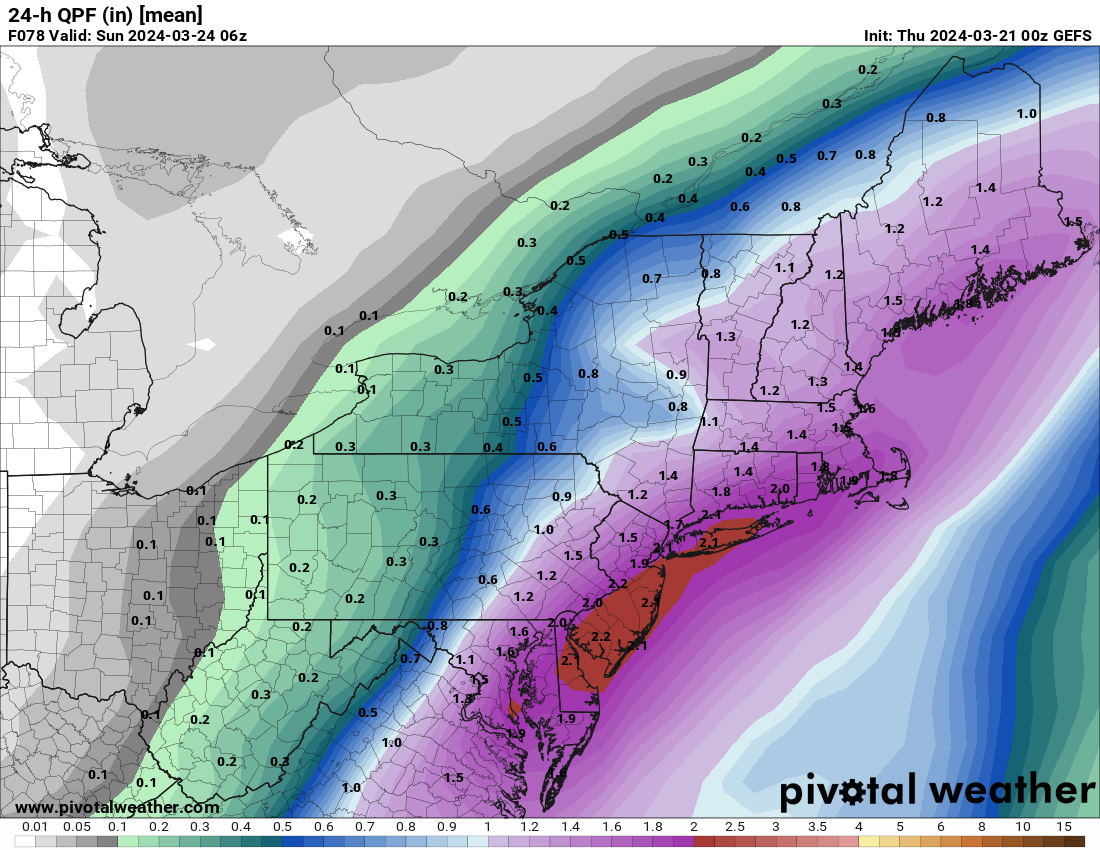
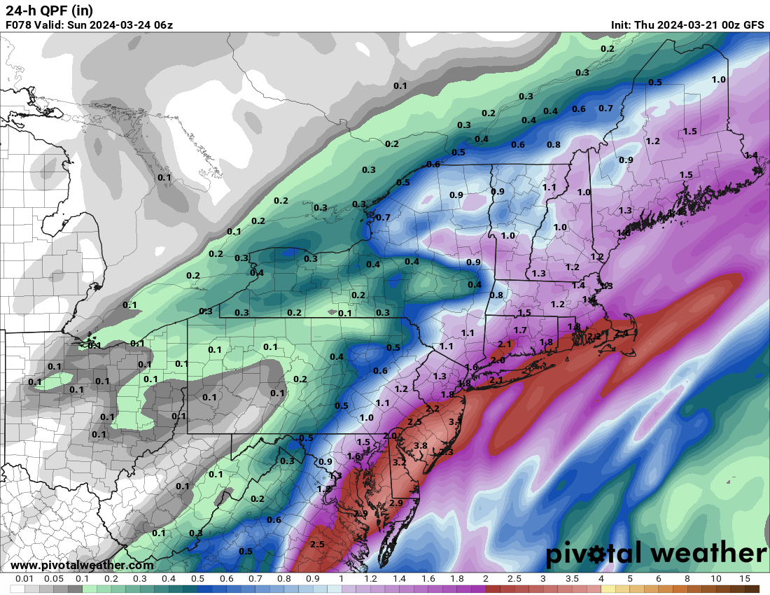
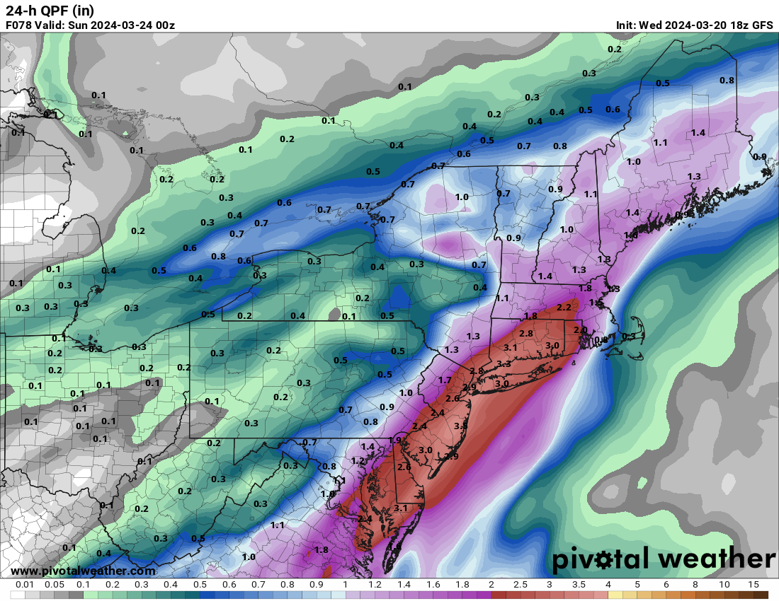
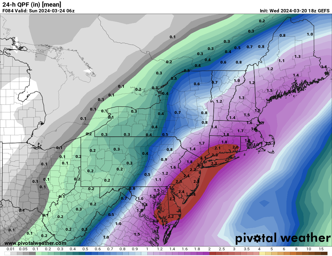
The overnight models continue to be very wet for the weekend with some of them continuing to increase rainfall amounts.
.thumb.png.37bed1e58c5d3b69844f65e7db1d1244.png)
.thumb.png.53ad6f0e4c8c02e7a46d67168e53d062.png)
.thumb.png.08d7630ca71eb3469328015d30452b1b.png)
.thumb.png.43ecdd09c60da917dcf73b9edf5a0bcc.png)
.thumb.png.22f7565fac451cff369b2e1c17577de4.png)
.thumb.png.44411bec335780f251455727dc76560e.png)
-
1
-
-
-
Thunder here. Wow
-
2
-
-
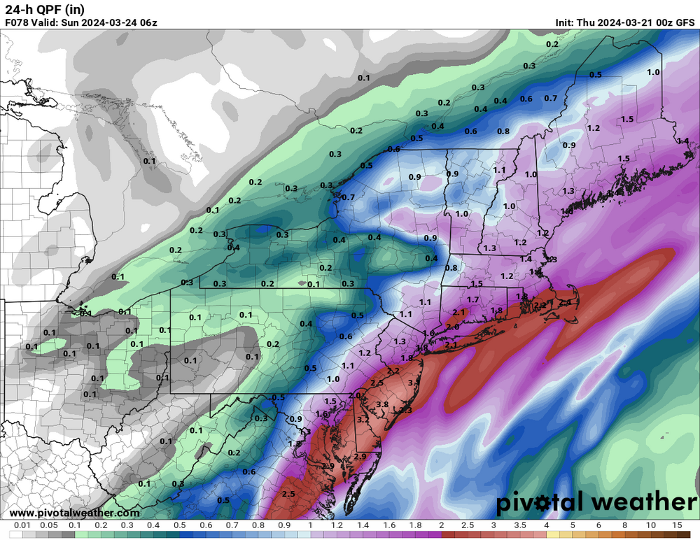
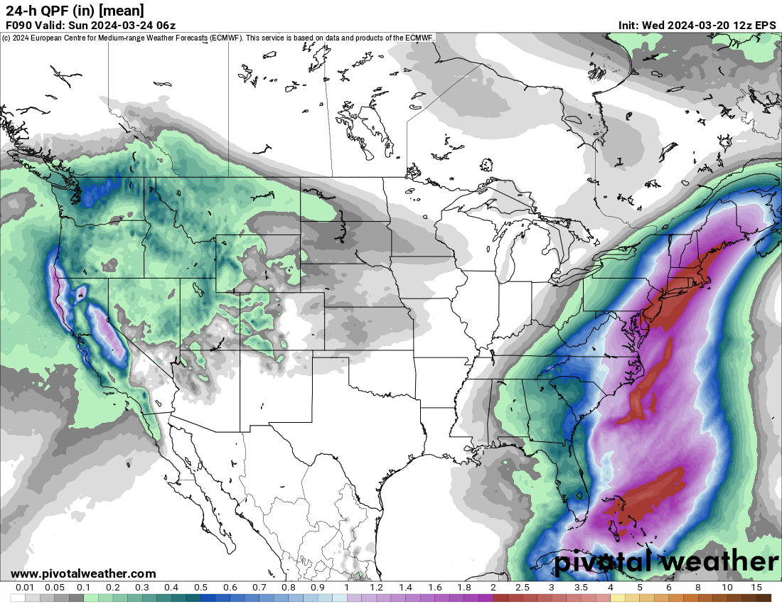
12z EPS is very wet for the weekend.
.png.5af87d4d7b4f5ecf2d05cfad2de7048a.png)
.png.9cba5d5bb4047c828b97ccf719416c03.png)


.gif.5579e98c91b7107e0aa58861d3641300.gif)
.png.5b5caf37f62503c190f3bc2fa58e88cb.png)
.png.b1a6de095473ed131e05b9420f3d3f65.png)
.png.41b088241bc30ee6e3fab1740a413f0e.png)
.png.141db29489bc957f6523ffbb04500c46.png)
.png.79a3e04fcbe5e18203ed3ff7e5b14522.png)
.png.f274437ab05e2388f33e4ea990c516fe.png)
April 2024
in New York City Metro
Posted
The 12z GFS is still showing next weeks storm sitting and looping off the New England coast. Not saying its right but interesting to say the least. It also shows very windy conditions over the NYC metro region later next week, something to monitor as we get closer.