

Rtd208
-
Posts
12,617 -
Joined
-
Last visited
Content Type
Profiles
Blogs
Forums
American Weather
Media Demo
Store
Gallery
Posts posted by Rtd208
-
-
Current temp is 80 here.
-
Current temp 71 here.
-
Current temp 71 here.
-
45 minutes ago, weathermedic said:
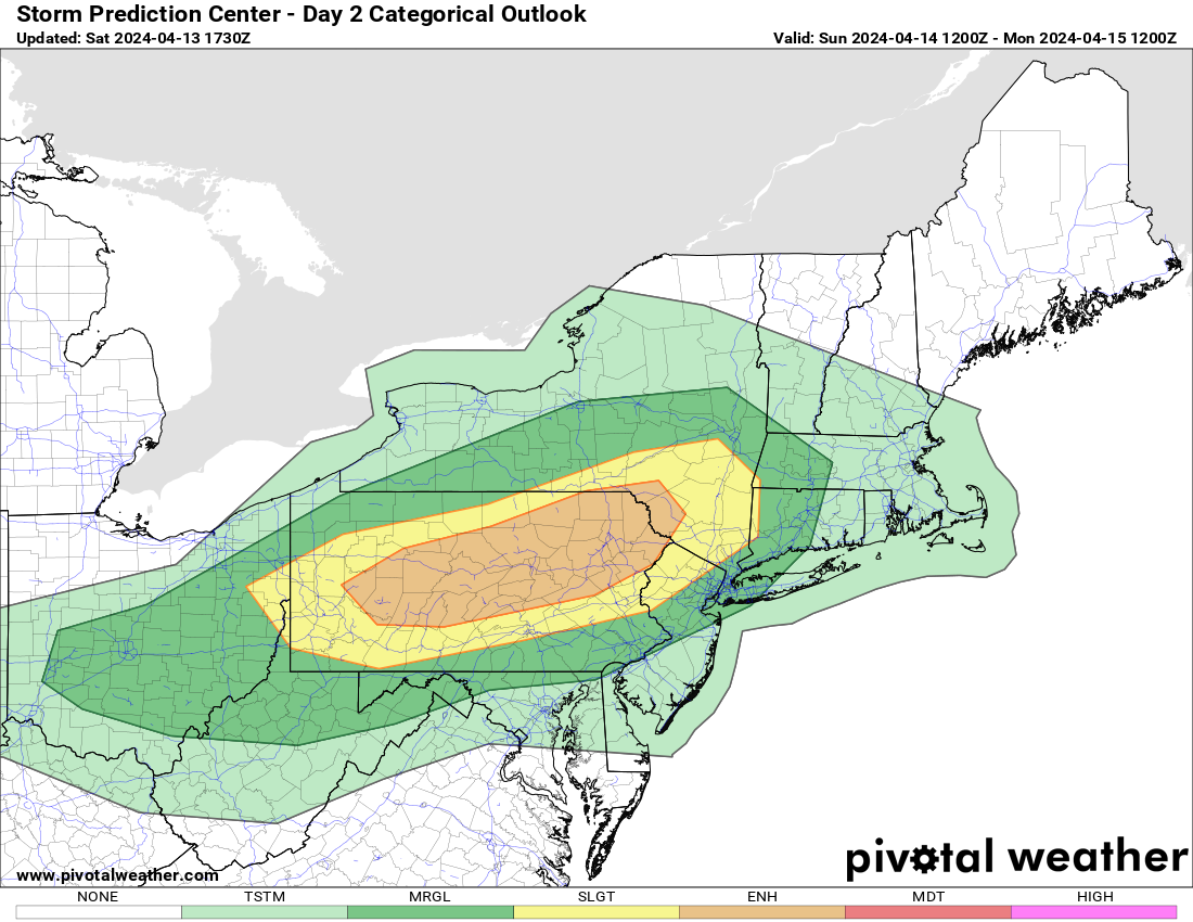
From OKX AFD:
While there is deep-layer shear present with strong mid-level
flow, instability is generally weak and confined primarily to
the mid levels. Surface-based CAPE is located mainly north and
west of the NYC metro with SPC HREF max CAPE values of 500-1000
J/KG. Mean CAPE values are less than 250 J/KG. This is partly
due to the frontal timing in the evening after max insolation,
but also dry air in the low-levels. CAMs generally show the line
dissipating this evening as it approaches the area and in some
cases with no more than a spotty shower reaching the coast. So
the best chance will be across the interior with chances
decreasing toward the coast.
Yeah the later timing will probably cause the line to weaken as it approaches the NYC metro plus its still a touch early for good severe storms especially closer to the coast but chances will be ramping up over the next few weeks.
-
 1
1
-
-
-
-
-
-
Picked up 0.44" of rain so far today.
Storm total 0.67"
-
Picked up 0.44" of rain so far today.
Storm total 0.67"
-
Picked up 0.23" of rain for the day yesterday
0.05" so far today.
Storm total so far 0.28"
-
1
-
-
Picked up 0.23" of rain for the day yesterday
0.05" so far today.
Storm total so far 0.28"
-
High for the day was 78 here.
-
High for the day was 78 here.
-
1
-
-
2 hours ago, MJO812 said:
This warm weather sucks. So many people out.
Come back in October.

-
5 minutes ago, JetsPens87 said:
Does a bay breeze ever make it over Staten Island to Carteret?
And if so is there really any effect?
Occassionally, if we do its usually only a slight temperature drop.
-
 1
1
-
-
Current temp is 77 here.
-
Current temp is 77 here.
-
1
-
-
-
1 hour ago, MJO812 said:
This
One of the few times I actually agree with him.
-
1
-
-
Picked up 0.30" of rain for the day.
Final storm total 3.34"
-
Picked up 0.30" of rain for the day.
Final storm total 3.34"
-
Blowing hard right up your fannies.
-
 1
1
-
-
Picked up 0.21" of rain so far today.
Storm total so far 3.25"


E PA/NJ/DE Spring 2024 OBS/Discussion
in Philadelphia Region
Posted
Current temp is 80 here.