

Castaway
-
Posts
318 -
Joined
-
Last visited
Content Type
Profiles
Blogs
Forums
American Weather
Media Demo
Store
Gallery
Posts posted by Castaway
-
-
Seems like a break in the howling now. Was constant in the background for a bit.
-
10 minutes ago, totsata said:
Also lost power for a few minutes in Buffalo Grove. Power is back on now. Wind is howling….power is flickering again.
Glad it came back.
Power is still down here in Oak Brook. Going to check the outage map. Hopefully gets up soon.
Branches and everything are weighted down. Winds are howling.
-
Power just went out in the neighborhood. Damn it. Hopefully it gets back up within the hour
-
 2
2
-
-
Oak Brook here. Mental alarm hit earlier than normal. Passed out early last night.
Awesome rates past hr. Everything looks plastered. Told my gf yesterday that it wasn’t going to start til later on in the day today.
Whoops. Text her good morning and no response yet.
(sips coffee) I’m just going to stick my guns and say this isn’t even the main event yet/just some freakish frontal that passed through etc
-
 2
2
-
-
Decent band over i-80.
Aurora looking good coming up

-
1 hour ago, Malacka11 said:
Pretty much how I’m feeling lol
Haven’t been following this at all until yesterday. And it has been ticking south since. Daddy like.
-
2
-
-
Wanted to share
-
I’m in Oklahoma City for a bit. Was watching a nice tower form to the east and went severe warned.
Hot day around 95
-
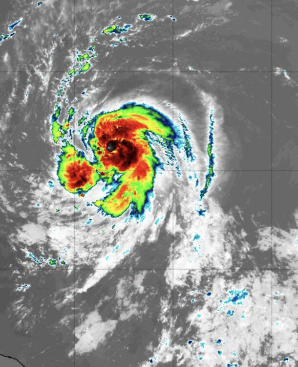
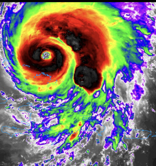
Waiting for the next frame. If it’s starting to look like I think it’s starting to look, the eye is looking insane and with potentially more strengthing ahead.

-
3 hours ago, NorthHillsWx said:
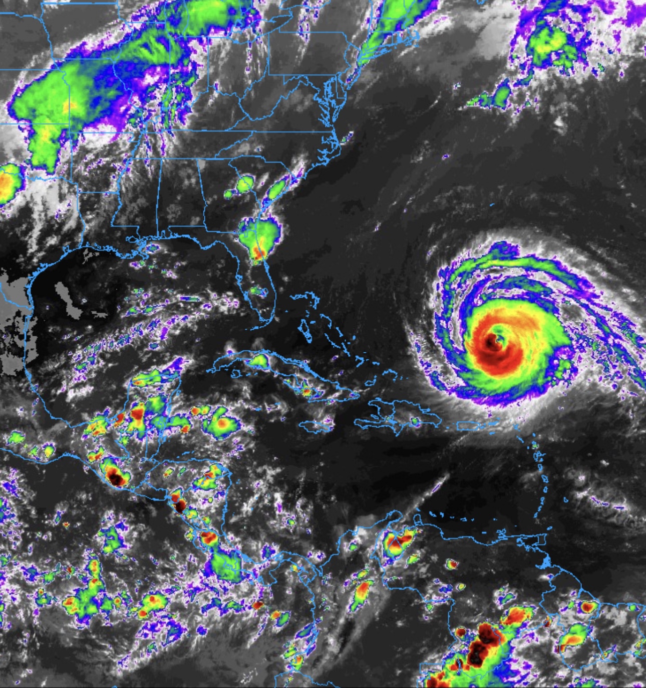
I’ll interrupt your regular scheduled programming to tell you to hop over to the EPAC and check out hurricane Jova. One of the most intense bouts of rapid intensification you will see and this thing has likely become a category 5 beast
Some of those classic high end EPAC hurricanes remind me of a spinning skateboard wheel that got caught in seaweed or something lol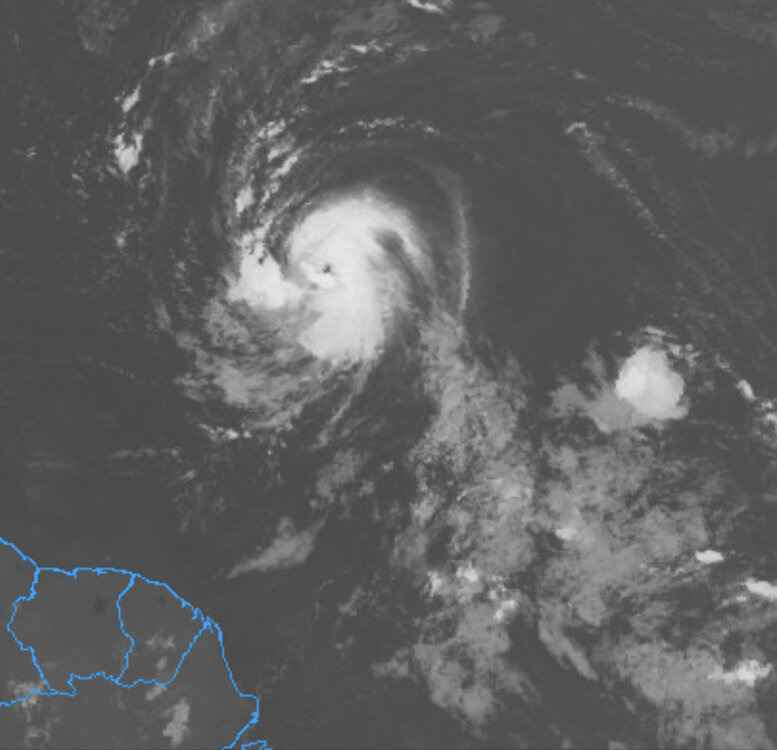
Lee appears to have popped an eye couple hrs ago.
Confirmed tower action formed southwest of the circulation earlier with it wrapping around full circle now.
-
 1
1
-
-
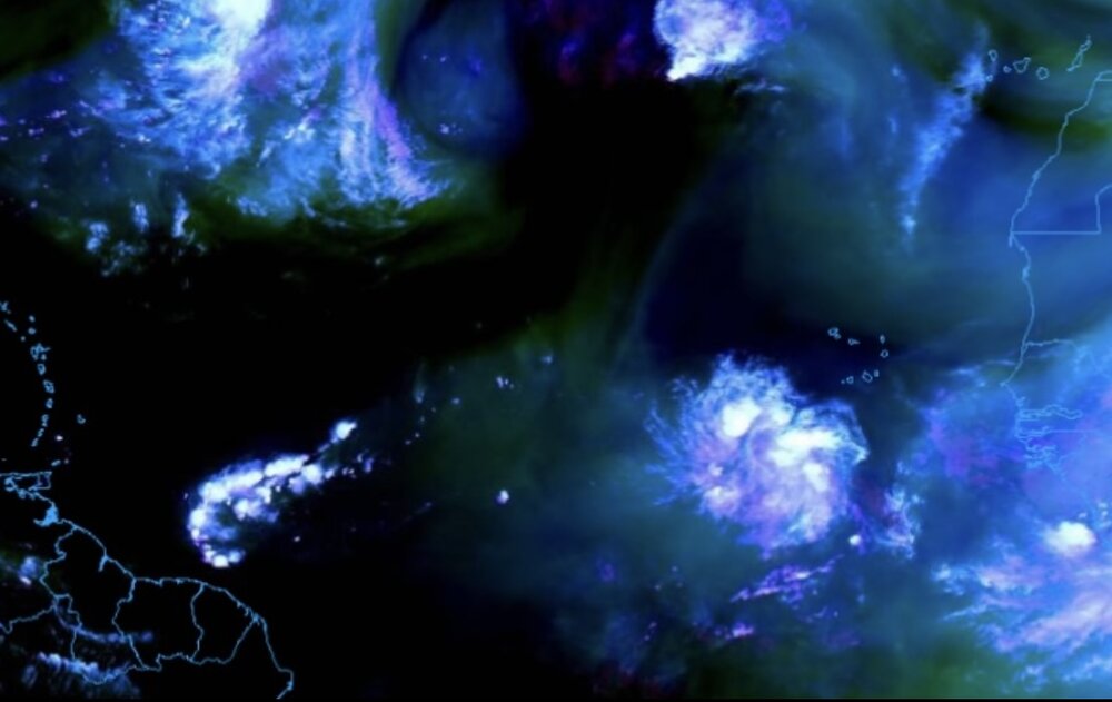
Speaking of Shrimp, after eyeballing this thing on satellite loop past hrs lol, I kept recalling Dorian when it was in its shrimp phase before taking off and eventually becoming a beast.
Even though Dorian developed it more west around Barbados I believe.
Catching similar vibes, especially if it’s headed on track towards the east side of the Bahamas area.
Might be premature, but wouldn’t be surprised this is hurricane status after a few more cycles in the next few hours or so. -
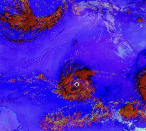
59 minutes ago, Windspeed said:
Recent ASCAT. Definitely a broad center, but looks closed. Needs continued bubbling convection to tighten low-level vorticity. We'll have a TC on Tuesday.

Nice! The general area of circulation has become more evident from watching it on and off past hours. It’s getting it’s act together.
-
 2
2
-
-
Still early obviously, but there’s definitely an ominous overall feel to this one imo.
Especially being this far out, and with the broad turning in the low levels as mentioned earlier.
This looks like it has a strong potential of displaying a mean buzzsaw representation in the incoming future with a broad robust CDO doughnut .
-
 1
1
-
-
14 hours ago, TheClimateChanger said:
Although outside this subforum, worth noting Denver reached 99 today. I checked on NowData, and that was a daily record and equals the third warmest reading on record in the month of September.
The only warmer readings were 100 on September 2, 2019, and 101 on September 5, 2020. It also reached 99 on September 7 & 8, 2022, and September 10, 2021.
Prior to 2019, it had never reached 98 in Denver in the month of September. With today’s high of 99, it has now reached 98 or better on nine occasions in the past 5 years.
In the context of the past five years, a pretty typical early September heat wave in Denver. But it would have been a new monthly record high prior to 2019. Records for Denver date to 1872.
Denver got 99’d yesterday? Just 1 French fry away from a 100.
ruff.
-
1
-
-
34 minutes ago, Malacka11 said:
What did I say about supercell-esque updraft that shit literally exploded overhead
Yeah it was definitely nice. Was under the overshoot for awhile here in Oak Brook.
Constant rumbling.

-
5 minutes ago, SchaumburgStormer said:
Something trying to get going in the south burbs along the lake front
Yeah just had a visual looking outside. Some nice explosive looking towers popped up
-
-
Was able to catch some timelapse footage, looking West towards Glen Ellyn, between Roosevelt Rd. and Butterfield Rd.
Will post more.
-
1
-
1
-
-
Well, that was a surprise. It really was trying to drop tornadoes around.
I was busy today and didn’t really look into it much.
Seemed weird. Initial thoughts walking out/quickly gauging it, reminded me of some cold funnel set up day. With rotations around/some funnels etc.
Came home and saw the velocity scans. Didn’t expect to see some of the videos out in Elgin and the damages in countryside etc
The scan earlier over by countryside seemed one of the better ones. Will be interesting to see some videos from there.
-
Rotation getting together just west of Batavia
-
21 minutes ago, mimillman said:
Your battery is stressing me out
lol. The ol days where being in red meant imminent death.
These days it depends on the phone. Red now will carry you for hours no prob.
-
Wonder if there’s a chance it’s being over done on having the low starting out as fast.
Which would have it a tick south. Having it more west on Friday than what’s being shown right now on some models.
Thinking at least 2” for the Chicago area.
-
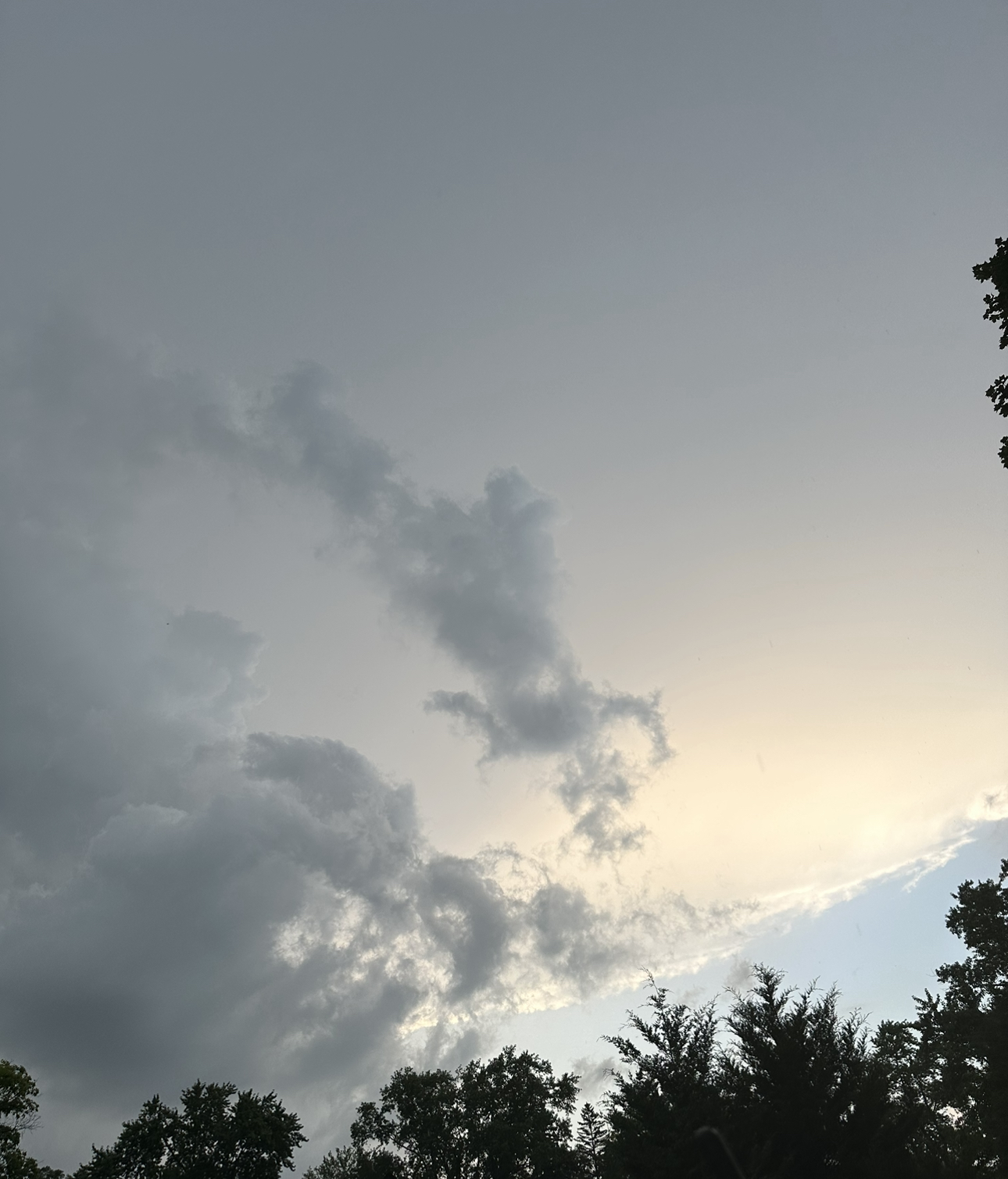
Anyone see the “face” in the SE?
lol
captured just now
-
1
-
2
-
-
47 minutes ago, Chicago Storm said:
A severe t’storm headed towards here at ORD faded as it approached, but it still provided great garden variety action.
Looks like home may have faired a bit better, with a more sustained line of severe warned t’storms having hit there a bit ago.Here by Oak Brook small to medium branches down.
Nothing crazy, but I didn’t expect much.
I was watching it outside for a bit. Thought the 2 cells would split through here and continue sliding SE. Then, it started shifting a little more easterly. Afterward 15mins or so, saw a shelf cloud appear and start rolling in. And had nice gusts.
About 100ft row of branches going across the street.
One of the more severe “events” IMBY/ neighborhood this year lol. Wouldn’t guess in September.
But not surprised either considering the multiple touchdowns we had in the dupage area lately past couple years now.
-
1
-


February 27-28 Severe Threat
in Lakes/Ohio Valley
Posted
The initial wording in the Tornado watch on the iOS weather app caught my eye
Severity: Extreme