-
Posts
18,459 -
Joined
-
Last visited
Content Type
Profiles
Blogs
Forums
American Weather
Media Demo
Store
Gallery
Posts posted by andyhb
-
-
Looks like a fairly large tornado here near Barr IL.
-
 1
1
-
-
Tornado trying to form on the west side of DVN right now.
-
https://livestormchasing.com/chasers/brett.adair
Tornado was in progress on this stream.
-
Cell in far SE IA looks poised to produce a sig tor.
-
Couple of supercells emerging on the southern end of the line for the tri-state area. Those are probably the main show down south.
-
Tornado in progress on this stream NW of DMX.
-
 1
1
-
 1
1
-
-
This first round has been notably cellular especially south of the IA/MO state line.
-
18z Euro was very impressive for tomorrow and probably worthy of a MDT risk. Gives ample time to destabilize with 300+ m2/s2 0-1 km SRH becoming common along a 50 kt LLJ over SE IA, NE MO, and far W IL by 21z. Signal is for a discrete/semi-discrete band of cells along the arcing Pacific front/dryline with better lapse rates thanks to CAA aloft closer to the primary upper low.
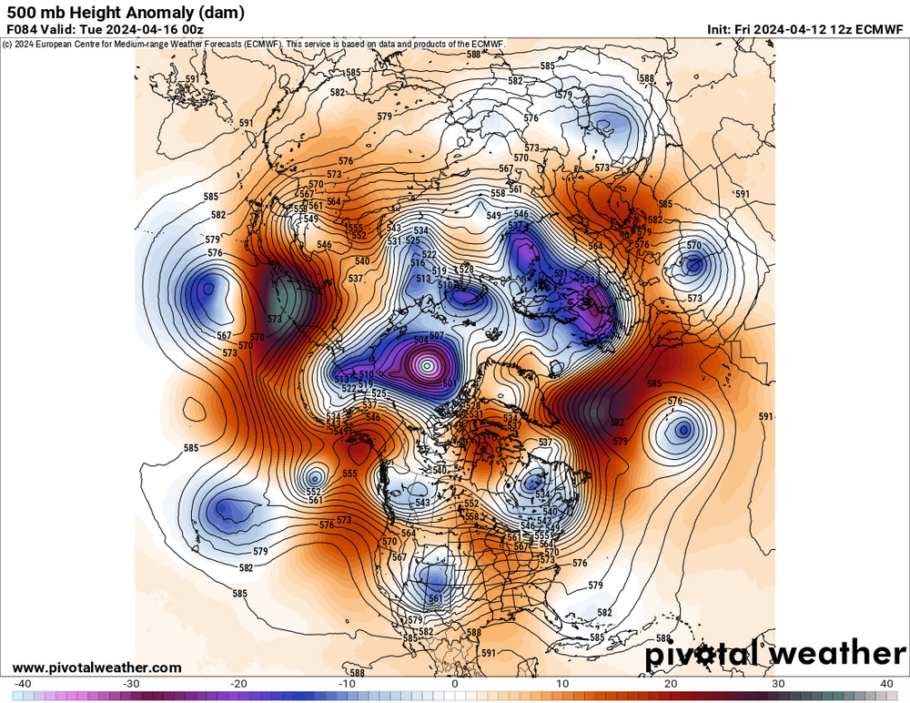
There are a number of larger synoptic N MO/IA events that looks like this one at 500 mb (5/27/1995, 4/8/1999, 3/31/2023, 4/11/2001 amongst them), and the dryslot in the mid levels as 700-500 mb, which is absolutely paramount for these types of events, looks pretty potent. I also noticed that most of the CAMs, despite different evolutions, ended up with robust cells with strong UH across some portion of the region, both at 12z and 18z.
-
 1
1
-
 1
1
-
-
-
CIPS analogs are absolutely jacked for Tuesday in the Mid Mississippi Valley. Going to be pending convection from Monday I'm sure, but the setup seems to be there for a significant and potentially widespread event.
-
 1
1
-
 1
1
-
-
Tuesday also looks like a potentially significant severe event over AR and MO primarily depending on what occurs overnight Monday into Tuesday morning. Very strong flow with the ejecting wave and a substantial dryslot aloft to aid in renewed destabilization. Additionally there appears to be a diffuse Pacific front/dryline pushing east.
-
 1
1
-
-
-
Not going to to get much more into specifics on this one right now, but the trough ejection on multiple models here looks favorable for a higher end threat, especially in Oklahoma.
-
 3
3
-
 1
1
-
-
Supercell on that boundary in the Austin area could be bad news, especially with rush hour on I-35.
-
 1
1
-
-
Looks like a tornado approaching West Union OH with the same storm.
-
Strong tornado in progress in E TN NE of Wartburg right now.
Edit: also a tornado in progress NE of Louisville.
-
Significant tornado in progress in central WV.
Also its 71/64 with a south wind at Covington KY (Cincinnati metro) rn. Anyone calling bust/counting out at least SW OH for later needs to take a step back.
-
 3
3
-
-
A lot of convection over OK and MO that is going to need to be worked out before we figure what tomorrow's ceiling is. I will say that this is on the "more inhibitive" side in terms of convective coverage from what I've seen in past events.
-
Outbreak potential with intense/long-tracked tornadoes mentioned in that outlook.
-
 1
1
-
-
12z HRRR was knocking on the door of a high risk for IN/OH.
-
Yeah there's definitely something eerie about a potentially significant severe threat one day before the 50th anniversary of, hands down, the worst tornado outbreak to ever affect the Ohio Valley.
-
 1
1
-
-
Probably should consider a separate thread for this one soon. The 12z NAM also brought back a significant threat after losing it at 00z.
-
 1
1
-
-
Yes the 18z NAM is absolutely nasty on Tuesday. Granted, that probably won't hold, although its 500 mb setup isn't much different than the other models.
The low levels will make or break this along with prior convection from Monday.
-
19 hours ago, Floydbuster said:
I mean "springtime" figuratively speaking. Most people consider "springtime" pretty much Valentine's Day to Memorial Day. March has flown by.
Well yeah, you used to live in Florida.
-
 1
1
-
 2
2
-


Spring 2024 Medium/Long Range Discussion
in Lakes/Ohio Valley
Posted
Going to need a dedicated thread somewhere/anywhere for the 4/25-28 potential severe sequence. 00z model runs in so far are rather alarming.