
Radtechwxman
-
Posts
2,099 -
Joined
-
Last visited
Content Type
Profiles
Blogs
Forums
American Weather
Media Demo
Store
Gallery
Posts posted by Radtechwxman
-
-
4 minutes ago, andyhb said:
https://livestormchasing.com/chasers/brett.adair
Tornado was in progress on this stream.
Do you know which storm that's on?
-
Huge debris fallout. Wow. That likely inflicted a good amount of damage in town.
-
 1
1
-
-
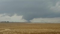
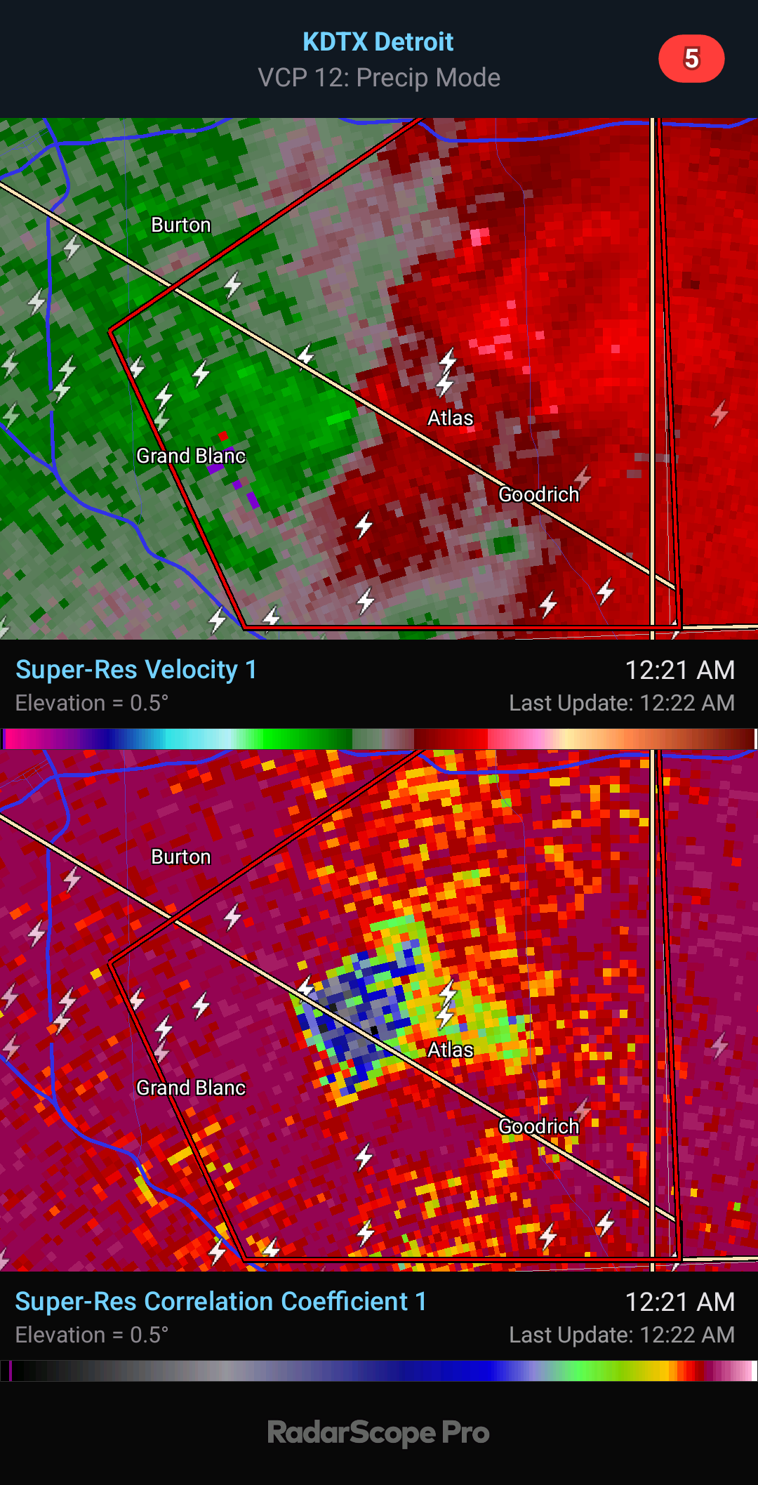
Damaging tornado about to come into Grand Blanc. Wrapped up fast
.thumb.png.2d93c32e08d6ebdfe334b946687feaa6.png)
-
1
-
-
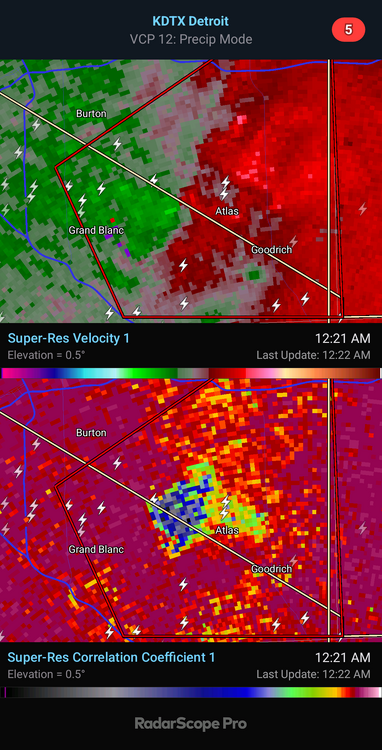
2 minutes ago, BYG Jacob said:
I think that's a violent tornado
You're pushing it just a bit man. Far from a violent tornado signature. But definitely a damaging tornado at night which is still dangerous regardless.
-
1
-
-
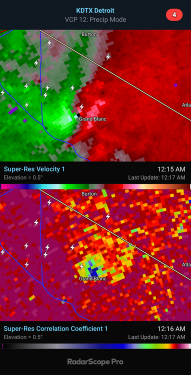
5 minutes ago, BYG Jacob said:
That looks like an absurdly large and powerful tornado.
There's no confirmation and no current debris signature. Impressive cell though with strong rotation.
-
1
-
-
6 minutes ago, RCNYILWX said:
Doing a deeper dive at the office now using ECMWF ERA5 reanalysis maps to look at antecedent conditions prior to some notable cool season events. This one definitely has questionable moisture with Gulf currently scoured out.
2017 not a bad comp w.r.t. Td over the GoM within this range of the event, though it had a better sfc pattern for more rapid moisture advection with the primary CO low a good deal stronger and a much stronger surface high (1035 mb) off the east coast.
Some other notable cool season events, November 17th, March 15, 2016, March 27, 1991 to name a few, had much better source region moisture present.
What Tuesday does have is exceptionally steep mid-level lapse rates as you mentioned with cold -15 to -20 C h5 temps. Seeing how February 8th performed with relatively questionable moisture quality, the cold mid-level temps/steep mid-level LRs could help compensate for the potentially middling moisture quality. We're concerned here that if the sun breaks out at all on Tuesday, Td could mix out substantially especially with northward extent.
Perhaps a narrow zone near the warm frontal zone is best bet where you can pool the moisture with a longer residence time and pump up the 3CAPE to the 50+ threshold. Still thinking southern LOT CWA and points south with this in mind.
Totally agree 100%. Last second moisture return esp in cold season always is a concern. Afraid moisture may be too shallow and can mix out easily like you said. It's too bad all winter we avoided big scouring cf's in Gulf overall but now that severe wx is upon us we are getting them. Ha. But as you said lapse rates will really help. Hodos have great low level curvature so wouldn't take much to produce tornadoes if storm mode avoids being too linear. I feel like wf will be very in play for your area.
-
2
-
-
24 minutes ago, RCNYILWX said:
00z Euro if anything upped the ante a bit, assuming we can trust its dew points. Liking the south third of LOT and points south where the near or over 50 J/kg 0-3 km CAPE is progged.
Also of note, the Bunkers right moving vectors are less crazy than you'd think they'd be for a cold season setup, so anything prior to sunset should be chaseable without having to speed as much.
Euro definitely the most ominous solution of all the models. Lapse rates are good esp for this north and this time of year thanks to that EML. This def bears some similarities to 2-28-17 though for that event we had a well defined wf up this way. I like that sfc winds are south to even slightly backed. Shear isn't crazy but definitely sufficient with that cape profile. Definitely am still worried about cap holding till cf moves in. That dewpoint depression and/or dryline feature could help fire storms ahead of cf if there's enough convergence on it and cap can break. Good thing is storms would likely be discrete. Sfc low is strong but wish it was more compact and not stretched out. Definitely not a perfect setup but definitely one worth chasing.
-
2
-
-
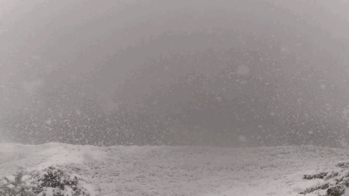
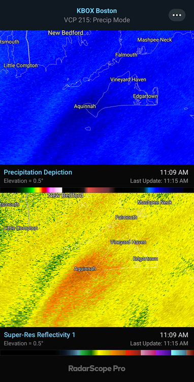
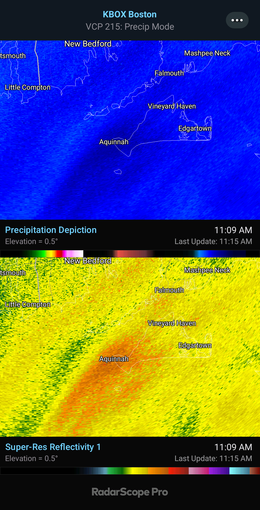
3 minutes ago, Patrick-02540 said:
Just checked the webcams in Barnstable and Cotuit. Looks like white tennis balls falling.
You're not lying. Insane
-
3
-
-
1 minute ago, CCHurricane said:
Definitely dealing with a decent amount of compaction and melting from underneath, don't believe it's adding up quite as much as we thought, but still awesome to watch.
Probably from warm antecedent conditions and the wet nature of the snow but if your rates keep up it should overcome it
-
 1
1
-
-
1 minute ago, CCHurricane said:
Mid-Cape. Impressive flake size and pouring snow.
That's insane. Kind of what I figured. Big ol' fatties. Easily getting 2-3in/hr rates there now if not more.
-
1 minute ago, WinterWolf said:
Ya we got downgraded overnight to a WWA lol…and then it starts snowing and goes bonkers, and they didn’t upgrade it back, kept it at a WWA, and we got 12.5” lmao. That’s pretty sad.
Yeah that's a massive epic fail by nws. I understand the downgrade overnight because of model trends but it was clear this morning models are performing poorly and this was a overperformer esp for areas further north.
-
 1
1
-
-
1 minute ago, Sn0waddict said:
Curious about the amount of QPF Hartford got in correlation with their 15 inches.
Surprised they didn't get upgraded to a WSW after radar trends this morning. That's pretty bad for being in a WWA.
-
Would love to see a report or video from here. CC shows that it should be mostly snow with minimal mixing. Probably some large aggregates.
-
The best banding for this definitely ended up pretty south. Some areas south of the wwa's may overperform.
-
3 minutes ago, cyclone77 said:
These might be the smallest flakes I've ever seen. Like salt grains coming down lol
Ratios might be trash outside of enhanced areas of snowfall.
Sounds about right. Lol. We had an uptrend in models now followed by a downtrend. By the looks of this, I was thinking it could be an overperformer. Guess not, ha. #2024
-
Yeah 0z runs no beuno. Lol. Of course better I80 north. Shocker. They get the front wing of precip and just a glancing blow here. Was looking solid for 2-4in here but now probably an 1-1.5in at best. Is it Spring yet?
-
I'm glad last night overperformed here because I look to get little if any snow based on latest hrrr/rap guidance on back side
-
Just now, NEILwxbo said:
This is more along the lines of what I was expecting tuesday AM but didn’t really pan out. Let er rip
You're really in the thick of it now. Mesoscale band parked right over you.
-
Hrrr nailed the waa snow tonight. Nam/rap only clipped me briefly with it. It's been snowing here since midnight with some impressive periods of moderate to heavy snow. Wind pretty intense in these mesoscale bursts. Looks like it's about to end here. Sadly that will start my warm up and set stage for rain or mix through afternoon before changeover. Hoping it doesn't all melt what fell tonight. Looks like a good 2-3in outside but hard to say cuz it's really blowing around.
-
1
-
-
Thundersnow starting to get active!
-
1
-
-
53 minutes ago, Chicago Storm said:
Give it time...
I know. I'm impatient. Probably because this is the "main event" for me. Precip blossoming in MO and a nice convective feed into this band up north.
-
9 minutes ago, WeatherMonger said:
Thunderous dud here, early March feel to it.
I'm sure that will be me here soon. I don't buy the hrrr output
-
I hope more precip blossoms south of this initial waa band like hrrr suggests. Otherwise not going to get much at all.
-
2 minutes ago, Chicago916 said:
End of the 03z HRRR is wild. Transfer of energy from one sub-980 Low to another. Like a nor'easter in the Midwest. Secondary Low causes temperatures to crash.

I was about to post this and say the almighty snow bosoms. RIP
-
 3
3
-

.png.c2d7312adbec4991c0f41c159527c7cd.png)
April 16-17 Severe Weather Event
in Lakes/Ohio Valley
Posted
That's what I was thinking. Tight couplet. Thanks