
Bubbler86
-
Posts
24,804 -
Joined
-
Last visited
Content Type
Profiles
Blogs
Forums
American Weather
Media Demo
Store
Gallery
Everything posted by Bubbler86
-
This AM's GFS actually has no 70's for 18Z temps next week much less anything near 80. Temps would probably still break 70 a day or two but a big shift from just a couple days ago. Not used to seeing this continuous trend toward less heat. It is often the other way. CMC still has a two-day warmer look.
-
It sucks...I had to fix the latch on my wife's car trunk (not a euphemism!) yesterday and she wanted to leave it outside. I told her there was no way I was working out there in the 'Cane, bring it in.
-
40 windy degrees this AM.
-
Most people in the LSV do not have overly gaudy numbers right now. 13-15.5" seems to be the norm. MDT 15.74 LNS 14.83 CXY 14.37 THV 14.31 HGR 11.54
-
URGENT - WEATHER MESSAGE National Weather Service State College PA 202 PM EDT Fri Apr 12 2024 PAZ006-012-018-019-026-027-035-036-045-130900- /O.EXA.KCTP.WI.Y.0010.000000T0000Z-240413T2200Z/ Potter-Northern Clinton-Northern Centre-Southern Centre- Huntingdon-Mifflin-Fulton-Franklin-Southern Clinton- Including the cities of Coudersport, Renovo, Philipsburg, State College, Huntingdon, Mount Union, Lewistown, McConnellsburg, Chambersburg, and Lock Haven 202 PM EDT Fri Apr 12 2024 ...WIND ADVISORY IN EFFECT UNTIL 6 PM EDT SATURDAY... * WHAT...West winds 20 to 30 mph with gusts up to 50 mph. * WHERE...Potter, Northern Clinton, Northern Centre, Southern Centre, Huntingdon, Mifflin, Fulton, Franklin and Southern Clinton Counties. * WHEN...Until 6 PM EDT Saturday. * IMPACTS...Gusty winds could blow around unsecured objects. Tree limbs could be blown down and a few power outages may result. * ADDITIONAL DETAILS...The combination of strong winds and saturated ground will bring an increased risk of downed trees and power outages. PRECAUTIONARY/PREPAREDNESS ACTIONS... Use extra caution when driving, especially if operating a high profile vehicle. Secure outdoor objects. For high wind safety information, visit weather.gov/safety/wind. The latest forecast information can be found on the NWS State College Facebook page and Twitter @NWSStateCollege, or on the web at weather.gov/ctp. &&
-
Heat activated. This is the one of the colder 51 degrees I have seen in a while. Winds gusting over 40 and no sun.
-
Models teasing that any 80 days next week may be a Sun/Mon thing vs. later in the week as progged before. Then Spring gets ugly for the flingers this time next week.
-
Nooners, back up to 52 degrees, Mostly Cloudy and quite windy with gusts in the mid 30's.
-
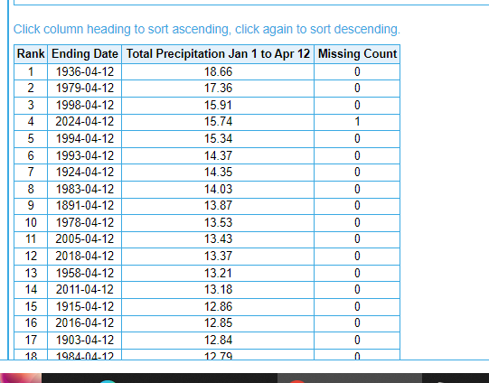
Down to 47 here. For the year we have had close to 13" now putting us in the top 20 wettest periods to this point using HGR numbers. Your total of 17.98" would be the second wettest start to the year since 1889 using MDT's numbers. As is MDT is #4 pending today's numbers getting added in.
-
WGAL let you down.
-
It is still on the MR though a muted single day or 2 vs the whole week....this is followed by a very chilly weekend.
-
A surprisingly 51 windy degrees and .45 since yesterday afternoon.
-
Losing streak over. The Caps and Flyers last several weeks are about as bad as it comes trying to get a spot. And the Pens and Wings tied which is worst case...3 points instead of 2.
-
Already up to .2". Wgal's predict in jeopardy.
-
In other news that keeps happening, Tom Brady is teasing a comeback though admits being an owner may squash it.
-
It forms in the humid air from our south.
-
The Meso's have most of that missing us as the SLP moves almost due North. Our stuff is developing per se.
-
I think an inch is doable if not a little more just not floods. I bet I get close 1/2 -1" here. It was starting to dry out a bit on the top.
-
It is already windy here. 20-25ish with gusts into the 30s...out of the SSE. .02 on the board.
-
Looks quite active overnight based on progs and radar but not sure it looks floody.
-
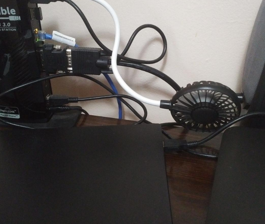
I even have AC for my one of my laptops which is underpowered and needs some cooling help.
-
Seconded. Toim Brady has big shoes to fill.
-
Not far from totality for the Eastern 1/3 of Ohio.
-
Late noon and 68/mostly cloudy.
-
Were you there for the first of several Howard Cosell off color comments?


