

Damage In Tolland
-
Posts
104,506 -
Joined
Content Type
Profiles
Blogs
Forums
American Weather
Media Demo
Store
Gallery
Posts posted by Damage In Tolland
-
-
3 hours ago, HIPPYVALLEY said:
GFS looked kind of meh’ compared to previous runs.
12z has 40-60 mph gusts across region. We’ll see how things shake out this week as we get closer
-
 2
2
-
 1
1
-
-
Shorts everyday here on out
-
 1
1
-
 1
1
-
2
-
-
15 minutes ago, CoastalWx said:
34 here. Last time I hit 32 was like two weeks ago. Maybe we grow now?
Start planting peppers and tomatoes
-
Big rains, big, big winds coming
-
60’s and 70’s next 2 days away from that awful North Atlantic . Cannot wait to tan .
https://x.com/darrensweeney/status/1777002405822971950?s=46&t=dhcbvkjmRcyBVQtDxJ3lRg
-
1
-
-
4 minutes ago, Sled said:
Bundle up and go sniff the flowers

Everything taut , tight , and at full attention.
-
1
-
-
14 minutes ago, Ginx snewx said:
Most are now wilted and peepers covered by a thin layer of ice in the swamp this morning. Another miserable cold windy day. Congrats on UCONN. Women got hosed by the Caitlin Clark phenomenon
One more win .
I don’t see any blooms wilted around here. Forsythia loaded with yellow
-
2
-
-
25 minutes ago, Sled said:
April brings in forsythia, daffodils, perrywinkle, magnolia, peepers, and if you're deep in the valley maybe even some morels. I'm not one to rank months but April is pretty great in my book.
Most of those came in Morch
-
After the huge screamer with winds and rain this week next weekend and beyond looks relatively nice EPS
-
2
-
-
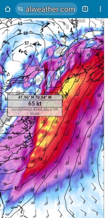
Strong/Damaging Winds... As for the wind threat the EPS continues to be more amped up. The EPS indicates winds 2-3 STD above model climo, but the V component (north/south) is around 3-3.5 STD above model climo. As for the NAEFS the winds are around 2-2.5 STD, while the V component is 2.5- 3 STD above model climo. Both sources indicate most anomalous winds at 850 hPa, which makes sense as deterministic guidance showing a 50- 80+ kt southerly jet impinging on our region. The big question on the winds is the exact timing and typically it is a bit more difficult to mix down southerly winds this time of year. This risk could be increased especially in areas where heavier rain slides through or with thunderstorm activity. -
9 minutes ago, HIPPYVALLEY said:
When does the damage hype train for next week’s storm leave the station?
Already has
-
1
-
-
13 minutes ago, Lava Rock said:
Power back. Lt sn.
Sent from my SM-G981U1 using Tapatalk
Shit
-
1
-
-
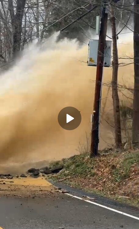
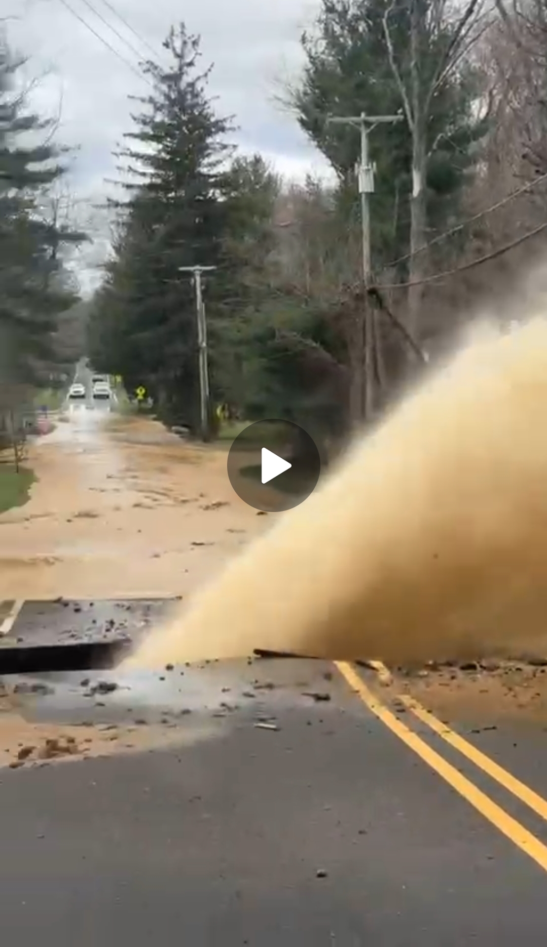
That end of week storm has big wind signatures this far out. Floods, trees, lines, bridges, lifts … all coming down
The risk of heavy rain, and perhaps stronger winds, is highlighted with NAEFS situational awareness table of PWATs already of 1.5 to 2.5 STD above model climo for the Northeast. We`ve also got winds roughly 1.5 to 2 STD above model climatology with perhaps a more amped up southerly component as the V component is 2-2.5 STD above model climo in the Thu-Fri timeframe.-
1
-
1
-
-
1 hour ago, Ginx snewx said:
Yes pretty consistent long lead on this one.
Deep rain and deeper wind
-
Just now, Ginx snewx said:
Hope things improve bro especially with this coming next Sat.

.thumb.png.3d50694f5f3ae5a5c9f6944c1dc7ed19.png)
.thumb.png.ae134a3977df2e0dab10837e4dac699d.png)
Nice stemwinder
-
11 minutes ago, BrianW said:
Here's a nice quake damage picture for you from my aunt in Randolph NJ.

Yes!
-
1
-
-
8 minutes ago, MJO812 said:
Aftershock here
Floor was shaking while I was making meatballs.
Balls ended up in shaking into mouth?
-
4
-
-
5 minutes ago, ineedsnow said:
been getting off and on light snow and rain here the last couple of hours
Hunker in
-
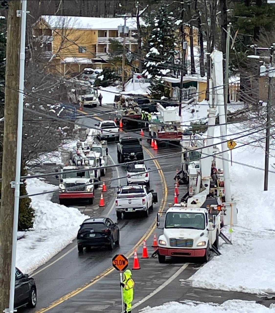
9 minutes ago, eekuasepinniW said:
Eversource sent a full battalion of 11 trucks.

That sucks
-
 1
1
-
-
2 minutes ago, CoastalWx said:
But you didn't feel it
Kids did. I was driving
-
1
-
1
-
-
7 minutes ago, dendrite said:
Hopefully you guys can rebuild.
Was wild
-
58 minutes ago, dendrite said:
Beer?
?
-
1
-
-
Daughter at the high school said room shook and all their chairs starting shaking
-
All over the area here folks rocked and rolled 4.8 in NJ


.png.582674ded7fe1d39a20150a3b7d455c3.png)
.png.97c9d278fa046543bd51898411530aea.png)

April 2024 Disco- SNE’s favorite month
in New England
Posted
70’s CT.. 50 E MA today . North Atlantic FTL