

weatherwiz
-
Posts
70,866 -
Joined
-
Last visited
Content Type
Profiles
Blogs
Forums
American Weather
Media Demo
Store
Gallery
Posts posted by weatherwiz
-
-
Let's just agree that the next few months are going to suck more than not. We'll get some beautiful days mixed in which tells us those days on a more consistent basis are approaching but we all know how springs work around here:
1. We could have a two week stretch of widespread 60's/70's within the region mid-month, higher elevations and northern New England will still have some snow threats well through April. We could get a stretch of 70's/80's and they still will.
2. We are going to have some brutal periods of chilly temperatures, stiff northeast breezes, clouds, showers, heavier rain.
3. We'll have some days with wild weather differences within the region. This will be characterized by periods where we get over the top warmth and NNE is dabbing 70's and lower 80's while SNE is shocked in with some marine crap.
4. We'll have days when portions of SNE are into the 60's and 70's while other parts are backdoored and dealing with 40's and low clouds/drizzle.
We are about to get a mixture of everything through the next 7-8 weeks.
-
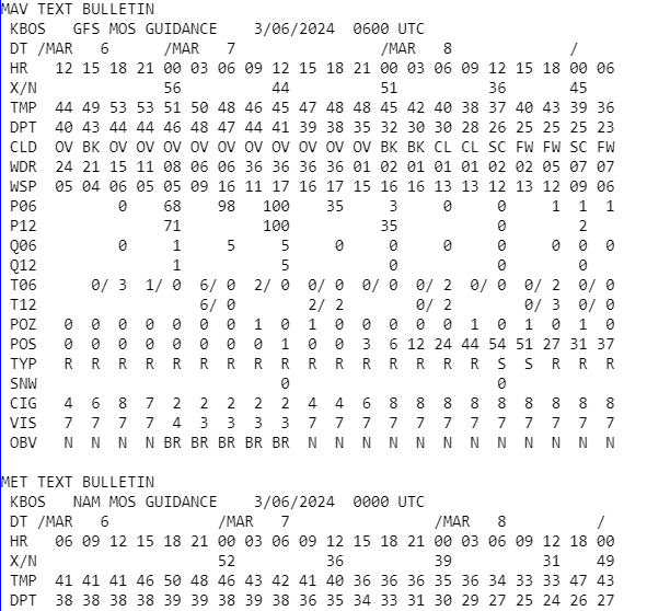
Gotta love the differences between MAV/MET guidance at BDL/BOS tomorrow

BOS for example
-
19 minutes ago, Torch Tiger said:
maybe the south coast sees a few bangers Saturday PM/ Sunday AM? Wiz?
don't see much in the way of elevated instability right now
-
 1
1
-
-
1 minute ago, ineedsnow said:

That should be printed out and added into the chapter of textbooks which focuses on tornadoes.
-
 1
1
-
-
19 minutes ago, Typhoon Tip said:
Thur night hydro concerns have been suggestive for days at this point. imho - I posted about awhile back.
The flood-wick was certainly priming since last summer's rain anomalies. Then a lack of substantive drying since.
Going to be some impressive rainfall totals for sure. Not sure if we see any thunder/lightning but there's a good amount of MUCAPE being modeled with steep mid-level lapse rates. If anything, there will be convective elements locally enhancing rainfall rates. Some of the rates are going to be pretty wild.
-
What a BEAUTIFULLLLLLLLLL day. Spent a few hours outside doing some outside cleanup including picking up months worth of dog poop. Then spent like 90 minutes cleaning dog poop off my shoes then went shopping. Today was much needed. Can't wait for this to become more consistent but with 70's and then eventually 80's and 90's with high humidity.
-
 2
2
-
 2
2
-
1
-
-
The evolution of everything for this upcoming week has been a shit show on guidance (and not talking just about our area).
-
2
-
-
13 minutes ago, powderfreak said:
Instead of "Heavy at Times" it should just be "Heavy all of the Time."
On an aside, I've always wondered why most of the western forecasts use "Snow Showers" instead of just "Snow".... maybe @OceanStWx can shed some light on how the grids are populated out there verses the Midwest and East. Because it does not matter the accumulation, most of the mountain forecasts out west all use "Snow Showers" as the description.
Today: Snow Showers. Four feet worth of Snow Showers.
May to them snow with visibility less than 1/8 of a mile is their typical snow showers
-
1
-
-
Close the shades. We've seen way too many times what happens when we have garbage airmasses ahead of impending "potential" storms. We couldn't get anything to evolve to work in our favor during peak climo...how the hell are we going to get it to work nearing mid-March...especially when the airmass out ahead of it is worlds milder. Obviously different story for the mountains up north where they get snow threats through April
-
5
-
-
I'll usually go outside and play with the dog for 10-15 minutes and whenever I'm out there now all winter dressed I just look at the trees and think to myself that in a few months I can be out here in shorts with everything all greened and blossomed. It's such a wonderful thought. I'm sick and tired of looking at bare trees.
-
 2
2
-
-
March 1!!!
Essentially just one more full month to go before we hit May.
WOW
-
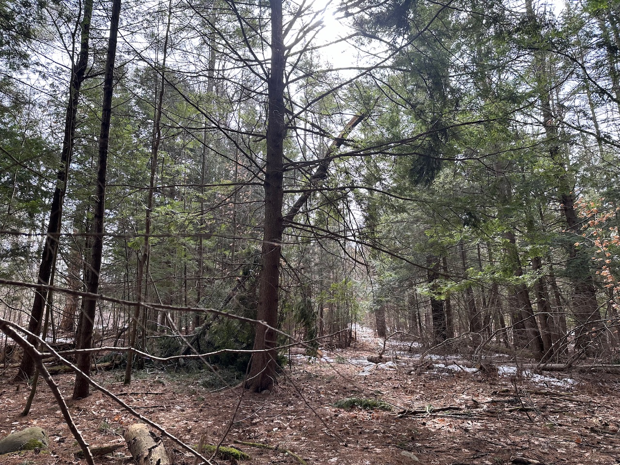
42 minutes ago, dendrite said:
Braved the woods. A couple of new tree toppings out there.

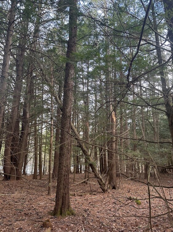
Still some snow down by the stream.
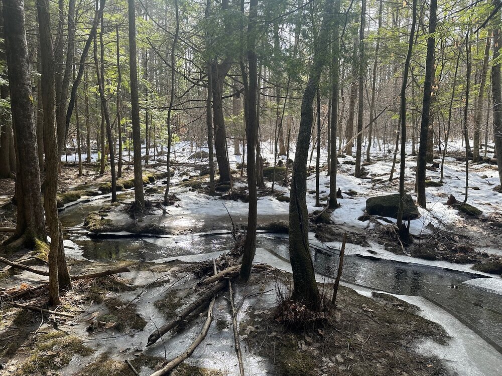
If a tree falls down in the forest and nobody is around to hear it, did it make a sound?
Ask that animals that it splattered.
-
1
-
-
While there was clearly a geographic area which received better winds, the overall premise of the event worked out well. In these setups, the best winds ahead of the front, typically associated with a fine line of convection, always happen:
1) Right along the leading edge of the heavier rain.
2) The highest wind gusts are very brief.
3) There is a lull, sometimes even dead calm, just behind the area of strongest winds under the heaviest rain (thermodynamic profile likely becomes inverted with the downward transport of colder air which becomes saturated and the lapse rates becomes very weak).
Based on some of the reports here, this was verified and was discussed several times as how it would play out. Certainly the overall thought would be much more of a region wide event but that did not pan out. Something like this can often come down to the mesosnalysis scale where you have to watch how things are progressing and evolving.
In terms of the CAA winds, it seemed like that was even more impressive farther north as opposed to the region as a whole.
-
1
-
-
I find these situations awesome where you can see some of the taller trees swaying pretty good at the top but at ground level not much going on. This goes to show how even a weak inversion, no matter where it is located can really dent the winds a bit.
-
1
-
-
6 minutes ago, Ginx snewx said:
Dropped 25 degrees in 38 minutes. Flash froze water on my truck
That is pretty impressive. Don't see that around here too often.
I think the best FROPA I've ever been in was when I was at the AMS in Austin in 2018. Temperatures went from mid 70's I think into the 20's. Came with a massive gust of wind. The colder air hit like pins and needles.
-
1 minute ago, Ginx snewx said:
Kevin expected 150K without power in CT and widespread damage/ what else is new
It was fun watching 850 temps on mesoanalysis throughout the day. This was some front.
-
1
-
-
13 minutes ago, CoastalWx said:
Pretty much as expected. Good winds.
Yup this went as expected. Not sure what others were expecting but this went well.
-
-
Some decent winds on velocities on the leading edge of the line not very far up off the ground.
-
I would guess we start cranking down some higher and more frequent gusts in the next few hours. should see strengthening 925mb winds over this time frame.
-
Just now, WinterWolf said:
It was beautiful yesterday and Monday too…you should have cleaned the dig shit then Wiz. C’mon
.
By the time I finished work it started clouding up and cooling off. But yeah I wish I did.
-
6 minutes ago, AstronomyEnjoyer said:
50.0° and 0.08" rain total so far. Wind is starting to pick up.
Starting to gust a bit more here too.
-
I'm kind of hoping a brief EF-0 tornado touches down in my backyard within the line and sucks up all the dog poop and takes it to the nearby woods. It's like walking through a landmine. Need warm weather so I can clean it.
-
1
-
3
-
 1
1
-
-
6 minutes ago, Damage In Tolland said:
We wild

The CAA winds tonight are going to crank.
6z bufkit still showing 50-60 mph across many stations.
-
1
-


March 2024 disco/obs
in New England
Posted
Tropics are my least knowledgeable area so I'm not entirely sure what to expect.
I mean naturally, if we're progressing towards La Nina you would expect an above-average season. While I don't think the warm waters factors into that aspect, the already well above-average waters are concerning in that should storms develop, they will have alot of fuel available.
Then of course we'll have to see the prospects for landfalling storms.