

weatherwiz
-
Posts
70,930 -
Joined
-
Last visited
Content Type
Profiles
Blogs
Forums
American Weather
Media Demo
Store
Gallery
Posts posted by weatherwiz
-
-
Just now, Typhoon Tip said:
Today is miserable ... no other way to cut it up. yuck -
Today blows.
Was just thinking to myself...it looks like 7:00 AM out there.
-
 1
1
-
-
Can we pop an early EML event?
-
 4
4
-
-
I don't think the GFS is that terrible
-
Some lightning strikes northwest of Pittsfield!
-
1
-
-
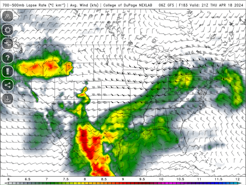
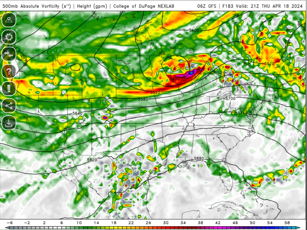
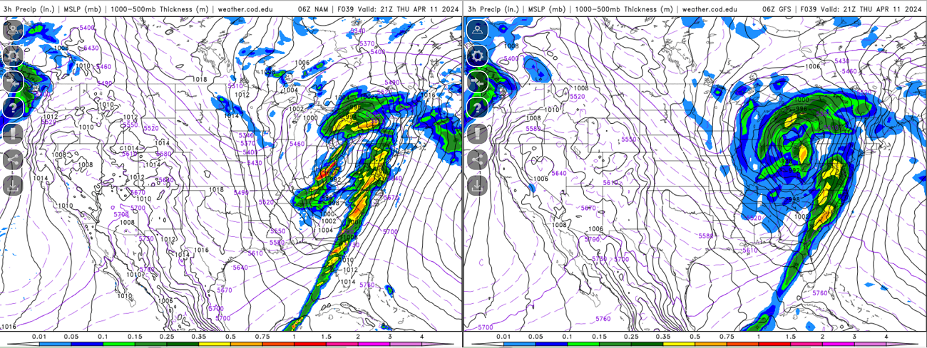
Nice model difference tomorrow within the Ohio Valley/Great Lakes region

Some pretty drastic differences at H5 across the country tomorrow.

-
1
-
-
In another 5 days the 384 HR GFS will be into May!
-
 1
1
-
3
-
-
2 hours ago, Torch Tiger said:
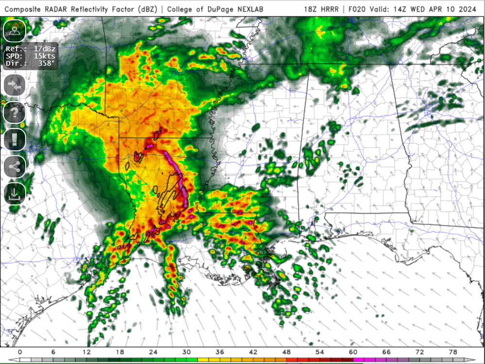
wish we could get that. looks like a messy/complex evolution wrt MCS/boundaries around

...LA...MS...AL...western FL Panhandle...
   Early on Wednesday, storms are forecast to be ongoing from much of
   LA into southeast AR and expanding into MS, in a zone of rich
   low-level moisture. This area will be quite unstable with 2000-3000
   J/kg MUCAPE common south of any existing clusters or outflows, and
   deep-layer shear will favor long-lived severe storms. Both damaging
   bows and supercells will be possible area-wide, with a strong SRH
   gradient near/east of the MS River supporting rotation and tornado
   risk. Evolution may be complex due to early day storms, but any
   existing MCS may proceed throughout the day producing damaging
   winds. Supercells will be more likely during the afternoon, possibly
   on the southwestern flank of any existing outflow boundaries.
   Diurnal warming as well as continued moisture advection may also
   support a few supercells within a growing area of warm advection
   precipitation east/southeast of any boundaries.
Thinking wind damage may be the greatest overall threat. Greatest tornado threat probably on the southern flank but it may turn out the southern flank is right along the coast or just off. We'll see how far north the warm front/greatest moisture return can get which should influence northern periphery of the bow/mcs
-
Hopefully we can get something like this in the next few months
-
1
-
2
-
-
2 minutes ago, dendrite said:
Can I get a hell yeah
how about this instead

-
1
-
-
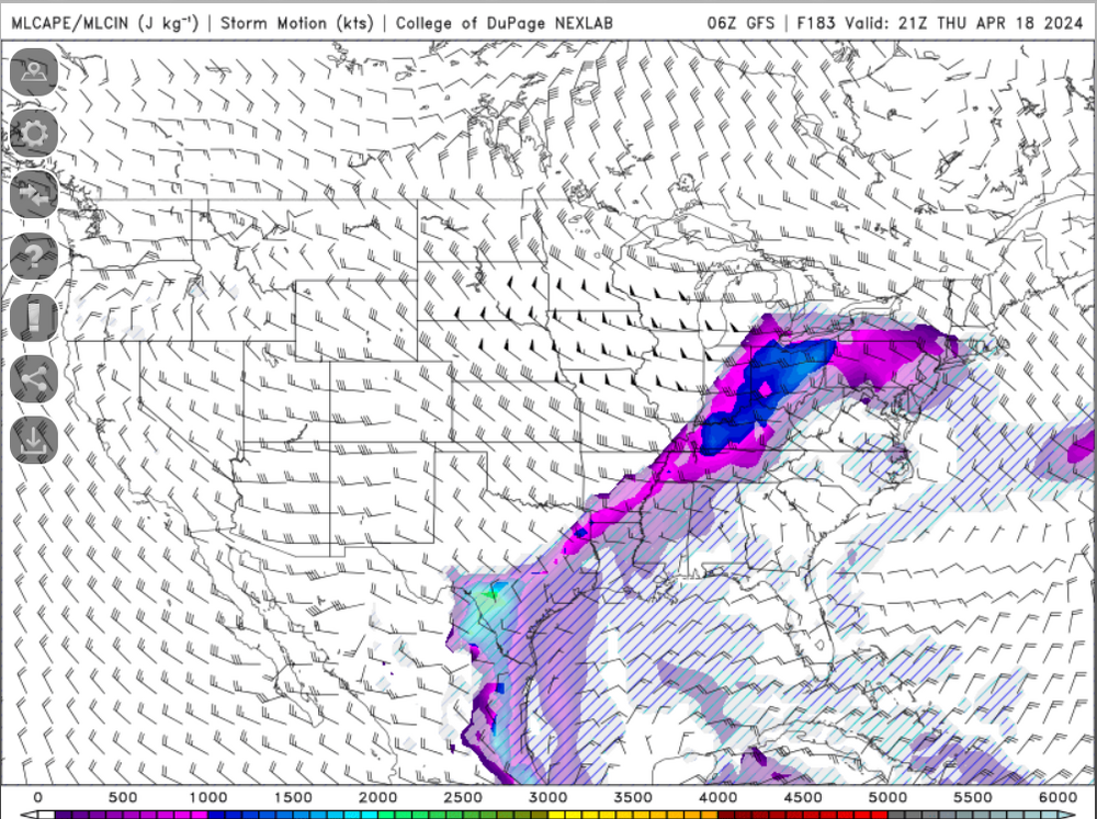
I know its like 3 or 4 weeks too early but I can't help but toggle through the CAPE maps through 384 hours. Its depressing seeing some big CAPE values within the Ohio Valley and sneak into portions of Pennsylvania and then just get poo pooed away but our time is coming.
-
3
-
-
2 hours ago, CT Rain said:
Completely cleared out in Dallas for totality. The cu field went poof and miraculously had no cirrus!
Just an absolutely exceptional experience.
Are you sticking around Dallas for the severe wx?
-
I actually may need to make some hot chocolate now. I was only wearing a short-sleeved shirt and a very light jacket. I'm cold now.
-
 1
1
-
2
-
-
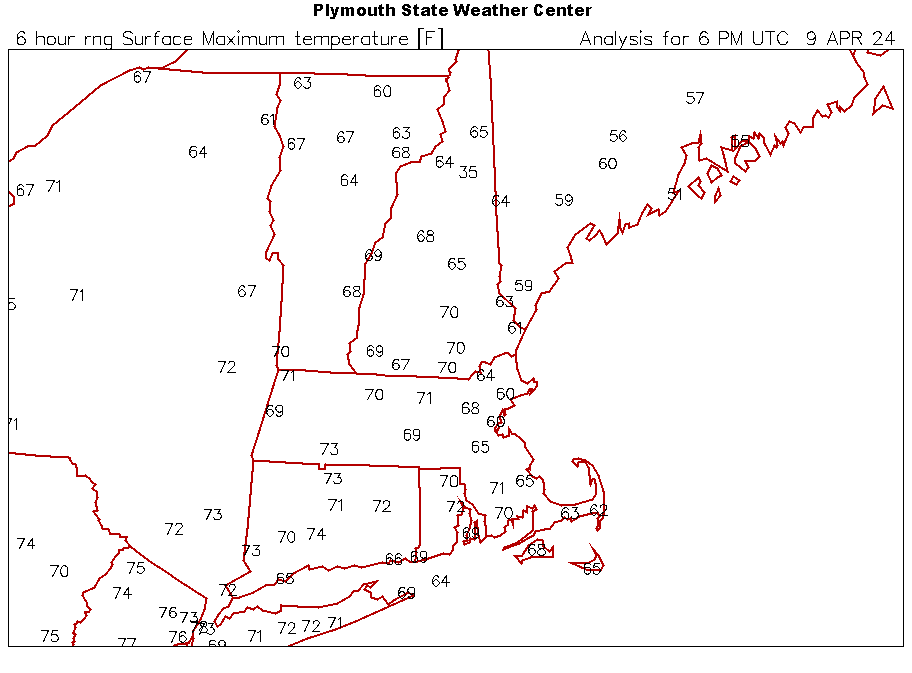
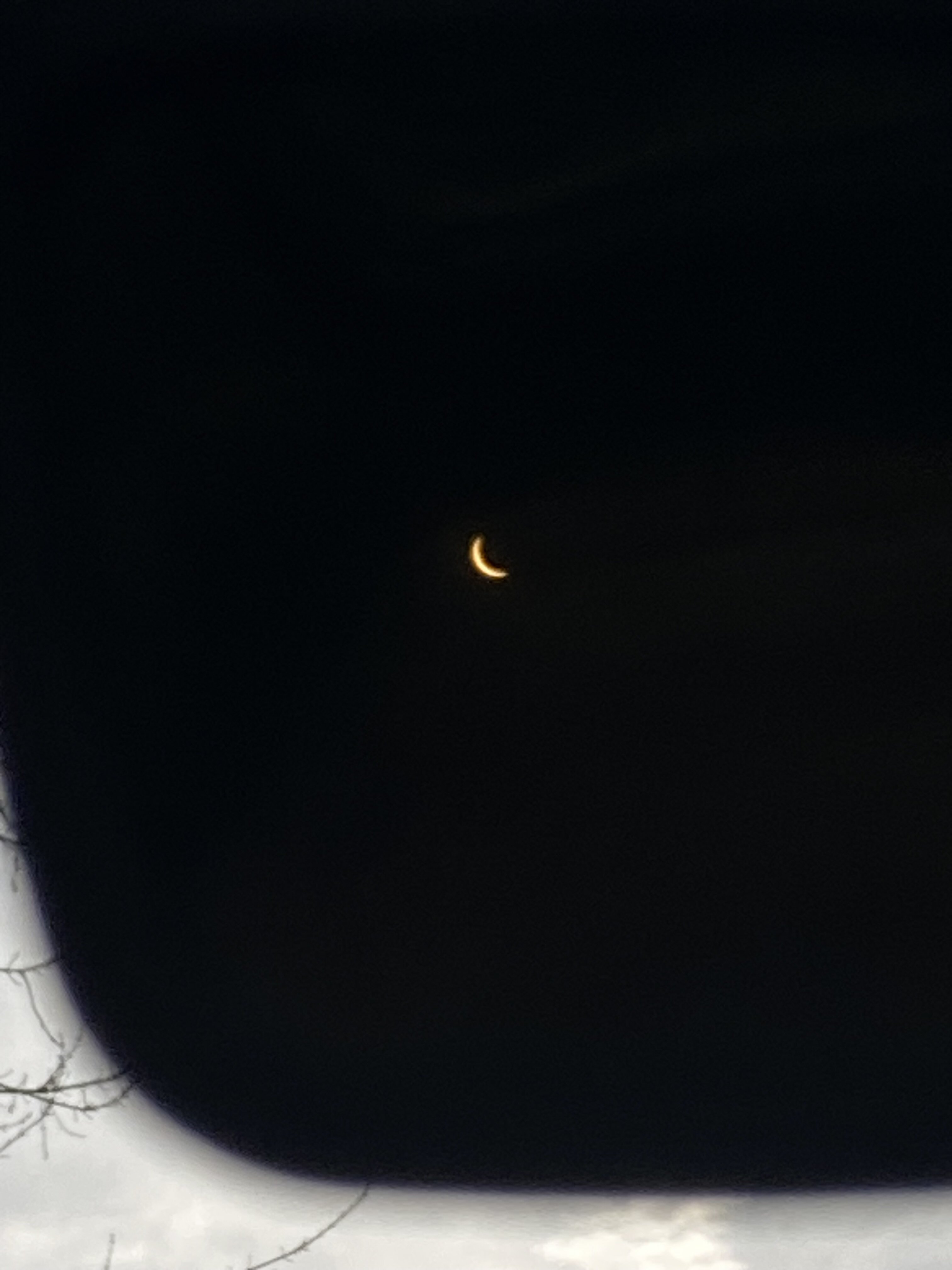
Taken at 3:30 PM EDT from Springfield
-
2
-
-
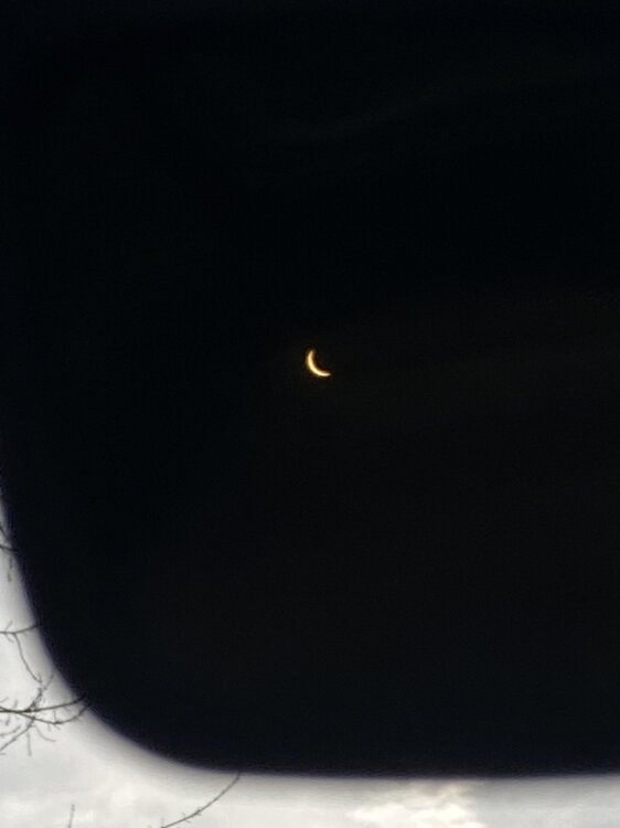
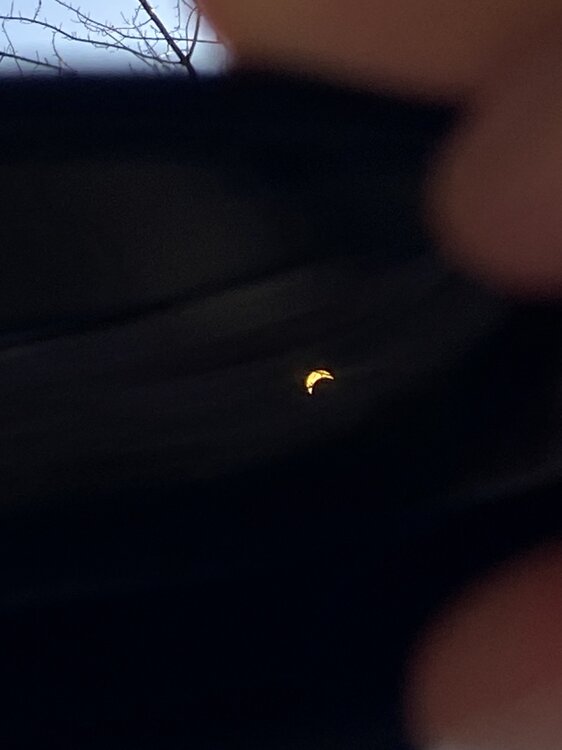
Had to lay in my back to be able to make this work
-
4
-
-
All this satellite watching and hoping for full Sun has me geared up for severe wx season.
-
1
-
-
Just went outside with glasses and can see it!
-
11 minutes ago, dendrite said:
Hopefully you guys can rebuild.
Thankfully not the same folks that are in charge of rebuilding the Mets
-
6 minutes ago, OceanStWx said:
I'll stick with what USGS goes with. They will revise as they get more data too.
5 minutes ago, metagraphica said:USGS already downgraded from 4.8 to 4.7. I would believe them over whatever bullshit "RAWSALERTS" is.
Agreed, only source that matters is USGS.
-
The magnitude estimates are all over the palce right now...
-
1
-
-
I didn't feel anything in Springfield but my I just told my girlfriend about it and she felt something. I was in the zone working though.
-
5 hours ago, Stormchaserchuck1 said:
That is interesting. We had a 4-contour Greenland block, but nothing rivaling the strength of even what we have seen the past few Winters. There seems be a major disconnect between CPC's NAO numbers and what is occurring in the NAO area, measured by sea-level pressure between Iceland and the Azore islands. This Winter came up with something like a +0.7 NAO for DJFM, but if you look at sea-level pressure and 500mb, it should have been measured negative.
Either way, hopefully this is some sign that we will see more persistent -NAO's in coming cold seasons, as we had seen 41/46 +NAO Winter months, going back to 2013. and 16/16 of the NAO's >1.11 in the monthly's during that time were all positive. 16-0 since 2013. I think the larger reasoning is issues with CPC's measurements, but maybe the overall signal is turning around..
Isn't the Hurrell NAO method a bit better overall than the CPC's method?
-
2 minutes ago, Brian5671 said:
Dont forget all the hurricanes we're going to get too...

Yup...those will take care of the damaged buildings
-
Well with how wet the ground is and how damaged the trees are, we're primed to level forests in 6-7 weeks when we hopefully get a derecho to blow through. They better prepare the power grid now.
-
1
-
-
11 minutes ago, Damage In Tolland said:
Where are all the damage pictures in Maine and NH? All these massive outages and no pics? Let’s get em up please
can't upload without power or internet
-
1
-


April 2024 Disco- SNE’s favorite month
in New England
Posted
I am itching to start a thread for strong thunderstorm potential later next week. Someone pinch me