weatherwiz
-
Posts
70,740 -
Joined
-
Last visited
Content Type
Profiles
Blogs
Forums
American Weather
Media Demo
Store
Gallery
Everything posted by weatherwiz
-
The only leaf blow out that matters these next few weeks are the ones from Toronto getting blown out of the playoffs.
-
It's freezing. Had to wear thermal socks today. booooooo
-
Time to start looking at CAPE maps not snow maps lol
-
The only frost or freeze I want right now is on my beer mug when I put it in the freezer
-
Well the end of the GFS run is getting into May. Just a few weeks away from getting serious about convective/severe monitoring
-
pics
-
What a day...top 5 material...hell maybe even top 3.
-
0z run of the GFS tonight will get into 0z May 1!!!!!
-
THUNDER!!!!!!!!!!!!
-
Yup
-
Still looks solid for a few localized damaging wind gusts early this evening within western sections.
-
Thread made. @dendrite pin the severe thread
-
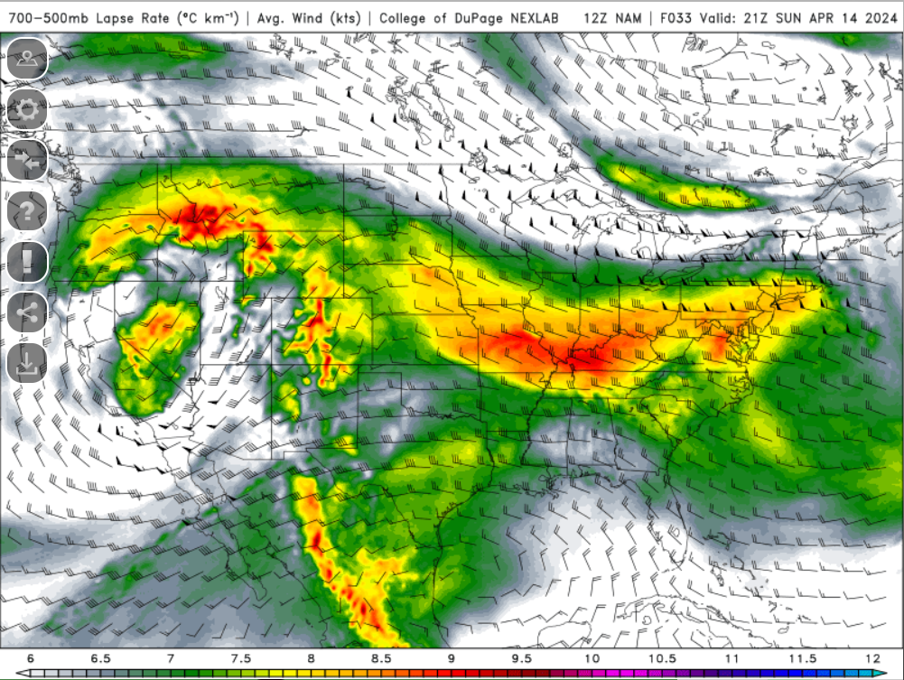
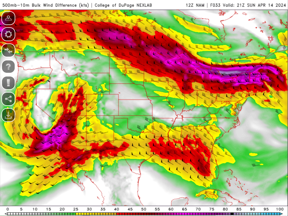
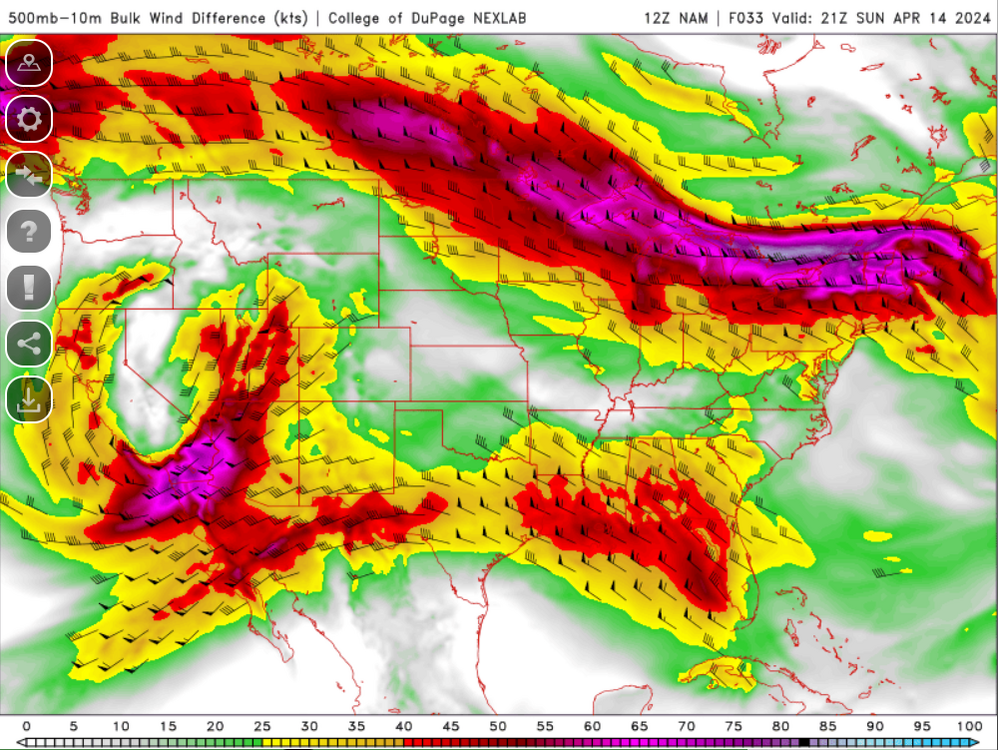
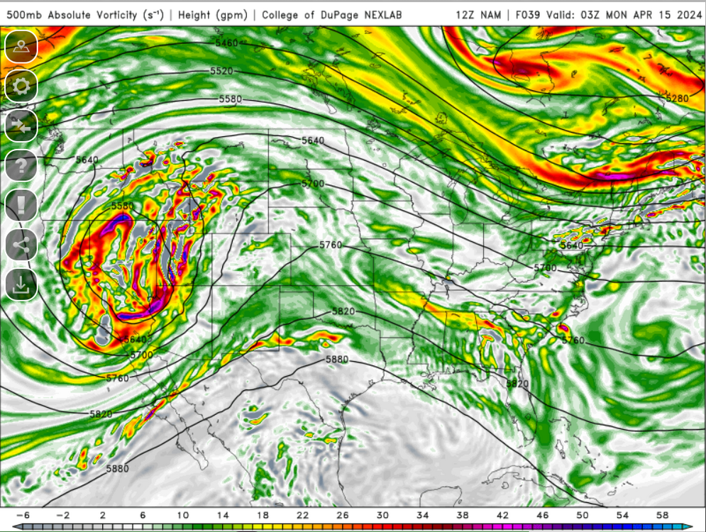
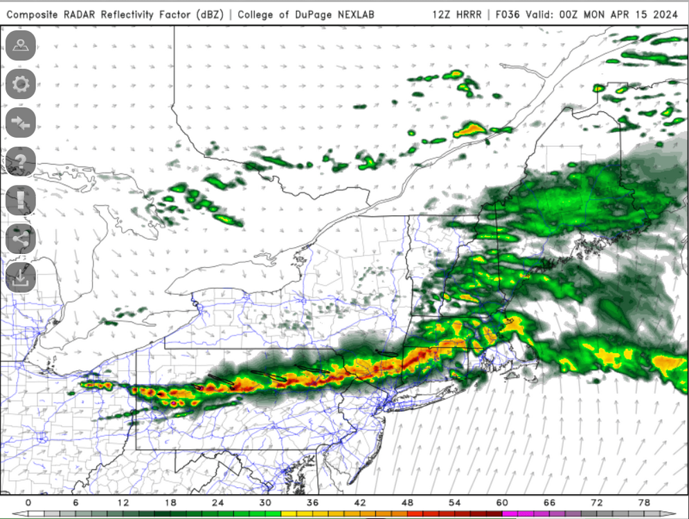
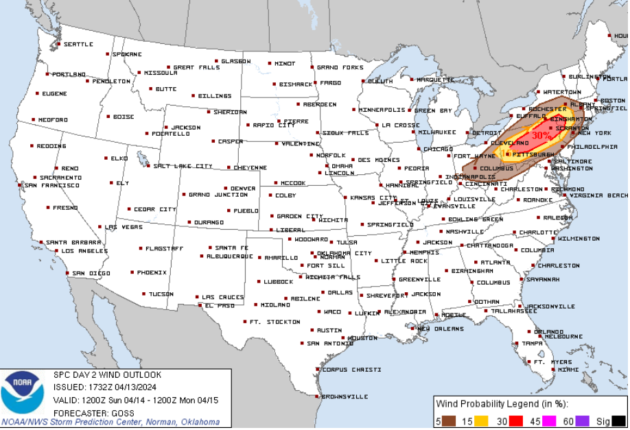
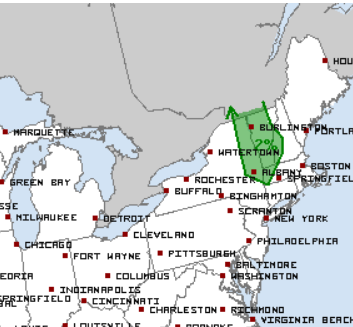
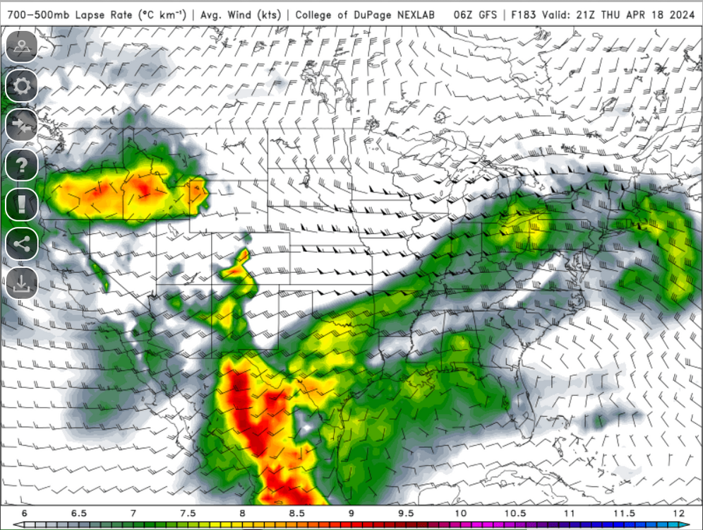
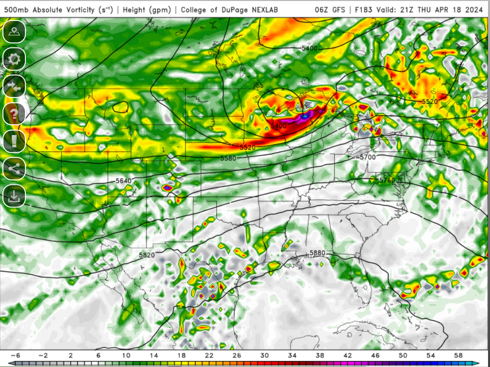
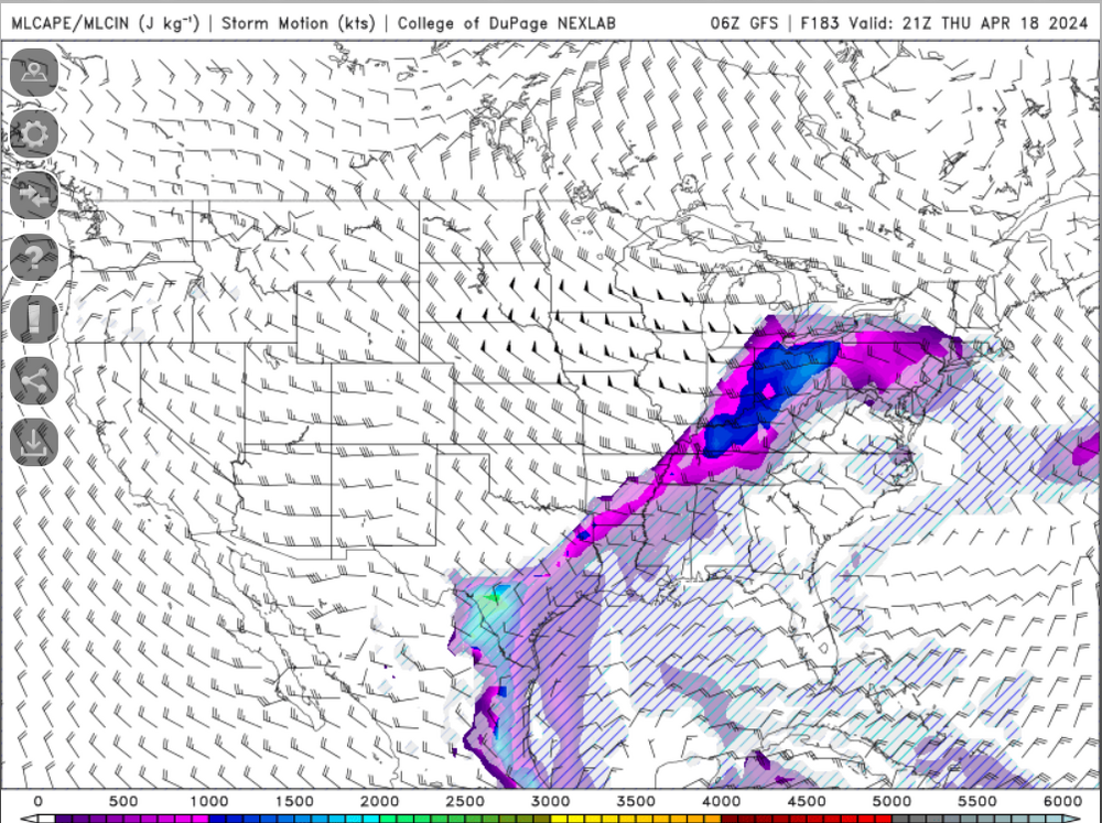
We are still just about 2.5 weeks away from the official start of our severe weather season, but that doesn't mean we can't get severe weather before then. The greatest overall potential is to the west of our region where the Storm Prediction Center has an enhanced risk in place for the potential of damaging wind gusts. A marginal risk for severe weather extends to the I-91 corridor across Massachusetts and Connecticut. Anyways, the most impressive element Sunday will the advection of very steep mid-level lapse rates: Shear will be impressive with 40-50+ knots of bulk shear overspreading the region Unfortunately, despite the presence of very steep mid-level lapse rates, surface temperatures only into the 60's with dewpoints into the 40's (maybe climbing into the lower 50's late) will hold back on instability potential and instability will be marginal at best. Also, while we have impressive shortwave energy and shortwave trough digging into the region, this does lag the sfc cold front so the best forcing will be a bit displaced: What can we expect? A line of heavy rain and embedded thunder should move across the region, particularly across western areas during the late afternoon and early evening Combination of steep lapse rates, strong winds aloft, and a bit of an inverted V look will promote the potential for some localized damaging wind gusts within the line

-
Being tickled by a marginal risk
-
65+
-
No
-
Most humid summer on record?
-
I am itching to start a thread for strong thunderstorm potential later next week. Someone pinch me
-
Today blows. Was just thinking to myself...it looks like 7:00 AM out there.
-
Can we pop an early EML event?
-
I don't think the GFS is that terrible
-
Some lightning strikes northwest of Pittsfield!
-
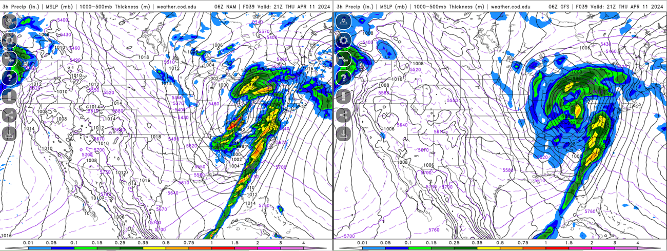
Nice model difference tomorrow within the Ohio Valley/Great Lakes region Some pretty drastic differences at H5 across the country tomorrow.

-
In another 5 days the 384 HR GFS will be into May!
-
Thinking wind damage may be the greatest overall threat. Greatest tornado threat probably on the southern flank but it may turn out the southern flank is right along the coast or just off. We'll see how far north the warm front/greatest moisture return can get which should influence northern periphery of the bow/mcs