

WeatherNC
-
Posts
3,564 -
Joined
Content Type
Profiles
Blogs
Forums
American Weather
Media Demo
Store
Gallery
Posts posted by WeatherNC
-
-
Pretty classic look for the MA crew at day 4, I would be prepping the clearing equipment 95 north of Richmond to NYC, particularly areas east of the Interstate. While we (SE) like Central FL or even GA, this is textbook with near term correction for your areas. Inside the benchmark with occlusion still on the table. Chase watch hoisted.
-
 7
7
-
 3
3
-
-
Does this count as a lollipop?

Code on a hydrant is 18” above grade center cap.
-
10
-
-
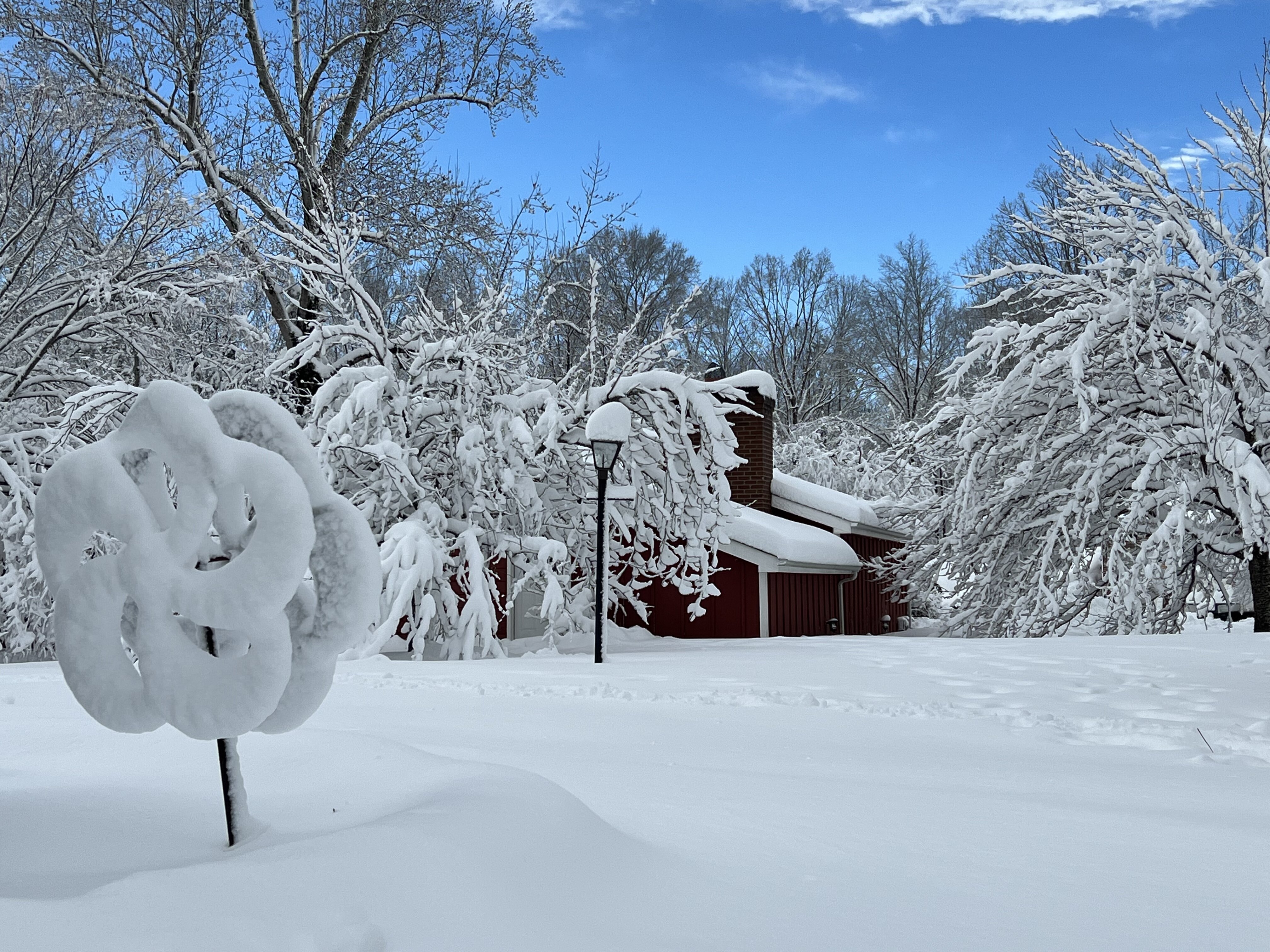
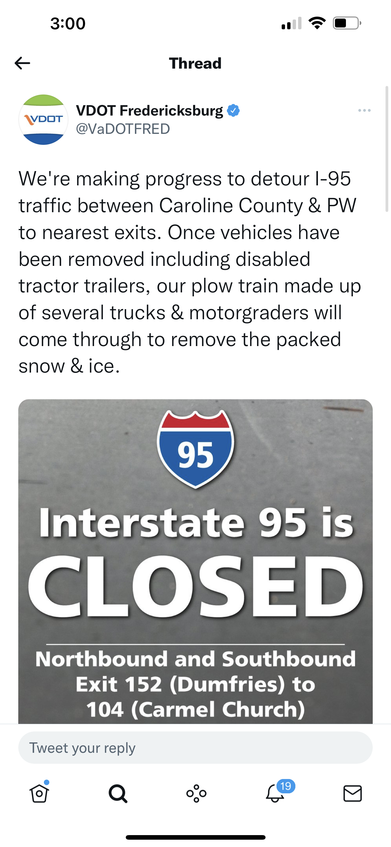
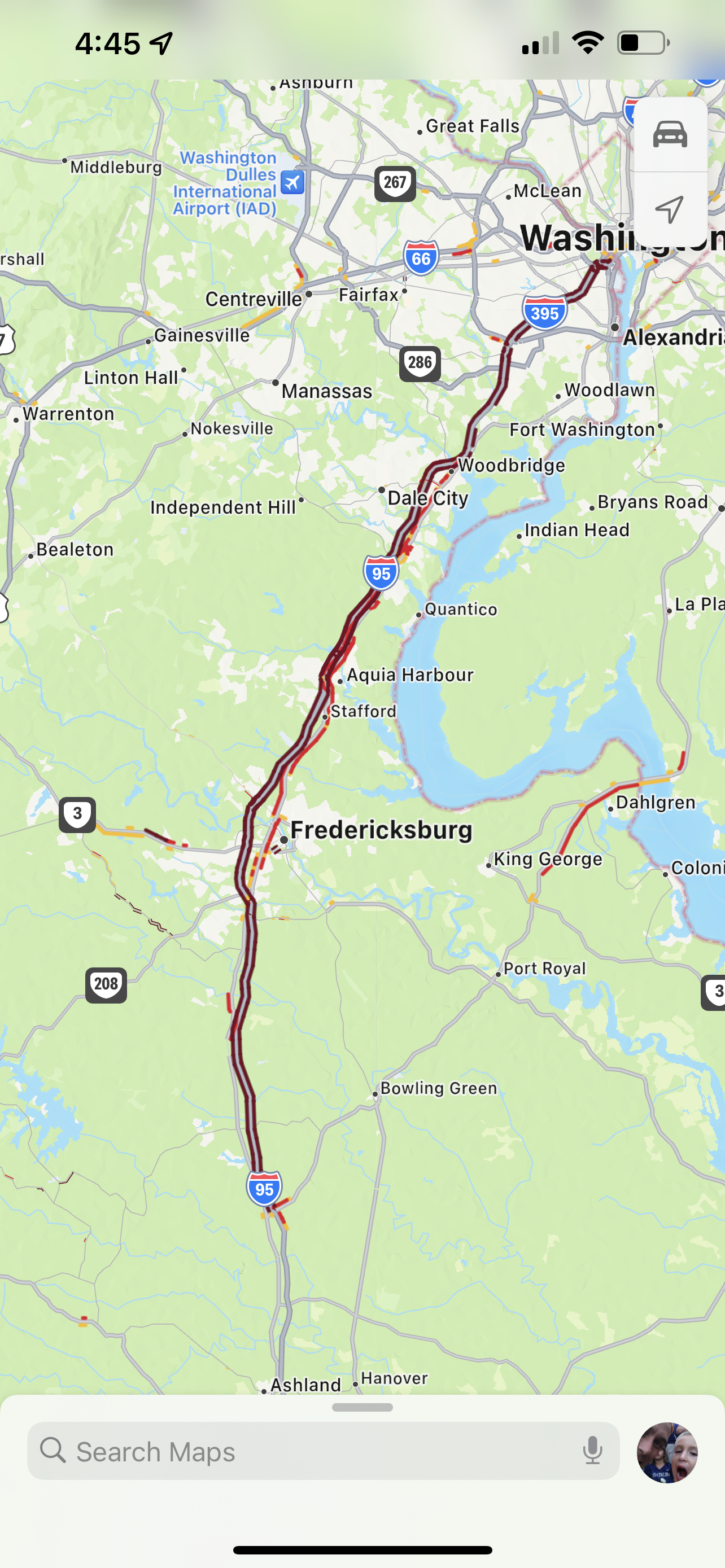
Ended up being a 27hr chase gate to gate from Greenville NC, required application of knowledge learned both in the mid Atlantic over the past 10-15 years punching some of the larger events on record and new things learned out in the PAC NW over the past two years, specifically wheel chains which I purchased for required areas out there and used on the rear for our drive down 1 to Ladysmith, we left about 430pm yesterday. VA law notes tire studs, chain info seems to be prohibited per law unless conditions warrant them in season but still unsure. And that’s with a 4x4 truck, it was rough.
9am
12pm
3pm
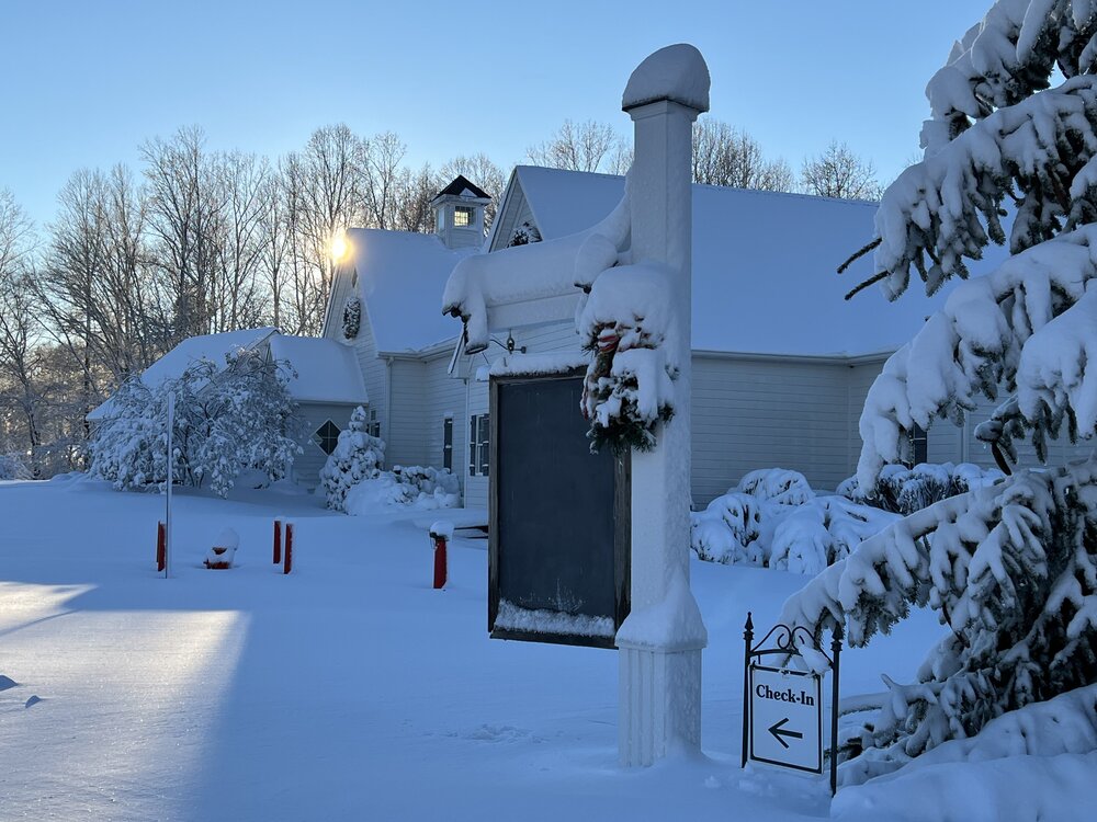
~14” with >1.5” liquid equivalent, heavy and wet with the pivot main deform supporting improved ratios after 11am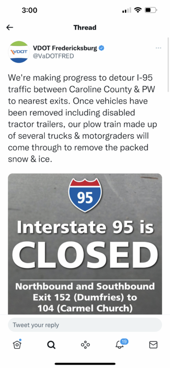

-
7
-
-
I'm in Birmingham this week and next for work, not a big SVR guy, prefer heavy snow, but somewhat concerned and at he same time a little pumped for what may be my 2nd time ever in a Day 1 High risk. The Boran model posted earlier is a private model from my understanding, based on the WRF and around a 2km res through 60hrs. The precip plots from the ECMWF strongly indicates discrete and long tracked cells.
-
2
-
-
SNOW SQUALL WARNING
NWS CHARLESTON WV
351 PM EST SUN FEB 10 2019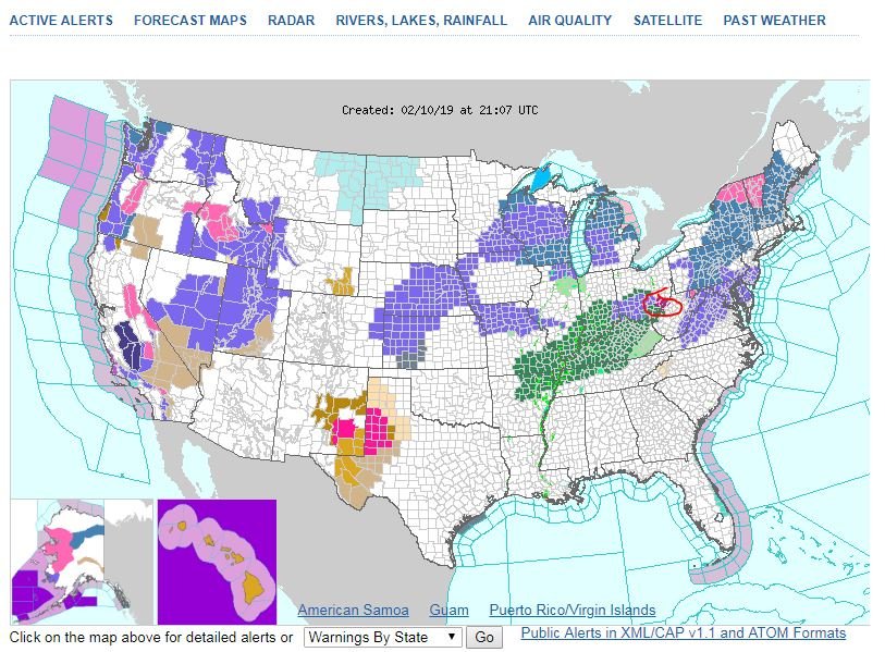
-
10 minutes ago, LithiaWx said:
Is there any hope? This is depressing.
Punting till 2/15...
-
1
-
 1
1
-
-
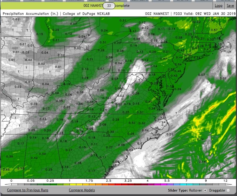
High res precip, widespread 2 to 3 tenths with locally more.
-
1 minute ago, PackGrad05 said:
00Z high res NAM is interesting. Has some light precipitation out ahead of the main front for central NC. albeit rain.
NAMNEST
-
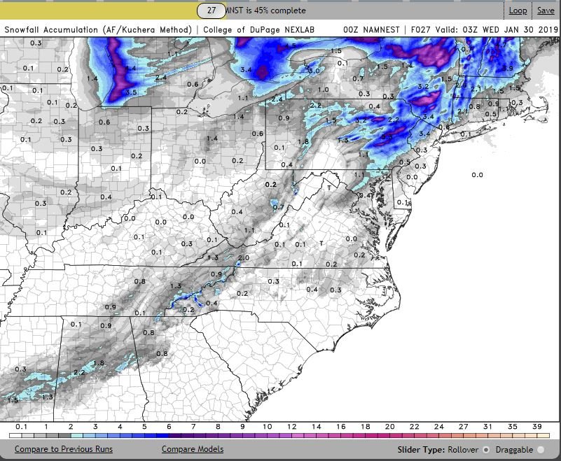
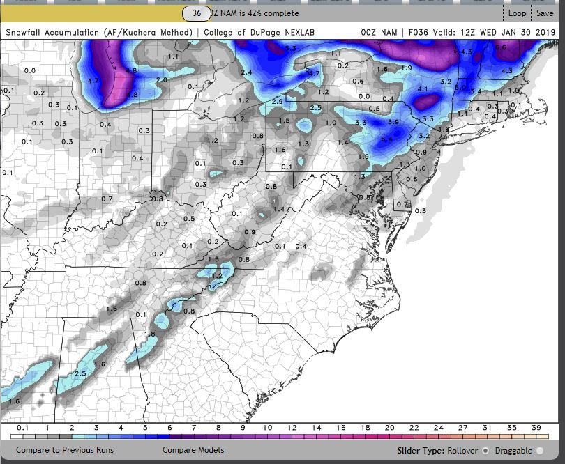
0Z NAM Kuchera
-
5 minutes ago, Isopycnic said:
Found elsewhere.
FYP...
-
2
-
-
2 minutes ago, Cheeznado said:
Hey, this is no longer long term, am going to start a separate thread for the post-frontal snow.
Please and thank you.
-
21 minutes ago, kvegas-wx said:
Take a step back, so what features are present that would either block the LP up the coast (dont see anything) and draw it back with a phase? (Thought we gave up on that already?) Something has to be there for the models to keep hinting at a coastal. I'm certainly not a modelologist so I'll sit back and learn.
Look at your 500mb vorticity evolution preferably on a site like Nexlab where you can slide the panels back and forth. There’s an 850 too, would like to see it more tucked in to the coast which means H5 needs to sharper and tune a little sooner.
-
First run I have seen with some snow in NE NC through 57hrs, ~1” using Kuchera and 2” on stock 10:1.
-
1
-
-
10 minutes ago, Cold Rain said:
50-100 miles NW over two days. When does that not happen? Lol. If I was in downeast, Shaggy, and weatherNc country, I’d be super excited! Maybe even eastern Wake could end up picking up a sprinkle.
Watch us get the coastal but miss out on boundary layer temps. I just don’t see how it will be cold enough for anything but rain, height falls in whatever semblance of a conveyer are not sharp enough.
-
1
-
-
Just now, SnowDawg said:
So? Its one run of an OP 7 days out.
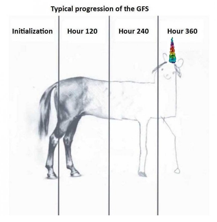
More the lack of run to run continuity with the ops and ensemble support 7 days out, while in no way unusual lets still be real, it's a unicorn at this very early stage.
-
1 minute ago, Waiting on snow said:
You don't have to worry about starting a thread based on the 18z GFS.
Congrats, Bermuda?
-
 1
1
-
1
-
-
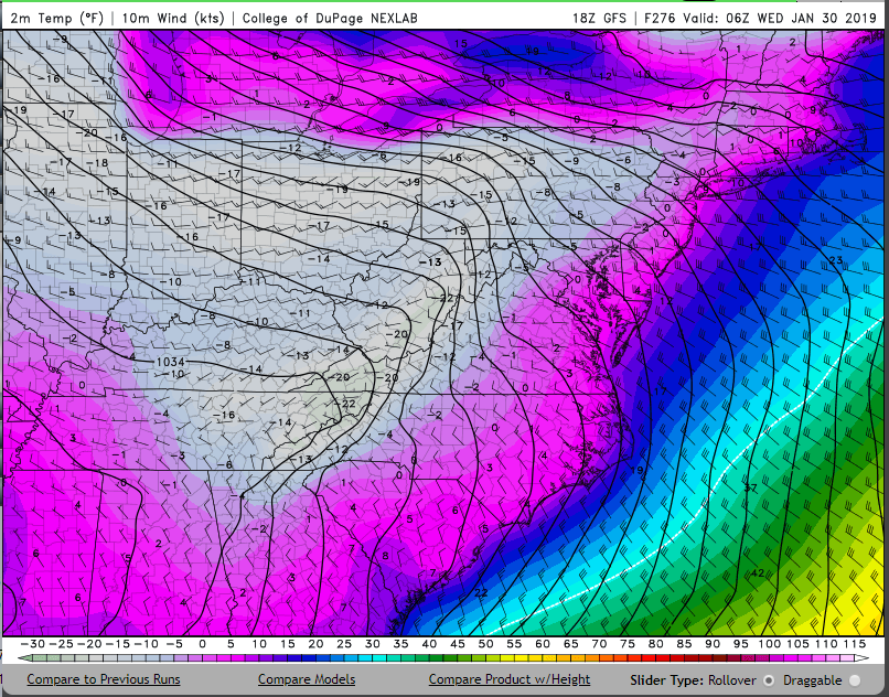
1 hour ago, olafminesaw said:
Single digit highs anyone?
18z GFS historic cold shot @ 276...
-
1
-
-
Congrats guys, indecisive motion ftw...

.-
7
-
-
Next weekend has my interest for the MA, to a point where tentative PTO for 1/21 was submitted yesterday and the current chase envelope includes PA. I am not driving that far for 16-20" though, need a solid 2' hatch with guidance painting 30"+ lollipops. At H5 its not far off, just need that PV lobe in Quebec to keep distance. Big dogs often come at the bookends of a pattern change.
-
1
-
-
0.92" event total, all RN.
-
39.9/26.2 with a few sprinkles, nothing to see here in the coastal plain.
-
Really really nice LR run of the 12z GFS, 1/19-1/21 is very close to a sig winter storm for the eastern US, not far off from being a long wave axis going neg tilt ivo the MS river. Then another chance, albeit less impressive at H5 on 1/23, wrapping up with a lobe of the PV in SE Canada with energy entering MT.
-
Happy New Year gents, 68F outback, punting to 1/21.
-
2
-
-
As things currently stand, there will be some moisture in play for the SE around Christmas, thermal profile TBD but looking marginal at best with low cutting through the Lakes and lackluster HP coming down in the Plains.
-
1
-
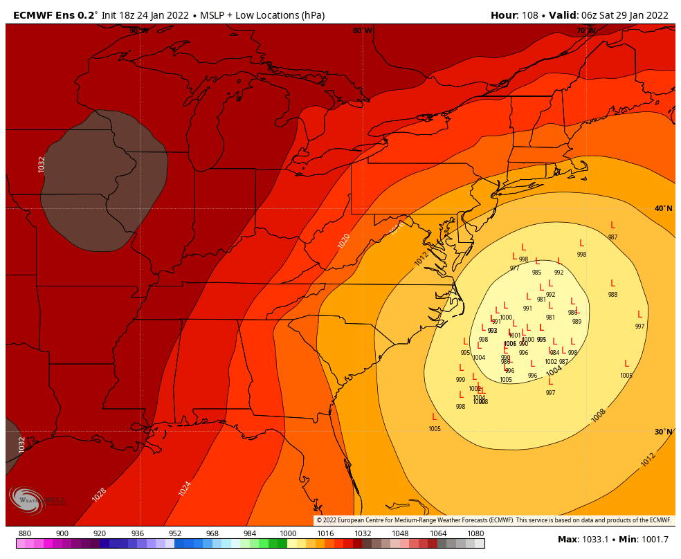
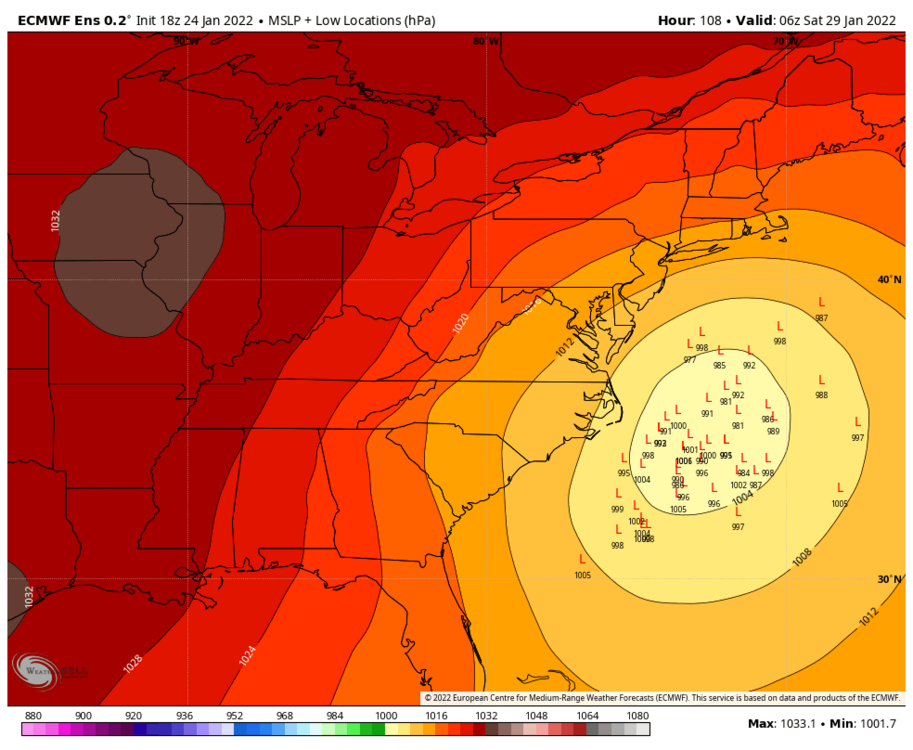
January 28-29, 2022 Miller abcdefu Storm Threat
in Mid Atlantic
Posted
Verbatim that hooks inside 40/70, dabenchmark 40/70 is grammar school for DCA - BOS with a bombing cyclone in the mid latitudes. Occlusion in southern NE (Long Island Sound) is high school
 ")