

mob1
-
Posts
2,154 -
Joined
-
Last visited
Content Type
Profiles
Blogs
Forums
American Weather
Media Demo
Store
Gallery
Posts posted by mob1
-
-
She's a hooker
-
 1
1
-
-
Euro is wide right
-
 1
1
-
-
3 minutes ago, ineedsnow said:
huge shift on the 12z GFS
You can say that again

-
2
-
-
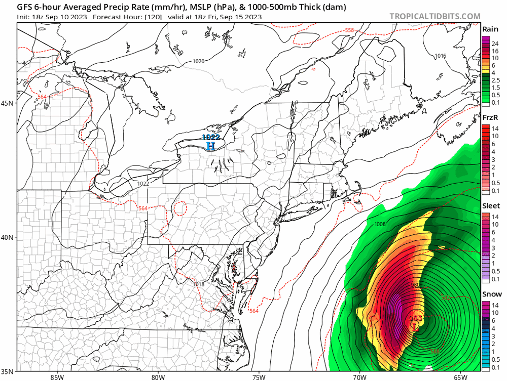
For what it's worth (which isn't much), the 12Z ICON hits SE Massachusetts pretty hard with Lee.
-
1
-
-
4 minutes ago, OSUmetstud said:
Westward short term adjustments to Lee don't increase US landfall probabilities much if it at all because they also delay latitude gain with the Great Lakes trough trending eastward and having a tendency to pull out of the northeast with time.
Correct, though speed/timing of both Lee and through/front/HP could have a bigger impact on where it ultimately ends up.
-
1
-
-
This looks pretty intense
-
6
-
-
Madison FL is next in line for the northern eyewall, but it looks like velocity scans are weakening a bit (obviously expected as it moves inland).
-
Strongest velocities look to be just east of Perry.
-
Landfall location and angle of approach look pretty bad for Cedar Key.
-
Latest center pass is at 965 mb, a 7 mb drop in about 2.5 hours (from the first pass).
-
1
-
-
1 minute ago, WxWatcher007 said:
NE eyewall sampled. 964.6mb extrapolated. FL winds peaked at 103kt. Peak SFMR of 84kt.
That's due east of the center, first recon flight will make a true NE to SW pass soon.
-
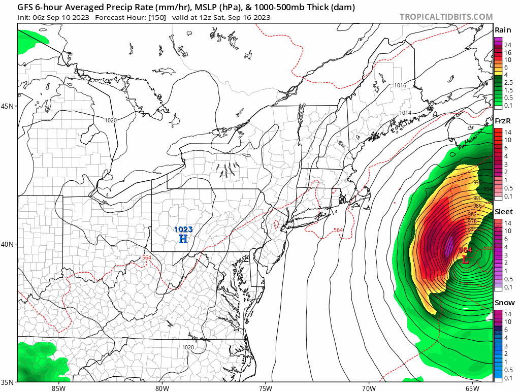
12Z Euro has it coming in near Crystal Springs. This thing really hauls once it clears the Yucatan, which might limit its potential.
-
Went from almost nothing to this is a few runs
.thumb.png.c8dbaa83a36f44c17807e46ec0f6ba49.png)
-
Recon finding extrapolated pressure of 997mb or so.
Some hurricane models have it passing fairly close to Bermuda.
-
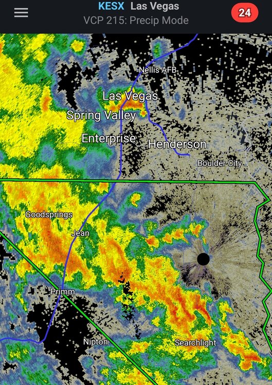
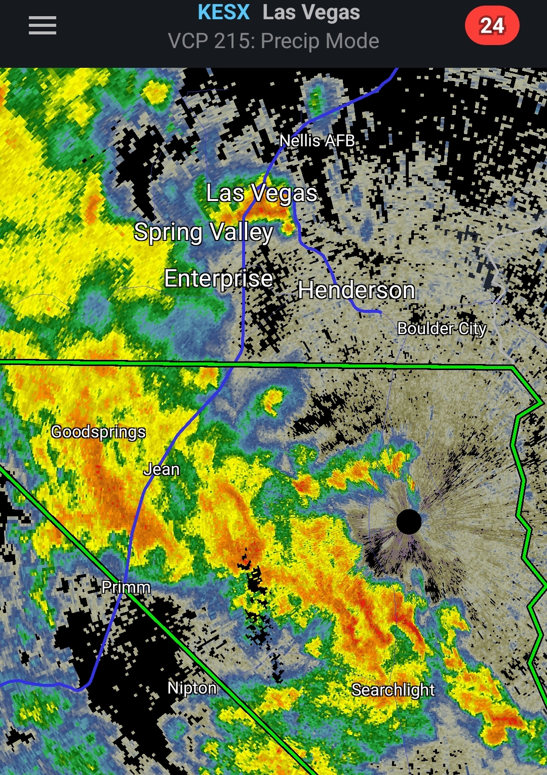
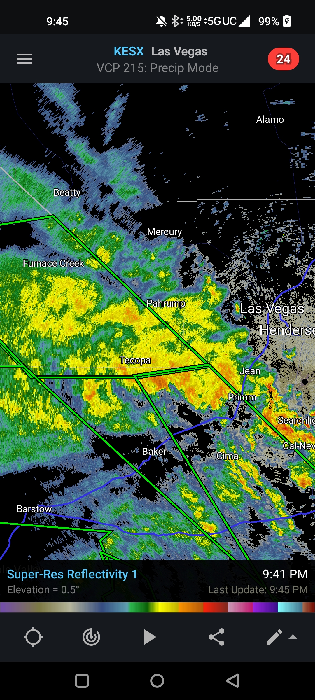
32 minutes ago, GaWx said:
It looks to me that Las Vegas will dodge the proverbial bullet as model consensus suggested ~2" was quite possible for the Fri-Mon period, including the Fri monsoon. Right now they're near 0.70" with ~1" total for Fri-Mon, if that, looking much more likely than anything close to 2" total. So far, the only flash flooding was 4-5PM Fri from the monsoon, not Hilary.
There are some incredibly heavy training cells not too far to their west. They're slowly making their way eastward so LV will likely miss the worst of it, but areas to their immediate northwest might still see some prolific flooding. Red Rock Canyon national park is going to take it on the chin.
-
 1
1
-
-
Lots of training cells over Death Valley and areas west of Las Vegas, flooding could be pretty bad there.

-
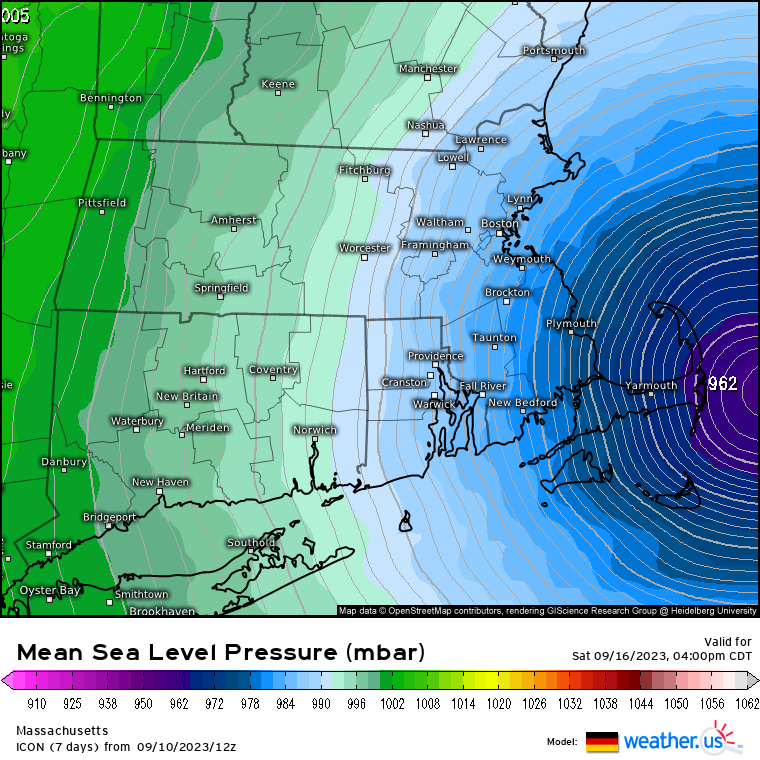
Some models have it affecting either the far eastern US (Nantucket or eastern Maine) or the Canadian maritimes.
Euro in general has a lot of traffic in the entire basin.
-
27 minutes ago, NorthHillsWx said:
Still no FFW with the event yet
First one just went up north of LA.
-
8 minutes ago, NJwx85 said:
The core is obviously gone and the radar doesn’t look overly impressive over Baja. I’m wondering if the forecast is overdone outside of areas with local enhancements from terrain/elevation.
This area has seen incredible training of cells, as Hilary moves northward it should give parts of SW CA a lot of rain.
A big chunk of death valley has seen moderate rain all morning, and it doesn't take all that much to get flooding there.
I wouldn't spike the ball just yet.

-
1
-
-
It's not often than you see dew points on the high 70's near the Salton See.
.thumb.png.452fe92e60660cf219a4de5f8effa1ad.png)
-
18Z looks very interesting at 90 hours with a tropical storm approaching the Leeward islands.
-
1
-
-
0.53" here.
From the NYC area airports, it looks like only LGA recorded more than an inch.
-
Nice little soaker here with this last batch getting me up to 1.27" for the day. It's deceptively heavy, even though it doesn't look overly impressive on radar.
-
1
-
-
1.11" for the day (and counting) between this morning's rain and the weakening line just now. Nothing exciting in terms of severe obviously, which has been the theme all summer here.

.png.a8dbe35a5831bb739a1b4b9f084394f6.png)

.png.0cd1148d2c3ee067b94ec7f37bbcd243.png)
Category Five Hurricane Lee
in Tropical Headquarters
Posted
Recon is finding some nice pressure drops for Lee, should continue to ramp up overnight.