

mob1
-
Posts
2,154 -
Joined
-
Last visited
Content Type
Profiles
Blogs
Forums
American Weather
Media Demo
Store
Gallery
Posts posted by mob1
-
-
1 minute ago, Brian5671 said:
yeah but the initial batch is much weaker....it now delivers Sunday night and Monday which is a somewhat new development that some other models are showing now.
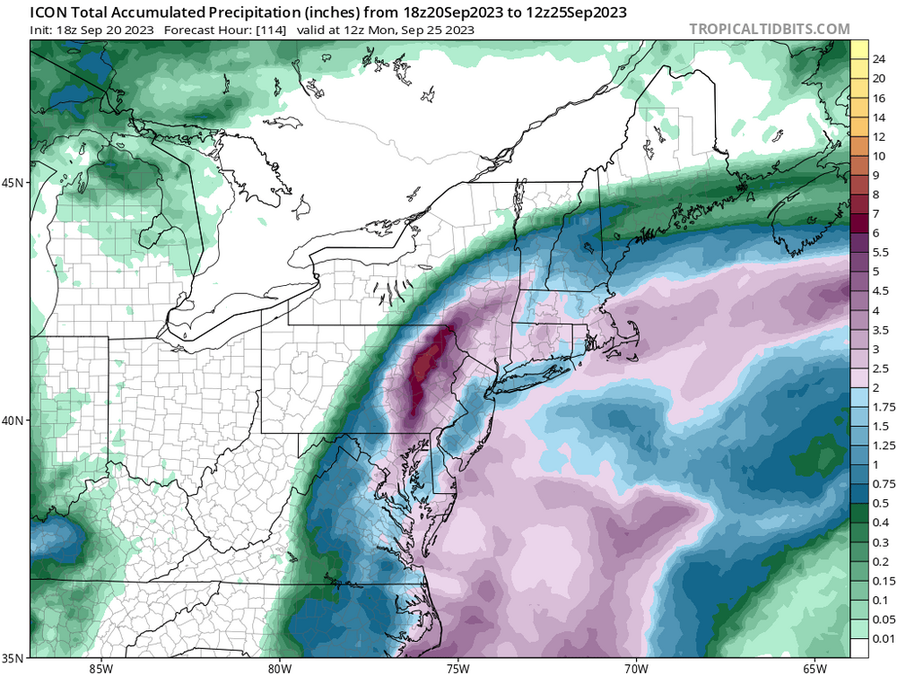
For sh!ts and giggles, look the entire ICON run. It has rain throughout the entire run.
-
 1
1
-
-
1 minute ago, Brian5671 said:
CMC finally jumps ship and is much drier....LOL

Has the majority of the rain in round 2 (and lots of it).
-
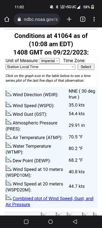
8 minutes ago, StantonParkHoya said:
Haven’t seen a land reporting station gusting over 30 yet
Cape Hatteras is gusting to 31

Beaufort Smith Field (KMRH) now gusting to 33 mph as well and Cherry Point to 37. Should pick up later this afternoon.
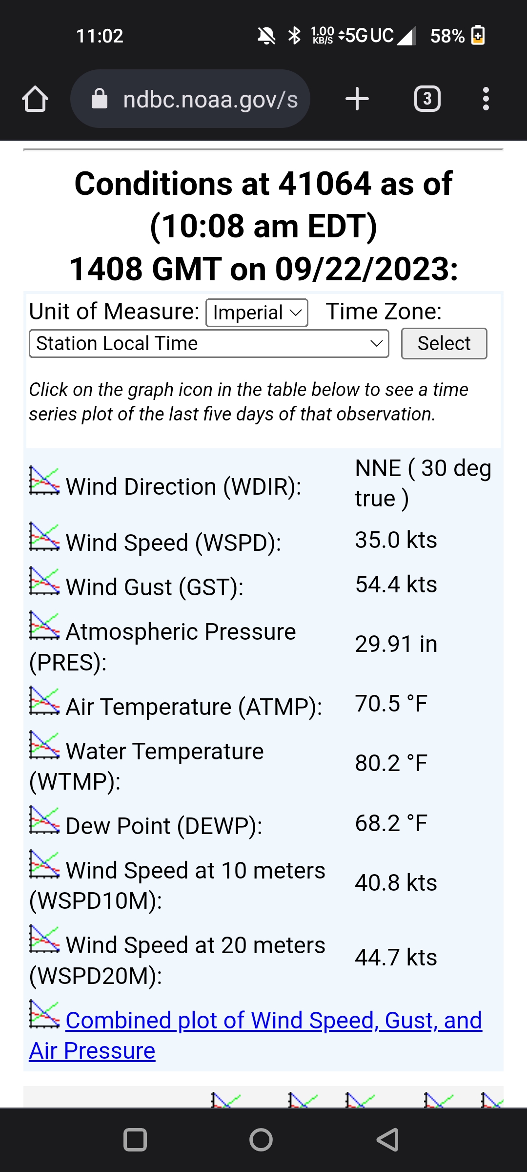
Aso, Buoy off the coast of Carolina gusting to 62 mph.
-
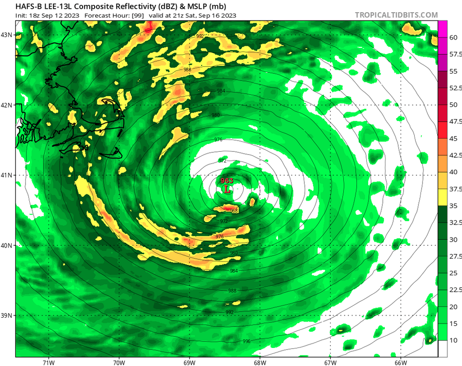
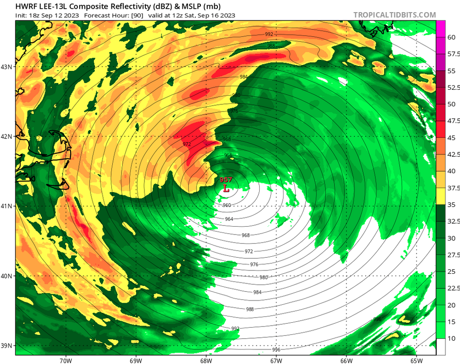
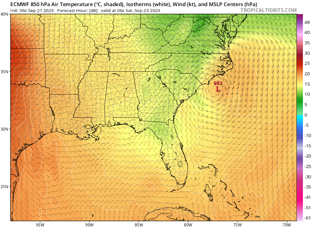
Almost every model now takes it from about 1010 mb at initiation to sub 1000 mb tomorrow at noon or so. It'll be interesting to see if it becomes vertically stacked overnight.
-
 1
1
-
-
7 minutes ago, Stormlover74 said:
12z but 18z is similar
Thanks for pointing it out. I corrected it.
-
RGEM has a nice region-wide soaking
.thumb.png.56f48ee37e915c282bc44150f44df208.png)
-
Tropical storm warnings issued to just offshore the jersey coast. Local HWO outlines heavy rain, gusty winds, coastal flooding and beach erosion.
-
2
-
-
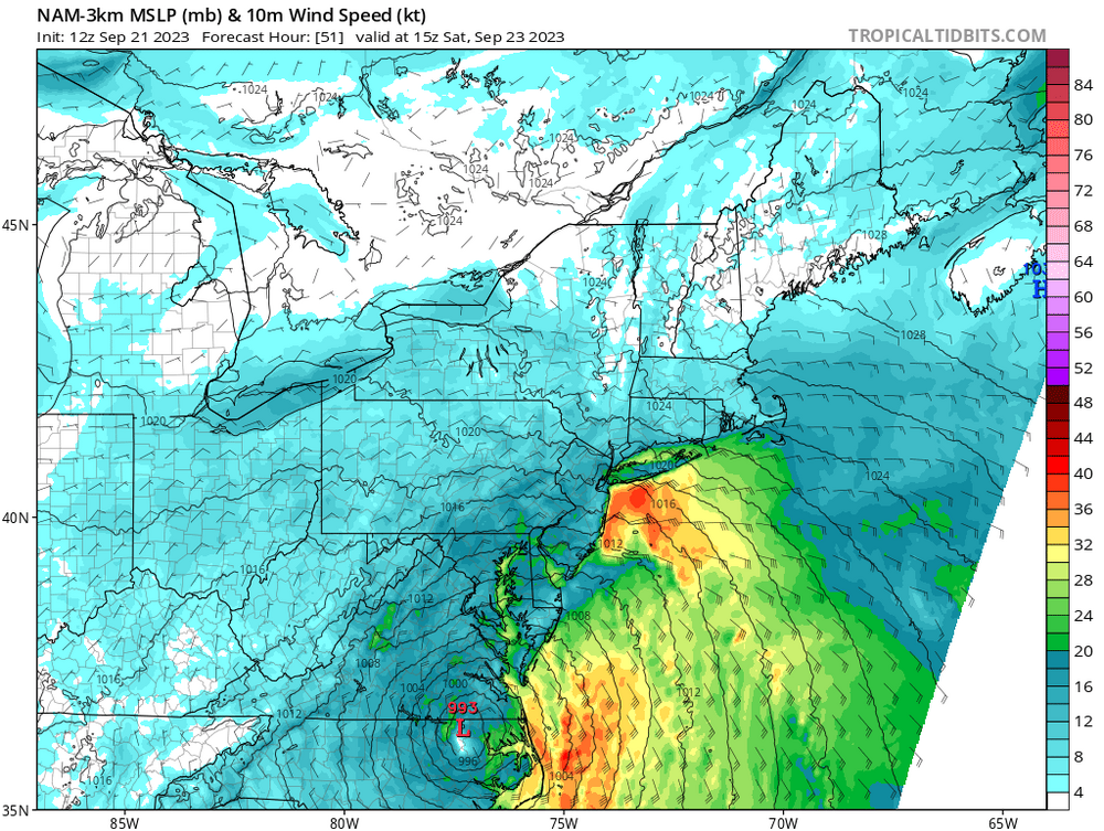
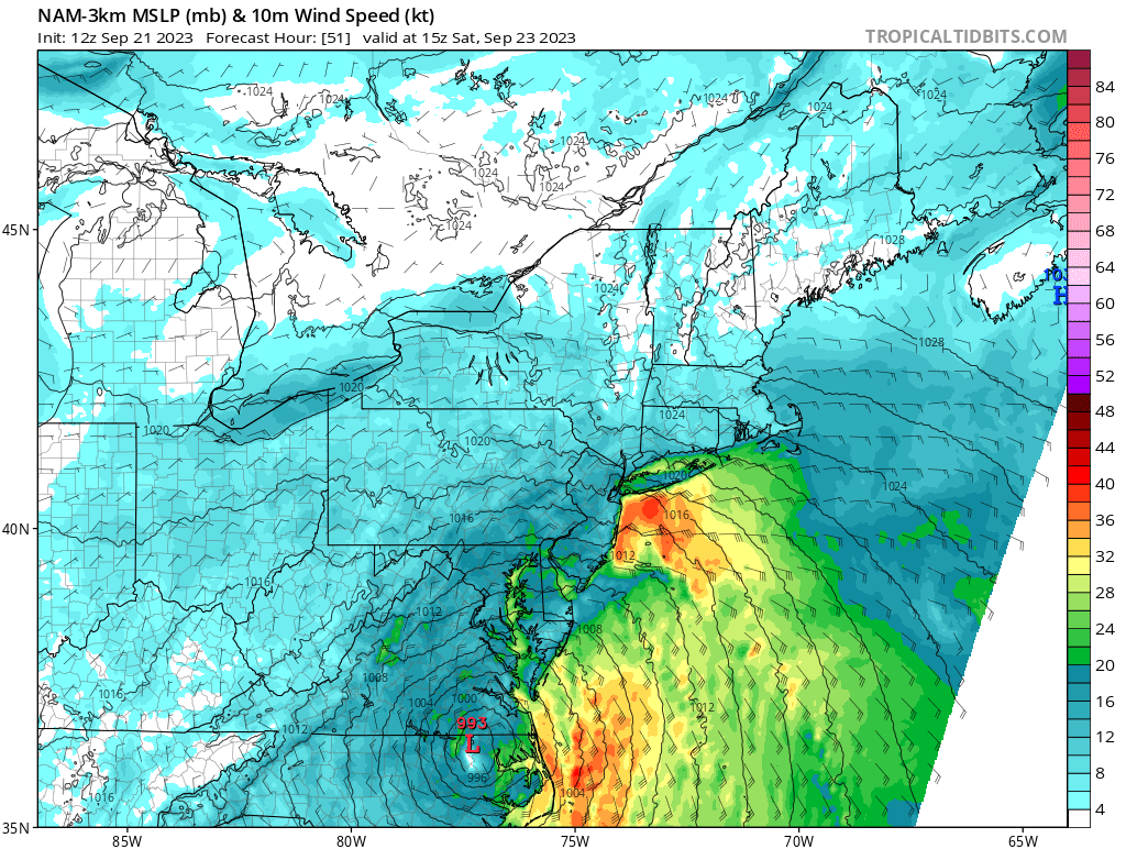
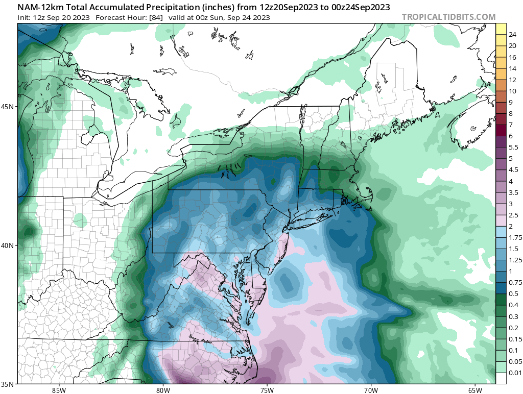
8 minutes ago, MANDA said:
PRE going on right there. Taken verbatim could be a notable flooding event for parts of the forum. Still a ways to go before final solution comes into better focus and this is the NAM after all.
The pre could have some gusty winds with it as the isobars are elongated northward and has a decent pressure gradient (yes yes, I have a wind fetish).
-
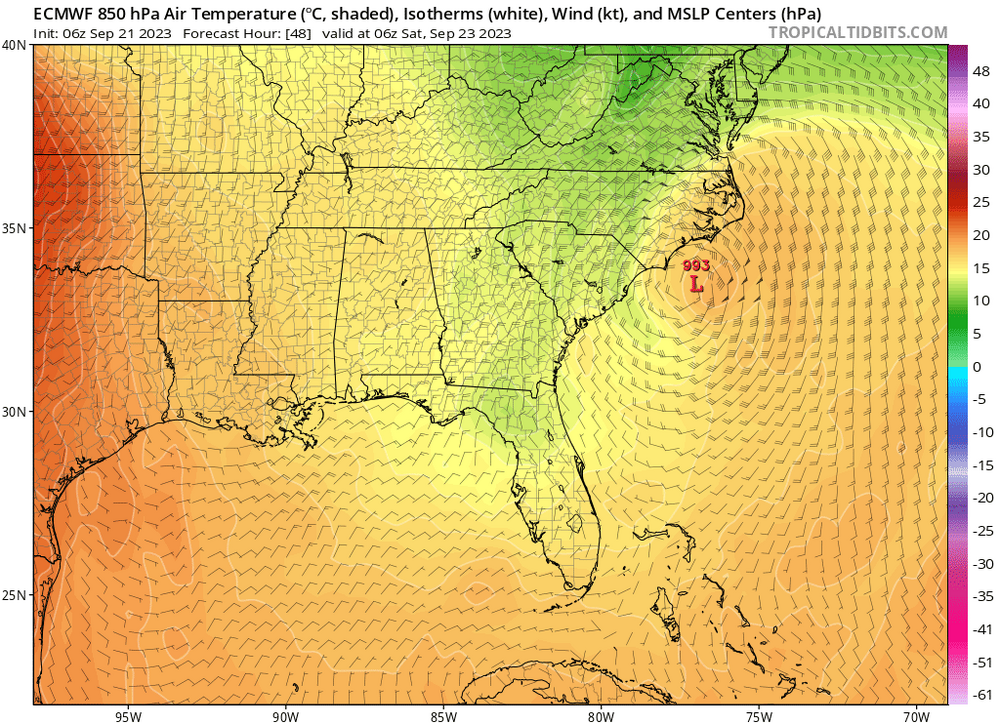
11 minutes ago, MJO812 said:
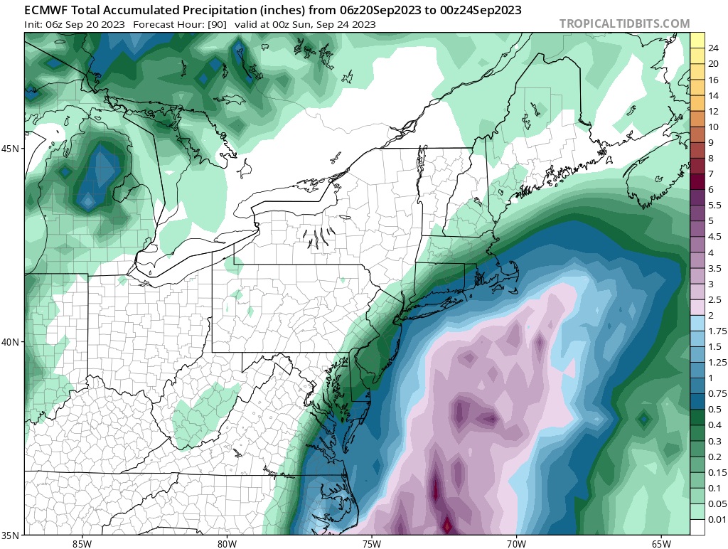
6z Euro with more coming for the coast

Depending on how strong invest 99L gets, there can be some decent winds along the coast as there's a pretty tight pressure gradient between the LP and strong high to the north-northeast.
.thumb.png.df6407bf5cc76ddbb4db17bcaa9c700d.png)
-
06Z Euro has a deeper storm now
-
3
-
-
ICON is a region-wife soaker as well. We'll see if the more reliable models follow suit.
-
1
-
 1
1
-
-
Love the difference for a 3.5 day forecast. If this was a winter storm it'd create some serious chaos.


-
1
-
-
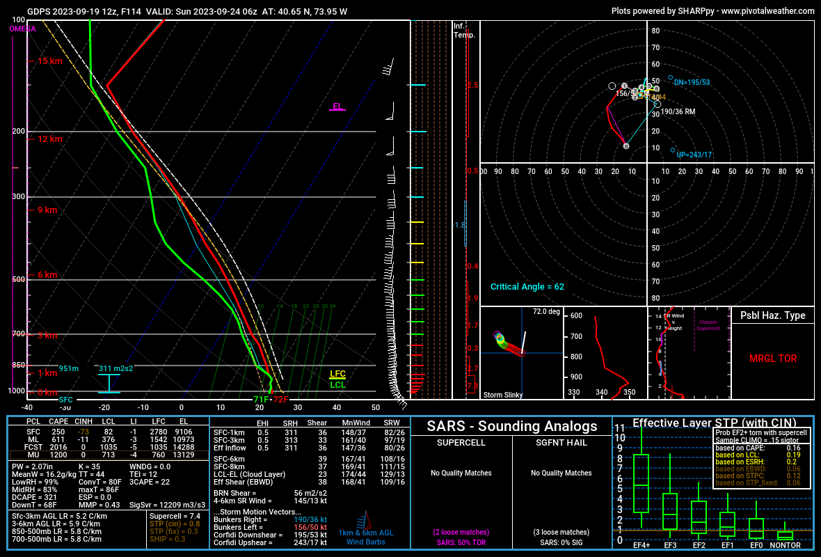
2 minutes ago, David-LI said:
How come?
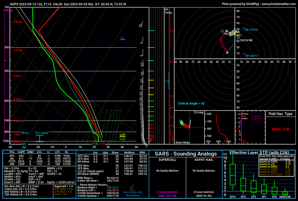
High SRH values and backed flow. In general, the eastern part of any significant low pressure system has the highest probabilities for severe weather (that's obviously broad-brushing it a bit, but you get the idea).
-
4
-
-
1.53" for the day now. Not too shabby.
-
Bango and Augusta gusting to 47 and 49 mph respectively. Overall, pretty meh event.
-
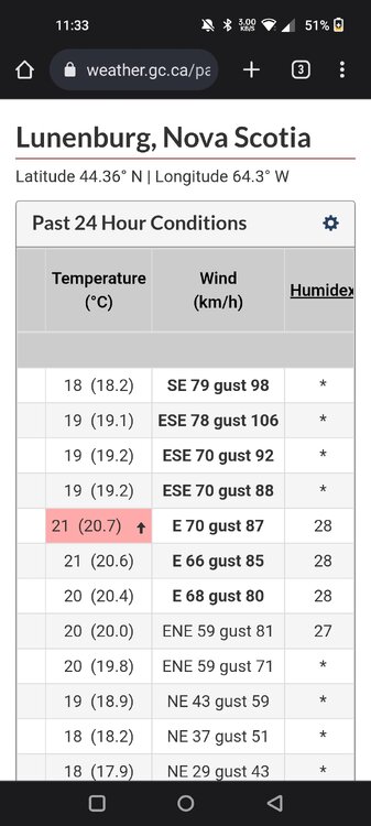
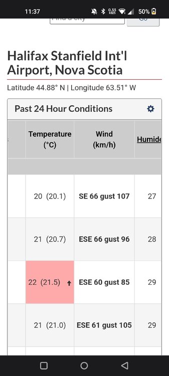
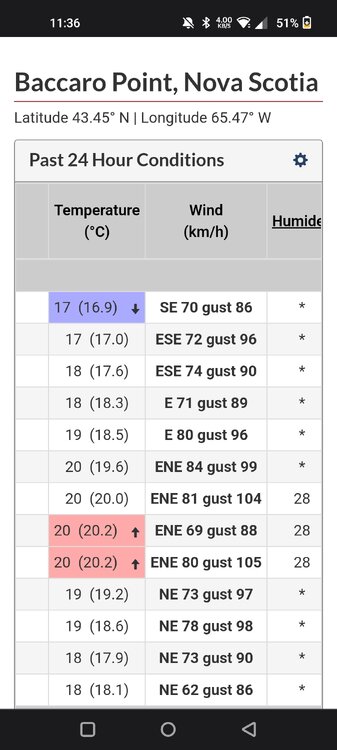
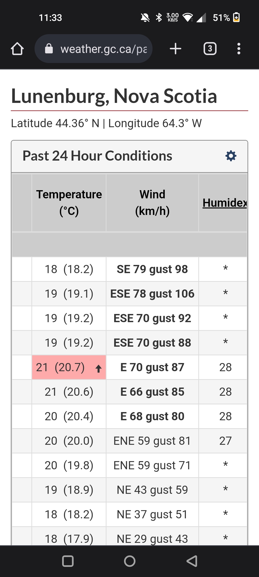
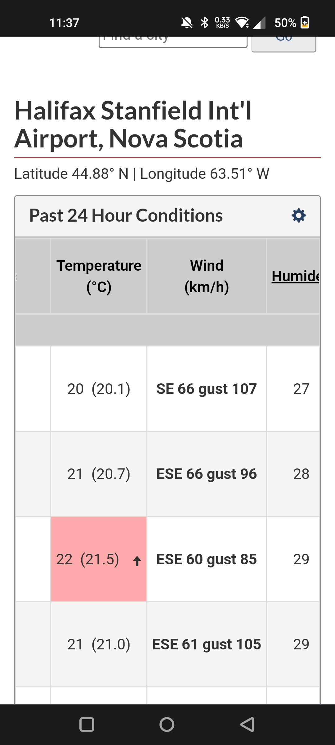
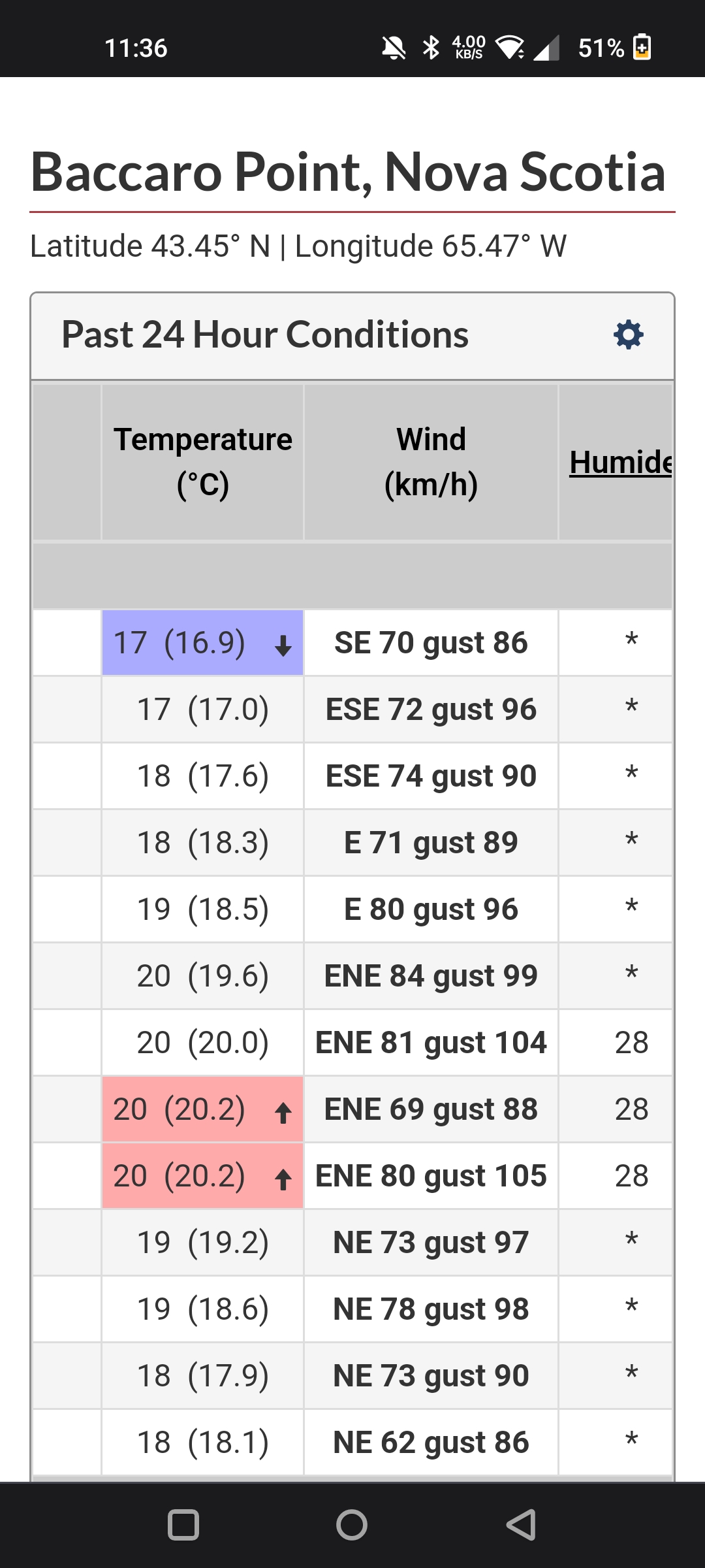
Winds in Nova Scotia so far look decent but not overly impressive (topping out at about 65-70 mph from what I've seen so far). Surge might be a different issue.
-
1
-
-
There must be some sting jet on the southern end of the transitioning Lee as recon just reported multiple unflagged SFMR readings of 82 knots.
-
Right on the border

-
1
-
-
2 minutes ago, Damage In Tolland said:
Incorrect
Time will tell. Model skill only increases as the event draws closer, and you'd need a pretty significant shift to get a truly impactful event.
I was contemplating a trip to eastern Massachusetts but it's probably not worth it at this point.
-
This is quickly trending towards a minor event for anyone outside of Maine (with perhaps far eastern New England getting a moderate event).
-
1
-
-
Yep, all overnight models shifted slightly east, though a few hurricane models keep it interesting. We'll see what today brings, but conventional wisdom says that it's no big deal outside of the cape and Maine.


-
 1
1
-
-
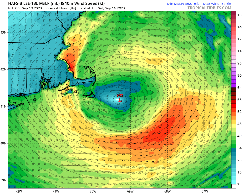
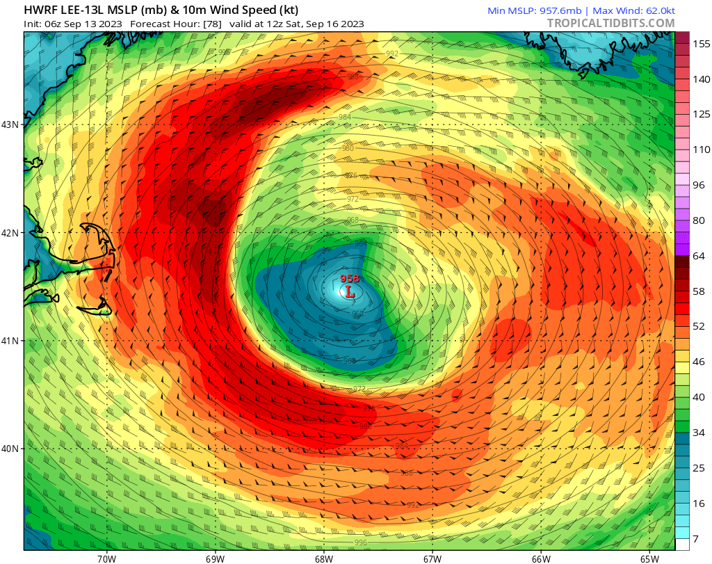
68 W (longitudinal) at our latitude is probably the line for significant impacts on eastern New England. Obviously if it gets even further west, it increases impacts further inland.
Aside from the Euro, some tropical models have it close enough as well.
-
1
-
-
I wholeheartedly agree with this sentiment. I'm a weather enthusiast who is absolutely fascinated by destructive weather and would like nothing more than a Category 5 hurricane right up my fanny.
As for the human suffering that it'll inevitably bring, I want to assure you guys that despite my rooting interests, I'm not actually in charge of the weather and have zero bearing on the outcome.
-
2
-
-
Some pretty significant street flooding in Brooklyn. Recorded a little under an inch back home.
-
1
-
.png.a11eb36bfd2f49fec9ed2e2209729cba.png)

.png.3d49f65c78051c59878f017725d66c26.png)

Tropical Storm Ophelia
in New York City Metro
Posted
GFS and CMC also have this meandering around all week but way further south than the ICON. With a stout blocking pattern, it would make sense that it'll hang around somewhere.