

mob1
-
Posts
2,154 -
Joined
-
Last visited
Content Type
Profiles
Blogs
Forums
American Weather
Media Demo
Store
Gallery
Posts posted by mob1
-
-
HRRR is still all over the place

-
 1
1
-
 1
1
-
-
Drove from Staten Island to Midwood this morning through insane rainfall rates. That was hairy.
-
I'm in Brooklyn and it's absolutely pouring now. Rain has a tropical feel to it.
-
1
-
-
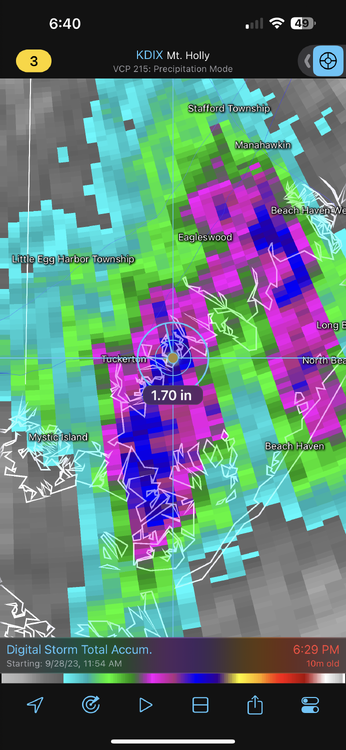
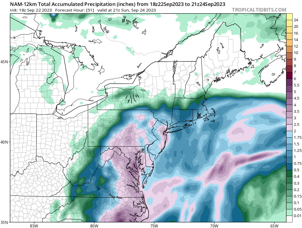
14 minutes ago, BoulderWX said:
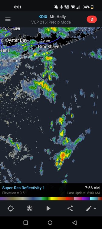
Highest amount on radar that I can find is 1.70” in Tuckerton
Let's compare that to what the 18Z HRRR had at this point.

-
6 minutes ago, LongBeachSurfFreak said:
Already pouring in Manhattan, not a good sign.
Some areas south of Tom's River are closing in on 2 inches but models had almost nothing for them to this point. It doesn't necessarily mean anything for the main show later tonight into tomorrow, but it shows how hard these mesoscale features are to pin down.
-
2
-
-
9 minutes ago, jm1220 said:
From 12z
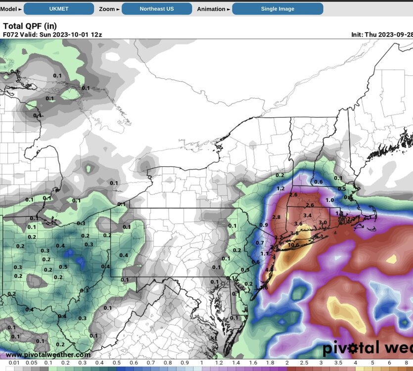
What did it look at at 0Z? Never mind, Pivotal has a trend option.

-
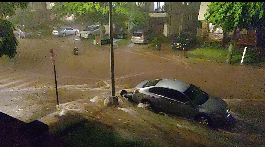
41 minutes ago, CoastalWx said:
Let’s get Ida 2.0
Yes, let's. My favorite flooding event ever, my street was literally a river. None of the cars in these pictures are actually moving, they're all parked.


-
6
-
-
6 minutes ago, WinterWolf said:
Enlighten us. 5” for NYC?
More like 7-9". It's confined to a relatively small area though, and looks like a classic winter norlun through with the isobars elongated towards the NW. Those suckers can generate a ton of forcing but are notoriously fickle and hard to pin down. More often than not, the axis of the heaviest precipitation ends up a bit NE of where it was modeled.
-
1
-
 1
1
-
-
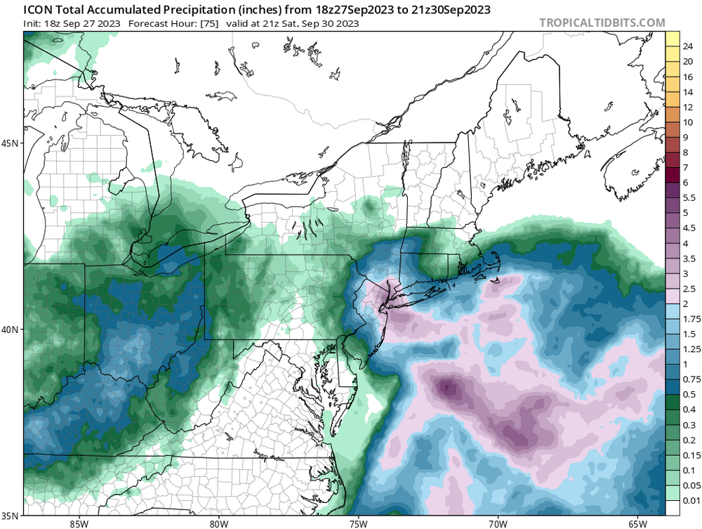
4 minutes ago, Allsnow said:
Icon over nyc
Yep, looks like a more realistic version of the NAM.
-
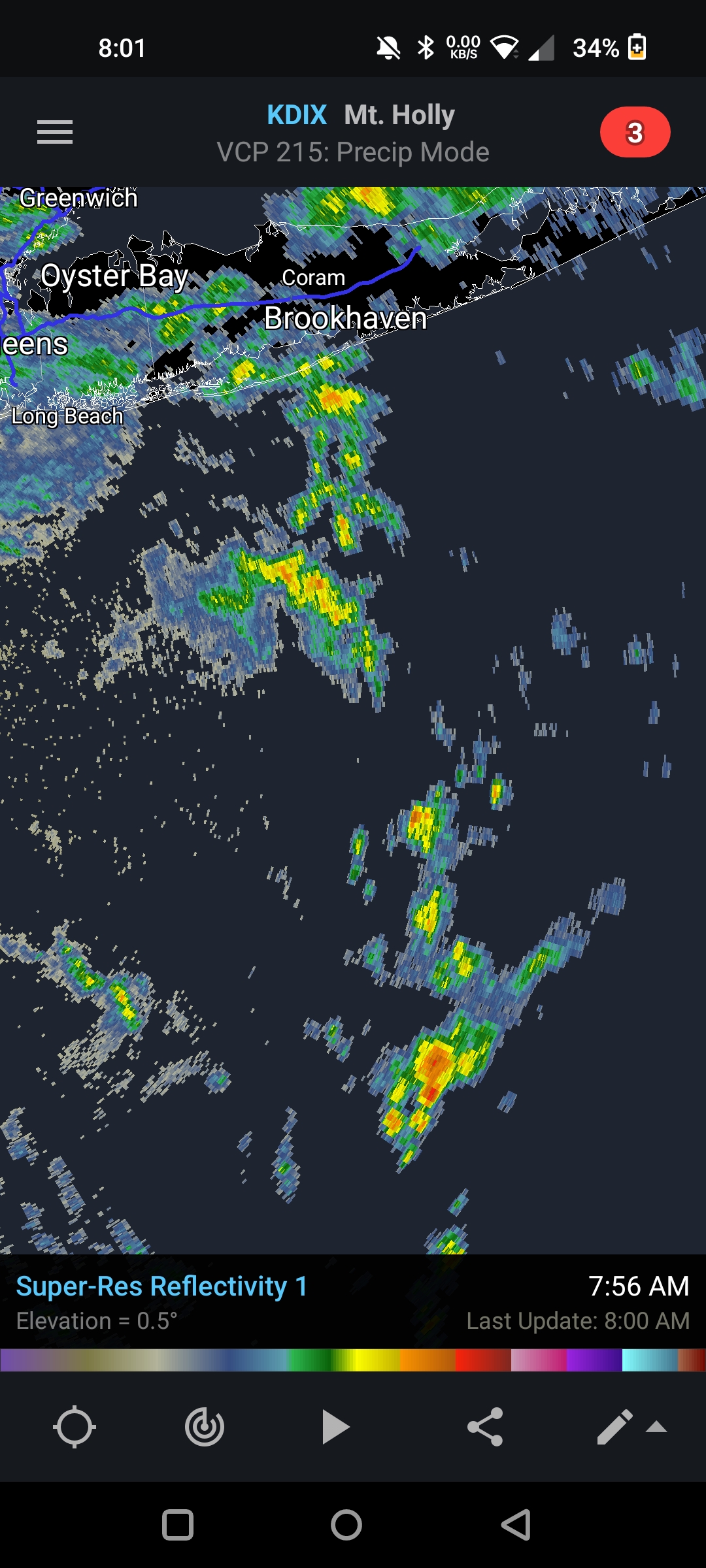
Absolutely pouring here for the past 20 minutes. These last few bands are going to add up quick.
-
Just crossed 2 inches for the event. It's been a slow bleed to get there so definitely not concerned about flooding.
-
We'll see if Ophelia's remnant low does indeed regenerate a bit to give parts of our region flooding rains. Models have hinted at it on and off, but for now it looks like a long shot.
-
2
-
-
1 minute ago, psv88 said:
Guess that heavy blob completely missed most of the island last night. Looked like it would get us.
These are a bit further east than the bands last night so it might clip a larger portion of the island.
-
1
-
-
Over 1.5" now with about the same amount left to go if models are to be believed.
-
1.27" here and there seems to be some nice bands that should rotate off the ocean in the next few hours. We'll see what tomorrow brings, but I'll probably end up with around 2 inches or so which is more than enough.
-
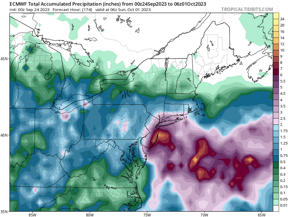
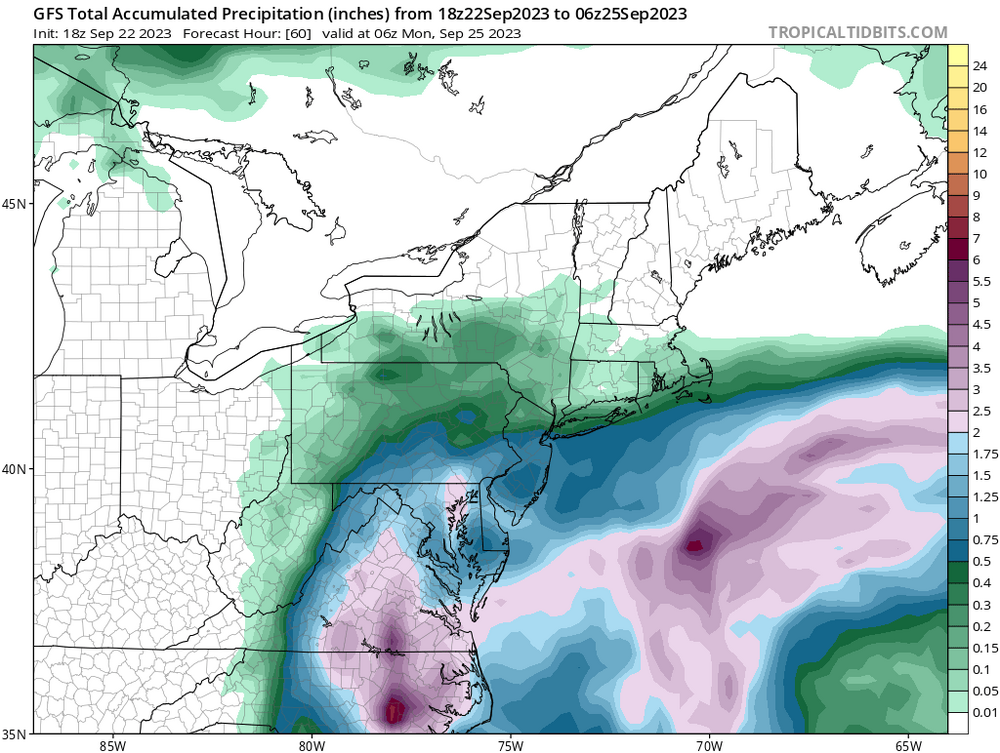
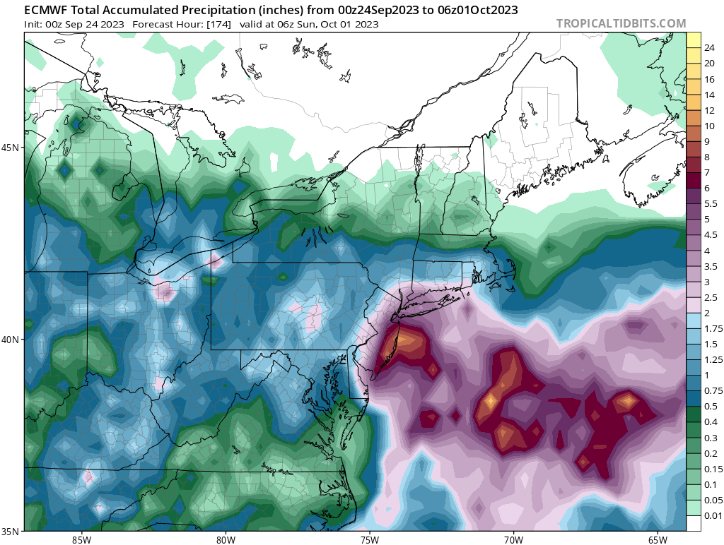
Now the GFS comes in with this. It's just impossible to get any kind of agreement and/or consistency from models anymore.
-
1
-
1
-
 2
2
-
-
2 minutes ago, TSG said:
SSTs offshore are well over 80
These two stations are roughly equidistant from the current center, NW and SE respectively. The GS is between those two so temps are likely even higher where the storm is.
Frying Pan Shoals is now at 80.1, was at 81.7 just before midnight.
https://www.ndbc.noaa.gov/station_page.php?station=41013
83.8 at this buoy
It's fine where it's now, we were discussing the shelf waters as it gets closer to the coast.
Either way, should be a fairly steady state from now through landfall (might strengthen a bit in the next few hours but should weaken a bit as it approaches the coast).
-
Just now, TSG said:
that's rich after reading your last 10 posts in this thread
You're coming on a bit strong. Relax, it's just a storm and the reality is that 78-80 degree SST's are borderline at best.
Recon recording unflagged SFMR of 70 knots should be enough for an upgrade (though they didn't do it at 5).
-
1
-
1
-
-
-
-
Just now, gymengineer said:
The wind’s kind of surprising given the lack of convection in the areas probed so far.
Maybe some kind of sting jet on the southern quadrant. It's actually quite common with subtropical "half-canes" at this latitude.
-
2
-
-
Recon so far has found flight level winds of 62 knots, surface at 48 knots and extrapolated pressure of 991 mb or so.
-
5
-
-
Just now, MJO812 said:
Alot of blocking
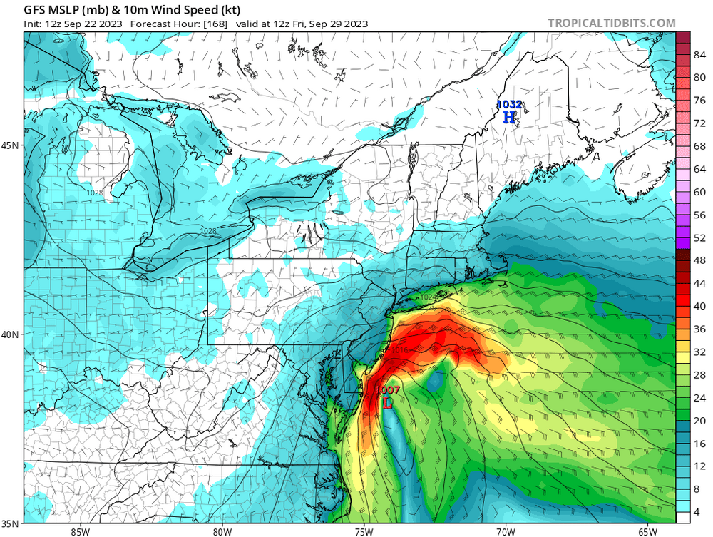
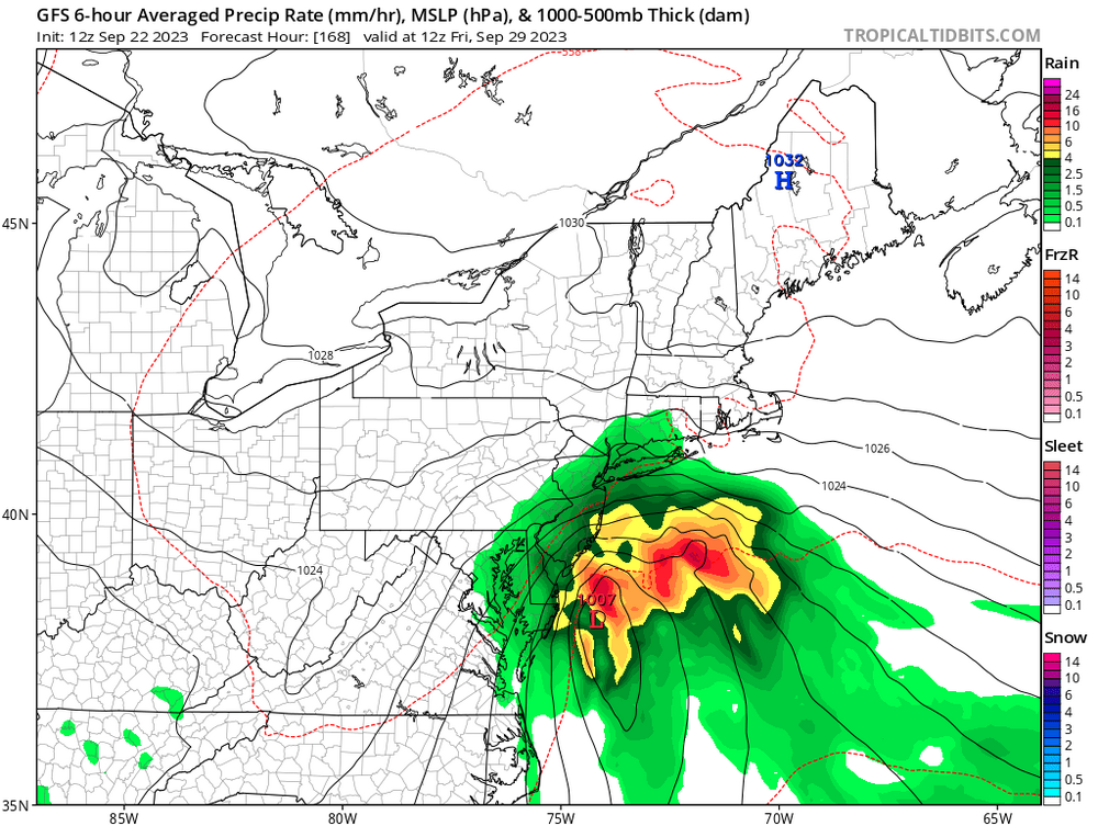
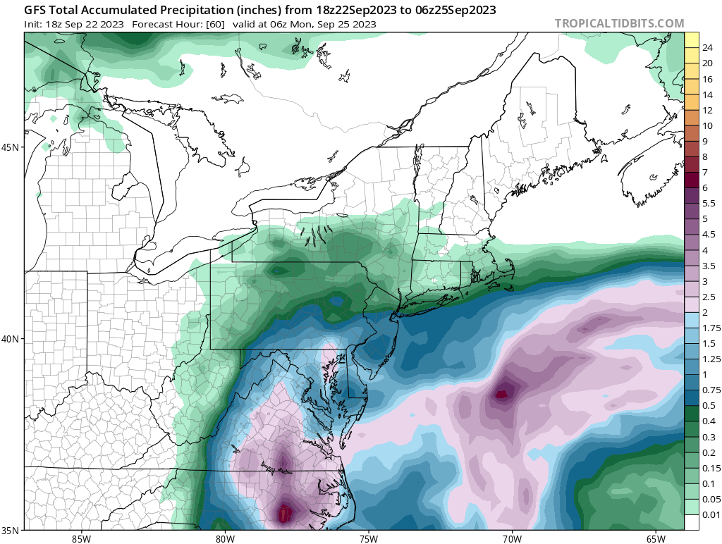
Verbatim, the GFS has a much more significant system the second time around. Some really strong winds and a ton of rain (it also coincides with the full moon). It's in fantasy range though, I can barely get it right 24 hours out.
-
1
-
-
It ultimately comes back for another round. Interesting evolution, it'll be fun to see what happens.
-
1
-


.png.673497ed1de1f7d28c6809746666fbd7.png)

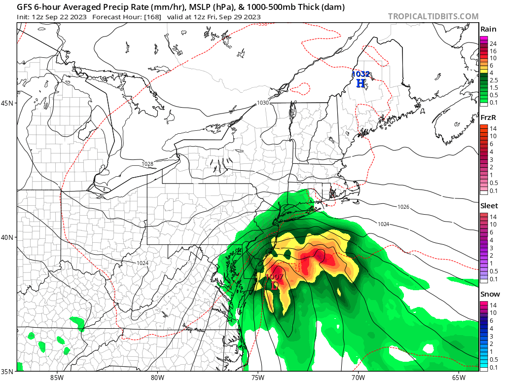
Another big Sept rain event between roughly midnight Friday morning and midnight Sunday morning (bulk 9/29-30/2023)
in New York City Metro
Posted
JFK already surpassed 4 inches with a heavy band moving in. We might get a nice break here soon and then we'll see if more rain develops.