wxmx
-
Posts
3,684 -
Joined
-
Last visited
Content Type
Profiles
Blogs
Forums
American Weather
Media Demo
Store
Gallery
Everything posted by wxmx
-
The San Narciso hurricane from 1867 would be near the worst case scenario for San Juan, had it kept it's intensity as a major for a little longer.
-
I didn't delete them, but they are removed to keep the thread clutter free...nothing against you.
-
Probably, just nitpicking...sorry .... Also, an E-W track would be a little worse than the SE track...but that's just me being argumentative.
-
I see that, that's why I said that a TC approaching from the SE would be bad. But the absolute worse would be from the same TC coming from the NE...untouched RFQ with N winds, longer time for piling surge as well.
-
Worst track would be from a TC coming from the NE. Since that's an unlikely track, a track from the E or SE are the next on bad tracks.
-
And Kingston
-
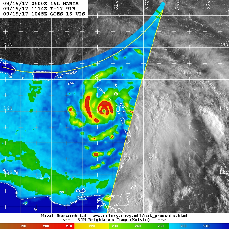
We may have an ERC underway.

-
Based on a 941.6mb extrapolated pressure, it's in an intensifying cycle once again (vs 945.2 the previous pass)
-
Looks like central pressure is up to the 940s
-
Recon missed the eye. 134FL/125SFMR and 936mb extrapolated, but outside the eye
-
Not true
-
Or the parallax effect
-
136FL/139SFMR ... and central pressure in the 920s...that's at least a 135 kts hurricane, borderline cat 4-5
-
There was a flagged 152 kts SFMR as well.
-
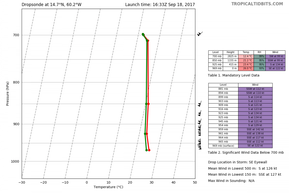
Or right now? Dropsonde in the SE eyewall up to 122 kts at the surface. 957mb in the latest vortex message
-
Texas/New Mexico/Louisiana/Mexico Obs And Discussion Thread Part 8
wxmx replied to wxmx's topic in Central/Western States
Models have been playing catchup with this cold shot for MBY. Strato snow is now in play, I think. Cold is stronger, earlier than forecasted, plus is drizzling, which most models didn't show. To be fair, drizzle is usually not well forecasted. Not saying there will be any accumulation, qpf is going to be meager, but maybe some surprise dusting in the morning...not bad considering we are almost 2 years since last subfreezing temp. -
Texas/New Mexico/Louisiana/Mexico Obs And Discussion Thread Part 8
wxmx replied to wxmx's topic in Central/Western States
Early November and my early swim laps are still a delight in an open air pool Just a couple of weak cold fronts have gone through MBY, when the average should be closer to 5-6. Tampico had 8" of rain yesterday (my parents live there) in less than 3 hours, with rainfall rates of 5"/hr at times (close to 6"/h at some point). Flash flooding was tremendous. This happens when there's still and abundant pool of moisture and a very warm Gulf still, while upper atmosphere is slowly cooling, even a weak disturbance can get these things going in a violent fashion. -
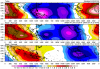
It seems so, as a strong CCKW/MJO pulse appears to be headed for the Atlantic past week 1 (Credit: http://mikeventrice.weebly.com/mjo.html)
-
Devastating tornado strikes Joplin, Missouri
wxmx replied to Hoosier's topic in Weather Forecasting and Discussion
They acknowledge the chair in the wall and the hose in the tree as evidence of the strength of the tornado. -
Devastating tornado strikes Joplin, Missouri
wxmx replied to Hoosier's topic in Weather Forecasting and Discussion
It looks like the branch partially detached from the tree because of the action of the wind, the hose blew in and then the branch snapped back -
Devastating tornado strikes Joplin, Missouri
wxmx replied to Hoosier's topic in Weather Forecasting and Discussion
Ok, gotcha. This limitation is for all tornado ratings, but they show more often the stronger the tornado. -
Devastating tornado strikes Joplin, Missouri
wxmx replied to Hoosier's topic in Weather Forecasting and Discussion
But there are structures that can withstand winds >210 ... though they are not that common (think reinforced concrete structures). Not sure if the gap between those type of structures and well built structures that can't withstand winds >210 mph is large, or if there's no calibration for the kind of winds that could destroy the "super-structures". IOW, what would be the kind of damage for 220mph? for 250mph? -
Devastating tornado strikes Joplin, Missouri
wxmx replied to Hoosier's topic in Weather Forecasting and Discussion
I really understood your point from the beginning, I was playing devil's advocate. Also I thought your range for low-end EF-5 was really restrictive... being that EF-5 baseline is >200mph and 210mph wasn't a low-end in your opinion, you left only 205mph as the unique value for low-end EF-5s (going by 5mph increments)... but I see your point about the realistic upper end in windspeed of a tornado (which I think it can be >220mph) -
Devastating tornado strikes Joplin, Missouri
wxmx replied to Hoosier's topic in Weather Forecasting and Discussion
Would a 145kt Cat 5 hurricane be low end? That's ~10mph above the cat 5 baseline -
Devastating tornado strikes Joplin, Missouri
wxmx replied to Hoosier's topic in Weather Forecasting and Discussion
What would be a high-end EF5?