

pasnownut
-
Posts
9,002 -
Joined
-
Last visited
Content Type
Profiles
Blogs
Forums
American Weather
Media Demo
Store
Gallery
Posts posted by pasnownut
-
-
44 minutes ago, canderson said:
What a nightmare for schools and companies timing wise. It might not snow hard enough for roads to accumulate yet could at any time pour snow and make them impassable.
Its tough, but its the public sectors responsibility to inform people of the POTENTIAL challenges....
People would rather know of the possibility of something happening and it not, than to be caught off guard. That's not an argument, thats just common sense. Most outside the weather boards dont care about who got an inch more or less....they arent weenies like us.
They need to be informed and can despite having an app that thinks for them, can come to their own conclusions or plan for as best possible.
-
 1
1
-
-
41 minutes ago, Itstrainingtime said:
I know a lot feel this came wayyyy to late...
...I'd also like to put it out there that CTP has issued a TON of winter weather headlines that never verified. Many never came close to verifying.
2 sides to that coin.
their responsibility is no different than ANY of the other regional NWS offices. IF/when they bust...so be it....everyone does, but to be so late to the game all the time...not sure how that is defendable.
Not picking an argument, but merely stating a fact that many here agree with.
-
1
-
-
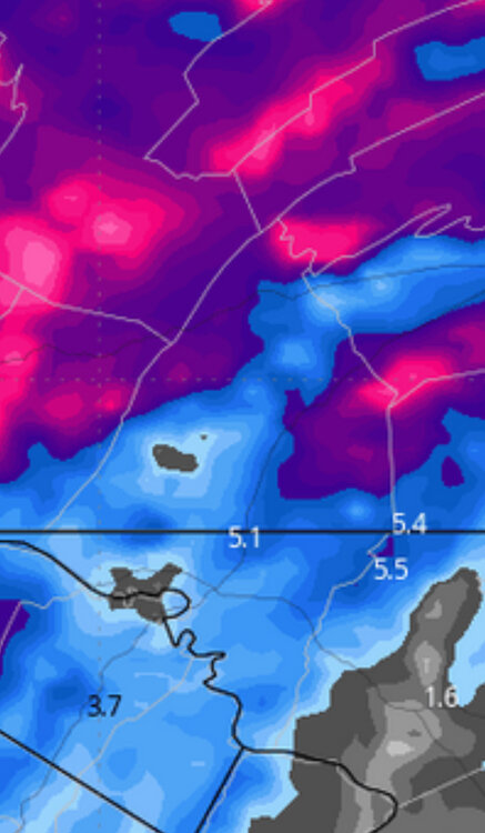
25 minutes ago, mitchnick said:
Gefs
.thumb.png.d3c53d13c6b9fc55f21151ed025130d9.png)
Since I said I was done posting Lanco centric stuff, this is a perfect depiction of how close our county is between the haves and have nots..
Edited for not looking before posting. Fingers faster than brain.
-
Icon also ticks SE for tomorrow, which gives us on the razors edge, a little hope. Again, just showing for current trend/consensus.
6z

12z

-
9 minutes ago, Superstorm said:
Winter Storm Watch finally issued for Adams, York and Lancaster.
FWIW Rgem eeked a touch SE, and while not great for us, I'm following for slight trends/adjustments/continuity purposes.
In summary, it didnt go the wrong way...
-
 1
1
-
-
8 minutes ago, Mount Joy Snowman said:
That's exactly what I'm thinking they'll do as well.
Yep. If we can get 2+ inch per hour stuff, all bets are off.
My last Lanco centric post, as this storm is about all of us, but we literally could have an event where Quarryville is brown, and Denver/Cocalico has 4-6" paste bomb. Wouldn't be too surprising.
-
2
-
-
4 minutes ago, paxpatriot said:
Have to keep laughing at these Franklin County depictions on the 3k, lol. People in the snow hole can walk a block or two to find 2-3 inches of snow.
thats normally right over my house. Happy it went west....
sorry
")
-
 1
1
-
-
2 minutes ago, GrandmasterB said:
Based on both NAM maps, if a forecaster said 2-5” for Lancaster/MDT/York that would probably be fine.
Lanco's forecaster said not to believe the models.....so don't
. Truth told, this one has been a nail biter for some time, notsomuch trackwise or evolution, but as we lack antecedent cold, and the waiting game can be tough thermally down here. We know that all too well.
Whether lanco gets into the goods or not, many just to our north and west should enjoy an nice event.
-
2
-
-
11 minutes ago, mahantango#1 said:
I'm wondering if this will changeover sooner than expected overnight.
need quicker transfer to coastal to get column to cool. slower transfer is kiss of death.
and thats a tough one, as we've been burnt far too many times waiting...

-
1
-
-
1 minute ago, paxpatriot said:
Sterling up with WWA’s and WSW’s on the Maryland side. Definitely one of my pet peeves is when they don’t communicate/coordinate, and end up looking stupid.
and THATS the big rub for many of us CTP'rs...sterling taunton, mt holly all post perty colors all AROUND us well in advance, while we wait to see what color we get....if any.
-
1
-
-
1 hour ago, mitchnick said:
Bwi gets more than me. Gotta just laugh. At least we're not NE where the Euro was showing 10-15" only yesterday.
itll tick north for nooners or Hh. Right where we want it.
-
1 hour ago, Storm Clouds said:
It’s beyond me why State College doesn’t even have a winter weather advisory yet for southern tern counties! Everyone model I see has at least 3-4 inches. People are going to be blindsided…
Par for the course. Been that way for....ever.
Its been said many times by many of us, I don't envy the position of pros/public service/safety folk that are responsible for getting the word out, but yeah even for southern tier folks, they should at least post an advisory with disclaimer that were riding the line, and while it may not happen....it may, so dont be surprised if your wet gets white. Specially with morning rush smack in the middle of it.
-
1
-
-
4 minutes ago, canderson said:
If the GFS was ever to kick the Euro's ass, a Presidents' Day storm should be the time.
as I said a couple times now, the normally bashed GFS Op at meduim/longer leads has had a decent run in the medium range this season, and while I know it shows what we want to see, there is valid reason the hug the hell outta it....for now.
-
3
-
-
6 minutes ago, Blizzard of 93 said:
Nice shift south on the 12z EPS as well.
12z top
6z bottom
Enough ticks south to say nooners went the right way for us, as we've got several of em showing hits of various proportions.
-
2 minutes ago, mitchnick said:
Looks to be suppressed at 240hrs.
I'll take it for now.
-
4 minutes ago, mitchnick said:
Gfs looking to move back to its look for PD when it had the 3 in a row snows. Too early to say if cold gets here on time.
For storm #1 i agree, but #2 and PDIII look fine in the cold department.
-
Really rooting for the GFS to be on point. Further SSE with transfer and keeps this under us. I'll take that at 5 days out.
-
1
-
-
6 minutes ago, mitchnick said:
Icon ain't smoking what Gfs did overnight.
yeah B transfer just south of KPIT with marginal thermals doesnt work well round here. Need further south track to give CTP a shot at this.
-
6 minutes ago, Atomixwx said:
I bought a thousand of those end of the world survivalist MRE buckets that Jim Bakker is shilling to recoup all the jail costs, and I am good on total horseshit food for the next seven thousand years because I can't imagine this happening soon enough.
Everybody start by going outside and lighting a fart. Do it now.
Sent from my motorola edge 5G UW (2021) using Tapatalk
actually heard of someone doin that and burned bunghole so bad that it ended up killin him....
well I read it on the internet....

-
6 minutes ago, mitchnick said:
Yep. End of the world can't come quick enough in my book.
hey now....some us "not quite as old" still have lo navigate this shitstorm in hopes of retirement - or a world worth livin in when the time comes.
-
12 minutes ago, sauss06 said:
thats it. Thanks Mike
I watched some sierra snow stuff last year, thanks for the reminder to do so once again (and trainer for the tip on what to search for on youtube.
-
1
-
-
15 minutes ago, Atomixwx said:
If the GFS is still showing the PD III event a week from now, I'll start throwing chips at the table. That's if I don't spend them all this Sunday at the pre Super Bowl poker game.
Sent from my motorola edge 5G UW (2021) using Tapatalk
Who are you kidding. You'll pawn off your snowblower for more poker chips if needed....and so would I. Thats a thing of beauty (map wise).
-
13 minutes ago, mitchnick said:
Snowfall line went back north a bit. Eps not budging.
as I know you know, with the way things have become wrt models Ops/Ens snow maps, biases etc, its really tough to pin down at this range, so just to see things somewhere inside the goalposts is all I look for at this juncture. Unfortunately goal posts are pretty wide right now, but with some north and some south, were in the middle which is good. Truth told, I'd rather have more members in the south camp, cause we all know things head north as we close in.
Lastly, that PDIII event on the maps is just a beautiful looking setup. If only we could lock that one in.
-
1 hour ago, mahantango#1 said:
Hopefully it verifies to feed us hungry snow geese. Hoping for a big snowfall/blizzard of 2 feet, then we can move on to
springthe next one.fyp
.png.3c858caf0eb7b288f8f9dc7886056a26.png)

Central PA Winter 23/24
in Upstate New York/Pennsylvania
Posted
I'm still nervous that I'll be smelling the snow and watching....and waiting, while peeps 20 miles to my north are in thumptown.