

WNash
-
Posts
1,184 -
Joined
-
Last visited
Content Type
Profiles
Blogs
Forums
American Weather
Media Demo
Store
Gallery
Posts posted by WNash
-
-
31 minutes ago, Stash said:
It's been standard wording in WSW's the last few years.
I think it's part of the guidance changes over the last 10-15 years to emphasize impact on human activity in text products.
-
2 hours ago, TugHillMatt said:
I'm so sick of this. I love you Western NY guys...but for real...can we just have some SYNOPTIC snowstorms that don't screw us in CNY?!?!?!? So maddening.
Buffalo is only slightly above its 30 year seasonal snowfall mean. Our brains have been so warped by these extreme snowfall deficits that we think Buffalo has been getting buried. In actuality, this is one great month in a great desert of crappy winters. I'm not complaining -- the last 3 1/2 weeks have been awesome -- but I don't see how Buffalo is going to get the 2.5 to 3 feet needed just to finish at the seasonal average.
-
 1
1
-
-
7 minutes ago, Buffalo Bumble said:
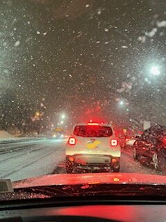
Heavy snow here now. Might end up with 4”’today when I was expecting a trace. Bonus!
Absolutely dumping near University Plaza. Huge dendrites.
-
 3
3
-
-
29 minutes ago, Stash said:
Nah, those of us that live out here have seen this from the NAM time and time again. I haven't invested much time with this one, but someone living on Mount Tolland should make out very well.
FIFY
-
 1
1
-
-
1 hour ago, BuffaloWeather said:
How can you be from Rochester and not be a Bills fan? Its an hour drive away from a real NFL team. So odd, everyone I know that lives there loves the Bills. His comment last night got him back on the ignore list. The only thing he posts is that webcam from Rochester airport and asking posters for maps from recent model runs, I won't be missing much.

You’re really missing out on the most IMBY comments in this forum.
-
2
-
-
6 hours ago, Thinksnow18 said:
The southtowns crew did not get the 90% of the synoptic, the northtowns were over 20” in most cases and almost 2 feet in parts of Niagara county. Might have your storms confused?
Sorry, I was comparing 18” in Kenmore/N Buffalo to my in laws in West Seneca, which was 15”. But the LES storm totals were significantly lower in WS.
in any case, while some of the Buffalo metro is still a few inches above mean snowfall to date, it has been uneven. I wouldn’t call this a good winter for the Southtowns.
-
2
-
-
3 minutes ago, TugHillMatt said:
Great January for you Buffalo and Niagara Frontier guys.
The southtowns crew got 90% of the synoptic, but lost out on the LES a couple weeks ago. I hope this one overperforms in Hamburg/OP.
-
1
-
-
1 hour ago, Blue Moon said:
Only 3" required for a WSW in Nashville. I forget what it is for the Smokies, but I know it's at least 6"
I’m originally from Nashville. 1” will shut down the city for days.
-
1
-
-
2 hours ago, BuffaloWeather said:
I can't believe Dolphins fired their coach, they went 8-1 in last 9 games.
What a mistake. Flores is a terrific coach whose only problem was a meddling owner. He should be coach of the year for doing as well as he did despite Ross’s interference.
-
2
-
-
50 minutes ago, SouthBuffaloSteve said:
wow yeah you might be right. thats my task this week is to get this list updated! the way these north town guys cry how they don't get big storms anymore and we really had that many top 20 setting events at KBUF during "the drought"?
KBUF isn’t on the same heading as North Buffalo/Northtowns, but you do you, boss
-
1 hour ago, Thinksnow18 said:
Some heavy 2”+ over the north part of the metro heading NE…I can see many areas over a foot with KBUF to Lancaster 2’
We’re at about 16” in the University District, making a run at 2 feet if the band continues to barely move south. I moved to WNY in October 2012 (at the same time Sandy was hitting the east coast). In my time here, I have only lived in 14214, and this is the best storm for the northern part of the city in that almost 10 year span. Really hoping for 2’.
-
6
-
 1
1
-
-
47 minutes ago, BuffaloWeather said:
Sunny here with less then an inch looking north

Wild to see a mirror image of LES storm of recent years. I feel that photo — watching a good band from the sunny side sucks.
-
1
-
-
2 hours ago, BuffaloWeather said:
This is the one @WNashhas been hoping for the last few years.
Yeah, this is awesome. I’ll get out there a measure later, but we have been drifting in and out of the 2-3” stuff all morning.
-
1
-
-
Sorry meant to put my comment in the off topic discussion. Glad we don’t have storm mode violation bans!
-
14 minutes ago, TugHillMatt said:
Ah, my old stomping grounds. I sure do miss the beautiful West Michigan lakeshore. They do fantastic when a low ushers in cold air on a SW wind. That's the glorious lake enhancement off of the wide part of Lake Michigan.
My ex grew up on White Lake. Those West Michigan lake storms with the multiple band setups hit frequently all the way into late March. Not as intense as the single band storms we get, but they share the wealth a lot more there, and the pack can really add up.
-
2
-
-
1 hour ago, Thinksnow18 said:
Mike Is on an island by himself
Not for the first time.
-
1
-
-
1 hour ago, Thinksnow18 said:
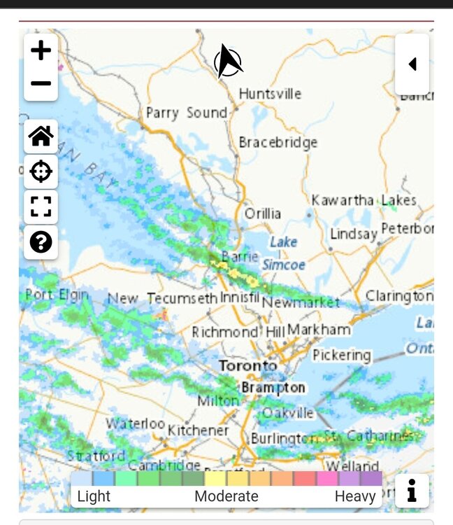
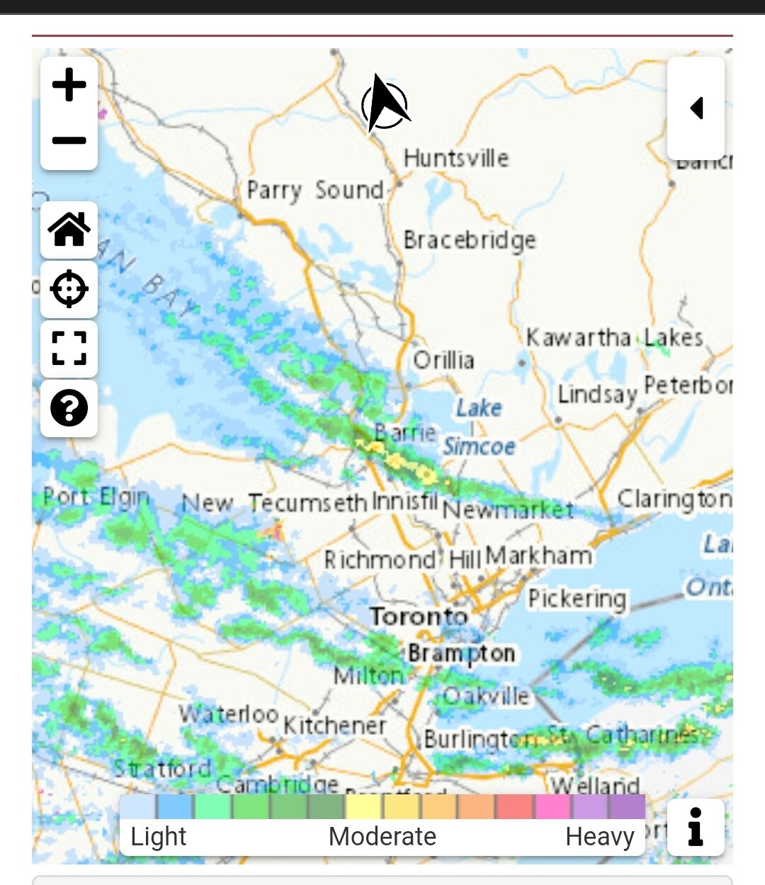
While I NEVER feel comfortable about LES, seeing all 6 models pretty much lockstep right now does make me a bit more optimistic. And looking at the snowfall forecast map from the NWS the biggest difference is the stripes of snow north of Buffalo have widened by a few miles. The 8-12” now solidly gets near the 990 and the 4-8 gets all the way to Tonawanda by the 290. This is different from yesterday when those areas were more in the 2-4 category, and the 8-12” area was a cutoff right near my location.
This will probably weenie-doom the storm for the northern half of the metro, but model consistency and upstream radar have me cautiously optimistic.
-
1
-
-
1 hour ago, Thinksnow18 said:
Expecting between 6-10” is my guess as I’m probably just a mile or two north of the heaviest snows for this one. West Seneca, Cheektowaga, Lancaster, South Buffalo and Depew Jackpot this one IMO.
This doesn’t surprise me, though I am disappointed. A heavy band with a long downtown to northtowns residence requires multiple parameters to align almost perfectly. That set of parameters seems to have had a return interval of about 10 years until the early 2000s, but for whatever reason, the odds against them seem to have gotten much worse. If any parameter is off, we see outcomes ranging from no band at all to a transient band with a short residence in most of the city to a band that reverts to a more WSW or W alignment.
The tolerances are so fine that as soon as any single credible model loses a 235/240 flow, the chances of a downtown to northtowns band drops to basically zero. So this is no surprise — in reality we lost this one days ago.
-
2
-
-
4 hours ago, Thinksnow18 said:
To be fair it’s about 5 miles north but the very heaviest accumulation will be airport or just south to Lancaster, Depew, Blasdell, Hamburg…I think the north areas are between 6-18” (N-S) with 24”+ in the areas I identified.
Yeah, I don’t think this is going to break the 20 year LES blockbuster drought for downtown through the north towns. I also have a bad feeling about winds in the first part of the storm - we have seen high winds and sheer break up bands in the city.
-
12 hours ago, BuffaloWeather said:
30 hours with a strong LES band over BUF on GFS. Classic SW flow event. The first I've seen in awhile with a SW flow for that long. This has potential to be the one @WNash
God save this weenie band
-
18 minutes ago, BuffaloWeather said:
Latest GFS pretty much drops PV on the lakes
Just 293 hours away!
-
3
-
 1
1
-
1
-
-
1 hour ago, rochesterdave said:
Hammer time here in Pittsford! Snow globe stuff. Beautiful. Getting close!!!

Crazy how it works, you’re going to jump from your 1” for the season to passing KBUF if this sets up the way it is looking like.
-
1 hour ago, vortmax said:
GB is really producing. Could be a nice connection for a bit of a surprise tonight.
When I was pIcking my daughter up from pre-K, the NW sky from the 290 was totally dominated by that band off southern Lake Huron. It looked like a total monster.
-
12 hours ago, Thinksnow18 said:
Yeah it’s over brother. The days of cold stretches with a brief warmup are long gone. Now it’s stretches of warmth with a transient cold shot from time to time. It’s time to face facts.
Sounds like the sensible weather in Tennessee in the 1990s and early 2000s. I moved here ecstatic that I was going to leave behind weeks of 43/31 weather, interspersed with warm-ups into the upper 50s to low 60s. Winters where precip was 4x as likely to be rain as snow. The standard for an A or A- winter would be at least one instance of accumulating snow (1” or more) falling into previously accumulated snow (snowpack at least 1”).
I’m going to put out a theory that our rate of winter warming is us losing about 0.5 degrees of latitude every three winters. So in 20 years, Buffalo went from the epic Christmas week storm that buried the whole city (https://www.weather.gov/buf/lesEventArchive?season=2001-2002&event=B) to winters where we get cutter after cutter, and where the front end thump of an inch or so leads to no lake response. We might as well live in the mid-south. At least they get to cheer for the occasional cut-off low bringing a jackpot every few years. And by 2040 we should be seeing the winters that Jackson, Mississippi had circa 2000. Who wants to trade lake effect chases for tornado chases? Will we be able to complain about weeks of 70 degrees and sunshine in January and and February?


Model Mayhem Snowstorm! 2/2-2/4
in Upstate New York/Pennsylvania
Posted
KS(n)YZ(zle)