
DavisStraight
-
Posts
9,742 -
Joined
-
Last visited
Content Type
Profiles
Blogs
Forums
American Weather
Media Demo
Store
Gallery
Posts posted by DavisStraight
-
-
6 minutes ago, AstronomyEnjoyer said:
Yeah, it'd be nice to snag a 20:1 or higher ratio. Maybe clear off the decks with a leaf blower.
I did that one storm, I bought one of those new turbo blowers, did my whole walk.
-
39 minutes ago, AstronomyEnjoyer said:
Wind is still whipping outside and the white pines are still flinging cones. Below, my crop of pinecones at 5pm. I'm sure it has since doubled. Mesos are averaging around 0.20" QPF over my head for this clipper. Hoping for more juice and some solid ratios.
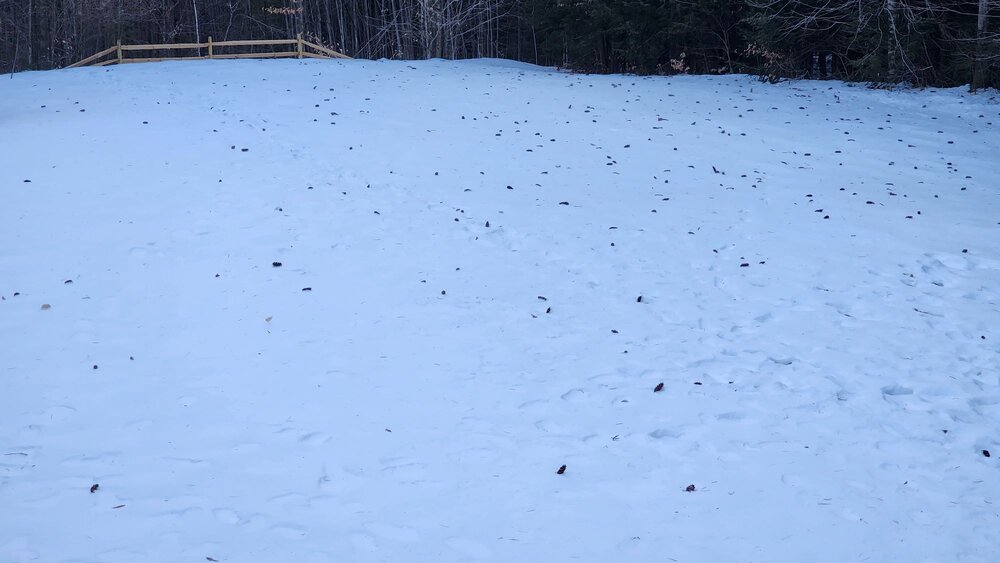
That's probably 4 inches for you.
-
 1
1
-
-
29 minutes ago, ORH_wxman said:
Bluebird sky out there this morning…with strong CAA at least it looks and feels like winter out there today.
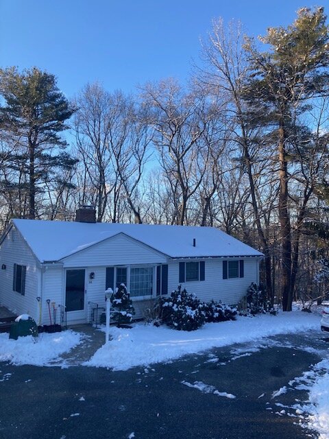
Great winter look and feel today, the winds been blowing the snow around, most of the top layers are powder and the stuff in trees is getting blown off. Not many more of these to go, have to savor these days.
-
5 minutes ago, Cold Miser said:
That 5.3 is right near me. Someone else had a sh.it amount.
Next town over from me 3.3, I got 7 but towns to the east and south were over a foot. That last killer band just missed me.
-
4 minutes ago, CoastalWx said:
Took my son down to Whitman to go sledding since they had about 3 inches of icy snow. It’s actually icy snow perfect sledding.
I was sliding around snow blowing, there's an icy lower layer that will freeze tonight and turn into a skating rink.
-
2
-
-
3 minutes ago, Damage In Tolland said:
I think this kind of event happens quite often in NNE in coastals that hit all of SNE hard. There almost always is a sneaky and unmodeled band that drops 6-12” + way north. Sometimes along the -8C line . With the storm shifting south yesterday that zone ended up south of where you’d normally see it
I was originally expecting it over my head.
-
18 minutes ago, Bryan63 said:
After shoveling the driveway with my shovel that worked while living in North Carolina, I am grateful we did not get anymore. If it snows again it may be time to finally upgrade.
I'd be in traction if I had to shovel todays snow, 7 inches of heavy wet snow, if I was a degree or two cooler, I would have had 10 inches.
-
1
-
-
32 minutes ago, Damage In Tolland said:
12.5” here . Smilin
Did you get that band swing over your area? Helps you're higher too, I ended with 7, just flurries now.
-
Ovah here, a tad over 6 inches of heavy wet snow sticking to everything
-
Im a tad above 6 but the back edge is approaching me now so that'll probably end it soon. Still I only expected 2 so this event's ok here.
-
1
-
-
I'm at six but it's lightened up a bit
-
1
-
-
Heaviest snow so far, over 4 inches, if I can get hit by that heavy band, I might make 8, not the 12-18 we thought but it salvages the storm for me.
-
22 minutes ago, Snowcrazed71 said:
I'm officially at 10.5" here in Plainville. I think we will hit 12" for sure ( I have pictures but for some reason I can never download them here, it always says two big of a file )
If they're on your phone, shrink them.
-
Still heavy snow, up to 4 inches.
-
Got a surprise this morning, I have 3 inches and it's snowing hard still.
What happened, everything nudged north a few miles?
-
1
-
-
1 minute ago, CT Valley Snowman said:
Not really feeling good about things up here 2 miles from the mass border in CT. Hopefully those further south cash in with at least a decent period of snow.
I think we get 2-4.
-
46 minutes ago, WinterWolf said:
Don’t believe it…At this point all the modeling should be blown up…
We're all gonna be gun shy after this latest debacle.
-
6 minutes ago, Ginx snewx said:
Nice to see qpf going back up here. A 6 to 8 works
You should do decent, north of you not so much.
-
9 minutes ago, Damage In Tolland said:
I think 0 is very possible in N CT. I am out
Sucks but I think we see 1-2 inches. We went from whiteout conditions to almost nothing.
-
What are the chances this think ticks 30 miles north? It's been wacky the last 24 hours.
-
Just now, ORH_wxman said:
That's just the super hi-res version of the RGEM. Thats the 12z run...I'd expect 18z to be pretty ugly for the pike crowd.
Good for the fishes
-
Just now, tavwtby said:
yeah I'm one of those...
Me too, I was hoping to see the storm slowed down and buried us, saw the opposite.
-
3 minutes ago, ORH_wxman said:
19z RAP ticked back NW a little bit compared to the 18z run. 19z HRRR doesn't look like it moved much at all. Gonna keep an eye on these post-18z runs. I don't think you should expect anything other than S trends with other 18z guidance that hasn't come out yet.
What about this model?

-
2 minutes ago, Prismshine Productions said:
NAM trends south, UKIE scored the coop
Sent from my SM-S146VL using Tapatalk
Aint over til it's over

NNE Cold Season Thread 2023/2024
in New England
Posted
I wish I picked this weekend to go up north, snow should be flying in the air the whole weekend.