

WxKnurd
-
Posts
1,426 -
Joined
-
Last visited
Content Type
Profiles
Blogs
Forums
American Weather
Media Demo
Store
Gallery
Posts posted by WxKnurd
-
-
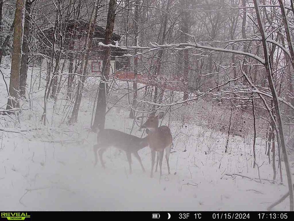
Well finally had a deer trigger my trail cam and have easily an inch it looks like. Been at 32 since like 3. Best snow of the season thus far, hate I missed it.
-
 5
5
-
-
The steady temp fall continues, down to 32.2 and still have room to fall. Wetbulb is 31.8 and continues to go down.
-
3
-
-
Down to 33, as temps come down so is the dewpoint at the same rate so wetbulb keeps creeping down to 32. Might have something going now. Plotts should be getting hit pretty good like Hires models were showing and @Maggie Valley Steve ‘s Soco report backs up
-
1
-
-
Down to 35.4, I need to get a webcam up and running for time like this when I’m curious about conditions.
-
2
-
-
1 minute ago, BooneWX said:
UNC fans occupy too much of my hating time to focus on anything west of the state line lol
Hear hear! But if I have to hear GBO one more time I might go crazy…
-
 1
1
-
-
32 minutes ago, BooneWX said:
Starting to hate the state of TN
You must not work with UT fans if you are just now starting to hate that state haha
-
2
-
-
3 minutes ago, ncjoaquin said:
So, I was bored. I drove 26 to find snow. I got to Buckner Gap 3370 ft and there was a mix. I got to Sam's Gap and there was the beginning of snow with some on the ground in TN. There was more in TN but it diminished quickly.
A few miles outside Erwin, the temp dropped to 30 and it was pouring snow. Snow on the ground and snow on the interstate. A few miles down the road in Erwin was a mix again though there was some on the ground.
I turned around there and got back to Sam's Gap and it was heavy snow on the TN side, but quickly diminished on the NC side.
Bottom line, the cold air in the upper atmosphere is somewhere near Erwin, TN. It was fun to see snow for a little bit.
Yep Erwin has been the battle ground (outside of elevation dependent temps along the spine and on our side of the line) based on reports I’ve been reading all morning on the TN Valley forum. Interesting dynamic how the cold in the upper atmosphere hit a wall it seems. I think now it boils down to two things if you are below say 4200’: can you get heavy enough rates for a mix or changeover to all snow and then can the backedge hold off long enough so when it clips the region it hits after the sun has set in order to put everything at your advantage.
-
4
-
-
54 in Mint Hill with the sun out, 37.6 at home.
-
1
-
-
2 minutes ago, strongwxnc said:
The conditions can be vastly different in the foothills and lee side.
.Grew up in Northern Catawba, can attest to that!
-
I’m just picking on you guys for starting this thread, I always considered anything north and west of hwy 64 say from Hiddenite to Rutherfordton the mountains. But it does make sense lately to discuss threats separately, which is unfortunate and sadly a sign of the Pacific being a pain in our backside for what seems like a decade. Heck, you guys aren’t too far ahead of me in the frustrated realm of things. Probably even more irritated than you guys considering I’m above 3800’ and 12 miles from the state line, got jack squat to show for that.
-
2 minutes ago, Met1985 said:
Yep I'm right at 36 here as well. I was really surprised we weren't lower. But hopefully the upper atmosphere becomes more conducive to snow falling.
It was 32 when I went to bed, figured we’d hold there or drop a few degrees but looking at weather station data it was 36 by midnight and hung around there ever since. I’ll miss whatever falls since I’ll be in Charlotte, hopeful for seeing something other than the token flakes I’ve seen all season late week into the weekend. Keeps up and we’ll need a “Non-State line aka Everyone not @Buckethead or @nchighcountrywx Mountain thread” post. Really break things down since our foothill brethren left us

-
3
-
-
Can definitely tell where the moisture has been this morning on this side of the state line, temps are much more elevation dependent where it’s been. Drop down out of the Newfounds into the FB valley and you can see how the cold has filtered in from TN there. 36 at my place, 33 on the Glades and then drop into Buncombe where the moisture has seemed to dry up and bam, uppers 20’s In Leicester and Sandy Mush. I did see a few flakes mixing in the drizzle earlier as the wind picked up. Front seems to bd working through based on that wind and falling dewpoints. Hope everyone gets a surprise later today and tonight. I think another .25” will put me over 1” total for the year

-
3
-
-
40 minutes ago, ncjoaquin said:
I do, lol. We ALL need some snow.
It’s been rough on all of us since Jan 2022
-
6
-
-
43 at home, not expecting but maybe an inch around that end of the county, maybe Crabtree and Sandy Mush balds squeeze out 3”, with the system coming tomorrow. much rather be in the Plotts for it, Soco Gap to Lynn Lowry should get hit pretty good. I’ll be headed to Charlotte in the morning anyway for work so I’m kind of hoping late week works out better anyway.
-
1
-
-
Congrats to you guys down further SW, got some cool pictures overnight during the heaviest rates at my places. Looks like .25” on my mountain too @Met1985, solid dusting at the very least.
-
7
-
-
22 minutes ago, Met1985 said:
Moderate snow at my casa.
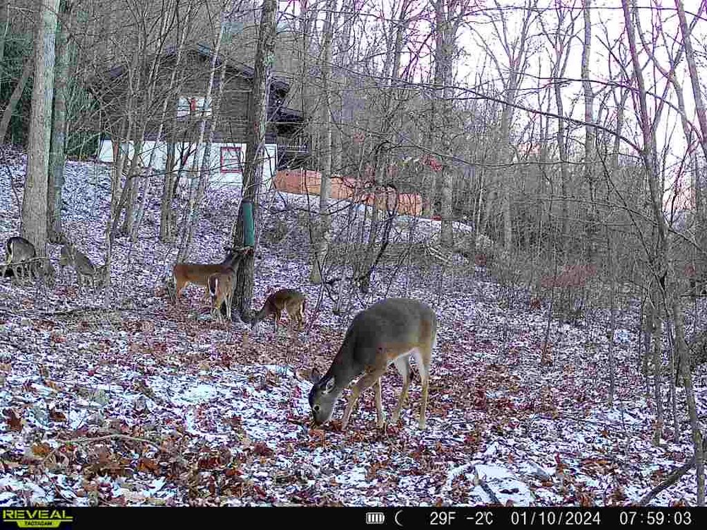
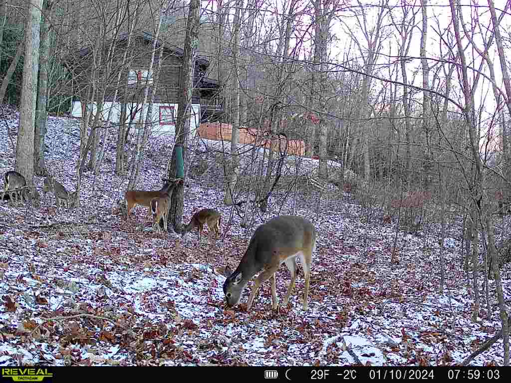
Thought I was seeing some flakes on the last few trail cam pics that got sent out, good to know I wasn’t seeing things
-
1
-
1
-
-
12 minutes ago, Met1985 said:
The orientation of the snow coming in is a bit different. It's coming in from the SW. which will actually give the southern mountains a chance at seeing some decent snow. Haywood virtually gets shadowed because of the Balsams. You can see it on all the models. Interesting for sure but I hope most enjoy.
Yep, Balsam Gap will do way better than us. Pain train continues for now.
-
1
-
-
24 for my low on my tropical mountain land in NE Haywood. @Met1985 frozen tundra takes sucks all the cold air away from me.
-
1
-
-
Flurries flying and another trace on the ground.
-
1
-
-
13 minutes ago, Met1985 said:
Back up to 28.
28.4/20.8, wetbulb keeps going down, now at 25.9. Will be interesting to see how long we hold off the warm nose and then the plain rain. Not expecting anything more than a few flakes that go quickly to sleet for a bit then a quick glaze before a nasty, cold, wet day tomorrow.
-
2
-
-
33.8 for the high, 30.9/21.6, wet bulb of 27.5.
-
2
-
-
Just now, Met1985 said:
Heck im still at 16.
200 ft lower, like 3 miles away and 10 degrees colder. I’m gonna need to buy another station from a different manufacturer so I can verify my readings haha
-
2
-
-
48 minutes ago, Met1985 said:
11 degrees this morning at my casa. A dang cold start to the day.
Geez. 21.7 was my low if my weather station was online all night. Sitting at 26.8 currently.
-
2
-
-
35 minutes ago, Buckethead said:
I'm just gonna move to San Diego. Then I dont have to worry about the weather because there is none...lol
Seriously though, I have 6" of snow for the season and can score up here into April. Living in southern SC for 30 years set the bar so low for me that I still get excited over flurries.
Sent from my SM-S908U using Tapatalk
I’m just gonna move to 7-8k feet in the Rockies
-
1
-
2
-

2023-2024 Fall/Winter Mountain Thread
in Southeastern States
Posted
How much do we have on the ground around our end of the county? Looked like a solid 1-2” on my camera at the house, some heavy returns up Fines Creek and Betsy Gap way makes me think they are at least 3-6” if they got colder faster.