Bob Chill
-
Posts
35,665 -
Joined
Content Type
Profiles
Blogs
Forums
American Weather
Media Demo
Store
Gallery
Everything posted by Bob Chill
-

Jan/Early Feb Medium/Long Range Discussion Part 3
Bob Chill replied to WinterWxLuvr's topic in Mid Atlantic
Exactly. Plus, 98 was warm for very obvious and unsurprising reasons. Far from apples to apples with Nino stuff other than sharing same name. I read PSU's post from yesterday about storm track. That's been ingrained into the winter pattern from the beginning and something that keeps me grounded. Sometimes things consistently line up similar but wrong for us. This winter has been wrong for I95 top to bottom so far except for our lucky slice. I personally don't look for reasons though. We're talking about 100 miles mostly. Imo- that type of wiggle happens just cuz. It cuts both ways as the 13-15 stretch is a great example of a long term lining up right. I doubt Feb has a consistent hostile 100mi wrong way storm track in an otherwise decent pattern. It's the best month for lower latitudes. But if the pattern sets in and things still slide overhead or west, it shouldn't surprise anyone imo -
Jan/Early Feb Medium/Long Range Discussion Part 3
Bob Chill replied to WinterWxLuvr's topic in Mid Atlantic
Analogs are starting to turn around. Top 5 d11+ adding winter back. 95 is a new one. Late Jan 95 showing with multiple dates. It was a good period as late Jan-mid Feb 95 was a wintry period. The analog that is scary is 1998 lol but prob just a Nino thing. I'm not concerned about it. -
Jan/Early Feb Medium/Long Range Discussion Part 3
Bob Chill replied to WinterWxLuvr's topic in Mid Atlantic
98 is showing up on d11+ analogs lol. But not at the top. Winter wx is making a small comeback on the analogs down the line already. That's encouraging considering how terrible they have looked last 5 days lol -
Jan/Early Feb Medium/Long Range Discussion Part 3
Bob Chill replied to WinterWxLuvr's topic in Mid Atlantic
Always a dam delicate balance lol. I don't like how intrusive the extensions are. The more I think about it the more it makes sense given the last 6 years of so. That balance is off for some reason as psu posted earlier. I'm going to pay much closer attention as lr guidance is consistently underestimating the extent of the intrusion. Feb is a deep winter month so may this time it progresses more traditionally. Maybe this is part of the new March effect. When wavelengths shorten, maybe the pac jet backs off of roids and ends up popping a correct +PNA instead of a convoluted flow ridge like we keep seeing. Idk man. Our problems seem more consistent to me as enso doesn't seem to change things all that much irt the ripping pac jet. Honestly, "traditional patterns" are becoming untraditional. Winter forecasts are consistently being upended. Even people who get US temps and snow right don't get it they way they explained but it verifies anyway lol -
Jan/Early Feb Medium/Long Range Discussion Part 3
Bob Chill replied to WinterWxLuvr's topic in Mid Atlantic
Thought provoking.... It's safe to say based on observation that the long range models are being tricked by this. Always quick to break it down in the long range only to back off an add a week as time rolls lol. Ish has been stuck on repeat lately lol. Brings up another thought. Maybe March being more wintry is a byproduct of this. Wavelengths all over the NH go through a transition and shortening period in late Feb thru March. Pac jet behavior included. Worth a look. I'm expecting a notable part of March to be more of a lion than lamb now. If we're going to keep having the same problems midwinter, maybe we keep getting the same bonus period late. -
Jan/Early Feb Medium/Long Range Discussion Part 3
Bob Chill replied to WinterWxLuvr's topic in Mid Atlantic
Seems like the extensions are more powerful and static than they used to be. You know more about this than me. I'm just using intuition. They often blast the entire continent. Maybe that's normal but I really don't remember massive recovery periods after "thaws" like we've been seeing. Could be a cycle in cycle that hasn't been figured out yet. The longer i live the more I recognize longer term patterns asserting influence that goes against what is predicted based on enso/climo/seasonal guidance. Maybe we should be expecting pac jet problems instead of being confused by them. Just spitballin' -
Jan/Early Feb Medium/Long Range Discussion Part 3
Bob Chill replied to WinterWxLuvr's topic in Mid Atlantic
The next couple weeks look a lot like late Dec / early Jan when east half of Canada was void of cold. The remnants of that anomalous height pattern cost us some snowfall with a good track. More often than not, big anomalous airmasses like to linger longer than guidance likes to think. Using that period as a guide, it's probably too optimistic to think we can flip to a snow window during first 7 days of Feb. I do believe the western trough undercuts and spikes the NAO or AO. Hopefully pac flow turns off right then and there. That would greatly speed up cooling the continent where it matters. Otherwise, we're prob normal temps at best with a though in the east until some sort of ridge deflects flow from the pac into the Conus. Right how, there is near unanimous agreement of this pattern in 2 week. Man, that's a continental problem lol If Feb 4th really looks like this, it's going to take a lot of work to reset and get back to workable. I'm gonna skip out of town to VA later this week and come back when winter comes back. Lol
-
Jan/Early Feb Medium/Long Range Discussion Part 3
Bob Chill replied to WinterWxLuvr's topic in Mid Atlantic
Maybe? It's the only thing I keep returning to if climate has shifted. Dec is awful close to a fall month here anyways and that goes back to my birth lol. Long term cycles are weird though. Just when you think something is figured out... oops. Kinda like Judah and his Siberia snowcover scam lol. Warmer oceans obviously screw with the front side of winter. That's simple to understand. How that could change March gets muddy. It does seem winters have moved forward a couple weeks on the calender compared to 15 years ago. Idk. I just want it to snow dammit -
Jan/Early Feb Medium/Long Range Discussion Part 3
Bob Chill replied to WinterWxLuvr's topic in Mid Atlantic
I threw an edit in my last post. I dont want to come off like I'm canceling anything because I'm most certainly not. And I strongly believe winter will make a return. But man there were some high expectations going into this one. It would be a let down for me if @WxUSAFs guess happens and half the forum walks away sour lol. His guess is basically identical to what I'm thinking and I'd be more surprised if we didn't get another warned event. Just maybe not widespread 1-2'. The one wildcard in my head is March. For many years I expected March to be a spring month and it was right. That's changed. Maybe just cycles in cycles or maybe because oceans are warmer and it shifts climate bookends. Not sure but lately March has been better than many Dec/Jan's. March ninos are generally bad here but the front half of March can produce big storms. Maybe big storm window ends up there instead of Feb. We'll see -
Jan/Early Feb Medium/Long Range Discussion Part 3
Bob Chill replied to WinterWxLuvr's topic in Mid Atlantic
2015 was only snowless south of the Mason Dixon. North of there got destroyed and there was a ton of arctic air floating around east of the MS River. Very different personality to this winter in general. I haven't liked any analogs popping up for early Feb. I'd like to see that change sooner rather than later but I have zero control of that lol ETA: I'm only skeptical of some big long duration turnaround that destroys the coast. Mulitple opportunities and future snowfall are both very likely in the coming 6 weeks. Some people may not like the type though lol hahaha -
Jan/Early Feb Medium/Long Range Discussion Part 3
Bob Chill replied to WinterWxLuvr's topic in Mid Atlantic
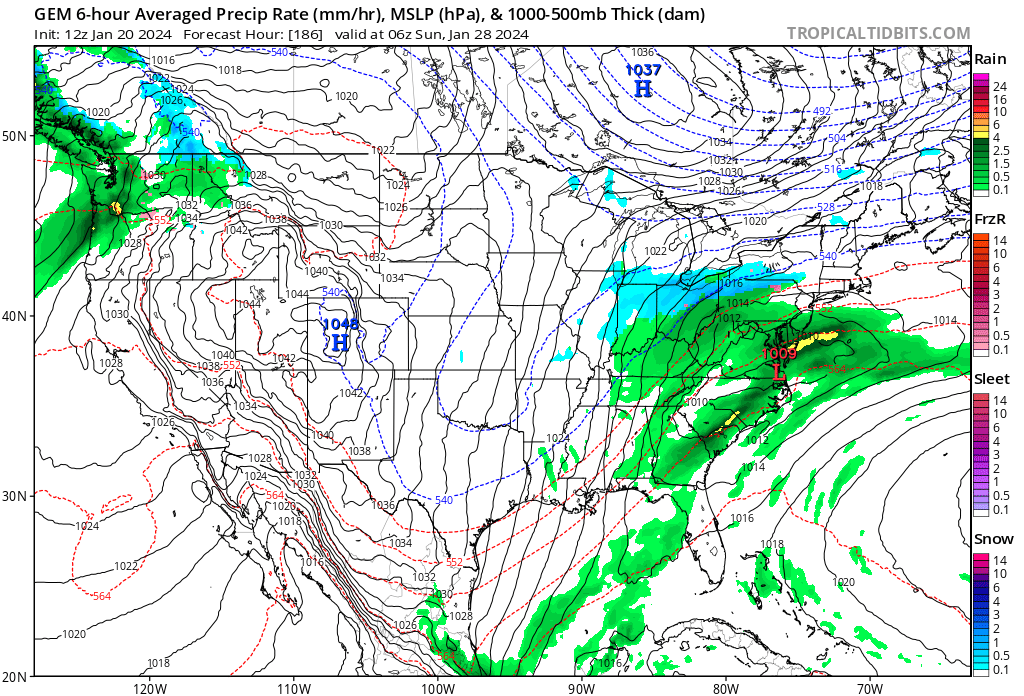
Here, I'll throw ya a bone. 6z Gfs obviously figured out a jacked up way to get it done but not much needed here and it's a week away. GFS is right in the pocket of similar setups. Maybe one of the rain waves next week kicks the boundary east enuff to have more cold available. This window originally looked like rain to maine and Buffalo. Notsomuch anymore. The trough is going to dig and there are multiple waves ejecting. For now, it's still low prob/flawed but no chance models have timing figured out. If we have something to track next week it will soften the blow of what may be down the pike during first 5-10 days of Feb.
-
Jan/Early Feb Medium/Long Range Discussion Part 3
Bob Chill replied to WinterWxLuvr's topic in Mid Atlantic
In the 22 years I've owned my house, the only flood threat that remotely got my interest was when the Needwood dam was thinking about popping back in 06. They evacuated the blowout zone so I was rooting for it for the sheer spectacle. -
Jan/Early Feb Medium/Long Range Discussion Part 3
Bob Chill replied to WinterWxLuvr's topic in Mid Atlantic
Pretty much what I'm thinking too. There's a lot of winter left. I'm just guessing based on what I've seen over the years. If we have another compressed week of winter with a moderate event followed by a decent or big one, this winter will get a B grade minimum from me. A 2-3 week favorable stretch has been completely elusive so far. Might happen but forces seem against -
You will find few winters in the last 30 years that offered a week like this. We are NOT a multiple event snowpack town and 8 days of subfreezing with solid snowpack is a rare and sweet winter gift. For this reason alone I'll go C- minimum but that's just me
-
Jan/Early Feb Medium/Long Range Discussion Part 3
Bob Chill replied to WinterWxLuvr's topic in Mid Atlantic
I haven't tracked the setup at all but looking back compared to now, the cold hp and boundary keeps moving in our direction. A lot of lead time so who knows if it even exists lol. But at least for now, the trend is our friend. It would be darn near a miracle or just easy #3 on our heater hahahaha -
Mid-Atlantic Snow Totals Thread - Winter 2023-2024
Bob Chill replied to mattie g's topic in Mid Atlantic
12/11/23: 0.4" 1/15-1/16/24: 4.7" 1/19: 5.5" Total: 10.6" -
Jan/Early Feb Medium/Long Range Discussion Part 3
Bob Chill replied to WinterWxLuvr's topic in Mid Atlantic
Couple random thoughts. I always talk about personalities of winters in a broad sense. At this point, this winter has spoken to me. It simply doesn't want to snow much up and down the east coast. Different reasons at different times but same result. North of us is suffering bad and that isn't the elephant. It's just repeating endless crappy tracks and/or setups when it matters. If you zoom out and look at the continent, our Mid-Atlantic problems are just a slice of the bigger issues plagueing the east. Will that change? Will Feb deliver? Beats me but my gut instinct is it probably won't up and down the coast. Feel pretty good about additional snowfall here in Feb. Might get a big one. But imho, the east as a whole is going to have a hard time doing a 180 and going on a heater. We turned on a dime in 2015 but north of us was already on an epic heater and snowfall to our NW was plentiful. Nobody (except our little slice) up and down 95 has had any kind of heater so far. Sometimes it's just the breaks and that's what this feels like to me. Things aren't breaking right in a broad sense and that's just the way it goes. Upcoming pattern looks to be another temp reset which is normal in any January. Now it's looking more like a problem than a break though. We had a long stretch of broad AN heights in Canada in Dec. Ens guidance agrees on another period of that. The longer that pattern holds, the longer it will take to reset. We'll prob see the way out within a week but hard to say what that looks like yet. Guidance has completely dropped the well placed epo/pna ridge idea for now. A +pna and neutral NAO is enuff to snow in Feb. A big +nao can only "easily" be offset with a big ridge out west and perfect trough axis in the east. I'd like to think a +pna takes over for a while at some point in Feb. The idea has drifted but can most certainly snap back. I'm not making any predictions or spiking anything. It could turn and rip for 6 straight weeks up and down 95. But it tuff to expect that at this point. I'll just get real happy if it does but until the personality switches, it's hard to bet against it. -

-
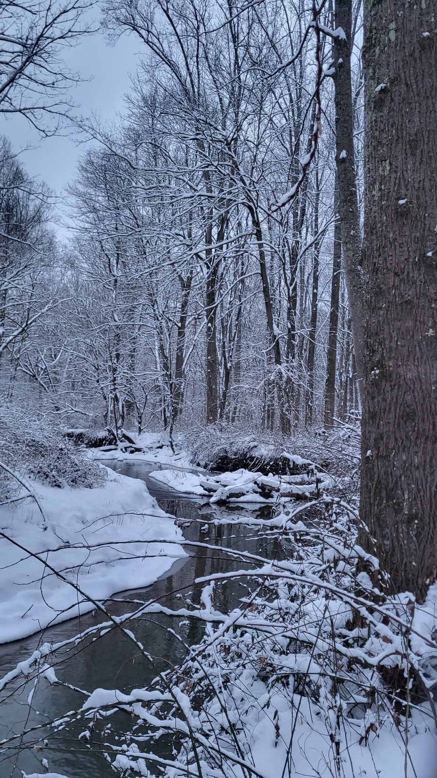
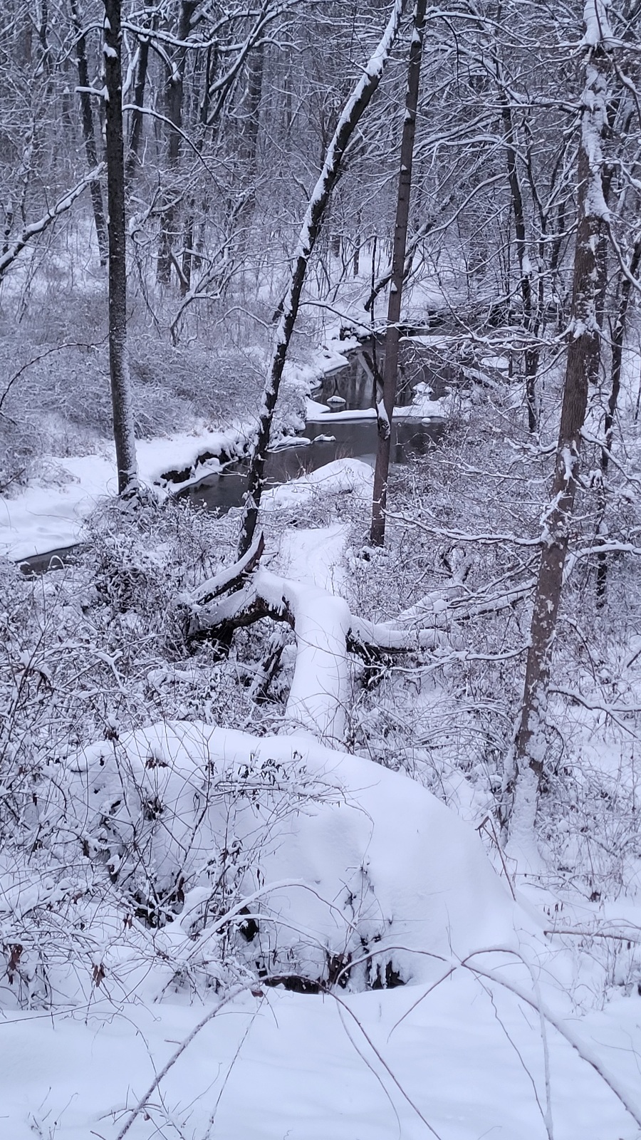
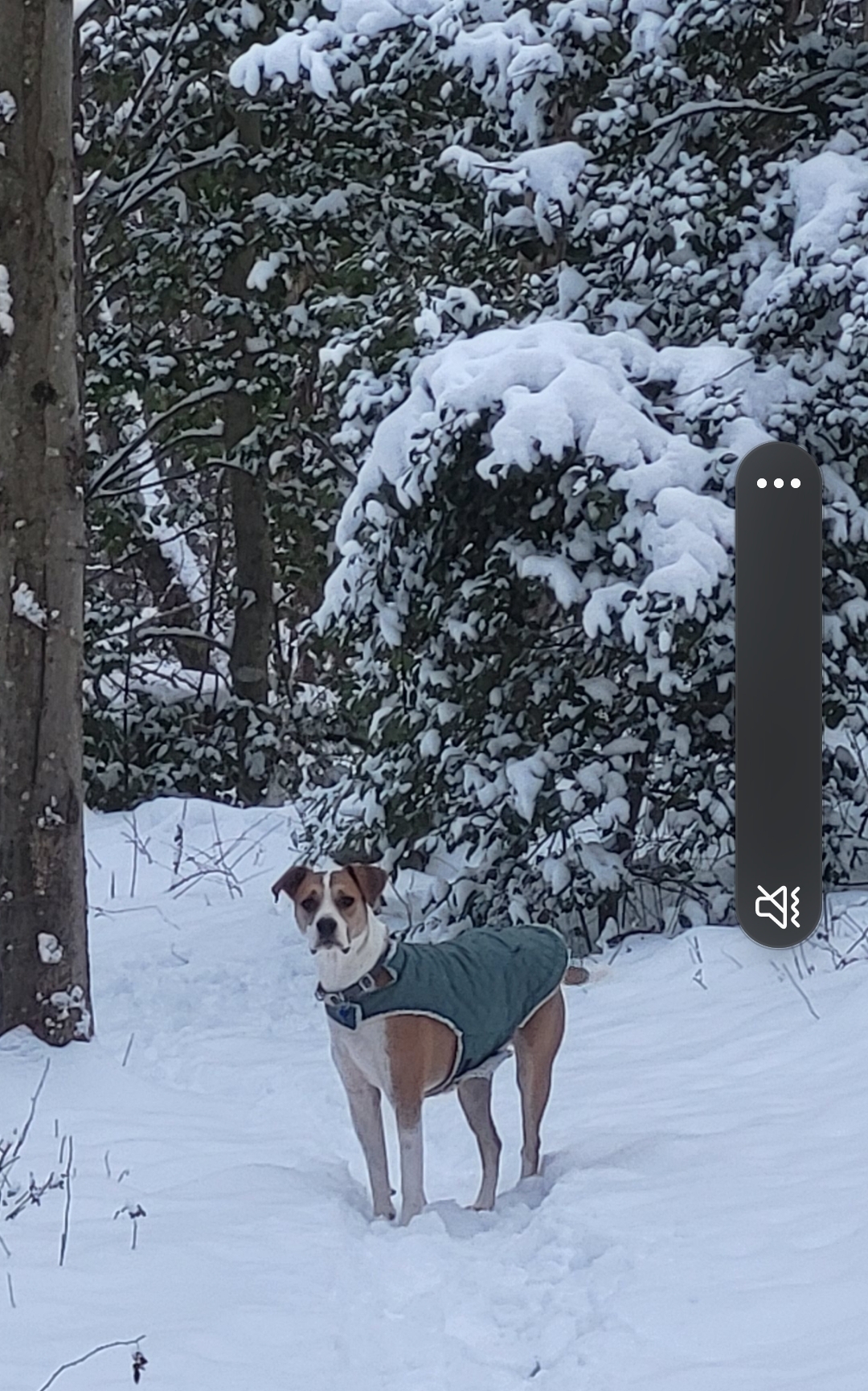
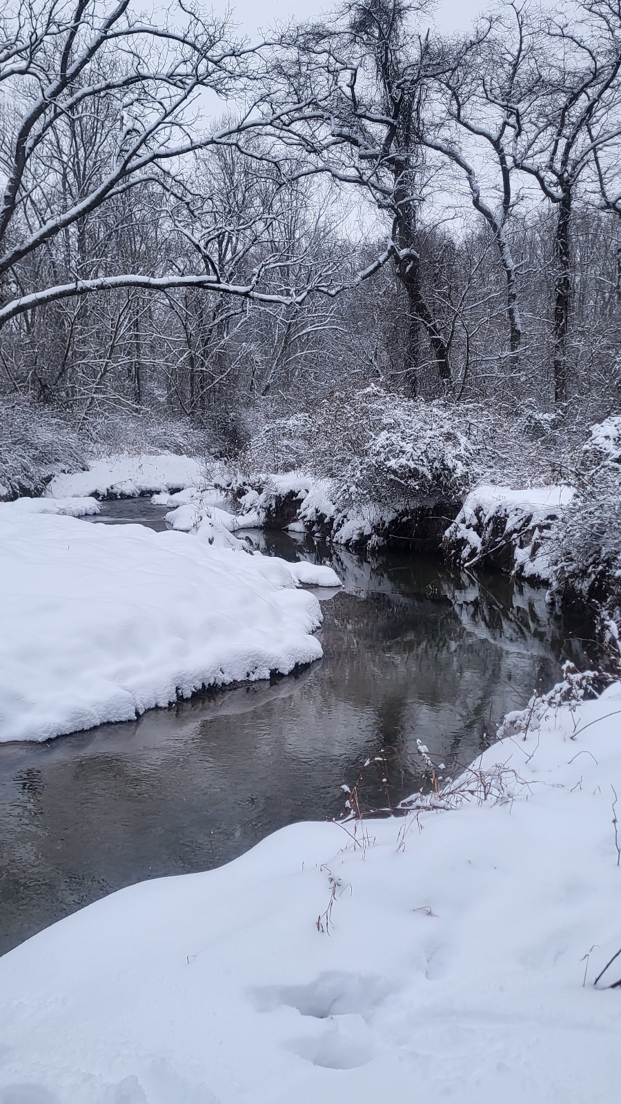
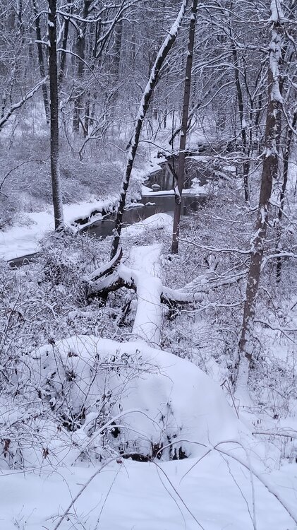
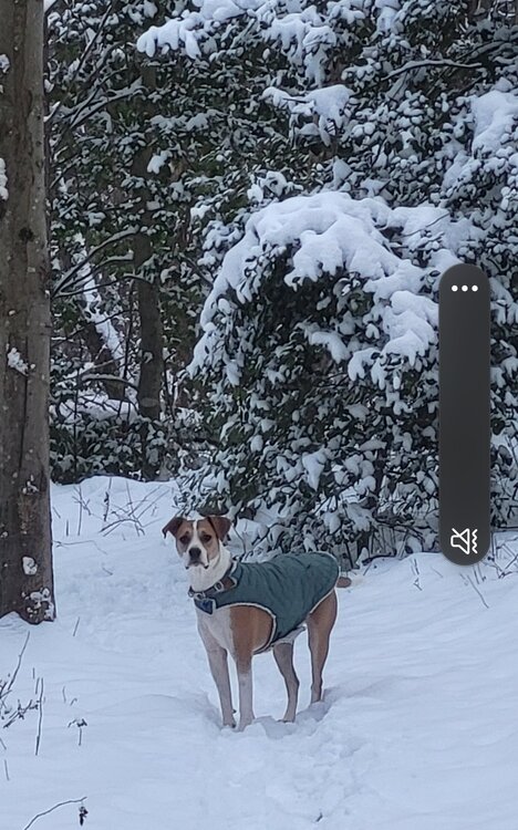
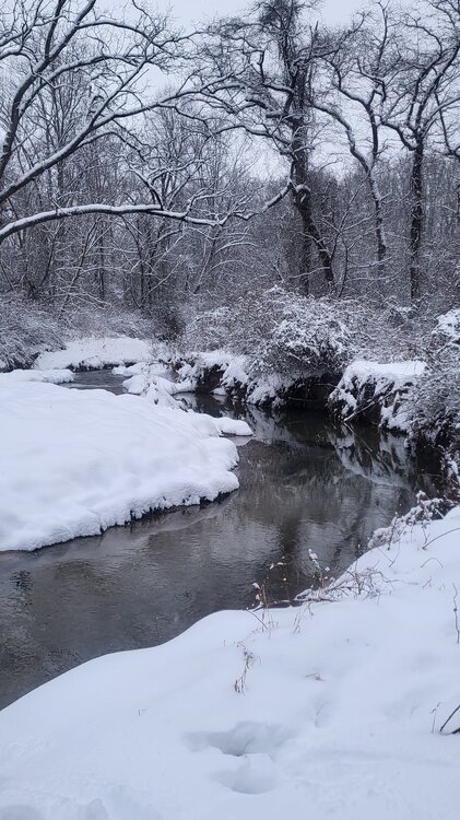
Took the dog out to upper rock creek near the Ag center earlier. What a peaceful and beautiful place to walk. Not a soul out there today.
-
Big storms are the apex of this game but they're too rare to base my satisfaction on. When a real chance shows up I go ape shit like anyone. But the odds are low and the breaks in between are too long. I don't like living my life feeling like I'm missing anything and I enjoy living in the moment more than anything. There were a ton of fun moments over the last week. What a blast
-
Winter appeal and stats are 2 different things. On paper, stats so far look entirely underwhelming. But the appeal of a week of sub freezing snowpacked yards, back to back events, and having them both overperform short range will make this winter for me. I'll remember this week until death or dementia lol
-
4.7" with some compaction. If I knew what I was doing it would prob be 5 lol. Tied with last event. Wow.
-
Popcorn look to radar coming in from WV. Looks light but that look is what I've been expecting. Maybe some brief heavies pop with that stuff.
-
It's a decent shortwave but not enough lift to maximize. We'll see what happens. Current shield is uniform. Stuff rolling in from WV will be a test
-
Interesting radar loop off just off OC. Seems like a meso low. Flow turned east just north of it. Maybe it bombs to 989 before lunch https://weather.cod.edu/satrad/nexrad/?parms=DOX-N0B-0-24-100-usa-rad