eurojosh
-
Posts
2,350 -
Joined
-
Last visited
Content Type
Profiles
Blogs
Forums
American Weather
Media Demo
Store
Gallery
Everything posted by eurojosh
-
Technically doesn't it actually run through DC, with erosion accounting for the current position of Great Falls?
-
Rain downtown DC, natch.
-
Seems doubly odd because virga would bring down temps via mixing, no?
-
Fropa or Faux Pas amiright
-
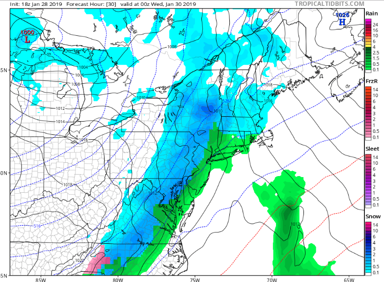
is nobody going to woof about the 18z GFS? NE of Balt in particular is in luck, though there's an embedded line of FRZ amidst the snow for DCA.
-
ICON remains relatively anemic for tomorrow, FWIW. Seems warmer and less dynamic than the NAMs.
-
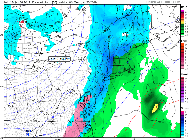
Yes - NAM is a good hit, even after a little rain, plenty of frozen after 20z for the metro region.
-
That's an odd extratropical cyclone hitting northern California next weekend on the GFS...
-
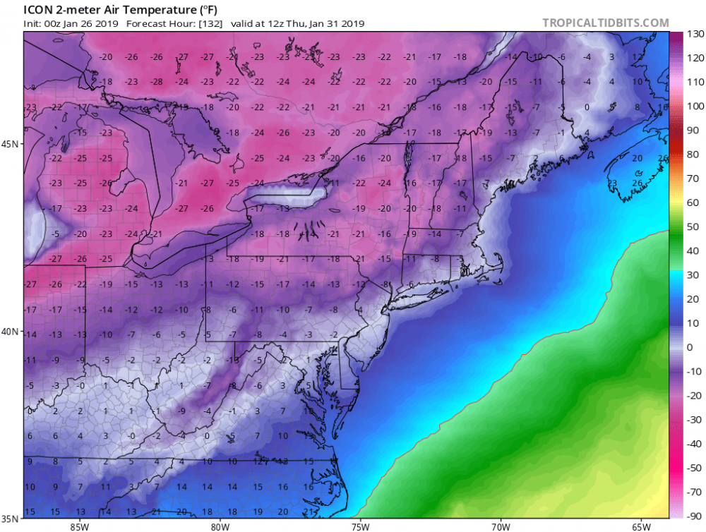
Speaking of which, check out the temps post-passage. Coldest I've seen it here in a long time.
-
That's not not promising... Edit: I'm not saying it's promising either. Just not unpromising. 2nd edit: Not a deep enough LP to do damage, but looks like a decent backside snowfall - am guessing around .1, maybe a little more.

-
I'd call the 6z suite a 'mitigated disaster'. Which is a two letter improvement from the last few runs.
-
Canadian is so close at 120 to giving us a decent Miller B, and then hits the no-snow-dome* around our region, and the LP slips north. *this is the technical term for the feature being described
-
Likewise the Fv3-GFS is very close with back to back snowstorms in that timeframe - it misses north on both occasions, but is enough to stay interested for now.
-
Lol - this is the first time it's shown that solution. But I'd take it in a heartbeat. That's the halfway solution between the 12Z Euro and GFS I was hoping for! Edit - infact, the whole second half of the Fv3 would be acceptable.
-
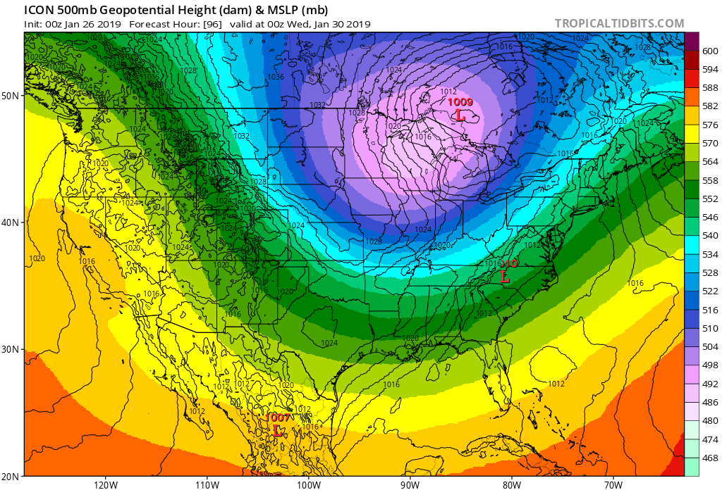
There's a huge difference between the Euro and GFS 500mb charts at hr 192 - GFS has an LP in the GL, Euro has a much deeper system heading OTS off OBX. If means counted for anything we'd be in luck.
-
I can't be the only one lurking until someone with the Euro precip panels chimes in?
-
I'll pray for E16 and put my money on E11.
-
GFS looks tasty af. That's my (non)professional analysis.
-
Healthy system down the line on the CMC... On a weird double-barreled front that has the leading LP in Canada (rain for us) and the trailing low in texas (snow, when it finally moves up the coast).
-
The amount I care about how much rain Boston gets is an inverse function of the amount of snow we get.
-
That is the best GFS run I have seen in days. It literally gives SNE (particularly Boston) nothing but heavy rain.
-
Hmmm. Well it's certainly different to the Canadian. Would like to see that LP stay south of the VA-NC border until it hits the Atlantic.
-
Just got done with a jebdrive around Potomac and Bethesda (not yet enough on the ground for a jebwalk). Couldn't stop in time for my driveway and had to go around the block again. Good times.
-
They have.
-
e18 or bust!