

RippleEffect
-
Posts
244 -
Joined
-
Last visited
Content Type
Profiles
Blogs
Forums
American Weather
Media Demo
Store
Gallery
Posts posted by RippleEffect
-
-
26 minutes ago, forkyfork said:
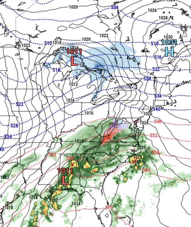
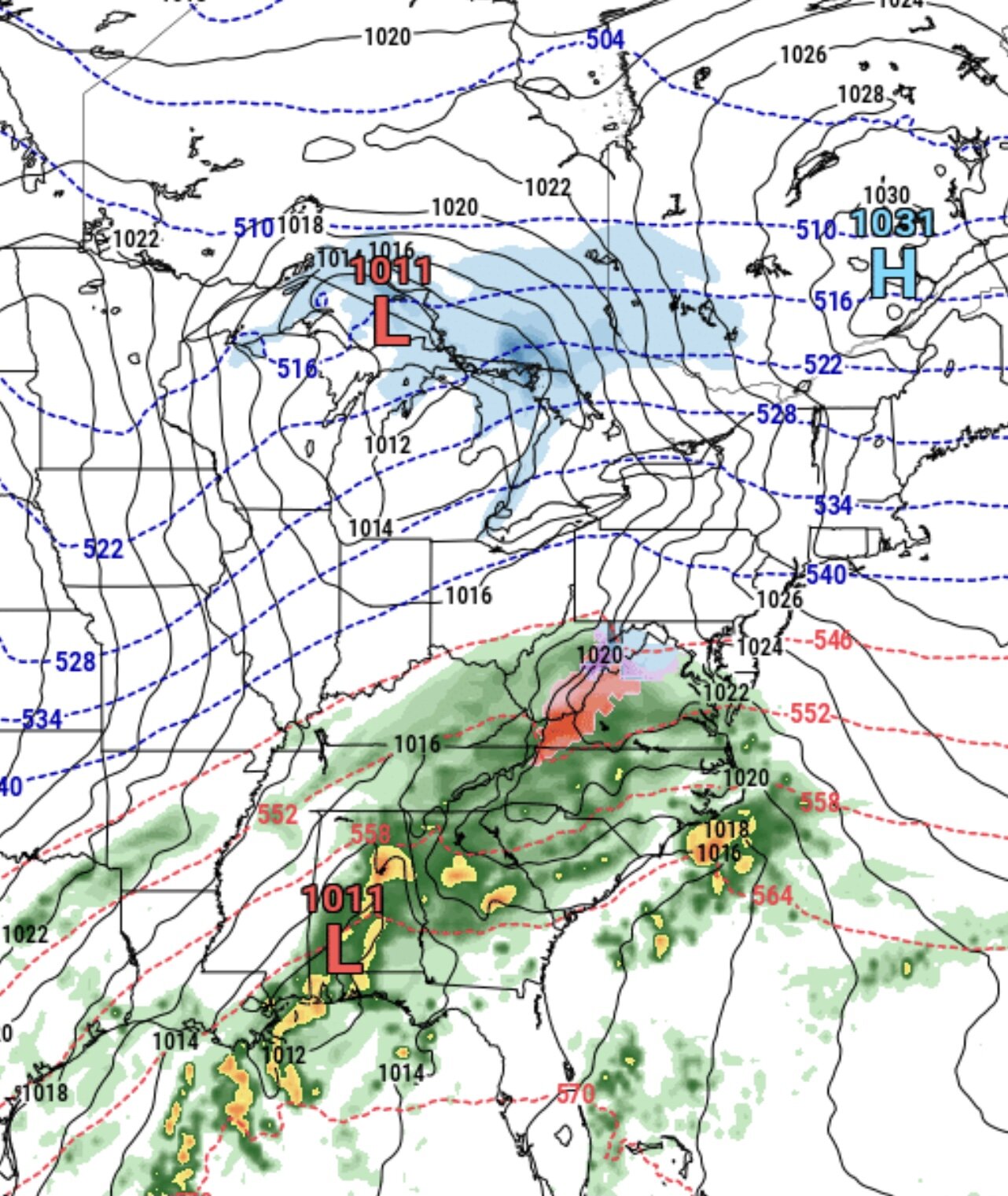
the gfs shows the problem with a -pna. this wave goes south of us but is too weak and we get light rain. the next wave amplifies and cuts too far west


everything trends south this year so this is nowhere near the exact solution! this will change 10 times until it actually happens!
-
 1
1
-
 1
1
-
 3
3
-
-
2 hours ago, jm1220 said:
We have a chance at something decent if the Aleutian ridge can really pop. If it stays too South based the gradient won’t establish far enough south for us and the SE ridge will dominate.
we can still get snow with the southeast ridge if we got polar air just north of here
-
1
-
-
euro shows some potential dight before christmas the problem is the low that's located around the midwest and it's pushing the high that we desperately need otherwise the nor'easter is going to cut!
-
1
-
1
-
-
any severe weather with this guys?
-
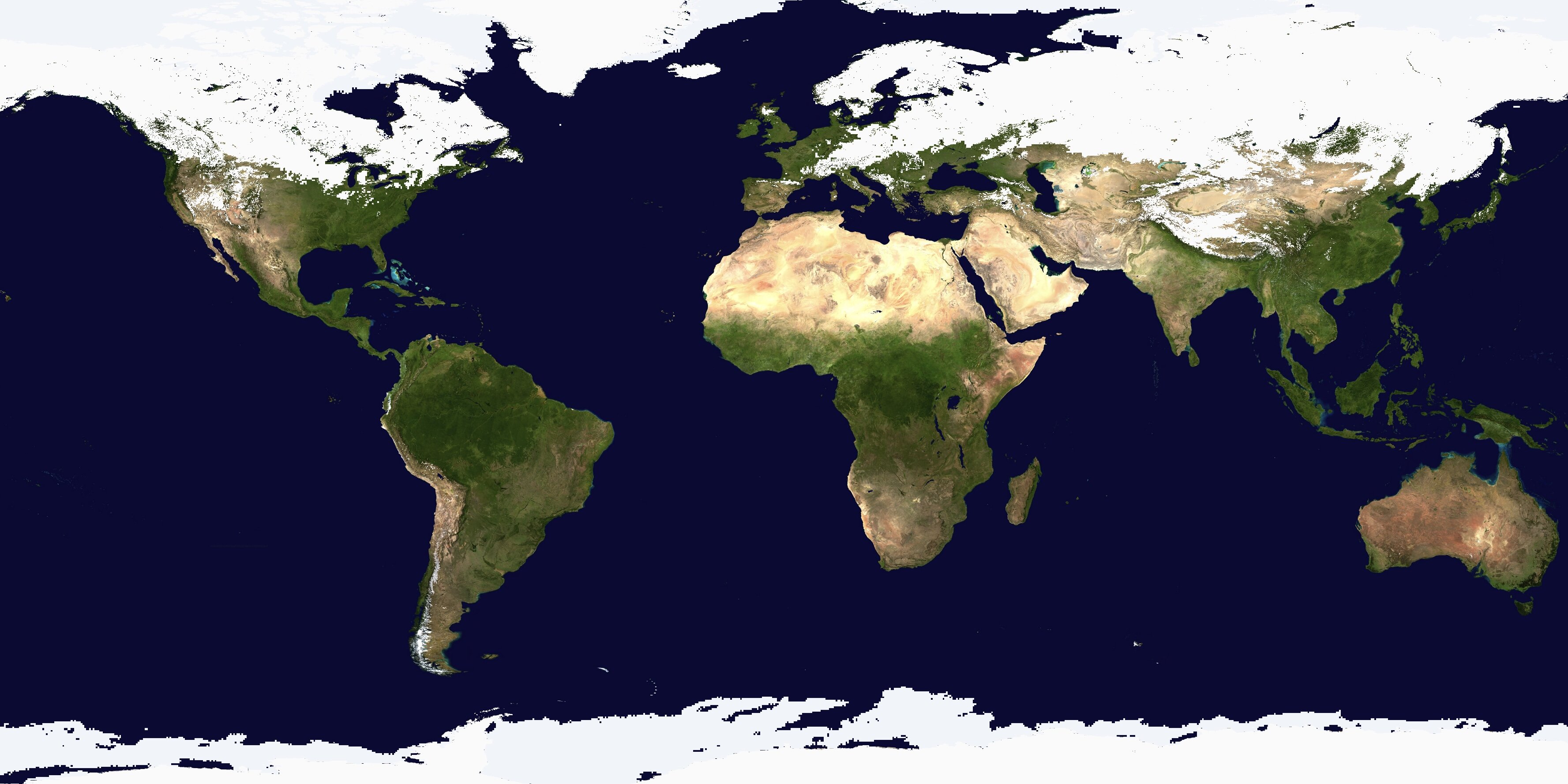
 world snow cover
-
1
-
-
27 minutes ago, SnoSki14 said:
Tornado threat later on?
i honestly believe it, look at this dreary weather it usually spells thunderstorms and or tornadoes!
-
2
-
-
plenty of snow chances after next week. just in time for christmas!
-
2
-
2
-
-
the christmas week from 20th and on looks prime for a big snowstorm here. let me not jinx it (knock on wood) but i think we're going to get a white christmas this year
-
1
-
-
Snowing here lightly but at least we’re getting something!
-
2
-
-
nothing burger?
-
1
-
-
5 hours ago, MJO812 said:
I can't believe we will not even see a flake. Wtf
i think we'll see snow showers tomorrow!
-
1
-
-
I had a feeling this was going to trend south. Everything has been trending south this fall!
-
only 36 hours to go time and we still don't know if we're getting 1-3 or flurries. damn the tech still sucks
-
2 minutes ago, DavisStraight said:
Yes
hope you guys are okay. that sucks man. canadian completely missed
-
5 minutes ago, DavisStraight said:
Me and my wife got hit head on at 45 in Shrewsbury, she almost went through the windshield, to this day she has back problems she never had, I do too but always had them. It was a drunk driver that came into out lane one week after he got out of jail for DUI.
did you sue? i would've. GFS looked better
-
1
-
-
GFS definitely north and a bit more organized. we need the euro to jump in
-
2
-
-
-
1 minute ago, donsutherland1 said:
Moving from a possible coating to an inch to 1”-3” does to translate into a significant snowfall.
i agree the most i see is a slushy inch or two. long island could get a nice surprise if the rates are good
-
1
-
-
3 minutes ago, donsutherland1 said:
From the related article:
Wednesday has the potential to cause a bit of havoc for the tri-state with the chance of the city and surrounding counties seeing "significant" snowfall if the current incoming system stays the course, Storm Team 4 says.
To be blunt, this “Storm Team” should ride the proverbial bench. Three factors argue for a very low probability of significant (6” or greater snowfall):1. The current pattern. The fast flow and absence of blocking will not allow any system to stay around sufficiently long to produce a significant snowfall.
2. The most snowfall for NYC during the December 1-20 period with an EPO+, AO+, PNA- was 4.7”. One would need very strong evidence to set aside historic experience. Such evidence does not exist (see #3).
3. Aside from two GFS runs, the guidance favors a light event. Out of the 51 EPS members, just one shows 3” of snow and 3 show 1” or more. 26 show no measurable snowfall (12/5 12z run).
The headline and article do not serve the NYC area well.
they do that for the views in my opinion. this storm has a "miss" written all over it
-
6 minutes ago, MJO812 said:
LOL

but what's wrong with this post if the storm goes north 50-75 miles we can definitely get a few inches.
-
7 minutes ago, qg_omega said:
Since when? Hasn’t had a storm in days, no data is much better than the GFS with all the data
what does this mean in plain english for us weenies

-
40 minutes ago, snowman19 said:
The new Euro is a complete miss, nothing. Total whiff
time to move on snowman?
-
 1
1
-
1
-
-
23 minutes ago, snowman19 said:
The GFS is laughably horrible. It’s been out in left field since Friday. It’s just finally starting to get a clue now. Full cave to the Euro
so we're getting a warm and sunny winter you think?
-
2 minutes ago, MJO812 said:
Ukie and cmc are really far right
It's funny how many people thought this was going to cut
this year everything has been trending south in days leading up the event i've noticed.
-
2
-


December 2021
in New York City Metro
Posted
agreed wish we had a +PNA that would give us a nice great lakes trough! we'll see what happens. still very far away.