

Chip
-
Posts
72 -
Joined
-
Last visited
Content Type
Profiles
Blogs
Forums
American Weather
Media Demo
Store
Gallery
Posts posted by Chip
-
-
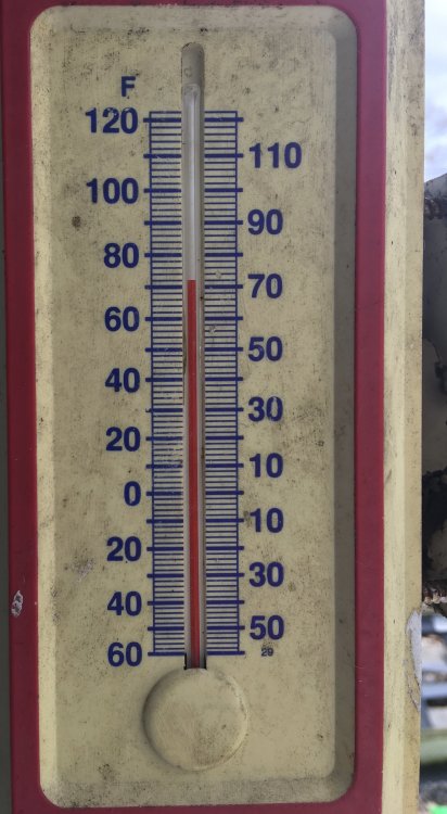
Here is the temp in middle TN at 1:40pm with sun out.
-
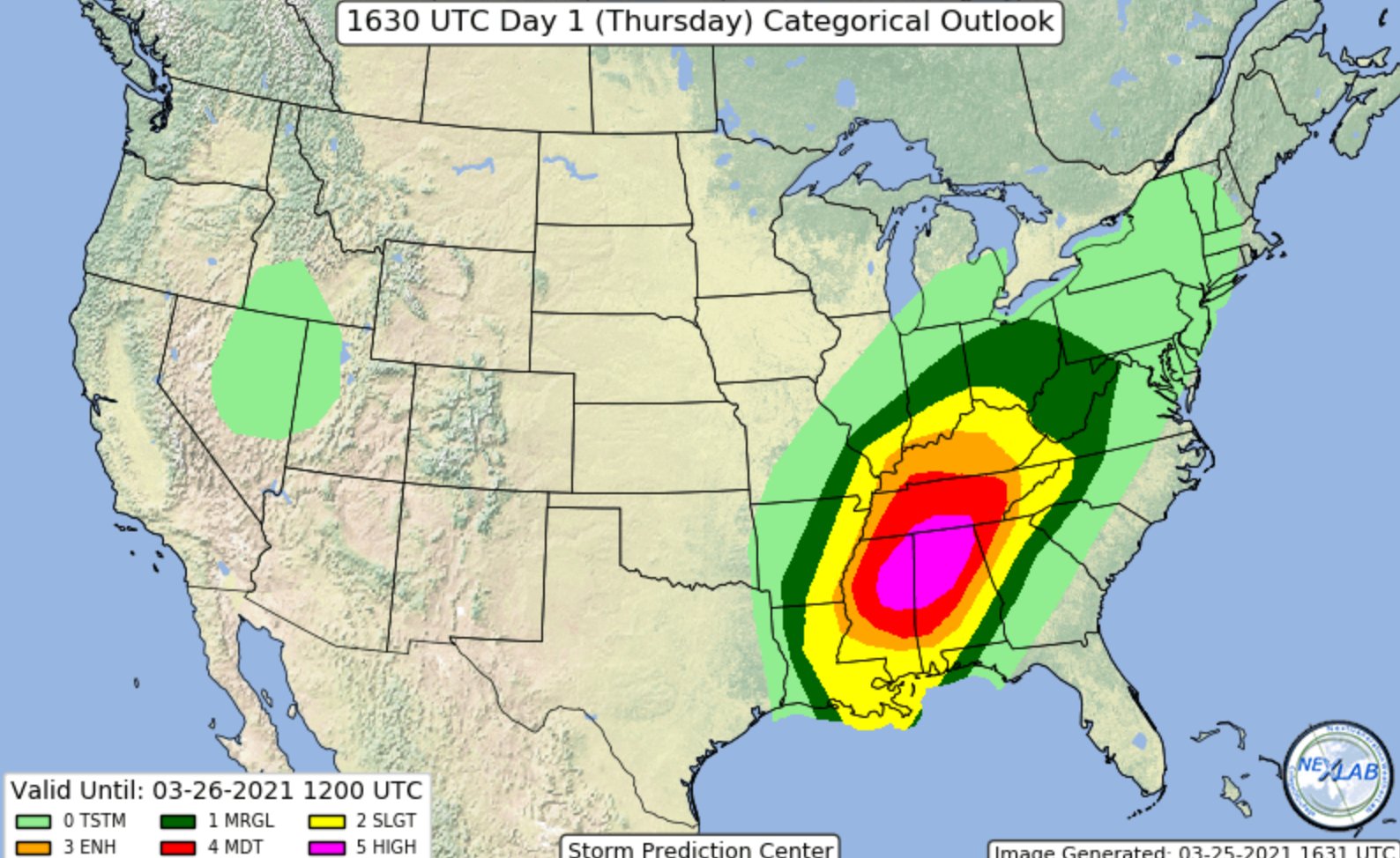
Well here is the new update

-
1 minute ago, jaxjagman said:
Yes it will
Well let’s hope it doesn’t! New SPC outlook due shortly as well
-
Just now, Chattownsnow said:
Things are clearing out a decent bit to our west. I don’t know how well that translates further east but we get any kind of clearing or partly cloudy skies and I think everyone on the forum knows what that means.
That’s irrelevant. If you read the discussion from the SPC they specify that the warm air surging north would override the lack of sun heating. Honestly I don’t think the warm front makes it through TN and I don’t think we see much here. Now Alabama.... have fun
-
Just now, Matthew70 said:
Oh heck no
This outcome would be terrible but I would hint this solution would be on he upper end when looking at others
-
1 minute ago, dwagner88 said:
Is. . . is that crayon?
Yes
-
This just hit me.... With the SRH values as insane as they are isn’t it feasible the updrafts are so strong they rip themselves apart...
-
1 minute ago, olafminesaw said:
If there's any consolation, it's that the primary threat area is centered over the least populous part of that region. Of course all those bigger cities in the moderate/enhanced are certainly quite at risk as well, but a silver lining nonetheless
Also storms don’t follow lines on a map. Unfortunately if any of these storms do go tornadic then from what I am gathering they will be long trackers this may extend into the moderate zone especially.
-
 1
1
-
-
-
2 minutes ago, jaxjagman said:
3kNAM is showing what Jeff said up above.The OFB starts to work its way up from MS/AL.In the mean time a inverersion will be into place late morning into early afternoon,this inversion will break early afternoon and the storms should start to explode mid afternoon
Do you think they extend that high end area any or do you feel like mostly TN will stay moderate risk?
-
Concerning? Very! Is there anything at all at this point that could throw a wrench in this?
-
2 minutes ago, jpeters3 said:
After the brief lull at 00Z, the HRRR is back to apocalypse mode. Pretty scary convergence of model guidance on what looks like a a worst case scenario...
So what is the ceiling here?
-
So I have some good news… At least temporarily… The new HRRR model came in and has tons of convection that should hamper this event if this verifies! Cross your fingers
-
Just now, jaxjagman said:
Where are you?
I am in middle TN
-
1
-
 2
2
-
-
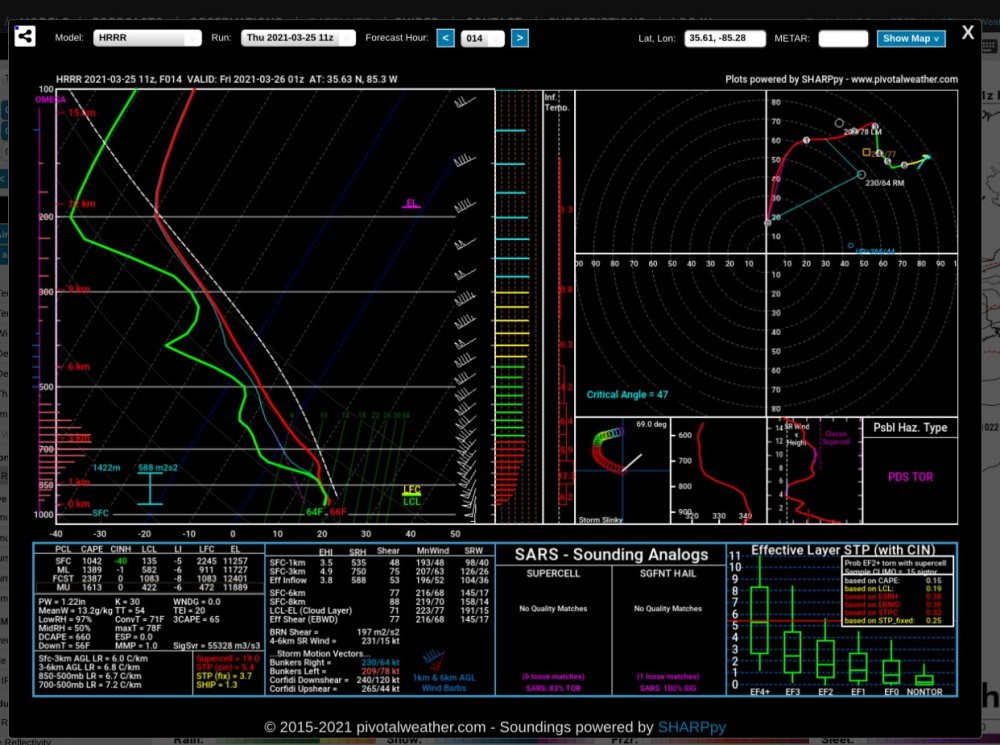
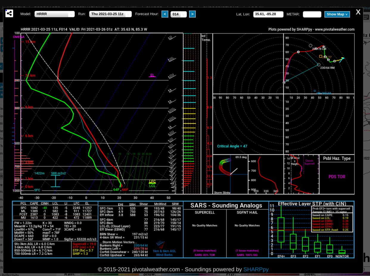
Well I really hope we do get junk convection in the morning that throws a wrench into this. I see this going very high end or bust completely. I just don’t feel we will get anything between.. Check out this sounding..... nasty
-
6 minutes ago, VOLtage said:
I’m wondering, if the current trends hold, more of East Tennessee could end up in an enhanced risk.
Honestly I hope we wake up to lots of mess on the radar to hamper this event. This could be historic if this were to verify. Trust me you don’t want this to verify!
-
 1
1
-
-
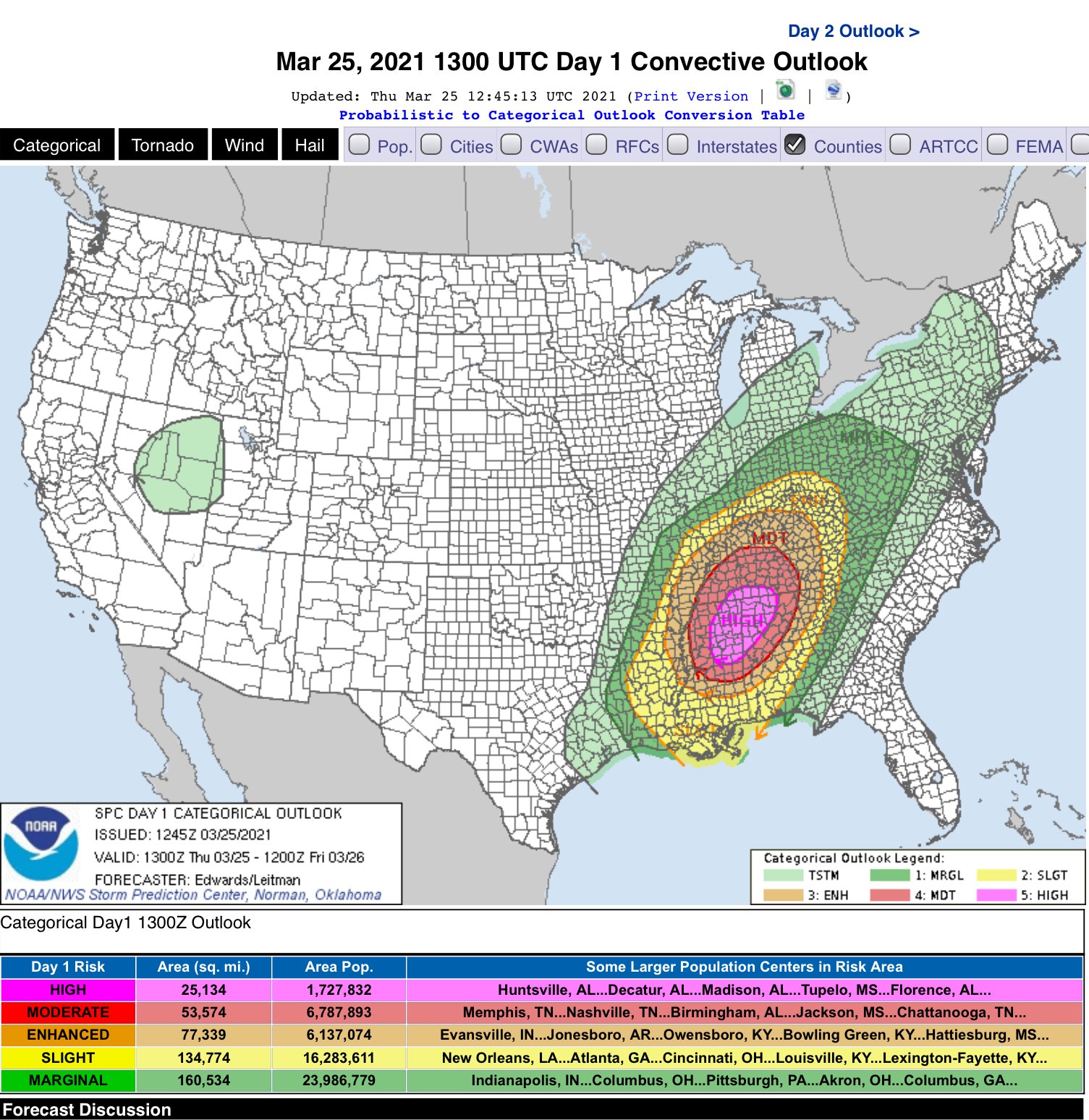
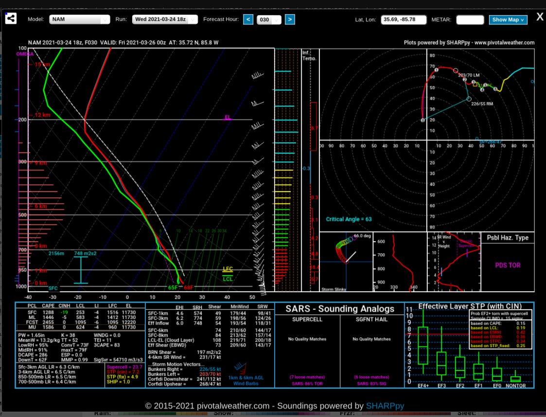
18Z Run here

-
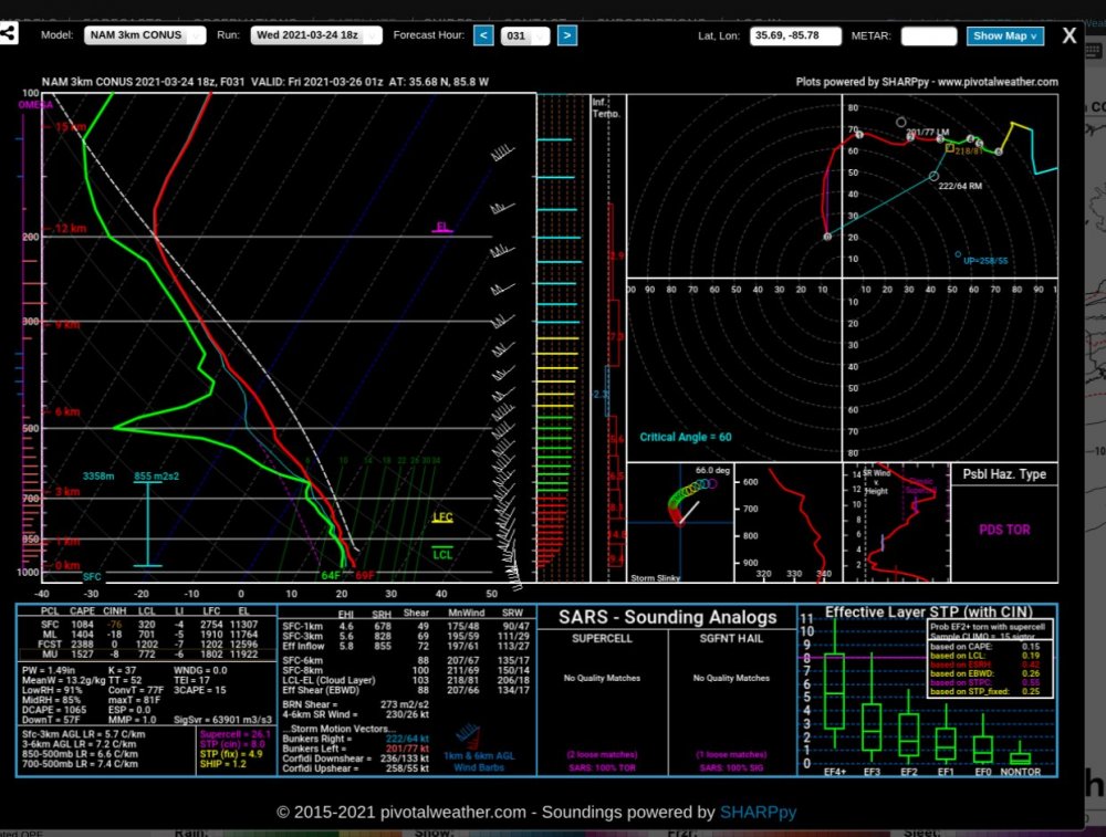
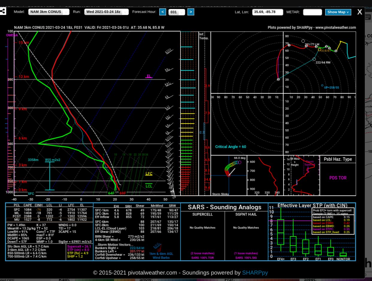
The NAM is not backing down!
-
 1
1
-
-
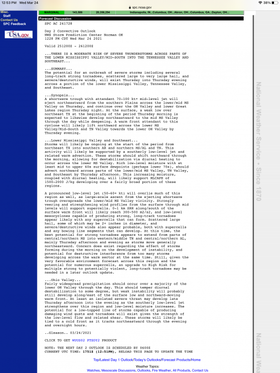
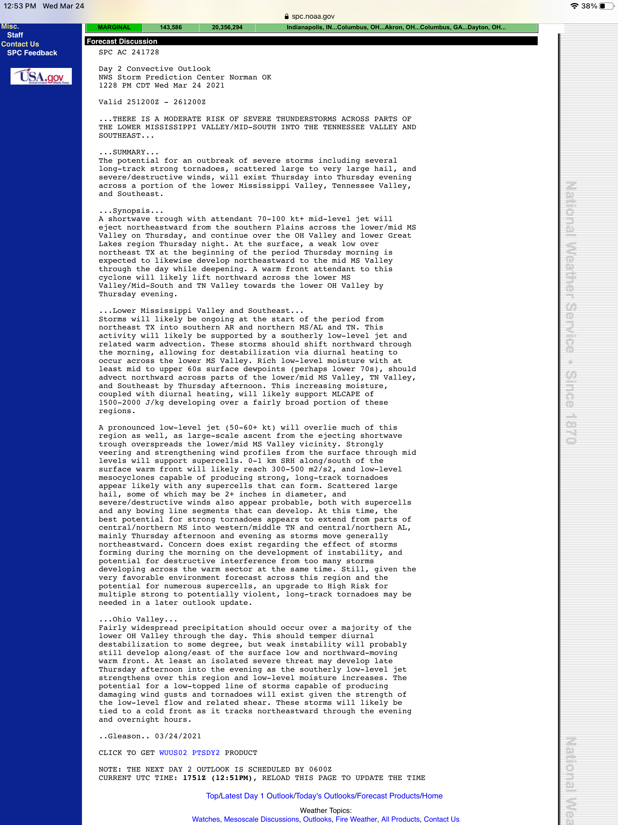
Here is the wording from the SPC... take I get is game on if we get sun in the morning tomorrow... if we get sun high risk could verify
-
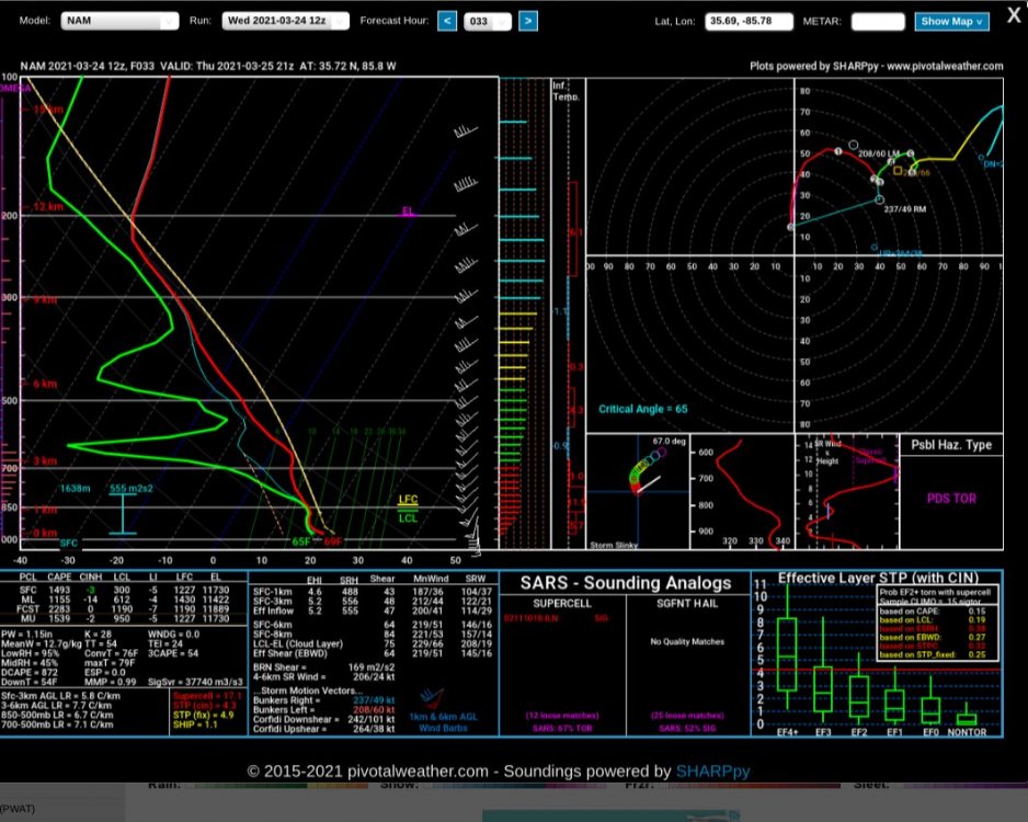
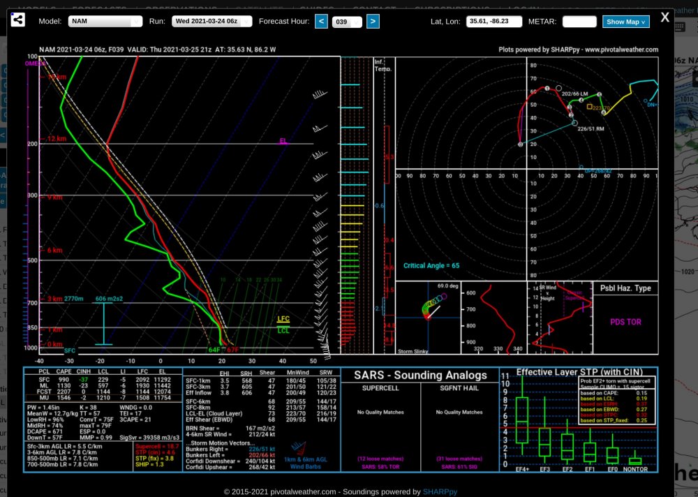
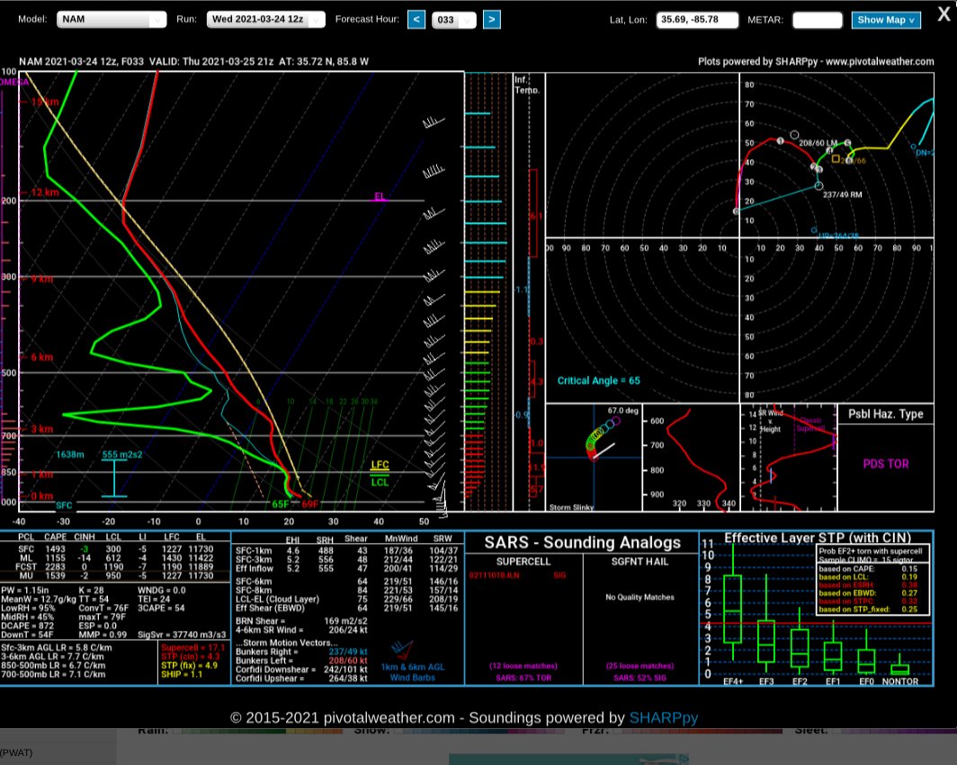
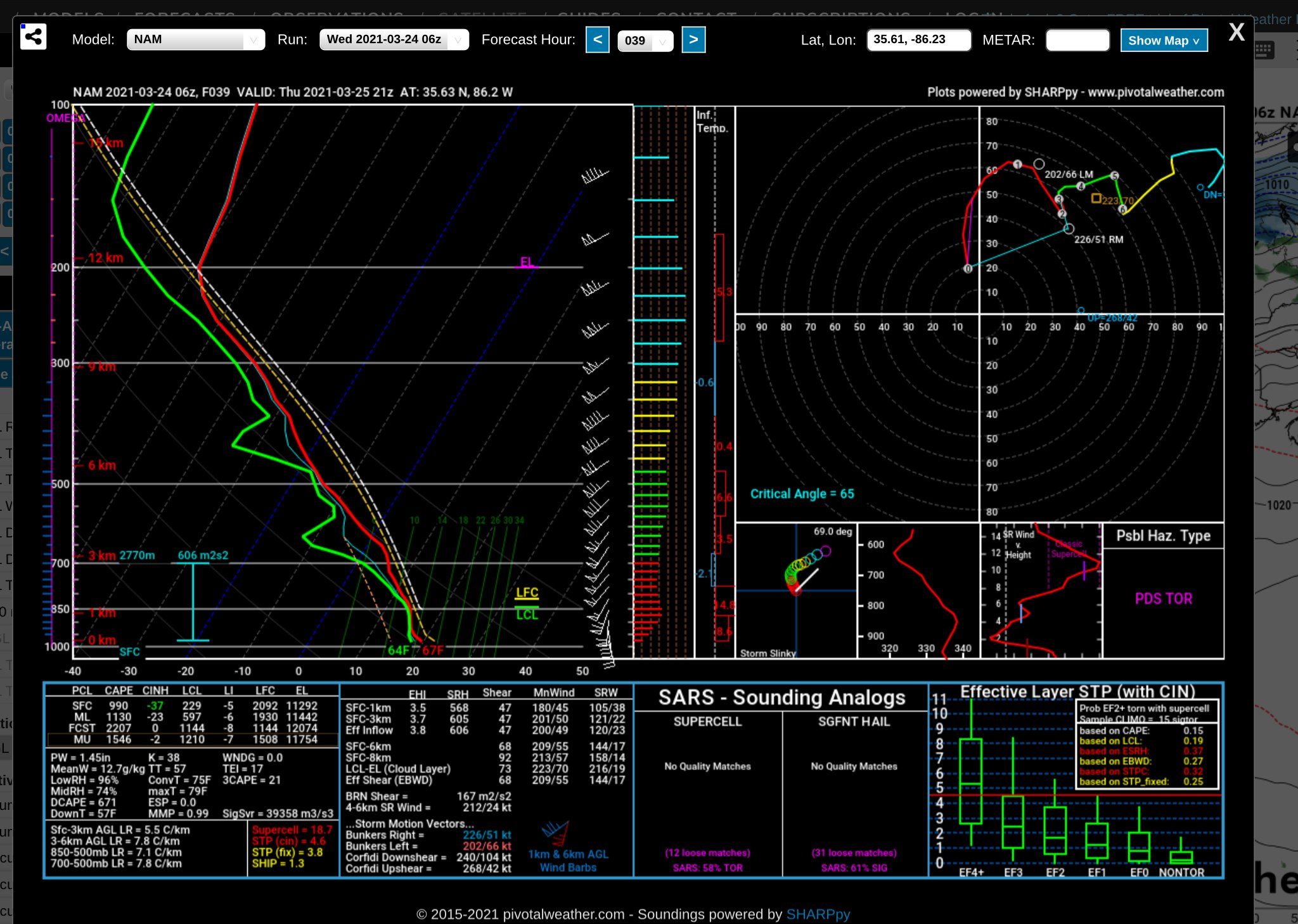
Forecast sounding off the NAM for middle TN
-
1
-
-
After looking at several models it appears to me that both TN and AL are in the crosshairs for this system? My big question further north into TN based off the atmosphere being able to sufficiently recover. Those STP values are crazy high but does anyone else think they are a bit over done?
-
1
-

March 25, Thursday Severe Weather
in Tennessee Valley
Posted
I agree... I think TN is out of this... MS and AL will have a few tornadoes