

Cambria County Wx
-
Posts
44 -
Joined
-
Last visited
Content Type
Profiles
Blogs
Forums
American Weather
Media Demo
Store
Gallery
Posts posted by Cambria County Wx
-
-
10 hours ago, MAG5035 said:
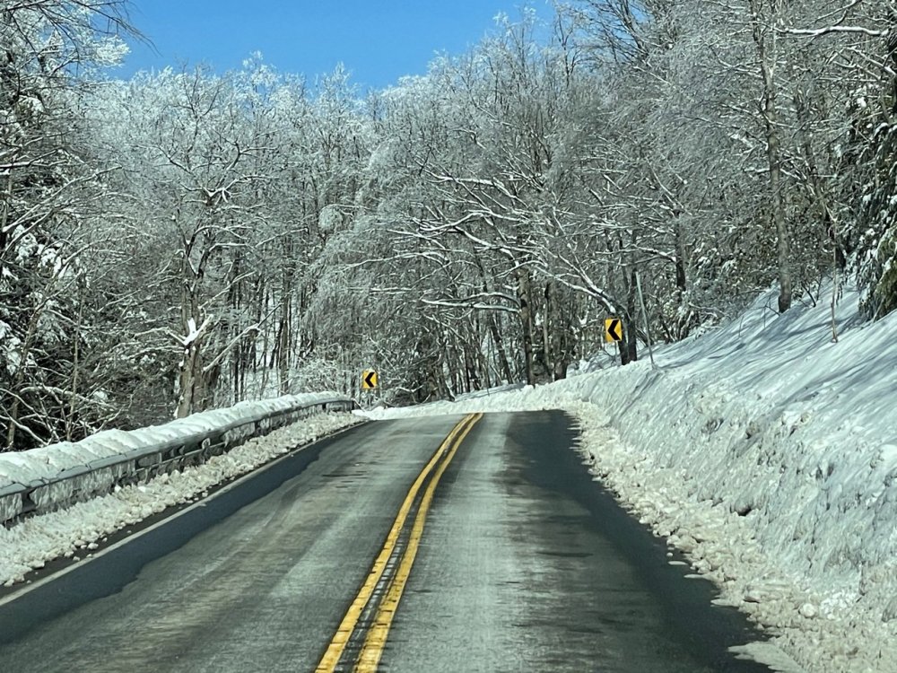
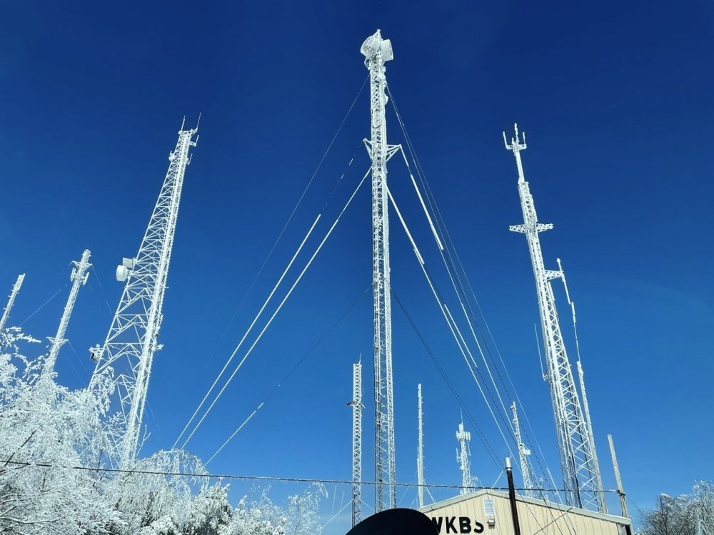
I did just that not too long ago, it definitely didn’t disappoint haha. It really sticks out with the clear skies today, I wish I could load the full quality pics on here. It’s always wild the difference 4 miles and 1100’ of elevation makes.
Top of Wopsononock Mtn west of Altoona
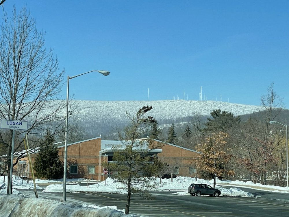


Never knew that many people lived up there, impressive. Nice pics MAG. I bet the Buckhorn looked a lot like that at some point.
-
Been real busy working, but ended up with about 2.5 inches for Thursday's event and received about 2 inches of upslope snows on Friday-Saturday timeframe. Looking at a solid snow event tomorrow. I'm feeling 3-5 inches my guess for my area.
-
Very light snow falling here.
-
Nothing here yet. 21 degrees
-
For everyone else:
URGENT - WINTER WEATHER MESSAGE
National Weather Service State College PA
239 PM EST Wed Feb 17 2021

PAZ024>026-033-034-181245-
/O.UPG.KCTP.WS.A.0007.210218T0600Z-210219T1500Z/
/O.NEW.KCTP.WW.Y.0015.210218T0600Z-210219T1500Z/
Cambria-Blair-Huntingdon-Somerset-Bedford-
Including the cities of Johnstown, Altoona, Huntingdon,
Mount Union, Somerset, and Bedford
239 PM EST Wed Feb 17 2021

...WINTER WEATHER ADVISORY IN EFFECT FROM 1 AM THURSDAY TO 10 AM
EST FRIDAY...

* WHAT...Snow expected. Total snow accumulations of 4 to 6
  inches.

* WHERE...Cambria, Blair, Huntingdon, Somerset and Bedford
  Counties.

* WHEN...From 1 AM Thursday to 10 AM EST Friday.
URGENT - WINTER WEATHER MESSAGE
National Weather Service State College PA
239 PM EST Wed Feb 17 2021

PAZ012-017>019-027-028-037-041-042-045-046-049>053-181245-
/O.UPG.KCTP.WS.A.0007.210218T0900Z-210219T1500Z/
/O.NEW.KCTP.WW.Y.0015.210218T0600Z-210219T1500Z/
Northern Clinton-Clearfield-Northern Centre-Southern Centre-
Mifflin-Juniata-Tioga-Northern Lycoming-Sullivan-Southern Clinton-
Southern Lycoming-Union-Snyder-Montour-Northumberland-Columbia-
Including the cities of Renovo, DuBois, Clearfield, Philipsburg,
State College, Lewistown, Mifflintown, Mansfield, Wellsboro,
Trout Run, Laporte, Lock Haven, Williamsport, Lewisburg,
Selinsgrove, Danville, Sunbury, Shamokin, Bloomsburg, and Berwick
239 PM EST Wed Feb 17 2021

...WINTER WEATHER ADVISORY IN EFFECT FROM 1 AM THURSDAY TO 10 AM
EST FRIDAY...

* WHAT...Snow expected. Total snow accumulations of 4 to 6
  inches.

* WHERE...Portions of central Pennsylvania.

* WHEN...From 1 AM Thursday to 10 AM EST Friday.
-
For the LSV crew
URGENT - WINTER WEATHER MESSAGE
National Weather Service State College PA
239 PM EST Wed Feb 17 2021

PAZ036-056>059-063>066-181245-
/O.UPG.KCTP.WS.A.0007.210218T0900Z-210219T1500Z/
/O.NEW.KCTP.WS.W.0005.210218T0600Z-210219T1500Z/
Franklin-Perry-Dauphin-Schuylkill-Lebanon-Cumberland-Adams-York-
Lancaster-
Including the cities of Chambersburg, Newport, Harrisburg,
Hershey, Pottsville, Lebanon, Carlisle, Gettysburg, York,
and Lancaster
239 PM EST Wed Feb 17 2021

...WINTER STORM WARNING IN EFFECT FROM 1 AM THURSDAY TO 10 AM EST
FRIDAY...

* WHAT...Heavy snow expected along with a light glaze of ice.
  Total snow accumulations of 6 to 9 inches and ice accumulations
  of a light glaze.

* WHERE...Portions of central Pennsylvania.

* WHEN...From 1 AM Thursday to 10 AM EST Friday.

* IMPACTS...Travel could be very difficult. The hazardous
  conditions could impact the morning or evening commute.

* ADDITIONAL DETAILS...A period of sleet mixed with freezing rain
  is possible late Thursday afternoon which may produce a light
  glaze of ice.

PRECAUTIONARY/PREPAREDNESS ACTIONS...
-
 1
1
-
 1
1
-
-
Good afternoon everyone. I can't believe how bright it is outside. There's this bright ball in the sky....haven't seen it around for awhile. How is the storm looking?
-
After getting up to 37 this morning and melting some of the ice, it quickly got cold and windy here about lunch time. Like clockwork the upslope snows kicked in and picked up a fresh .5 - 1 inch of wind blown powder. Roads are getting rough again and the temperature is 19.
-
2
-
-
I went outside, wind has picked up and things are starting to melt.
-
6 minutes ago, MAG5035 said:
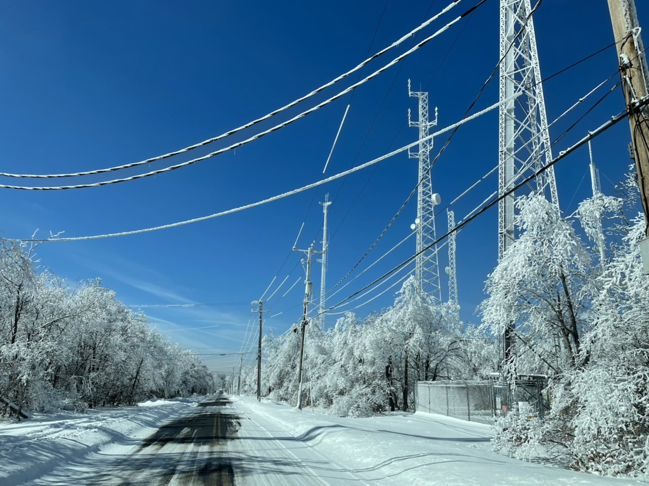
Starting to notice the ice on the trees some now. P-type is mainly freezing rain with temp floating 32ish. Do have a fairly stiff SSE breeze now, which may help mix temps up a degree or two (KAOO at 34ºF). The wind probably won't help matters on the ridges though, where the bigger ice accumulations likely will be.
Temp here has made it up to 34 now with rain with an occasional ping or two. I can see a solid glaze on the power lines. With KIDI at 36 and KJST at 30 most likely most lower elevation places probably sitting at 32 or 33. Curious to see how many places got pure freezing rain.
-
Precip is tapering off for now, still hearing sleet pinging.
-
Heavy sleet, very loud pinging temperature is up to 30 now.
-
Update....pretty much all sleet here. Roads are covered and powerlines have a glaze on the wires here.
-
2 minutes ago, MAG5035 said:
Hopefully we can stay more sleet for a good bit of this event. Looking at the dual pol products on the radar with the higher tilts it looks like the mixing layer is still pretty high up.. roughly about the 4,000ft level (up closer to the 850mb level). So that gives a good bit of time for droplets to refreeze thru the colder 925mb level to the surface.
Agree. I'm encouraged that KIDI is sitting at 32 right now. Have to watch them to see how strong the warm push is.
-
11 minutes ago, MAG5035 said:
Looks like a pretty heavy area of precip about ready to get to your neck of the woods within the next 30 min.
Yeah, it's moving in now, definitely trying to become more sleet.....close to 70/30, 80/20 than earlier.
-
7 minutes ago, Voyager said:
Too late. Stuck on the ramp to I-81 north. I was going to Tomhicken for another load, but a multi vehicle wreck shut down the freeway...

That sucks. Stay safe.
-
Just went outside to bring in jugs of water, more sleet than freezing rain now...60/40. Cars are getting covered in ice, almost slipped.
-
Sleet is mixing in with the freezing rain now.
-
Light freezing rain has started 28 degrees
-
33 minutes ago, MAG5035 said:
Yea it's def attainable in the warning area. The main consequences of the models trending NW the last several runs are aloft, with much more robust warming at the 850mb and 925mb level, especially looking at today's runs. Surface CAD is still about the same which will maintain freezing rain, and I know it's above freezing in some spots right now but dew points are mostly in the 20s and this is coming overnight as well.
I'm hoping more sleet is able to nose down and knock freezing rain down some here. This is my point and click for tonight, then 12ºF for a low tomorrow night, ugh.
I'm really hoping for more sleet also. Plus I'm banking on hopefully crawling to the freezing mark. Usually around here the real bad ice is confined to Ebensburg, Cresson, Coupon, Richland areas due to higher elevation....usually we sneak above freezing due to our lower elevation(1594). But hoping that holds true.
-
Moderate snow falling here. Looks like maybe a coating so far. Not looking forward to all the sleet and freezing rain tonight.
-
3 minutes ago, MAG5035 said:
Looked like that upper band of snow is still over Northern Cambria on radar, not getting anything?
After reading your quote, I turned on the outdoor spotlight and see that it's snowing very lightly.
-
Snow has ended here. Looks like about 1.5 maybe a little more. Just missed the best snows by about 5-10 miles.
-
Really nice band to my south close to 22. Moving towards Altoona and Huntingdon.


Central PA - Winter 2020/2021 Part 2
in Upstate New York/Pennsylvania
Posted
Ended up with just about 4 inches here, but now its raining and the temperature is 36.