
.jpg.0d116cf1ef87110697ff67fc9ad286ea.jpg)
BYG Jacob
-
Posts
156 -
Joined
-
Last visited
Content Type
Profiles
Blogs
Forums
American Weather
Media Demo
Store
Gallery
Posts posted by BYG Jacob
-
-
-
-
-
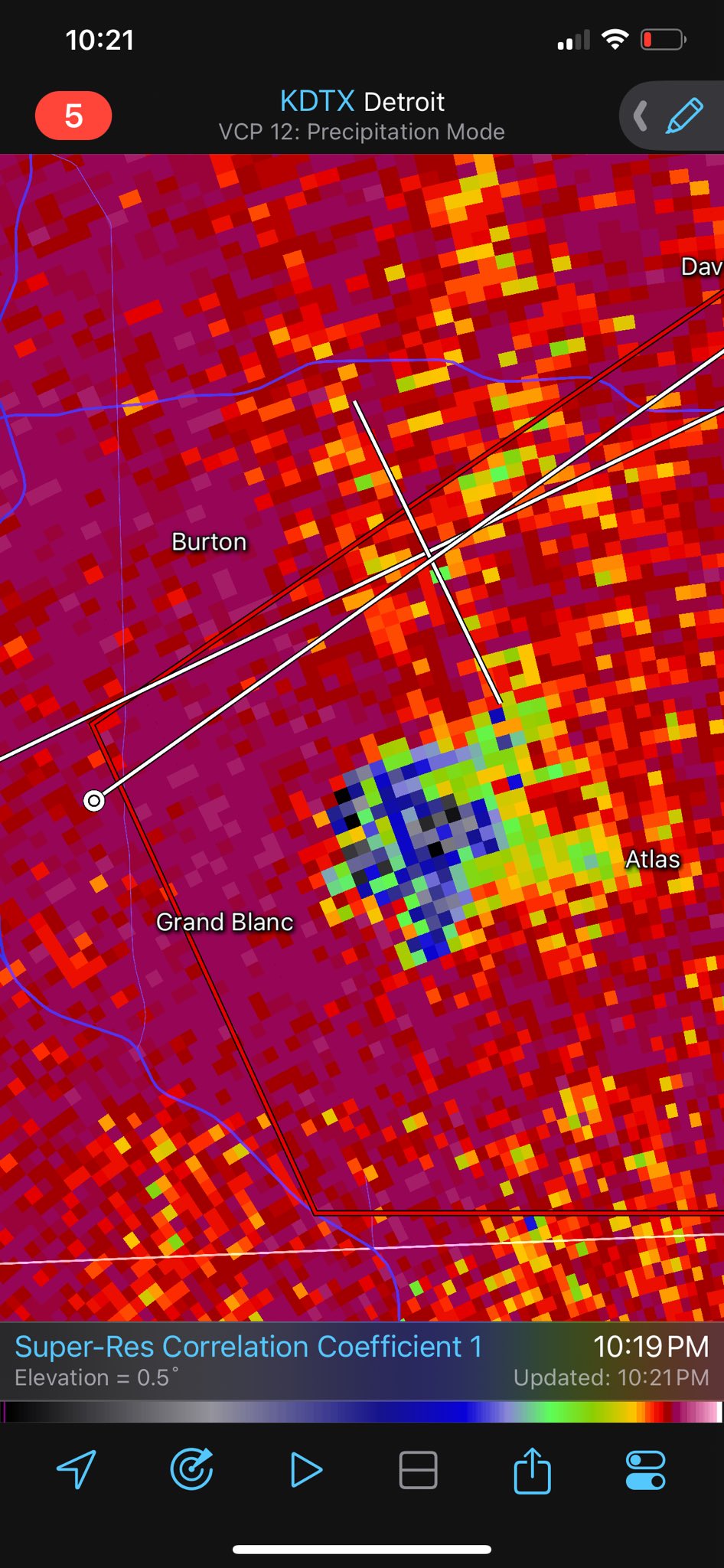
That's a crazy TDS
-
24 minutes ago, Radtechwxman said:
You're pushing it just a bit man. Far from a violent tornado signature. But definitely a damaging tornado at night which is still dangerous regardless.
I was reacting too quickly to the donut hole. That looked pretty strong.
-
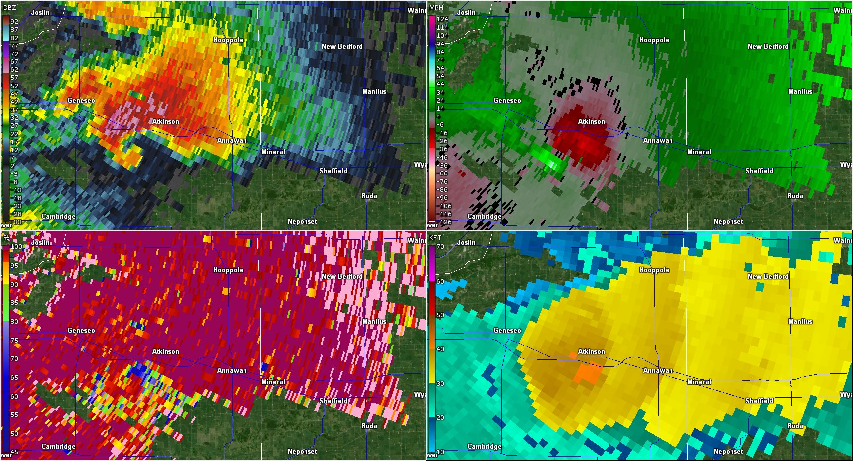
I think that's a violent tornado
-
-
Donut hole alert for Battle Creek.
-
20 minutes ago, frostfern said:
I really should not have dismissed the possibility of tornadoes at night.
 Rotation headed straight for Battle Creek is nasty.
That looks like an absurdly large and powerful tornado.
-
-
-
-
How many tornadoes is that cell producing?
-
Rope on Ryan Hall's stream
-
21 minutes ago, SchaumburgStormer said:
And it’s T warned
That looks pretty nasty
-
-
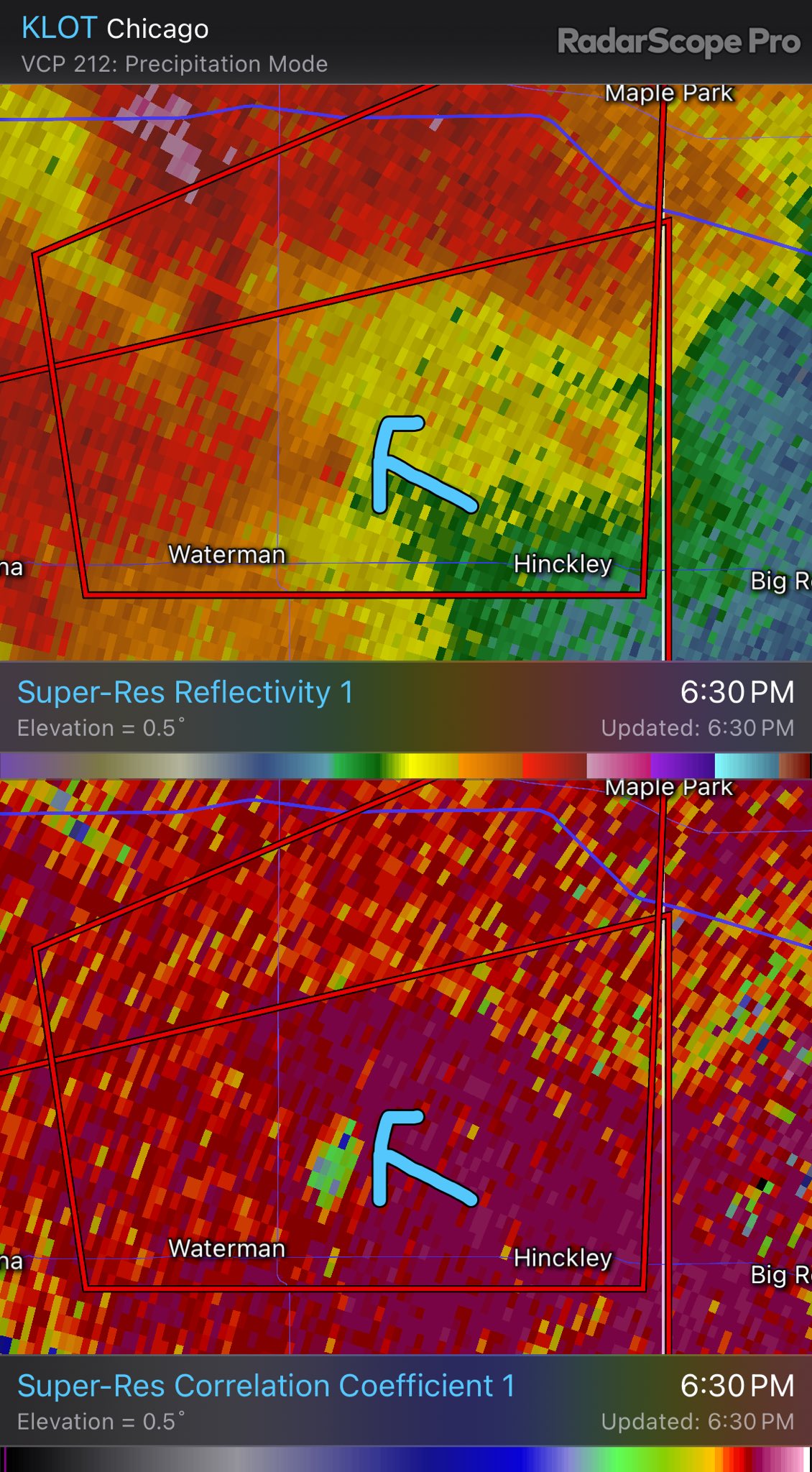
Looks like a TDS
-
-
19 minutes ago, GaWx said:
Latest models are pretty unimpressive. That includes the 12Z UKMET, which has no TCG.
This one has way too much time under little shear and very high OHC. I don't know what the models are seeing.
-
Models are out to lunch on this one.
-
25 minutes ago, StormChaser4Life said:
Looks like eye started to fill right before landfall. May have weakened ever so slightly probably from land interaction with mountainous terrain. But NHC called it a 165mph landfall
Satellites do not accurately show the position of a storm dude
-
25 minutes ago, NJwx85 said:
Hurricane models showed this nicely. Huge expansion of wind field and truck tire eye. Not much strengthening though due to larger size.
A lot less weakening though, Canada and NE may be in for a really bad time.
-
First time I've seen Idalia with intense convection around the entire eyewall
-

On the cusp of becoming a major hurricane
-
 2
2
-
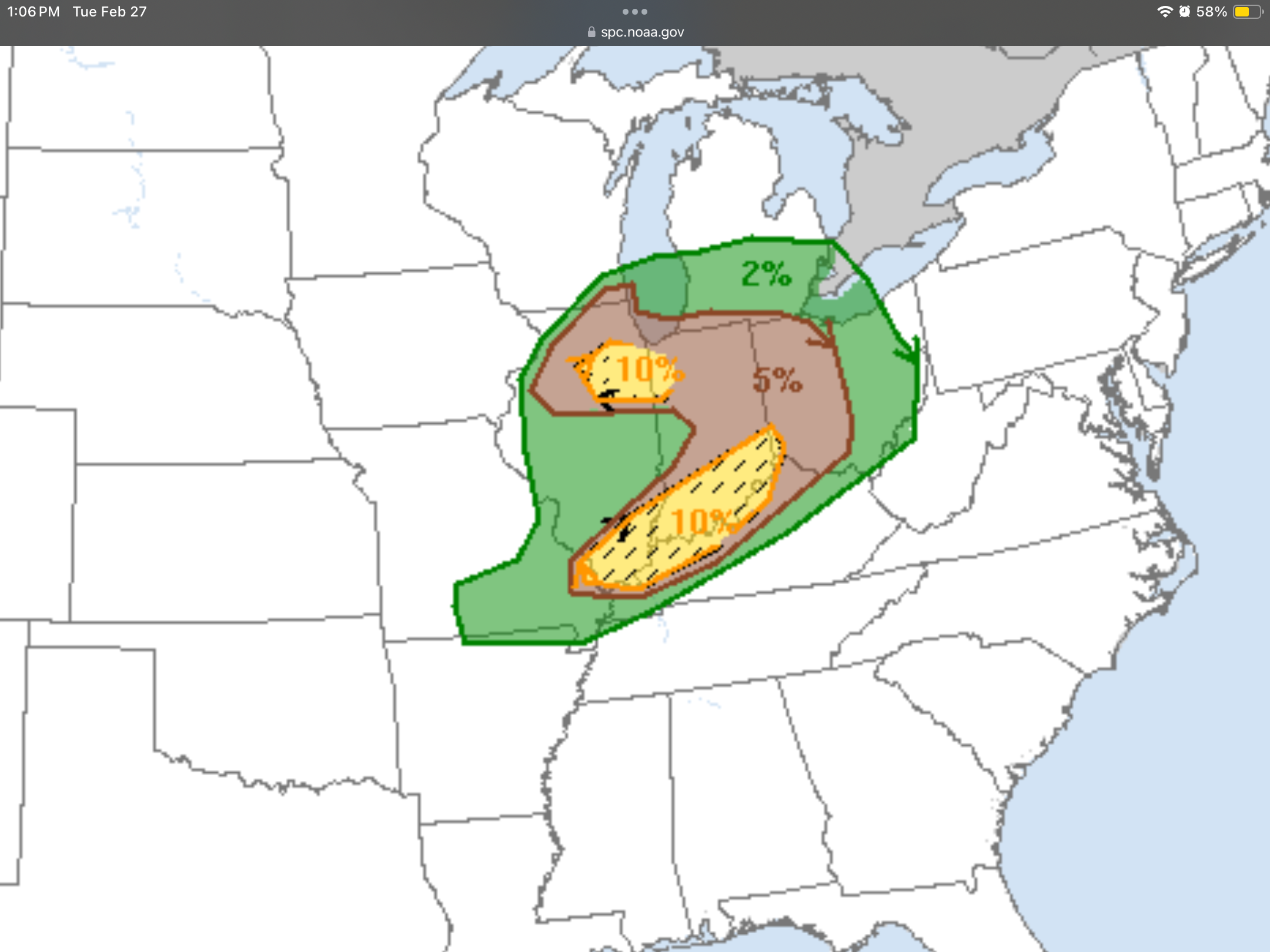
Tn Valley Severe Weather
in Tennessee Valley
Posted
PDS now