

MN Transplant
-
Posts
16,358 -
Joined
-
Last visited
Content Type
Profiles
Blogs
Forums
American Weather
Media Demo
Store
Gallery
Posts posted by MN Transplant
-
-
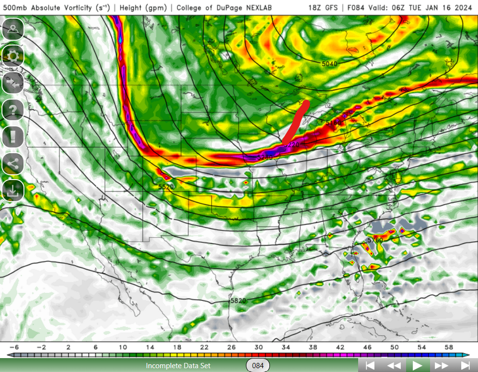
That northern stream vort just gets squashed. And of course the trailing trough is still positively tilted by the time it gets to us.
-
1 minute ago, psuhoffman said:
Busy between meetings but I think at a glance it made a positive move. But this is the issue IMO why the euro is on its own
Look at the GGEM

Now look at the euro. The feature X is the issue. The more amplified guidance is much weaker with that wave and allows the trailing wave Y to amplify more. The euro is stronger and further north with feature X and its preventing Y from amplifying.

The problem is that the best GFS runs had X and Y join up. My concern is that now that X and Y are decoupled on the GFS, we risk moving further toward a Euro scenario where X simply serves to completely squash Y. And X isn’t going to be able to give us much unless it digs deeper.
-
 2
2
-
-
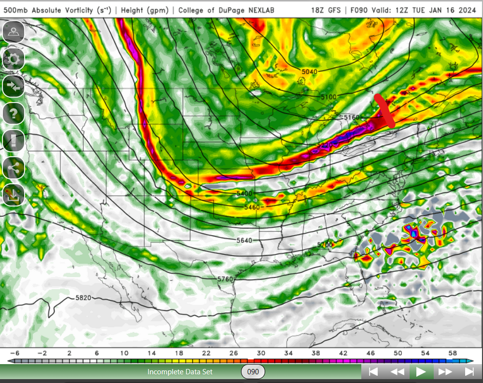
It simply comes down to this - we can’t have this feature so shallow and that far north. The GFS moved away from tying the disturbances together but still had this one dig far enough south to help us out late. The Euro sweeps this through north of us and has the second result of crushing the western vort.

-
4
-
 6
6
-
-
Smoke
-
1
-
-
4 minutes ago, WEATHER53 said:
I’m going to stop doing this. I know what I see from models and won’t be told different.
Rather right now ride the wave of good potentiality
You can check out the code here and decide where the programmers decided to put in the 'every option' lines. https://github.com/NOAA-EMC/fv3atm
-
1
-
 9
9
-
-
38 minutes ago, Ji said:
Can you imagine if someone had told you that you would have 10 inches of liquid since Nov 20 and no snow by now?Unfortunately, yes.
-
1
-
-
~2.5” which means I’m approaching 10” since the start of December. Drought, busted.
-
2
-
-
DCA not even reporting gusts at this point. If it sticks, the peak gust will be 48 mph.
4 mph wind/gust here. The boundary layer always wins for a southerly wind (*results may vary east of 95).
-
Wind here has been a dud. Gust to 29 a couple of hours ago. The rain just keeps coming, though.
-
1
-
 1
1
-
-
5 minutes ago, TSSN+ said:
If this was summer time woof

Near our favorite place

-
1
-
4
-
-
DCA to 47 mph
My daughter’s music class was cancelled because the building lost power.
-
1
-
-
Far more puddles than the previous storms over the past month. We really are saturated now in the top levels of the soil. Over an inch and plenty more on the way.
-
4
-
 1
1
-
-
Good news here is that the precip is still significant. Not quite as much as 00z, but still most of us are 0.8"-1.0" QPF.
-
3
-
-
They closed what is probably the most flood-prone area of Fairfax County, Burke Lake Road at the lake. The first domino to drop.
-
2
-
-
500 is messier than 00z
-
1
-
-
24 minutes ago, yoda said:
@MN Transplant will probably be surprised by the HWW
I'm still skeptical that we see the widespread significant winds, but yeah with the preexisting conditions I don't have a problem with it.
-
1
-
-
9 minutes ago, Ji said:
i feel like next week is going to make or break our winter
I haven't been looking at the long-term stuff, but diving into the GFS it is interesting that there is a regular cadence of chances in a broad sense. There is effectively a re-load every few days, which is really apparent looking at the precipitable water. That gives us chances, even if nothing is coming together on the model right now.
- 9th
- 12/13th
- 15/16th
- 18/19th
- 21st
-
9
-
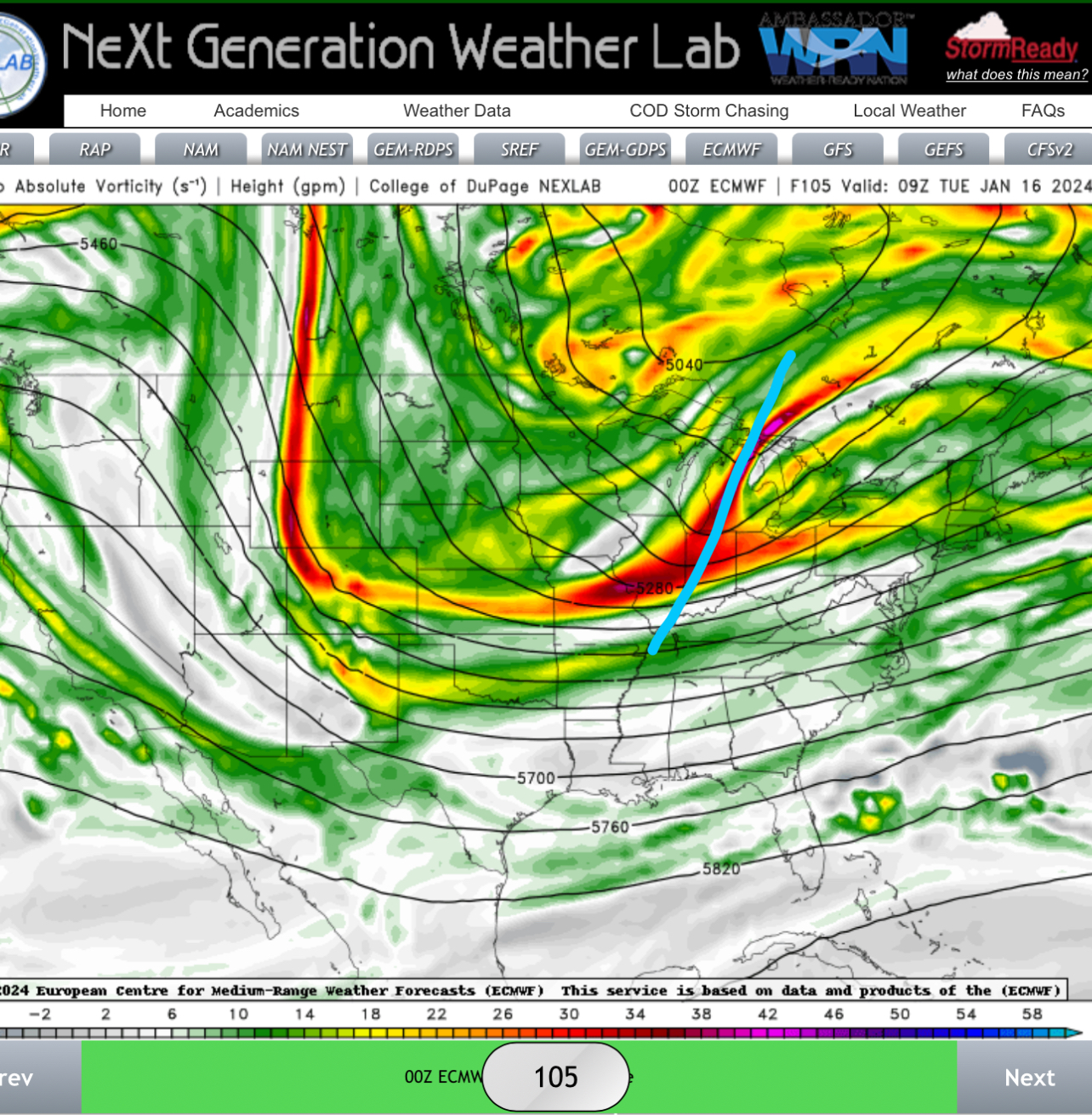
Just a completely different evolution than the Euro. That said, the players are there. The euro pairs the shortwave in the SW with the trough diving down through the Plains. The GFS has both of these things, but doesn't sync them up.
-
6
-
-
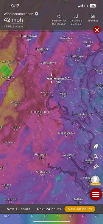
Just for fun, the wind accumulation product from Windy provides the peak modeled wind gust. Let's see how they do at DCA:
NAM 3k (06z): 57mph
HRRR (13z): 60mph (!)
GFS (06z): 63mph
Euro (06z): 49mph
ICON (06z): 54mph
-
5
-
2
-
1
-
-
3 minutes ago, Kmlwx said:
The 12z HRRR seems pretty robust on wind. Haven't followed the past few runs but I seem to recall it had much lower gusts than the outlandish models showing widespread 60+
ETA: RRFS is robust now as well.You are correct. The HRRR has definitely stepped up winds since yesterday.
-
973 low making landfall in coastal Maine with Caribou switching over to rain.
-
1
-
-
1 minute ago, Terpeast said:
Map? If the low pressure track is the same, then what's the problem?
It’s not the same track.
-
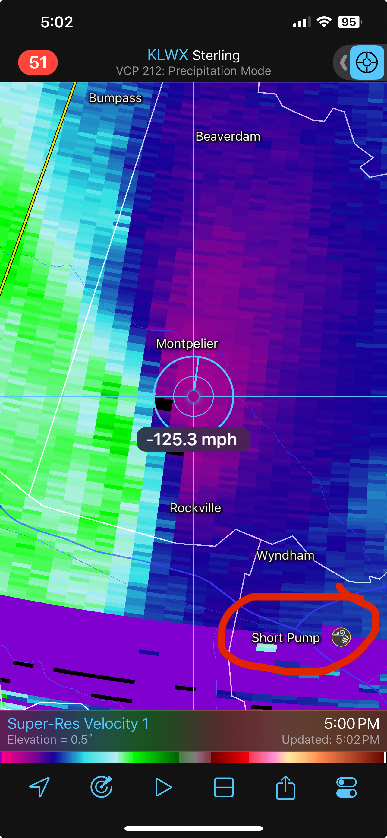
12z HRRR looks far more realistic with the surface wind gusts than the NAM.
Peak wind gusts via Windy. Reds are 40s, purples are 50s.
-
2
-
-
A causal reminder that, inland, we don't typically get big winds with SE flow. It generally stays elevated. That said, the NWS P&C for DC Tuesday evening has 30G45mph which is solid.
-
4
-


January Discobs 2024
in Mid Atlantic
Posted
0.56” of more not snow