

StormySquares
-
Posts
69 -
Joined
-
Last visited
Content Type
Profiles
Blogs
Forums
American Weather
Media Demo
Store
Gallery
Posts posted by StormySquares
-
-
Just now, TexMexWx said:
Well this aged poorly.
VAD from Shreveport had around 300 0-3km SRH
-

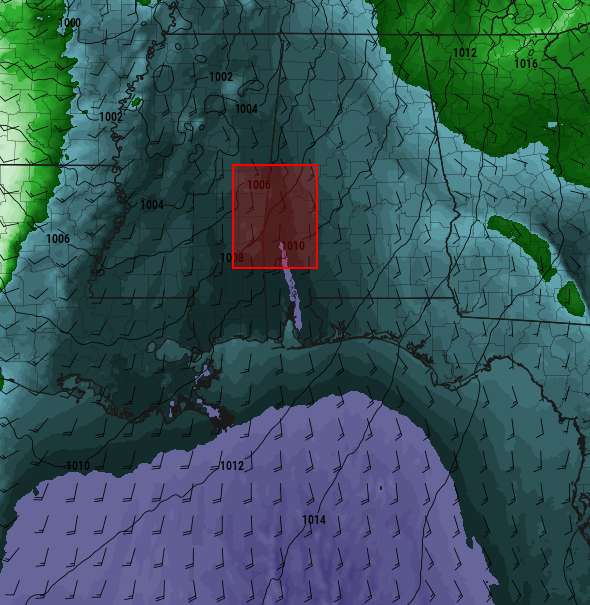
Sig tor on going southeast of Carthage, TX
-
 1
1
-
-
I think the 12z HRRR redefined what the ceiling may be
-
1 minute ago, Bob's Burgers said:
From a probabilistic standpoint, the 45% contour did verify. However the language used in the convective outlook was too strong (i.e. several long track, violent tornadoes) for the actual event. The shear profiles for Thursday are more supportive of a violent tornado than last week.
I agree. It doesn't feel right that last Wednesday had the same probs as 4/27 or 5/24. This Thursday looks pretty impressive.
-
 1
1
-
-
16 minutes ago, CheeselandSkies said:
The LLJ problem is why I was skeptical of the high risk until the overnight models Tuesday into last Wednesday (when it seemed like less of an issue, at least according to the CAMs) and the 45% "let's tie the 4/27/11 probs over the exact same area" always seemed like an odd choice to me.
For what it's worth a 45% did verify in Alabama. A large high risk area verified for much of central Alabama and eastern Mississippi.
-
1
-
-
Possible SVC feeding into the Selma storm enhancing tornado potential.
-
The cells coming into Alabama be I-20 could cause some problems in the next few hours.
-
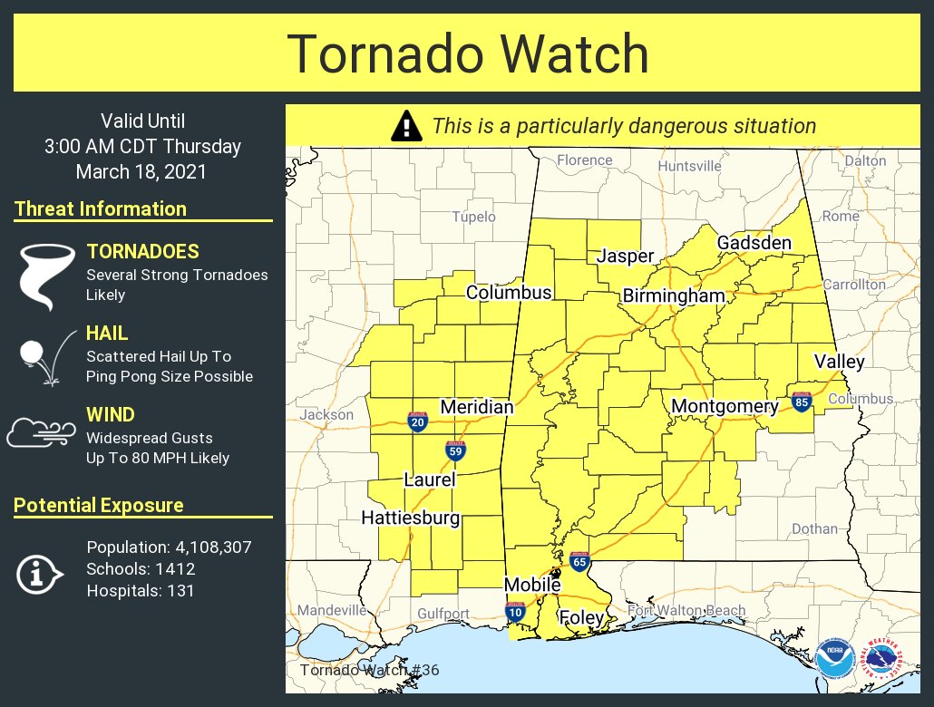
New PDS watch up. 80/80 props
-
4 minutes ago, KoalaBeer said:
From earlier today. Looks pretty big but the base is obscured by the hill...from what I’m seeing these tornadoes don’t look super intense but there’s sure as hell a lot of touchdowns. That’s obviously a premature observation with a long way to go, hopefully it stays that way. Anyone else think MS might of kinda dodge a bullet as well? The main line of storms is getting ready to move through Jackson.
https://mobile.twitter.com/meteodon/status/1372299928018558980
Not with the pacific front still back in Texas. It's only 22:30z. Up until this morning the main tornado threat wasn't until after 00z.
-
The TOG on the Brookewood storm is literally on the 4/27 path.
-

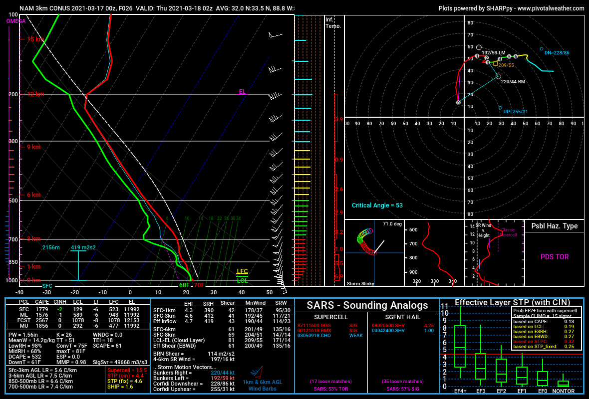
Area average sounding from the 3kNAM at 02z. Downright scary.
-
 2
2
-
-
1 minute ago, crossbowftw3 said:
the most unfortunate part of this all remains the idea that SPC hoists potential PDS watches by mid-afternoon, and very little winds up happening until the jet kicks in, lulling people into thinking not much would wind up occuring.
Spann has done a pretty good job of saying the primary threat for Alabama may not be until overnight.
-
I'm setting up in east Iowa, probably use US 11 to get back across the Mississippi. Hopefully any sups track north of my house (Janesville). Today is conditional but I'm thinking it over preforms, especially if SPC leaves it at slight.
-
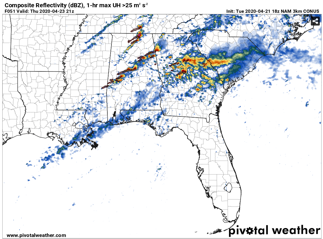
NAM3K doesn't have discrete cells often, but it does Thursday. Most models are showing the slowing trend, Thursday looks to be another severe weather outbreak across Dixie. Pending 00z guidance a day 2 moderate risk is certainly possible.

-
6 minutes ago, Orangeburgwx said:
I see that too, it is a pretty close match. So now we got the NAM and The King on board, all others have to play catch up
Sent from my LML212VL using Tapatalk
Really the only model that isn't on board is the GFS, UKMet has been mirroring the NAM for the past couple days.
-
22 minutes ago, hlcater said:
In a raw 1v1, I'm inclined to agree, but the NAM goes against consensus here which is notable to me. It is very possible guidance trends in that direction(euro had a tick slower), but I don't see this reaching the levels the NAM thinks it will.
Is it me or is the 12z Euro almost a copy of the past few NAM runs at 500mb.
-
36 minutes ago, hlcater said:
Looking like consensus is still sticking with a faster(rather than slower) evolution with this system keeping the ceiling much lower than it would be if it were to slow down significantly. Definitely still time for that, but seeing the 12z suite, I think the NAM is almost certainly the outlier on the slow end, GFS an outlier on the fast end.
12z Euro continues to slow a bit.
-
The outflow from the northern convection earlier is coming south. If the storm rides it, the tornado threat may continue, but the stable air may cut off surface inflow.
-
Just now, mob1 said:
Not hitting anything, regardless of how strong the tornado is there needs to be something in its path to loft debris.
Plenty of trees in MS. The terrain it's going over isn't any different then when the cc hole was very deep.
-
1
-
-
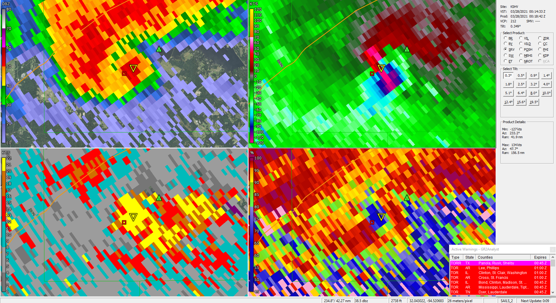
What would cause the velocity to be this impressive but have the cc hole progressively get less pronounced? Can someone smarter then me answer this?
-
Looks like the storm behind it may be raining into the updraft, I wonder what that's going to do to the longevity of the tornado.
-
There's the cc drop. GR2 seems to be having a problem resolving the velocity again. Strong couplet though.
-
PDS Tor warning
-
Seems well organized now.
April 9th Severe Threat
in Southeastern States
Posted