

Prospero
-
Posts
1,095 -
Joined
-
Last visited
Content Type
Profiles
Blogs
Forums
American Weather
Media Demo
Store
Gallery
Posts posted by Prospero
-
-
News reporters are already in Gulfport. The ocean is rising at a solid rate possibly until mid-day tomorrow or longer.
https://thegabber.com/gulfport-fl-beach-webcam/

-
 1
1
-
-
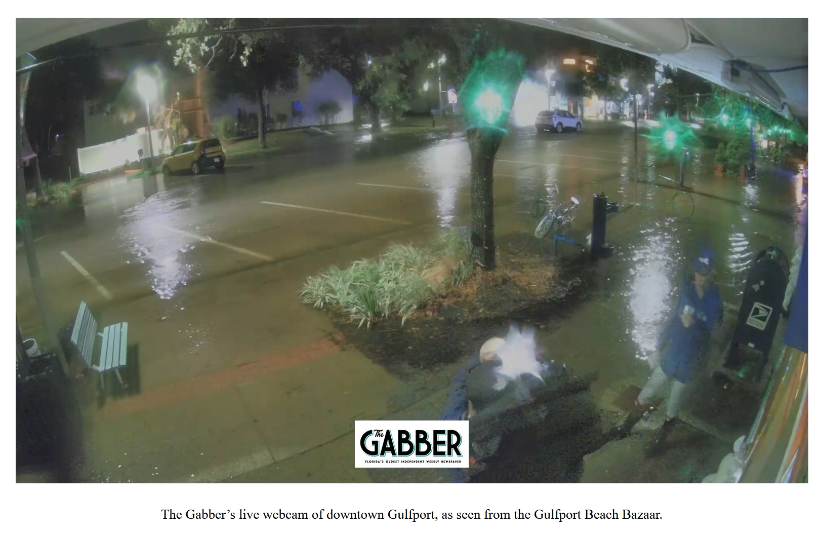
Downtown Gulfport beginning to flood. The highest tide is just after noon tomorrow. It's going to be difficult for the business owners and residents in Zone A.

-
1
-
-
We are going to see a storm surge on the Gulf Coast to be remembered for many years.
-
1
-
-
If you know Clearwater Beach, you'll realize how high the tide is now and the surge is just beginning. I think noon tomorrow is the Blue Moon peak tide. It might be a doozy all long the Gulf Coast.
https://clearwaterbeachcams.com/
-
7 minutes ago, wncsnow said:
Surely this will be the biggest hit this Niño season?
No, the BIG one will be during the Thanksgiving holidays.
-
The tide is creeping up on Captiva Island. As the night goes on and Idalia moves away the wind gets stronger on Sanibel and Captiva.
-
32 minutes ago, TradeWinds said:
Was looking at some obs in the band over St Pete. Not bad. Almost tropical storm force winds.

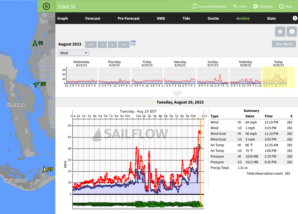
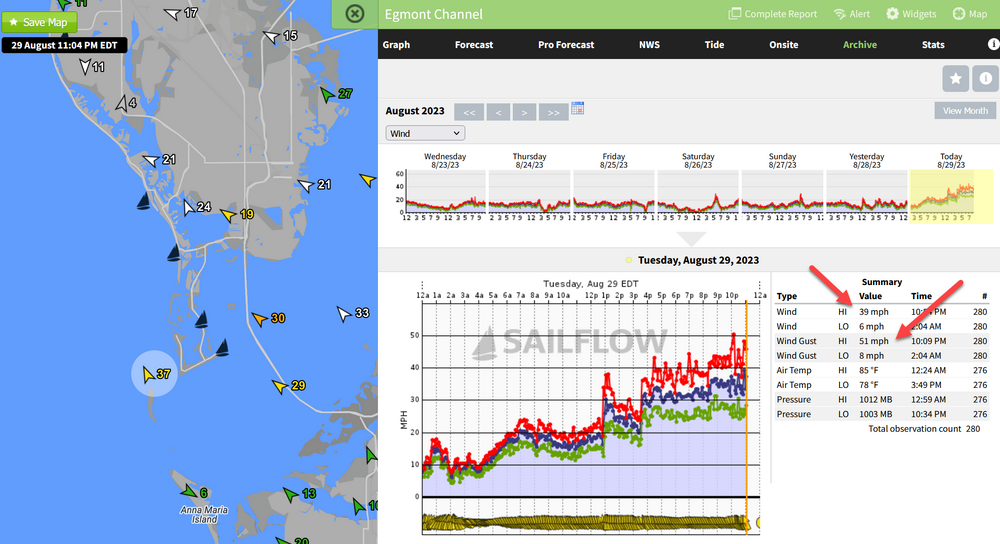
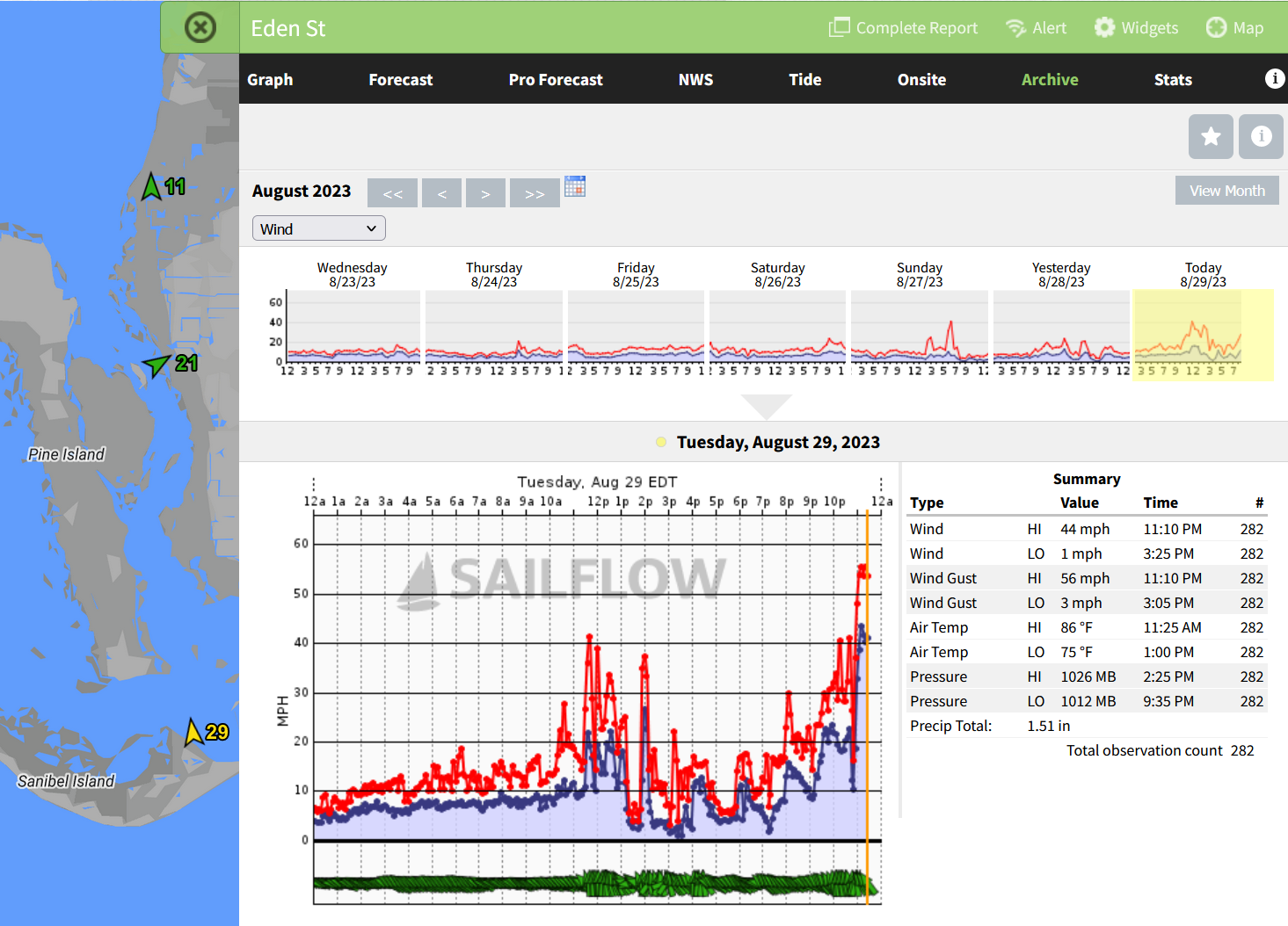
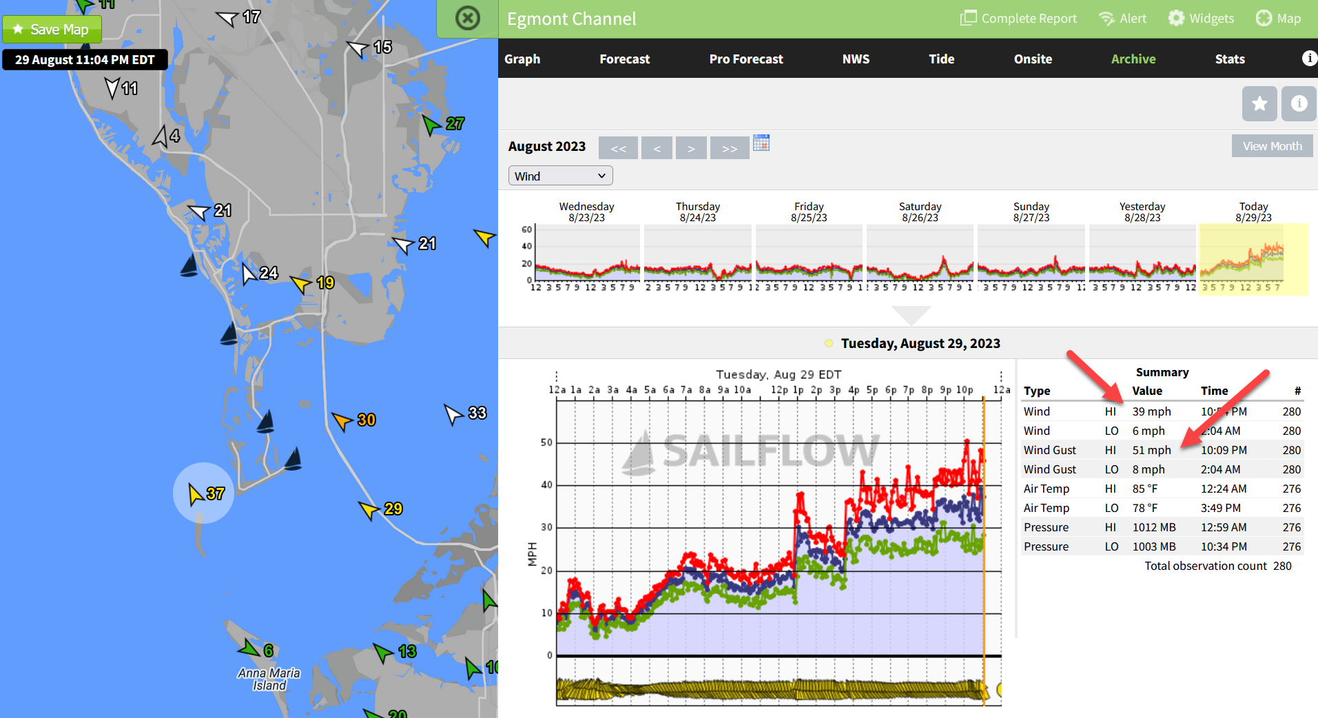
Feeling it here in Gulfport with solid rain and a stiff breeze with gusts into the high 30s. Egmont Channel has TS conditions close to here.
-
1
-
-
38 minutes ago, hickory said:

It’s a large prison directly in the path. I wonder what there procedures are for something like this. I know those buildings are built well, but does make you wonder.
.Two bag lunches to every inmate in a cell, then the Correctional Officers evacuate...
-
1 minute ago, Master of Disaster said:
I haven't been following there severe threat. Anything show up worth mentioning today on that topic?

-
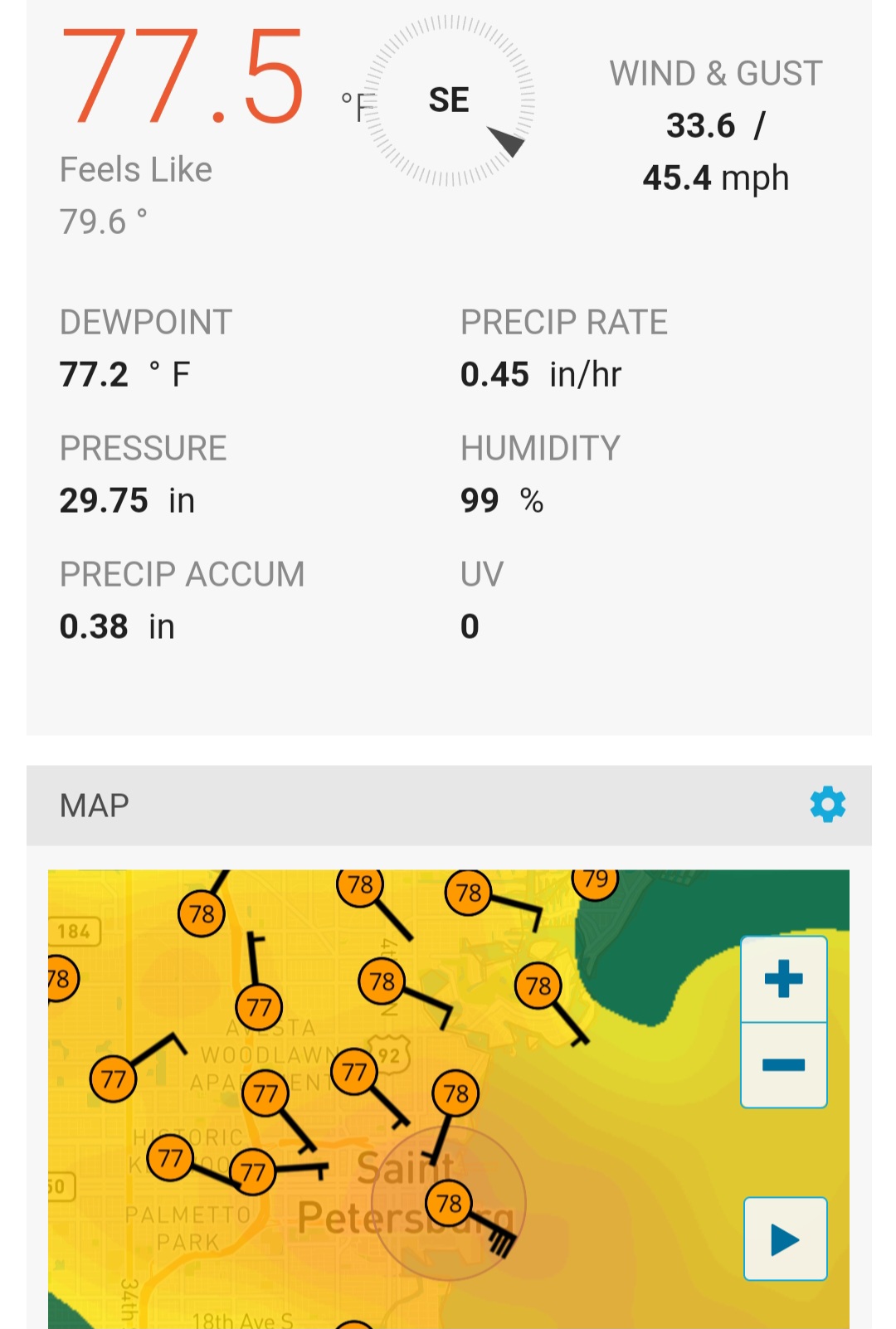
Sanibel had its strongest gust of the day just now. Winds are picking up here in Pinellas County, still sub-TS for sure.
It appears Idalia has a tail that will whip us late tonight and tomorrow morning.

-
1
-
-
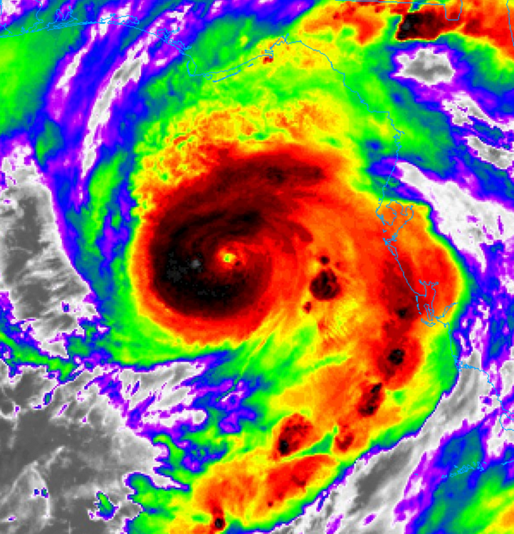
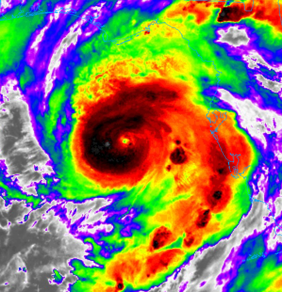
Idalia is making pretty pictures. I'm glad it is not going up Tampa Bay as we were concerned about yesterday.
-
1
-
-
9 minutes ago, turtlehurricane said:
Got some classic post-band stratiform light rain ongoing. Overall I am underwhelmed at the short duration of this event…. Gonna give my wife some Cat 5 loving and get some rest. Then I’ll have a breakfast of champions including eggs, pancakes, sweet potatoes, coffee, Kratom, & Adderall, and I’ll watch the show. This is gonna be an interesting next 12 hours no doubt, and perfect timing so I can go into full storm mode and see the whole thing without it interfering with my daily business responsibilities
Busted my butt for two or three days to be able to endure an all night storm and a few days with no electricity. Now I have electricity and I'm a week ahead of deadlines.
")
-
1
-
-
2 minutes ago, friedmators said:
The band headed into Sarasota and points West had some hurricane force winds off the deck.
.I'm not finding them on SailFlow. Where should I look?
-
3 minutes ago, Tezeta said:
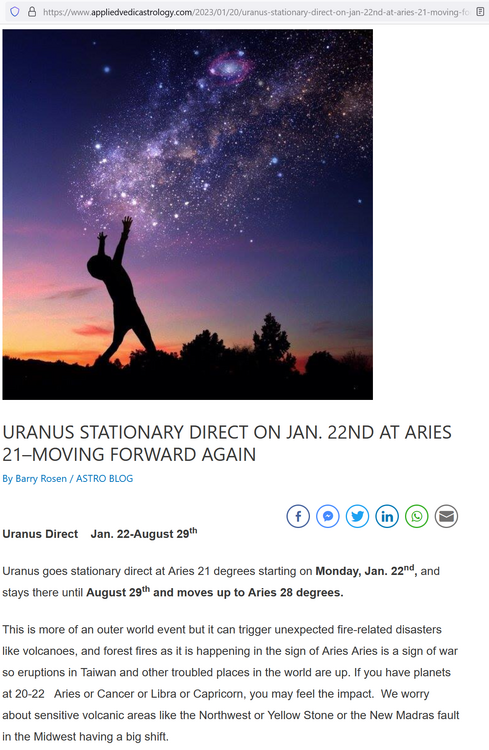
Uranus is stationary
Starts on Francis Bacon's birthday, January 22.
-
Just now, Prospero said:
This Blue Moon?
From a friend in England this morning:
QuoteAre you in the path of this hurricane? Just to warn you to expect it to be a big one, as it’s happening at the time of a Supermoon.
We also have Uranus stationary which tends to correlate to unexpected events involving Space or the air, so it may have a surprise. I guess that might be a sudden change of path or intensification, but could be anything, positive or negative. So keep safe and alert for this one.
Hoping it surprises everyone and turns into a damp squib and not something ginormous! -
8 minutes ago, lilj4425 said:
TO THE MOON!!!
This Blue Moon?
-
 1
1
-
-
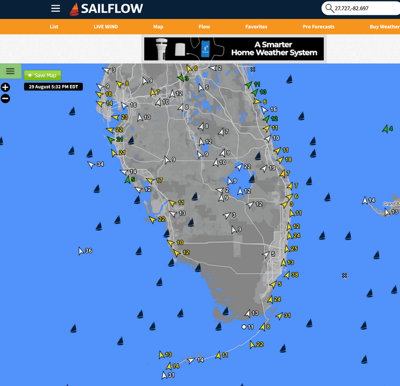
I keep waiting for some serious Idalia winds on SailFlow and right now south east Florida appears to have stronger winds than the Gulf Coast. Are those wind speeds due to Franklin?
-
1
-
-
For Gulfport, Florida which will have some water in town by tomorrow morning, if this camera is still Live that means there is less than a foot or two in the store where the internet connection lives a half block from Boca Ciega Bay:
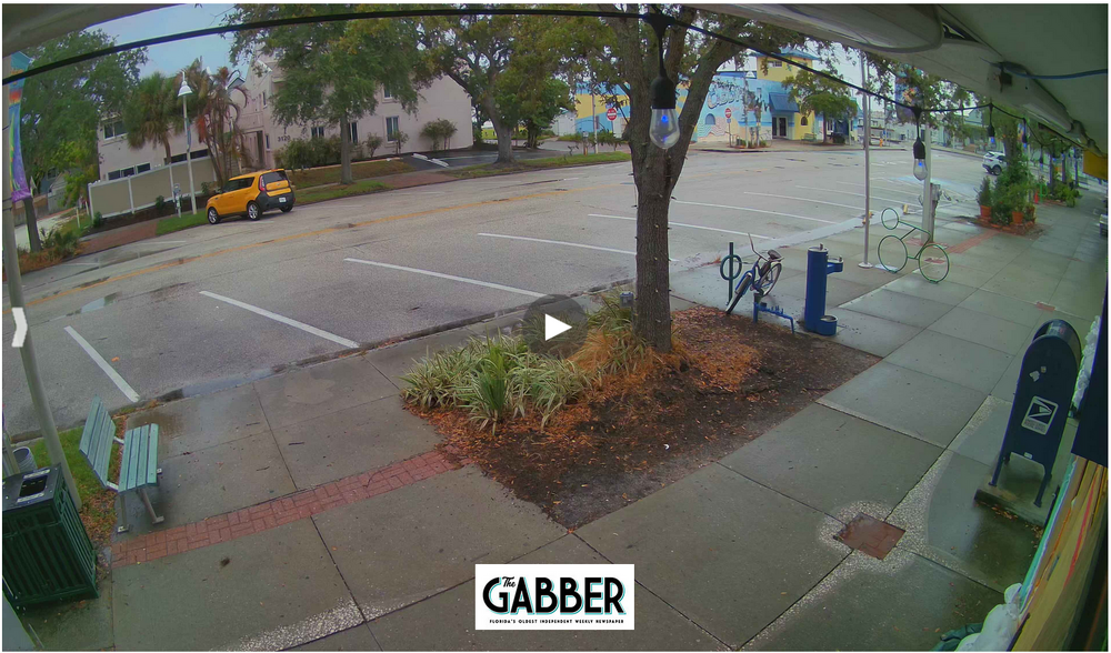
I hope we do not get more, but with high tide there will be a surge on some level. We might have a calm sunny morning with several feet of ocean in town.
-
5 minutes ago, Brewbeer said:
ok, boomer
Weather Channel has been in the background noise here for a couple days. They had a really cool AI/Drone animation of a 6ft storm surge here in Gulfport showing our little town that floods every TS and Hurricane. Now they are doing Cedar Key with a 9ft surge!
One of my storm forecast factors is where the Weather Channel goes, the storms pass by. LOL
-
Just now, Tezeta said:
Hell yeah brother. I would love to just stay up all night taking in the breeze as it floats by offshore
We've had two bands; 35 mph gust and sideways rain on the first for about ten minutes, and now a 31 mph gust and light rain. We'll get more, but standing outside right now it feels soooooooo great after a hot ass summer with very few thunderstorms.
I love the feel of a tropical system, at least when it is not destroying everything.
-
2 hours ago, Tezeta said:
Weenie away. When you guys are burning the midnight oil tonight complaining about weird eyewall structure come back to me. It’s going to strengthen but not like you think.
Drinking beer and will make a pot of coffee later to experience Idalia all night. I've been waiting for this night since we got our electricity back on after Ian knocked it out here for a few days last year.
Here in Gulfport, FL until this morning we were very concerned that we were on the inside edge of the target of a Major Hurricane. Now we are relaxing, hopefully not prematurely, that we'll enjoy some needed rain and very cool winds to watch. My friends who have businesses downtown might have a bit of a storm surge flood, but we should fair out well again. Lucky again in Tampa Bay.
")
-
1 minute ago, Stormfly said:
Isabel, Irene, Isaias for us.
Female names seem to be the most memorable and super destructive too!

How did I forget Irene!! UGH
-
1
-
1
-
-
1 hour ago, dbullsfan said:
Unless thing’s drastically change it will be a surge and wind event is all.
If it rains, we'll have a hurricane! LOL
-
2
-
-
Just now, Windspeed said:
I am expected in Key West on Friday. Driving down from Tennessee. I have been in hurricane aftermath paths before, but the forecasted turn and angle is going to bring down a lot of old growth along the interstate routes in S.GA and N.Florida. Some of these areas haven't seen this inland forecasted intensity in a long time. Idalia should still be packing a formidable punch as it is moving back towards the Atlantic with trough enhancement. This will also be a big circulation. Back to point, expect a lot of downed trees everywhere.
Friday should be a beautiful day In Key West.
-
1
-


Idalia Banter
in Tropical Headquarters
Posted
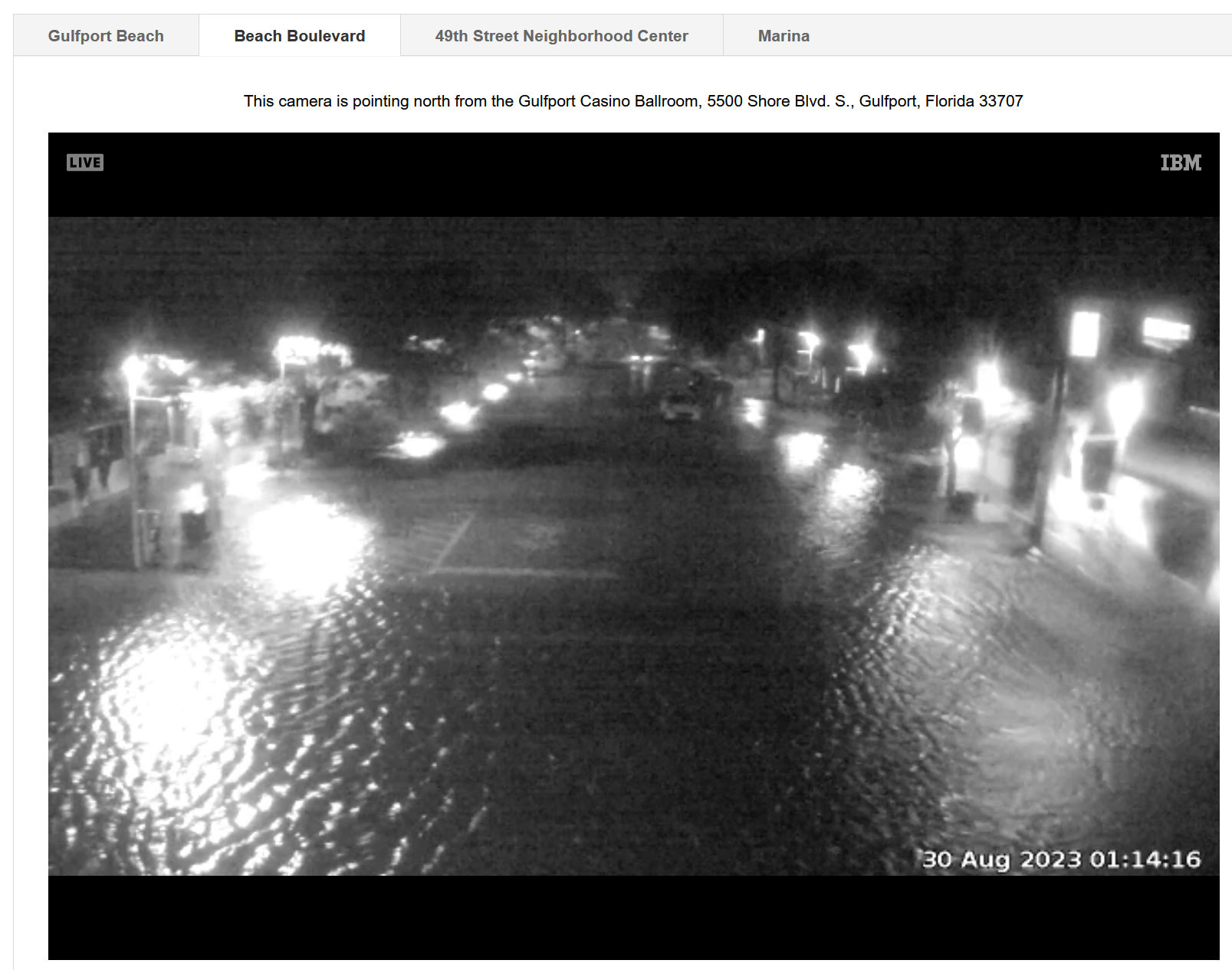
Storm surge rising in Gulfport.