ORH_wxman
-
Posts
89,090 -
Joined
-
Last visited
Content Type
Profiles
Blogs
Forums
American Weather
Media Demo
Store
Gallery
Everything posted by ORH_wxman
-
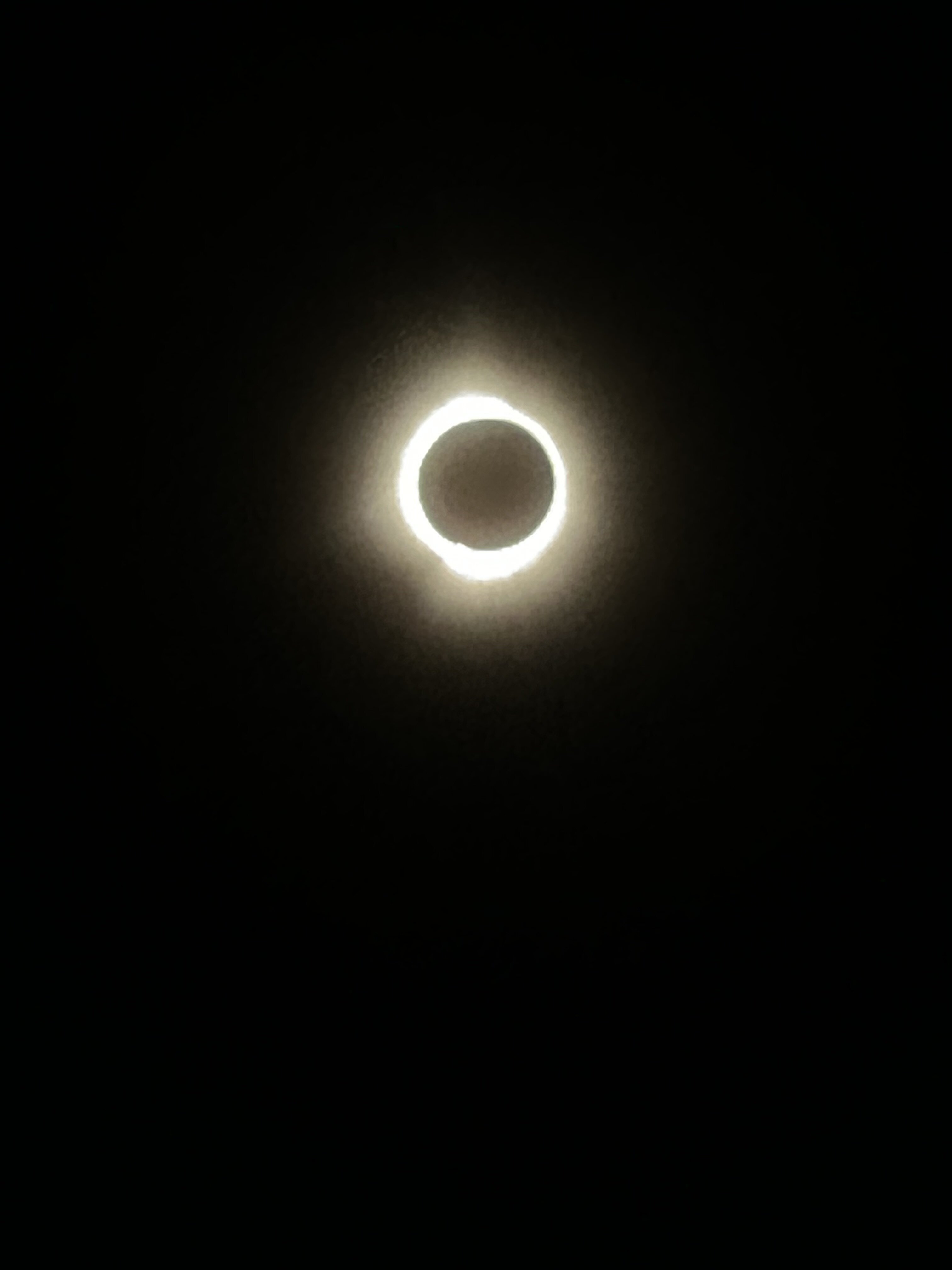
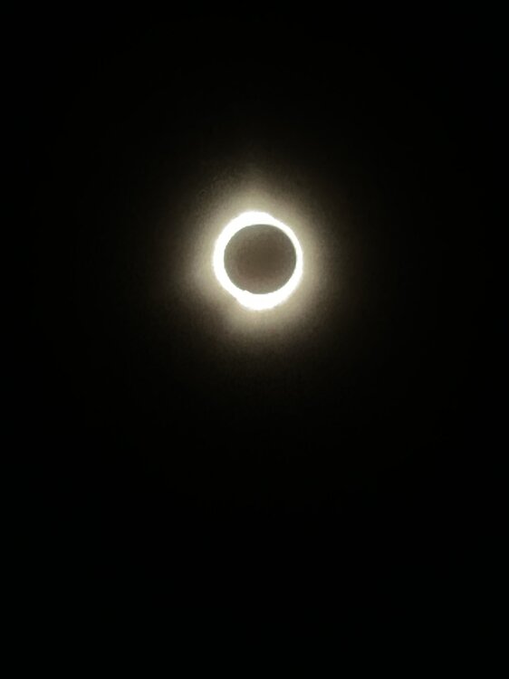
I don’t have fancy camera pics like some here but it was incredible. Went up to my cousin’s in south Burlington to see it. Got this cell phone pic on Megan’s phone (my phone camera is worse than hers) Problem with the cell phone pics is that even a sliver of light around the edges gets dispersed out on the picture to make it look a lot brighter and thicker than it is.
-
Might be some stuff that rotates down overnight depending on which model to believe.
-
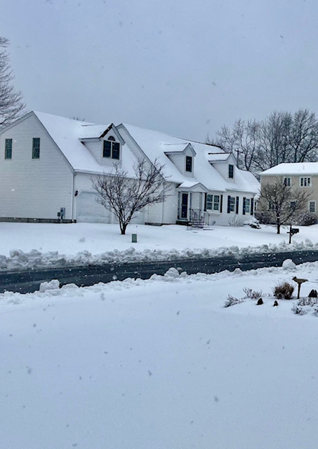
5.5” on winter hill in ORH.
-
Sleet is in Holliston. I’ll report form winter hill at some pint probably.
-
Starting to get scalped here. Pinging picked up big time in the past 10 min
-
Significant Miller B Nor'easter watch, Apr 3rd-4th
ORH_wxman replied to Typhoon Tip's topic in New England
Yes. I think the western ULL ended up overpowering some of the height bulges out to the east that we were seeing yesterday on some runs. It’s a bit less prominent today so it’s taking longer for the storm to turn the mid-level winds easterly…and as you said, pretty hard to get monster totals when you are relying too much on WAA precip. Someone a little further north may benefit more though. I wouldn’t mind being near my summer vacation spot on Moose Pond in Denmark for this one. Pleasant Mountain FTW -
Significant Miller B Nor'easter watch, Apr 3rd-4th
ORH_wxman replied to Typhoon Tip's topic in New England
The H7 warm front lifts north relatively quickly once it gets established over SNE. Some of the better runs yesterday we’re trying to stall it for a few hours which is how you get 20-burgers there but that seems unlikely now as it doesn’t slow down until near S ME/NH border. But yeah, if you can flash to parachutes by 03-04z, then you’ll have a path to warning criteria snow. -
Significant Miller B Nor'easter watch, Apr 3rd-4th
ORH_wxman replied to Typhoon Tip's topic in New England
Trying to flip the pike region to snow around 06-07z. Warm layer really tries to wash out. I’m skeptical but big lift can do the trick sometimes. Esp if it’s in the DGZ where it will enhance latent cooling. -
Significant Miller B Nor'easter watch, Apr 3rd-4th
ORH_wxman replied to Typhoon Tip's topic in New England
NAM had a much higher area of 2”+ QPF over maine and SE NH and far NE MA. Euro had a small bullseye. They weren’t too dissimilar further west though. -
Significant Miller B Nor'easter watch, Apr 3rd-4th
ORH_wxman replied to Typhoon Tip's topic in New England
It’s been that way for several runs now for the most part since yesterday. Might be a red flag. But it basically has no agreement from other guidance. -
Significant Miller B Nor'easter watch, Apr 3rd-4th
ORH_wxman replied to Typhoon Tip's topic in New England
They run it off Ray’s computer. -
Significant Miller B Nor'easter watch, Apr 3rd-4th
ORH_wxman replied to Typhoon Tip's topic in New England
I think I’d hedge mostly sleet there based on guidance trends overnight. It’ll change to snow but I think the meat of the QPF is going to be a lot of sleet and mixed crud. -
Significant Miller B Nor'easter watch, Apr 3rd-4th
ORH_wxman replied to Typhoon Tip's topic in New England
18z Euro seems kind of flaccid on QPF compared to other guidance. Really nothing over about an inch and a half for the frozen zones with lots of 1.2ish totals. -
Significant Miller B Nor'easter watch, Apr 3rd-4th
ORH_wxman replied to Typhoon Tip's topic in New England
Yeah and I think we’ll have a decent idea by tomorrow afternoon if it’s likely or not. I am assuming the differences in model guidance right now will try to converge a little more…or we’ll either see one last bump south or north in these next couple cycles. If it bumps south, then it’s easily game-on for you, if it bumps north, game over. Status quo? You might be nowcasting. -
Significant Miller B Nor'easter watch, Apr 3rd-4th
ORH_wxman replied to Typhoon Tip's topic in New England
18z GFS is just bonkers between 06z and 12z for extreme NE MA and SE NH. Like 3 hourly QPF of around an inch between 06z and 09z in Essex county and Rockingham county. That’s one way to overcome elevation deficiency. -
Significant Miller B Nor'easter watch, Apr 3rd-4th
ORH_wxman replied to Typhoon Tip's topic in New England
You might get two 20-burger storms inside of 2 weeks after the equinox. Not bad. -
Significant Miller B Nor'easter watch, Apr 3rd-4th
ORH_wxman replied to Typhoon Tip's topic in New England
Man what a pelting the NAM is over a lot of MA. Wish we could keep that mid-level warm front south longer but it doesn’t seem to want to happen except on a few rogue model runs. Western Maine is going to get crushed. Doesn’t really seem to matter the exact solution, they are getting 18-30” every run. Some a little close to 30 and others closer to 18 but always crushed. -
Significant Miller B Nor'easter watch, Apr 3rd-4th
ORH_wxman replied to Typhoon Tip's topic in New England
Was also snowier N of pike. Esp up by Rt 2 and over to Ray's hood. -
Significant Miller B Nor'easter watch, Apr 3rd-4th
ORH_wxman replied to Typhoon Tip's topic in New England
Yes. It’s subtle but we really need the height field to try and “open up” south of New England. That trend started yesterday after most guidance had relegated the system pretty much a total non-event south of monadnocks from the tempest they showed 2-3 days prior…but it’s a precarious trend that could easily snap back. And it’s possible we may not even know the fate of that idea until very close to go-time. As both of us know, convection can wreak havoc on those subtle height field differences and cause the mid-level warm front to stay further south than modeled. Or the reverse might happen and it goes further north than progged. -
Significant Miller B Nor'easter watch, Apr 3rd-4th
ORH_wxman replied to Typhoon Tip's topic in New England
As soon as I looped H5 (I usually do that first) I knew it was going to be slightly worse since it wasn’t bulging out the H5 heights quite as well to the east as 06z was. That, in turn, pushes the midlevel warmth and dryslot further north. It’s crucial we keep the H7 front south of us through 12z Thursday if we want warning criteria snowfall. -
Significant Miller B Nor'easter watch, Apr 3rd-4th
ORH_wxman replied to Typhoon Tip's topic in New England
12z euro looks a bit warmer than 06z. Took a step back. Gonna have to sweat it out apparently in the N MA/S NH zone. -
Significant Miller B Nor'easter watch, Apr 3rd-4th
ORH_wxman replied to Typhoon Tip's topic in New England
That sounding honestly looks like it would be in the upper 20s range at the sfc if you have heavy lift. You’re pulling -5C not very far off the deck there. But the million dollar question remains is how organized can we keep the heavy lift? Given the relatively late nature of the secondary development and the ULL remaining very strong to our west, I worry about conveyor mechanics getting out of sync. But this subtle trend of “bulging” out the H5 low to the east and lowering heights there is helping over the past few cycles. -
Significant Miller B Nor'easter watch, Apr 3rd-4th
ORH_wxman replied to Typhoon Tip's topic in New England
I think omega/lift will have a lot to do with it too. If we get a very good area of consolidated strong lift, the soundings are going to want to flash colder. But if we keep things a little more banded and slightly less organized or the lift just isn’t quite as intense, it’s prob a lot more sleet. -
Significant Miller B Nor'easter watch, Apr 3rd-4th
ORH_wxman replied to Typhoon Tip's topic in New England
Yes. It’s pretty cold in the 925 layer around -3ish Heres the sounding at 06z tomorrow night near you while GFS is pounding…you can see how once off the immediate surface, you’re comfortably below freezing so this isn’t going to be a scenario where you have slush balls falling through an isothermal layer 3000 feet thick and not sticking well. If the rate are good, accumulations will easily be 10:1 on that type of sounding…you might even pull 15:1 for a while with that cross hair sig, but I’d want to see all the models agree on that before taking it too seriously.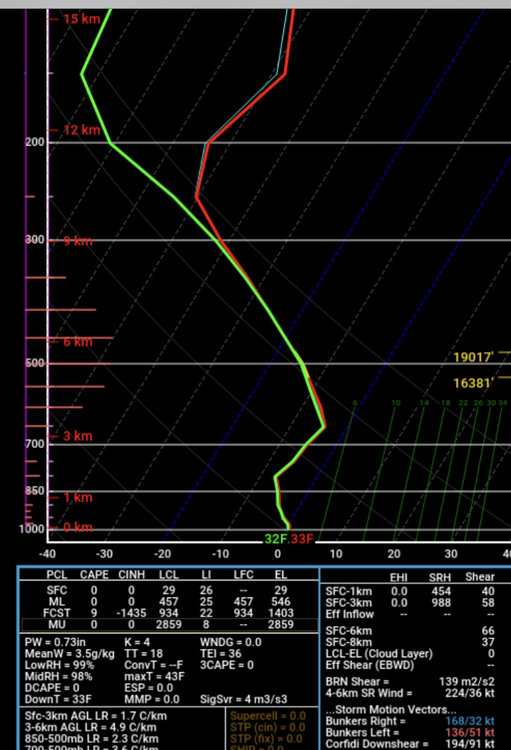
-
Significant Miller B Nor'easter watch, Apr 3rd-4th
ORH_wxman replied to Typhoon Tip's topic in New England
Yeah it doesn't need much to get BOS into legit snow. What a tease.