

skonajezski31
-
Posts
12 -
Joined
-
Last visited
Content Type
Profiles
Blogs
Forums
American Weather
Media Demo
Store
Gallery
Posts posted by skonajezski31
-
-
im thinking mason dixon line will once again be ground 0 for anything that does fall... timing will be key but yeah no more than 1-4" as i see it however that system coming into CA last night was beastly just dont see how its nothing out east
-
lets use this thread to talk about the march 8 event !!!!
-
4 minutes ago, greenskeeper said:
plenty of flakes in this forum
thats for sure ...
-
 1
1
-
-
gonna be a lot of wasted flakes no matter what way you slice it
-
1
-
-
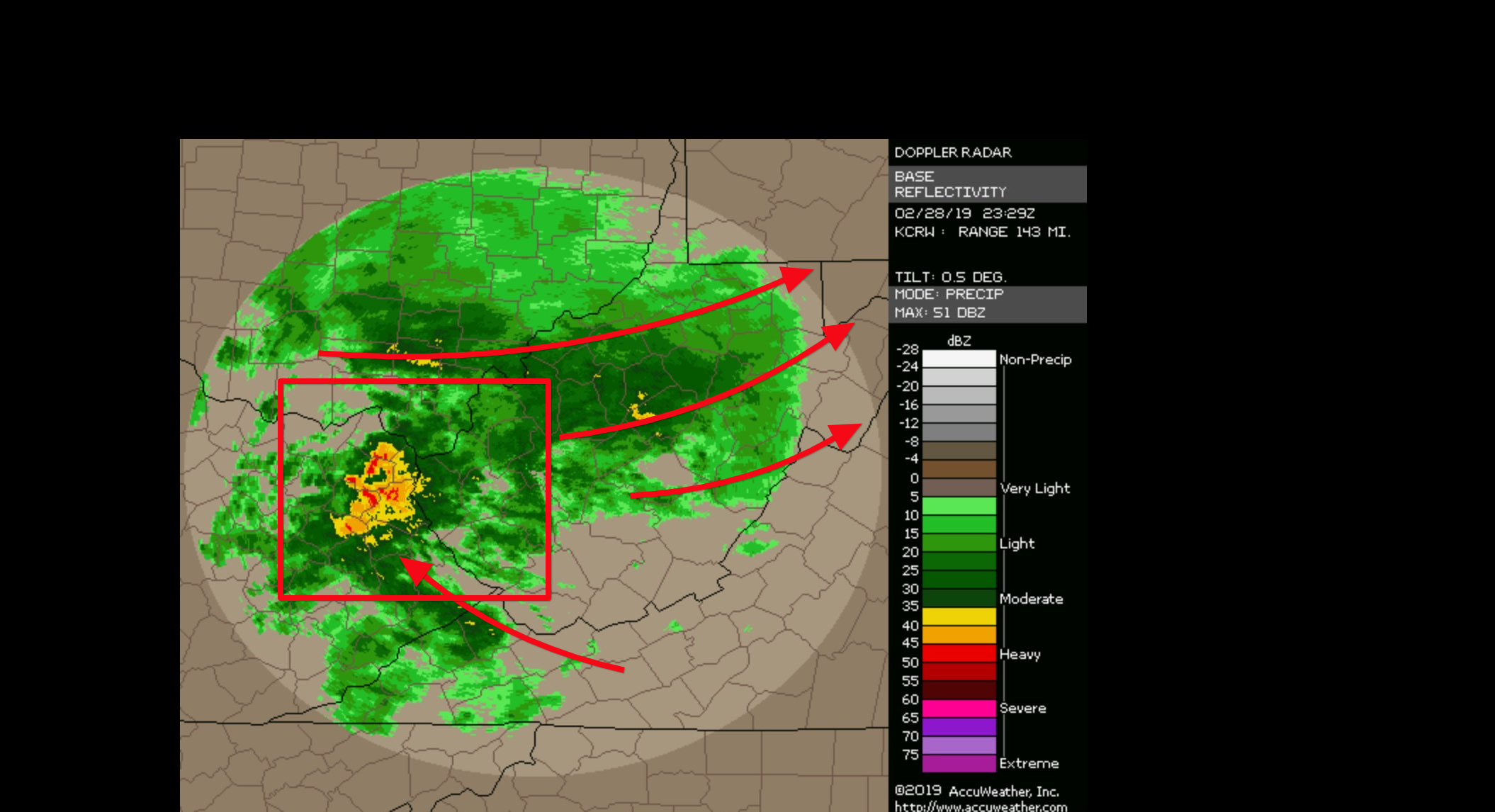
im reviewing current radar down in WV and the precip output by hrdps and its almost spot on
-
yeah that and the rap have not been all that impressed but when i see this its impresses me

-
rgem has been showing this for past 36 hours however bouncing it around 18z sets up along mason dixon line and watching the current radar that seems about right
-
1
-
-
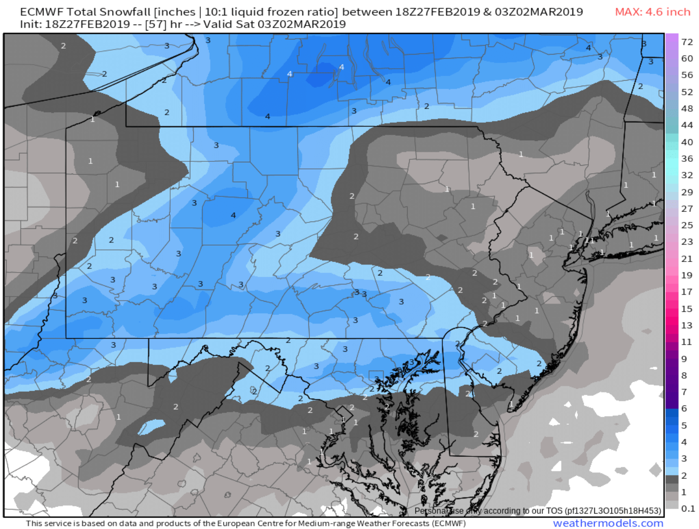
lets start this with the 3/1 event. models playing catch up to nam/rgem/cmc blend
-
41 minutes ago, Ralph Wiggum said:
I like that we moved away from an amped up system today and more of a slow moving boundary with stj moisture via 700mb transport along the cold sector. This is one way I95 areas can cash in. Amp this up and it's mostly a farther N and W event. Steady as she goes.
i dunno about i95 for sunday into monday. i think if you take gfs move it 50-75 miles NW , euro move it 25-50 miles SE you get your axis of heaviest snow .. gotta smell the sleet to get the thump !
-
1
-
-
-
decent hit coming to SCPA /NMD friday am thump snow looks like 2-5" the euro had this back on monday , lost it and now its back on 18z. the gem has been steady eddy with it along with nam/rgem combo. should be interesting as it comes overnight almost all sticks and ends morning rush hour, trafic might be a nightmare
march 8 potential event ???
in Philadelphia Region
Posted
this march 8 is friday not sunday. the sunday event yes is a warm storm i started this to talk about friday !