

tiger_deF
-
Posts
490 -
Joined
-
Last visited
Content Type
Profiles
Blogs
Forums
American Weather
Media Demo
Store
Gallery
Posts posted by tiger_deF
-
-
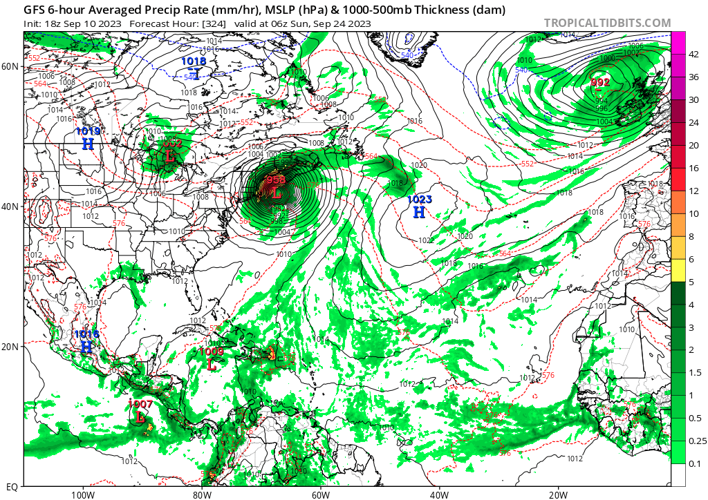
If we get both a Lee landfall/close brush and Nigel becomes a threat, would this be the most active tropical period for NE in recent history?
-
 1
1
-
-
17 minutes ago, STILL N OF PIKE said:
Lee looks like garbage . Dry air just took over North side of system again . Seems it just can’t get its act together . Thought it was back this afternoon now looks like crap .
is this the inner eyewall collapsing finally or is it basically the storm crapping itself . Haven’t checked in this pm till now
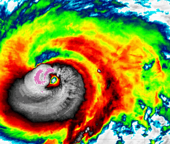
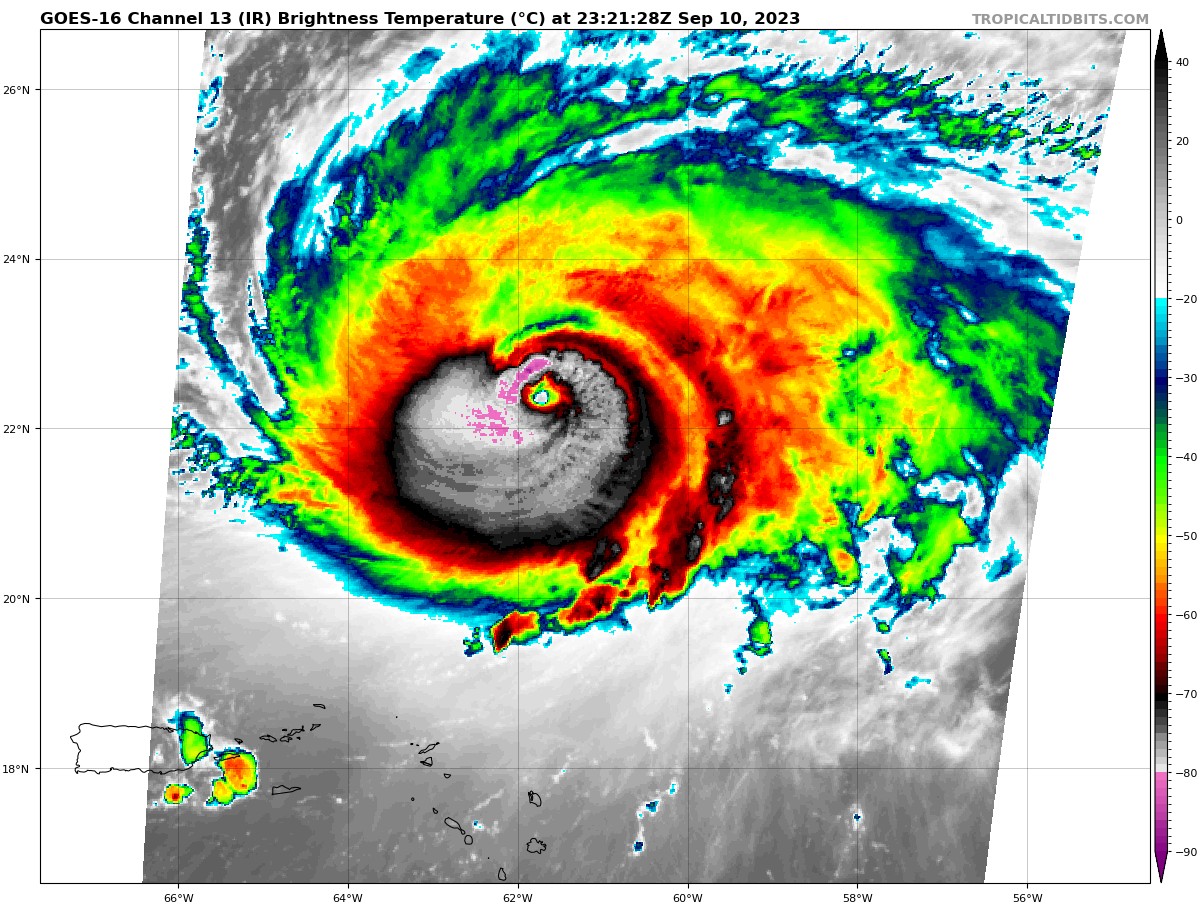
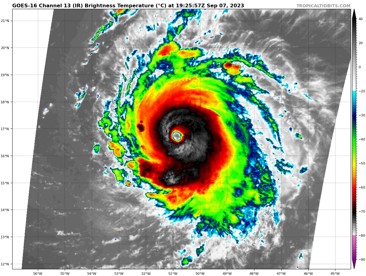
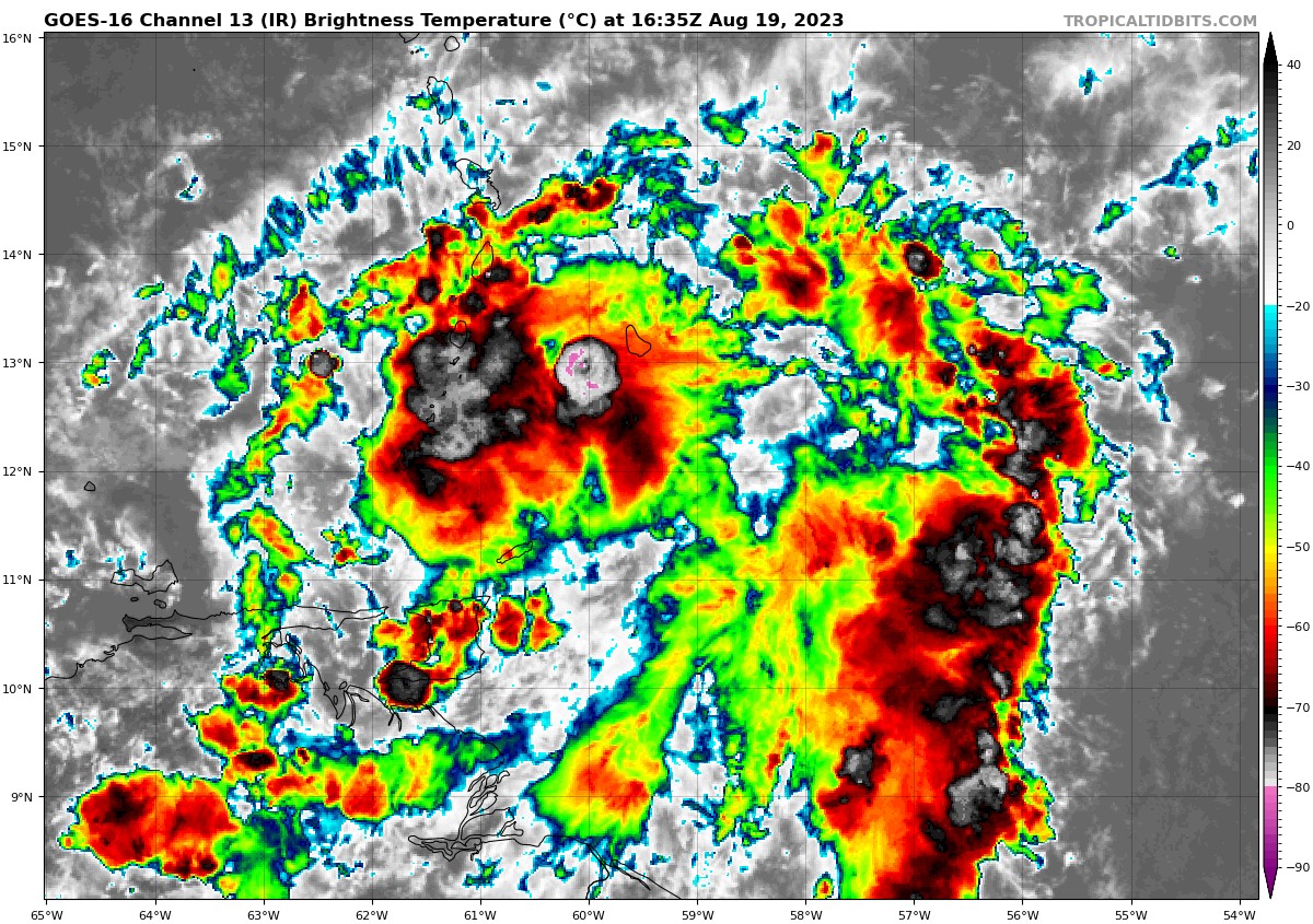
Now this is an overreaction if I've ever seen one. Lee is in the latter stages of an ERC, and though the inner eyewall is fighting back it will be toast in the long run. I expect that by tomorrow Lee will clear a big, beautiful eye.
-
GOES trying to will a hit into existence

-
 8
8
-
 1
1
-
-
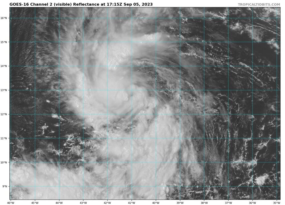
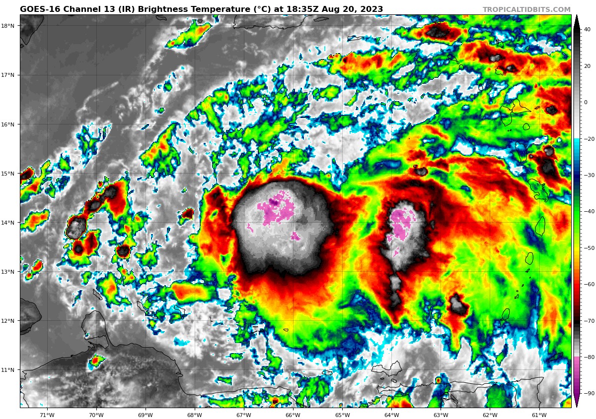
Lee is looking better by the frame; this is the clearest the eye has been in days, and intense convection has fully surrounded the center of the system. I think he might make a run for his earlier peak if trends continue.

-
 2
2
-
-
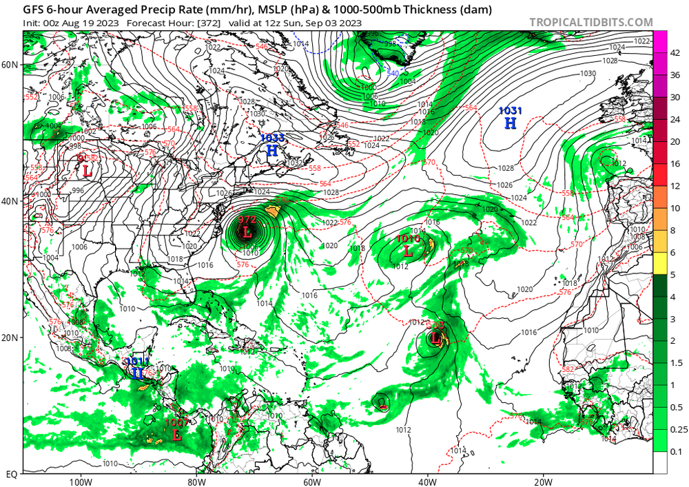
Even if Lee whiffs we have a whole other week of potential tracking for soon-to-be Nigel.
-
3
-
1
-
-
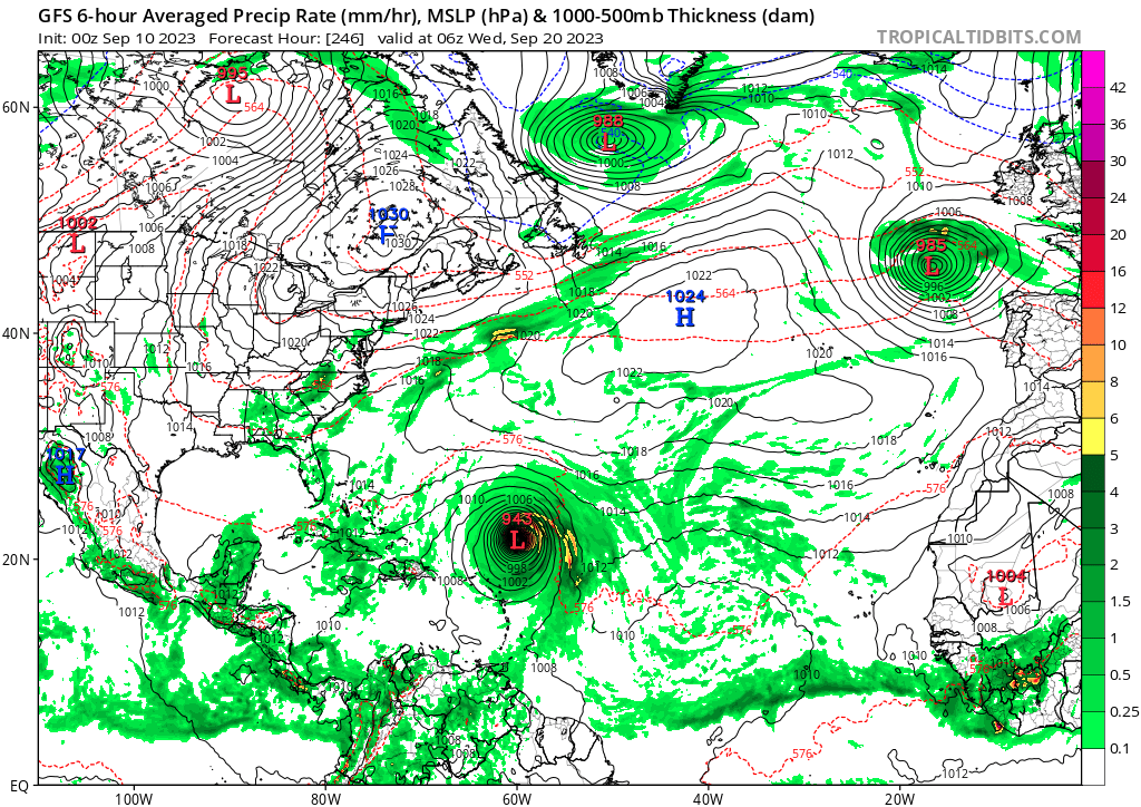
GFS bringing round 2
-
Sheared slop. NEXT!

-
What a beast. Looking better by the frame.
-
1
-
-
Even if the winds aren't more than a typical nor'easter, this will be carrying a significantly larger fetch of water, which is often the larger threat with hurricanes anyway.
-
It's cumming for us

-
1
-
3
-
1
-
-
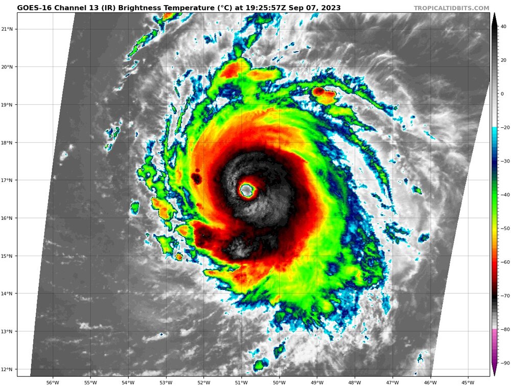
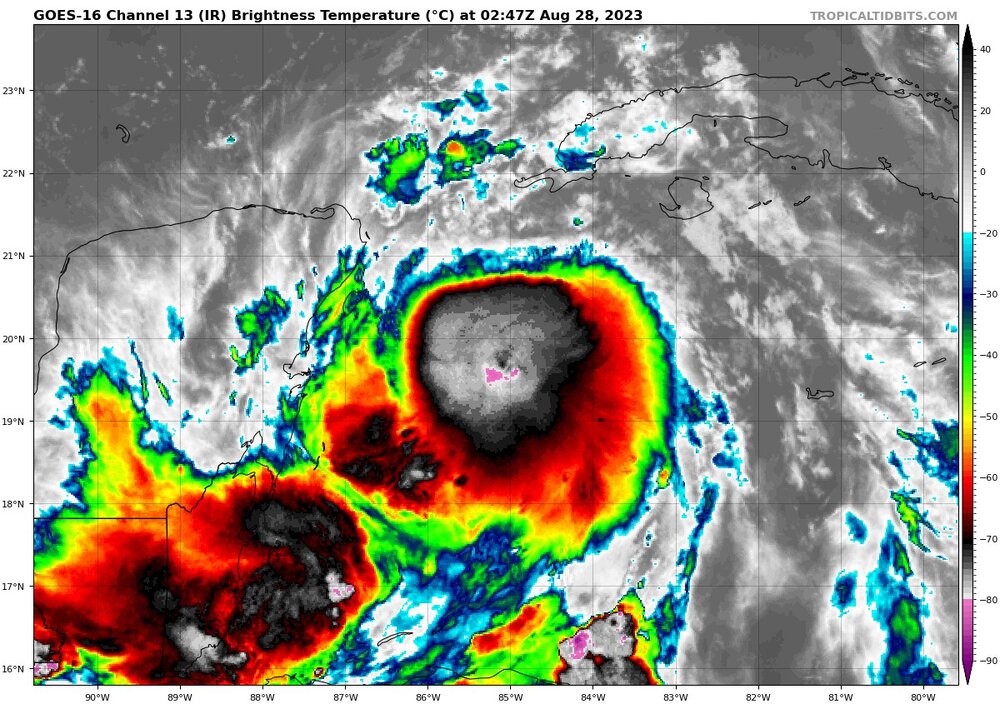
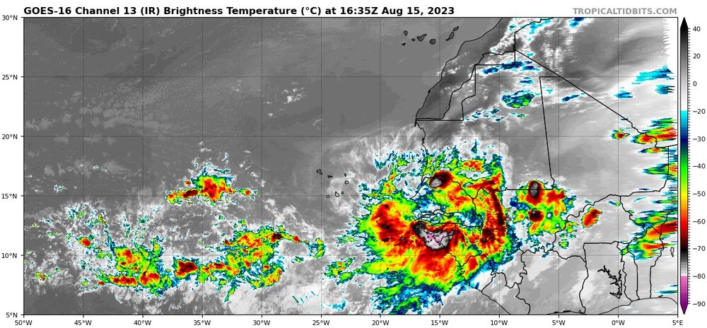
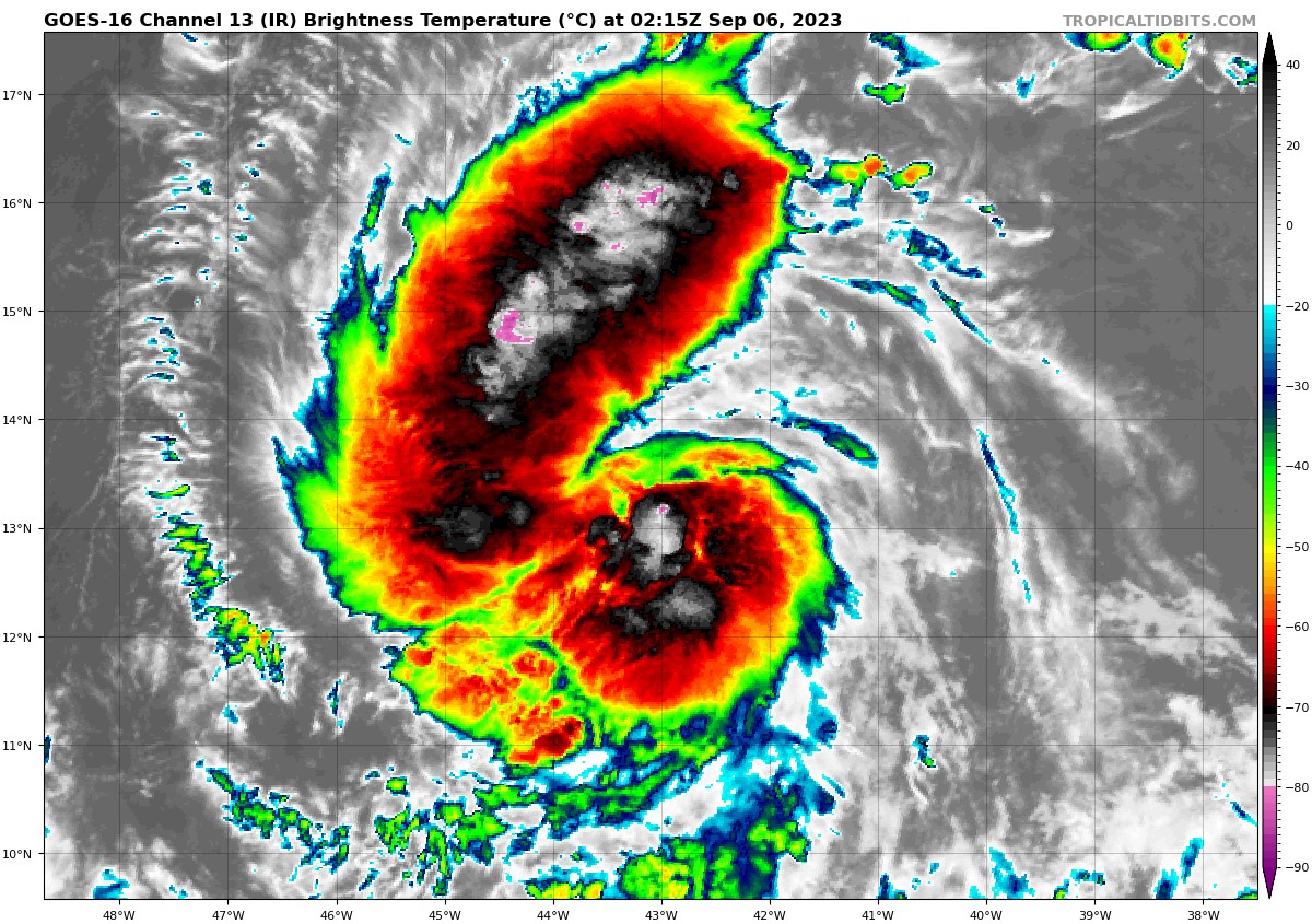
Aside from a thick CDO, you can't really ask for a better tropical depression satellite presentation. Robust dual outflow channels, a defined low level circulation, and visible banding. Future Lee is primed to take off. Not only is this going to be a powerful hurricane, but it is also going to be a large one.
-
8
-
-
3 minutes ago, MJO812 said:
Weenie run
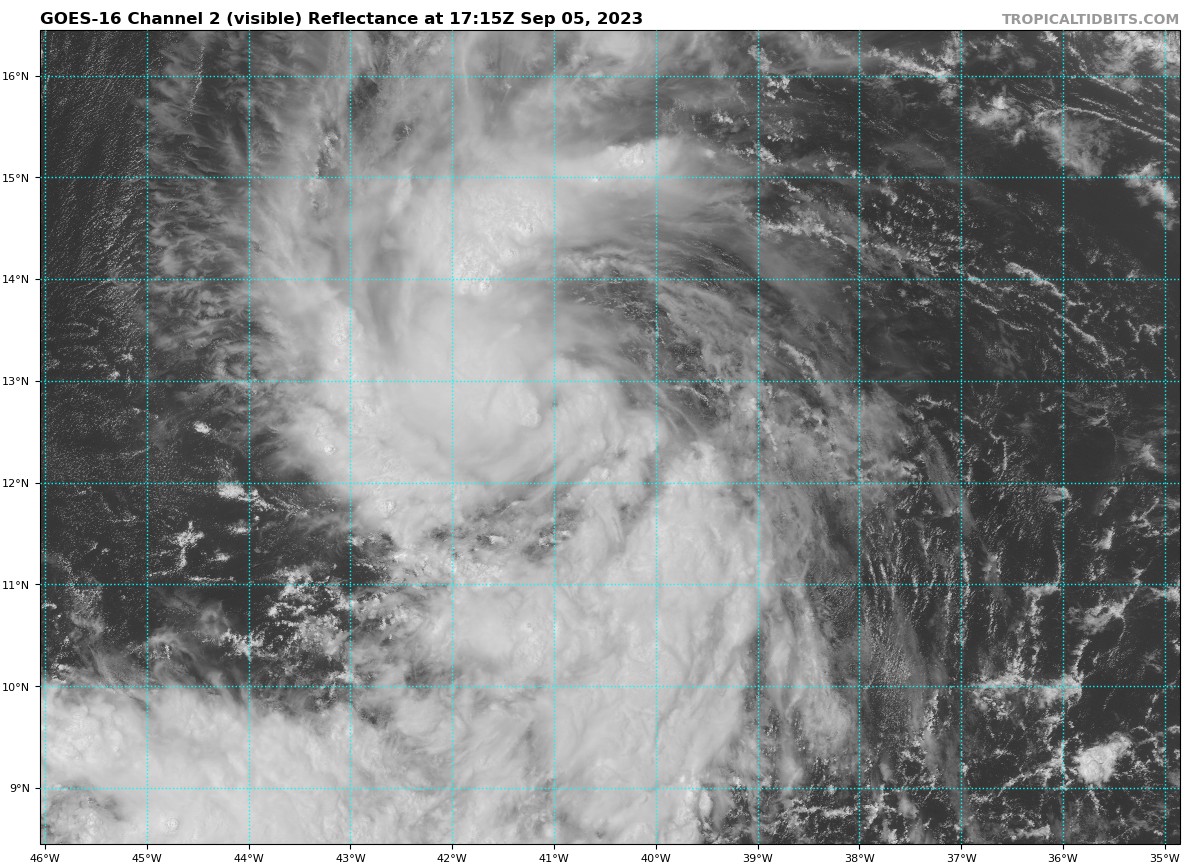
If we could just get the system moving a little faster.. would-be Lee is absolutely crawling past day 7. Either way, we track

-
1
-
-
Looks like Idalia is forming a potent and relatively tiny core. Will be interesting to see if it will collapse like Delta's or give way to a period of rapid intensification. All interests on the Florida gulf coast and coastal Southeastern states should be watching very closely.
-
1
-
-
So close but yet so far

-
12z ICON and GFS are shifting way West, I wouldn't write this one off just yet. Frankly I think there's a scenario where Franklin misses us to the South and hits somewhere else on the EC, depending on how ridging builds in.
-
3
-
-
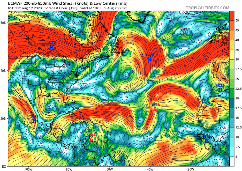
GFS is insistent that the current LLC will die off and another will form farther Northeast (which is entirely possible due to the high levels of shear). If that doesn't pan out, I'd expect the track will be adjusted to the west somewhat.
-
Very strong convective burst occurring slightly to the East of the low level center. Definitely looks to be strengthening quicker than forecast (most models didn't bring 90L down to 1001 mb until right before landfall/in the open Atlantic). Will be interesting to see how this affects the track.

-
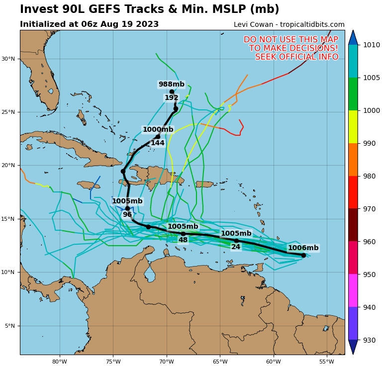
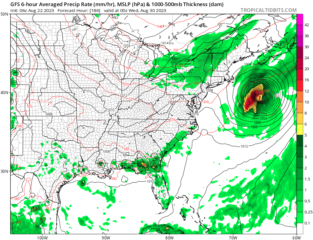
Figured I'd make a thread for this disturbance. 90L has come on the scene rather quickly - As a disturbance from the western edge of the monsoon trough, models only started picking up on potential development of this system a few days ago. 90L has appeared to be steadily organizing over the past day, with popcorning CBs and early indications of banding patterns. Model-wise, a powerful trough is expected to pick up the developing system through Hispaniola and potentially posing a threat to Bermuda down the line. However, as indicated by the GEFS spaghetti plot, there are lots of options still on the table, and a great deal of uncertainty as to the future track.

-
 1
1
-
-
On 8/12/2023 at 5:09 PM, tiger_deF said:
I think the chances of an August shutout are looking more and more likely...
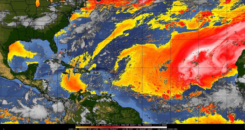
Looks like I was wrong about August at least! The basin looks to be getting quite active over the next couple of weeks. Two areas that I think present distinct threats to land:
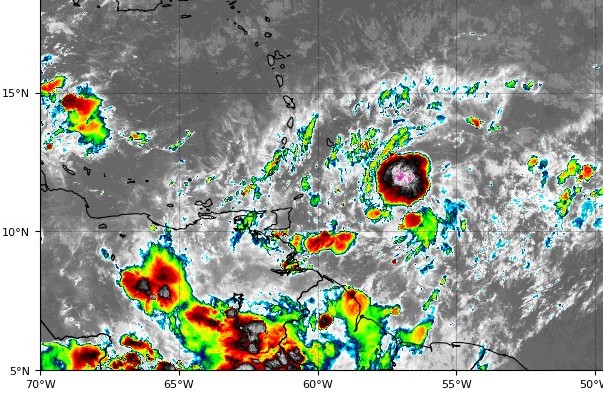
1. The westernmost portion of the decaying monsoon trough. Model support has quickly grown over the past day, and there is currently a massive convective burst taking place over the center of the disturbance, shown below. Models take this system right over the antilles/PR.
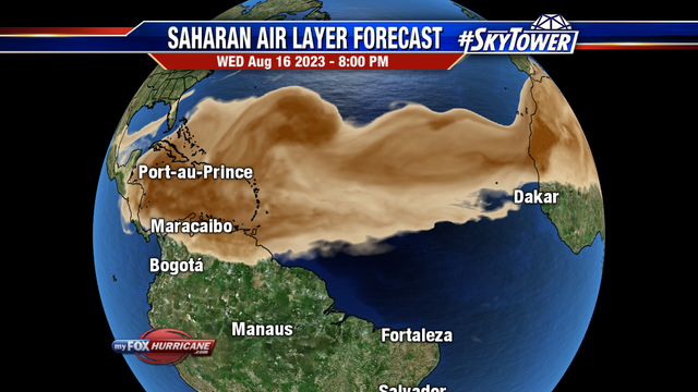
2. The wave currently coming off of Africa. Model support is also growing, with the 00z GFS developing the system in a few days. The Bermuda high appears much more stout than it has been, and the GFS takes the system across the entire Atlantic, recurving extremely close to the east coast. With 98L acting as a sacrificial lamb to SAL, the local environment looks very conductive for development.
-
5
-
-
The wave just moving off of Africa is picking up some interesting model support.
-
2
-
1
-
-
Worth looking at the vorticity as well. 99L is well on its way.
.gif.ce887076b575207bb417458278d87f18.gif)
-
1
-
-
The wave moving off of Africa right now is quite impressive. How it develops (or fails to) and how it interacts with the wave in the Central Atlantic to the left will be interesting to watch over the next few days.
-
1
-
-
49 minutes ago, GaWx said:
1. Today's 0Z CFS develops only 1 of the 4 possibilities now being watched.
If the CFS is correct verbatim the season outlook is pretty grim. Two total storms from now to mid-September, right past the peak of the season.
EDIT: SAL forecasts show the entire basin completely smothered in dry air a couple of days before the bell ring
-
1
-
-
I think the chances of an August shutout are looking more and more likely. The Euro is forecasting a large area of shear that will smother a substantial portion of the basin, the 384 hour GFS has been effectively dead for weeks and has shown nothing but hostile conditions, and extremely dry air pervades the eastern and central Atlantic. Just a few weeks ago, 95L and 96L had decent model support yet completely failed to develop. All models are intent on developing multiple hurricanes in the EPAC over the next couple of weeks. Meanwhile we are grasping at straws looking at patchy areas of vorticity and and ensemble members over 7 days out for even the faintest signs of life.
I'm still expecting a "switch flip" at some point so to speak, and I'm fully prepared to eat crow, but I'm astonished agencies have actually been raising their forecasts. Nothing in the past month has been indicative of an active season, and El Nino seasons are not known for being backloaded.
-
3
-


Hurricane Lee--Glorified Nor'Easter or Legit Tropical? Near Miss or Direct Hit?
in New England
Posted
This goes against my preferred narrative, therefore the UKMET is as garbage as they come and can be completely ignored.