
JTrout
-
Posts
152 -
Joined
-
Last visited
Content Type
Profiles
Blogs
Forums
American Weather
Media Demo
Store
Gallery
Posts posted by JTrout
-
-
One time!! Tired of being in the LSV snow hole this winter.
-
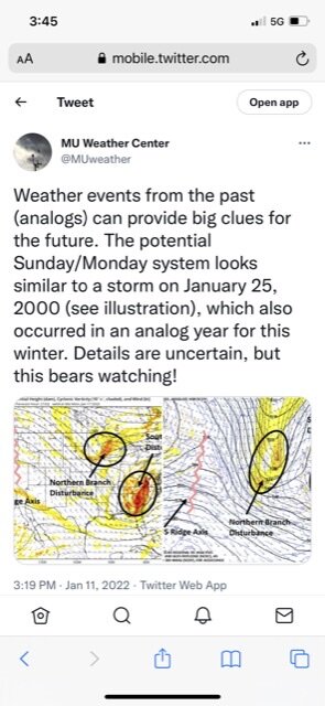
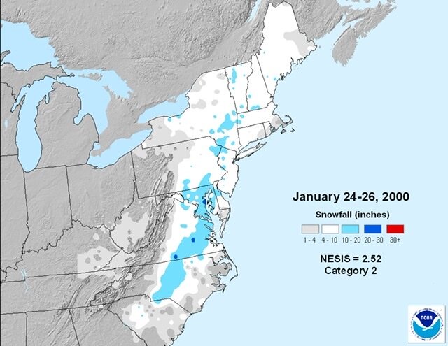
Elliot from Millersville compared the potential to the Carolina Crusher from 2000. I added that snowmap for comparison. Maybe this one can be the Keystone Crusher!
-
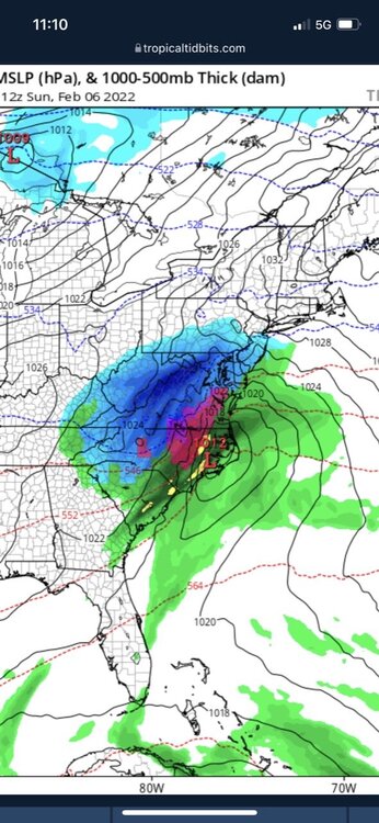
Is this anything to talk about for tomorrow. Possible squall line or something?
-
45 minutes ago, Mount Joy Snowman said:
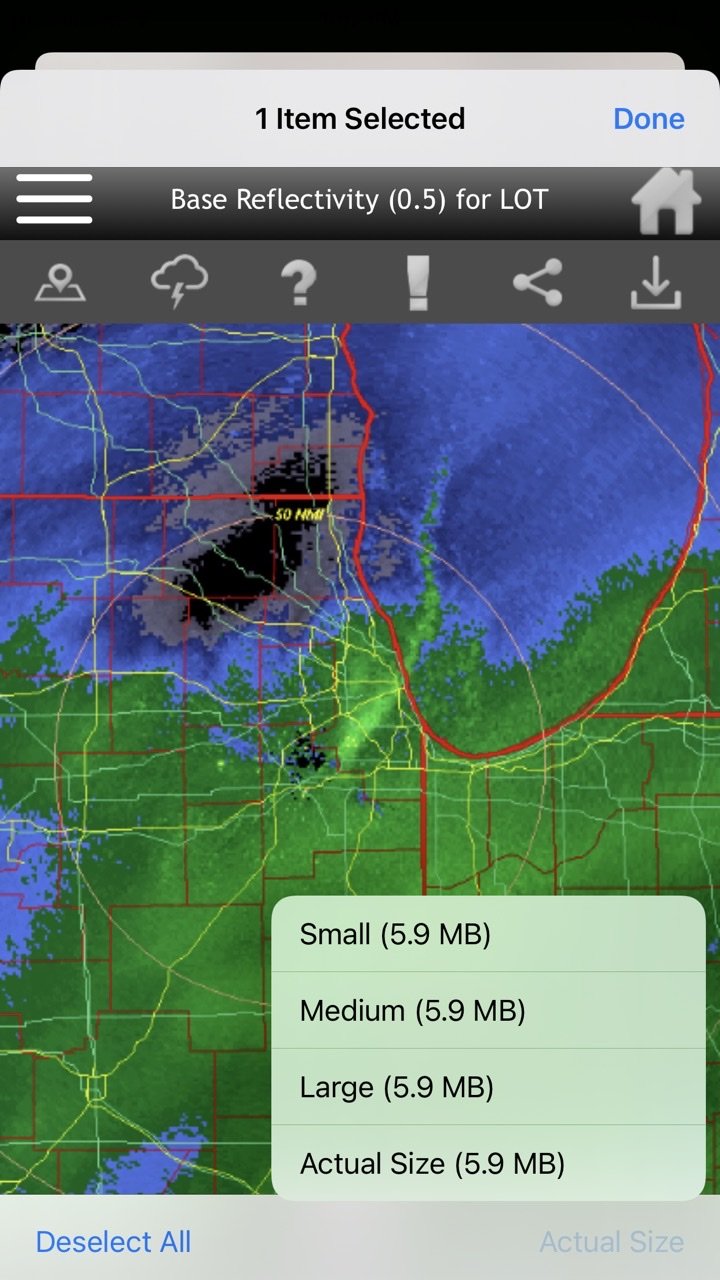
It’s saying I cant post a photo from my phone bc its too big? 1.95MB limit or something. Im new to this forum anyone have any advice?
Mine does the same, on my phone I just switch it to the large size, not actual size. Then it works.
-
 1
1
-
-
43 minutes ago, Mount Joy Snowman said:
It’s saying I cant post a photo from my phone bc its too big? 1.95MB limit or something. Im new to this forum anyone have any advice?

-
Moderate snow in Etown, first flakes about 30 minutes ago.
-
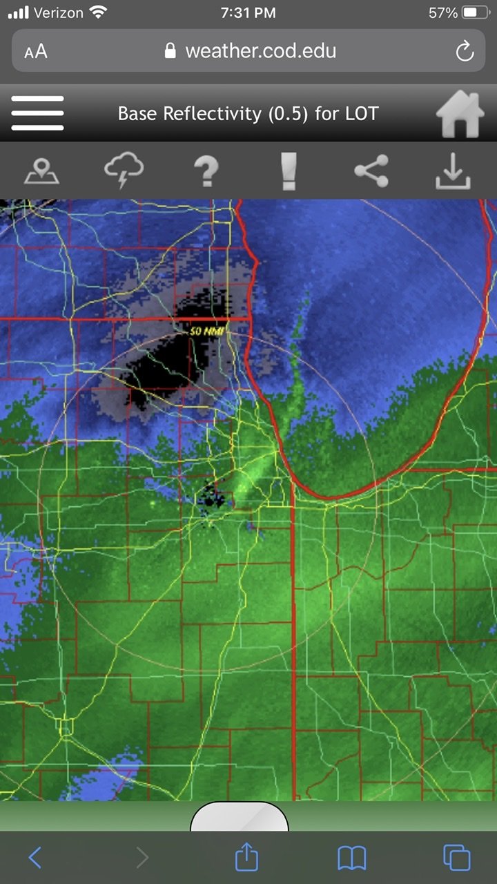
I would love to know what is happening under that lake effect band heading south on Lake Michigan and the southern storm heading north into the same area. I am assuming insane rates. Never seen that before!
-
9 minutes ago, Jonesy56 said:
Yea!! High fluff factor, huge flakes for past 20 minutes.. pleasantly surprised.
.Good to hear, hopefully it holds for its journey through the LSV
-
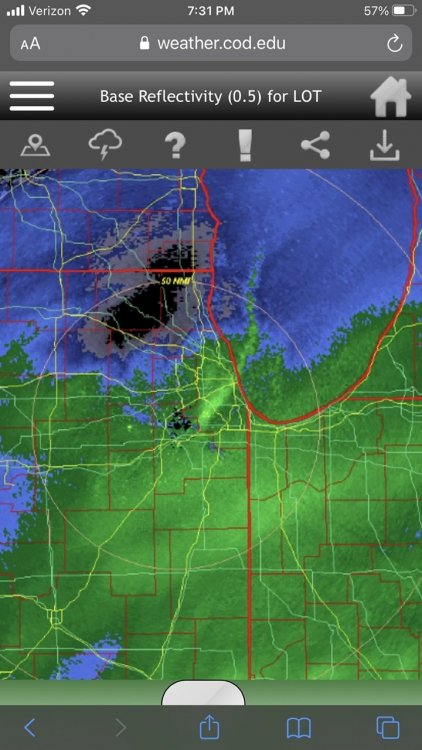
This band doing anything for anyone? Looks a little mean
-
11 minutes ago, paweather said:
GFS rolling....Friday looks like rain for most.
1 minute ago, pasnownut said:Just densifying the pack for the next events to pile onto...

I was just going to ask someone if we have a chance at anything frozen for Friday...
-
10.75 inches NW of Etown, 29.5 and mod snow.
-
1 minute ago, MAG5035 said:
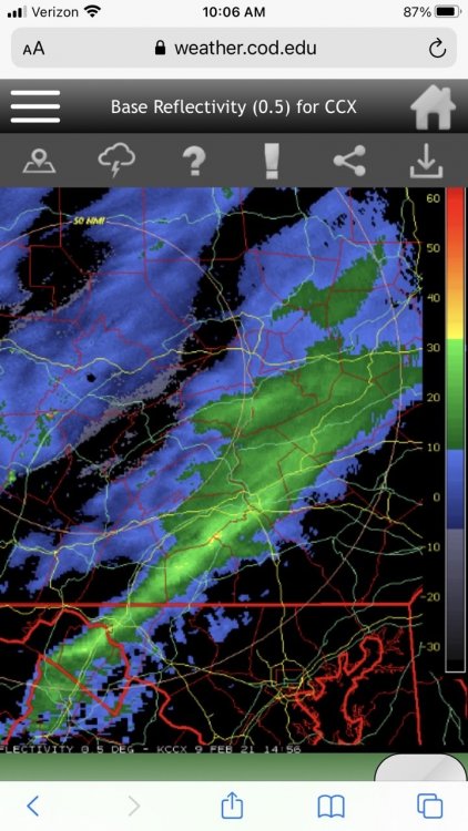
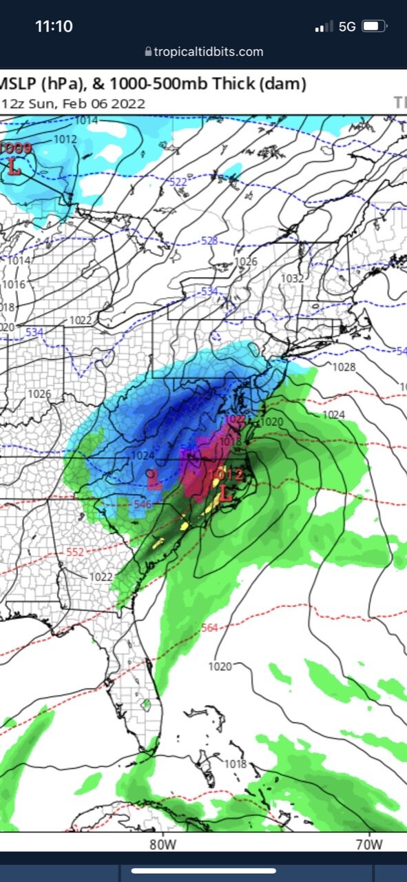
The best forcing and deepest moisture is a bit NW right now, so your still left with the low level easterly flow still bringing in moisture and snowfall even though crystal growth is limited. This is in the lowest several thousand feet so can't really see it in the LSV from CCX or LWX radar. Looking at KDIX (Philly) radar you can see the radar is filled in with echoes and that continues into the LSV.
It sucks looking at the radar, just feels like we are getting screwed in the hole. Then I look outside.....mod snow. Feel okay again!
-
Snow starting to come down pretty good NW of Etown! Sleet mixed out 5 minutes ago.
-
7 minutes ago, Anduril said:
Radarscope has a pretty good option for it for mobile. not sure on computer
Thank you!!
-
Mod sleet just started 10 minutes ago, what do you guys use to see the sleet line? Is it advancing still or should we switch back to snow soon in the LSV?
-
 1
1
-
-
Starting snowing in Etown 5 minutes ago! So it begins....
-
1
-
-
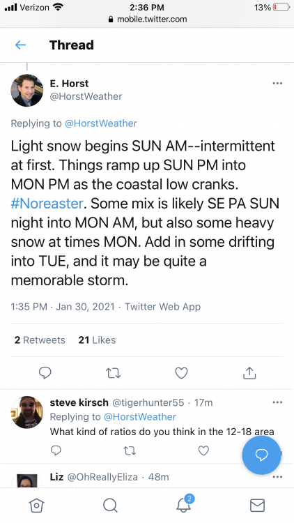
My favorite part of the Horst quote is “it may be quite a memorable storm”
-
1
-
-
Alright storm is over, what's next....anything look interesting in the next week to anyone? Looks like we have a shot to keep the snow around till x-mas.
-
2 minutes ago, Voyager said:
Gravity waves?
Is that good for LSV to get snow rolling again, heavy precip, just some fun looking radar?
-
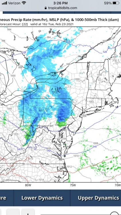
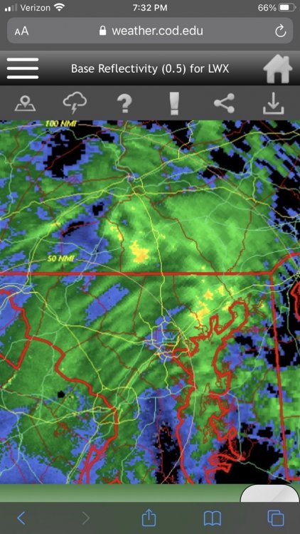
Could someone smart tell what the rippling in the radar is from? Also, some heavier precip is definitely building back up for the LSV. Better then a dry slot!
-
2 minutes ago, pasnownut said:
I swear. WTF is it with the outline around Lanco. FFS
Ever hear of the warm nose! Lancaster is kinda nose like in shape, so they thinks it’s funny!! Haha
-
1 minute ago, Voyager said:
But the creator of thundersnow...
Yea if you want 4” hour rates and some thunder snow. He is your man
-
1
-
-
3 minutes ago, paweather said:
Cantore the kiss of snow death.
Gotta love the guys enthusiasm for weather!
-
1
-
-
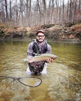
Sorry, not sure why the pic uploaded sideways


Central PA - Winter 2021/2022
in Upstate New York/Pennsylvania
Posted