

Sernest14
-
Posts
340 -
Joined
-
Last visited
Content Type
Profiles
Blogs
Forums
American Weather
Media Demo
Store
Gallery
Posts posted by Sernest14
-
-
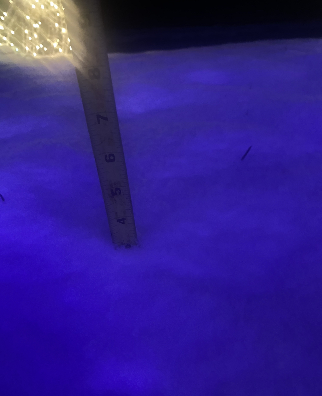
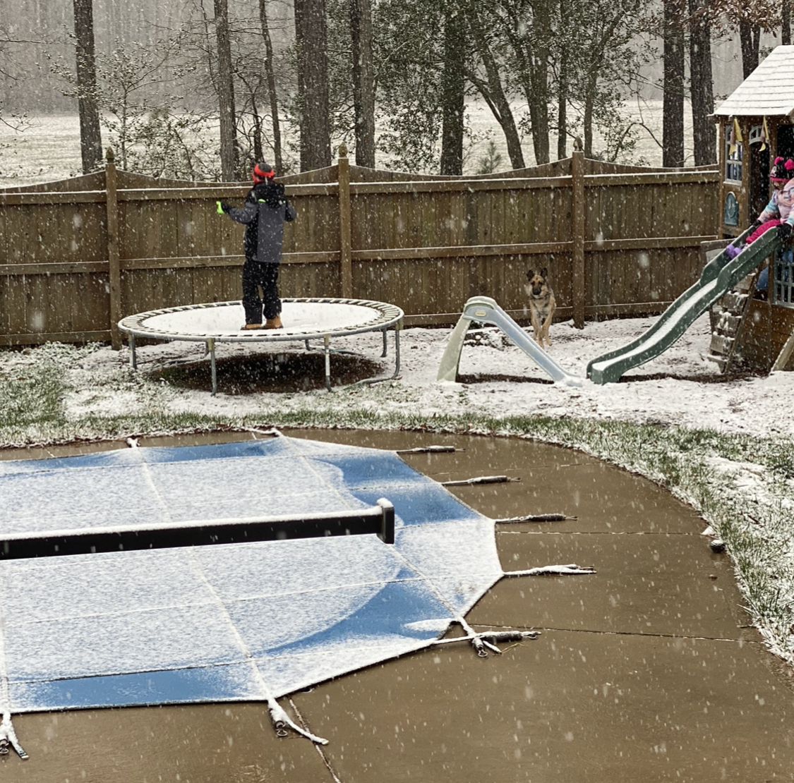
Finished right around 3” in Ashland between ric and kings dominion. Looks like a shot later with the stuff in NW NC but other than that appears done. Definitely over performed the short range models and the southern edge of precip

-
 9
9
-
-
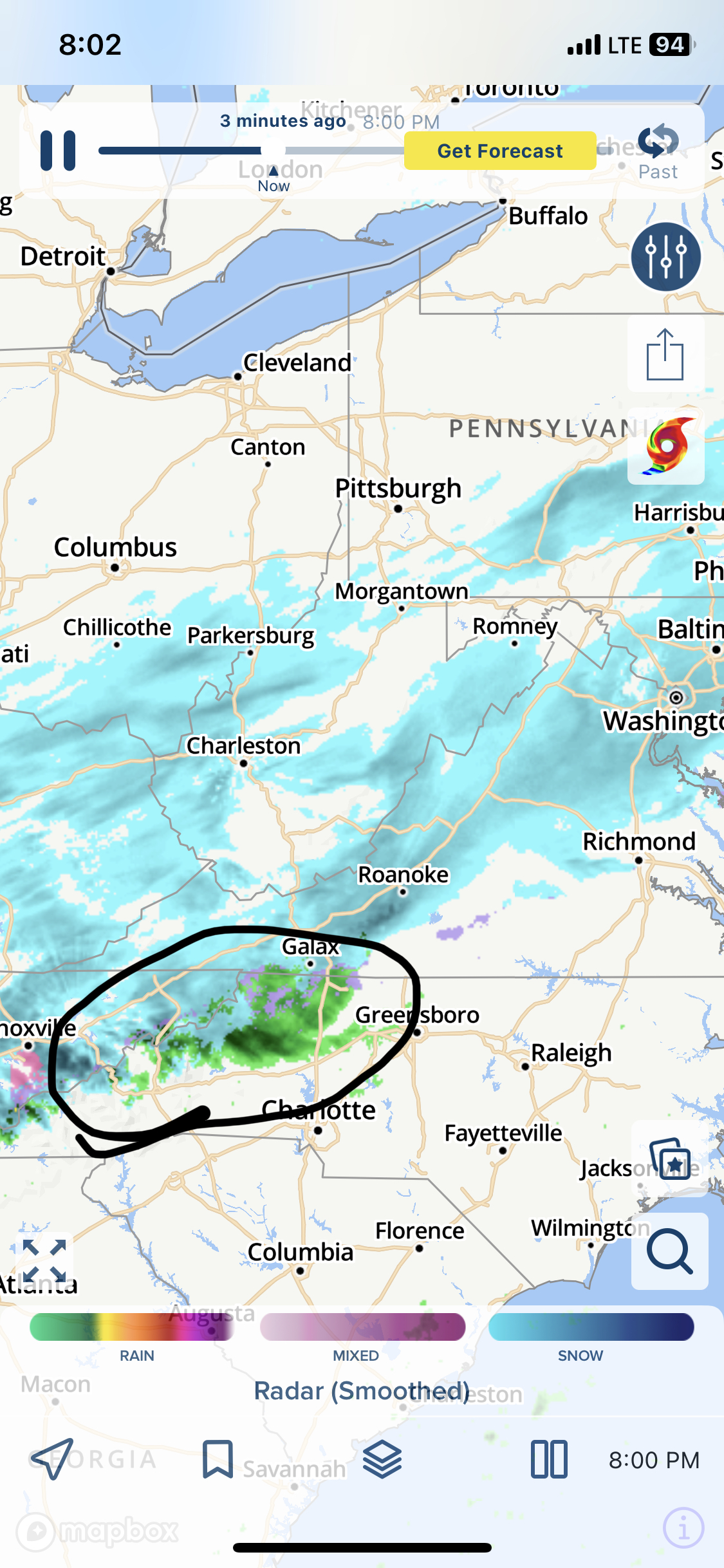
Looks like we have another little shot with this

-
1
-
-
Currently at 3”- definitely better than models were showing!
-
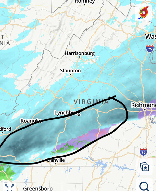
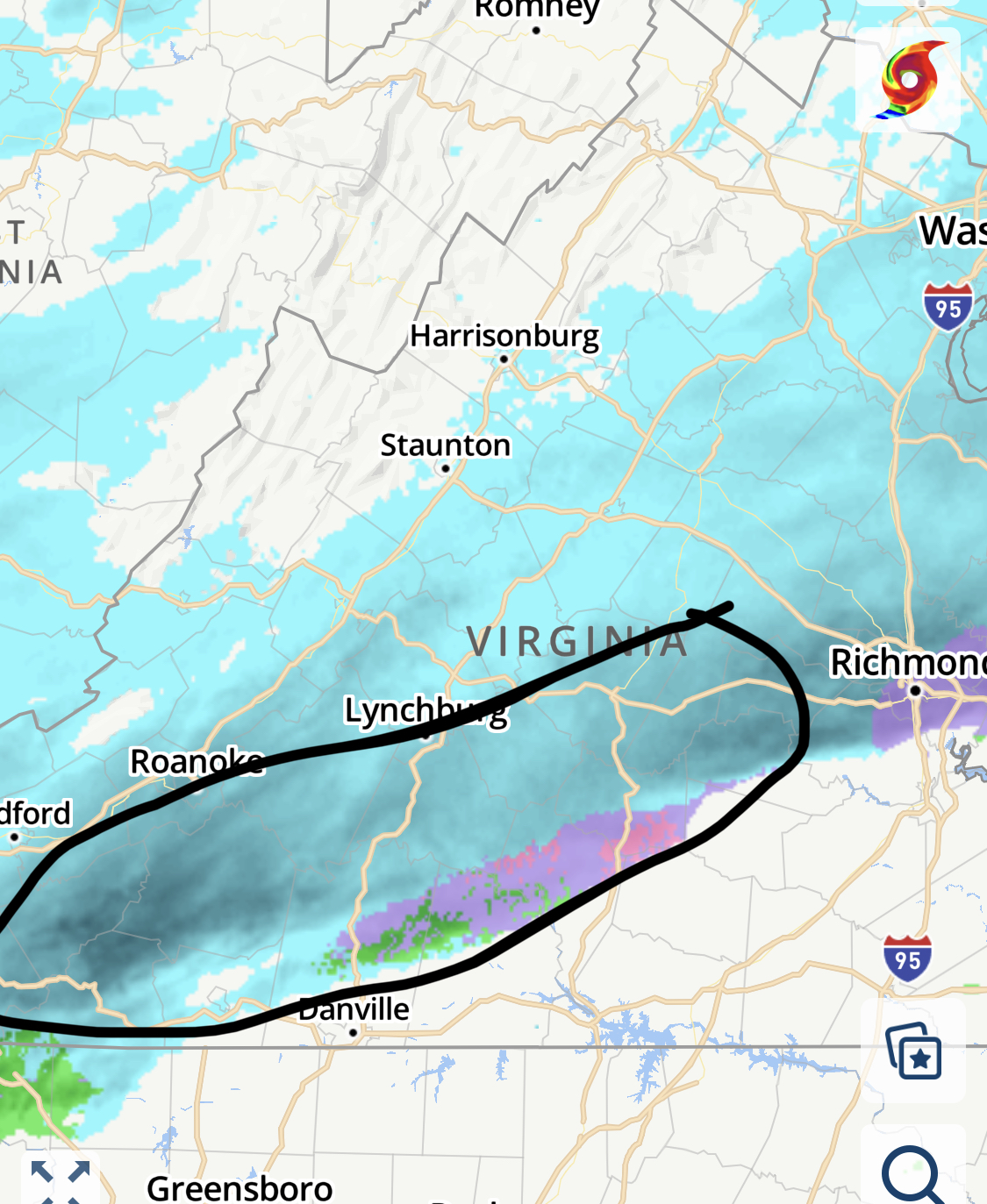
Looks to be filling back in around Danville but a dry slot between there and Lynchburg opening up
-
Same on both- back to all snow and coming down pretty good atm - probably sitting at 1.25” to 1.5” on the surfaces that accumulated first
-
1
-
-
Spoke to soon- sleet mixed in now
-
Hoping that band south of Roanoke and Lynchburg doesn’t move too far north and we can get some of that. May be pushing north too quickly though
-
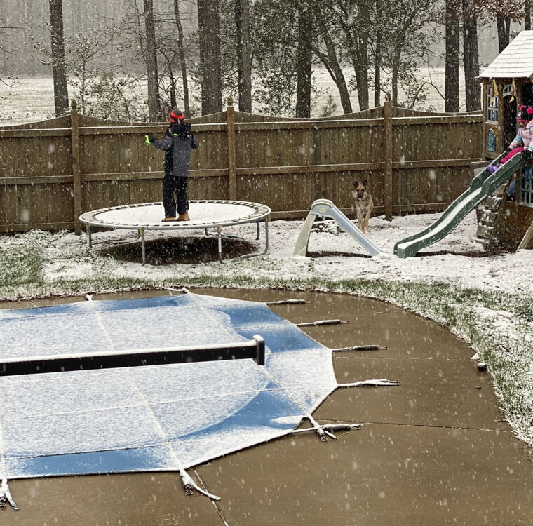
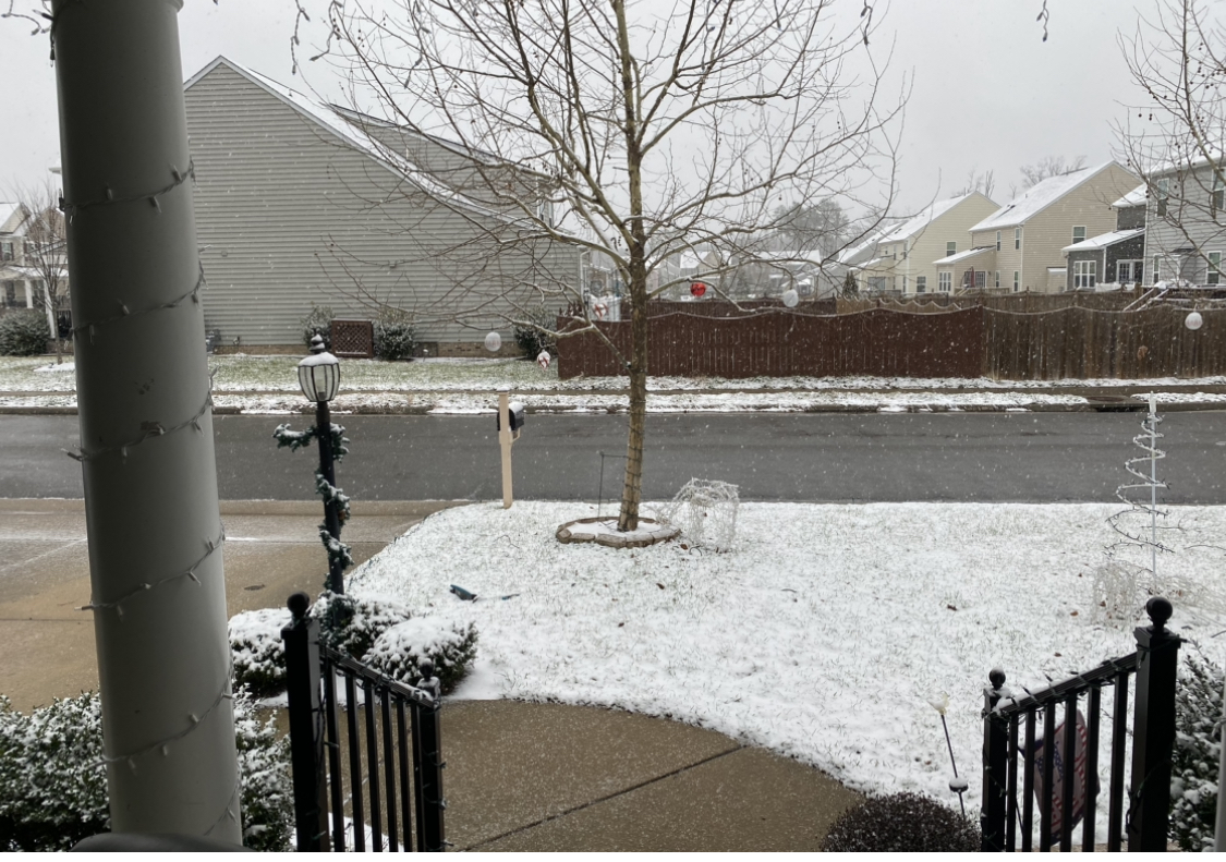
Still snow in Ashland (just north of Richmond). Walkway and driveway starting to cave a little.
looks like we have maybe another . To 1” to go before it moves out

-
3
-
 1
1
-
-
Still coming down decent and all snow in Ashland. Driveway and sidewalk starting to cave a little

-
18z NAM giving about an inch or so over the next couple hours- fingers crossed
-
Decent coating so far
-
1
-
-
Sticking minus concrete/roads- hopefully can pick up and have those start to cave too
-
1
-
-
Finally some flakes in ashland. Looks like it should stay snow for a bit and pick up based on radar
-
1
-
-
11 minutes ago, wasnow215 said:
100% -and it looks like returns are coming in more south than some of the short term models and even the GFS had it this morning and 0Z last night. You see that @RIC Airport? Or am I having “radar hallucinations”? Haha
Seeing the same, looks like Danville area is seeing snow make it down per traffic cams so hopefully a good sign for us
-
2
-
-
Radar looks a lot more full and expands south more, especially in carolina from what models are showing so hopefully that’s a good sign
-
1
-
-
Some sleet starting to mix in
-
18z’s look great for here. Upping totals by a bit
-
1
-
-
Just started here
-
Looking like a 1-3 type event (with upside of 3-5). GFS seems a bit more precip. than others but everything has at least 1"
-
ICON's out here saying, "yeah, we'll just skip this, we have no idea what's going to happen so we're just not even going to try"
-
Definitely looks like it’s trending more to the GFS in terms of when and where the frozen precip is at 60
-
Slowing up a bit- really confused cause multiple radars show nothing overhead (or even very close) but still coming down as at a nice light clip
-
1
-
-
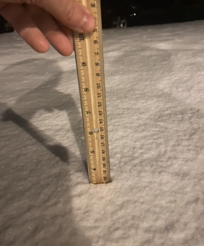
Right around 3” in Ashland (grass measurement). Shaded pavement areas caved

-
1
-
-
Right around 3” in Ashland (grass measurement)

-
1
-


Richmond Metro/Hampton Roads Area Discussion
in Mid Atlantic
Posted
HRRR has been awful with this storm so far (at least for our area). it has wanted to continue to push the precip more due north than a more ENE direction which is what we saw all day. I feel like every run they had precip out of our area within the hour