
SnowDreamer
-
Posts
436 -
Joined
-
Last visited
Content Type
Profiles
Blogs
Forums
American Weather
Media Demo
Store
Gallery
Posts posted by SnowDreamer
-
-
12k NAMming in progress.
-
 1
1
-
-
What is the best source for snow verification maps? I was planning to use this https://www.nohrsc.noaa.gov/interactive/, but it looks like an errant 21" reading around harrisonburg has messed that map up.
-
14 minutes ago, Demeter said:
Are we going to roll this thread right into obs for this one? Looks like some blue returns over the area.
For my bingo card... do I get "virga", "radar hallucinations", or both for this?
-
UKIE is meh

-
QPF is just a bit better pretty much everywhere. trend = friend
-
7
-
-
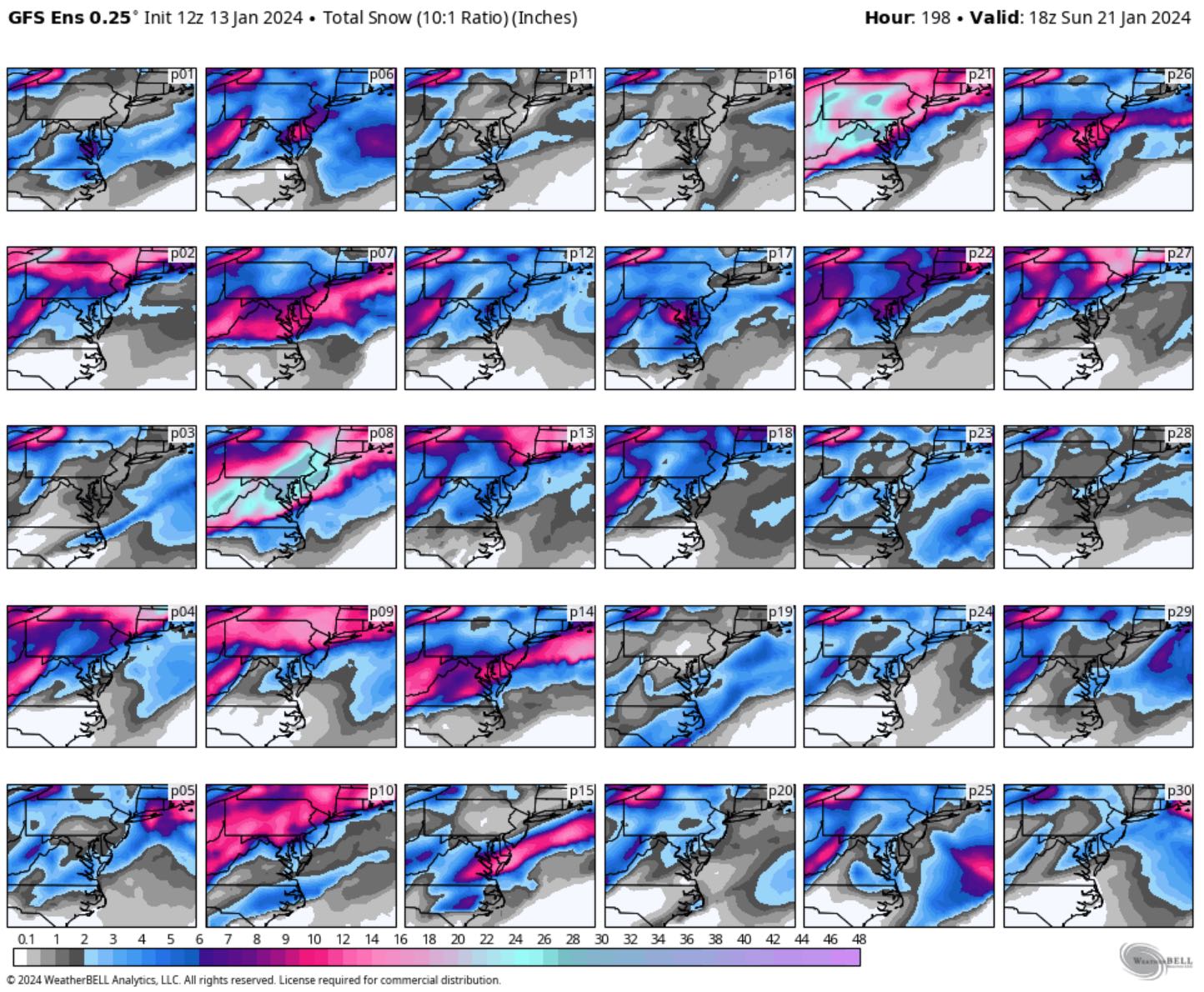
Unsurprisingly, the GEFS mean is skewed by two HECS. I'll take P08 and call it a decade.

-
2
-
-
The fact that we are now posting MECS in the panic thread is telling. Tough times in Weenie-ville.
-
No threads until the 1” streak is broken. Desperate times call for desperate measures. EURO shows 20” in 24 hours? No thread.
-
56 minutes ago, Paleocene said:
And never nothing to sudden surprise snow inside 96 hours
Not that I'm not bummed, but we do sometimes get good trends. Jan 3rd 2022 was a late trend North which increased totals for many by a lot.
-
1
-
-
Kicker coming out of AK is weaker again.
-
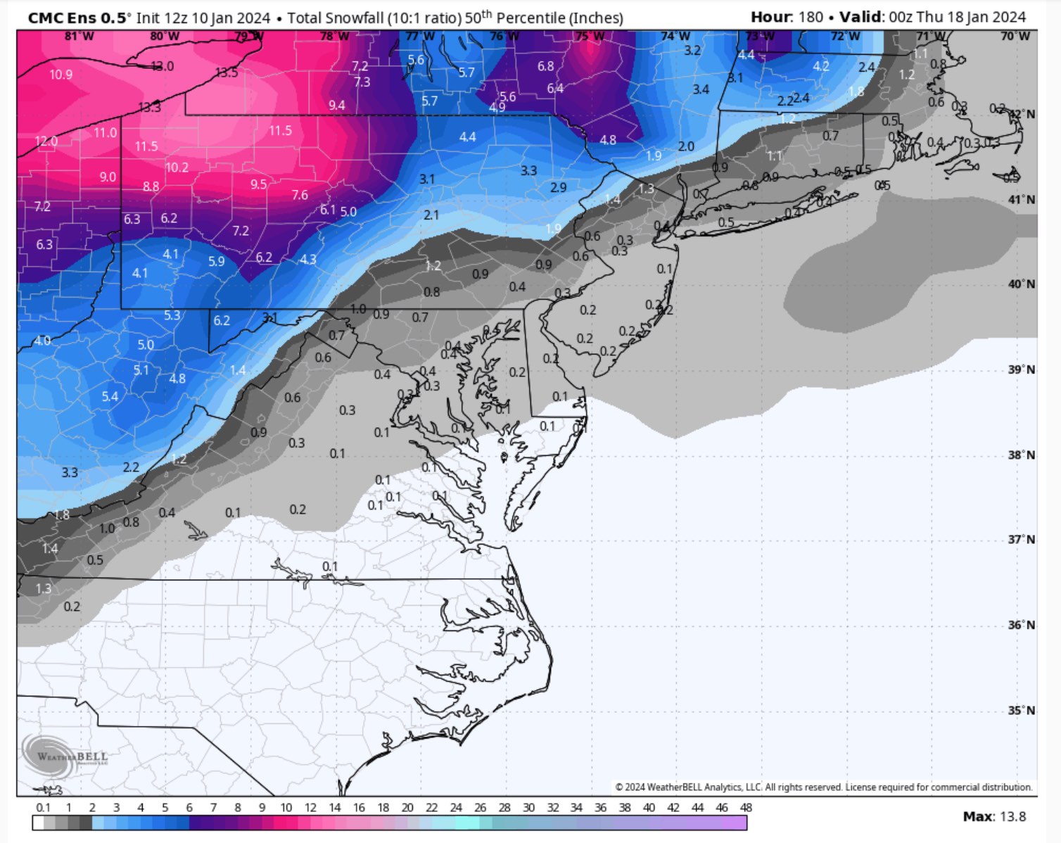
GEPS snowfall looks a lot better than 12Z... 3-4" region wide on the mean. The GEM looks like a warm outlier against its own ensemble.
-
2
-
-
3 minutes ago, H2O said:
I blame that we even mentioned a storm thread
.gif.0646a69836edbd63086c930724975774.gif)
-
 2
2
-
-
12 minutes ago, Terpeast said:
I don’t like the CMC solution, but it still seems unsettled with the h5 evolution. How has its performance been lately?
Also unsettled for the 7th storm. Was usually either the most or least snow of globals.
-
Beauty of a track. Straight up the coast with plenty of inland snow too.
-
GEPS median took a massive leap forward at 00Z.
-
7
-
-
1 minute ago, psuhoffman said:
@Ji TLDR version...there are multiple ways for us to get F'd
I vote this for the next storm thread title.
-
3
-
 2
2
-
10
-
-
1 minute ago, brooklynwx99 said:
the evolution on the GEPS is straight up classic
Help me out here - trying to learn when things are calm. I see a huge West-based block, low heights around the great lakes, and a 50-50ish low at the start. The block breaks down, and I've heard many say that we often score our bigs ones when blocking regimes relax. The low heights around the great lakes move East, but seem kinda far North to me. What should I be keying in on here?
-
Nearly .55" of rain in the last 2 hours brings my total to .76" - Sigh
-
GFS has a solid hit the 16th/17th
-
3
-
-
5 minutes ago, Amped said:
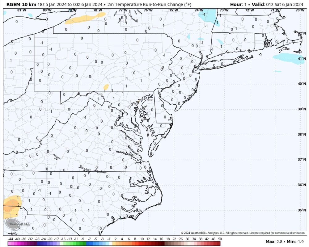
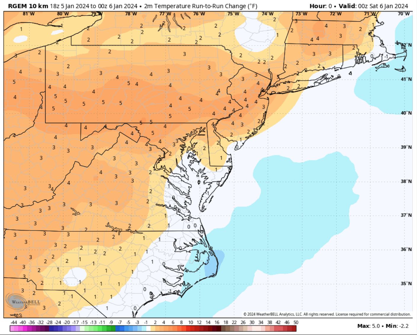
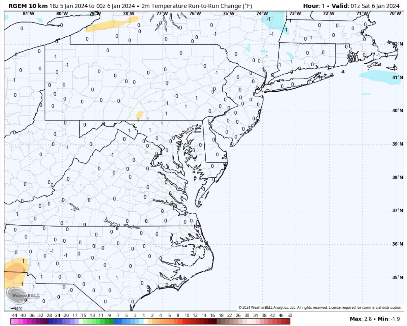
RGEM pretty much matches it's 18z run except for a snow hole near York PA. NAM could never dream of being that consistent.
It is comically stubborn. I love that it initializes 3-5F warmer than the 18Z run at hour 0 and then INSTANTLY jumps to its old forecast at hour 1. "Nah, I was definitely right before"

-
1
-
2
-
-
18 minutes ago, Jebman said:
...taking in long jebwalks and sneaking out at 3am and walking in and wallowing in other people's snowdrifts! It is so much fun and such a THRILL! rolling around in stolen snowdrifts in the middle of the night!
This is so wholesome.
-
1
-
-
I'm rooting for you Westerners!
-
3
-
1
-
-
2 minutes ago, psuhoffman said:
One is 12z the other 18z
Well **** me. Thanks lol
-
1
-
-
5 minutes ago, high risk said:
That's because the code that accumulates snow is inside the model and is driven by microphysics, and the code that generates precip type is outside of the model and is driven (mostly) by the temperature profiles.
If the code that accumulates snow is inside the model and driven by physics, then why are snow accumulations so wildly different on different websites? Presumably they all use the exact same data from the model.


The Weekend Rule? Saturday 2/17 - The Icon Storm
in Mid Atlantic
Posted
40/19
Got a good feeling about this one