Beachin
-
Posts
337 -
Joined
-
Last visited
Content Type
Profiles
Blogs
Forums
American Weather
Media Demo
Store
Gallery
Everything posted by Beachin
-
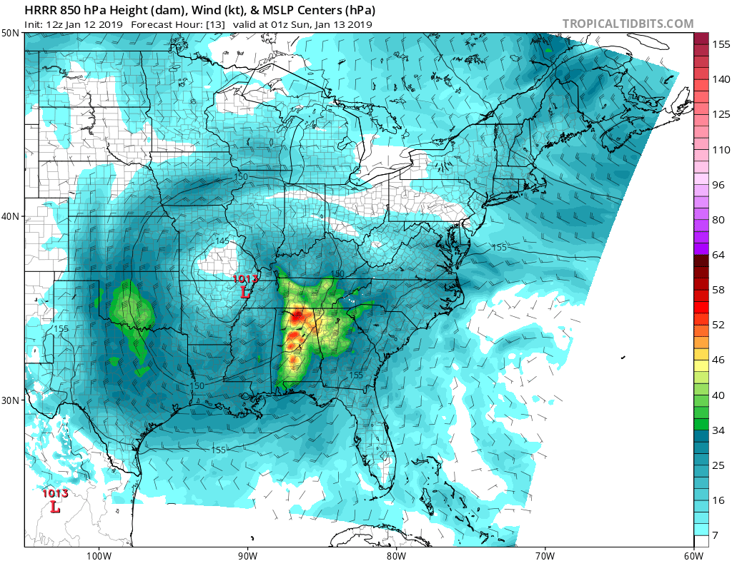
There is some really deep moisture and vorticity advection aloft. Soundings are gonna show some definite instability aloft. Pretty good signal for strong banding and possible convection (Thundersnow)
-
Man this run is gonna be a beatdown lol Low is actually inland over NC headed towards EVA
-
I spy the NAM strengthening the 850mb jet Closed 145DM 850 low this run too. Everything is only getting better
-
LOL oh yeah big time NAM'ING incoming 500MB is the best its looked Yet!
-
This is gonna be a good run much more expansive precip into WV and a strong 850mb jet coming out of the south 14 still has a closed low signature Vort has responded much better. Consolidated and stronger
-
Long long range HRRR its still snowing so you can add to this im sure but yeah looks good HRRR KUCHERA Northern MD 5-8 Baltimore metro and DC metro 6-10 few 10+ pockets

-
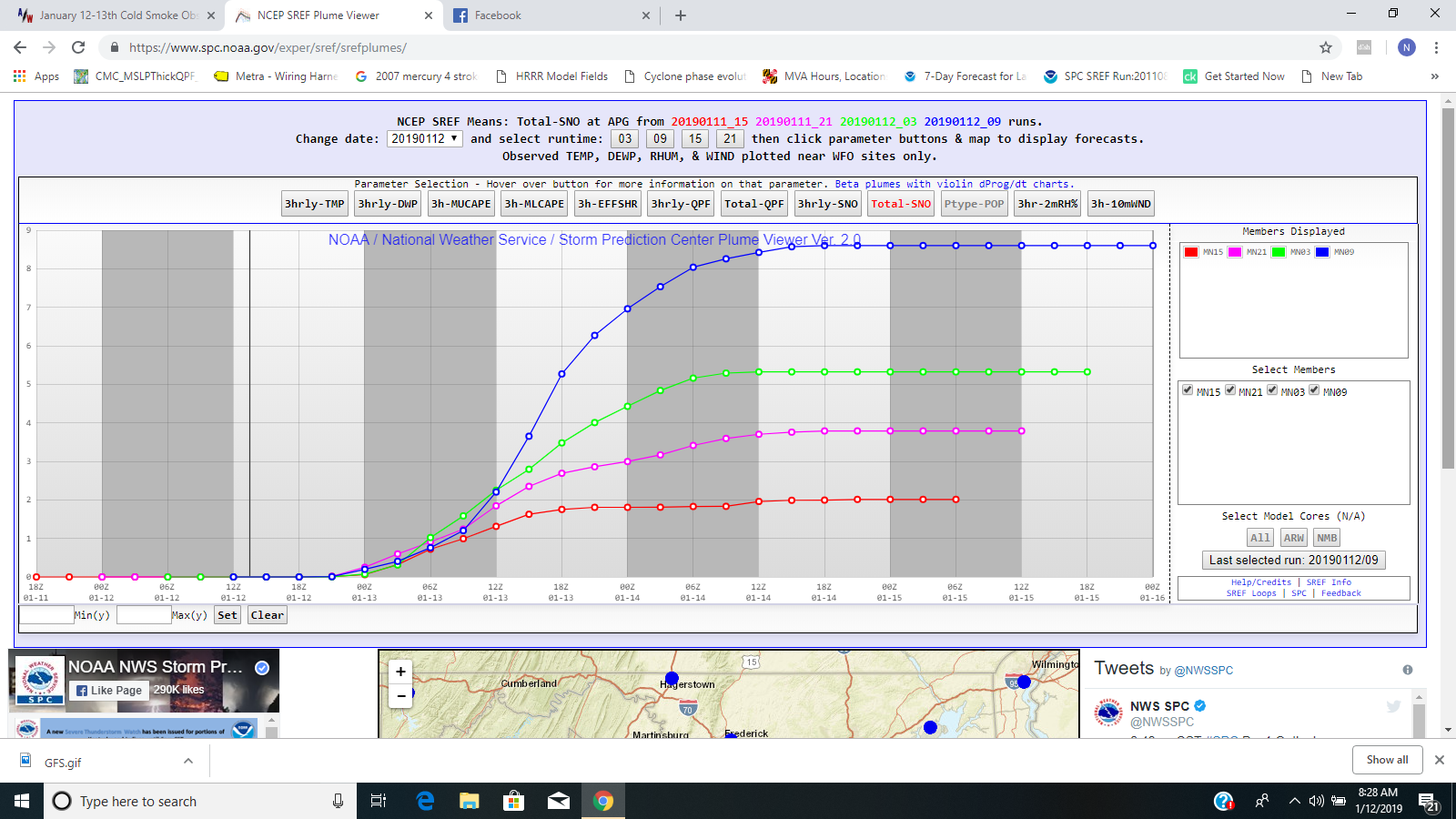
I know the NWS uses the SREF'S for trends very close to a event so this has to have them thinking for sure. IF 12z models nail WSW will fly for everyone im sure
-
You are reading it right and its very possible with what the trends have been
-
For you DC area
-
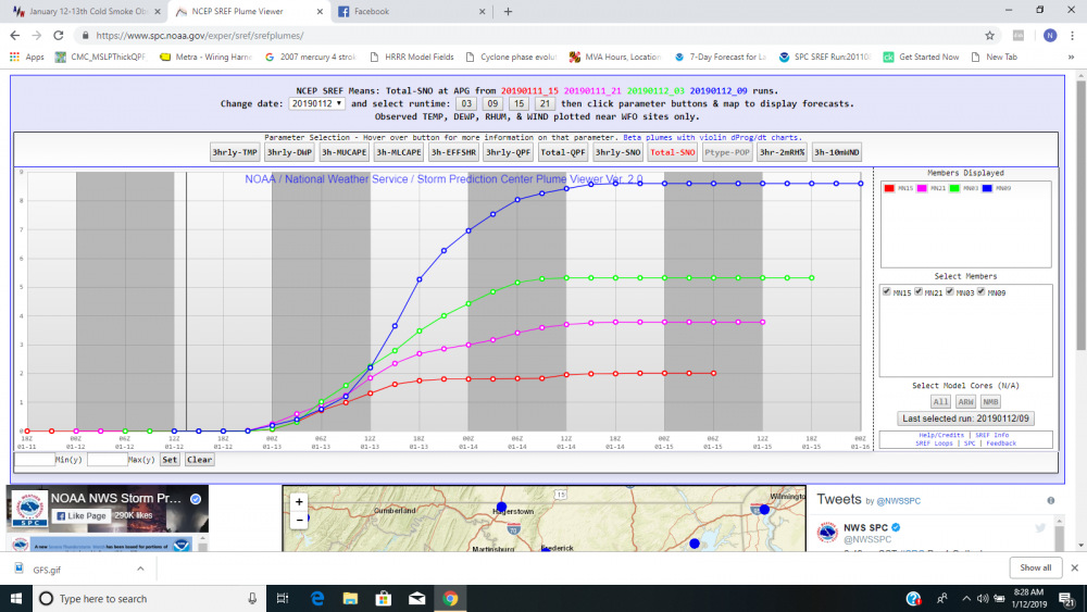
Huge jump on the SREF for northern MD no doubt
-
This is for Aberdeen Harford county. Look at the mean jump!!!!!
-
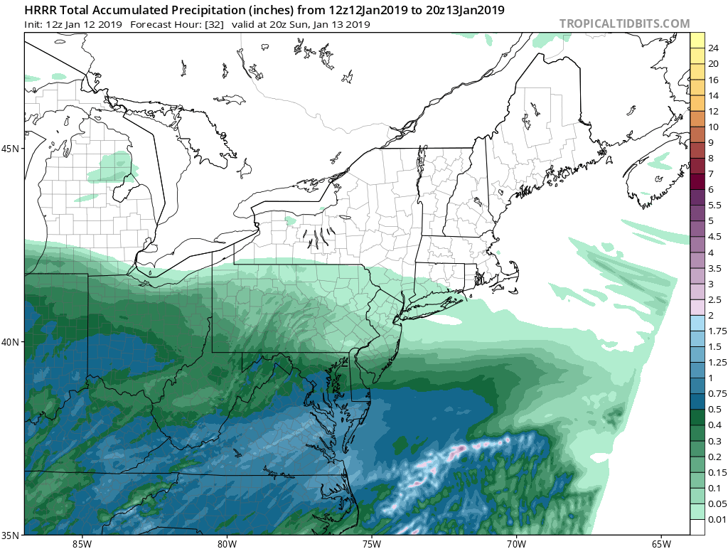
Not really going to need the coastal low to rack up good totals you can see the moisture transport pretty clear on radar and where the fetch runs into cold air its dumping snow. The vort has been continually looking better and better since 24 hours ago. I see a over performer.
-
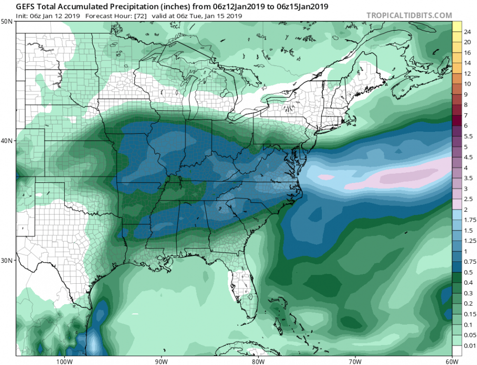
Moisture transport from Gulf and Atlantic

-
That gulf tap does so much
-
Storm is continuing to trend north so I'm confident to let this out. (Northern area's may go higher later since ratios are much higher then southern areas) I think area wide masondixon south gets a WSW Northern MD 5-8 Baltimore metro 6-10 DC metro 6-10 (isolated 10+)
-
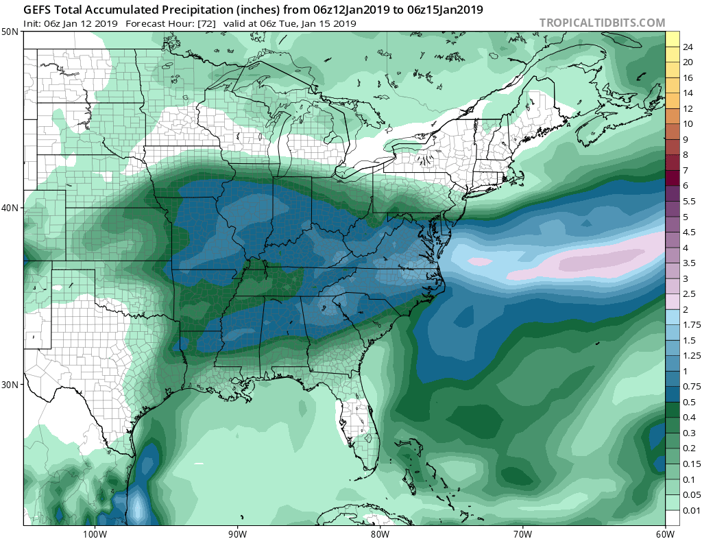
Fyiy the GEFS is north and still north then the OP. Don't think this north trend is over
-
HRRR looks dang sweet too
-
Am hearing the 6z euro improved over 0z especially for northern MD and DE
-
These last minute trends are so predictable. Finally something more related to climo. I don't think the shifting is done either
-
I always have liked to watch model trends and it rarely has let me down below 72 hours. I get the high is pushing a bit more on the GFS but its important to see what the model is doing at the surface vs 500mb. The GFS still is trying to enlongate the low and not have a nice clean transfer and that effects winds at the surface and aloft. The focus needs to be on the low closer to OBX vs the low out in the ocean. it has big time implications as to how and where a deformation band can set up. It is definitely catching up to the idea but its not there yet.
-
GFS is definitely headed towards a deform band idea like most other guidance at 48. Surface is sloppy still but once it focuses on the western side of the elongated low its showing it will reflect more precip west. Model correction in full effect
-
GFS had a closed low for a few hours this run. Every model that does this impacts us more with the coastal later 558 DM 12z was in western MD now its in Northern OH. Big difference and nice bowling ball structure showing at 500
-
Think mostly everyone will like the trend here
-
Icon improved decently this run again Pretty nice deform band setting up at 48. The slower primary is allowing confluence to leave the area and allowing the coastal to form a little later and closer to the coast
-
Icon now has the closed low at 500 it tried to get it 18z but definitely has it now. That closing really is amplifying the heights in front of the storm more then prior runs its also slowing the primary down and keeping it stronger longer.