Beachin
-
Posts
337 -
Joined
-
Last visited
Content Type
Profiles
Blogs
Forums
American Weather
Media Demo
Store
Gallery
Everything posted by Beachin
-
-
-
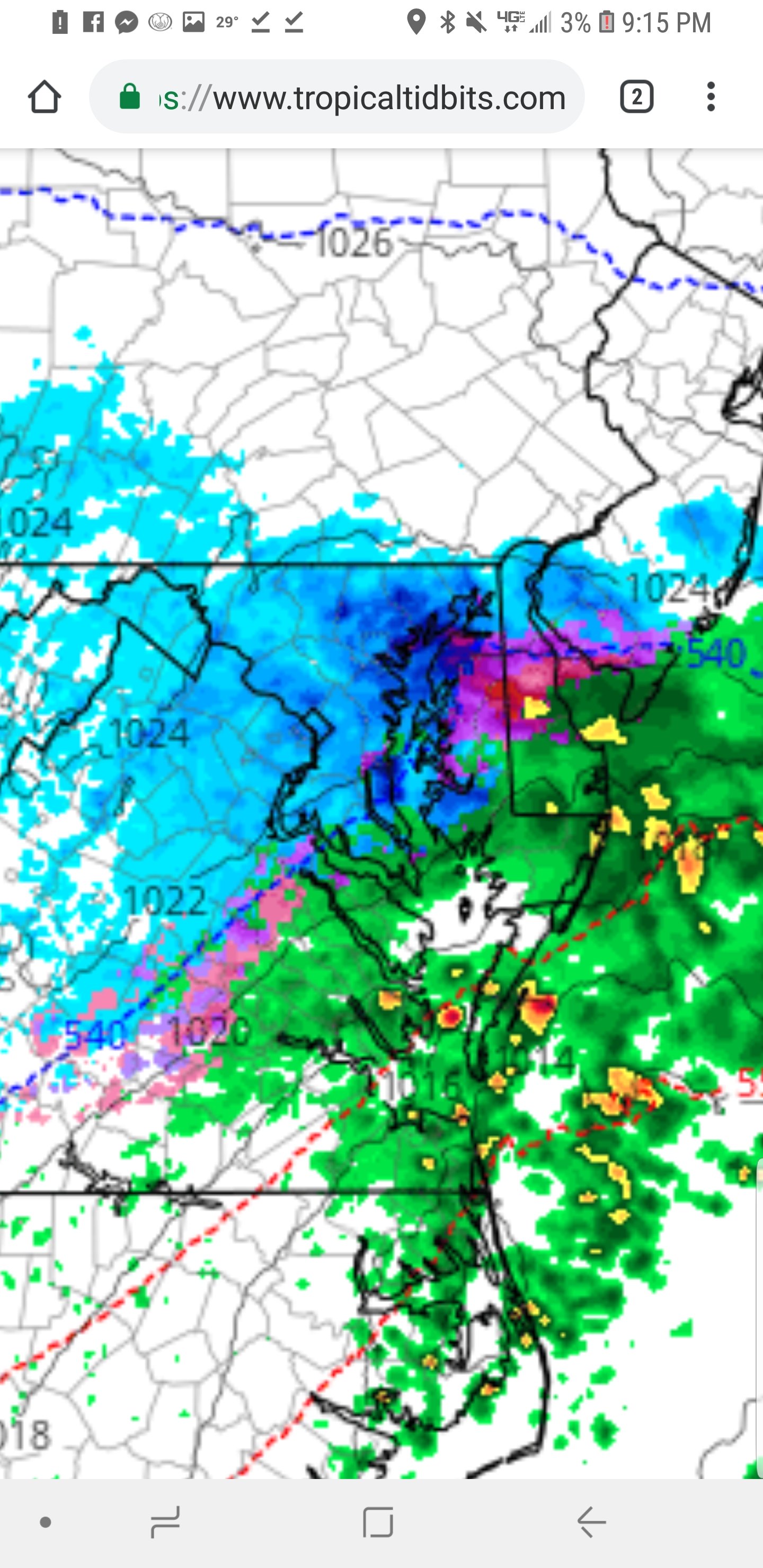
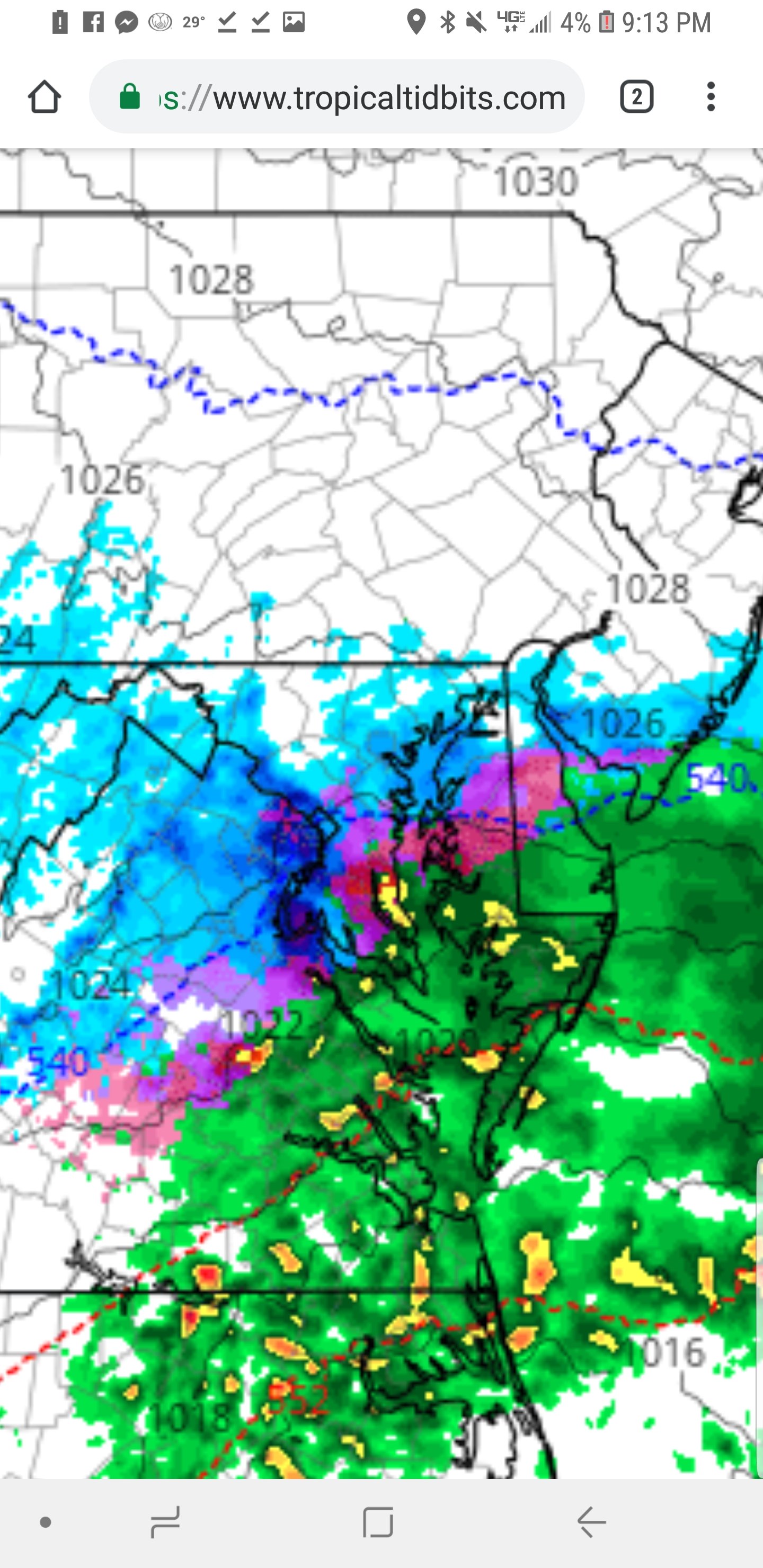
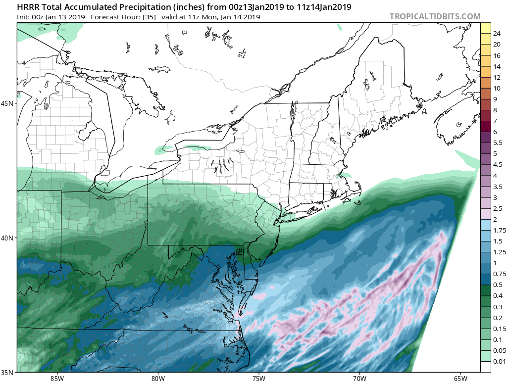
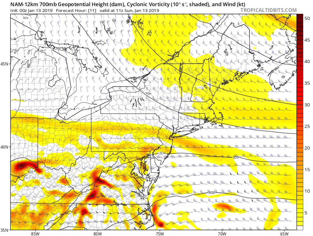
3k has a very very heavy band of snow 18z to 22z rotate through dc and Baltimore
-
Nam says enjoy your deform band tomorrow eve/night

-
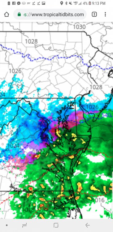
Low is even closer tomorrow night, above freezing temps and mixing/rain showing up now south and east of bsltimore.
-
Lol SREF and NAM are nailing this. For those who care 00z NAM is pretty dang similar to the 12z monster run. Nice banding features are back
-
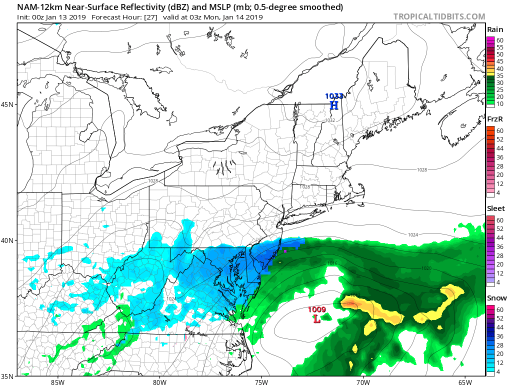
Nam looking like 12z again Here is long range hrrr
-
Do not be suprised if the DC-Balt area end up over 8 inches
-
Guess what is coming back with a vengeance tomorrow night!!!!!!! Fyi entire hrrr run looks like the 12z nam
-
All depends on opinion. Nws uses them often close up
-
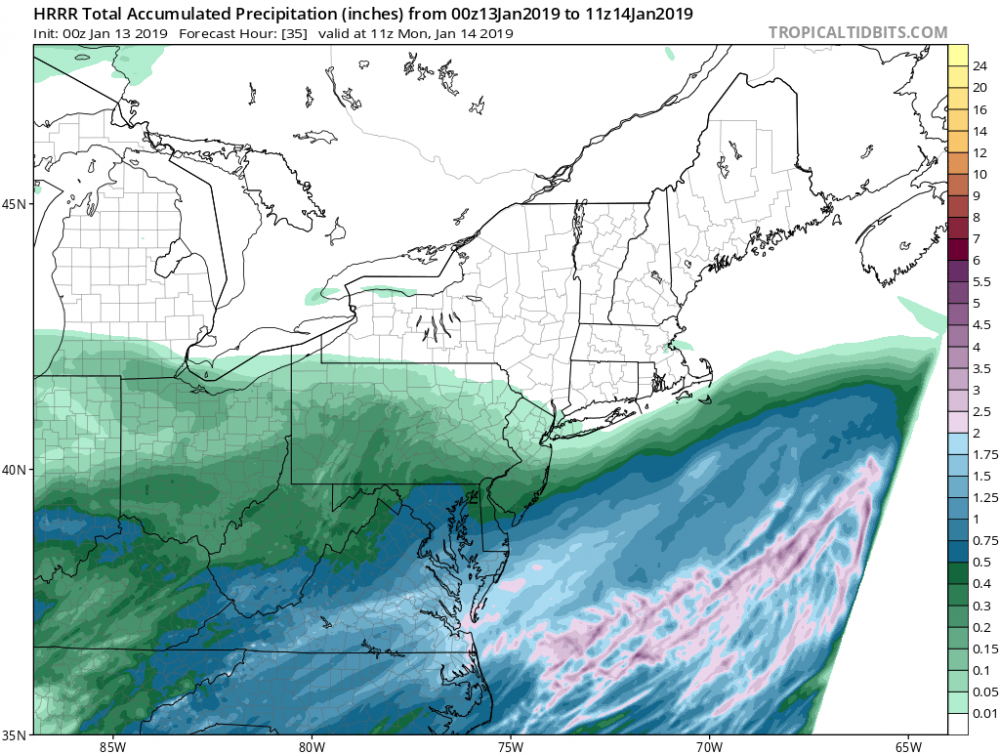
DC is projected 1.5 QPF BWI 1.4 QPF APG 1.2 QPF SREF 21Z PLUMES
-
Sref plumes now give BWI 12 inches as a mean. DCA very similar to BWI 13 inches APG is now projected 10 inches
-
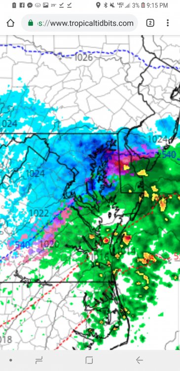
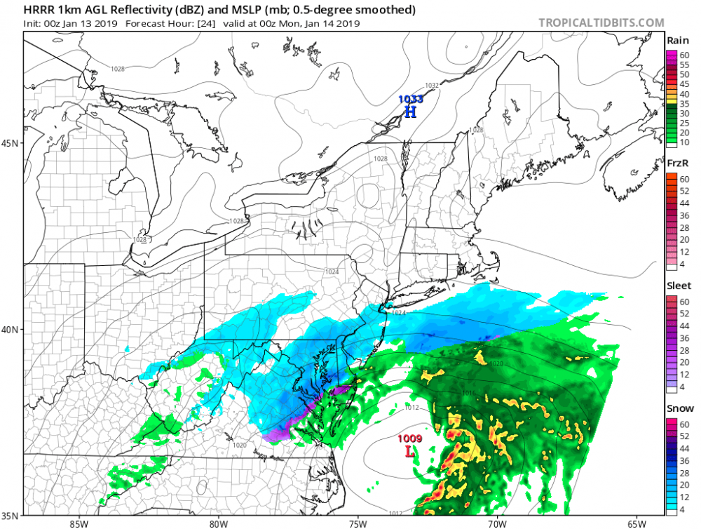
This is the best the HRRR has looked for tomorrow morning. Getting better. Pretty sweet
-
Ratios are really nice here big flakes and super light. The type of snow that crunches when you walk
-
Its comin down
-
Forest hill MD
-
Forest hill area
-
.25 visibility here in bel air and Baltimore .5 so far very fluffy
-
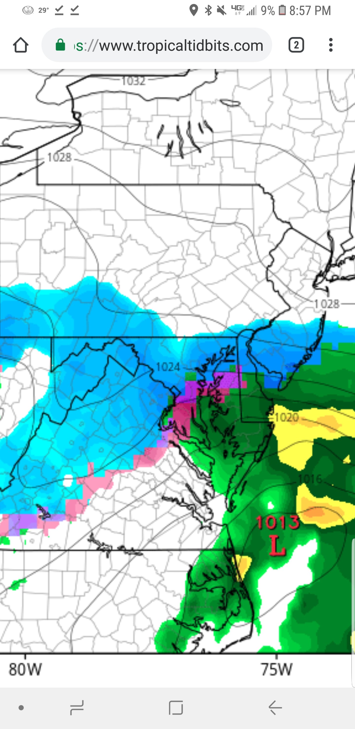
Snow has really picked up in Baltimore dark green/yellows pushing in
-
I will say the snow is super fluffy up here. Ratios are gonna make up for a little less qpf
-
The usual LWX stubbornness
-
Hrrr usually dont do a jump like this but it made a pretty big adjustment this run lol
-
Icon looks great little more improved for us up north. LWX doesn't match MT holly at all for harford and cecil. Wsw needed up here too.
-
Bigger flakes in bel air radar getting heavier returns up here
-