

Tar Heel Snow
-
Posts
345 -
Joined
-
Last visited
Content Type
Profiles
Blogs
Forums
American Weather
Media Demo
Store
Gallery
Posts posted by Tar Heel Snow
-
-
6 minutes ago, Kmlwx said:
18z and 06z because there aren't the 12z and 0z RAOBs.
RAOBs?
-
Next 24-48 hours or so of the NAM will be interesting to see wrt the temp profile of this system. I always trust it most with handling that, but not sure if we're quite at the range to take its precip depiction literally.
-
2 minutes ago, yoda said:
Lol 00z NAM has SLP south of FL panhandle at 51
about the same odds as Brian Boyle getting a hat trick tonight in LA...
-
 1
1
-
 3
3
-
-
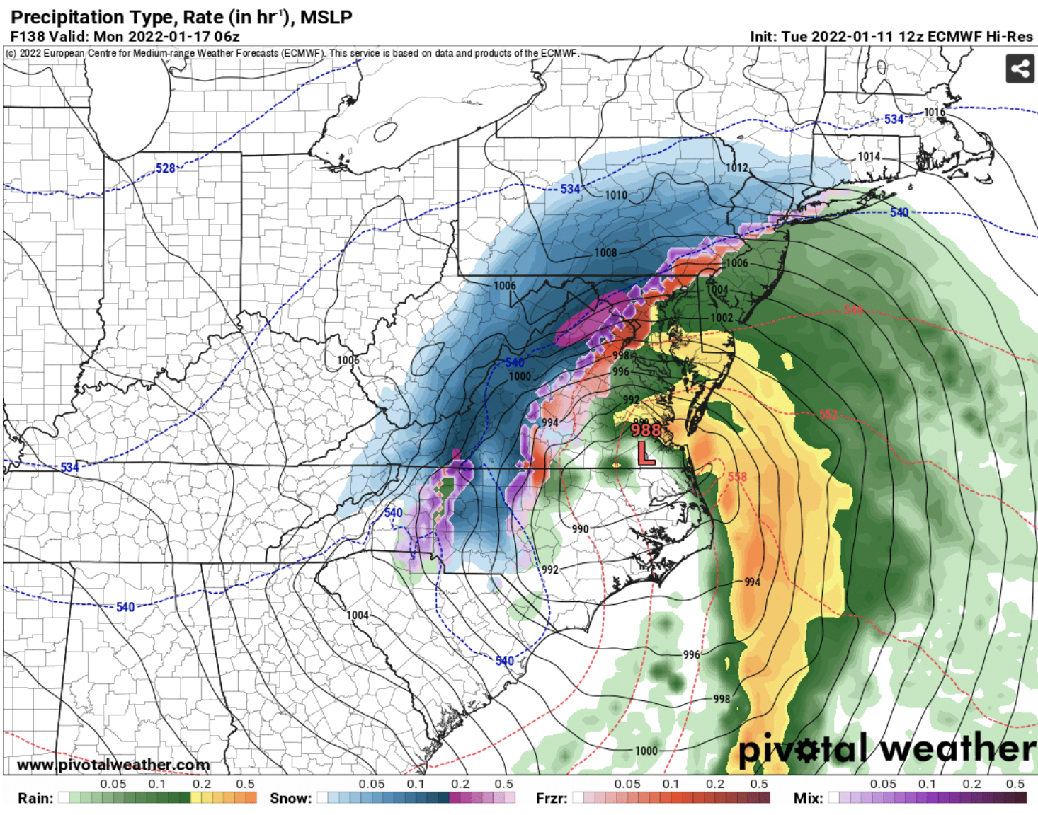
1 hour ago, csnavywx said:
Name one system where that warm nose was over-forecast on something wrapped up like this.
I think this is going to be a bigger sleetfest than most are willing to accept atm. I'd be kind of surprised if DC gets any more than ~3-4 hours of snow out of it before pingers mix in. That elevated warm nose/WCB is going to kill totals east of the mountains.
Reminds me a lot of an old @Cold Rain post in the SE forum after a big bust there in Jan 2017. Obviously this is a very different storm, and not everything here applies. But I always try to keep in in mind.
-
1
-
 1
1
-
 1
1
-
-
Hey it looks like the actual fun-to-watch stuff should fall when we're awake at least for the 95 folks. I've been trying to focus on timing. If the snow turns to rain but you're asleep for it, did it really happen?
-
Roxboro, NC with a foot while Raleigh gets 3 inches, take this to the bank

(I swear I'll learn more about this area instead of posting about NC all the time soon)
-
-
14 minutes ago, Snowchaser said:
Looks like 2018


Best storm I can remember in chapel hill, though some of my wake county NC friends were victim of that awful gradient over Raleigh. I’ll be willing all that yellow blob northeast this time lol
-
-
I’m going to be in NC for Christmas, so I’m certain it will actually snow up here next week lol
-
Happy to report that 13th St NW is brined in downtown DC, here’s hoping for a 30 second flizzard!
-
Nothing to add that hasn't been added to the discourse, but I absolutely love this idea! AMWX TV coming next?
-
5 minutes ago, BTRWx's Thanks Giving said:
D.C. dry slotted yet again.
Yeah after being disappointed by many a North Carolina storm, I’ve learned that when the NAM sniffs out a warm nose to never doubt it. I’d hoped maybe DC’s climo would maybe make up for some of it, but oof. I’ve learned my lesson again for a new place!
Guess I have to move to Canada.
But yeah, the dryness is very frustrating.
-
Been lightly snowing with small flakes for the past hour or so here in the District. The fact that there's still snow covering the ground and flakes in the sky is an absolute win in my book having just moved from Raleigh. Most snow I've seen since we had about a foot 3 years ago down there.
-
1
-
-
El oh el. This latest threat verbatim with models now blankets where I am now and then snow holes DC...where I'm moving this weekend. I think i've been the bad luck charm this whole time SE friends, please accept my sincerest apologies.
-
1
-
-
1 hour ago, caviman2201 said:
So... the north trend that has effed us all year will work in our favor to give us the goods on the 29th and not bury NC, right? That won't like be the one storm all year that doesn't trend north... right?
Who am I kidding... we're going to end up with a DC-Balt snow hole of biblical proportions. I can't wait to see how hilarious the seasonal snowfall map looks late next week. This is legitimately cruel if it verifies.

I’m literally moving to DC on Tuesday from Raleigh, this one’s on me! And I thought OUR snow hole was bad...
-
1
-
-
Just getting caught up here, so apologies if this has been mentioned, but ratios also will be down, maybe 5:1. I think a LOT of this storm is going to have to wait until the final hours just to get a handle on where strong bands will set up and to narrow down p types.
-
2
-
-
I figured I might as well fire up the thread just in time for the 12z Euro! Get your chainsaws ready, and let’s see what the first real track of winter brings us!
-
1
-
-
50 minutes ago, ILMRoss said:
^ here's a take that aged like milk in a hot car. it happens.
For next Wednesday, don't really think it's our storm unless you're above 2k feet (even then, apps may have moisture issues). That CAD high will need to get stronger or drop south some for this storm to be relevant to non-mountain folks.
Great point, I think there’s still time for things to trend our way, but I also have a hard time trusting thermals on globals, especially this far out. Especially when it’s the CMC. It’s not too far out from NAM range, and I’d like to see what it looks like when it gets its hands on temp profiles throughout the different layers of the atmosphere.
It doesn’t have the feel of an outside-the-mountains/foothills type storm, but there’s still time I suppose. Either way, the ceiling is probably low.
-
1
-
-
I'm just gonna allow myself to enjoy this for a bit before I go back to reality

-
1
-
1
-
-
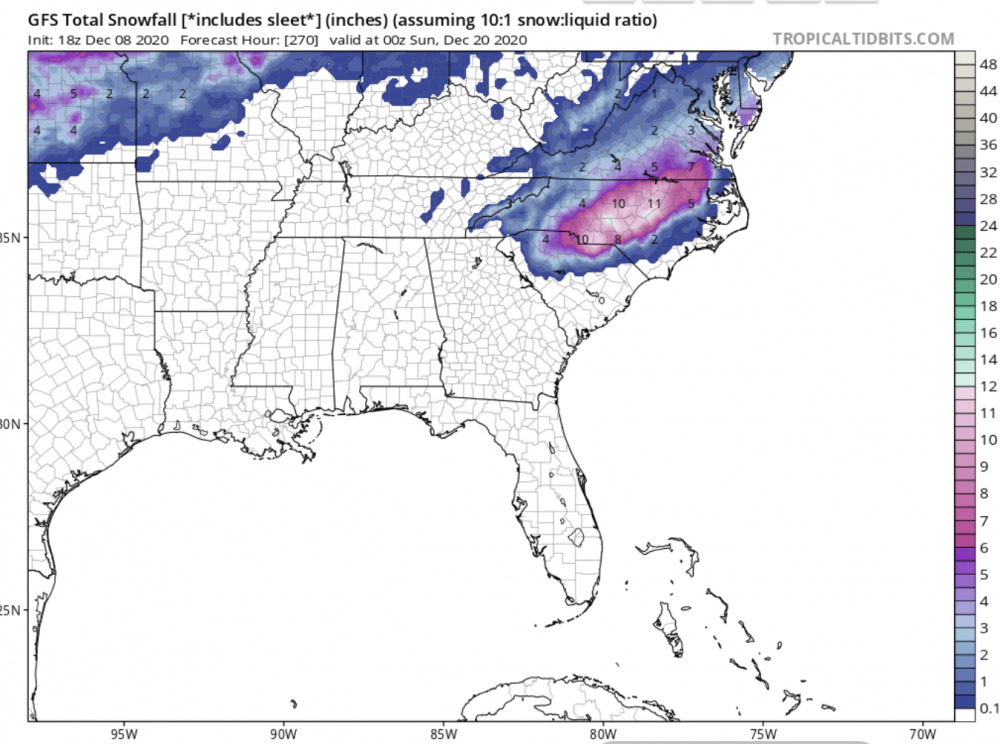
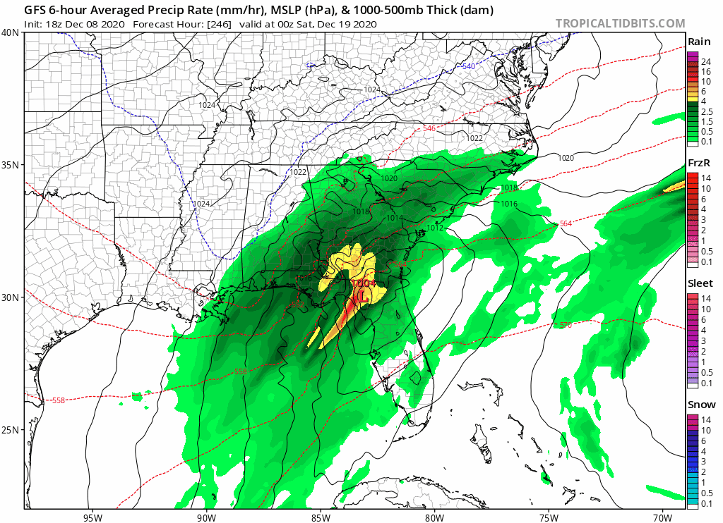
First GFS weenie run clown map in QUITE some time.
-
3
-
-
Welp. Back to waiting for the next clown map. I see few on here deceived to even venture on. Lol are we all that burned by last year?
-
Based on the NAM run, not really looking forward to the GFS this time
-
 1
1
-
-
This afternoon's runs are my needed dose of seratonin


January Banter 2022
in Mid Atlantic
Posted